Bogle Den

Valley in Perthshire

Scotland

Bogle Den

Woodland, Redmyre Mature conifers in a landscape dominated by younger woodlands.
Woodland, Redmyre Credit: Richard Webb

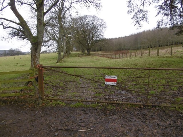
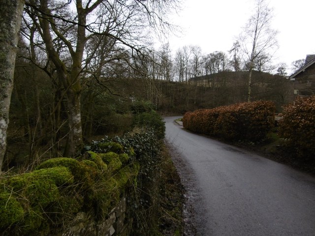
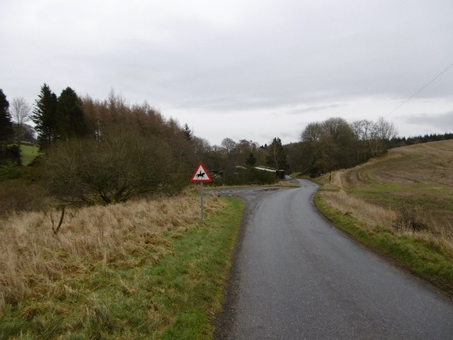
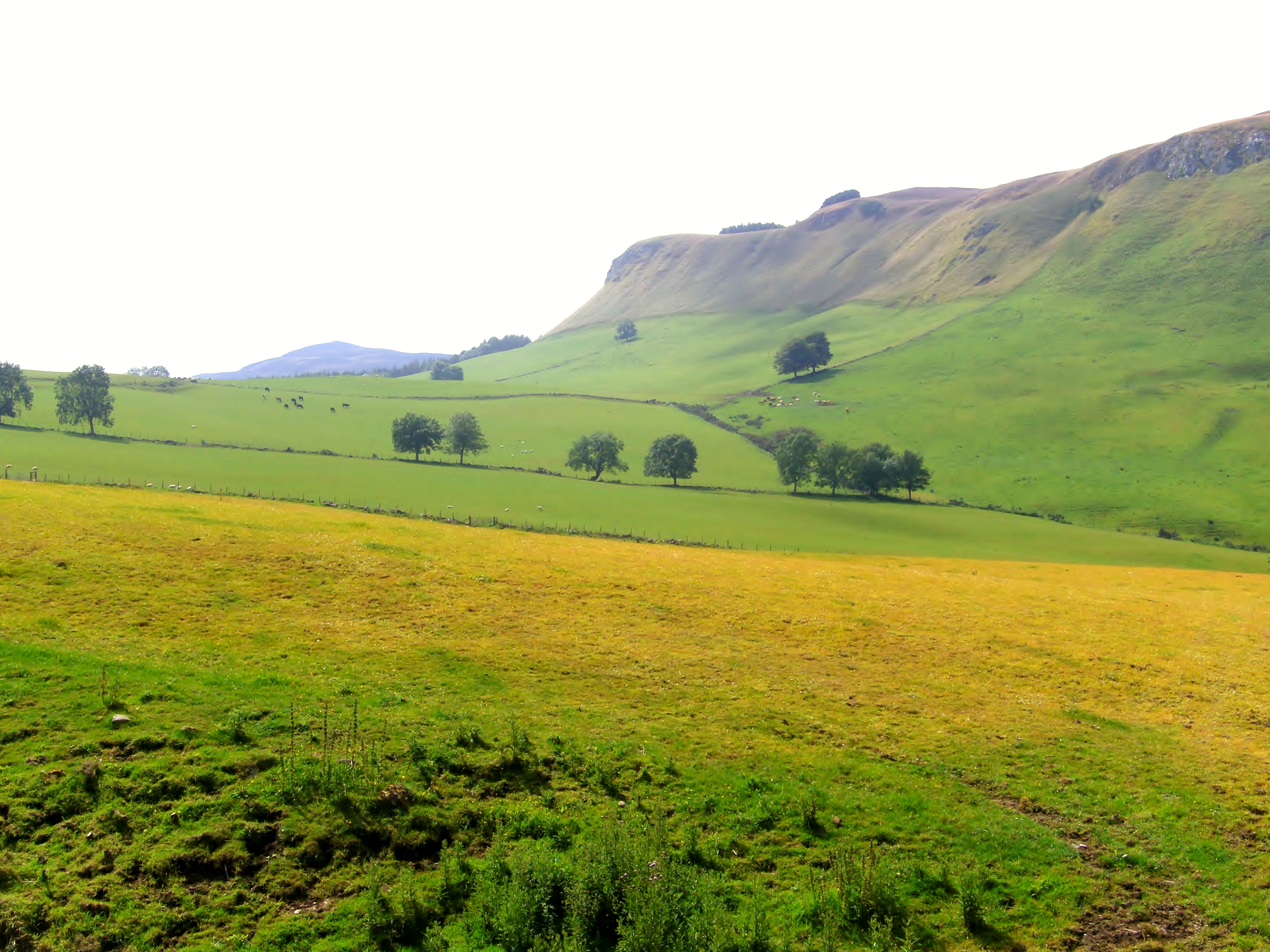
Bogle Den is a picturesque valley located in the Perthshire region of Scotland. Nestled amidst the rolling hills and lush greenery, this enchanting destination offers a tranquil escape from the hustle and bustle of city life.

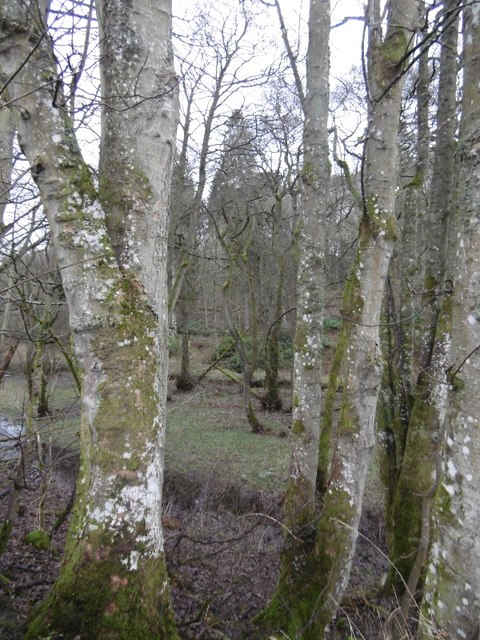
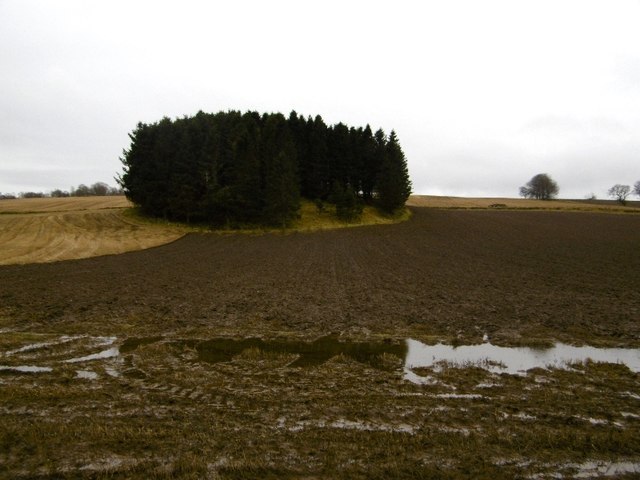
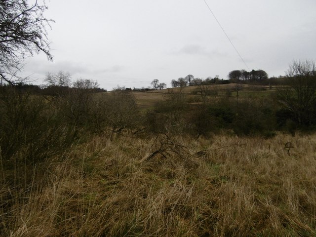
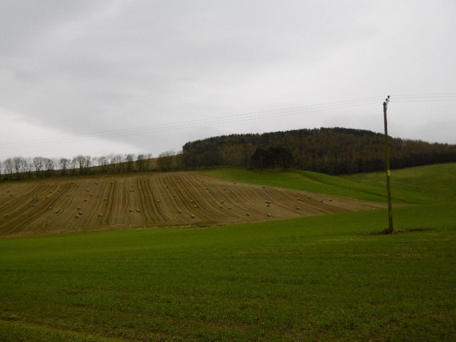
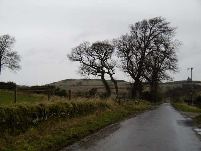
The valley is known for its stunning natural beauty, with a meandering river running through it and dense forests surrounding the area. The landscape is dotted with charming cottages and traditional farmhouses, adding to the idyllic atmosphere. Bogle Den is particularly famous for its vibrant display of wildflowers during the spring and summer months, creating a vibrant tapestry of colors.

Nature enthusiasts will be delighted by the abundance of wildlife in the area. The valley is home to a diverse range of fauna, including deer, foxes, and various bird species. Exploring the numerous walking trails that crisscross the valley provides an opportunity to observe these creatures in their natural habitat.

For those seeking adventure, Bogle Den offers a range of outdoor activities. The river that flows through the valley is perfect for fishing and canoeing, while the surrounding hills provide excellent opportunities for hiking and cycling.

In addition to its natural attractions, Bogle Den is also steeped in history. The remnants of ancient settlements and stone circles can be found in the vicinity, providing a glimpse into the region's past.

Overall, Bogle Den is a haven for nature lovers and history enthusiasts alike. Its stunning scenery, diverse wildlife, and rich cultural heritage make it a must-visit destination for anyone seeking to experience the beauty of Perthshire.

If you have any feedback on the listing, please let us know in the comments section below.
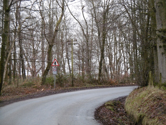
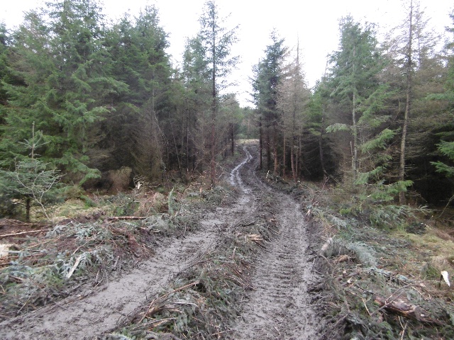
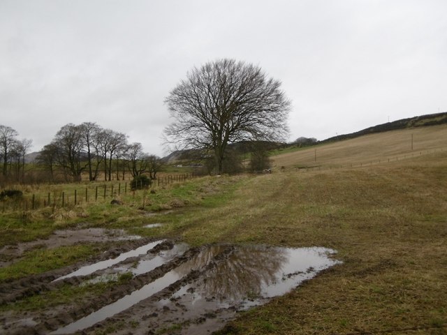
Bogle Den Images

Images are sourced within 2km of 56.490512/-3.1897176 or Grid Reference NO2633. Thanks to Geograph Open Source API. All images are credited.

Woodland, Redmyre Mature conifers in a landscape dominated by younger woodlands.
Woodland, Redmyre
Mature conifers in a landscape dominated by younger woodlands.
Come on England  - you could do this The red band on the sign is the deletion of a keep out sign.  More advanced nations have laws against them, but we must never ever be complacent. 

A scattering of ancient beeches suggest there was once a tree lined strip here, old maps show a 2 acre elongated enclosure between the gate and Redmyre.
Come on England - you could do this
The red band on the sign is the deletion of a keep out sign. More advanced nations have laws against them, but we must never ever be complacent. A scattering of ancient beeches suggest there was once a tree lined strip here, old maps show a 2 acre elongated enclosure between the gate and Redmyre.
Old beech, Redmyre Once there was a line of beeches either side of a road here, possibly a pair of hedges.  Old maps show a long 2 acre (0.8 Ha) strip here. Redmyre Wood beyond has a chequered history. 1950s 1:25,000 maps show no woodland here, but there was a substantial wood here on the 25" map of 1900.
Old beech, Redmyre
Once there was a line of beeches either side of a road here, possibly a pair of hedges. Old maps show a long 2 acre (0.8 Ha) strip here. Redmyre Wood beyond has a chequered history. 1950s 1:25,000 maps show no woodland here, but there was a substantial wood here on the 25" map of 1900.
Lane near Knapp The road has just crossed the Knapp Burn beside the wall of Rossie Priory Estate.
Lane near Knapp
The road has just crossed the Knapp Burn beside the wall of Rossie Priory Estate.
Knapp Den Rossie Woodlands.  The wall had recently collapsed here, a common occurrence during periods of heavy rain.
Knapp Den
Rossie Woodlands. The wall had recently collapsed here, a common occurrence during periods of heavy rain.
Roundel woodland, Lochton Ploughing is going to be an issue this year with so much rainfall.
Roundel woodland, Lochton
Ploughing is going to be an issue this year with so much rainfall.
East Newton A road running off the Sidlaw Hills towards the Carse of Gowrie passes a sawmill.
East Newton
A road running off the Sidlaw Hills towards the Carse of Gowrie passes a sawmill.
Wetland beside the Knapp Burn Wet and scrubby land by the East Newton sawmill.
Wetland beside the Knapp Burn
Wet and scrubby land by the East Newton sawmill.
Farmland, Newton Round bales still out, later I saw soggy round bales being removed from a field at Redmyre.
Farmland, Newton
Round bales still out, later I saw soggy round bales being removed from a field at Redmyre.
Road, East Newton A dreich day in the Sidlaw Hills.
Road, East Newton
A dreich day in the Sidlaw Hills.
Road by South Lochton A road across the Sidlaw Hills between Abernyte and Burrelton.
Road by South Lochton
A road across the Sidlaw Hills between Abernyte and Burrelton.
Timber tracks The block to the south of Laird's Loch had been recently felled and the timber extracted by this track to a logging road further up Northballo Hill.  Great news as the track to the south of Northballo Hill was undamaged.
Timber tracks
The block to the south of Laird's Loch had been recently felled and the timber extracted by this track to a logging road further up Northballo Hill. Great news as the track to the south of Northballo Hill was undamaged.
Stubble, Little Ballo Stubble covered slopes of Little Ballo Hill beside a wetland area.
Stubble, Little Ballo
Stubble covered slopes of Little Ballo Hill beside a wetland area.
Yellow road, Little Ballo
Priest's Road There is still a way through the gorse and broom on a very attractive path through mixed woodland, mostly young but with some older trees.
Priest's Road
There is still a way through the gorse and broom on a very attractive path through mixed woodland, mostly young but with some older trees.
Priest's Road The path was obviously wider here once, but is now largely covered in gorse and broom.  It is however unobstructed and has gates which can be opened.
Priest's Road
The path was obviously wider here once, but is now largely covered in gorse and broom. It is however unobstructed and has gates which can be opened.
Wetland near Redmyre Marshy rough grazing next to the woodlands.
Wetland near Redmyre
Marshy rough grazing next to the woodlands.
Track, Redmyre Becomes a single track path through broom and gorse at the end of this field.
Track, Redmyre
Becomes a single track path through broom and gorse at the end of this field.
Show me another place!

Bogle Den is located at Grid Ref: NO2633 (Lat: 56.490512, Lng: -3.1897176)

Unitary Authority: Perth and Kinross

Police Authority: Tayside

What 3 Words

///cashier.intention.wolves. Near Inchture, Perth & Kinross

Nearby Locations

Littleton Den Bogle Den

Related Wikis

Sidlaws

The Sidlaws are a range of hills in the counties of Perthshire and Angus in Scotland that extend for 30 miles (45 km) from Kinnoull Hill, near Perth, northeast...

Northballo Hill

Northballo Hill is one of the hills of the Sidlaw range in South East Perthshire, and is located near Coupar Angus. It is popular with dog walkers and...

Abernyte

Abernyte is a small village in Perth and Kinross in Scotland. == Geography == The village lies roughly 2 miles (3 kilometres) northwest of the former Inchture...

Knapp, Perthshire

Knapp is a hamlet in Perth and Kinross, Scotland. It is located to the northeast of Inchture, about 9.7 miles (15.6 km) by road west of the city centre...

Gask Hill

Gask Hill is one of the least climbed hills of the Sidlaw range in south east Perthshire, Scotland. Gask Hill is located near Coupar Angus and is seen...

Lundie

Lundie is a parish and small settlement in Angus, Scotland, 10 miles (16 km) northwest of Dundee, situated at the head of the Dighty valley in the Sidlaws...

Lundie Kirk

Lundie Kirk was the parish church of Lundie, Angus, in Scotland from the 12th century until 2017. The church was constructed in Romanesque style in the...

Pitcur

Pitcur is a hamlet at the eastern edge of Perth and Kinross, Scotland, about 2.5 miles (4.0 km) southeast of Coupar Angus.It is home to the ruined 16th...

Nearby Amenities

Located within 500m of 56.490512,-3.1897176
Littleton
Place: hamlet
Lat/Long: 56.4932075/-3.1936964
Power: pole
Lat/Long: 56.48842/-3.1965647
Power: pole
Lat/Long: 56.4890844/-3.1962342
Power: pole
Lat/Long: 56.4897066/-3.195927
Power: pole
Lat/Long: 56.4902867/-3.1956431
Power: pole
Lat/Long: 56.4910212/-3.1952702
Power: pole
Lat/Long: 56.4916353/-3.1949821
Power: pole
Lat/Long: 56.4921218/-3.1950584
Power: pole
Lat/Long: 56.4928078/-3.195176
Power: pole
Lat/Long: 56.4933633/-3.1952766
Power: pole
Lat/Long: 56.4940767/-3.1939991
The data included in this document is from www.openstreetmap.org. The data is made available under ODbL.

Have you been to Bogle Den?

Leave your review of Bogle Den below (or comments, questions and feedback).