Cwm Ffrwd-oer

Valley in Monmouthshire

Wales

Cwm Ffrwd-oer

Layby alongside the A472 in Torfaen Ahead for Pontypool. Behind the camera for Hafodyrynys.
Layby alongside the A472 in Torfaen Credit: Jaggery

The requested URL returned error: 429 Too Many Requests

If you have any feedback on the listing, please let us know in the comments section below.

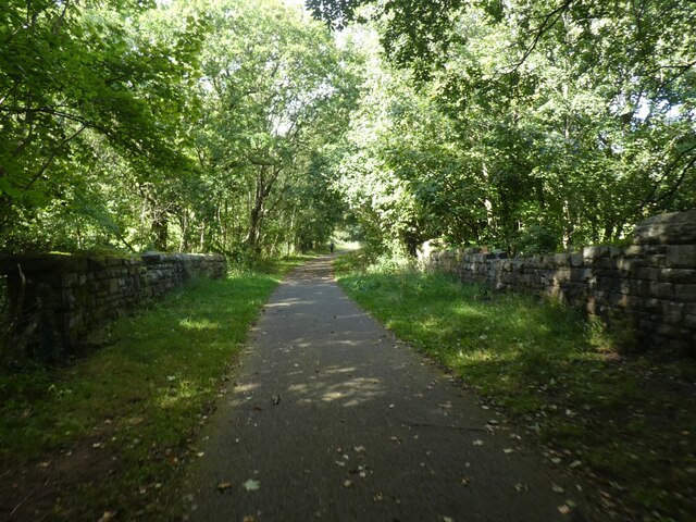
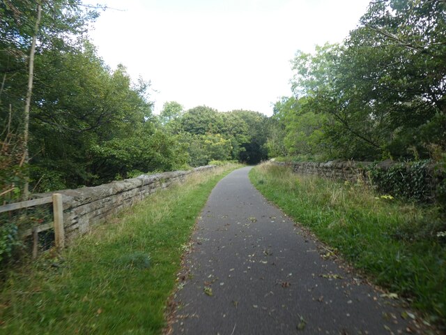
Cwm Ffrwd-oer Images

Images are sourced within 2km of 51.697141/-3.0800963 or Grid Reference SO2500. Thanks to Geograph Open Source API. All images are credited.

Layby alongside the A472 in Torfaen Ahead for Pontypool. Behind the camera for Hafodyrynys.
Layby alongside the A472 in Torfaen
Ahead for Pontypool. Behind the camera for Hafodyrynys.
Pantygasseg - Please drive carefully The sign also shows Welcome and the Welsh Croeso.
Pantygasseg - Please drive carefully
The sign also shows Welcome and the Welsh Croeso.
Bush Terrace, Pantygasseg, Torfaen Ahead for Hafodyrynys. Behind the camera for Pontypool.
Bush Terrace, Pantygasseg, Torfaen
Ahead for Hafodyrynys. Behind the camera for Pontypool.
Side road in Pantygasseg, Torfaen Viewed from Bush Terrace.
Side road in Pantygasseg, Torfaen
Viewed from Bush Terrace.
5-bar gate, Pantygasseg, Torfaen On the right here. <a title="https://www.geograph.org.uk/photo/7488539" href="https://www.geograph.org.uk/photo/7488539">Link</a>
5-bar gate, Pantygasseg, Torfaen
On the right here. Link
Hafodyrynys Coal Washery The washery at Hafodyrynys contained equipment for extracting coal dust from slurry and drying the remaining waste before tipping: processes which were rare before the 1950s. It was built entirely of reinforced concrete with continuous glazed panels. The colliery closed in 1966 and the site was cleared in 1985, but the slimes thickener at the washery was retained at the request of Sir Richard Hanbury-Tenison of Pontypool Park Estate, to which the site reverted. Plans were drawn up at the time to adapt the building as a restaurant. Its futuristic use of reinforced concrete and the splendid isolation in which it now stands have made it a well-known landmark.
Hafodyrynys Coal Washery
The washery at Hafodyrynys contained equipment for extracting coal dust from slurry and drying the remaining waste before tipping: processes which were rare before the 1950s. It was built entirely of reinforced concrete with continuous glazed panels. The colliery closed in 1966 and the site was cleared in 1985, but the slimes thickener at the washery was retained at the request of Sir Richard Hanbury-Tenison of Pontypool Park Estate, to which the site reverted. Plans were drawn up at the time to adapt the building as a restaurant. Its futuristic use of reinforced concrete and the splendid isolation in which it now stands have made it a well-known landmark.
NCN492 on former railway track south of Cwm Ffrwd-oer The National Cycle Network is a network of cycle routes. It was created by the charity Sustrans <span class="nowrap"><a title="http://www.sustrans.org.uk/what-we-do/national-cycle-network" rel="nofollow ugc noopener" href="http://www.sustrans.org.uk/what-we-do/national-cycle-network">Link</a><img style="margin-left:2px;" alt="External link" title="External link - shift click to open in new window" src="https://s1.geograph.org.uk/img/external.png" width="10" height="10"/></span>  (Sustainable Transport), aided by a National Lottery grant.

Many routes aim to minimise contact with motor traffic, though 70% of them are on roads. In some cases the NCN uses pedestrian routes, disused railways, minor roads, canal towpaths, or traffic-calmed routes in towns and cities.
NCN492 on former railway track south of Cwm Ffrwd-oer
The National Cycle Network is a network of cycle routes. It was created by the charity Sustrans LinkExternal link (Sustainable Transport), aided by a National Lottery grant. Many routes aim to minimise contact with motor traffic, though 70% of them are on roads. In some cases the NCN uses pedestrian routes, disused railways, minor roads, canal towpaths, or traffic-calmed routes in towns and cities.
Access to NCN492 near Cwm Ffrwd-oer The metal barrier on the right is designed to prevent motorcycles from accessing the cycle track.  They also hamper cyclists with unusual bicycles.  NCN492 runs along a former railway line
Access to NCN492 near Cwm Ffrwd-oer
The metal barrier on the right is designed to prevent motorcycles from accessing the cycle track. They also hamper cyclists with unusual bicycles. NCN492 runs along a former railway line
NCN492 on old railway line On each side there are what appear to be platforms; no station is marked on the old maps, but a brickworks was close to the line
NCN492 on old railway line
On each side there are what appear to be platforms; no station is marked on the old maps, but a brickworks was close to the line
Farm bridge over NCN492 (old railway track) The National Cycle Network is a network of cycle routes. It was created by the charity Sustrans <span class="nowrap"><a title="http://www.sustrans.org.uk/what-we-do/national-cycle-network" rel="nofollow ugc noopener" href="http://www.sustrans.org.uk/what-we-do/national-cycle-network">Link</a><img style="margin-left:2px;" alt="External link" title="External link - shift click to open in new window" src="https://s1.geograph.org.uk/img/external.png" width="10" height="10"/></span>  (Sustainable Transport), aided by a National Lottery grant.

Many routes aim to minimise contact with motor traffic, though 70% of them are on roads. In some cases the NCN uses pedestrian routes, disused railways, minor roads, canal towpaths, or traffic-calmed routes in towns and cities.
Farm bridge over NCN492 (old railway track)
The National Cycle Network is a network of cycle routes. It was created by the charity Sustrans LinkExternal link (Sustainable Transport), aided by a National Lottery grant. Many routes aim to minimise contact with motor traffic, though 70% of them are on roads. In some cases the NCN uses pedestrian routes, disused railways, minor roads, canal towpaths, or traffic-calmed routes in towns and cities.
Cycle track on Cwm Ffrwd-Oer viaduct The National Cycle Network is a network of cycle routes. It was created by the charity Sustrans <span class="nowrap"><a title="http://www.sustrans.org.uk/what-we-do/national-cycle-network" rel="nofollow ugc noopener" href="http://www.sustrans.org.uk/what-we-do/national-cycle-network">Link</a><img style="margin-left:2px;" alt="External link" title="External link - shift click to open in new window" src="https://s1.geograph.org.uk/img/external.png" width="10" height="10"/></span>  (Sustainable Transport), aided by a National Lottery grant.

Many routes aim to minimise contact with motor traffic, though 70% of them are on roads. In some cases the NCN uses pedestrian routes, disused railways, minor roads, canal towpaths, or traffic-calmed routes in towns and cities.
Cycle track on Cwm Ffrwd-Oer viaduct
The National Cycle Network is a network of cycle routes. It was created by the charity Sustrans LinkExternal link (Sustainable Transport), aided by a National Lottery grant. Many routes aim to minimise contact with motor traffic, though 70% of them are on roads. In some cases the NCN uses pedestrian routes, disused railways, minor roads, canal towpaths, or traffic-calmed routes in towns and cities.
Cycle track in railway cutting north of Cwm Ffrwd-Oer The National Cycle Network is a network of cycle routes. It was created by the charity Sustrans <span class="nowrap"><a title="http://www.sustrans.org.uk/what-we-do/national-cycle-network" rel="nofollow ugc noopener" href="http://www.sustrans.org.uk/what-we-do/national-cycle-network">Link</a><img style="margin-left:2px;" alt="External link" title="External link - shift click to open in new window" src="https://s1.geograph.org.uk/img/external.png" width="10" height="10"/></span>  (Sustainable Transport), aided by a National Lottery grant.

Many routes aim to minimise contact with motor traffic, though 70% of them are on roads. In some cases the NCN uses pedestrian routes, disused railways, minor roads, canal towpaths, or traffic-calmed routes in towns and cities.
Cycle track in railway cutting north of Cwm Ffrwd-Oer
The National Cycle Network is a network of cycle routes. It was created by the charity Sustrans LinkExternal link (Sustainable Transport), aided by a National Lottery grant. Many routes aim to minimise contact with motor traffic, though 70% of them are on roads. In some cases the NCN uses pedestrian routes, disused railways, minor roads, canal towpaths, or traffic-calmed routes in towns and cities.
Football pitch near Cwm Ffrwd-Oer
The woodland of Graig Ddu
Plasycoed Road bridge over NCN492 The National Cycle Network is a network of cycle routes. It was created by the charity Sustrans <span class="nowrap"><a title="http://www.sustrans.org.uk/what-we-do/national-cycle-network" rel="nofollow ugc noopener" href="http://www.sustrans.org.uk/what-we-do/national-cycle-network">Link</a><img style="margin-left:2px;" alt="External link" title="External link - shift click to open in new window" src="https://s1.geograph.org.uk/img/external.png" width="10" height="10"/></span>  (Sustainable Transport), aided by a National Lottery grant.

Many routes aim to minimise contact with motor traffic, though 70% of them are on roads. In some cases the NCN uses pedestrian routes, disused railways, minor roads, canal towpaths, or traffic-calmed routes in towns and cities.
Plasycoed Road bridge over NCN492
The National Cycle Network is a network of cycle routes. It was created by the charity Sustrans LinkExternal link (Sustainable Transport), aided by a National Lottery grant. Many routes aim to minimise contact with motor traffic, though 70% of them are on roads. In some cases the NCN uses pedestrian routes, disused railways, minor roads, canal towpaths, or traffic-calmed routes in towns and cities.
Nant Ffrwd-oer Looking downstream from the end of the former railway bridge.
Nant Ffrwd-oer
Looking downstream from the end of the former railway bridge.
Stile on footpath from former railway track Field footpath leading to Nant Ffrwd-oer.
Stile on footpath from former railway track
Field footpath leading to Nant Ffrwd-oer.
Road bridge over former GWR railway trackbed Bridge, reinforced with corrugated iron sheets, carrying minor road over NCR 492, formerly GWR Monmouthshire Railway - Eastern Valleys.
Road bridge over former GWR railway trackbed
Bridge, reinforced with corrugated iron sheets, carrying minor road over NCR 492, formerly GWR Monmouthshire Railway - Eastern Valleys.
Show me another place!

Cwm Ffrwd-oer is located at Grid Ref: SO2500 (Lat: 51.697141, Lng: -3.0800963)

Unitary Authority: Torfaen

Police Authority: Gwent

What 3 Words

///film.adding.counts. Near Pontypool, Torfaen

Related Wikis

Torfaen (UK Parliament constituency)

Torfaen is a constituency in Wales represented in the House of Commons of the UK Parliament since 2015 by Nick Thomas-Symonds, a member of the Labour Party...

Torfaen (Senedd constituency)

Torfaen is a constituency of the Senedd. It elects one Member of the Senedd by the first past the post method of election. It is also one of eight constituencies...

Cwmffrwdoer Halt railway station

Cwmffrwdoer Halt railway station served the suburb of Pontnewynydd, in the historical county of Monmouthshire, Wales, from 1912 to 1941 on the Pontypool...

Pen Tranch

Pen Tranch is a large village and a community in Torfaen, South East Wales. It lies to the west of Pontypool in the valley leading west to Crumlin. It...

Nearby Amenities

Located within 500m of 51.697141,-3.0800963
Mountain Air (closed)
Historic Amenity: pub
Lat/Long: 51.6928035/-3.0813004
The data included in this document is from www.openstreetmap.org. The data is made available under ODbL.

Have you been to Cwm Ffrwd-oer?

Leave your review of Cwm Ffrwd-oer below (or comments, questions and feedback).