Barrow

Settlement in Shropshire

England

Barrow

View of a field and woodpile south of Hillview Farm There's a large pile of felled logs just behind the fence on the right at the top of the hill. This is adjacent to the footpath from Atterley to Shirlett.
View of a field and woodpile south of Hillview Farm Credit: Richard Law

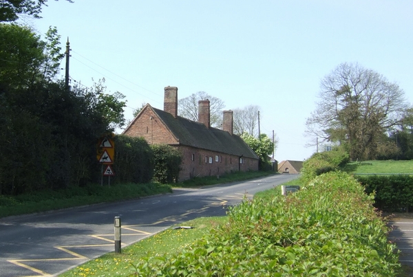
Barrow is a small village located in the county of Shropshire, England. Situated approximately 15 miles southeast of Shrewsbury, the village is nestled in the picturesque countryside, surrounded by rolling hills and meandering streams. With a population of around 500 residents, Barrow offers a tranquil and close-knit community atmosphere.

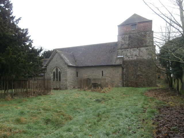
The village dates back to medieval times, and evidence of its rich history can be seen in the architecture of the village church, St. Giles, which was built in the 12th century. The church's intricate stonework and stained glass windows are a testament to the village's heritage.

Barrow's rural setting provides ample opportunities for outdoor activities, such as hiking, cycling, and fishing. The nearby River Severn, one of England's longest rivers, offers a particularly scenic spot for angling enthusiasts. The surrounding countryside also boasts several walking trails, allowing visitors to explore the area's natural beauty.

Although small, Barrow has a few amenities to cater to its residents' needs. The village has a primary school, a post office, and a local pub, where locals and visitors can enjoy a pint and hearty pub fare. There are also regular community events and festivals organized throughout the year, bringing the village together and creating a strong sense of community spirit.

Overall, Barrow is a charming and idyllic village that offers a peaceful retreat from the hustle and bustle of city life. Its historical significance, picturesque surroundings, and tight-knit community make it a desirable place to live or visit for those seeking a quaint English village experience.

If you have any feedback on the listing, please let us know in the comments section below.
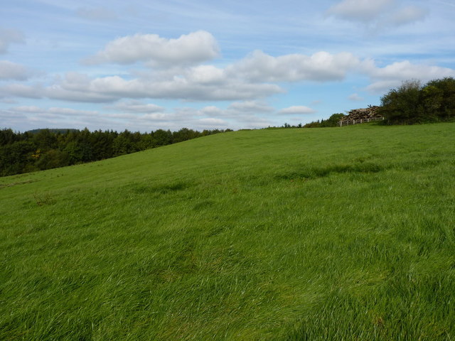
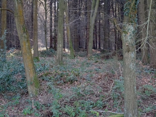
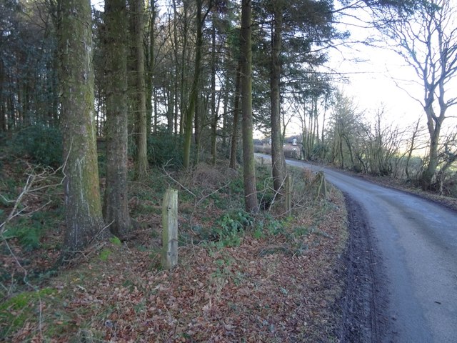
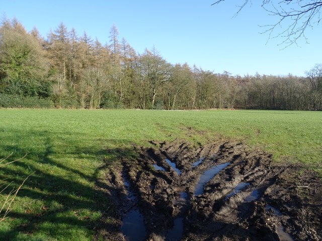
Barrow Images

Images are sourced within 2km of 52.597049/-2.5067829 or Grid Reference SJ6500. Thanks to Geograph Open Source API. All images are credited.

View of a field and woodpile south of Hillview Farm There's a large pile of felled logs just behind the fence on the right at the top of the hill. This is adjacent to the footpath from Atterley to Shirlett.
View of a field and woodpile south of Hillview Farm
There's a large pile of felled logs just behind the fence on the right at the top of the hill. This is adjacent to the footpath from Atterley to Shirlett.
Willey Park: aerial 2018
St Giles, Barrow Another church without an immediate village.
St Giles, Barrow
Another church without an immediate village.
Green lane, Barrow
Green lane, Barrow
Fields and woodland, Barrow Towards the woods around Willey from near the church.
Fields and woodland, Barrow
Towards the woods around Willey from near the church.
Winter cereals, The Marsh Near Barrow with Ash Coppice on the skyline.
Winter cereals, The Marsh
Near Barrow with Ash Coppice on the skyline.
B4376 and B4375 Turn right to stay on the B4376 here with straight on for Broseley on the B4375. The junction is marked by a yew tree,
B4376 and B4375
Turn right to stay on the B4376 here with straight on for Broseley on the B4375. The junction is marked by a yew tree,
Field, Shirley A rough field with plenty of signs of plant growth other than grass or crops. There was once  a house at the far end, near the big tree but there is no longer any sign of it. The flatter grass to the left is on the site of its access road.
Field, Shirley
A rough field with plenty of signs of plant growth other than grass or crops. There was once a house at the far end, near the big tree but there is no longer any sign of it. The flatter grass to the left is on the site of its access road.
Shirlett Common A big hilltop wood.  It once hosted a sanatorium near its southern end.
Shirlett Common
A big hilltop wood. It once hosted a sanatorium near its southern end.
Road, Shirlett Common Passing the woodland, a no through road for motors, but there are a couple of good green lanes out from the end of the tarmac.
Road, Shirlett Common
Passing the woodland, a no through road for motors, but there are a couple of good green lanes out from the end of the tarmac.
Field, Shirlett Grass between the woodlands at Shirlett High Park (background) and Shirlett Common.
Field, Shirlett
Grass between the woodlands at Shirlett High Park (background) and Shirlett Common.
Cottage, Shirlett High Park
Sheep grazing near Marsh Cottages Off the B4376.
Sheep grazing near Marsh Cottages
Off the B4376.
B4376 towards Barrow Looking east near Marsh Cottages.
B4376 towards Barrow
Looking east near Marsh Cottages.
Old Toll House, Marsh Gates Toll House in the parish of Barrow, at Marsh Gates and the junction of the B4376 with the unclassified road to Shirlett.

Shropshire HER.
HER Number (PRN): 33586 <span class="nowrap"><a title="https://www.heritagegateway.org.uk/Gateway/Results_Single.aspx?uid=MSA36418&resourceID=1015" rel="nofollow ugc noopener" href="https://www.heritagegateway.org.uk/Gateway/Results_Single.aspx?uid=MSA36418&resourceID=1015">Link</a><img style="margin-left:2px;" alt="External link" title="External link - shift click to open in new window" src="https://s1.geograph.org.uk/img/external.png" width="10" height="10"/></span>

Surveyed

Milestone Society National ID: SA.BAR01
Old Toll House, Marsh Gates
Toll House in the parish of Barrow, at Marsh Gates and the junction of the B4376 with the unclassified road to Shirlett. Shropshire HER. HER Number (PRN): 33586 LinkExternal link Surveyed Milestone Society National ID: SA.BAR01
The church of St Giles, Barrow Grade I listed building. It is one of the earliest surviving churches in Shropshire, and contains the county's only Saxon chancel.
The church of St Giles, Barrow
Grade I listed building. It is one of the earliest surviving churches in Shropshire, and contains the county's only Saxon chancel.
The medieval  font, St Giles Church, Barrow Grade I listed building. It is one of the earliest surviving churches in Shropshire, and contains the county's only Saxon chancel.
The medieval font, St Giles Church, Barrow
Grade I listed building. It is one of the earliest surviving churches in Shropshire, and contains the county's only Saxon chancel.
The Church of St Giles, Barrow, Shropshire
Show me another place!

Barrow is located at Grid Ref: SJ6500 (Lat: 52.597049, Lng: -2.5067829)

Unitary Authority: Shropshire

Police Authority: West Mercia

What 3 Words

///resurgent.racetrack.norms. Near Broseley, Shropshire

Nearby Locations

Barrow

Related Wikis

Barrow, Shropshire

Barrow is a hamlet and civil parish in Shropshire, England, some 5 miles south of Telford between Ironbridge and Much Wenlock. Although Barrow itself consists...

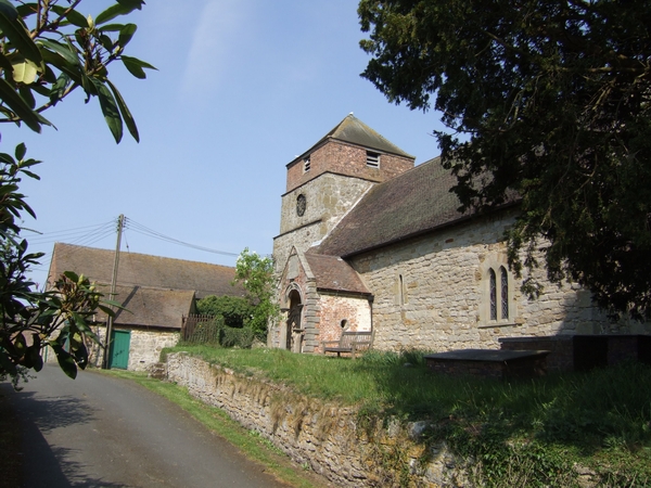
St Giles' Church, Barrow

St Giles' Church is in the hamlet of Barrow, Shropshire, England. It is an active Anglican parish church in the deanery of Telford Severn Gorge, the archdeaconry...

Buildwas Formation

The Buildwas Formation (Bw, BUI), formerly called Wenlock Shale and Buildwas Beds, is a geologic formation in Shropshire, England. It preserves fossils...

Willey, Shropshire

Willey is a small village in the civil parish of Barrow, south west of the town of Broseley, Shropshire, England. It is made up of about 4 farms and the...

Nearby Amenities

Located within 500m of 52.597049,-2.5067829
Barrow
Place: hamlet
Source: NPE
Wikidata: Q4577707
Wikipedia: en:Barrow, Shropshire
Lat/Long: 52.5965854/-2.5069873
Generator Method: photovoltaic
Generator Output Electricity: yes
Generator Source: solar
Generator Type: solar_photovoltaic_panel
Location: roof
Power: generator
Lat/Long: 52.5963502/-2.5070715
The data included in this document is from www.openstreetmap.org. The data is made available under ODbL.

Have you been to Barrow?

Leave your review of Barrow below (or comments, questions and feedback).