Moasdale

Valley in Cumberland Copeland

England

Moasdale

Cockley Beck from above Wrynose Bottoms The view is looking westwards towards Hardknott Pass.
Cockley Beck from above Wrynose Bottoms Credit: Andy Beecroft

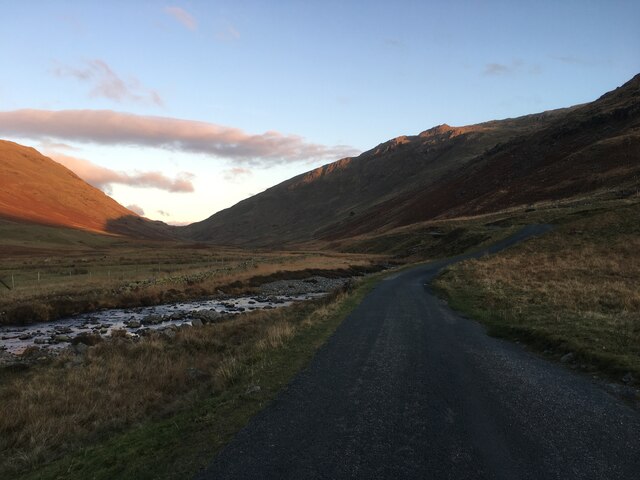
Moasdale is a small village located in the picturesque valley of Cumberland, England. Nestled amidst the rolling hills and lush green landscapes, this charming hamlet offers a tranquil and idyllic setting for its residents and visitors alike.

The village is characterized by its quaint stone cottages and traditional architecture, which adds to its timeless appeal. Moasdale is renowned for its close-knit community, where neighbors know each other by name and a friendly atmosphere prevails. The village boasts a small but well-maintained community center that serves as a hub for various social activities, bringing the locals together.

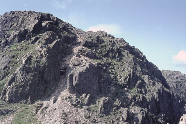
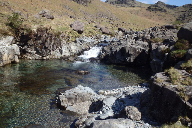
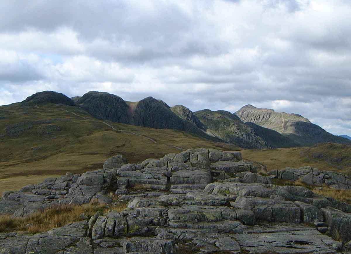
Nature enthusiasts are drawn to Moasdale for its proximity to the stunning Cumberland Valley. The valley is a haven for hikers, cyclists, and nature lovers, offering an abundance of scenic trails and breathtaking vistas. The surrounding countryside is also home to diverse wildlife, making it a popular destination for birdwatching and wildlife spotting.

While Moasdale is primarily a residential area, it benefits from its proximity to nearby towns and cities. The bustling market town of Cumberland is a short drive away, offering a range of amenities including shopping centers, restaurants, and entertainment options. Additionally, the village is well-connected through public transport, making it easily accessible for commuters and day-trippers.

In conclusion, Moasdale is a charming village nestled in the beautiful Cumberland Valley, offering a peaceful and close-knit community, stunning natural surroundings, and convenient access to nearby amenities. It is a place where residents can enjoy the tranquility of rural living while still being connected to the wider region.

If you have any feedback on the listing, please let us know in the comments section below.

Moasdale Images

Images are sourced within 2km of 54.419099/-3.1732781 or Grid Reference NY2303. Thanks to Geograph Open Source API. All images are credited.

Cockley Beck from above Wrynose Bottoms The view is looking westwards towards Hardknott Pass.
Cockley Beck from above Wrynose Bottoms
The view is looking westwards towards Hardknott Pass.
Ordnance Survey Cut Mark This OS cut mark can be found on barn at Cockley Beck Farm. It marks a point 216.688m above mean sea level.
Ordnance Survey Cut Mark
This OS cut mark can be found on barn at Cockley Beck Farm. It marks a point 216.688m above mean sea level.
Road towards the Wrynose Pass
Eastern end of the Hardknott Pass
Wrynose Bottom View to Hardknott Pass viewed from Wyrnose Bottom.  The road traversing Hardknott Pass, one of the steepest in the country can be seen.
Wrynose Bottom
View to Hardknott Pass viewed from Wyrnose Bottom. The road traversing Hardknott Pass, one of the steepest in the country can be seen.
Cattle in Wrynose Bottom
Harter Fell viewed from Wrynose Bottom Harter Fell viewed from the Duddon Valley  between Wrynose Pass and Hardknott Pass.  There are two Harter Fells in the Lake District, this one is above Eskdale, the other is above Mardale in the east of the district.
Harter Fell viewed from Wrynose Bottom
Harter Fell viewed from the Duddon Valley between Wrynose Pass and Hardknott Pass. There are two Harter Fells in the Lake District, this one is above Eskdale, the other is above Mardale in the east of the district.
On the move! Farmers moving their Herdwick sheep in the Duddon valley.  The picture was taken out of the car window as I sat waiting for the sheep to cross the road.
On the move!
Farmers moving their Herdwick sheep in the Duddon valley. The picture was taken out of the car window as I sat waiting for the sheep to cross the road.
The Hardknott Pass Approaching the Hardnott Pass, one of the steepest road pass in the country.
The Hardknott Pass
Approaching the Hardnott Pass, one of the steepest road pass in the country.
View to Wrynose Pass View of Wrynose Bottom and Wrynose Pass from Hardknott Pass.
View to Wrynose Pass
View of Wrynose Bottom and Wrynose Pass from Hardknott Pass.
The 'Bad Step' on Crinkle Crags It is interesting to see that this route was already badly eroded back in 1965.

Competent scramblers will take a route immediately right of the chockstone. There is clearly an easier route to the right of the huge central slab. But mere hillwalkers, as I am, used a path on the left, out of shot.
The 'Bad Step' on Crinkle Crags
It is interesting to see that this route was already badly eroded back in 1965. Competent scramblers will take a route immediately right of the chockstone. There is clearly an easier route to the right of the huge central slab. But mere hillwalkers, as I am, used a path on the left, out of shot.
On lower slope of Hard Knott On lower slope of Hard Knott looking in the distance to the Scafells
On lower slope of Hard Knott
On lower slope of Hard Knott looking in the distance to the Scafells
Cockley Beck in 1958 Looking southwest from the bridge towards Harter Fell.
Cockley Beck in 1958
Looking southwest from the bridge towards Harter Fell.
Path heading past the tarn down to the pass From Hard Knott the path heading past the tarn down to the pass
Path heading past the tarn down to the pass
From Hard Knott the path heading past the tarn down to the pass
Tarn by far west top of Cold Fell
River Esk Bowfell in the distance
River Esk
Bowfell in the distance
River Esk Small fall and pool on the Esk
River Esk
Small fall and pool on the Esk
Show me another place!

Moasdale is located at Grid Ref: NY2303 (Lat: 54.419099, Lng: -3.1732781)

Administrative County: Cumbria

District: Copeland

Police Authority: Cumbria

What 3 Words

///theory.live.canny. Near Ambleside, Cumbria

Nearby Locations

Moasdale Yew Bank

Related Wikis

Hard Knott

Hard Knott is a fell in the English Lake District, at the head of Eskdale. == Geology == Rhyolitic lava-like tuff of the Bad Step Tuff forms the summit...

Crinkle Crags

Crinkle Crags is a fell in the English Lake District in the county of Cumbria. It forms part of two major rings of mountains, surrounding the valleys of...

Cockley Beck

Cockley Beck is a small hamlet, situated in the Duddon Valley in Cumbria, England. Historically, the hamlet was part of Lancashire. Located today within...

Hardknott Pass

Hardknott Pass is a hill pass between Eskdale and the Duddon Valley in the Lake District National Park, Cumbria, England. The tarmac-surfaced road, which...

Nearby Amenities

Located within 500m of 54.419099,-3.1732781
Ford: yes
Lat/Long: 54.4157149/-3.1701824
Ford: yes
Lat/Long: 54.4223608/-3.1774098
The data included in this document is from www.openstreetmap.org. The data is made available under ODbL.

Have you been to Moasdale?

Leave your review of Moasdale below (or comments, questions and feedback).