Cossarshill Scar

Valley in Selkirkshire

Scotland

Cossarshill Scar

Minor road and bridge near Cossarhill Farm Looking southward. At this point Cossarhill Burn flows beneath the road.
Minor road and bridge near Cossarhill Farm Credit: Peter Wood

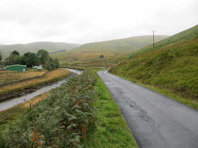
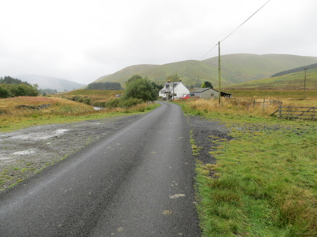
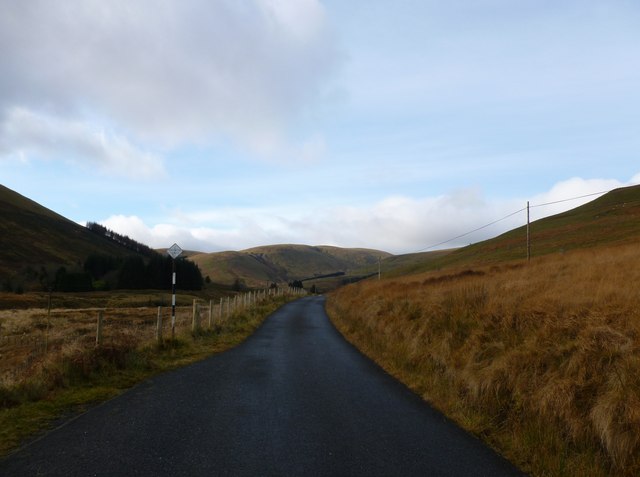
Cossarshill Scar is a stunning valley located in Selkirkshire, Scotland. Nestled amidst the picturesque Scottish Borders, this natural wonder offers breathtaking views and an abundance of natural beauty.

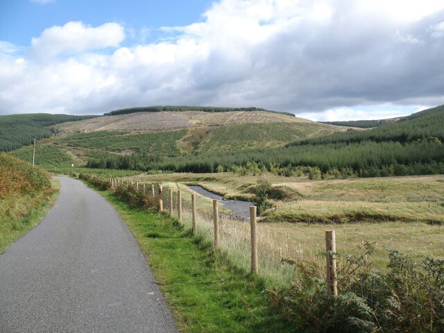
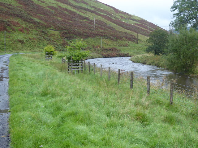
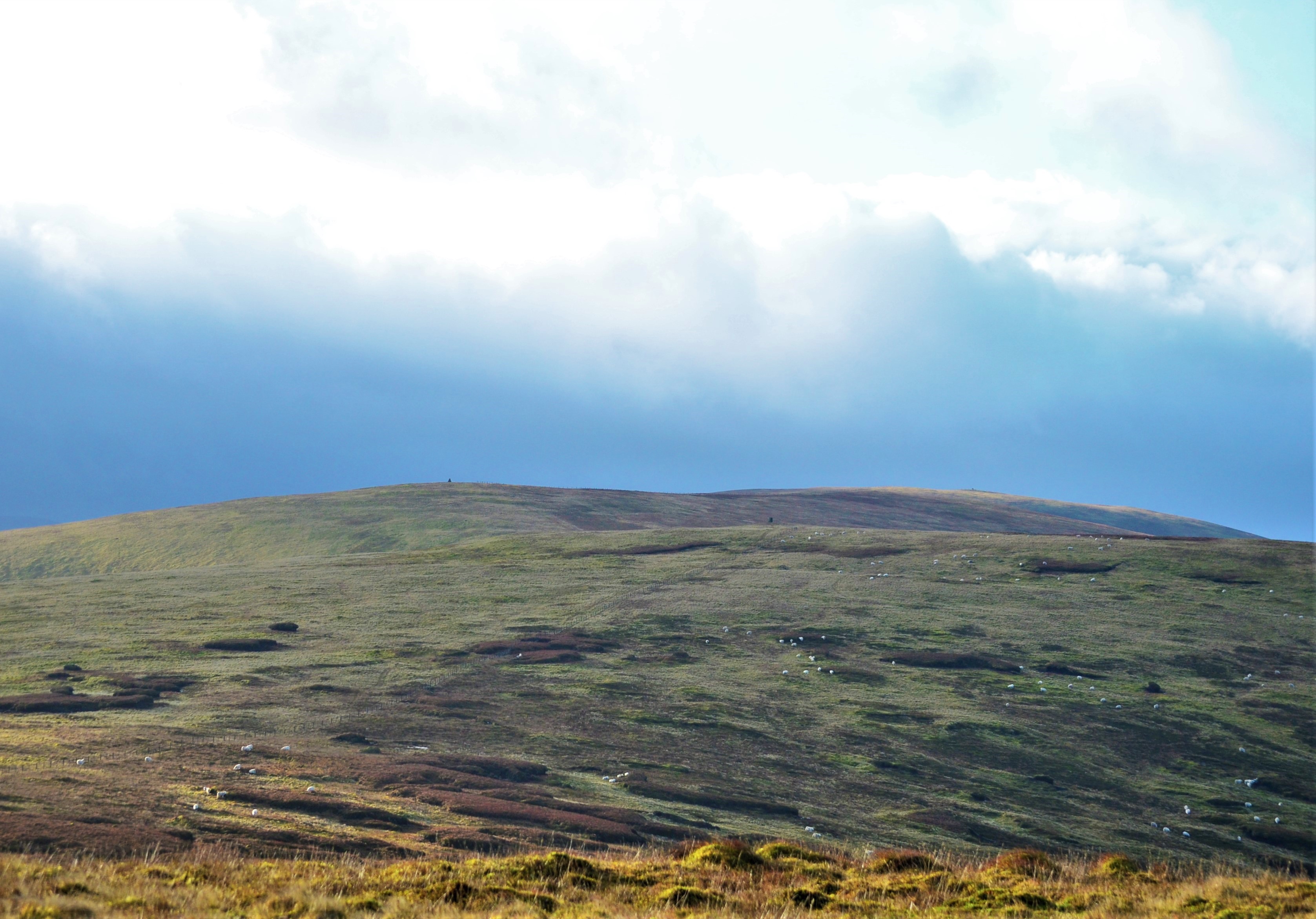
The valley is characterized by its rugged terrain, with steep slopes and rocky outcrops creating an impressive and dramatic landscape. Cossarshill Scar is home to a diverse range of flora and fauna, making it a haven for nature enthusiasts and wildlife lovers. The valley is known for its rich biodiversity, with a variety of plant species, including heather, ferns, and wildflowers, dotting the landscape.

One of the main attractions of Cossarshill Scar is its panoramic views. From the valley, visitors can enjoy sweeping vistas of the surrounding countryside, with rolling hills and meandering rivers stretching as far as the eye can see. The valley also offers several vantage points, allowing visitors to take in the beauty of the landscape from different perspectives.

Cossarshill Scar is a popular destination for outdoor activities such as hiking and walking. The valley is crisscrossed with a network of trails, offering visitors the opportunity to explore the area on foot. These trails cater to all levels of experience, from leisurely strolls to more challenging hikes, providing something for everyone.

Overall, Cossarshill Scar is a truly remarkable place, offering visitors a chance to immerse themselves in the natural wonders of Selkirkshire. Whether it's the stunning views, the diverse wildlife, or the exhilarating outdoor activities, this valley is a must-visit for anyone seeking a memorable and enriching experience in the Scottish Borders.

If you have any feedback on the listing, please let us know in the comments section below.

Cossarshill Scar Images

Images are sourced within 2km of 55.40883/-3.221752 or Grid Reference NT2213. Thanks to Geograph Open Source API. All images are credited.

Minor road and bridge near Cossarhill Farm Looking southward. At this point Cossarhill Burn flows beneath the road.
Minor road and bridge near Cossarhill Farm
Looking southward. At this point Cossarhill Burn flows beneath the road.
Minor road between Cossarhill and Brockhoperig Looking south-westward. Ettrick Water can be glimpsed through the trees on the left.
Minor road between Cossarhill and Brockhoperig
Looking south-westward. Ettrick Water can be glimpsed through the trees on the left.
Minor road beside Ettrick Water at Brockhoperig Looking north-eastward.
Minor road beside Ettrick Water at Brockhoperig
Looking north-eastward.
Minor road beside Ettrick Water at Shorthope Looking westward.
Minor road beside Ettrick Water at Shorthope
Looking westward.
Minor road approaching Crook Cottage Looking south-westward.
Minor road approaching Crook Cottage
Looking south-westward.
Ettrick Valley near Shorthope The Ettrick Water is a tributary of the River Tweed.  Hope Head is in the background.
The Southern Upland Way follows the road.
Ettrick Valley near Shorthope
The Ettrick Water is a tributary of the River Tweed. Hope Head is in the background. The Southern Upland Way follows the road.
The Southern Upland Way near Scabcleuch The Southern Upland Way follows this minor road along the Ettrick Valley between Scabcleuch and Longhope Burn.
The Southern Upland Way near Scabcleuch
The Southern Upland Way follows this minor road along the Ettrick Valley between Scabcleuch and Longhope Burn.
The Southern Upland Way near Shorthope
The Southern Upland Way near Brockhoperig
Single track road, Ettrickdale Complete with some very old looking passing place signs.  Ferny Hill in the background.
Single track road, Ettrickdale
Complete with some very old looking passing place signs. Ferny Hill in the background.
Old Milestone above Ettrick Water, Shorthope, Ettrick Parish By the UC road, in parish of Ettrick (Selkirk District), Shorthope, above Ettrick Water, in bracken, on unfenced verge, North side of road.

Inscription once read:-
(Selkirk)
(21)
Carved bench mark on lower face.

Surveyed

Milestone Society National ID: BD_SKEW21
Old Milestone above Ettrick Water, Shorthope, Ettrick Parish
By the UC road, in parish of Ettrick (Selkirk District), Shorthope, above Ettrick Water, in bracken, on unfenced verge, North side of road. Inscription once read:- (Selkirk) (21) Carved bench mark on lower face. Surveyed Milestone Society National ID: BD_SKEW21
Southwest from Scabcleuch Hill Looking from the flat summit towards the Ettrick valley.
Southwest from Scabcleuch Hill
Looking from the flat summit towards the Ettrick valley.
North from Scabcleuch Hill Peniestone Knowe to the left and Rig Head to the right. The Southern Upland Way crosses this pass between Ettrick and Yarrow.
North from Scabcleuch Hill
Peniestone Knowe to the left and Rig Head to the right. The Southern Upland Way crosses this pass between Ettrick and Yarrow.
Drainage ditch, Scabcleuch Moss One of several ditches draining into Thorter Sike.
Drainage ditch, Scabcleuch Moss
One of several ditches draining into Thorter Sike.
Thorter Sike and Scabcleuch Hill Looking down the burn from the east side of Corse Hill.
Thorter Sike and Scabcleuch Hill
Looking down the burn from the east side of Corse Hill.
Sheep fank, Trow Grain Below the top of Andrewhinney Hill, sheep gathering pen overgrown by bracken
Sheep fank, Trow Grain
Below the top of Andrewhinney Hill, sheep gathering pen overgrown by bracken
Back Burn Just before the burn meets the road up the glen. Looking upstream towards Andrewhinney Hill.
Back Burn
Just before the burn meets the road up the glen. Looking upstream towards Andrewhinney Hill.
Ettrick Water
Ettrick Water
Show me another place!

Cossarshill Scar is located at Grid Ref: NT2213 (Lat: 55.40883, Lng: -3.221752)

Unitary Authority: The Scottish Borders

Police Authority: The Lothians and Scottish Borders

What 3 Words

///purifier.mass.visitor. Near Ettrick, Scottish Borders

Related Wikis

Andrewhinney Hill

Andrewhinney Hill is a hill in the Ettrick Hills range, part of the Southern Uplands of Scotland. It is the highest summit of a ridge that runs parallel...

Ettrick, Scotland

Ettrick (Scottish Gaelic: Eadaraig, IPA: [ˈet̪əɾɪkʲ]) is a small village and civil parish in the Scottish Borders area of Scotland. It is located on the...

Southern Uplands

The Southern Uplands (Scottish Gaelic: Na Monaidhean a Deas) are the southernmost and least populous of mainland Scotland's three major geographic areas...

Dob's Linn

Dob's Linn is a small steep valley in Dumfries and Galloway, just north of the A708 road between Moffat and Selkirk, in Scotland. It is part of the Grey...

Have you been to Cossarshill Scar?

Leave your review of Cossarshill Scar below (or comments, questions and feedback).