Bench Cleuch

Valley in Peeblesshire

Scotland

Bench Cleuch

Summit fence, Middle Hill Renewed fence at the summit, with Dollar Law and Cramalt Craig (with the snow) in the background.
Summit fence, Middle Hill Credit: Jim Barton

Bench Cleuch is a picturesque valley located in Peeblesshire, a historic county in the southern region of Scotland. Situated within the stunning Scottish Borders, this valley is a hidden gem offering breathtaking natural beauty and tranquility.

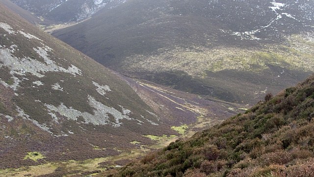
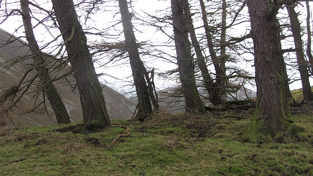
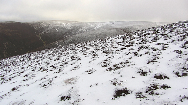
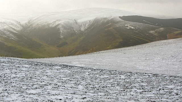
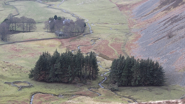
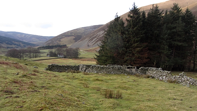
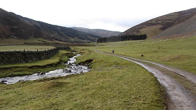
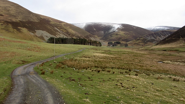
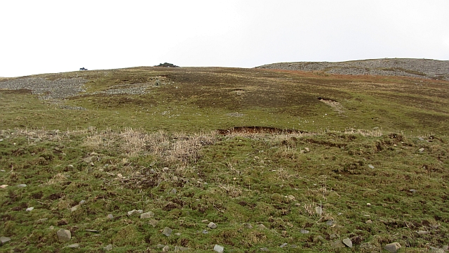
Nestled amidst rolling hills and lush greenery, Bench Cleuch is renowned for its idyllic landscapes. The valley is characterized by a meandering river that flows through its heart, creating a soothing ambiance. The surrounding hills provide a stunning backdrop, with their rugged slopes and heather-covered moorlands.

This valley is a haven for outdoor enthusiasts, offering various recreational activities. Hiking and walking trails crisscross the area, allowing visitors to explore its scenic beauty at their leisure. The river is also a popular spot for fishing, attracting anglers from far and wide.

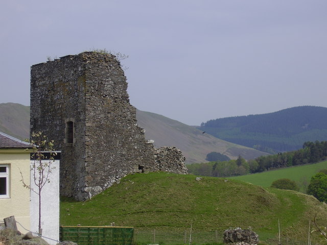
Bench Cleuch is not only a natural haven but also boasts a rich cultural heritage. The valley is home to several ancient ruins and historical sites, adding an element of intrigue to its already captivating allure. Visitors can explore the remnants of old castles or wander through ancient burial grounds, experiencing the region's fascinating past.

The valley is also known for its diverse wildlife, making it a paradise for nature lovers. Birdwatchers can spot various avian species, including golden eagles and peregrine falcons, soaring through the skies. Red deer and otters are also commonly sighted in the area.

In conclusion, Bench Cleuch is a stunning valley in Peeblesshire, Scotland, offering a perfect blend of natural beauty, outdoor activities, and cultural heritage. Whether you seek adventure or simply wish to immerse yourself in the peaceful ambiance, this valley is sure to captivate your senses.

If you have any feedback on the listing, please let us know in the comments section below.
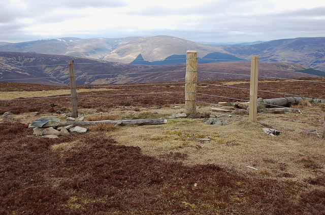
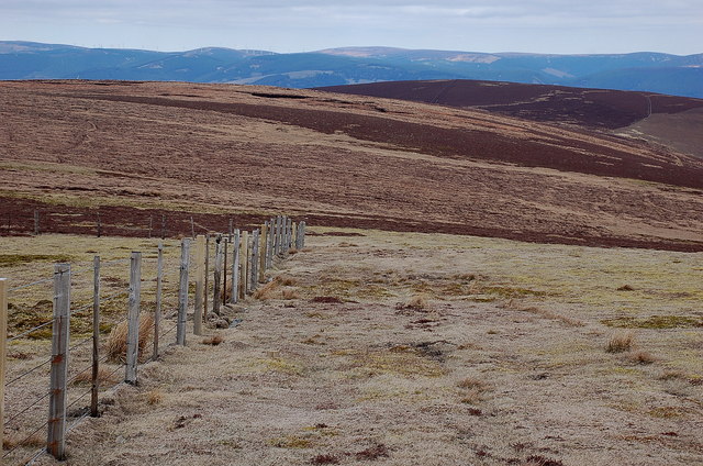
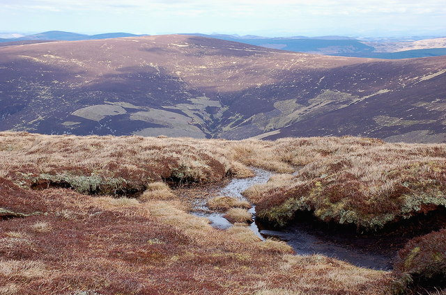
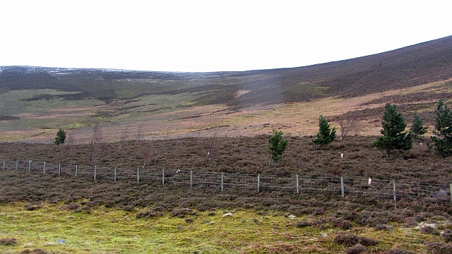
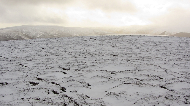
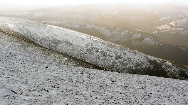
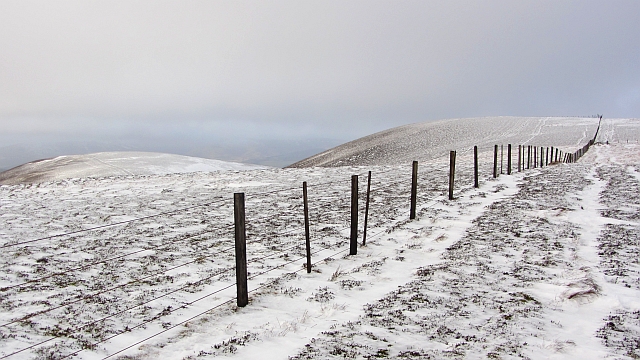
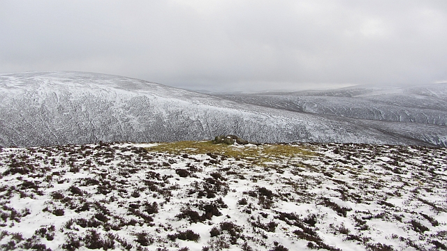
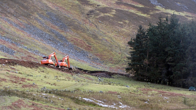
Bench Cleuch Images

Images are sourced within 2km of 55.582643/-3.2277965 or Grid Reference NT2232. Thanks to Geograph Open Source API. All images are credited.

Summit fence, Middle Hill Renewed fence at the summit, with Dollar Law and Cramalt Craig (with the snow) in the background.
Summit fence, Middle Hill
Renewed fence at the summit, with Dollar Law and Cramalt Craig (with the snow) in the background.
Hundleshope Heights from Middle Hill The route to Hundleshope Heights - the darker area of heather - keeps straight on here while the fence swings left towards Broom Hill and Stob Law. The Bowbeat wind farm is visible on the skyline.
Hundleshope Heights from Middle Hill
The route to Hundleshope Heights - the darker area of heather - keeps straight on here while the fence swings left towards Broom Hill and Stob Law. The Bowbeat wind farm is visible on the skyline.
Birkscairn Hill from Broom Hill Looking across Glen Sax to the Old Drove Road crossing Birkscairn below the summit.
Birkscairn Hill from Broom Hill
Looking across Glen Sax to the Old Drove Road crossing Birkscairn below the summit.
New wood, Hundles Hope A fenced off bit of moorland with young trees.
New wood, Hundles Hope
A fenced off bit of moorland with young trees.
Bleak Hope and Hundles Hope One of the joys of the Southern Uplands is the network of secretive glens which branch out into hidden corners, no doubt put to bad use in reiving days. Here out of sight of the outside world, the young Hundleshope receives the waters of the Glenfinnin Burn flowing out of Bleak Hope.
Bleak Hope and Hundles Hope
One of the joys of the Southern Uplands is the network of secretive glens which branch out into hidden corners, no doubt put to bad use in reiving days. Here out of sight of the outside world, the young Hundleshope receives the waters of the Glenfinnin Burn flowing out of Bleak Hope.
Larches, Hundles Hope An old larch plantation above a once enclosed field at the foot of Stob Law.
Larches, Hundles Hope
An old larch plantation above a once enclosed field at the foot of Stob Law.
North ridge of Stob Law A heathery nose descends to Hundes Hope and provides an easy ascent, even without a path or the usual quad bike track. The view is towards Scawd Law at the head of Hundles Hope and Bleak Hope.
North ridge of Stob Law
A heathery nose descends to Hundes Hope and provides an easy ascent, even without a path or the usual quad bike track. The view is towards Scawd Law at the head of Hundles Hope and Bleak Hope.
Glenrath Hill A fence runs across the ridge between Stob Law and Canada Hill. The fence has been there for a long time, yet is still only mapped by Harvey's.
Glenrath Hill
A fence runs across the ridge between Stob Law and Canada Hill. The fence has been there for a long time, yet is still only mapped by Harvey's.
Summit of Stob Law An unmarked heathery summit (there has been an attempt at a cairn, but it is not at the highest point).
Summit of Stob Law
An unmarked heathery summit (there has been an attempt at a cairn, but it is not at the highest point).
Glenrath Heights The western slopes fall steeply to Glenrathhope by a series of heathery spurs. The far spur gives an easy way up or down.
Glenrath Heights
The western slopes fall steeply to Glenrathhope by a series of heathery spurs. The far spur gives an easy way up or down.
Glenrath Heights A fence, still after many years, unmapped by the Ordnance Survey, runs southwards through heather moorland towards Middle Hill.
Glenrath Heights
A fence, still after many years, unmapped by the Ordnance Survey, runs southwards through heather moorland towards Middle Hill.
Cairn, Glenrath Heights A cairn sits amongst moss on the spur between Fash Cleuch and Whitson's Cleuch. The cairn has probably attracted perching birds which have affected the local vegetation.  
Cairns like this are used for navigation by shepherds. I once met somebody who admitted to having got lost on his hill farm, even though he had worked there for thirty years.
Cairn, Glenrath Heights
A cairn sits amongst moss on the spur between Fash Cleuch and Whitson's Cleuch. The cairn has probably attracted perching birds which have affected the local vegetation. Cairns like this are used for navigation by shepherds. I once met somebody who admitted to having got lost on his hill farm, even though he had worked there for thirty years.
Woodland, Glenrath Hope Shepherds are moving a ewe which escaped when the hill sheep were being gathered earlier. The woodland has suffered recent storm damage.
Woodland, Glenrath Hope
Shepherds are moving a ewe which escaped when the hill sheep were being gathered earlier. The woodland has suffered recent storm damage.
Stell, Glenrath Hope A ruined fank and sheep shelter beside a small woodland.
Stell, Glenrath Hope
A ruined fank and sheep shelter beside a small woodland.
Road building, Glenrathhope Another hill road has been built up Black Cleuch. Suspiciously large scale but unlikely to be wind farmers as they would come in from the south off a bigger road. There are none of the dreaded masts visible.
Road building, Glenrathhope
Another hill road has been built up Black Cleuch. Suspiciously large scale but unlikely to be wind farmers as they would come in from the south off a bigger road. There are none of the dreaded masts visible.
Glenrathope road Access road to Glenrathope beside the Back Burn.
Glenrathope road
Access road to Glenrathope beside the Back Burn.
Glenrath Hope The access road to Glenrathope with a background view of Glenrath Heights.
Glenrath Hope
The access road to Glenrathope with a background view of Glenrath Heights.
Lower slopes of Glenrath Hill Glenrath Hill has some extensive screes and even on this gentler aspect there is a lot of exposed rock.
Lower slopes of Glenrath Hill
Glenrath Hill has some extensive screes and even on this gentler aspect there is a lot of exposed rock.
Show me another place!

Bench Cleuch is located at Grid Ref: NT2232 (Lat: 55.582643, Lng: -3.2277965)

Unitary Authority: The Scottish Borders

Police Authority: The Lothians and Scottish Borders

What 3 Words

///giraffes.towels.drilling. Near Peebles, Scottish Borders

Nearby Locations

Bench Cleuch

Related Wikis

Manor Hills

The Manor Hills, also known as the Tweedsmuir Hills, are a range of hills south of Peebles in the Scottish Borders, one of the ranges which collectively...

Posso Tower

Posso Tower is a 16th-century tower house, about 6.0 miles (9.7 km) south and west of Peebles, Scottish Borders, Scotland, and west of Manor Water. �...

Castlehill Tower

Castlehill Tower, also known as Castle Hill of Manor, is a ruined oblong tower house dating from the end of the 15th century, situated in the parish of...

Dun Rig

Dun Rig is a hill in the Manor Hills range, part of the Southern Uplands of Scotland. It is the highest hill in the northernmost cluster of the Manor Hills...

Nearby Amenities

Located within 500m of 55.582643,-3.2277965
Power: pole
Lat/Long: 55.5791053/-3.2322966
Power: pole
Lat/Long: 55.5788829/-3.2309957
Power: pole
Lat/Long: 55.5786653/-3.2297624
The data included in this document is from www.openstreetmap.org. The data is made available under ODbL.

Have you been to Bench Cleuch?

Leave your review of Bench Cleuch below (or comments, questions and feedback).