Pant y Ffynnon

Valley in Radnorshire

Wales

Pant y Ffynnon

Lawn Brook Deep valley on the east side of Beacon Hill. The prominent building is The Farm - does what it says on the label. Above is a large area of heather moorland.
Lawn Brook Credit: Richard Webb

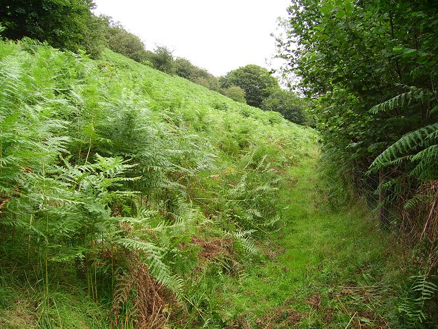
Pant y Ffynnon is a scenic valley located in the county of Radnorshire, Wales. Situated in the heart of the Welsh countryside, it is renowned for its breathtaking natural beauty and tranquil atmosphere. The valley is nestled between rolling hills and is crisscrossed by a meandering river, adding to its picturesque charm.

The name "Pant y Ffynnon" translates to "the valley of the spring" in English, which is a fitting description as the area is dotted with numerous natural springs that provide a constant flow of fresh water. These springs not only contribute to the valley's idyllic landscape but also sustain a diverse range of flora and fauna, making it a haven for nature enthusiasts and wildlife lovers.

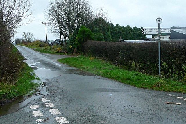
The valley is predominantly rural, characterized by scattered farmhouses and small, close-knit communities. The local residents are known for their warm hospitality and strong sense of community spirit. Agriculture plays a significant role in the local economy, with the fertile soil in the valley allowing for the cultivation of crops and the rearing of livestock.

Pant y Ffynnon offers a range of outdoor activities for visitors to enjoy, including hiking, cycling, and fishing. There are several well-marked trails that wind through the valley, offering stunning views of the surrounding countryside. The peacefulness and serenity of the area make it an ideal destination for those seeking a break from the hustle and bustle of city life.

In conclusion, Pant y Ffynnon is a captivating valley in Radnorshire, Wales, known for its natural beauty, charming communities, and outdoor recreational opportunities. It is a place that embraces its rural heritage and provides a sanctuary for both locals and visitors alike.

If you have any feedback on the listing, please let us know in the comments section below.

Pant y Ffynnon Images

Images are sourced within 2km of 52.389139/-3.173971 or Grid Reference SO2077. Thanks to Geograph Open Source API. All images are credited.

Lawn Brook Deep valley on the east side of Beacon Hill. The prominent building is The Farm - does what it says on the label. Above is a large area of heather moorland.
Lawn Brook
Deep valley on the east side of Beacon Hill. The prominent building is The Farm - does what it says on the label. Above is a large area of heather moorland.
Lane to The Farm Lane dropping off the moorland towards Pennant and The Farm. The lower ground in the valley of Lawn Brook is enclosed, with common grazing on Beacon Hill above.
Lane to The Farm
Lane dropping off the moorland towards Pennant and The Farm. The lower ground in the valley of Lawn Brook is enclosed, with common grazing on Beacon Hill above.
The Farm Farm under Beacon Hill. There are a lot of horses here.
The Farm
Farm under Beacon Hill. There are a lot of horses here.
Bracken, Beacon Hill An almost disused farm track, kept open by someone recently cutting the bracken.
Bracken, Beacon Hill
An almost disused farm track, kept open by someone recently cutting the bracken.
On Beacon Hill Shade seeking sheep on the common above Fron.
On Beacon Hill
Shade seeking sheep on the common above Fron.
Pant y Ffynnon Gully carrying a young stream from the eponymous spring. Clun Forest in the background. 
The moor here is choked in bracken.
Pant y Ffynnon
Gully carrying a young stream from the eponymous spring. Clun Forest in the background. The moor here is choked in bracken.
Beacon Hill Path up the eastern slopes through heather and wimberry (Vaccinium myrtillus).
Beacon Hill
Path up the eastern slopes through heather and wimberry (Vaccinium myrtillus).
Cwm-yr-Ingel Beacon Hill moorland, looking over Cwm-yr-Ingel towards Teme Valley hills which now have improved land. Much of Radnorshire and Shropshire's moorland has gone, replaced by grassland. However here and there, soil fertility is dropping in the new fields, and heather is returning.
Cwm-yr-Ingel
Beacon Hill moorland, looking over Cwm-yr-Ingel towards Teme Valley hills which now have improved land. Much of Radnorshire and Shropshire's moorland has gone, replaced by grassland. However here and there, soil fertility is dropping in the new fields, and heather is returning.
Fron Rocks Small crags on Beacon Hill
Fron Rocks
Small crags on Beacon Hill
Fron Rocks Crags on the side of Beacon Hill.
Fron Rocks
Crags on the side of Beacon Hill.
Frosty fields Thick frost for a morning walk up the bridleway from Pantycaragle towards Cwmyringel. The boggy, rushy low ground appears to be the remnant of a sunken lane, now largely impassible.
Frosty fields
Thick frost for a morning walk up the bridleway from Pantycaragle towards Cwmyringel. The boggy, rushy low ground appears to be the remnant of a sunken lane, now largely impassible.
Track to Pantycaragle A farm track follows the bridleway up the hill from the farm. It is likely that the original track passed between the double line of Hawthorn trees on the right, which is an old hedgerow.
Track to Pantycaragle
A farm track follows the bridleway up the hill from the farm. It is likely that the original track passed between the double line of Hawthorn trees on the right, which is an old hedgerow.
Un-named hill Without way-markers, navigation is difficult - but the broad summit of this featureless hill makes a rough landmark to get a bearing.
Un-named hill
Without way-markers, navigation is difficult - but the broad summit of this featureless hill makes a rough landmark to get a bearing.
Distant sunlight Beyond the bog and the stream running beneath the gate, the path climbs again, away from the wooded dingle ascending from Bryndraenog. Sunlight played on the rounded hilltops nearby, but didn't reach us.
Distant sunlight
Beyond the bog and the stream running beneath the gate, the path climbs again, away from the wooded dingle ascending from Bryndraenog. Sunlight played on the rounded hilltops nearby, but didn't reach us.
View of Cwmyringel Bridleways join on the shoulder of the hill overlooking lower Cwmyringel. The distant hill is Beacon Hill <a href="https://www.geograph.org.uk/gridref/SO1776">SO1776</a>.
View of Cwmyringel
Bridleways join on the shoulder of the hill overlooking lower Cwmyringel. The distant hill is Beacon Hill SO1776.
Old trackway On the flank of lower Cwmyringel the bridleway follows an old track lined on each side by an overgrown Hawthorn hedgerow.
Old trackway
On the flank of lower Cwmyringel the bridleway follows an old track lined on each side by an overgrown Hawthorn hedgerow.
Track to Cwmyringel There is a junction here in the bridleways, one descending into the cwm, and the other rising to the top of the ridge above Cwm-yr-ingel Wood.
Track to Cwmyringel
There is a junction here in the bridleways, one descending into the cwm, and the other rising to the top of the ridge above Cwm-yr-ingel Wood.
Above Cwm-yr-ingel Wood From the flank of the hill the head of Cwnyringel can be seen beneath the summit of Beacon Hill. The fenced lane along the ridge can be seen to the right.
Above Cwm-yr-ingel Wood
From the flank of the hill the head of Cwnyringel can be seen beneath the summit of Beacon Hill. The fenced lane along the ridge can be seen to the right.
Show me another place!

Pant y Ffynnon is located at Grid Ref: SO2077 (Lat: 52.389139, Lng: -3.173971)

Unitary Authority: Powys

Police Authority: Dyfed Powys

What 3 Words

///chairing.button.novelist. Near Knighton, Powys

Nearby Locations

Dutlas Pant y Ffynnon

Related Wikis

Beguildy

Beguildy (Welsh: Bugeildy) is a village and community in Powys, Wales. It lies in a remote tract of countryside, 8 miles (13 km) northwest of Knighton...

Beacon Hill, Powys

Beacon Hill (Welsh: Mynydd Disglair) is a hill in the county of Radnorshire, Wales. It lies within the Powys unitary council area. It is located north...

Quabbs

Quabbs is a small, scattered hamlet in the southwest of Shropshire, near the border between England and Wales. The name, which also occurs in Gloucestershire...

East Wales

East Wales (Welsh: Dwyrain Cymru) is either a ITL 3 statistical region of Wales or generally a region encompassing the easternmost parts of the country...

Nearby Amenities

Located within 500m of 52.389139,-3.173971
Bicycle: yes
Designation: public_bridleway
Lat/Long: 52.3849029/-3.175909
Bicycle: yes
Designation: public_bridleway
Lat/Long: 52.3851089/-3.1758317
Bicycle: yes
Designation: public_bridleway
Lat/Long: 52.385377/-3.1757504
Bicycle: yes
Designation: public_bridleway
Lat/Long: 52.385688/-3.1758353
Bicycle: yes
Designation: public_bridleway
Lat/Long: 52.3860509/-3.1763308
Bicycle: yes
Designation: public_bridleway
Lat/Long: 52.3863447/-3.1767697
Bicycle: yes
Designation: public_bridleway
Lat/Long: 52.3870314/-3.1780625
Bicycle: yes
Designation: public_bridleway
Lat/Long: 52.3872665/-3.1784692
Bicycle: yes
Designation: public_bridleway
Lat/Long: 52.3873037/-3.1785308
Bicycle: yes
Designation: public_bridleway
Lat/Long: 52.3873943/-3.178725
Bicycle: yes
Designation: public_bridleway
Lat/Long: 52.3874451/-3.1788451
Bicycle: yes
Designation: public_bridleway
Lat/Long: 52.3875089/-3.1788955
Bicycle: yes
Designation: public_bridleway
Lat/Long: 52.3876482/-3.1788667
Bicycle: yes
Designation: public_bridleway
Lat/Long: 52.3878231/-3.1787927
Bicycle: yes
Designation: public_bridleway
Lat/Long: 52.3879284/-3.1787927
Bicycle: yes
Designation: public_bridleway
Lat/Long: 52.3880205/-3.1788174
Bicycle: yes
Designation: public_bridleway
Lat/Long: 52.3882389/-3.1787798
Bicycle: yes
Designation: public_bridleway
Lat/Long: 52.3887579/-3.1784409
Bicycle: yes
Designation: public_bridleway
Lat/Long: 52.3902885/-3.1774303
Bicycle: yes
Designation: public_bridleway
Lat/Long: 52.3917363/-3.1745588
Bicycle: yes
Designation: public_bridleway
Lat/Long: 52.3924223/-3.1747195
Bicycle: yes
Designation: public_bridleway
Lat/Long: 52.3924871/-3.1747549
Bicycle: yes
Designation: public_bridleway
Lat/Long: 52.3931425/-3.1758468
Bicycle: yes
Designation: public_bridleway
Lat/Long: 52.3934881/-3.1758184
The data included in this document is from www.openstreetmap.org. The data is made available under ODbL.

Have you been to Pant y Ffynnon?

Leave your review of Pant y Ffynnon below (or comments, questions and feedback).