Bitch Cleuch

Valley in Peeblesshire

Scotland

Bitch Cleuch

Moorland on Greenside Law Looking towards Bitch Craig and Manor Water valley.
Moorland on Greenside Law Credit: wrobison

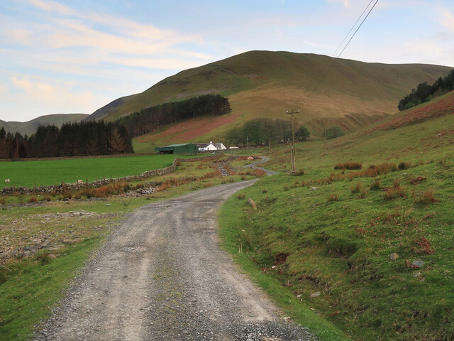
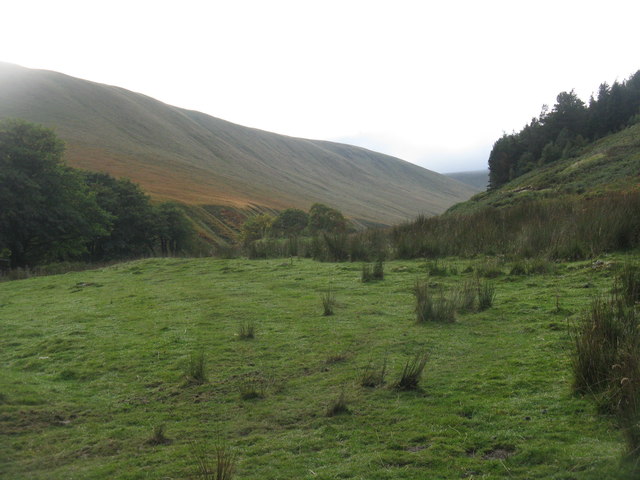
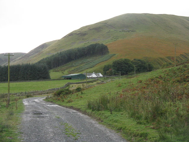
Bitch Cleuch is a picturesque valley located in Peeblesshire, Scotland. Nestled within the rolling hills of the Scottish Borders, this charming valley is renowned for its natural beauty and tranquil atmosphere.

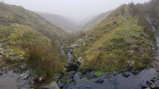
The name "Bitch Cleuch" derives from the Scottish Gaelic word "cleuch," meaning a narrow ravine or gully, and does not carry any derogatory connotation. The valley is named after the Bitch Burn, a small stream that flows through the area, adding to the allure of the landscape.

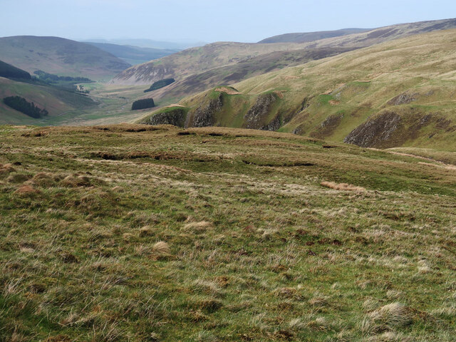
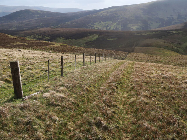
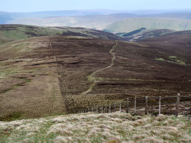
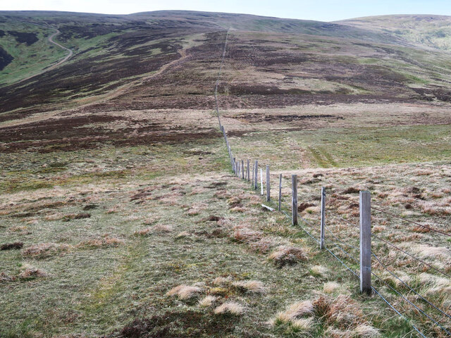
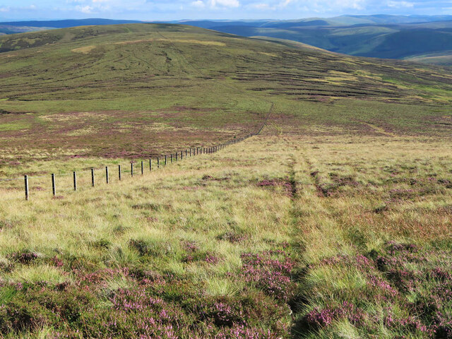
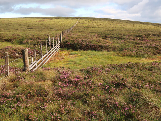
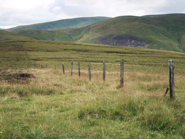
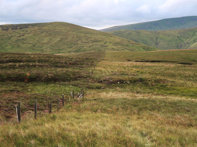
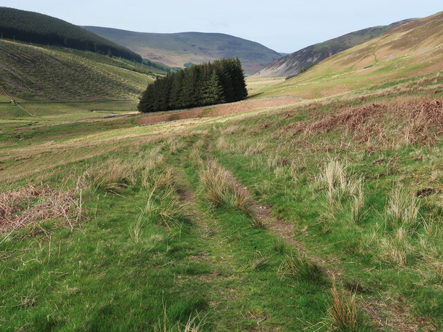
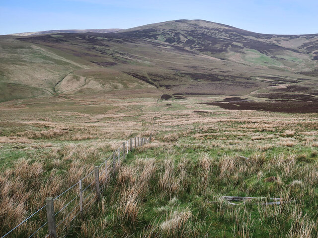
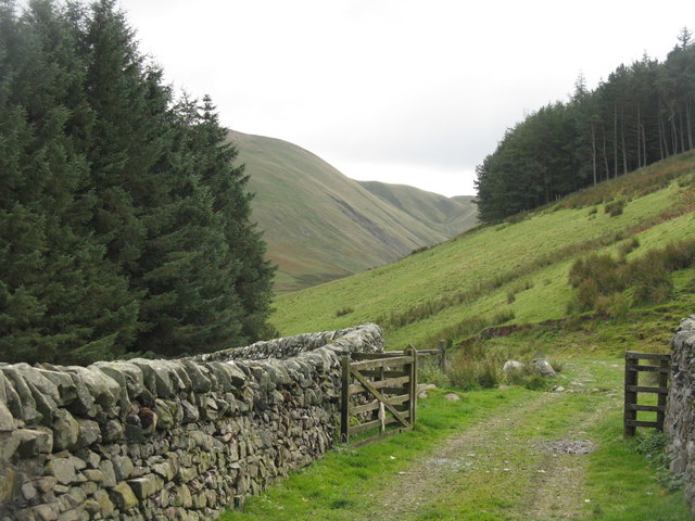
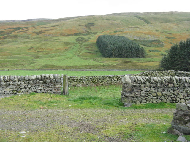
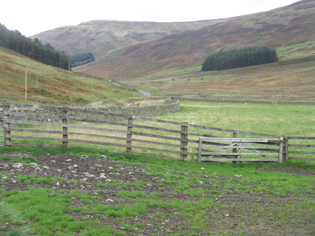
The valley is characterized by its lush green meadows, dense woodlands, and rugged rocky outcrops. It is a haven for nature enthusiasts, offering numerous walking trails and opportunities to spot wildlife. The surrounding hills provide stunning panoramic views of the valley and its surroundings, making it a popular destination for hikers and photographers alike.

Historically, Bitch Cleuch was once a site of lead mining, and remnants of the industry can still be seen today. The ruins of old mine buildings and the remnants of mining equipment serve as a reminder of the area's industrial past.

Visitors to Bitch Cleuch can enjoy a peaceful and serene environment, away from the hustle and bustle of city life. The valley offers a chance to reconnect with nature, breathe in the fresh air, and take in the breathtaking scenery. Whether it's a leisurely stroll through the meadows or a more challenging hike up the surrounding hills, Bitch Cleuch has something to offer for everyone seeking a taste of Scotland's natural beauty.

If you have any feedback on the listing, please let us know in the comments section below.

Bitch Cleuch Images

Images are sourced within 2km of 55.525346/-3.2685286 or Grid Reference NT2026. Thanks to Geograph Open Source API. All images are credited.

Moorland on Greenside Law Looking towards Bitch Craig and Manor Water valley.
Moorland on Greenside Law
Looking towards Bitch Craig and Manor Water valley.
Fence on Greenside Law Descending to Water Head.
Fence on Greenside Law
Descending to Water Head.
Fence and moorland on Notman Law Grassy moorland on the left of the fence and heather moorland with the Thief's Road on the right.
Fence and moorland on Notman Law
Grassy moorland on the left of the fence and heather moorland with the Thief's Road on the right.
Fence and moorland on Notman Law Looking towards Fifescar Knowe.
Fence and moorland on Notman Law
Looking towards Fifescar Knowe.
Track to Manorhead The old telephone poles are carrying a new fibre optic cable.
Track to Manorhead
The old telephone poles are carrying a new fibre optic cable.
Fence and track on Black Law Looking south to Conscleuch Head and Deer Law.
Fence and track on Black Law
Looking south to Conscleuch Head and Deer Law.
Fence and bog between Black Law and Conscleuch Head A good fence and an area of bog to be avoided.
Fence and bog between Black Law and Conscleuch Head
A good fence and an area of bog to be avoided.
Old fence on Redsike Head No longer intact but still marking the change from heather moorland on the left to grassy moorland on the right, see <a href="https://www.geograph.org.uk/photo/6194886">NT2027 : Fence west of Black Law</a> and <a href="https://www.geograph.org.uk/photo/3518363">NT2027 : The western ridge of Black Law</a> for other views.
Old fence on Redsike Head
No longer intact but still marking the change from heather moorland on the left to grassy moorland on the right, see NT2027 : Fence west of Black Law and NT2027 : The western ridge of Black Law for other views.
A typical Border Cleuch. A Border Cleuch, (pronounced clooch, as in loch), is a steep sided ravine and is a common feature of the Border hills. They can be quite deep and dangerous, especially in mist and after heavy rain. This one carries the Thrashie Burn, a very minor tributary of the Manor Water.
A typical Border Cleuch.
A Border Cleuch, (pronounced clooch, as in loch), is a steep sided ravine and is a common feature of the Border hills. They can be quite deep and dangerous, especially in mist and after heavy rain. This one carries the Thrashie Burn, a very minor tributary of the Manor Water.
Track and trees at Manorhead The start of the track to the Megget Dam and St Mary's Loch.
Track and trees at Manorhead
The start of the track to the Megget Dam and St Mary's Loch.
Moorland fence on Foulbrig Looking towards Black Law.
Moorland fence on Foulbrig
Looking towards Black Law.
Ugly Grain at Manorhead Mostly in the shadow of Manor Rig.
Ugly Grain at Manorhead
Mostly in the shadow of Manor Rig.
The head of the Manor Valley from Manorhead Some of the steep ridges around the coomb at the head of the Manor Valley.
The head of the Manor Valley from Manorhead
Some of the steep ridges around the coomb at the head of the Manor Valley.
Red Sike from Manorhead The head of the Manor Valley.
Red Sike from Manorhead
The head of the Manor Valley.
The Manor Valley Looking northeast from Manorhead.
The Manor Valley
Looking northeast from Manorhead.
The road to Manorhead  Ugly Grain burn flows past the house from the right, to join the main Manor Water valley on the left.
The road to Manorhead
Ugly Grain burn flows past the house from the right, to join the main Manor Water valley on the left.
The head of the Manor Valley The valley ends with a half-ring of 600-800m hilltops - Redsike Head, Greenside Law, Water Head, Notman Law and Fifescar Knowe.
The head of the Manor Valley
The valley ends with a half-ring of 600-800m hilltops - Redsike Head, Greenside Law, Water Head, Notman Law and Fifescar Knowe.
Show me another place!

Bitch Cleuch is located at Grid Ref: NT2026 (Lat: 55.525346, Lng: -3.2685286)

Unitary Authority: The Scottish Borders

Police Authority: The Lothians and Scottish Borders

What 3 Words

///tokens.birthing.restrict. Near Ettrick, Scottish Borders

Nearby Locations

Redsike Head Bitch Cleuch

Related Wikis

Black Law (hill)

Black Law is a hill in the Manor Hills range, part of the Southern Uplands of Scotland. One of the more remote Donalds, it does not easily combine into...

Craigierig

Craigierig is a village on the Megget Reservoir, in the Scottish Borders area of Scotland, in the former Selkirkshire. Places nearby include the Glengaber...

Megget

Megget is a former chapelry or parish containing the valley of Megget Water, now forming the westernmost part of the parish of Yarrow, Selkirkshire in...

Megget Reservoir

Megget Reservoir is an impounding reservoir in the Megget valley in Ettrick Forest, in the Scottish Borders. The 259 hectares (640 acres) reservoir is...

Have you been to Bitch Cleuch?

Leave your review of Bitch Cleuch below (or comments, questions and feedback).