Chapel Den

Valley in Fife

Scotland

Chapel Den

Road to Corston Mill
Road to Corston Mill Credit: Steven Brown

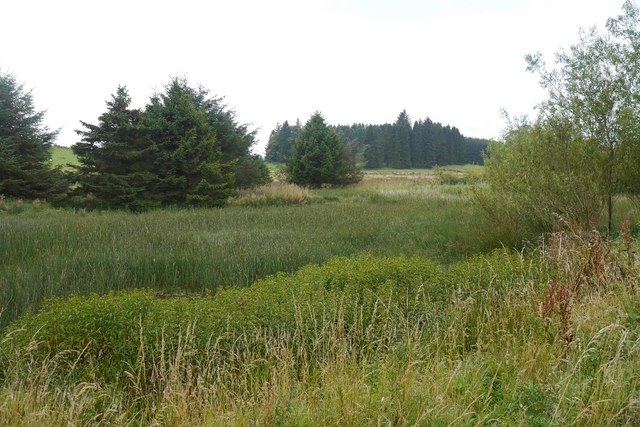
Chapel Den is a small valley located in the region of Fife, Scotland. Situated near the village of Collessie, it is known for its picturesque and tranquil setting, attracting visitors from both near and far.

Surrounded by rolling hills and lush greenery, Chapel Den offers a peaceful escape from the hustle and bustle of everyday life. The valley is adorned with a variety of trees, including oak, beech, and birch, creating a colorful and vibrant landscape throughout the year. The presence of a small stream meandering through the valley adds to its charm, providing a soothing soundtrack to the nature lovers who explore the area.

Chapel Den is a haven for wildlife enthusiasts, as it boasts a diverse range of fauna. Visitors may be lucky enough to spot various bird species, such as woodpeckers and owls, as well as small mammals like hedgehogs and squirrels. The valley's rich biodiversity is also reflected in its flora, with an array of wildflowers and ferns carpeting the forest floor.

For those who enjoy outdoor activities, Chapel Den offers several walking trails that allow visitors to immerse themselves in the natural beauty of the surroundings. These paths wind through the valley, offering stunning views of the countryside and opportunities for peaceful contemplation.

Overall, Chapel Den is a hidden gem in the heart of Fife, providing a serene and idyllic setting for nature lovers and outdoor enthusiasts alike.

If you have any feedback on the listing, please let us know in the comments section below.
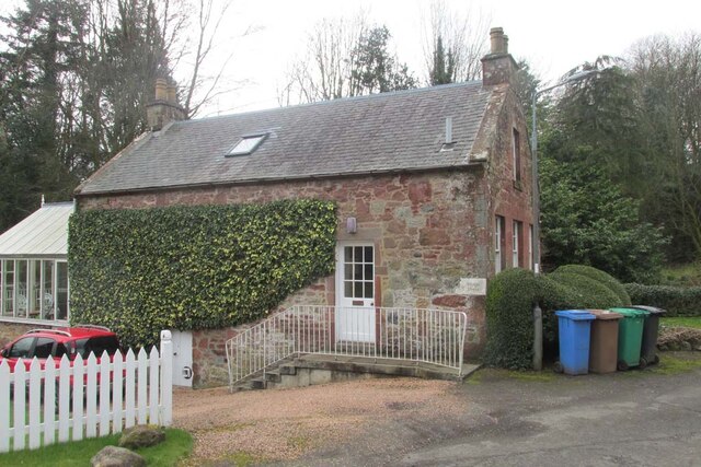
Chapel Den Images

Images are sourced within 2km of 56.267972/-3.3176743 or Grid Reference NO1809. Thanks to Geograph Open Source API. All images are credited.

Road to Corston Mill
A91 at Gateside
A91 at Gateside
A912 towards Perth
A912 towards Perth
Toll House, Gateside, Strathmiglo Thought to be an ex Toll House, though its position is not on the main route through the village. It would be more suited to a residence of the toll-keeper.

Milestone Society National ID: FF.STR
Toll House, Gateside, Strathmiglo
Thought to be an ex Toll House, though its position is not on the main route through the village. It would be more suited to a residence of the toll-keeper. Milestone Society National ID: FF.STR
The road to Wester and Easter Upper Urquhart Farms Looking south to West Lomond Hill.
The road to Wester and Easter Upper Urquhart Farms
Looking south to West Lomond Hill.
Fields at Easter Upper Urquhart The nearest appears to be a hay field regrowing after the first cut.
Fields at Easter Upper Urquhart
The nearest appears to be a hay field regrowing after the first cut.
Marsh, Kincraigie A rather vegetated pool.
Marsh, Kincraigie
A rather vegetated pool.
Marsh above Wellfield Wetland surrounded by coniferous stripwoods. A contrast to the arable land to the north.
Marsh above Wellfield
Wetland surrounded by coniferous stripwoods. A contrast to the arable land to the north.
Trees by the Leden Urquhart Road
Benchmark on wall, Leden Urquhart Road Ordnance Survey benchmark described on database at <span class="nowrap"><a title="https://www.bench-marks.org.uk/bm135749" rel="nofollow ugc noopener" href="https://www.bench-marks.org.uk/bm135749">Link</a><img style="margin-left:2px;" alt="External link" title="External link - shift click to open in new window" src="https://s1.geograph.org.uk/img/external.png" width="10" height="10"/></span>. See also <a href="https://www.geograph.org.uk/photo/6678551">NO1710 : Gate on the Leden Urquhart Road</a>.
Benchmark on wall, Leden Urquhart Road
Ordnance Survey benchmark described on database at LinkExternal link. See also NO1710 : Gate on the Leden Urquhart Road.
Gate on the Leden Urquhart Road There is an Ordnance Survey benchmark on the left hand gatepost. See <a href="https://www.geograph.org.uk/photo/6678548">NO1710 : Benchmark on wall, Leden Urquhart Road</a>.
Gate on the Leden Urquhart Road
There is an Ordnance Survey benchmark on the left hand gatepost. See NO1710 : Benchmark on wall, Leden Urquhart Road.
Leden Urquhart Road, north of Gateside, Fife
Road Junction to Balcanquhal
Wheat, Leden Urquhart Wheat field and small wood. Very typical of the south facing slopes of the Fife end of the Ochil Hills.
Wheat, Leden Urquhart
Wheat field and small wood. Very typical of the south facing slopes of the Fife end of the Ochil Hills.
Road to Freeland
Road to Freeland
Cadgeracre Wood Unlike the surrounding woodlands, this wood appears to be "natural" unlike the planted windbreaks which surround it.
Cadgeracre Wood
Unlike the surrounding woodlands, this wood appears to be "natural" unlike the planted windbreaks which surround it.
Freeland and Gateside View from the slopes of West Lomond Hill.
Freeland and Gateside
View from the slopes of West Lomond Hill.
Arable land near Kincraigie A contrast between harvested winter sown fields and still green spring barley.
Arable land near Kincraigie
A contrast between harvested winter sown fields and still green spring barley.
Show me another place!

Chapel Den is located at Grid Ref: NO1809 (Lat: 56.267972, Lng: -3.3176743)

Unitary Authority: Fife

Police Authority: Fife

What 3 Words

///phantom.stir.furniture. Near Auchtermuchty, Fife

Nearby Locations

Chapel Den Gateside

Related Wikis

Gateside, Fife

Gateside is a small village in the north east of Fife, Scotland. It is inhabited by around 200 people. It also comprises a school (which is currently closed...

Gateside railway station

Gateside railway station served the village of Gateside, Fife, Scotland from 1858 to 1950 on the Fife and Kinross Railway. == History == The station opened...

Bunnet Stane

The Bunnet Stane (or bonnet stone) is a rock formation near the hamlet of Gateside in Fife, at the foot of West Lomond. It sits upon one of the calciferous...

Balvaird Castle

Balvaird Castle in Perthshire is a traditional late medieval Scottish tower house. It is located in the Ochil Hills, around 5 kilometres (3.1 mi) south...

Nearby Amenities

Located within 500m of 56.267972,-3.3176743
Gateside
Place: village
Source: npe
Wikidata: Q1495782
Wikipedia: en:Gateside, Fife
Lat/Long: 56.2681674/-3.3185232
Post Box
Collection Times: Mo-Fr 09:00; Sa 07:00
Manufacturer: Machan Scotland
Operator: Royal Mail
Post Box Mounting: pier
Post Box Type: lamp
Ref: KY14 284D
Royal Cypher: scottish_crown
Source: survey
Lat/Long: 56.267448/-3.3226765
Power: pole
Lat/Long: 56.2635669/-3.3163163
Gateside
Historic Railway: station
Railway: site
Wikidata: Q101003886
Wikipedia: en:Gateside railway station
Lat/Long: 56.2655898/-3.3206778
The data included in this document is from www.openstreetmap.org. The data is made available under ODbL.

Have you been to Chapel Den?

Leave your review of Chapel Den below (or comments, questions and feedback).