Broken Cleuch

Valley in Dumfriesshire

Scotland

Broken Cleuch

Upper Falls The last fall and smallest of the many waterfalls on the Tail Burn generically known as the Grey Mare's Tail. To the left above the dyke is the Corbett of White Coomb.
Upper Falls Credit: Adam Ward

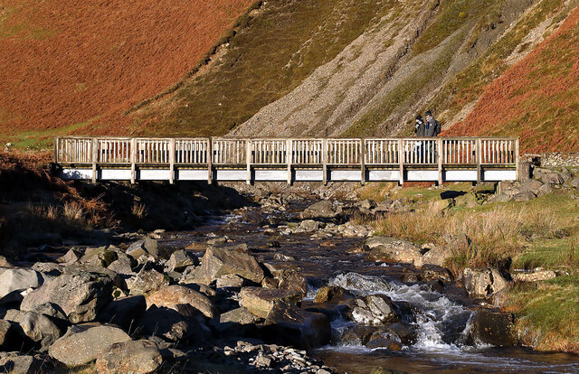
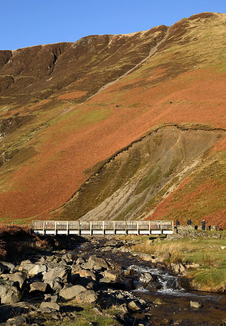
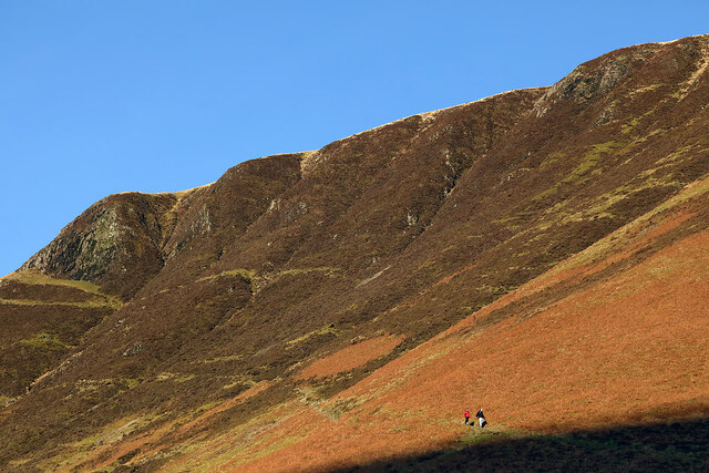
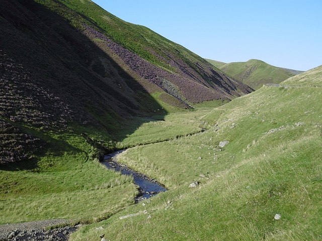
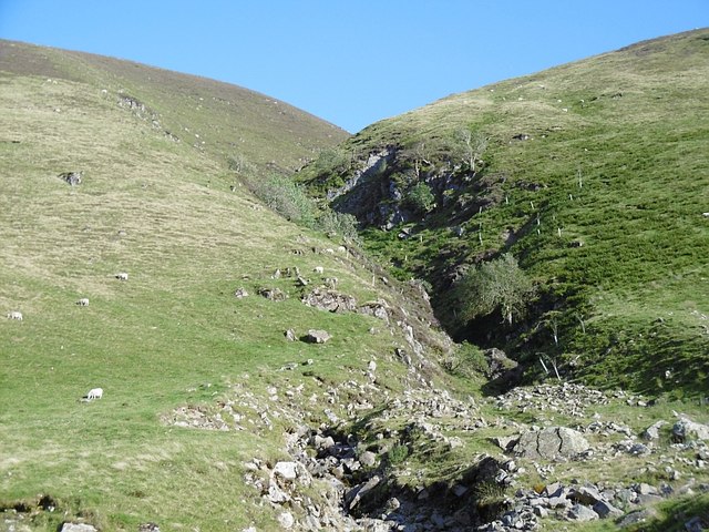
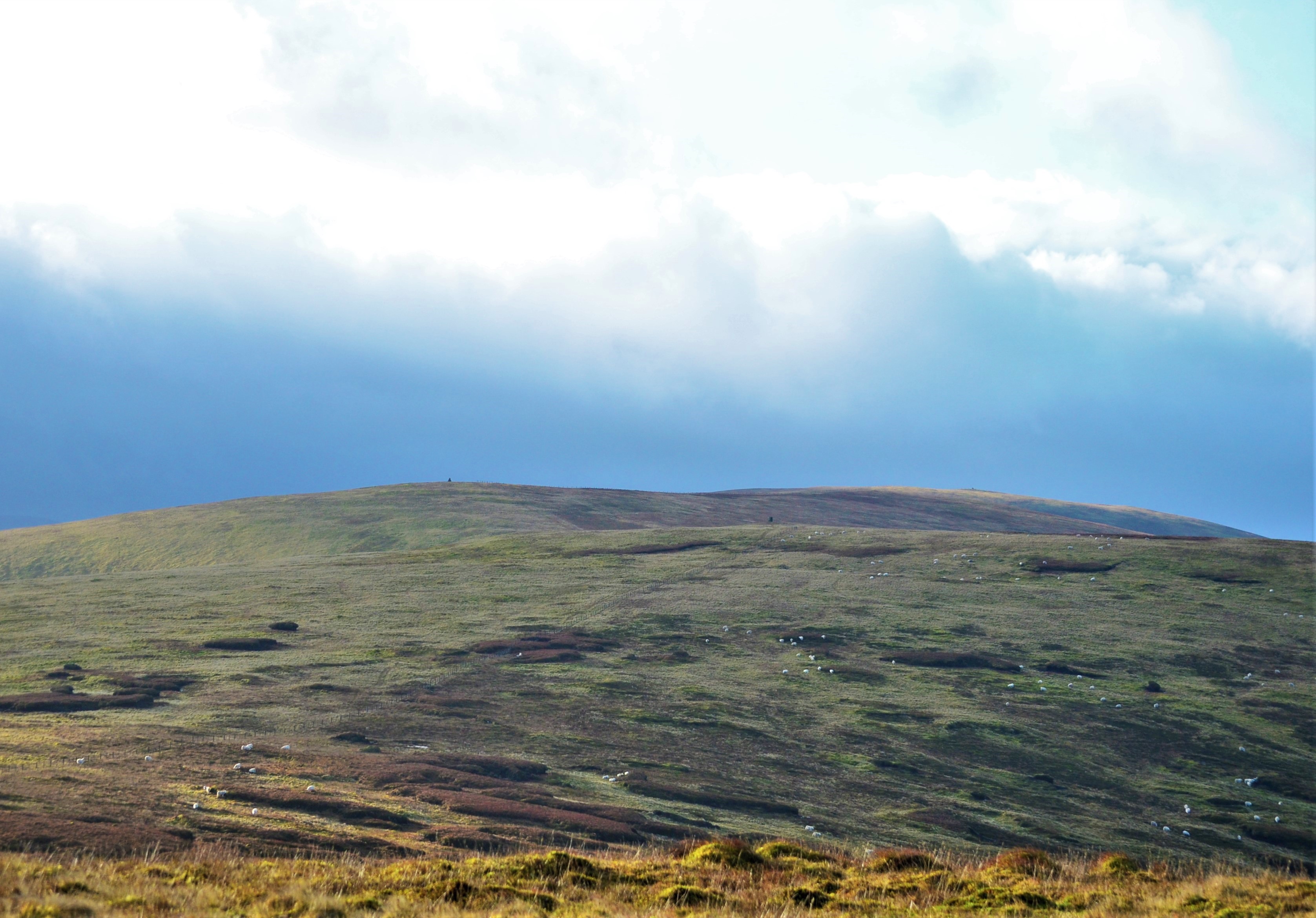
Broken Cleuch is a picturesque valley located in Dumfriesshire, Scotland. The valley is characterized by its rugged terrain, steep slopes, and lush greenery. The name "Broken Cleuch" refers to the deep, narrow gorge that runs through the valley, creating a dramatic landscape that is popular among hikers and nature enthusiasts.

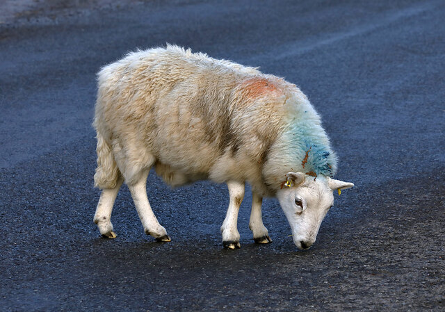
The valley is home to a diverse range of plant and animal species, including rare birds, wildflowers, and ancient trees. The area is also known for its rich history, with evidence of ancient settlements and archaeological sites scattered throughout the valley.

Visitors to Broken Cleuch can enjoy stunning views of the surrounding countryside, as well as opportunities for hiking, birdwatching, and photography. The valley is a peaceful retreat from the hustle and bustle of city life, offering visitors a chance to reconnect with nature and experience the beauty of the Scottish countryside.

Overall, Broken Cleuch is a hidden gem in Dumfriesshire, offering a unique and unforgettable experience for those who venture into its depths.

If you have any feedback on the listing, please let us know in the comments section below.

Broken Cleuch Images

Images are sourced within 2km of 55.408435/-3.2891187 or Grid Reference NT1813. Thanks to Geograph Open Source API. All images are credited.

Upper Falls The last fall and smallest of the many waterfalls on the Tail Burn generically known as the Grey Mare's Tail. To the left above the dyke is the Corbett of White Coomb.
Upper Falls
The last fall and smallest of the many waterfalls on the Tail Burn generically known as the Grey Mare's Tail. To the left above the dyke is the Corbett of White Coomb.
River Eroded Valley Classic v-shaped eroded river valley. In this case the Moffat Water just downstream of the car park for the Grey Mare's Tail. A glorious day has brought the crowds out so the car park is full and some cars have had to be parked on the verge opposite - or they are trying to avoid the £3 charge to look at a waterfall.
River Eroded Valley
Classic v-shaped eroded river valley. In this case the Moffat Water just downstream of the car park for the Grey Mare's Tail. A glorious day has brought the crowds out so the car park is full and some cars have had to be parked on the verge opposite - or they are trying to avoid the £3 charge to look at a waterfall.
Ruined Shepherd's Cottage Beside the Tail Burn <span class="nowrap"><a title="https://canmore.org.uk/site/320760/tail-burn" rel="nofollow ugc noopener" href="https://canmore.org.uk/site/320760/tail-burn">Link</a><img style="margin-left:2px;" alt="External link" title="External link - shift click to open in new window" src="https://s1.geograph.org.uk/img/external.png" width="10" height="10"/></span>
Ruined Shepherd's Cottage
Beside the Tail Burn LinkExternal link
Grey Mare's Tail
Grey Mare's Tail
The Upper Falls at The Grey Mare's Tail
A low flying Tornado GR4 I often used to wait on a hillside in the Selkirk to Moffat Valley for any low flying military aircraft that might come along on low flying sorties. This Tornado GR4 (ZA370/004) was passing the Tail Burn at the Grey Mare’s Tail Waterfalls. Air crews referred to the very narrow part of the valley between Birkhill and the Grey Mare’s Tail as ‘Star Wars’. The Tornado was withdrawn in early 2019 after nearly 40 years of service with the RAF and I still miss them.
A low flying Tornado GR4
I often used to wait on a hillside in the Selkirk to Moffat Valley for any low flying military aircraft that might come along on low flying sorties. This Tornado GR4 (ZA370/004) was passing the Tail Burn at the Grey Mare’s Tail Waterfalls. Air crews referred to the very narrow part of the valley between Birkhill and the Grey Mare’s Tail as ‘Star Wars’. The Tornado was withdrawn in early 2019 after nearly 40 years of service with the RAF and I still miss them.
A footbridge over the Tail Burn The bridge provides access from the Grey Mare’s Tail main car park to the hillside path that leads to Loch Skene.
A footbridge over the Tail Burn
The bridge provides access from the Grey Mare’s Tail main car park to the hillside path that leads to Loch Skene.
A bridge over the Tail Burn The bridge provides access from the Grey Mare’s Tail main car park to the hillside path leading to Loch Skene.
A bridge over the Tail Burn
The bridge provides access from the Grey Mare’s Tail main car park to the hillside path leading to Loch Skene.
Dodging a sheep on the A708 Motorists have to be aware of sheep wandering on to the road between Riskinhope and the Grey Mare’s Tail car park.
Dodging a sheep on the A708
Motorists have to be aware of sheep wandering on to the road between Riskinhope and the Grey Mare’s Tail car park.
A sheep on the A708 Sheep wandering on to the road between Riskinhope and the Grey Mare’s Tail car park is a common sight. This sheep was licking the tarmac.
A sheep on the A708
Sheep wandering on to the road between Riskinhope and the Grey Mare’s Tail car park is a common sight. This sheep was licking the tarmac.
Walkers descending the Loch Skene path below Deacon Snout A well maintained path leads from the Grey Mare’s Tail car park to Loch Skene.
Walkers descending the Loch Skene path below Deacon Snout
A well maintained path leads from the Grey Mare’s Tail car park to Loch Skene.
Moffat Water The upper reaches of Moffat Dale in the heather season.
Moffat Water
The upper reaches of Moffat Dale in the heather season.
Strang Cleuch One of several steep burns and ravines flowing into the depths of Moffat Dale.
Strang Cleuch
One of several steep burns and ravines flowing into the depths of Moffat Dale.
Mid Rig (cairn) The cairn near the summit of Mid Rig.
Mid Rig (cairn)
The cairn near the summit of Mid Rig.
Grey Mare's Tail Waterfall near Moffat
The Tail Burn Named after the Grey Mare's Tail waterfall upstream. Nearby is a NTS car park for the start of the popular walk up to Loch Skene (or Skeen if you prefer).
The Tail Burn
Named after the Grey Mare's Tail waterfall upstream. Nearby is a NTS car park for the start of the popular walk up to Loch Skene (or Skeen if you prefer).
A708 closed at the Tail Burn The A708 Yarrow to Moffat road has been closed here temporarily for surface dressing work with tar and chippings. Traffic was allowed through at intervals with a one-way flow. We waited 20 minutes before getting the all-clear.
A708 closed at the Tail Burn
The A708 Yarrow to Moffat road has been closed here temporarily for surface dressing work with tar and chippings. Traffic was allowed through at intervals with a one-way flow. We waited 20 minutes before getting the all-clear.
A miniature rowan This small rowan has taken seed on an old fence post in Moffat Dale.
A miniature rowan
This small rowan has taken seed on an old fence post in Moffat Dale.
Show me another place!

Broken Cleuch is located at Grid Ref: NT1813 (Lat: 55.408435, Lng: -3.2891187)

Unitary Authority: Dumfries and Galloway

Police Authority: Dumfries and Galloway

What 3 Words

///slot.tiny.portfolio. Near Ettrick, Scottish Borders

Nearby Locations

Broken Cleuch

Related Wikis

Southern Uplands

The Southern Uplands (Scottish Gaelic: Na Monaidhean a Deas) are the southernmost and least populous of mainland Scotland's three major geographic areas...

Grey Mare's Tail, Moffat Hills

Grey Mare's Tail is a 60-metre (200 ft) hanging valley waterfall near to Moffat in southern Scotland. The fall is produced by the Tail Burn flowing from...

Andrewhinney Hill

Andrewhinney Hill is a hill in the Ettrick Hills range, part of the Southern Uplands of Scotland. It is the highest summit of a ridge that runs parallel...

Dob's Linn

Dob's Linn is a small steep valley in Dumfries and Galloway, just north of the A708 road between Moffat and Selkirk, in Scotland. It is part of the Grey...

Nearby Amenities

Located within 500m of 55.408435,-3.2891187
Southern Uplands
Name Sk: Juhoškótska vysočina
Natural: mountain_range
Place: region
Region Type: mountain_range
Wikidata: Q1549065
Lat/Long: 55.4110674/-3.2852322
The data included in this document is from www.openstreetmap.org. The data is made available under ODbL.

Have you been to Broken Cleuch?

Leave your review of Broken Cleuch below (or comments, questions and feedback).