Green Cleugh
Valley in Peeblesshire
Scotland
Green Cleugh

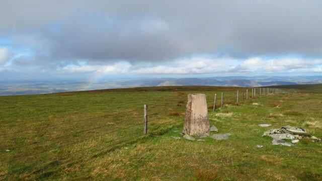
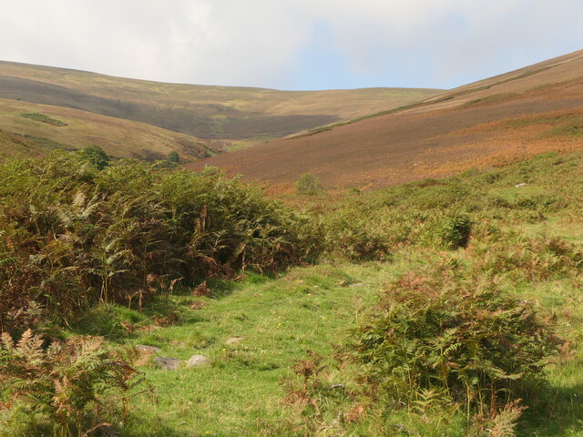
Green Cleugh is a picturesque valley located in Peeblesshire, Scotland. Situated amidst the breathtaking Scottish Borders, it is known for its scenic landscapes and natural beauty. The valley is nestled between rolling hills and is traversed by a meandering river, adding to its charm.
Green Cleugh is renowned for its vibrant greenery, which blankets the valley throughout the year. The lush vegetation comprises a variety of flora, including mosses, ferns, and wildflowers, creating a rich and diverse ecosystem. The valley is home to several species of birds and small mammals, making it a popular destination for nature enthusiasts and birdwatchers.
The valley offers numerous walking trails, which allow visitors to explore its beauty up close. One of the most notable trails is the Green Cleugh Circular Walk, which takes hikers through the heart of the valley and offers breathtaking views of the surrounding countryside. The trail is well-maintained and suitable for all levels of fitness, making it an ideal choice for families and outdoor enthusiasts.
In addition to its natural attractions, Green Cleugh boasts a rich history. The valley has been inhabited for centuries, and remnants of ancient settlements can still be found in the area. The ruins of a medieval castle, believed to have been built in the 13th century, are one of the valley's historical highlights.
Overall, Green Cleugh is a hidden gem in Peeblesshire, offering visitors a tranquil escape into nature and a glimpse into Scotland's rich history. Its stunning landscapes, diverse wildlife, and historical sites make it a must-visit destination for those seeking a peaceful and immersive experience in the Scottish Borders.
If you have any feedback on the listing, please let us know in the comments section below.
Green Cleugh Images
Images are sourced within 2km of 55.562976/-3.2964118 or Grid Reference NT1830. Thanks to Geograph Open Source API. All images are credited.


Green Cleugh is located at Grid Ref: NT1830 (Lat: 55.562976, Lng: -3.2964118)
Unitary Authority: The Scottish Borders
Police Authority: The Lothians and Scottish Borders
What 3 Words
///sometimes.badly.napkins. Near Peebles, Scottish Borders
Nearby Locations
Related Wikis

Posso Tower
Posso Tower is a 16th-century tower house, about 6.0 miles (9.7 km) south and west of Peebles, Scottish Borders, Scotland, and west of Manor Water. �...

Dawyck Chapel
Dawyck Chapel, also known as Dalwick Church, is located (NGR NT 16798 34933) within the Parish of Drumelzier in the Scottish Borders area of Scotland....
Dawyck House
Dawyck House is a historic house at Dawyck, in the parish of Drumelzier in the former Peeblesshire, in the Scottish Borders area of Scotland. The alternative...

Black Law (hill)
Black Law is a hill in the Manor Hills range, part of the Southern Uplands of Scotland. One of the more remote Donalds, it does not easily combine into...
Have you been to Green Cleugh?
Leave your review of Green Cleugh below (or comments, questions and feedback).