Deer Hope

Valley in Peeblesshire

Scotland

Deer Hope

The Pentland Hills From Portmore Estate
The Pentland Hills Credit: Anthony O'Neil

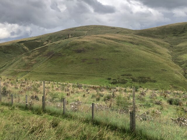
Deer Hope is a picturesque valley located in Peeblesshire, Scotland. It is nestled amidst the rolling hills and lush greenery of the Scottish Borders region, offering a tranquil retreat for nature enthusiasts and those seeking a peaceful getaway.

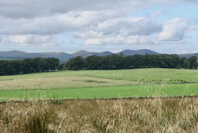
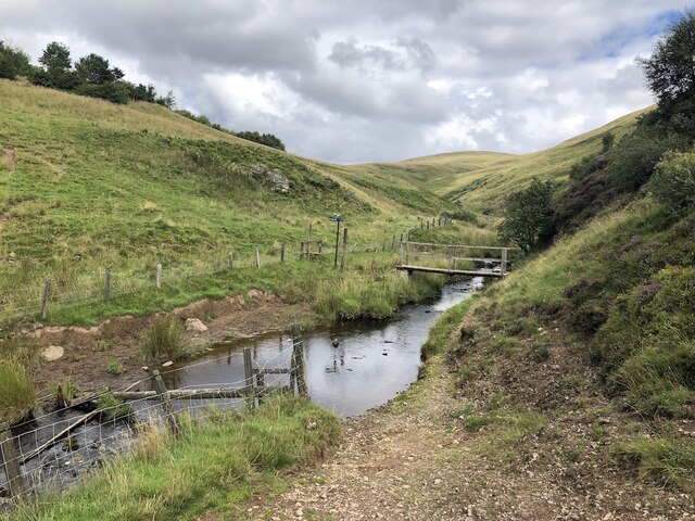
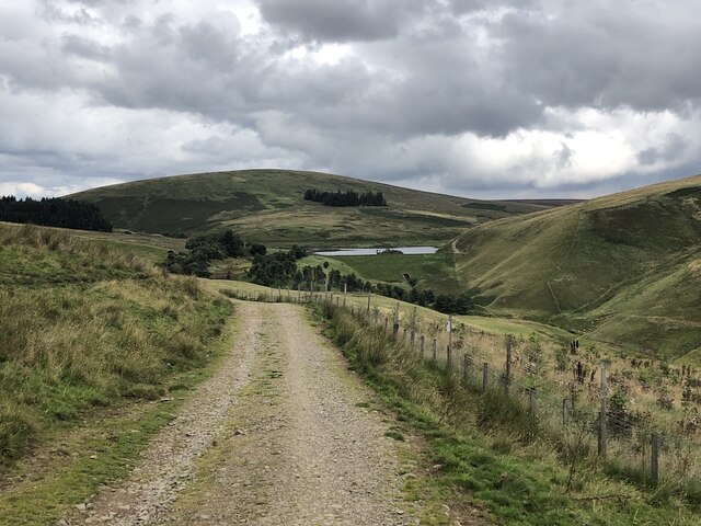
The valley is renowned for its stunning natural beauty, characterized by its sweeping meadows, dense forests, and babbling streams. The landscape is dotted with ancient oak trees, adding a touch of enchantment to the area. The valley's idyllic setting is further enhanced by the presence of the River Tweed, which meanders through the heart of Deer Hope, providing a soothing soundtrack to the surroundings.

The valley is home to a diverse range of wildlife, making it a popular destination for birdwatchers and wildlife enthusiasts. Visitors have the opportunity to spot various species of birds, including buzzards, kestrels, and peregrine falcons, as well as red squirrels, roe deer, and even the occasional otter.

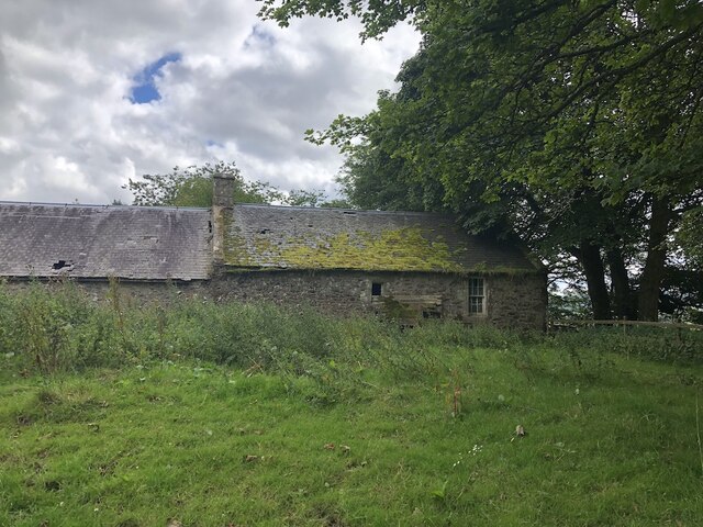
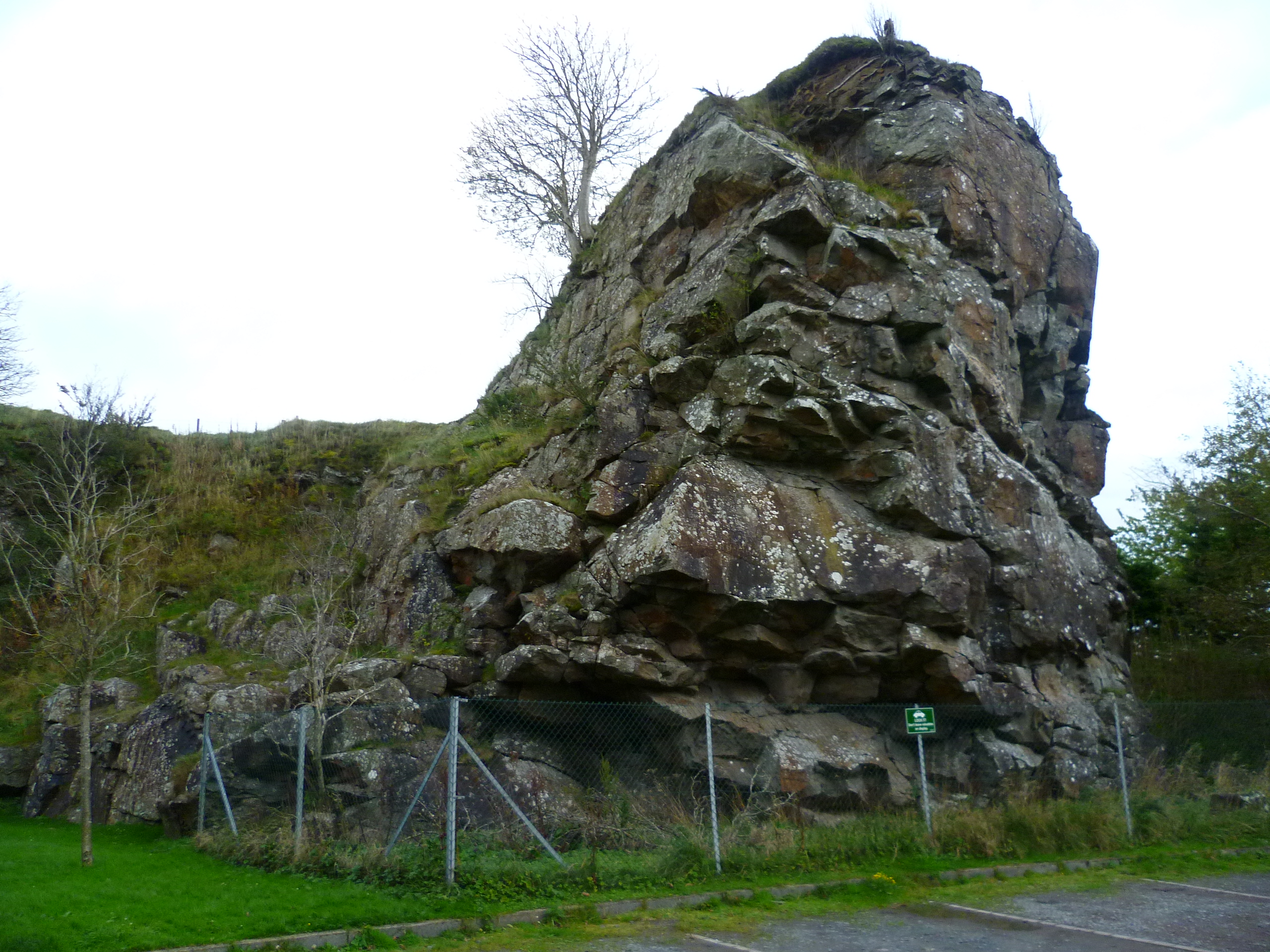
Aside from its natural attractions, Deer Hope also boasts a rich history. The valley is peppered with remnants of ancient settlements, standing stones, and burial mounds, providing a glimpse into the area's past. Additionally, the surrounding countryside offers numerous walking and hiking trails, allowing visitors to explore the valley's beauty at their own pace.

Overall, Deer Hope is a hidden gem in Peeblesshire, offering a serene escape from the hustle and bustle of everyday life. With its breathtaking scenery, abundant wildlife, and historical significance, it is a destination that appeals to both nature lovers and history enthusiasts alike.

If you have any feedback on the listing, please let us know in the comments section below.

Deer Hope Images

Images are sourced within 2km of 55.807888/-3.3661959 or Grid Reference NT1458. Thanks to Geograph Open Source API. All images are credited.

The Pentland Hills From Portmore Estate
The Pentland Hills
From Portmore Estate
Bridge below Fairliehope Connects a path from the road to the North Esk Reservoir with paths on the Midlothian side of the burn. Cattle drink in the foreground.
Bridge below Fairliehope
Connects a path from the road to the North Esk Reservoir with paths on the Midlothian side of the burn. Cattle drink in the foreground.
Steadings, Fairliehope
Red Angus cattle, Fairliehope
Road to the North Esk Reservoir Rounding Fairliehope Hill
Road to the North Esk Reservoir
Rounding Fairliehope Hill
Young trees,  Fairleehope Hill There are numerous small young plantations in the upper North Esk catchment.
Young trees, Fairleehope Hill
There are numerous small young plantations in the upper North Esk catchment.
Road to North Esk Reservoir
Gate, North Esk Cottage Track to the dam.  Note that someone has kindly locked the side gate as well.
Gate, North Esk Cottage
Track to the dam. Note that someone has kindly locked the side gate as well.
North Esk Reservoir Built to ensure a water flow in the North Esk to power the paper mills.  Now the mills have gone, the water has been drawn down to a level needing less dam maintenance and the loch is managed as a nature reserve.
North Esk Reservoir
Built to ensure a water flow in the North Esk to power the paper mills. Now the mills have gone, the water has been drawn down to a level needing less dam maintenance and the loch is managed as a nature reserve.
North Esk Reservoir Track to the dam and a road on the other side which had appeared in the 14 years since my last visit. The dam was built to ensure a water flow in the North Esk to power the paper mills.  Now the mills have gone, the water has been drawn down to a level needing less dam maintenance and the loch is managed as a nature reserve.
North Esk Reservoir
Track to the dam and a road on the other side which had appeared in the 14 years since my last visit. The dam was built to ensure a water flow in the North Esk to power the paper mills. Now the mills have gone, the water has been drawn down to a level needing less dam maintenance and the loch is managed as a nature reserve.
North Esk Reservoir Built to ensure a water flow in the North Esk to power the paper mills.  Now the mills have gone, the water has been drawn down to a level needing less dam maintenance and the loch is managed as a nature reserve.
North Esk Reservoir
Built to ensure a water flow in the North Esk to power the paper mills. Now the mills have gone, the water has been drawn down to a level needing less dam maintenance and the loch is managed as a nature reserve.
Path beside North Esk Reservoir
North Esk Reservoir Built to ensure a water flow in the North Esk to power the paper mills.  Now the mills have gone, the water has been drawn down to a level needing less dam maintenance and the loch is managed as a nature reserve.
North Esk Reservoir
Built to ensure a water flow in the North Esk to power the paper mills. Now the mills have gone, the water has been drawn down to a level needing less dam maintenance and the loch is managed as a nature reserve.
Spittal Hill View from the North Esk Reservoir.
Spittal Hill
View from the North Esk Reservoir.
Path beside North Esk Reservoir Heading for the Boar Stane.
Path beside North Esk Reservoir
Heading for the Boar Stane.
North Esk Reservoir The surrounding hillsides have been partly covered in new plantations and there are some game crops. The reservoir ensured a water flow in the North Esk to power the paper mills.  Now the mills have gone, the water has been drawn down to a level needing less dam maintenance and the loch is managed as a nature reserve.
North Esk Reservoir
The surrounding hillsides have been partly covered in new plantations and there are some game crops. The reservoir ensured a water flow in the North Esk to power the paper mills. Now the mills have gone, the water has been drawn down to a level needing less dam maintenance and the loch is managed as a nature reserve.
Path to the Boar Stane A route over the Pentland Hills between Carlops and Buteland.
Path to the Boar Stane
A route over the Pentland Hills between Carlops and Buteland.
Wether Law Moorland hill above the headwaters of the North Esk
Wether Law
Moorland hill above the headwaters of the North Esk
Show me another place!

Deer Hope is located at Grid Ref: NT1458 (Lat: 55.807888, Lng: -3.3661959)

Unitary Authority: The Scottish Borders

Police Authority: The Lothians and Scottish Borders

What 3 Words

///grapevine.fooling.about. Near West Linton, Scottish Borders

Nearby Locations

Deer Hope

Related Wikis

Pentland Hills

The Pentland Hills are a range of hills southwest of Edinburgh, Scotland. The range is around twenty miles (thirty kilometres) in length, and runs southwest...

East Cairn Hill

East Cairn Hill is a hill in the Pentland Hills range of Scotland. With a height of 567 m (1,860 ft), it is the highest hill in Edinburgh and is located...

Carlops

Carlops (Scottish Gaelic: Leum na Caillich) is a small village in the Pentland Hills, within the Scottish Borders area of Scotland, close to the boundary...

Baddinsgill Reservoir

Baddinsgill Reservoir is a small reservoir in the Scottish Borders area of Scotland close to Carlops, West Linton, and the boundary with Midlothian. It...

Nearby Amenities

Located within 500m of 55.807888,-3.3661959
The Mount
Ele: 537
Natural: peak
Wikidata: Q24661213
Lat/Long: 55.8039999/-3.3668537
Deer Hope
Place: locality
Lat/Long: 55.8081779/-3.3644855
The data included in this document is from www.openstreetmap.org. The data is made available under ODbL.

Have you been to Deer Hope?

Leave your review of Deer Hope below (or comments, questions and feedback).