Bone Cleuch

Valley in Dumfriesshire

Scotland

Bone Cleuch

Fingland Fell Trig Point Flush Bracket S7703
Fingland Fell Trig Point Flush Bracket S7703 Credit: thejackrustles

Bone Cleuch is a picturesque valley located in Dumfriesshire, Scotland. Situated in the southern part of the country, the valley is known for its breathtaking natural beauty and rich history.

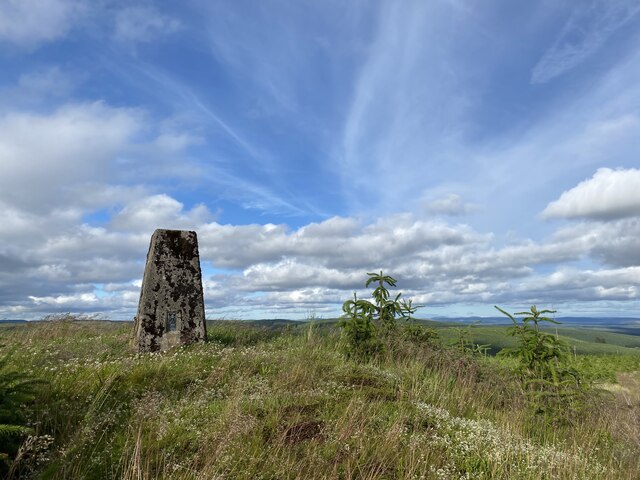
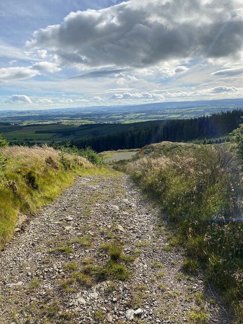
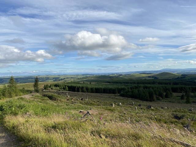
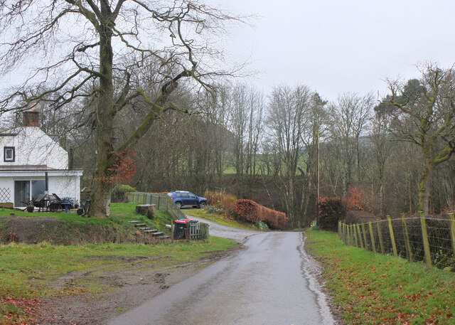
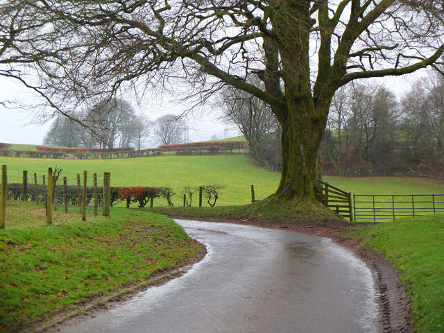
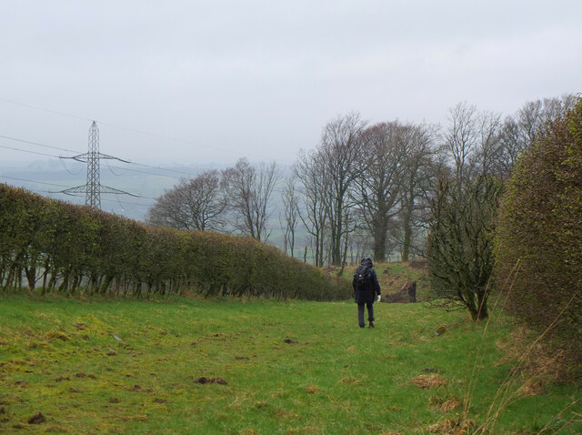
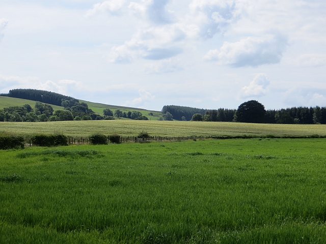
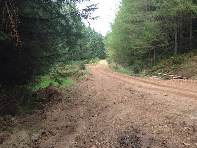
Nestled among rolling hills and lush greenery, Bone Cleuch is a haven for nature enthusiasts and hikers. The valley is home to a diverse range of plant and animal species, making it a popular destination for wildlife lovers. Visitors can explore the numerous walking trails that wind through the valley, offering stunning views of the surrounding landscape.

One of the standout features of Bone Cleuch is its stunning waterfall, which cascades down the rocky cliffs, creating a mesmerizing sight and a soothing soundtrack of flowing water. This waterfall serves as a popular spot for photography and relaxation, with many visitors taking the opportunity to have a picnic or simply enjoy the tranquility of the surroundings.

In addition to its natural beauty, Bone Cleuch also holds historical significance. The valley is said to have been a site of ancient settlements, with remnants of stone structures and artifacts discovered in the area. These archaeological findings provide insights into the lives of the people who once called this valley home.

Overall, Bone Cleuch offers a serene and captivating experience for those seeking an escape from the hustle and bustle of everyday life. With its stunning landscapes, diverse wildlife, and rich history, the valley is a must-visit destination for anyone exploring Dumfriesshire.

If you have any feedback on the listing, please let us know in the comments section below.

Bone Cleuch Images

Images are sourced within 2km of 55.235483/-3.3553683 or Grid Reference NY1394. Thanks to Geograph Open Source API. All images are credited.

Fingland Fell Trig Point Flush Bracket S7703
Short section of steep track on descent from Fingland Fell
Views near Fingland Fell
Log pile on descent from Fingland Fell
Descent from Fingland Fell
Foxgloves near track on descent from Fingland Fell
Track on descent from Fingland Fell
Fingland Red Cleuch
Fingland Red Cleuch
Gate at start of track to Fingland Fell
Path at Kirkhill The path skirts the farm to reach a track down to Kirkhill Cottages.
Path at Kirkhill
The path skirts the farm to reach a track down to Kirkhill Cottages.
Road at Kirkhill Cottages The metalled track from Kirkhill farm approaches a bridge over the Kirk Burn.
Road at Kirkhill Cottages
The metalled track from Kirkhill farm approaches a bridge over the Kirk Burn.
Road through farmland, Wamphray Glen A farm road also used on the Wamphray Glen circular path.
Road through farmland, Wamphray Glen
A farm road also used on the Wamphray Glen circular path.
Grassy track, Wamphray Glen Descending through farmland to Hillhouse on the Wamphray Glen circular path.
Grassy track, Wamphray Glen
Descending through farmland to Hillhouse on the Wamphray Glen circular path.
Track to Hillhouse A track on the Wamphray Glen circular walk which can be started either at Wamphray Bridge or by Wamphray Parish Church.
Track to Hillhouse
A track on the Wamphray Glen circular walk which can be started either at Wamphray Bridge or by Wamphray Parish Church.
Hillhouse farm Farmland south of the Wamphray Water. The Wamphray Glen circular walk goes left past the farm to meet the minor road near the bridge.
Hillhouse farm
Farmland south of the Wamphray Water. The Wamphray Glen circular walk goes left past the farm to meet the minor road near the bridge.
View southwest towards Hazlebank from road between Boreland & Wamphreygate
Barley, Saughtrees Fields in Annandale. Soon to the east the ground gets higher and turns rougher.
Barley, Saughtrees
Fields in Annandale. Soon to the east the ground gets higher and turns rougher.
Forestry road, Fingland Fell
Show me another place!

Bone Cleuch is located at Grid Ref: NY1394 (Lat: 55.235483, Lng: -3.3553683)

Unitary Authority: Dumfries and Galloway

Police Authority: Dumfries and Galloway

What 3 Words

///excuse.exits.smoke. Near Johnstonebridge, Dumfries & Galloway

Nearby Locations

Bone Cleuch Blaze Hill

Related Wikis

Newton Wamphray

Newton Wamphray is a village in Dumfries and Galloway. Wamphray is the name of the surrounding parish and of the Wamphray Water, which flows south-west...

Wamphray railway station

Wamphray railway station served Newton Wamphray, near Beattock, in the Scottish county of Dumfries and Galloway. It was served by local trains on what...

Annandale Water services

Annandale Water services is a motorway service station in the village of Johnstonebridge, Scotland. The service station is located next to the A74(M) motorway...

Annandale Water

Annandale Water is a loch in Annandale, Dumfries and Galloway, in the south west of Scotland. It is part of Annandale Water service station at Junction...

Johnstonebridge

Johnstonebridge is a village in Dumfries and Galloway, Scotland.It is roughly halfway between Moffat and Lockerbie, and lies on the A74(M) motorway. The...

Boreland

Boreland is a village in Dumfries and Galloway, Scotland, which is located in Dryfesdale about 7 miles (11 kilometres) north of Lockerbie on the B723 road...

Dinwoodie railway station

Dinwoodie railway station was a station which served the rural area around the settlement of Dinwoodie, 6 miles north of Lockerbie in Applegarth parish...

Lochwood Tower

Lochwood Tower, also known as Lochwood Castle, is a ruined 16th-century L-plan tower house situated in Annandale (Valley of the River Annan) about 6 miles...

Nearby Amenities

Located within 500m of 55.235483,-3.3553683
Fingland
Place: hamlet
Lat/Long: 55.2336254/-3.3563766
Kirncleuch
Place: hamlet
Source: OS7
Lat/Long: 55.236513/-3.3517418
Design: barrel
Power: tower
Lat/Long: 55.2341449/-3.3597866
Design: barrel
Power: tower
Lat/Long: 55.2368262/-3.359356
Power: pole
Lat/Long: 55.2341889/-3.3577334
Power: pole
Lat/Long: 55.2343416/-3.356788
Power: pole
Lat/Long: 55.2342726/-3.3562445
Power: pole
Lat/Long: 55.2337056/-3.3556958
Power: pole
Lat/Long: 55.2339127/-3.3554021
Power: pole
Lat/Long: 55.2342197/-3.3549668
Power: pole
Lat/Long: 55.2348058/-3.3541476
Power: pole
Lat/Long: 55.2352215/-3.3534805
Power: pole
Lat/Long: 55.2359221/-3.3524192
Power: pole
Lat/Long: 55.2363598/-3.3517674
Power: pole
Lat/Long: 55.2310762/-3.3544941
Power: pole
Lat/Long: 55.2314934/-3.3545933
Power: pole
Lat/Long: 55.2319591/-3.3546963
Power: pole
Lat/Long: 55.232363/-3.3547878
Power: pole
Lat/Long: 55.2327685/-3.3548702
Power: pole
Lat/Long: 55.2332356/-3.3549732
Power: pole
Lat/Long: 55.2337967/-3.3551046
The data included in this document is from www.openstreetmap.org. The data is made available under ODbL.

Have you been to Bone Cleuch?

Leave your review of Bone Cleuch below (or comments, questions and feedback).