Langside

Settlement in Renfrewshire

Scotland

Langside

Roundabout in Muirend At the junction of Langside Drive and Muirend Road.
Roundabout in Muirend Credit: G Laird

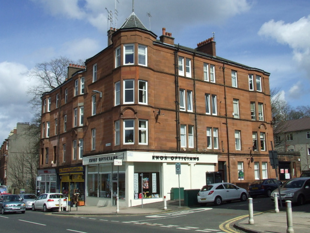
Langside is a residential area located in Renfrewshire, Scotland. Situated on the outskirts of Glasgow, Langside is known for its charming atmosphere and close-knit community. The area is primarily composed of traditional sandstone houses and well-maintained gardens, giving it a picturesque appearance.

Langside offers its residents a range of amenities and facilities. The local high street hosts a variety of independent shops, cafes, and restaurants, allowing residents to enjoy a vibrant and diverse shopping and dining experience. Additionally, there are several supermarkets and convenience stores in the area, ensuring that residents have easy access to everyday essentials.

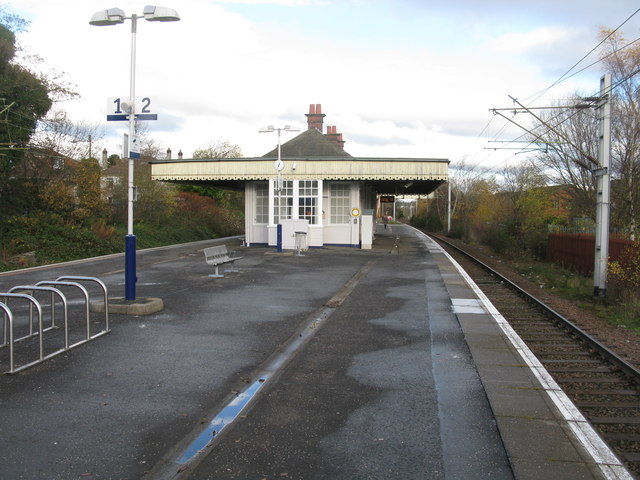
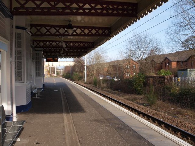
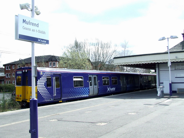
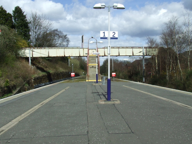
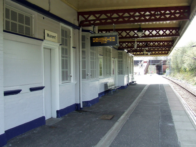
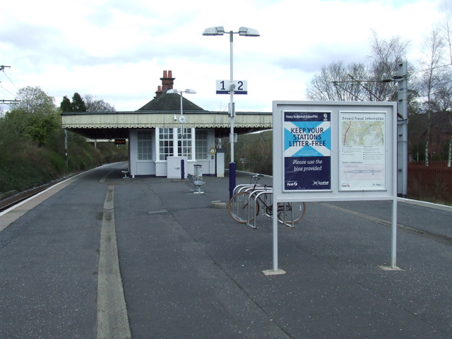
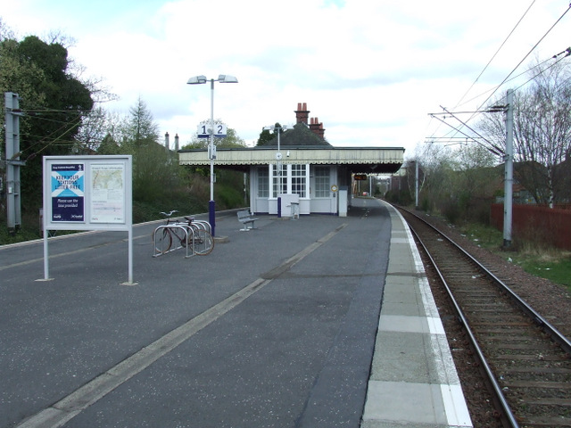
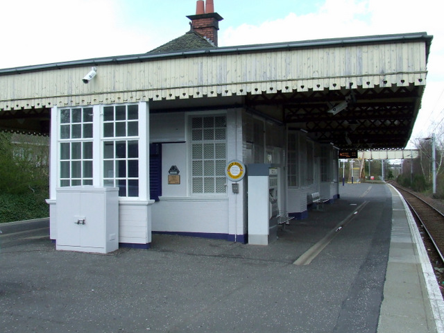
The area is well-connected by public transport, with several bus routes serving the community. Langside railway station provides regular train services, allowing for convenient travel to other parts of Renfrewshire and beyond.

Langside is also home to several green spaces and parks, offering residents opportunities for outdoor activities and leisure. Queen's Park, a large public park situated nearby, features beautiful gardens, walking paths, and a boating pond, making it a popular spot for families and nature enthusiasts.

Education is well-catered for in Langside, with a number of primary and secondary schools in the area. Langside College is a further education institution situated in the heart of the community, offering a wide range of courses for students of all ages.

Overall, Langside is a desirable residential area characterized by its attractive architecture, community spirit, and convenient amenities.

If you have any feedback on the listing, please let us know in the comments section below.

Langside Images

Images are sourced within 2km of 55.827572/-4.2780198 or Grid Reference NS5761. Thanks to Geograph Open Source API. All images are credited.

Roundabout in Muirend At the junction of Langside Drive and Muirend Road.
Roundabout in Muirend
At the junction of Langside Drive and Muirend Road.
Muirend Railway Station The station between Cathcart and Williamwood on the Neilston branch of the Cathcart Circle Line.
Muirend Railway Station
The station between Cathcart and Williamwood on the Neilston branch of the Cathcart Circle Line.
Muirend train station, platform 2 Trains from Glasgow Central arrive at platform 2, heading on towards the end of the line at Neilston. The picture looks roughly north, in the direction the trains arrive from.
Muirend train station, platform 2
Trains from Glasgow Central arrive at platform 2, heading on towards the end of the line at Neilston. The picture looks roughly north, in the direction the trains arrive from.
Muirend railway station Class 314 train number 314 208 is heading for Neilston.
Muirend railway station
Class 314 train number 314 208 is heading for Neilston.
Muirend railway station The steps leading to the footbridge between Whitemooss Avenue and Cairndow Court.
Muirend railway station
The steps leading to the footbridge between Whitemooss Avenue and Cairndow Court.
Muirend railway station Looking south along the line to Neilston. 

The station building is a Category B Listed structure, described by Historic Scotland as follows...

Style of James Millar. Late 19th/early 20th century. Station with Art Nouveau detailing, free standing on island platform, and with deep cantilevered flat canopy, decorative timber valance with pierced heart ornament. Red brick and timber, small-paned openings, slated main roof with red ridging, deep-corniced brick axial stacks; distinctive aedicular notice boards.
Muirend railway station
Looking south along the line to Neilston. The station building is a Category B Listed structure, described by Historic Scotland as follows... Style of James Millar. Late 19th/early 20th century. Station with Art Nouveau detailing, free standing on island platform, and with deep cantilevered flat canopy, decorative timber valance with pierced heart ornament. Red brick and timber, small-paned openings, slated main roof with red ridging, deep-corniced brick axial stacks; distinctive aedicular notice boards.
Muirend railway station The station building is a Category B Listed structure, described by Historic Scotland as follows...

Style of James Millar. Late 19th/early 20th century. Station with Art Nouveau detailing, free standing on island platform, and with deep cantilevered flat canopy, decorative timber valance with pierced heart ornament. Red brick and timber, small-paned openings, slated main roof with red ridging, deep-corniced brick axial stacks; distinctive aedicular notice boards.
Muirend railway station
The station building is a Category B Listed structure, described by Historic Scotland as follows... Style of James Millar. Late 19th/early 20th century. Station with Art Nouveau detailing, free standing on island platform, and with deep cantilevered flat canopy, decorative timber valance with pierced heart ornament. Red brick and timber, small-paned openings, slated main roof with red ridging, deep-corniced brick axial stacks; distinctive aedicular notice boards.
The Bank The former Savings Bank of Glasgow building (also former Muirend Savings Bank) at the corner of Clarkston Road and Gartly Street.

The Category B Listed building became Muirend's first pub as recently as 2006.

See also <a href="https://www.geograph.org.uk/photo/3438621">NS5759 : Ghost sign on Clarkston Road</a> & <a href="https://www.geograph.org.uk/photo/3438634">NS5759 : The Bank</a>.

Historic Scotland describes it as follows...

Bank, built 1925-27 to designs of A N Paterson and Stoddart. Renaissance; tall single storey with steep slate roof and occupying corner site. Polished ashlar, contrasting granite detail and plinth. Symmetrical tripartite front to Clarkston Road, iron-balconied centre 3-light window in Doric 'in antis' frame, parapet over with sculpted vase finials; arched recesses in outer bays with prominent key-stones (door to right, sculptured crest over); flank elevation to Gartly Street is a simplified version of the same composition. INTERIOR: large banking hall, coffered ceiling with elliptical centre cupola, original full-width counter and partition along north (rear) wall.

"The Savings bank of Glasgow" sign placed on gable of tenement adjoining (437 Clarkston Road) is presumably also the work of Paterson and Stoddart.
The Bank
The former Savings Bank of Glasgow building (also former Muirend Savings Bank) at the corner of Clarkston Road and Gartly Street. The Category B Listed building became Muirend's first pub as recently as 2006. See also NS5759 : Ghost sign on Clarkston Road & NS5759 : The Bank. Historic Scotland describes it as follows... Bank, built 1925-27 to designs of A N Paterson and Stoddart. Renaissance; tall single storey with steep slate roof and occupying corner site. Polished ashlar, contrasting granite detail and plinth. Symmetrical tripartite front to Clarkston Road, iron-balconied centre 3-light window in Doric 'in antis' frame, parapet over with sculpted vase finials; arched recesses in outer bays with prominent key-stones (door to right, sculptured crest over); flank elevation to Gartly Street is a simplified version of the same composition. INTERIOR: large banking hall, coffered ceiling with elliptical centre cupola, original full-width counter and partition along north (rear) wall. "The Savings bank of Glasgow" sign placed on gable of tenement adjoining (437 Clarkston Road) is presumably also the work of Paterson and Stoddart.
Ghost sign on Clarkston Road The
Savings
Bank of
Glasgow

Safe Bind
Safe Find

On a tenement gable end, above the former Savings Bank of Glasgow building
Ghost sign on Clarkston Road
The Savings Bank of Glasgow Safe Bind Safe Find On a tenement gable end, above the former Savings Bank of Glasgow building
The Bank The former Savings Bank of Glasgow building (also former Muirend Savings Bank) at the corner of Clarkston Road and Gartly Street.

The Category B Listed building became Muirend's first pub as recently as 2006.

See also <a href="https://www.geograph.org.uk/photo/3438621">NS5759 : Ghost sign on Clarkston Road</a> & <a href="https://www.geograph.org.uk/photo/3438613">NS5759 : The Bank</a>.

Historic Scotland describes it as follows...

Bank, built 1925-27 to designs of A N Paterson and Stoddart. Renaissance; tall single storey with steep slate roof and occupying corner site. Polished ashlar, contrasting granite detail and plinth. Symmetrical tripartite front to Clarkston Road, iron-balconied centre 3-light window in Doric 'in antis' frame, parapet over with sculpted vase finials; arched recesses in outer bays with prominent key-stones (door to right, sculptured crest over); flank elevation to Gartly Street is a simplified version of the same composition. INTERIOR: large banking hall, coffered ceiling with elliptical centre cupola, original full-width counter and partition along north (rear) wall.

"The Savings bank of Glasgow" sign placed on gable of tenement adjoining (437 Clarkston Road) is presumably also the work of Paterson and Stoddart.
The Bank
The former Savings Bank of Glasgow building (also former Muirend Savings Bank) at the corner of Clarkston Road and Gartly Street. The Category B Listed building became Muirend's first pub as recently as 2006. See also NS5759 : Ghost sign on Clarkston Road & NS5759 : The Bank. Historic Scotland describes it as follows... Bank, built 1925-27 to designs of A N Paterson and Stoddart. Renaissance; tall single storey with steep slate roof and occupying corner site. Polished ashlar, contrasting granite detail and plinth. Symmetrical tripartite front to Clarkston Road, iron-balconied centre 3-light window in Doric 'in antis' frame, parapet over with sculpted vase finials; arched recesses in outer bays with prominent key-stones (door to right, sculptured crest over); flank elevation to Gartly Street is a simplified version of the same composition. INTERIOR: large banking hall, coffered ceiling with elliptical centre cupola, original full-width counter and partition along north (rear) wall. "The Savings bank of Glasgow" sign placed on gable of tenement adjoining (437 Clarkston Road) is presumably also the work of Paterson and Stoddart.
Shops on Clarkston Road Looking towards Hazel Avenue.
Shops on Clarkston Road
Looking towards Hazel Avenue.
Shops on Clarkston Road Hazel Avenue is to the right.
Shops on Clarkston Road
Hazel Avenue is to the right.
Clarkston Road Looking towards the city centre from Cairndow Avenue.
Clarkston Road
Looking towards the city centre from Cairndow Avenue.
Clarkston Road Looking towards the city centre from Cairndow Avenue.
Clarkston Road
Looking towards the city centre from Cairndow Avenue.
Clarkston Road Looking towards the city centre from Cairndow Avenue.
Clarkston Road
Looking towards the city centre from Cairndow Avenue.
Cairndow Avenue Looking towards Clarkston Road from Muirend Avenue.
Cairndow Avenue
Looking towards Clarkston Road from Muirend Avenue.
Show me another place!

Langside is located at Grid Ref: NS5761 (Lat: 55.827572, Lng: -4.2780198)

Unitary Authority: City of Glasgow

Police Authority: Greater Glasgow

What 3 Words

///patrol.entire.drum. Near Giffnock, East Renfrewshire

Nearby Locations

Langside Battlefield

Related Wikis

Langside

Langside is a district in the Scottish city of Glasgow. It is situated south of the River Clyde, and lies east of Shawlands, south of Queens Park, west...
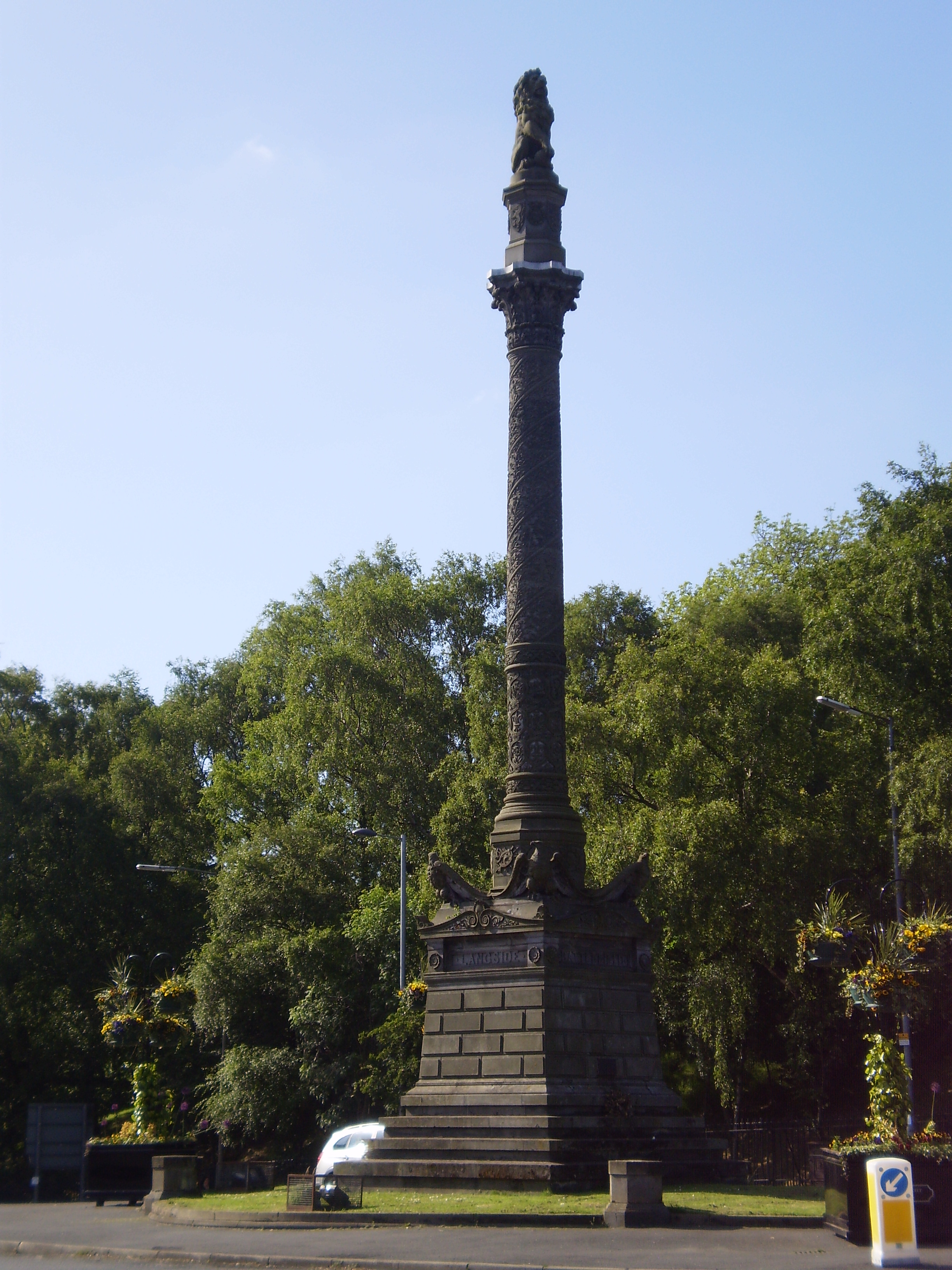
Battle of Langside

The Battle of Langside was fought on 13 May 1568 between forces loyal to Mary, Queen of Scots, and forces acting in the name of her infant son James VI...

Shawlands Academy

Shawlands Academy is a state secondary school in the Shawlands area of Glasgow, Scotland. == Admissions == Shawlands Academy was Glasgow's designated International...

Battlefield, Glasgow

Battlefield is a district in the Scottish city of Glasgow. It is situated south of the River Clyde. The area takes its name from the Battle of Langside...

Millbrae Crescent

Millbrae Crescent is a street located in Glasgow providing numerous examples of category A listed buildings thought to be designed by Alexander "Greek...

Pollokshaws East railway station

Pollokshaws East railway station is a railway station in Glasgow, Scotland, serving parts of the Pollokshaws, Auldhouse, Newlands and Shawlands neighbourhoods...

Glasgow Victoria Infirmary

The Glasgow Victoria Infirmary was a teaching hospital situated at Langside/Battlefield in the south-east of Glasgow from 1880 until 2015. It was managed...

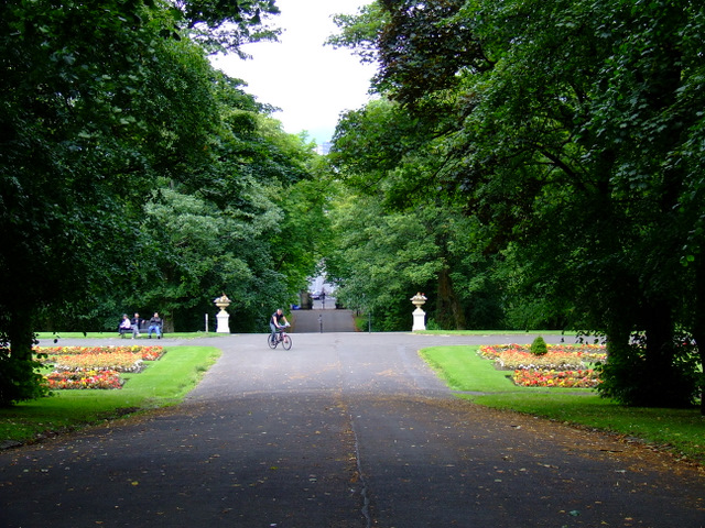
Queen's Park, Glasgow

Queen's Park (Scottish Gaelic: Pàirc na Banrìghinn, Scots: Queen's Pairk) is a park situated on the south side of the city of Glasgow, Scotland, between...

Nearby Amenities

Located within 500m of 55.827572,-4.2780198
Traffic Signals
Lat/Long: 55.8315573/-4.2788596
Battle of Langside
Date: 13th May 1568
Historic: monument
Subject Wikidata: Q4087439
Lat/Long: 55.8276875/-4.270526
Bus Stop
Battlefield Place / Algie Street
Bus: yes
Naptan AtcoCode: 60902609
Naptan Bearing: NW
Naptan CommonName: Algie Street
Naptan Indicator: before
Naptan Landmark: Algie Street
Naptan NaptanCode: 45239639
Naptan Street: Battlefield Place
Public Transport: platform
Ref: 60902609
Lat/Long: 55.82758/-4.27091
Bus Stop
Minard Road / Frankfort Street
Bus: yes
Naptan AtcoCode: 60902911
Naptan Bearing: NW
Naptan CommonName: Frankfort Street
Naptan Indicator: before
Naptan Landmark: Frankfort Street
Naptan NaptanCode: 45242627
Naptan Street: Minard Road
Nat Ref: 60902911
Public Transport: platform
Ref: 60902911
Lat/Long: 55.8317921/-4.2794269
Bar
The Linen Bar
Lat/Long: 55.8306927/-4.2808742
Cafe
Glasshouses Cafe
Lat/Long: 55.8290623/-4.2707174
Barrier: bollard
Lat/Long: 55.83177/-4.2751501
Bicycle Parking
Bicycle Parking: stands
Capacity: 4
Covered: no
Lat/Long: 55.8319694/-4.2779903
Bar
Sports Bar
Source: survey
Lat/Long: 55.8317543/-4.2760282
Cafe
Buongiorno
Addr Housenumber: 1012
Addr Postcode: G41 2HG
Addr Street: Pollokshaws Road
Fhrs Id: 125754
Source Addr: FHRS Open Data
Lat/Long: 55.8319486/-4.2784261
Bench
Backrest: yes
Covered: no
Leisure: picnic_table
Lat/Long: 55.83025/-4.2737864
Bench
Backrest: yes
Covered: no
Leisure: picnic_table
Lat/Long: 55.8294305/-4.2733358
Display House
Fee: no
Tourism: gallery
Lat/Long: 55.8287572/-4.2708921
Reptile House
Tourism: zoo
Zoo: reptile
Lat/Long: 55.8287957/-4.2704009
Temperature Corridor
Lat/Long: 55.8288684/-4.2706636
Tropical and Economic
Leisure: garden
Lat/Long: 55.8285976/-4.2703674
Cacti & Succulents
Leisure: garden
Lat/Long: 55.8285652/-4.2708435
The Co-operative Food
Addr City: Glasgow
Addr Housenumber: 1060-1078
Addr Postcode: G41 3EA
Addr Street: Pollokshaws Road
Brand: The Co-operative Food
Brand Wikidata: Q3277439
Brand Wikipedia: en:Co-op Food
Operator: The Co-operative Group
Operator Wikidata: Q117202
Shop: supermarket
Website: https://www.coop.co.uk/store-finder/G41-3EA/1060-1078-pollokshaws-road
Lat/Long: 55.8311751/-4.2799509
Bar
Waverley Tea Rooms
Lat/Long: 55.8310139/-4.2818378
Bar
Tusk
Lat/Long: 55.831014/-4.2816256
Pub
The Granary
Addr Housenumber: 10
Addr Postcode: G41 3NH
Addr Street: Kilmarnock Road
Fhrs Id: 112537
Source Addr: FHRS Open Data
Lat/Long: 55.8301981/-4.2815956
Restaurant
Bella Napoli
Lat/Long: 55.8284188/-4.283211
Restaurant
Cathay Cuisine
Delivery: yes
Takeaway: yes
Lat/Long: 55.8282752/-4.2833575
Bar
Jayz
Lat/Long: 55.8283556/-4.2832754
Restaurant
Spice of Life
Lat/Long: 55.8289063/-4.282685
John Stirling Maxwell
Disused Amenity: pub
Lat/Long: 55.8275808/-4.2847189
Restaurant
Cafe Noor
Lat/Long: 55.8290457/-4.2825107
Crossing
Crossing: traffic_signals
Crossing Island: no
Tactile Paving: yes
Traffic Signals Sound: yes
Lat/Long: 55.8290218/-4.2828629
Cafe
Biscuit
Addr Housenumber: 17
Addr Postcode: G41 3AB
Addr Street: Skirving Street
Fhrs Id: 872005
Source Addr: FHRS Open Data
Lat/Long: 55.8298894/-4.2808821
Cafe
Beanscene
Lat/Long: 55.8298306/-4.2807628
Cycleway: asl
Lat/Long: 55.8306506/-4.2812989
Post Office
Shawlands Post Office
Addr Country: GB
Addr Postcode: G41 3EA
Brand: Post Office
Brand Wikidata: Q1783168
Contact Website: https://www.postoffice.co.uk/branch-finder/1538322/shawlands
Ref Pol Id: 22670
Lat/Long: 55.831387/-4.2797562
Restaurant
Di Maggios
Addr Housenumber: 1040
Addr Postcode: G41 3EB
Addr Street: Pollokshaws Road
Fhrs Id: 511175
Source Addr: FHRS Open Data
Lat/Long: 55.8315469/-4.2791495
Post Box
Collection Times: Mo-Fr 17:30; Sa 12:00
Operator: Royal Mail
Operator Wikidata: Q638098
Ref: G41 1388
Lat/Long: 55.831226/-4.2795733
Fast Food
BABA Tandoori
Lat/Long: 55.8311654/-4.2792944
Pub
Georgic
Addr Housenumber: 1097
Addr Postcode: G41 3YG
Addr Street: Pollokshaws Road
Brand: Belhaven Pubs
Brand Wikidata: Q105516156
Fhrs Id: 49122
Source Addr: FHRS Open Data
Website: https://www.belhaven.co.uk/pubs/lanarkshire/georgic
Lat/Long: 55.8308102/-4.2799005
Fast Food
Subway
Addr City: Glasgow
Addr Housenumber: 1103
Addr Postcode: G41 3YG
Addr Street: Pollokshaws Road
Brand: Subway
Brand Wikidata: Q244457
Brand Wikipedia: en:Subway (restaurant)
Contact Website: https://restaurants.subway.com/united-kingdom/sc/glasgow/1103-pollokshaws-road
Cuisine: sandwich
Fhrs Id: 10662
Source Addr: FHRS Open Data
Takeaway: yes
Lat/Long: 55.8307425/-4.2800373
Cafe
Kavir
Addr Street: Pollokshaws Road
Lat/Long: 55.8306905/-4.2802051
Fast Food
Haddock's Fish Bar & Spicy Hut
Addr Street: Pollokshaws Road
Lat/Long: 55.8306075/-4.2803479
Pharmacy
J.P. Mackie
Healthcare: pharmacy
Lat/Long: 55.8310863/-4.2794336
Bus Stop
Kilmarnock Road / Skirving Street
Bus: yes
Naptan AtcoCode: 60902651
Naptan Bearing: SW
Naptan CommonName: Skirving Street
Naptan Indicator: After
Naptan Landmark: Skirving Street
Naptan NaptanCode: 45239429
Naptan Street: Kilmarnock Road
Public Transport: platform
Ref: 60902651
Lat/Long: 55.8298528/-4.2816269
Bus Stop
Kilmarnock Road / Mount Stuart Street
Bus: yes
Naptan AtcoCode: 60902653
Naptan Bearing: NE
Naptan CommonName: The Granary
Naptan Indicator: at
Naptan Landmark: Mount Stuart Street
Naptan NaptanCode: 45237375
Naptan Street: Kilmarnock Road
Public Transport: platform
Ref: 60902653
Lat/Long: 55.829984/-4.2817601
Fast Food
Nicos Fast Food
Lat/Long: 55.8298895/-4.2820311
Bank
Virgin Money
Brand: Virgin Money
Brand Wikidata: Q2527746
Lat/Long: 55.8295818/-4.2818609
Bank
RBS
Brand: RBS
Brand Wikidata: Q160126
Brand Wikipedia: en:Royal Bank of Scotland
Official Name: Royal Bank of Scotland
Operator: Royal Bank of Scotland
Lat/Long: 55.8294081/-4.2820612
Fast Food
Hong Kong
Addr Street: Pollokshaws Road
Lat/Long: 55.8303756/-4.2807787
Restaurant
Oscar Bar & Kitchen
Addr Housenumber: 1
Addr Postcode: G41 3YN
Addr Street: Kilmarnock Road
Cuisine: french
Opening Hours: Mo-Su 10:00-22:00
Phone: +44 141 632 3552
Website: https://oscarsouth.co.uk
Lat/Long: 55.8299056/-4.281444
Pharmacy
Shawlands Pharmacy
Healthcare: pharmacy
Lat/Long: 55.8298004/-4.2815955
Crossing
Crossing: traffic_signals
Crossing Island: no
Crossing Ref: pelican
Kerb: lowered
Tactile Paving: yes
Traffic Signals Sound: yes
Lat/Long: 55.8262269/-4.285531
Bicycle Parking
Capacity: 6
Covered: no
Lat/Long: 55.8309786/-4.280197
Recycling
Location: overground
Recycling Type: container
Lat/Long: 55.8263506/-4.2857043
Bus Stop
Pollokshaws Road / Kilmarnock Road
Bus: yes
Naptan AtcoCode: 60902668
Naptan Bearing: SW
Naptan CommonName: Shawlands Cross
Naptan Indicator: at
Naptan Landmark: Kilmarnock Road
Naptan NaptanCode: 45242732
Naptan Street: Pollokshaws Road
Public Transport: platform
Ref: 60902668
Lat/Long: 55.83012/-4.2821414
Recycling
Recycling Glass: yes
Source: local_knowledge
Lat/Long: 55.830315/-4.278645
Langside
Is In: Glasgow
Place: suburb
Wikidata: Q6486480
Wikipedia: en:Langside
Lat/Long: 55.8253002/-4.2772524
Girasoli Barber Shop
Addr Housenumber: 24
Addr Postcode: G41 3AA
Addr Street: Skirving Street
Shop: hairdresser
Website: https://www.girasoli.co.uk/
Lat/Long: 55.8296317/-4.2808888
Girasoli Ladies
Addr Housenumber: 16
Addr Postcode: G41 3AA
Addr Street: Skirving Street
Shop: hairdresser
Website: https://www.girasoli.co.uk/
Lat/Long: 55.829723/-4.2810738
Fast Food
Skirving
Addr Housenumber: 6
Addr Postcode: G41 3AA
Addr Street: Skirving Street
Cuisine: chinese
Lat/Long: 55.8298447/-4.2813206
Post Box
Collection Times: Mo-Fr 09:00; Sa 07:00
Operator: Royal Mail
Operator Wikidata: Q638098
Post Box Type: pillar
Ref: G41 796D
Royal Cypher: scottish_crown
Lat/Long: 55.8296842/-4.2808798
Bus Stop
Kilmarnock Road / Trefoil Avenue
Bench: yes
Bin: no
Bus: yes
Lit: yes
Naptan AtcoCode: 60902655
Naptan Bearing: SW
Naptan CommonName: Tefoil Avenue
Naptan Indicator: Opp
Naptan Landmark: Tefoil Avenue
Naptan NaptanCode: 45236252
Naptan Street: Kilmarnock Road
Public Transport: platform
Ref: 60902655
Shelter: yes
Source: survey;bing
Tactile Paving: no
Lat/Long: 55.8266935/-4.2850567
Bus Stop
Kilmarnock Road / Millwood Street
Bench: yes
Bin: yes
Bus: yes
Lit: yes
Naptan AtcoCode: 60902654
Naptan Bearing: NE
Naptan CommonName: Millwood Street
Naptan Indicator: Opp
Naptan Landmark: Millwood Street
Naptan NaptanCode: 45237627
Naptan Street: Kilmarnock Road
Public Transport: platform
Ref: 60902654
Shelter: yes
Source: survey;bing
Tactile Paving: yes
Lat/Long: 55.8275273/-4.2845614
Sainsbury's Local
Addr Housenumber: 102
Addr Postcode: G41 3NN
Addr Street: Kilmarnock Road
Brand: Sainsbury's Local
Brand Wikidata: Q13218434
Brand Wikipedia: en:Sainsbury's Local
Shop: convenience
Website: https://stores.sainsburys.co.uk/4482/glasgow-shawlands-local
Lat/Long: 55.8282675/-4.2841165
Pharmacy
Boots
Addr Housenumber: 92
Addr Postcode: G41 3NN
Addr Street: Kilmarnock Road
Brand: Boots
Brand Wikidata: Q6123139
Brand Wikipedia: en:Boots UK
Healthcare: pharmacy
Source: Bing
Website: https://www.boots.com/stores/6057-glasgow-shawlands-g41-3nn
Lat/Long: 55.8285643/-4.2837464
Superdrug
Addr Housenumber: 80-82
Addr Postcode: G41 3NN
Addr Street: Kilmarnock Road
Brand: Superdrug
Brand Wikidata: Q7643261
Brand Wikipedia: en:Superdrug
Contact Website: https://www.superdrug.com/store/shawlands-%28glasgow%29
Shop: chemist
Lat/Long: 55.82884/-4.2834057
Recycling
Lat/Long: 55.831001/-4.280157
Bus Stop
Kilmarnock Road / Mount Stuart Street
Bus: yes
Naptan AtcoCode: 60902652
Naptan Bearing: SW
Naptan CommonName: Mount Stuart Street
Naptan Indicator: before
Naptan Landmark: Mount Stuart Street
Naptan NaptanCode: 45237428
Naptan Street: Kilmarnock Road
Public Transport: platform
Ref: 60902652
Lat/Long: 55.8297273/-4.2817881
Bus Stop
Langside Avenue / Blairhall Avenue
Bus: yes
Naptan AtcoCode: 60902611
Naptan Bearing: NW
Naptan CommonName: Blairhall Avenue
Naptan Indicator: before
Naptan Landmark: Blairhall Avenue
Naptan NaptanCode: 45239638
Naptan Street: Langside Avenue
Public Transport: platform
Ref: 60902611
Lat/Long: 55.828888/-4.2739421
Bus Stop
Langside Avenue / Queens Park
Bus: yes
Naptan AtcoCode: 60902612
Naptan Bearing: SE
Naptan CommonName: Blairhall Avenue
Naptan Indicator: opp
Naptan Landmark: Queens Park
Naptan NaptanCode: 45232698
Naptan Street: Langside Avenue
Public Transport: platform
Ref: 60902612
Shelter: no
Lat/Long: 55.82932/-4.27462
Bus Stop
Langside Avenue / Queens Park
Bus: yes
Naptan AtcoCode: 60902613
Naptan Bearing: SE
Naptan CommonName: Tantallon Road
Naptan Indicator: opp
Naptan Landmark: Queens Park
Naptan NaptanCode: 45232523
Naptan Street: Langside Avenue
Public Transport: platform
Ref: 60902613
Shelter: no
Lat/Long: 55.8302659/-4.2764282
Bus Stop
Langside Avenue / Queens Park
Bus: yes
Naptan AtcoCode: 60902614
Naptan Bearing: NW
Naptan CommonName: Tantallon Road
Naptan Indicator: after
Naptan Landmark: Queens Park
Naptan NaptanCode: 45239843
Naptan Street: Langside Avenue
Public Transport: platform
Ref: 60902614
Lat/Long: 55.83065/-4.27748
Bus Stop
Pollokshaws Road / Kilmarnock Road
Bus: yes
Naptan AtcoCode: 60902669
Naptan Bearing: SW
Naptan CommonName: Old Parish Church
Naptan Indicator: opp
Naptan Landmark: Kilmarnock Road
Naptan NaptanCode: 45239793
Naptan Street: Pollokshaws Road
Public Transport: platform
Ref: 60902669
Lat/Long: 55.8300472/-4.2823526
Bus Stop
Pollokshaws Road / Moss-side road
Bus: yes
Naptan AtcoCode: 60902670
Naptan Bearing: NE
Naptan CommonName: Old Parish Church
Naptan Indicator: at
Naptan Landmark: Moss-side road
Naptan NaptanCode: 45234948
Naptan Street: Pollokshaws Road
Public Transport: platform
Ref: 60902670
Lat/Long: 55.83018/-4.28224
Bus Stop
Langside Avenue / Algie Street
Bus: yes
Naptan AtcoCode: 60902610
Naptan Bearing: SE
Naptan CommonName: Algie Street
Naptan Indicator: opp
Naptan Landmark: Algie Street
Naptan NaptanCode: 45239536
Naptan Street: Langside Avenue
Public Transport: platform
Ref: 60902610
Lat/Long: 55.82788/-4.27104
Man Made: surveillance
Lat/Long: 55.8317817/-4.2790618
Cafe
Glad Cafe
Addr City: Glasgow
Addr Housenumber: 1006A
Addr Postcode: G41 2HG
Addr Street: Pollokshaws Road
Diet Vegan: yes
Diet Vegetarian: yes
Fhrs Id: 433001
Opening Hours: Mo-Th 17:00-23:00; Fr 17:00-24:00; Sa 10:00-24:00; Su 10:00-23:00
Phone: +44 141 636 6119
Website: https://www.thegladcafe.co.uk/
Lat/Long: 55.8320417/-4.2782944
Bicycle Parking
Bicycle Parking: stands
Capacity: 12
Covered: no
Lat/Long: 55.8317252/-4.2783109
Atm
Cash In: no
Check Date: 2021-07-04
Operator: Tesco
Lat/Long: 55.8272596/-4.2701879
Corner Bikes
Shop: bicycle
Lat/Long: 55.8276258/-4.2822537
Shawlands
Place: suburb
Lat/Long: 55.8284587/-4.2852012
Pub
The James Tassie
Addr Housenumber: 45
Addr Postcode: G41 3YR
Addr Street: Kilmarnock Road
Fhrs Id: 49155
Operator: Stonegate
Operator Wikidata: Q7619176
Source Addr: FHRS Open Data
Website: https://www.greatukpubs.co.uk/james-tassie-glasgow
Lat/Long: 55.8288221/-4.2827827
Restaurant
Black Dove
Lat/Long: 55.828759/-4.2828511
Cafe
eat café
Lat/Long: 55.8287197/-4.2828983
Restaurant
Little India
Lat/Long: 55.8286822/-4.2829358
Optical Express
Brand: Optical Express
Brand Wikidata: Q7098810
Brand Wikipedia: en:Optical Express
Contact Website: https://www.opticalexpress.co.uk/clinic-finder/scotland/shawlands-kilmarnock-road
Shop: optician
Lat/Long: 55.8286447/-4.2829749
Mollie Brown
Shop: hairdresser
Lat/Long: 55.8286136/-4.2830058
William Hill
Brand: William Hill
Brand Wikidata: Q4053147
Brand Wikipedia: en:William Hill (bookmaker)
Shop: bookmaker
Lat/Long: 55.8285505/-4.2830807
Best-one
Brand: Best-one
Brand Wikidata: Q4896532
Brand Wikipedia: en:Best-one
Shop: convenience
Lat/Long: 55.828502/-4.2831279
Apollo Blinds
Shop: window_blind
Lat/Long: 55.8281599/-4.2834829
Man Made: surveillance
Lat/Long: 55.8317991/-4.2790913
Shawlands Cross
Junction: yes
Lat/Long: 55.8305024/-4.2809292
Post Box
Post Box Type: pillar
Ref: G41 252
Royal Cypher: EVIIIR
Royal Cypher Wikidata: Q33102195
Lat/Long: 55.8292456/-4.2781423
Cafe
Strange Brew
Addr City: Glasgow
Addr Housenumber: 1109
Addr Postcode: G41 3YG
Addr Street: Pollokshaws Road
Cuisine: brunch
Internet Access: wlan
Opening Hours: Mo-Sa 09:00-16:30; Su 09:30-15:30
Lat/Long: 55.8309098/-4.2802727
Countrywide North Estate Agents
Addr City: Glasgow
Addr Housenumber: 202
Addr Postcode: G41 3PG
Addr Street: Kilmarnock Road
Office: estate_agent
Phone: +44 141 432 1089
Lat/Long: 55.8264725/-4.2855777
Addr City: Glasgow
Addr Housenumber: 25
Addr Street: Mansionhouse Road
Lat/Long: 55.825672/-4.274988
Addr City: Glasgow
Addr Housenumber: 25a
Addr Street: Mansionhouse Road
Lat/Long: 55.8255765/-4.2748755
Post Box
Collection Times: Mo-Fr 09:00; Sa 07:00
Operator: Royal Mail
Operator Wikidata: Q638098
Post Box Type: wall
Ref: G41 130D
Royal Cypher: GVIR
Royal Cypher Wikidata: Q33102169
Lat/Long: 55.8240142/-4.2757902
Traffic Signals
Traffic Signals: signal
Lat/Long: 55.8304819/-4.280878
Traffic Signals
Traffic Signals: signal
Lat/Long: 55.8305204/-4.2809742
Memory Stone
Historic: monument
Lat/Long: 55.8307335/-4.2745115
Bench
Backrest: no
Material: stone
Seats: 1
Lat/Long: 55.8312635/-4.2780997
Bench
Backrest: no
Material: stone
Seats: 1
Lat/Long: 55.8312762/-4.2780086
Bench
Backrest: no
Material: stone
Seats: 1
Lat/Long: 55.8312677/-4.2780693
Bench
Backrest: no
Material: stone
Seats: 1
Lat/Long: 55.831272/-4.2780391
Bench
Backrest: no
Material: stone
Seats: 1
Lat/Long: 55.8316342/-4.2784944
Bench
Backrest: no
Material: stone
Seats: 1
Lat/Long: 55.8316046/-4.2785517
Bench
Backrest: no
Material: stone
Seats: 1
Lat/Long: 55.8316638/-4.2784384
Bench
Backrest: no
Material: stone
Seats: 1
Lat/Long: 55.8316946/-4.2783807
Fingertips
Shop: beauty
Lat/Long: 55.8268648/-4.2713917
Cafe
Langside Cafe
Lat/Long: 55.8269092/-4.271501
First Physio Glasgow
Shop: massage
Lat/Long: 55.8269273/-4.2715446
Louis Grace
Shop: electronics
Lat/Long: 55.826951/-4.2716116
Hair Beau
Shop: hairdresser
Lat/Long: 55.8269733/-4.27167
The Wool Haven
Shop: fabric
Lat/Long: 55.8270034/-4.2717377
Monument Grocers
Shop: convenience
Lat/Long: 55.8270388/-4.2718242
Post Box
Collection Times: Mo-Fr 09:00; Sa 07:00
Operator: Royal Mail
Operator Wikidata: Q638098
Post Box Type: pillar
Ref: G41 103D
Royal Cypher: GR
Royal Cypher Wikidata: Q33102273
Lat/Long: 55.8269028/-4.2716633
Charging Station
Capacity: 4
Opening Hours: 24/7
Operator: ChargePlace Scotland
Operator Wikidata: Q105359316
Ref: 52090
Lat/Long: 55.8282286/-4.2835388
Post Box
Collection Times: Mo-Fr 16:00; Sa 12:30
Operator: Royal Mail
Operator Wikidata: Q638098
Post Box Type: pillar
Ref: G41 227
Royal Cypher: VR
Royal Cypher Wikidata: Q33102356
Lat/Long: 55.8281194/-4.2835414
Cosgrove
Office: company
Lat/Long: 55.8298752/-4.2813823
Butterfly Kisses
Addr Housenumber: 8
Addr Street: Skirving Street
Shop: boutique
Lat/Long: 55.8298143/-4.2812589
Paper Plane
Addr Housenumber: 12
Addr Street: Skirving Street
Shop: stationery
Lat/Long: 55.8297839/-4.2811972
Beauty Inc.
Addr Housenumber: 14
Addr Street: Skirving Street
Shop: beauty
Lat/Long: 55.8297534/-4.2811355
Young's Interesting Books
Shop: books
Lat/Long: 55.8296925/-4.2810121
Georgina Sheward
Shop: tailor
Lat/Long: 55.8296621/-4.2809504
Recycling
Recycling Glass Bottles: yes
Recycling Type: container
Lat/Long: 55.8272629/-4.2766656
Post Box
Collection Times: Mo-Fr 09:00; Sa 07:00
Operator: Royal Mail
Operator Wikidata: Q638098
Post Box Type: pillar
Ref: G41 628D
Royal Cypher: GR
Royal Cypher Wikidata: Q33102273
Lat/Long: 55.8272072/-4.2769003
Helen Anderson
Shop: hairdresser
Lat/Long: 55.8269366/-4.2723184
Louis Grace
Addr Housenumber: 28
Addr Street: Langside Place
Shop: electronics
Lat/Long: 55.8269082/-4.2722434
Art Hair Design
Shop: hairdresser
Lat/Long: 55.8268759/-4.2721579
A:B Studio Architects
Office: architect
Lat/Long: 55.8268474/-4.2720826
Skyline Barbers
Addr City: Glasgow
Addr Housenumber: 34
Addr Street: Langside Place
Contact Facebook: https://www.facebook.com/skylinebarbers/
Phone: +44 141 959 5583
Shop: hairdresser
Lat/Long: 55.8268168/-4.2720015
Poinsettia
Shop: boutique
Lat/Long: 55.8267939/-4.271941
Queen's Park Camera Club Rooms
Craft: photographer
Lat/Long: 55.8267409/-4.2718009
Bank
Nationwide
Brand: Nationwide
Brand Wikidata: Q846735
Brand Wikipedia: en:Nationwide Building Society
Contact Website: https://locations.nationwidebranches.co.uk/glasgow/116-kilmarnock-road
Lat/Long: 55.8279785/-4.2843998
Card Factory
Brand: Card Factory
Brand Wikidata: Q5038192
Brand Wikipedia: en:Card Factory
Shop: gift
Lat/Long: 55.8284048/-4.2839492
Betfred
Brand: Betfred
Brand Wikidata: Q4897425
Brand Wikipedia: en:Betfred
Shop: bookmaker
Lat/Long: 55.828458/-4.2838816
Bank
Barclays
Brand: Barclays
Brand Wikidata: Q245343
Brand Wikipedia: en:Barclays
Lat/Long: 55.8286632/-4.283575
Iceland
Brand: Iceland
Brand Wikidata: Q721810
Brand Wikipedia: en:Iceland (supermarket)
Contact Website: https://www.iceland.co.uk/store-finder/store?StoreID=808&StoreName=SHAWLANDS
Shop: frozen_food
Lat/Long: 55.8290986/-4.283005
B&M Bargains
Brand: B&M Bargains
Brand Wikidata: Q4836931
Brand Wikipedia: en:B & M
Contact Website: https://www.bmstores.co.uk/stores/shawlands-221
Shop: variety_store
Lat/Long: 55.8287838/-4.283473
Fast Food
Greggs
Brand: Greggs
Brand Wikidata: Q3403981
Brand Wikipedia: en:Greggs
Contact Website: https://www.greggs.co.uk/shop-finder?shop-code=1630
Cuisine: sandwich;bakery
Takeaway: yes
Lat/Long: 55.8297433/-4.2816736
Deanston Bakery
Addr City: Glasgow
Addr Housenumber: 167
Addr Postcode: G41 3LR
Addr Street: Deanston Drive
Shop: bakery
Lat/Long: 55.8277017/-4.2822203
Crossing
Crossing: zebra
Lat/Long: 55.8247497/-4.2832173
Cafe
Dnisi
Addr City: Glasgow
Addr Housenumber: 265
Addr Postcode: G41 3JF
Addr Street: Kilmarnock Road
Opening Hours: Mo-Sa 08:00-17:00; Su 09:30-16:30
Website: https://dnisi.com/
Lat/Long: 55.8261582/-4.2854404
Dentist
Shawlands Dental Care
Healthcare: dentist
Lat/Long: 55.8300871/-4.2812364
Oddbins
Brand: Oddbins
Brand Wikidata: Q7077472
Brand Wikipedia: en:Oddbins
Shop: alcohol
Lat/Long: 55.8299786/-4.2810553
Bicycle Parking
Bicycle Parking: stands
Capacity: 4
Covered: no
Lat/Long: 55.8299701/-4.2814166
Cycleway: asl
Lat/Long: 55.8302309/-4.2813247
Cycleway: asl
Lat/Long: 55.8303814/-4.2814073
Crossing
Crossing: traffic_signals
Lat/Long: 55.8306311/-4.2812503
Cycleway: asl
Lat/Long: 55.8305712/-4.2807005
Crossing
Crossing: traffic_signals
Lat/Long: 55.8305456/-4.2807517
Crossing
Crossing: traffic_signals
Lat/Long: 55.8314684/-4.2790311
Crossing
Crossing: traffic_signals
Lat/Long: 55.8316311/-4.278991
Ladbrokes
Brand: Ladbrokes
Brand Wikidata: Q1799875
Brand Wikipedia: en:Ladbrokes Coral
Shop: bookmaker
Lat/Long: 55.8313755/-4.279447
Mika
Shop: hairdresser
Lat/Long: 55.8314824/-4.2792633
Crossing
Crossing: zebra
Tactile Paving: yes
Lat/Long: 55.8306336/-4.2773005
Street Lamp
Lat/Long: 55.8320661/-4.2778328
Street Lamp
Lat/Long: 55.8318368/-4.2781966
Street Lamp
Lat/Long: 55.8315683/-4.2786562
Street Lamp
Lat/Long: 55.8317963/-4.279498
Man Made: surveillance
Lat/Long: 55.8318617/-4.2796557
Street Lamp
Lat/Long: 55.8318204/-4.279848
Waste Basket
Lat/Long: 55.8319853/-4.2794853
Man Made: surveillance
Lat/Long: 55.8317929/-4.2790739
Shop: butcher
Lat/Long: 55.8318185/-4.2791084
Shop: electronics
Lat/Long: 55.8318626/-4.2791929
Pharmacy
Lat/Long: 55.8318012/-4.2790689
Cafe
Tapa
Lat/Long: 55.8319014/-4.2792372
eagles dare
Shop: tattoo
Lat/Long: 55.8319386/-4.2793042
Restaurant
Lat/Long: 55.8319635/-4.2793438
Shawlands Laundry
Shop: laundry
Lat/Long: 55.831994/-4.2794115
Power: transformer
Lat/Long: 55.8273989/-4.2700573
Crossing
Crossing: traffic_signals
Tactile Paving: yes
Lat/Long: 55.8294127/-4.2847159
Crossing
Crossing: zebra
Crossing Island: no
Tactile Paving: yes
Lat/Long: 55.8267312/-4.2716084
Crossing
Crossing: zebra
Crossing Island: no
Tactile Paving: yes
Lat/Long: 55.8267616/-4.2714664
Crossing
Crossing: zebra
Crossing Island: no
Tactile Paving: yes
Lat/Long: 55.8267002/-4.2714946
Crossing
Crossing: traffic_signals
Crossing Island: yes
Lat/Long: 55.8314829/-4.2787408
Bicycle Parking
Access: customers
Bicycle Parking: stands
Capacity: 6
Covered: yes
Fee: yes
Operator: Cyclehoop
Ref: 3114
Website: https://www.cyclehoop.rentals
Lat/Long: 55.8299984/-4.2812456
Fast Food
Cuisine: sushi
Takeaway: yes
Lat/Long: 55.8299439/-4.2809872
VPZ
Brand: VPZ
Brand Wikidata: Q107300487
Shop: e-cigarette
Lat/Long: 55.8292575/-4.2822205
Bank
TSB
Brand: TSB
Brand Wikidata: Q7671560
Website: https://branches.tsb.co.uk/glasgow/glasgow-shawlands.html
Lat/Long: 55.8285111/-4.283814
Covered: no
Leisure: picnic_table
Lat/Long: 55.8312938/-4.2781958
Covered: no
Leisure: picnic_table
Lat/Long: 55.8313231/-4.2782298
Covered: no
Leisure: picnic_table
Lat/Long: 55.831345/-4.2782703
Covered: no
Leisure: picnic_table
Lat/Long: 55.8313627/-4.2783059
Covered: no
Leisure: picnic_table
Lat/Long: 55.8313841/-4.2783365
Bicycle Parking
Capacity: 10
Covered: no
Lat/Long: 55.8313207/-4.2776564
James Mathieson
Access: yes
Historic: monument
Inscription: Saturday 20th march 1971 whilst engaged in fighting a serious house fire Station officer James Mathieson of the Glasgow fire service died whilst engaged in fire fighting
Lat/Long: 55.8280825/-4.2817647
The data included in this document is from www.openstreetmap.org. The data is made available under ODbL.

Have you been to Langside?

Leave your review of Langside below (or comments, questions and feedback).