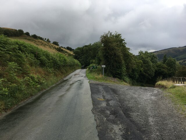
Ceunant Clochnant
Valley in Montgomeryshire
Wales
Ceunant Clochnant

Ceunant Clochnant is a picturesque valley located in Montgomeryshire, Wales. Nestled within the stunning Cambrian Mountains, it offers breathtaking views and a serene atmosphere for nature enthusiasts.
The valley is renowned for its lush greenery, consisting of dense forests, rolling hills, and meandering streams. It is home to an array of diverse flora and fauna, making it a haven for wildlife. Visitors can expect to spot various bird species, including red kites and peregrine falcons, along with otters and badgers.
Ceunant Clochnant boasts a network of hiking trails that cater to all levels of fitness and experience. These trails meander through the valley, offering hikers the chance to explore its hidden gems. One of the highlights is the Clochnant Waterfall, a stunning cascade that tumbles down the rocky cliffs, creating a mesmerizing sight and a soothing soundtrack for visitors.
For those seeking tranquility, Ceunant Clochnant is the perfect destination. Its remote location and limited tourist infrastructure ensure a peaceful and undisturbed experience. Visitors can enjoy the sounds of nature, breathe in the fresh mountain air, and appreciate the untouched beauty of the valley.
Although there are no amenities or facilities within the valley itself, the nearby towns of Llanbrynmair and Machynlleth offer accommodation options, restaurants, and shops for visitors to utilize during their stay.
Ceunant Clochnant truly captures the essence of rural Montgomeryshire, showcasing the natural wonders that Wales has to offer. Whether you are a nature lover, an avid hiker, or simply seeking a tranquil escape, this valley is sure to leave a lasting impression.
If you have any feedback on the listing, please let us know in the comments section below.
Ceunant Clochnant Images
Images are sourced within 2km of 52.795564/-3.4189426 or Grid Reference SJ0422. Thanks to Geograph Open Source API. All images are credited.


Ceunant Clochnant is located at Grid Ref: SJ0422 (Lat: 52.795564, Lng: -3.4189426)
Unitary Authority: Powys
Police Authority: Dyfed Powys
What 3 Words
///prominent.worldwide.searcher. Near Llangynog, Powys
Nearby Locations
Related Wikis
Llangynog
Llangynog (; grid reference SJ053261) is a village and community at the confluence of the Afon Eirth and the Afon Tanat at the foot of the Berwyn range...

Llangynog railway station
Llangynog railway station was the western terminus station of the Tanat Valley Light Railway in Llangynog, Powys, Wales. The station opened in 1904, closed...

Abertridwr, Powys
Abertridwr () is a small village in the historic county of Montgomeryshire in the north of Powys and close to Lake Vyrnwy in the community (civil parish...

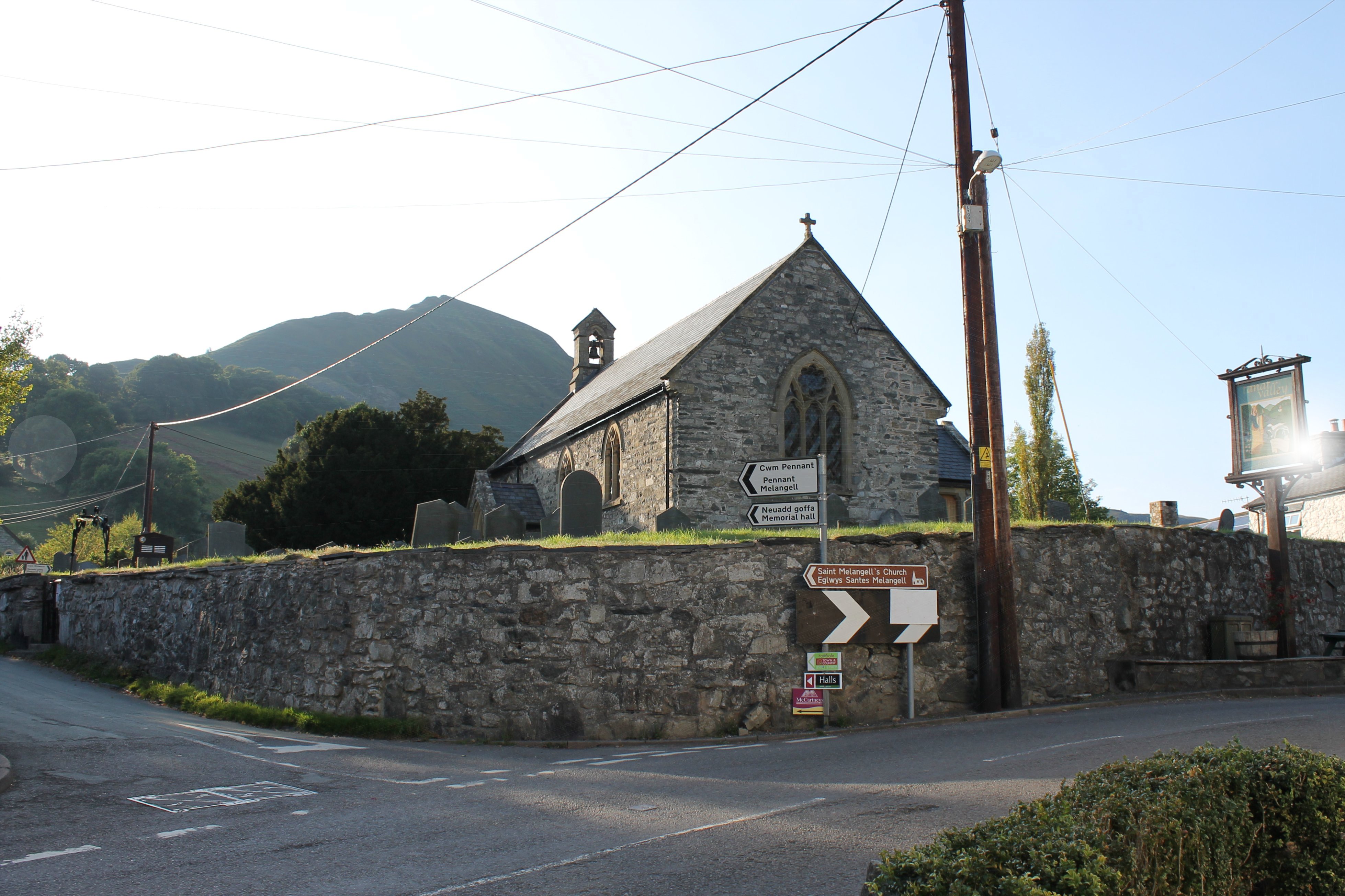
St Melangell's Church, Pennant Melangell
St Melangell's Church, Pennant Melangell, is a small church located on a minor road which joins the B4391 near the village of Llangynog, Powys, Wales....
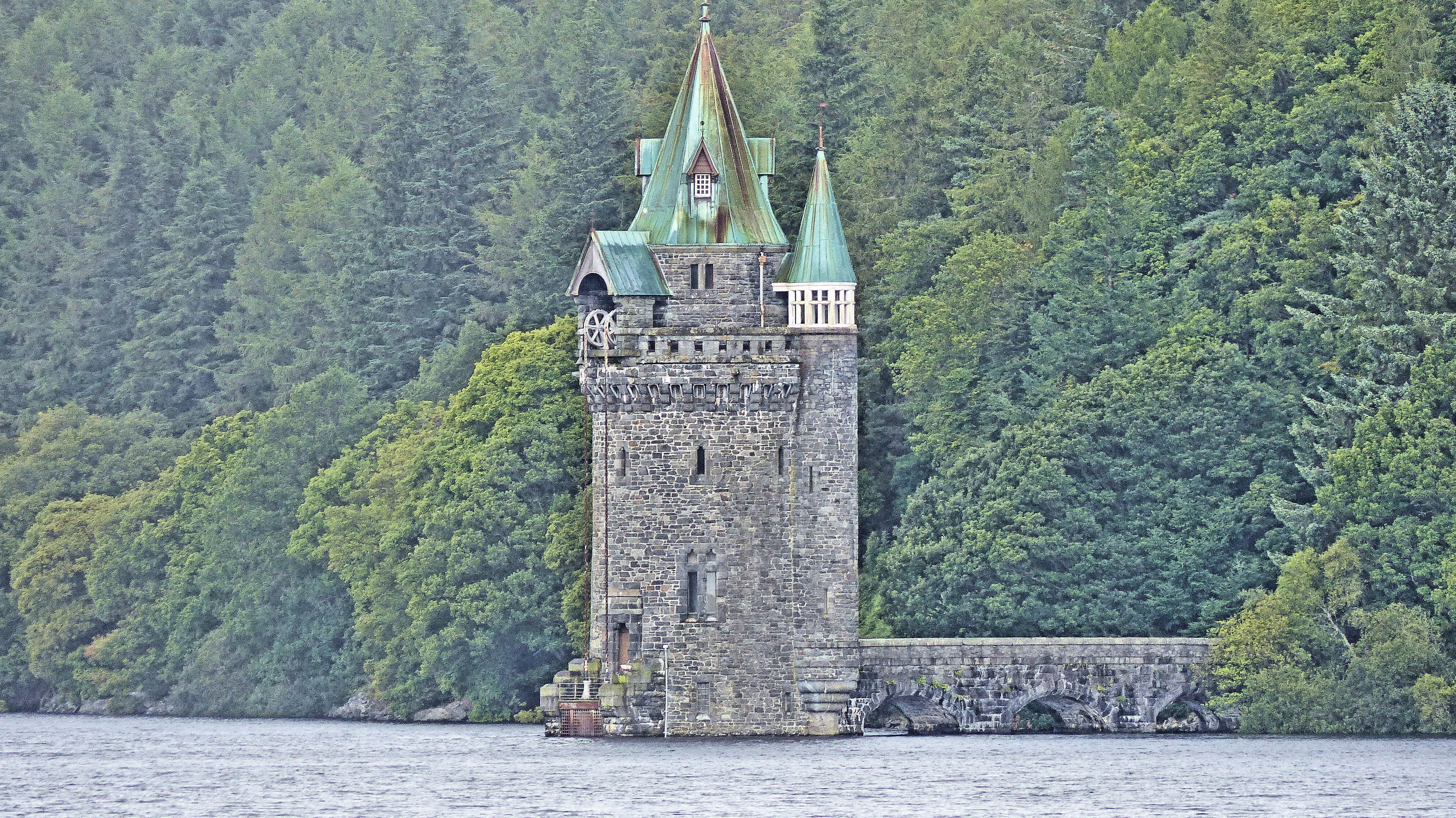
Lake Vyrnwy Straining Tower
The Straining Tower at Lake Vyrnwy is an intake tower built to extract water from the lake. The tower stands on the north shore of Lake Vyrnwy, near the...
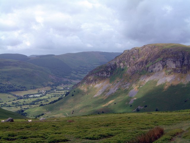
Craig Rhiwarth
Craig Rhiwarth is a mountain in the Berwyn range, in Powys (formerly Montgomeryshire), Wales, overlooking the village of Llangynog to the south. On the...

Llanwddyn
Llanwddyn () is a village and community in Montgomeryshire, Powys, Wales. The community is centred on the Lake Vyrnwy reservoir. The original Llanwddyn...

Pen-y-Bont-Fawr
Pen-y-Bont-Fawr (or Penybontfawr) is a small village and community in Montgomeryshire, Powys, Wales located in the Tanat valley. In the 2011 UK Census...
Nearby Amenities
Located within 500m of 52.795564,-3.4189426Have you been to Ceunant Clochnant?
Leave your review of Ceunant Clochnant below (or comments, questions and feedback).