Ceunant yr Hir-rhôs

Valley in Montgomeryshire

Wales

Ceunant yr Hir-rhôs

Forestry entrance to Coed Ffridd-y-drum
Forestry entrance to Coed Ffridd-y-drum Credit: Steven Brown

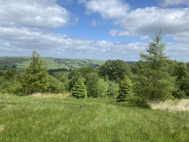
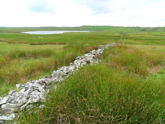
Ceunant yr Hir-rhôs is a picturesque valley located in Montgomeryshire, Wales. Situated amidst the rolling hills and lush greenery, this valley offers a serene and tranquil setting for nature lovers and outdoor enthusiasts alike.

The valley is characterized by its steep slopes, with the river Hir-rhôs meandering through the heart of the landscape. The river is known for its clear waters and is a popular spot for fishing and kayaking. The surrounding woodlands are home to a diverse range of flora and fauna, making it an ideal location for birdwatching and wildlife spotting.

Ceunant yr Hir-rhôs is also renowned for its breathtaking waterfalls. The cascading waters create a mesmerizing sight as they plunge down the rugged cliffs into crystal-clear pools below. The most prominent waterfall in the valley is known as Rhaeadr Ceunant, which attracts visitors from far and wide.

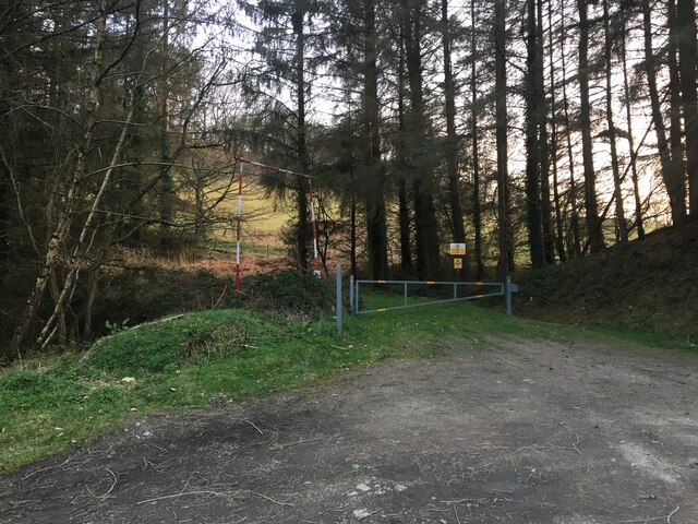
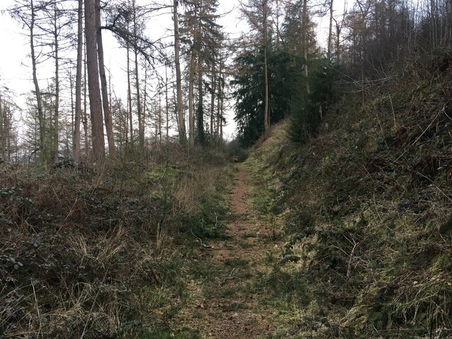
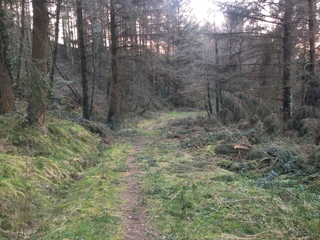
For those interested in hiking and exploring, there are numerous trails that wind their way through the valley, offering stunning panoramic views of the surrounding countryside. The valley is also intersected by a network of footpaths, providing ample opportunities for leisurely walks and picnics in the peaceful surroundings.

Overall, Ceunant yr Hir-rhôs is a hidden gem in Montgomeryshire, offering visitors a chance to escape the hustle and bustle of everyday life and immerse themselves in the beauty of nature.

If you have any feedback on the listing, please let us know in the comments section below.

Ceunant yr Hir-rhôs Images

Images are sourced within 2km of 52.657357/-3.4188233 or Grid Reference SJ0407. Thanks to Geograph Open Source API. All images are credited.

Forestry entrance to Coed Ffridd-y-drum
Path in Coed Ffridd-y-drum
Path in Coed Ffordd-y-Drum
New plantation South of Llanerfyl.
New plantation
South of Llanerfyl.
Road uphill A dead-end road leading up on to Mynydd Waun Fawr.
Road uphill
A dead-end road leading up on to Mynydd Waun Fawr.
Llyn y Grinwydden
Llyn y Grinwydden
Tre Gwynt 'Wind Town' seems an appropriate name for this isolated and long-abandoned farm building.
Tre Gwynt
'Wind Town' seems an appropriate name for this isolated and long-abandoned farm building.
Rocky valley on the west side of Disgwylfa
The summit of Disgwylfa There are two rocky lumps which could argue for the actual highest point of Disgwylfa.  But once you've stood on each of them a couple of times, this one wins the day.  A lovely remote hill which is littered with such pinnacles.  That's the Arans in the distant background.
The summit of Disgwylfa
There are two rocky lumps which could argue for the actual highest point of Disgwylfa. But once you've stood on each of them a couple of times, this one wins the day. A lovely remote hill which is littered with such pinnacles. That's the Arans in the distant background.
Gardden Iron Age Hillfort This is the feature that is marked as a ring on your OS Maps and labelled as antiquity, Settlement. Gardden Hillfort above Llanerfyl.  I recommend <span class="nowrap"><a title="www.cpat.org.uk" rel="nofollow ugc noopener" href="http://www.cpat.org.uk">Link</a><img style="margin-left:2px;" alt="External link" title="External link - shift click to open in new window" src="https://s1.geograph.org.uk/img/external.png" width="10" height="10"/></span> for further information.
Gardden Iron Age Hillfort
This is the feature that is marked as a ring on your OS Maps and labelled as antiquity, Settlement. Gardden Hillfort above Llanerfyl. I recommend LinkExternal link for further information.
Tre Gwynt The derelict Tre Gwynt. Presumably at one time a farmstead.  Now there are sheep shearing sheds here and this rancid shelter. Trashed inside, presumably by the sheep which have got in at some point - and also died there, but also by the weather.  Four bunk beds stacked in one corner and a mangled table. Signs of past habitation in gas heater and candles in bottles.  Probably connected to shooting fraternity as there were a couple of ancient decoy geese on the top bunk.
I think if I stumbled across this place in a white-out blizzard, I might still press on.
I did spent 15 minutes here rescuing an enormous bumble bee though.
Tre Gwynt
The derelict Tre Gwynt. Presumably at one time a farmstead. Now there are sheep shearing sheds here and this rancid shelter. Trashed inside, presumably by the sheep which have got in at some point - and also died there, but also by the weather. Four bunk beds stacked in one corner and a mangled table. Signs of past habitation in gas heater and candles in bottles. Probably connected to shooting fraternity as there were a couple of ancient decoy geese on the top bunk. I think if I stumbled across this place in a white-out blizzard, I might still press on. I did spent 15 minutes here rescuing an enormous bumble bee though.
Ancient boundary wall A few hundred (wet and difficult) yards west of Tre Gwynt.  Llyn Hir in the background.
Ancient boundary wall
A few hundred (wet and difficult) yards west of Tre Gwynt. Llyn Hir in the background.
A458 at entrance to Ffridd-y-Drum
A458 at entrance to Bluebell Park
The A458 Between Four Crosses and Llanerfyl.
The A458
Between Four Crosses and Llanerfyl.
Beside The A458 Farmland and white cottages beside the A458 below the hill called Moel Bentyrch.
Beside The A458
Farmland and white cottages beside the A458 below the hill called Moel Bentyrch.
Heather Mill The Farm at Melin-y-grug (Heather Mill), South of Four Crosses.
Heather Mill
The Farm at Melin-y-grug (Heather Mill), South of Four Crosses.
South Of Four Crosses On the road to Melin-y-grug (Heather Mill).
South Of Four Crosses
On the road to Melin-y-grug (Heather Mill).
Show me another place!

Ceunant yr Hir-rhôs is located at Grid Ref: SJ0407 (Lat: 52.657357, Lng: -3.4188233)

Unitary Authority: Powys

Police Authority: Dyfed Powys

What 3 Words

///deduced.emailed.streetcar. Near Llangadfan, Powys

Related Wikis

Llanerfyl

Llanerfyl is a village and community in Montgomeryshire, Powys, Wales. Located near the River Banwy, the community includes the village of Llanerfyl, several...

Four Crosses, Llanfair Caereinion

Four Crosses is a hamlet located west of Llanfair Caereinion in Powys, Wales. It is situated off the A458 between Llanfair Caereinion and Mallwyd. The...

Montgomeryshire (Senedd constituency)

Montgomeryshire (Welsh: Sir Drefaldwyn) is a constituency of the Senedd. It elects one Member of the Senedd by the first past the post method of election...

Montgomeryshire (UK Parliament constituency)

Montgomeryshire (Welsh: Sir Drefaldwyn) is a constituency in Wales represented in the House of Commons of the UK Parliament. Created in 1542, it elects...

District of Montgomeryshire

The District of Montgomeryshire or Montgomery (Welsh: Maldwyn) was one of three local government districts of the county of Powys, Wales, from 1974 until...

Llangadfan

Llangadfan is a small village in Powys, Wales, based in the community of Banwy. The village lies on the A458 between Foel and Llanerfyl, 12 kilometres...

Cefn Coch

Cefn Coch is a small village or hamlet near Llanfair Caereinion in Mid Wales, located at grid reference SJ 0482 0284. In 2012, the village was chosen as...

Llanllugan Abbey

Llanllugan Abbey was a monastery of Cistercian nuns located at Llanllugan, Powys, Wales. It was one of only two Cistercian women's monasteries in Wales...

Nearby Amenities

Located within 500m of 52.657357,-3.4188233
Place: farm
Lat/Long: 52.6575006/-3.4144311
Direction: 175
Generator Method: photovoltaic
Generator Output Electricity: yes
Generator Solar Modules: 16
Generator Source: solar
Generator Type: solar_photovoltaic_panel
Location: roof
Power: generator
Lat/Long: 52.6575882/-3.4122352
The data included in this document is from www.openstreetmap.org. The data is made available under ODbL.

Have you been to Ceunant yr Hir-rhôs?

Leave your review of Ceunant yr Hir-rhôs below (or comments, questions and feedback).