Comrie Dean

Valley in Fife

Scotland

Comrie Dean

Harvest stored near Kinneddar Park Silage bales - not sure if the wrapping colour is of any significance?
Harvest stored near Kinneddar Park Credit: M J Richardson

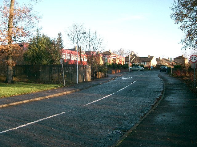
Comrie Dean is a picturesque valley located in the Fife region of Scotland. Nestled amidst the rolling hills and lush greenery, this charming village offers a tranquil retreat for visitors seeking a peaceful countryside experience.

The valley boasts stunning natural beauty, with the River Earn meandering through its heart. The surrounding landscape is dotted with farms, woodlands, and idyllic countryside views, making it an ideal destination for nature lovers and outdoor enthusiasts. The valley's location at the foot of the Ochil Hills also provides ample opportunities for hiking, cycling, and exploring the surrounding wilderness.

Comrie Dean is home to a small but close-knit community, with a population of around 300 residents. The village maintains a quaint charm, with traditional stone cottages and buildings that date back centuries. Visitors can immerse themselves in the local culture and history by taking a leisurely stroll through the village, admiring the well-preserved architecture and enjoying the peaceful ambiance.

Although relatively secluded, Comrie Dean is within easy reach of nearby towns and cities. The historic town of Dunfermline is a short drive away, offering a range of amenities, including shops, restaurants, and cultural attractions. The city of Edinburgh is also within reach, providing opportunities for day trips to explore its famous landmarks and vibrant city life.

In conclusion, Comrie Dean is a hidden gem in the Fife region, offering a tranquil escape from the hustle and bustle of city life. With its stunning natural scenery and charming village atmosphere, it is a perfect destination for those seeking a peaceful retreat in the Scottish countryside.

If you have any feedback on the listing, please let us know in the comments section below.

Comrie Dean Images

Images are sourced within 2km of 56.083458/-3.5914679 or Grid Reference NT0188. Thanks to Geograph Open Source API. All images are credited.

Harvest stored near Kinneddar Park Silage bales - not sure if the wrapping colour is of any significance?
Harvest stored near Kinneddar Park
Silage bales - not sure if the wrapping colour is of any significance?
Sheep pasture at Muirside of Kinneddar
Grass fields at Kinneddar Park Possibly the source of the silage at <a href="https://www.geograph.org.uk/photo/6291724">NT0290 : Harvest stored near Kinneddar Park</a>.
Grass fields at Kinneddar Park
Possibly the source of the silage at NT0290 : Harvest stored near Kinneddar Park.
A907 at Mains of Comrie
A907 near Comrie
A907 near Comrie
Flats above a row of shops, Oakley
Path, Comrie The trackbed of the Oakley and Comrie Collieries mineral line. It links with the path along the Dunfermline to Alloa trackbed and paths through woodland.
Path, Comrie
The trackbed of the Oakley and Comrie Collieries mineral line. It links with the path along the Dunfermline to Alloa trackbed and paths through woodland.
Remnant of Oakley Colliery Mapped as a mill. Once there was a large area covered with colliery buildings and railway lines here.
Remnant of Oakley Colliery
Mapped as a mill. Once there was a large area covered with colliery buildings and railway lines here.
Pigeon Lofts Kinneddar Park Lofts where some of the members of Oakley Pigeon Club keep their doos.
Pigeon Lofts
Kinneddar Park Lofts where some of the members of Oakley Pigeon Club keep their doos.
Ruined House Named on the map as Sunnyside.
Ruined House
Named on the map as Sunnyside.
Derelict Building This is some of what remains of Comrie Colliery which operated on this site from 1935 to 1986.
Derelict Building
This is some of what remains of Comrie Colliery which operated on this site from 1935 to 1986.
Comrie Colliery This is some of what remains of Comrie Colliery which operated here from 1935 to 1986.
Comrie Colliery
This is some of what remains of Comrie Colliery which operated here from 1935 to 1986.
The auld hoose, Blairhall Doon the red ash road to Comrie pit
The auld hoose, Blairhall
Doon the red ash road to Comrie pit
Comrie Colliery Ruins of surface buildings at Comrie which was closed down in 1986. There was a lot of activity in the area suggesting some form of redevelopment.
Comrie Colliery
Ruins of surface buildings at Comrie which was closed down in 1986. There was a lot of activity in the area suggesting some form of redevelopment.
Sunnyside A ruined farm.
Sunnyside
A ruined farm.
Road, Bickramside The road leads to the site of Comrie Colliery which is now showing a lot of signs of activity - flashing amber lights and deep engine noises. The snow will tell you that this is not the usual route of access, someone had attempted to slide down it and then later thought better of it.
Road, Bickramside
The road leads to the site of Comrie Colliery which is now showing a lot of signs of activity - flashing amber lights and deep engine noises. The snow will tell you that this is not the usual route of access, someone had attempted to slide down it and then later thought better of it.
Sunnyside A ruined farm.
Sunnyside
A ruined farm.
Access road to Comrie colliery The access road to the colliery at Comrie, with the derelict buildings at Sunnyside visible on the right of the image.
Access road to Comrie colliery
The access road to the colliery at Comrie, with the derelict buildings at Sunnyside visible on the right of the image.
Show me another place!

Comrie Dean is located at Grid Ref: NT0188 (Lat: 56.083458, Lng: -3.5914679)

Unitary Authority: Fife

Police Authority: Fife

What 3 Words

///sniff.mimics.blurts. Near Oakley, Fife

Nearby Locations

Comrie Dean

Related Wikis

Blairhall

Blairhall is a village in West Fife, Scotland. It is situated 1.1 miles (1.77 km) west of Comrie, and 6.7 miles (10.783 km) west of Dunfermline. The village...

Comrie, Fife

Comrie ( locally or ); is a village in Fife, Scotland, located immediately west of the neighbouring village of Oakley, 6.2 miles (9.98 km) west of Dunfermline...

East Grange (Fife) railway station

East Grange railway station served the area of East Grange, Fife, Scotland, from 1850 to 1958 on the Stirling and Dunfermline Railway. == History == The...

Oakley United F.C.

Oakley United Football Club are a Scottish football club based in Oakley, Fife. Formed in 1964, they play their home games at Blairwood Park. The club...

Oakley (Fife) railway station

Oakley (Fife) railway station served the village of Oakley, Fife, Scotland from 1850 to 1986 on the Stirling and Dunfermline Railway. == History == The...

Balgownie Wood

Balgownie Wood is a woodland in West Fife, Scotland, south of the village of Blairhall and east of Balgownie Mains. The woods used to belong to nearby...

Oakley, Fife

Oakley is a village in Fife, Scotland located at the mutual border of Carnock and Culross parishes, Fife, 5+1⁄2 miles (9 kilometres) west of Dunfermline...

Valleyfield, Fife

Valleyfield consists of High Valleyfield and Low Valleyfield which are neighbouring villages in Fife, Scotland, midway between Dunfermline and Kincardine...

Nearby Amenities

Located within 500m of 56.083458,-3.5914679
Power: pole
Lat/Long: 56.0877873/-3.5916246
Material: wood
Power: pole
Lat/Long: 56.0837157/-3.597184
Material: wood
Power: pole
Lat/Long: 56.0845114/-3.5963099
Power: pole
Lat/Long: 56.0852607/-3.5954567
Power: pole
Lat/Long: 56.0862058/-3.5943177
Power: pole
Lat/Long: 56.0871996/-3.593203
Historic Railway: spur_junction
Railway Position: 15.0
Lat/Long: 56.0831135/-3.595193
Material: wood
Power: pole
Lat/Long: 56.0835143/-3.5987401
Bench
Lat/Long: 56.0849534/-3.5843844
The data included in this document is from www.openstreetmap.org. The data is made available under ODbL.

Have you been to Comrie Dean?

Leave your review of Comrie Dean below (or comments, questions and feedback).