Langley Mill

Settlement in Derbyshire Amber Va

England

Langley Mill

Tesco's car park The car park was very busy for early on a Thursday afternoon.
Tesco's car park Credit: Malcolm Neal

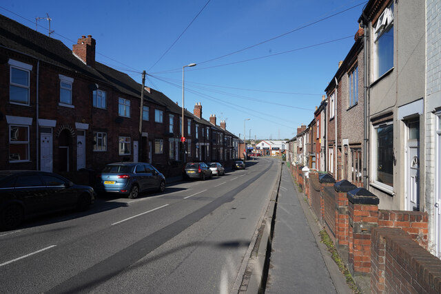
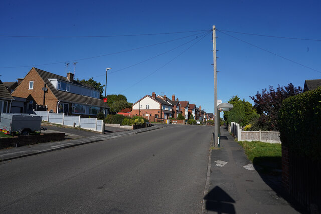
Langley Mill is a small town located in the Amber Valley district of Derbyshire, England. Situated along the River Erewash, it lies approximately 12 miles northwest of Nottingham and 12 miles northeast of Derby. This former industrial town has a population of around 6,000 residents.

Historically, Langley Mill played a significant role in the textile and coal mining industries, with several mills and collieries operating in the area during the 18th and 19th centuries. The remnants of these industries can still be seen today, with some of the old mill buildings repurposed for modern use.

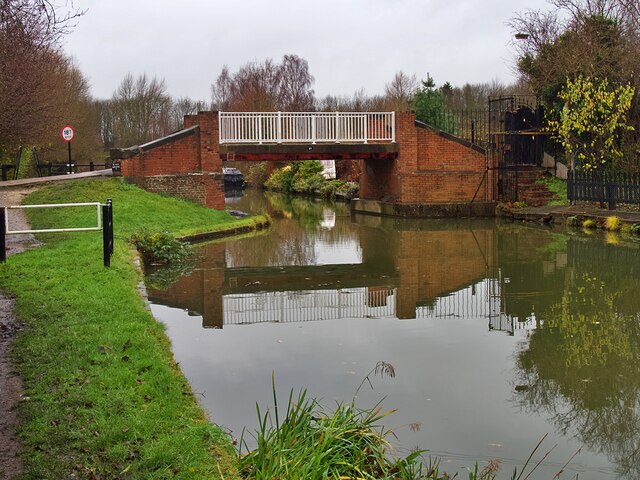
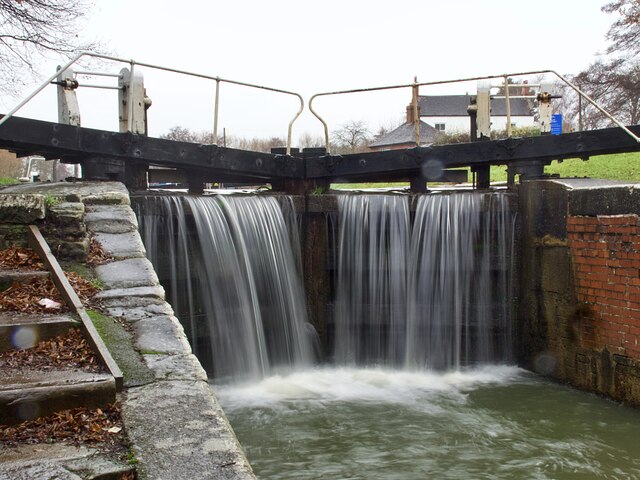
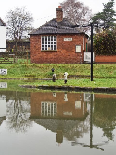
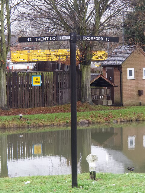
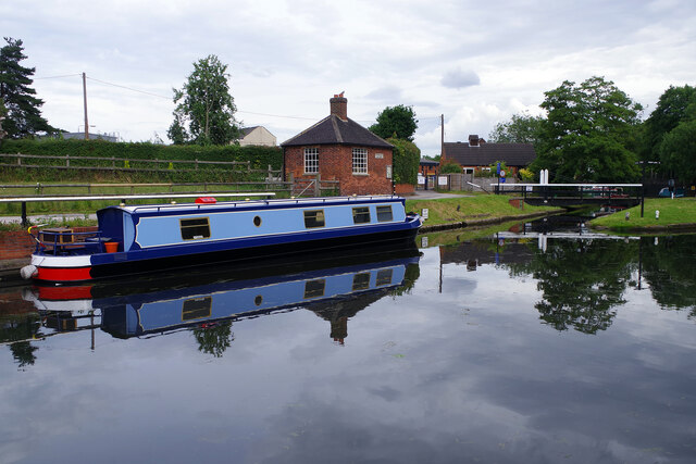
One of the prominent features of Langley Mill is the Erewash Canal, which passes through the town. Built in the late 18th century, the canal was a vital transportation route for coal and other goods. Nowadays, it serves as a leisure facility, attracting visitors for boating, fishing, and walking along its picturesque towpaths.

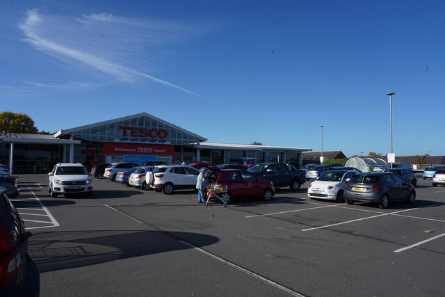
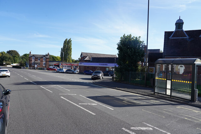
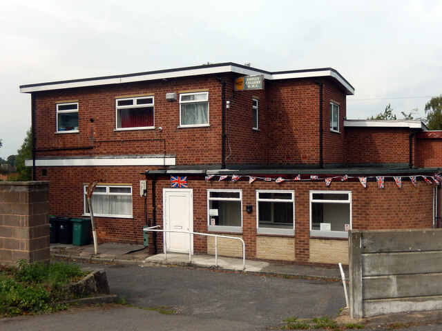
The town has a range of amenities, including shops, supermarkets, pubs, and restaurants, catering to the needs of both residents and visitors. It also has a primary school, a library, and a community center that hosts various events throughout the year.

Transportation links in Langley Mill are convenient, with regular bus services connecting the town to nearby cities and towns. The Langley Mill railway station provides rail access to Nottingham, Derby, and other destinations, making it an ideal commuter town.

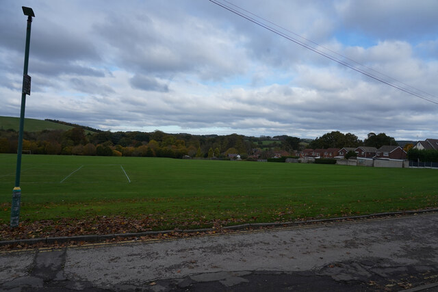
In terms of recreation, Langley Mill offers several green spaces, including parks and nature reserves, providing opportunities for outdoor activities such as walking, cycling, and birdwatching.

Overall, Langley Mill is a charming town that combines its industrial heritage with modern amenities, making it a pleasant place to live and visit.

If you have any feedback on the listing, please let us know in the comments section below.
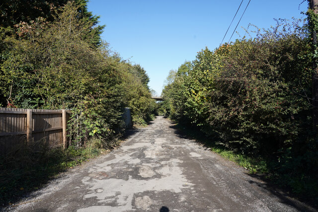
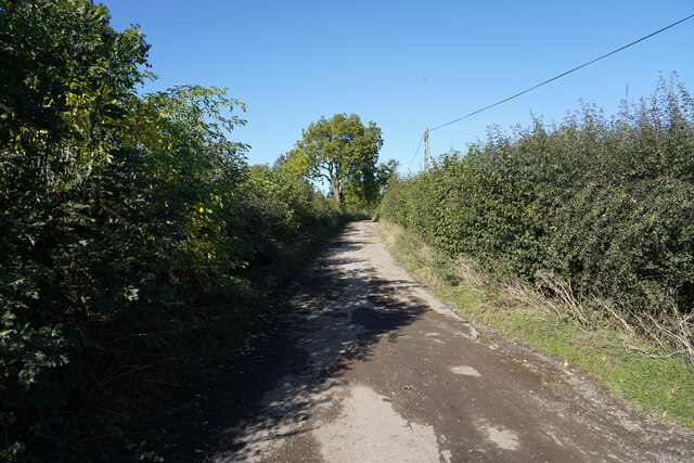
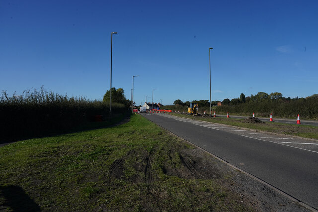
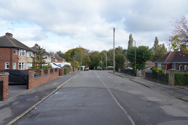
Langley Mill Images

Images are sourced within 2km of 53.021367/-1.3377975 or Grid Reference SK4447. Thanks to Geograph Open Source API. All images are credited.

Tesco's car park The car park was very busy for early on a Thursday afternoon.
Tesco's car park
The car park was very busy for early on a Thursday afternoon.
Heanor Road The houses here are very close to this very busy road.
Heanor Road
The houses here are very close to this very busy road.
Mansfield Road The flat roofed building between the trees is the Co-operative Society Funeral service.
Mansfield Road
The flat roofed building between the trees is the Co-operative Society Funeral service.
Lower Dunstead Road This road runs up the hill in Langley Mill ending at a cross road junction with Aldercar Lane and Cromford Road.
Lower Dunstead Road
This road runs up the hill in Langley Mill ending at a cross road junction with Aldercar Lane and Cromford Road.
Aldercar Lane Aldercar lane is more like a track with a very poor surface with many deep potholes.  Just ahead is the flyover for the A610. To the right of the hedge is the site of Aldercar Allotments.
Aldercar Lane
Aldercar lane is more like a track with a very poor surface with many deep potholes. Just ahead is the flyover for the A610. To the right of the hedge is the site of Aldercar Allotments.
Aldercar Lane Now out beyond the allotments with field to either side. It is a busy lane despite the poor surface, especially for the use of tractors.
Aldercar Lane
Now out beyond the allotments with field to either side. It is a busy lane despite the poor surface, especially for the use of tractors.
Cromford Road The A610 or Cromford Road has some road works up ahead with the sign saying NO 'U' turns.
Cromford Road
The A610 or Cromford Road has some road works up ahead with the sign saying NO 'U' turns.
Fall Road This is a quiet cul-de-sac that is a continuation of Midland Road in Heanor.
Fall Road
This is a quiet cul-de-sac that is a continuation of Midland Road in Heanor.
Playing fields No one is using the pitches at the moment.
Playing fields
No one is using the pitches at the moment.
The Erewash Canal and towpath south of bridge #26
Bridge #27 on the Erewash Canal Carrying Anchor Road over the canal
Bridge #27 on the Erewash Canal
Carrying Anchor Road over the canal
Narrowboat 'Gone Roaming' But not roaming today as it's moored below Anchor Bridge <a href="https://www.geograph.org.uk/photo/7044756">SK4546 : Bridge #27 on the Erewash Canal</a>]
Narrowboat 'Gone Roaming'
But not roaming today as it's moored below Anchor Bridge SK4546 : Bridge #27 on the Erewash Canal]
Water overflowing the lock gates at Langley Mill Lock Langley Mill Basin is where the Erewash Canal joins the Cromford and Nottingham Canals.
Water overflowing the lock gates at Langley Mill Lock
Langley Mill Basin is where the Erewash Canal joins the Cromford and Nottingham Canals.
The junction of the Cromford and Nottingham Canals The building is the former toll office for the Nottingham Canal. This location is unusual in that three canals meet here, the third being the Erewash Canal to Trent Lock. The three way finger post <a href="https://www.geograph.org.uk/photo/7044762">SK4547 : Direction signpost at Langley Mill Basin</a> is a recent addition, not present when the location was last geographed in 2017 <a href="https://www.geograph.org.uk/photo/5607048">SK4547 : Junction of the Nottingham and Cromford Canals</a>
The junction of the Cromford and Nottingham Canals
The building is the former toll office for the Nottingham Canal. This location is unusual in that three canals meet here, the third being the Erewash Canal to Trent Lock. The three way finger post SK4547 : Direction signpost at Langley Mill Basin is a recent addition, not present when the location was last geographed in 2017 SK4547 : Junction of the Nottingham and Cromford Canals
Direction signpost at Langley Mill Basin An unusual location where three canals meet: the Erewash, Nottingham and Cromford Canals.
Direction signpost at Langley Mill Basin
An unusual location where three canals meet: the Erewash, Nottingham and Cromford Canals.
Ghost sign on Derby Road, Eastwood It appears that this sign for Neville's Garage was mostly covered by an advertising hoarding when the gable end was repainted, obliterating part of the N and G when the hoarding was removed and the sign re-appeared.
Ghost sign on Derby Road, Eastwood
It appears that this sign for Neville's Garage was mostly covered by an advertising hoarding when the gable end was repainted, obliterating part of the N and G when the hoarding was removed and the sign re-appeared.
Great Northern Basin This pleasant spot was once a canal junction where the Erewash, Nottingham and Cromford Canals met; today only the first of these is navigable so it is effectively a dead end for boats that make their way here from Trent Lock. A few yards of the Nottingham Canal provide private moorings and access is through the swing bridge seen here; the small restored building was a toll house. Visiting boats can moor where the blue narrowboat is.
Great Northern Basin
This pleasant spot was once a canal junction where the Erewash, Nottingham and Cromford Canals met; today only the first of these is navigable so it is effectively a dead end for boats that make their way here from Trent Lock. A few yards of the Nottingham Canal provide private moorings and access is through the swing bridge seen here; the small restored building was a toll house. Visiting boats can moor where the blue narrowboat is.
Shipley Working Men's Club The building may be an unprepossessing 1960s box, but the club itself appears to be thriving with regular live entertainment. Although now known simply as the Shipley Working Men's Club, the old sign tells us that it was the Shipley Colliery Working Men's Club. Mining actually ceased at Shipley Colliery by 1930. On the left side of the sign is the Kimberley Ales yellow hop logo. Kimberley Ales were brewed by Hardys and Hansons at nearby Kimberley until the brewery closed in 2006.
Shipley Working Men's Club
The building may be an unprepossessing 1960s box, but the club itself appears to be thriving with regular live entertainment. Although now known simply as the Shipley Working Men's Club, the old sign tells us that it was the Shipley Colliery Working Men's Club. Mining actually ceased at Shipley Colliery by 1930. On the left side of the sign is the Kimberley Ales yellow hop logo. Kimberley Ales were brewed by Hardys and Hansons at nearby Kimberley until the brewery closed in 2006.
Show me another place!

Langley Mill is located at Grid Ref: SK4447 (Lat: 53.021367, Lng: -1.3377975)

Administrative County: Derbyshire

District: Amber Va

Police Authority: Derbyshire

What 3 Words

///props.spearhead.flight. Near Heanor, Derbyshire

Nearby Locations

Aldercar Langley Mill

Related Wikis

Langley Mill

Langley Mill is a large village in the Amber Valley district of Derbyshire, England. == History == Originally named Long Lea, the village of Langley Mill...

Aldercar High School

Aldercar High School is a coeducational secondary school and sixth form located in Aldercar, Derbyshire, England.It is close to the A610 and Langley Mill...

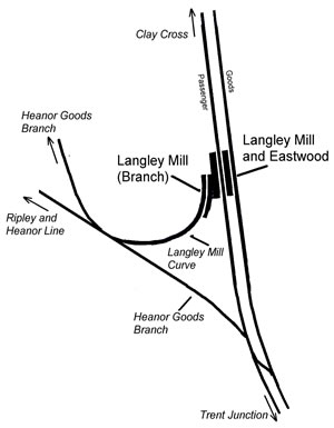
Langley Mill railway station (Erewash Valley line)

Langley Mill railway station was a railway station which served the village of Langley Mill in Derbyshire, England. It was opened in 1895 by the Midland...

Langley Mill railway station

Langley Mill railway station (formerly known as Langley Mill for Heanor and Langley Mill and Eastwood) on the Erewash Valley Line serves the large village...

Eastwood and Langley Mill railway station

Eastwood and Langley Mill railway station is a former railway station serving the town of Eastwood and the village of Langley Mill in Derbyshire, England...

Aldercar

Aldercar is a village in Derbyshire, England. It is located near Langley Mill, close to the county boundary with Nottinghamshire, and forms part of the...

Heanor and Loscoe

Heanor and Loscoe is a civil parish within the Amber Valley district, which is in the county of Derbyshire, England. Mainly built up with rural fringes...

Heanor Town Hall

Heanor Town Hall is a municipal building in the Market Street, Heanor, Derbyshire, England. The town hall, which is the meeting place of Heanor and Loscoe...

Nearby Amenities

Located within 500m of 53.021367,-1.3377975
Langley Mill
Is In: Derbyshire, England, UK
Place: town
Wikidata: Q6486274
Wikipedia: en:Langley Mill
Lat/Long: 53.0206084/-1.3356727
Traffic Signals
Crossing Ref: pelican
Lat/Long: 53.0182886/-1.3383314
Crossing
Crossing: traffic_signals
Crossing Ref: pelican
Lat/Long: 53.0182541/-1.3332905
Speed Camera
Direction: 270
Maxspeed: 30 mph
Lat/Long: 53.0180709/-1.335983
Traffic Calming: table
Lat/Long: 53.0217/-1.3432396
Traffic Calming: table
Lat/Long: 53.0203537/-1.3426594
Man Made: tower
Lat/Long: 53.0199935/-1.3327766
Traffic Calming: table
Lat/Long: 53.0191605/-1.3403083
Traffic Calming: hump
Lat/Long: 53.0217609/-1.3422776
Traffic Calming: hump
Lat/Long: 53.0227898/-1.343447
Barrier: cycle_barrier
Lat/Long: 53.0235146/-1.3346674
Post Box
Collection Times: Mo-Fr 17:30; Sa 11:45
Ele: 58.0447998
Operator: Royal Mail
Operator Wikidata: Q638098
Post Box Type: pillar
Ref: NG16 26
Royal Cypher: GVIR
Royal Cypher Wikidata: Q33102169
Lat/Long: 53.018251/-1.3373429
Entrance: yes
Lat/Long: 53.0183777/-1.3332817
Leisure: pitch
Sport: cricket
Lat/Long: 53.017617/-1.3357503
Entrance: main
Lat/Long: 53.018539/-1.3343755
Entrance: main
Step Count: 3
Lat/Long: 53.0183549/-1.3337531
Entrance: main
Step Count: 1
Lat/Long: 53.0183648/-1.3335524
Aldercar
Place: village
Wikidata: Q4713650
Wikipedia: en:Aldercar
Lat/Long: 53.0251319/-1.3368586
Entrance: main
Lat/Long: 53.018331/-1.3381004
Crossing
Crossing: traffic_signals
Lat/Long: 53.0182874/-1.3385849
Crossing
Crossing: traffic_signals
Lat/Long: 53.0182741/-1.3381629
Natural: wetland
Wetland: marsh
Lat/Long: 53.0208922/-1.3448202
Post Box
Collection Times: Mo-Fr 09:00; Sa 07:00
Operator: Royal Mail
Operator Wikidata: Q638098
Post Box Type: pillar
Ref: NG16 23D
Royal Cypher: EIIR
Royal Cypher Wikidata: Q33102113
Lat/Long: 53.0227763/-1.3375284
Maxheight: 2.2
Source: survey
Lat/Long: 53.0186273/-1.3328441
Post Box
Collection Times: Mo-Fr 09:00; Sa 07:00
Operator: Royal Mail
Operator Wikidata: Q638098
Post Box Manufacturer: W.T. Allen & Co. Ltd, London
Post Box Type: wall
Ref: NG16 25D
Royal Cypher: EIIR
Royal Cypher Wikidata: Q33102113
Lat/Long: 53.0199631/-1.3330679
Castle Stores
Addr Housenumber: 45-47
Addr Postcode: NG16 4FX
Addr Street: Horsley Crescent
Fhrs Id: 927
Shop: convenience
Source: survey
Source Addr: FHRS open data
Lat/Long: 53.0218067/-1.3427804
Telephone
Booth: KX100
Door: no
Source: survey
Lat/Long: 53.0218247/-1.3429566
Post Box
Collection Times: Mo-Fr 17:30; Sa 11:45
Operator: Royal Mail
Operator Wikidata: Q638098
Post Box Manufacturer: Carron Company, Stirlingshire
Post Box Type: pillar
Ref: NG16 220
Royal Cypher: GR
Royal Cypher Wikidata: Q33102273
Lat/Long: 53.0218105/-1.3429813
Barrier: cycle_barrier
Lat/Long: 53.0227084/-1.341833
Barrier: cycle_barrier
Lat/Long: 53.0220008/-1.3400682
Barrier: cycle_barrier
Lat/Long: 53.0221086/-1.3400964
Bench
Ele: 84.0000000
Lat/Long: 53.0219442/-1.3378247
Bench
Ele: 58.0000000
Lat/Long: 53.0183581/-1.3389183
Bench
Ele: 76.0000000
Lat/Long: 53.0205421/-1.3380433
Entrance: main
Lat/Long: 53.0182323/-1.3350398
Beggarlee Branch Junction
Railway: junction
Lat/Long: 53.0196018/-1.3312805
Railway: junction
Lat/Long: 53.0229862/-1.3323964
Bailey's Hair & Beauty
Addr Place: St Andrews Court
Addr Street: Station Road
Addr Suburb: Langley Mill
Shop: hairdresser
Source: survey
Lat/Long: 53.017955/-1.3336306
C Fletcher
Shop: trade
Source: survey
Trade: building_supplies
Website: http://www.fletchers-timber.co.uk/
Lat/Long: 53.0189372/-1.331943
Bus Stop
Saint Andrews Church
Bus: yes
Public Transport: platform
Shelter: yes
Lat/Long: 53.0181917/-1.3338692
Bus Stop
Saint Andrews Church
Bus: yes
Public Transport: platform
Shelter: yes
Lat/Long: 53.0182522/-1.3339846
Mill Floorings
Addr Place: St Andrews Court
Addr Street: Station Road
Addr Suburb: Langley Mill
Shop: carpet
Source: survey
Website: http://www.millfloorings.com/
Lat/Long: 53.0179493/-1.3337509
Entrance: main
Lat/Long: 53.0180398/-1.3339156
Entrance: main
Lat/Long: 53.018045/-1.3339826
Entrance: yes
Lat/Long: 53.0180535/-1.333707
Entrance: main
Lat/Long: 53.0180665/-1.3336249
Entrance: service
Lat/Long: 53.0180725/-1.3335658
Historic: memorial
Memorial: war_memorial
Memorial Conflict: Boer_Wars
Memorial Conflict Wikidata: Q1676845
Source: survey
Lat/Long: 53.0181711/-1.3328925
Grit Bin
Lat/Long: 53.0183134/-1.3340556
Entrance: main
Step Count: 2
Lat/Long: 53.0183592/-1.3336655
Entrance: passageway
Lat/Long: 53.0183632/-1.333699
Entrance: main
Step Count: 1
Lat/Long: 53.0183692/-1.3334523
Entrance: main
Lat/Long: 53.0183867/-1.3332033
Godfrey Street Motors
Addr Place: Langley Business Park
Addr Postcode: NG16 4DG
Addr Street: Station Road
Addr Unit: 2
Shop: car_repair
Source Addr: Companies House Registered Companies
Lat/Long: 53.0174813/-1.3346058
Bus Stop
Hillside
Bus: yes
Public Transport: platform
Shelter: no
Lat/Long: 53.0188161/-1.3389522
Addr Housenumber: 31A
Addr Postcode: NG16 4DQ
Addr Street: Station Road
Entrance: home
Source: survey
Source Addr Postcode: OS Opendata Codepoint
Lat/Long: 53.018325/-1.3380322
Addr Flats: 1-3
Addr Housenumber: 33
Addr Postcode: NG16 4DQ
Addr Street: Station Road
Entrance: home
Source: survey
Source Addr Postcode: OS Opendata Codepoint
Lat/Long: 53.0183167/-1.3379358
Bus Stop
Peel Street
Bus: yes
Naptan AtcoCode: 1000DLMS4444
Naptan NaptanCode: dbsdtjta
Public Transport: platform
Shelter: yes
Lat/Long: 53.0182281/-1.3374889
Bus Stop
Bailey Brook Drive
Bus: yes
Public Transport: platform
Shelter: yes
Lat/Long: 53.0190017/-1.33827
Barrier: lift_gate
Lat/Long: 53.017435/-1.3408123
Entrance: main
Lat/Long: 53.0181934/-1.3363345
Entrance: home
Lat/Long: 53.0181945/-1.3363016
Entrance: main
Lat/Long: 53.0182318/-1.335068
Entrance: main
Lat/Long: 53.0182794/-1.3343853
Entrance: main
Lat/Long: 53.0183129/-1.3378921
Entrance: main
Lat/Long: 53.018319/-1.337962
Entrance: service
Lat/Long: 53.0183268/-1.3380508
Entrance: main
Lat/Long: 53.0183428/-1.3382375
Crossing
Crossing: traffic_signals
Lat/Long: 53.0183696/-1.3383157
Entrance: main
Lat/Long: 53.0185478/-1.3387401
Entrance: home
Lat/Long: 53.0187063/-1.3387267
Martindale Home Improvements
Addr Housenumber: 5A
Addr Postcode: NG16 4BG
Addr Street: Station Road
Alt Shop: window;shed
Shop: conservatory
Source: survey
Source Addr: website
Website: https://www.martindalehomeandgarden.co.uk/
Lat/Long: 53.0180223/-1.3412495
Bus Stop
Trent Barton Garage
Bus: yes
Public Transport: platform
Shelter: yes
Lat/Long: 53.0181382/-1.3399564
Bus Stop
Bailey Brook Drive
Bus: yes
Public Transport: platform
Shelter: no
Lat/Long: 53.0220806/-1.3429278
Bus Stop
Gregory Avenue
Bus: yes
Public Transport: platform
Shelter: yes
Lat/Long: 53.0230102/-1.3427936
Bus Stop
Andrews Drive
Bus: yes
Naptan AtcoCode: 1000DALD4021
Naptan NaptanCode: dbsagamd
Public Transport: platform
Shelter: yes
Lat/Long: 53.0216078/-1.3377515
Bus Stop
Andrews Drive
Bus: yes
Public Transport: platform
Shelter: yes
Lat/Long: 53.0221418/-1.337734
Bus Stop
Godkin Drive
Bus: yes
Naptan AtcoCode: 1000DAUD4977
Naptan NaptanCode: dbsgwgjt
Public Transport: platform
Shelter: no
Lat/Long: 53.0241931/-1.3371717
Bus Stop
Godkin Drive
Bus: yes
Public Transport: platform
Shelter: yes
Lat/Long: 53.0245791/-1.3368586
Entrance: main
Lat/Long: 53.0218336/-1.3427453
Entrance: main
Lat/Long: 53.0232479/-1.3371207
Generator Method: photovoltaic
Generator Output Electricity: yes
Generator Source: solar
Generator Type: solar_photovoltaic_panel
Location: roof
Power: generator
Lat/Long: 53.0201596/-1.3415283
Generator Method: photovoltaic
Generator Output Electricity: yes
Generator Source: solar
Generator Type: solar_photovoltaic_panel
Location: roof
Power: generator
Lat/Long: 53.0213874/-1.3415846
Generator Method: photovoltaic
Generator Output Electricity: yes
Generator Source: solar
Generator Type: solar_photovoltaic_panel
Location: roof
Power: generator
Lat/Long: 53.0219037/-1.3413513
Generator Method: photovoltaic
Generator Output Electricity: yes
Generator Source: solar
Generator Type: solar_photovoltaic_panel
Location: roof
Power: generator
Lat/Long: 53.0216665/-1.3429794
Generator Method: photovoltaic
Generator Output Electricity: yes
Generator Source: solar
Generator Type: solar_photovoltaic_panel
Location: roof
Power: generator
Lat/Long: 53.0233895/-1.3430196
Generator Method: photovoltaic
Generator Output Electricity: yes
Generator Source: solar
Generator Type: solar_photovoltaic_panel
Location: roof
Power: generator
Lat/Long: 53.0233573/-1.3438082
Generator Method: photovoltaic
Generator Output Electricity: yes
Generator Source: solar
Generator Type: solar_photovoltaic_panel
Location: roof
Power: generator
Lat/Long: 53.0225054/-1.3448274
Generator Method: photovoltaic
Generator Output Electricity: yes
Generator Source: solar
Generator Type: solar_photovoltaic_panel
Location: roof
Power: generator
Lat/Long: 53.0225296/-1.3449079
Generator Method: photovoltaic
Generator Output Electricity: yes
Generator Source: solar
Generator Type: solar_photovoltaic_panel
Location: roof
Power: generator
Lat/Long: 53.022286/-1.3449857
Generator Method: photovoltaic
Generator Output Electricity: yes
Generator Source: solar
Generator Type: solar_photovoltaic_panel
Location: roof
Power: generator
Lat/Long: 53.0222409/-1.3450366
Generator Method: photovoltaic
Generator Output Electricity: yes
Generator Source: solar
Generator Type: solar_photovoltaic_panel
Location: roof
Power: generator
Lat/Long: 53.0221747/-1.3450903
Generator Method: photovoltaic
Generator Output Electricity: yes
Generator Source: solar
Generator Type: solar_photovoltaic_panel
Location: roof
Power: generator
Lat/Long: 53.0217859/-1.3444519
Generator Method: photovoltaic
Generator Output Electricity: yes
Generator Source: solar
Generator Type: solar_photovoltaic_panel
Location: roof
Power: generator
Lat/Long: 53.020571/-1.343253
Generator Method: photovoltaic
Generator Output Electricity: yes
Generator Source: solar
Generator Type: solar_photovoltaic_panel
Location: roof
Power: generator
Lat/Long: 53.0203128/-1.33975
Generator Method: photovoltaic
Generator Output Electricity: yes
Generator Source: solar
Generator Type: solar_photovoltaic_panel
Location: roof
Power: generator
Lat/Long: 53.020308/-1.3396829
Generator Method: photovoltaic
Generator Output Electricity: yes
Generator Source: solar
Generator Type: solar_photovoltaic_panel
Location: roof
Power: generator
Lat/Long: 53.0196513/-1.3389266
Generator Method: photovoltaic
Generator Output Electricity: yes
Generator Source: solar
Generator Type: solar_photovoltaic_panel
Location: roof
Power: generator
Lat/Long: 53.0192609/-1.3391975
Generator Method: photovoltaic
Generator Output Electricity: yes
Generator Source: solar
Generator Type: solar_photovoltaic_panel
Location: roof
Power: generator
Lat/Long: 53.0193464/-1.3384625
Generator Method: photovoltaic
Generator Output Electricity: yes
Generator Source: solar
Generator Type: solar_photovoltaic_panel
Location: roof
Power: generator
Lat/Long: 53.0192689/-1.338484
Generator Method: photovoltaic
Generator Output Electricity: yes
Generator Source: solar
Generator Type: solar_photovoltaic_panel
Location: roof
Power: generator
Lat/Long: 53.0191721/-1.3384947
Home
Addr City: Nottingham
Addr Housenumber: 2
Addr Postcode: NG16 4GH
Addr Street: Castle View
Tourism: guest_house
Lat/Long: 53.0243738/-1.3412035
Location Transition: yes
Power: pole
Lat/Long: 53.0197643/-1.3430893
Location Transition: yes
Power: pole
Lat/Long: 53.0196739/-1.3430209
Power: pole
Lat/Long: 53.0198853/-1.3439396
Generator Method: photovoltaic
Generator Output Electricity: yes
Generator Source: solar
Generator Type: solar_photovoltaic_panel
Location: roof
Power: generator
Lat/Long: 53.0181293/-1.341226
Generator Method: photovoltaic
Generator Output Electricity: yes
Generator Source: solar
Generator Type: solar_photovoltaic_panel
Location: roof
Power: generator
Lat/Long: 53.0183633/-1.3404977
Generator Method: photovoltaic
Generator Output Electricity: yes
Generator Source: solar
Generator Type: solar_photovoltaic_panel
Location: roof
Power: generator
Lat/Long: 53.018331/-1.3404333
Generator Method: photovoltaic
Generator Output Electricity: yes
Generator Source: solar
Generator Type: solar_photovoltaic_panel
Location: roof
Power: generator
Lat/Long: 53.0225191/-1.3443694
Generator Method: photovoltaic
Generator Output Electricity: yes
Generator Source: solar
Generator Type: solar_photovoltaic_panel
Location: roof
Power: generator
Lat/Long: 53.0225272/-1.3444606
Generator Method: photovoltaic
Generator Output Electricity: yes
Generator Source: solar
Generator Type: solar_photovoltaic_panel
Location: roof
Power: generator
Lat/Long: 53.0202554/-1.3423082
Generator Method: photovoltaic
Generator Output Electricity: yes
Generator Source: solar
Generator Type: solar_photovoltaic_panel
Location: roof
Power: generator
Lat/Long: 53.0195423/-1.3375177
Generator Method: photovoltaic
Generator Output Electricity: yes
Generator Source: solar
Generator Type: solar_photovoltaic_panel
Location: roof
Power: generator
Lat/Long: 53.0199763/-1.3375687
Generator Method: photovoltaic
Generator Output Electricity: yes
Generator Source: solar
Generator Type: solar_photovoltaic_panel
Location: roof
Power: generator
Lat/Long: 53.0202376/-1.3373112
Generator Method: photovoltaic
Generator Output Electricity: yes
Generator Source: solar
Generator Type: solar_photovoltaic_panel
Location: roof
Power: generator
Lat/Long: 53.0202312/-1.3370215
Generator Method: photovoltaic
Generator Output Electricity: yes
Generator Source: solar
Generator Type: solar_photovoltaic_panel
Location: roof
Power: generator
Lat/Long: 53.0201871/-1.3362699
Generator Method: photovoltaic
Generator Output Electricity: yes
Generator Source: solar
Generator Type: solar_photovoltaic_panel
Location: roof
Power: generator
Lat/Long: 53.0209659/-1.3341119
Generator Method: photovoltaic
Generator Output Electricity: yes
Generator Source: solar
Generator Type: solar_photovoltaic_panel
Location: roof
Power: generator
Lat/Long: 53.0183295/-1.3348897
Generator Method: photovoltaic
Generator Output Electricity: yes
Generator Source: solar
Generator Type: solar_photovoltaic_panel
Location: roof
Power: generator
Lat/Long: 53.0182279/-1.3354691
Generator Method: photovoltaic
Generator Output Electricity: yes
Generator Source: solar
Generator Type: solar_photovoltaic_panel
Location: roof
Power: generator
Lat/Long: 53.0242368/-1.335048
Generator Method: photovoltaic
Generator Output Electricity: yes
Generator Source: solar
Generator Type: solar_photovoltaic_panel
Location: roof
Power: generator
Lat/Long: 53.0240577/-1.3333582
Generator Method: photovoltaic
Generator Output Electricity: yes
Generator Source: solar
Generator Type: solar_photovoltaic_panel
Location: roof
Power: generator
Lat/Long: 53.0218894/-1.3347449
Generator Method: photovoltaic
Generator Output Electricity: yes
Generator Source: solar
Generator Type: solar_photovoltaic_panel
Location: roof
Power: generator
Lat/Long: 53.0211424/-1.3354047
Generator Method: photovoltaic
Generator Output Electricity: yes
Generator Source: solar
Generator Type: solar_photovoltaic_panel
Location: roof
Power: generator
Lat/Long: 53.0209262/-1.3355844
Bus Stop
Trent Barton Garage
Bus: yes
Naptan AtcoCode: 1000DLMM4978
Naptan NaptanCode: dbsdtjmg
Public Transport: platform
Lat/Long: 53.017987/-1.3400524
Camera Mount: pole
Camera Type: dome
Man Made: surveillance
Surveillance: public
Surveillance Type: camera
Surveillance Zone: town
Lat/Long: 53.0183569/-1.3386011
Hair By Kelly
Addr City: Heanor
Addr Housenumber: 5
Addr Postcode: DE75 7YY
Addr Street: Carlton Close
Contact Facebook: https://www.facebook.com/hairbykellyottewell
Email: hairbykellyottewell@outlook.com
Opening Hours: Mo-Sa 09:00-18:00
Payment Cash: yes
Payment Contactless: yes
Payment Credit Cards: yes
Payment Debit Cards: yes
Payment Mastercard: yes
Payment Visa: yes
Phone: +447825 687109
Shop: hairdresser
Lat/Long: 53.0184831/-1.3432754
The data included in this document is from www.openstreetmap.org. The data is made available under ODbL.

Have you been to Langley Mill?

Leave your review of Langley Mill below (or comments, questions and feedback).