Ceunant Du

Valley in Montgomeryshire

Wales

Ceunant Du

A458 towards Foel
A458 towards Foel Credit: Steven Brown

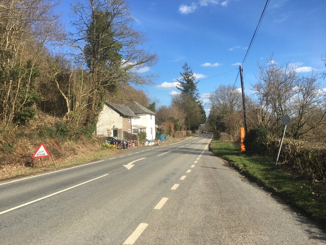
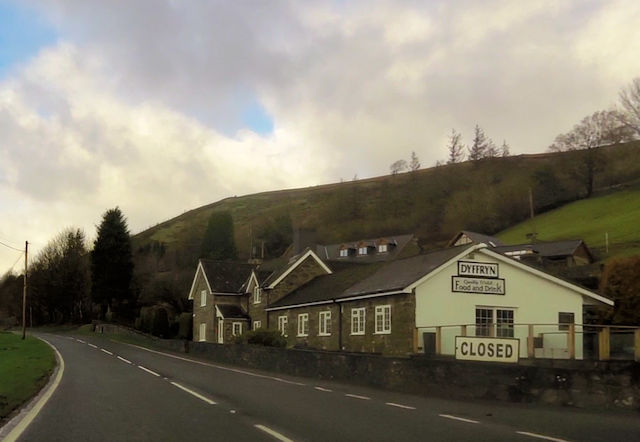
Ceunant Du is a picturesque valley located in Montgomeryshire, Powys, Wales. Nestled within the stunning landscape of the Cambrian Mountains, this valley offers breathtaking views and a tranquil atmosphere.

The name "Ceunant Du" translates to "Black Ravine" in English, and it accurately describes the dark, narrow gorge that cuts through the heart of the valley. This ravine is formed by the Afon Ceunant Du, a charming river that flows through the valley, adding to its natural beauty. The river is known for its crystal-clear waters, which cascade over rocky waterfalls, creating a soothing and mesmerizing sound.

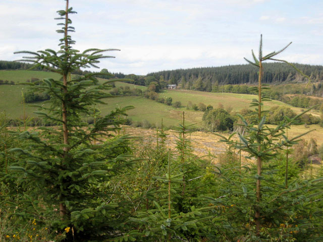
The valley is home to a diverse range of flora and fauna, making it a haven for nature enthusiasts. The surrounding hills are covered in lush greenery, with vibrant wildflowers dotting the landscape during the summer months. Visitors may be lucky enough to spot various bird species, including red kites and peregrine falcons, soaring overhead.

Ceunant Du is also a popular destination for hiking and walking enthusiasts. There are numerous trails that wind through the valley, offering stunning views at every turn. These trails cater to different levels of difficulty, ensuring that there is something for everyone.

For those seeking a peaceful retreat, Ceunant Du provides a fantastic opportunity to escape the hustle and bustle of everyday life. With its natural beauty, tranquil river, and abundance of wildlife, this valley offers a truly immersive experience in the heart of Montgomeryshire.

If you have any feedback on the listing, please let us know in the comments section below.
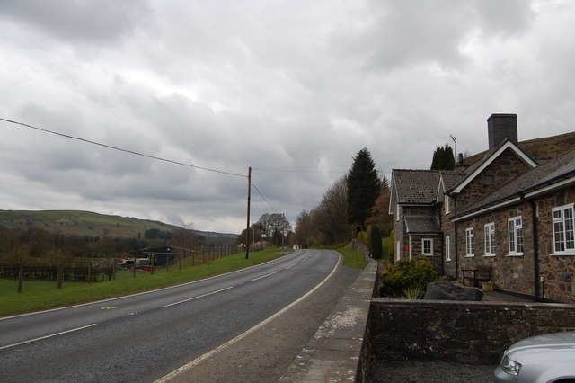
Ceunant Du Images

Images are sourced within 2km of 52.689338/-3.5292892 or Grid Reference SH9611. Thanks to Geograph Open Source API. All images are credited.

A458 towards Foel
A458 towards Foel
A458 towards Foel
A458 towards Foel
A458 near Foel
A458 near Foel
Dyffryn Cafe on the A485 west of Foel Exact location taken from Where's the path
Dyffryn Cafe on the A485 west of Foel
Exact location taken from Where's the path
Fron-las-fawr from A458
Grave Under the Yew An unusual grave under one of the Yews South of the Church at St Tydecho's Church Garthbeibio, Powys.
Grave Under the Yew
An unusual grave under one of the Yews South of the Church at St Tydecho's Church Garthbeibio, Powys.
Old Milestone by the A458, near The Wern, Banwy Parish Machynlleth Chamfer by the A458, in parish of Banwy (Powys District), near Wern Farmyard, on verge, North side of road.

Inscription reads:-
MACHYNLLETH
19 MILES
MALLWYD 7½
CANOFFICE 4½
POOL 19

Grade II listed by Cadw. Reference Number: 80793
<span class="nowrap"><a title="https://cadwpublic-api.azurewebsites.net/reports/listedbuilding/FullReport?lang=&id=80793" rel="nofollow ugc noopener" href="https://cadwpublic-api.azurewebsites.net/reports/listedbuilding/FullReport?lang=&id=80793">Link</a><img style="margin-left:2px;" alt="External link" title="External link - shift click to open in new window" src="https://s1.geograph.org.uk/img/external.png" width="10" height="10"/></span>

Surveyed

Milestone Society National ID: MOT_MCWP19.
Old Milestone by the A458, near The Wern, Banwy Parish
Machynlleth Chamfer by the A458, in parish of Banwy (Powys District), near Wern Farmyard, on verge, North side of road. Inscription reads:- MACHYNLLETH 19 MILES MALLWYD 7½ CANOFFICE 4½ POOL 19 Grade II listed by Cadw. Reference Number: 80793 LinkExternal link Surveyed Milestone Society National ID: MOT_MCWP19.
Old Milestone by the A458 near Foel Machynlleth Chamfer by the A458, in parish of Banwy (Powys District), Pant Gals, Pont Twrch; Foel, near Dyffryn Restaurant, on verge, North side of road.
N.B. Re-located from South to North side of road

Inscription reads:-
MACHYNLLETH
20 MILES
MALLWYD 8½
CANOFFICE 3½
POOL
18 MILES 

Grade II listed by Cadw.
Reference Number: 80791 <span class="nowrap"><a title="https://cadwpublic-api.azurewebsites.net/reports/listedbuilding/FullReport?lang=&id=80791" rel="nofollow ugc noopener" href="https://cadwpublic-api.azurewebsites.net/reports/listedbuilding/FullReport?lang=&id=80791">Link</a><img style="margin-left:2px;" alt="External link" title="External link - shift click to open in new window" src="https://s1.geograph.org.uk/img/external.png" width="10" height="10"/></span>

Surveyed

Milestone Society National ID: MOT_MCWP20
Old Milestone by the A458 near Foel
Machynlleth Chamfer by the A458, in parish of Banwy (Powys District), Pant Gals, Pont Twrch; Foel, near Dyffryn Restaurant, on verge, North side of road. N.B. Re-located from South to North side of road Inscription reads:- MACHYNLLETH 20 MILES MALLWYD 8½ CANOFFICE 3½ POOL 18 MILES Grade II listed by Cadw. Reference Number: 80791 LinkExternal link Surveyed Milestone Society National ID: MOT_MCWP20
Roadworks by Fron-las-fawr A common sight on Welsh roads. This is on the A458 near Foel.
Roadworks by Fron-las-fawr
A common sight on Welsh roads. This is on the A458 near Foel.
The Dyffryn Restaurant On the A458 west of Foel.
The Dyffryn Restaurant
On the A458 west of Foel.
A458 east of Dyffryn Restaurant The restaurant can be seen in the distance
A458 east of Dyffryn Restaurant
The restaurant can be seen in the distance
Road junction to Llwyn from A458
Lay by with phone near Fron-las-fach
Llechwedd from A458
Llechwedd from A458
Entrance to Wern from A458
A458 bend approaching Wern
A VERY boggy forest bridleway Knee deep in water in places. The dog and I were soaked in no time.
A VERY boggy forest bridleway
Knee deep in water in places. The dog and I were soaked in no time.
More of the boggy bridleway
Show me another place!

Ceunant Du is located at Grid Ref: SH9611 (Lat: 52.689338, Lng: -3.5292892)

Unitary Authority: Powys

Police Authority: Dyfed Powys

What 3 Words

///duck.clothed.regulates. Near Llangadfan, Powys

Related Wikis

Dyfnant Forest

Dyfnant Forest is a remote forest in northeastern-central Powys, Wales. == Location == Dyfnant Forest lies to the west of the B4395 road, a road which...

Llangadfan

Llangadfan is a small village in Powys, Wales, based in the community of Banwy. The village lies on the A458 between Foel and Llanerfyl, 12 kilometres...

Montgomeryshire (UK Parliament constituency)

Montgomeryshire (Welsh: Sir Drefaldwyn) is a constituency in Wales represented in the House of Commons of the UK Parliament. Created in 1542, it elects...

District of Montgomeryshire

The District of Montgomeryshire or Montgomery (Welsh: Maldwyn) was one of three local government districts of the county of Powys, Wales, from 1974 until...

Nearby Amenities

Located within 500m of 52.689338,-3.5292892
Place: farm
Lat/Long: 52.6922962/-3.52422
Ford: yes
Lat/Long: 52.6874518/-3.5329277
Ford: yes
Lat/Long: 52.6880687/-3.5341823
The data included in this document is from www.openstreetmap.org. The data is made available under ODbL.

Have you been to Ceunant Du?

Leave your review of Ceunant Du below (or comments, questions and feedback).