Bramble Combe
Valley in Somerset Somerset West and Taunton
England
Bramble Combe
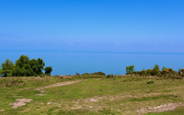
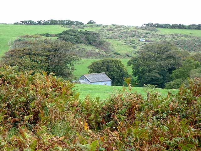
Bramble Combe is a picturesque valley located in Somerset, England. Nestled within the rolling hills of the Exmoor National Park, this charming area offers a serene and idyllic setting for visitors and locals alike.
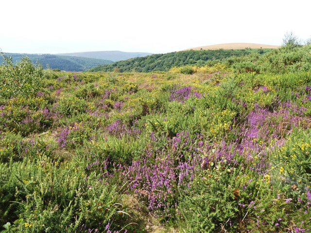
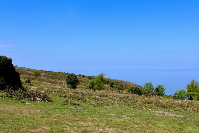
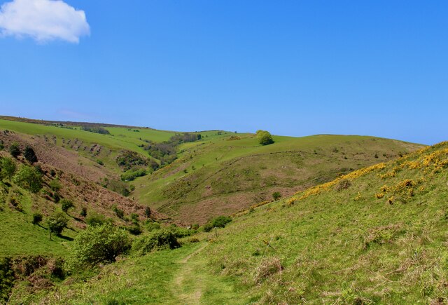
The valley is characterized by its lush greenery, with dense woodland areas, meandering streams, and open fields. The landscape is dotted with charming cottages, adding to the rural charm of the area. Bramble Combe is particularly renowned for its stunning display of wildflowers during the spring and summer months, creating a vibrant and colorful scene.
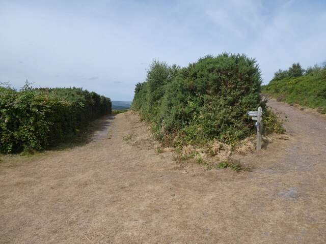
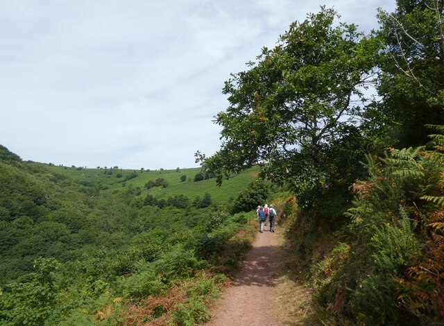
The valley is a haven for nature enthusiasts and outdoor adventurers. It boasts a network of scenic walking trails that meander through the valley and up into the surrounding hills, providing breathtaking views of the countryside. These trails cater to different skill levels, making it accessible for both seasoned hikers and casual walkers.
Wildlife enthusiasts will also find much to explore in Bramble Combe. The valley is home to a variety of bird species, including buzzards and woodpeckers, while the streams attract otters and trout. Visitors might also catch a glimpse of the elusive red deer that roam the area.
For those seeking a peaceful and secluded getaway, Bramble Combe offers a range of accommodation options, including cozy bed and breakfasts and self-catering cottages. Additionally, the nearby village of Lynton provides amenities such as shops, cafes, and restaurants for visitors to enjoy.
With its natural beauty, tranquil atmosphere, and a wealth of outdoor activities, Bramble Combe is a hidden gem in the heart of Somerset, inviting visitors to immerse themselves in the splendor of the English countryside.
If you have any feedback on the listing, please let us know in the comments section below.
Bramble Combe Images
Images are sourced within 2km of 51.221852/-3.5116761 or Grid Reference SS9448. Thanks to Geograph Open Source API. All images are credited.


Bramble Combe is located at Grid Ref: SS9448 (Lat: 51.221852, Lng: -3.5116761)
Administrative County: Somerset
District: Somerset West and Taunton
Police Authority: Avon and Somerset
What 3 Words
///plea.uproot.reporting. Near Minehead, Somerset
Nearby Locations
Related Wikis
East Myne
East Myne is a univallate Iron Age hill fort enclosure in the West Somerset district of Somerset, England. The hill fort is situated approximately 1.1...

Bratton Court
Bratton Court in the hamlet of Bratton within the parish of Minehead Without, Somerset, England was built as a manor house, with a 14th-century open hall...

Minehead Without
Minehead Without is a civil parish in the English county of Somerset, and within the Exmoor National Park. As its name suggests, the parish covers a rural...

Church of St Michael, Minehead
The Anglican Church of St Michael in Minehead, Somerset, England was built in the 15th century. It is a Grade II* listed building. == History == The church...
Selworthy Beacon
Selworthy Beacon is a hill and Marilyn of Exmoor in Somerset, England. It lies within the boundaries of Exmoor National Park, to the north of the village...
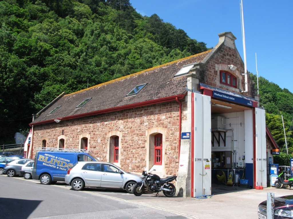
Minehead Lifeboat Station
Minehead Lifeboat Station is the base for Royal National Lifeboat Institution (RNLI) search and rescue operations at Minehead, Somerset in England. The...

Bury Castle, Selworthy
Bury Castle is an Iron Age hillfort near Selworthy, Somerset, England. It has been designated as a scheduled monument. == History == Bury Castle was built...

South West Coast Path
The South West Coast Path is England's longest waymarked long-distance footpath and a National Trail. It stretches for 630 miles (1,014 km), running from...
Nearby Amenities
Located within 500m of 51.221852,-3.5116761Have you been to Bramble Combe?
Leave your review of Bramble Combe below (or comments, questions and feedback).