Over Cleuch

Valley in Lanarkshire

Scotland

Over Cleuch

Looking down on the B7040 Taken from the track between the B7040 and the disused Leadhills and Wanlockhead railway.
Looking down on the B7040 Credit: Alistair Stewart

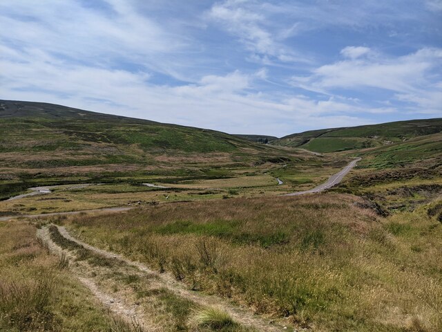
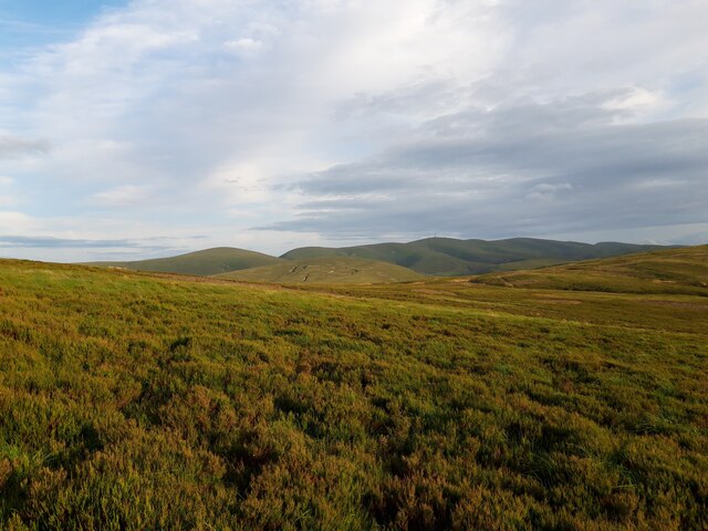
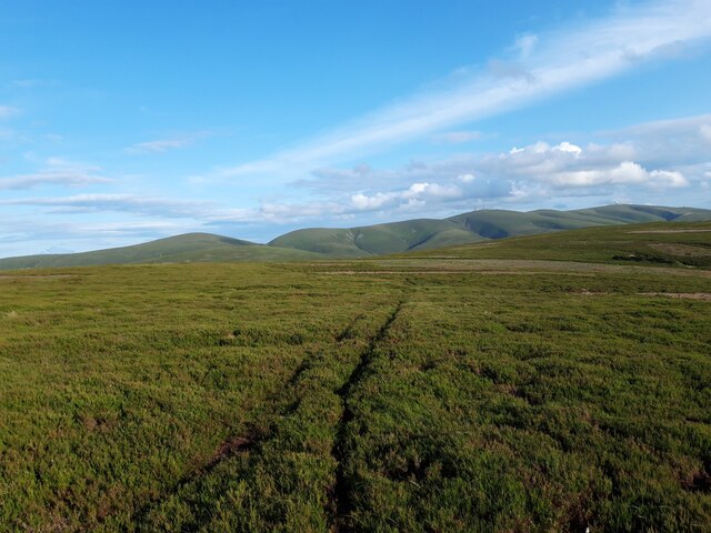
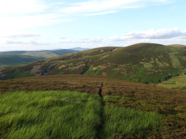
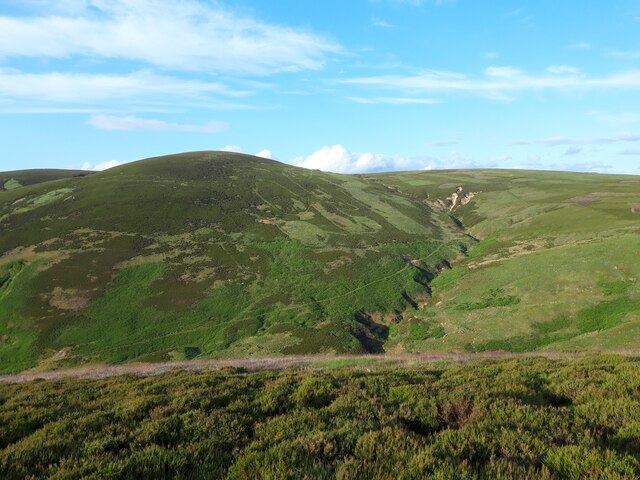
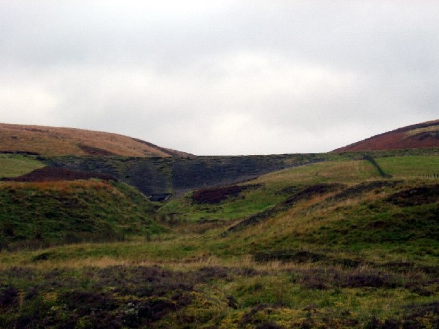
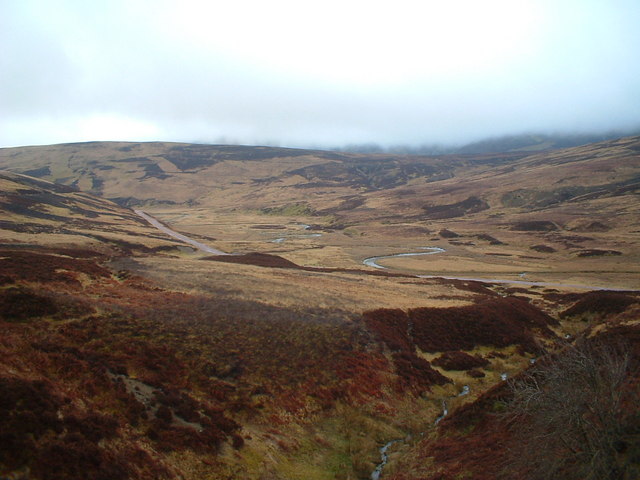
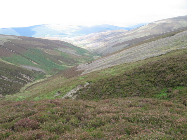
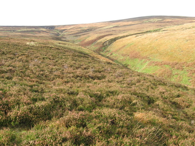
Over Cleuch is a picturesque valley located in Lanarkshire, Scotland. Situated in the southern part of the country, this valley is renowned for its natural beauty and stunning landscapes. Over Cleuch is nestled within the larger Cleuch Valley, which is surrounded by rolling hills and lush greenery.

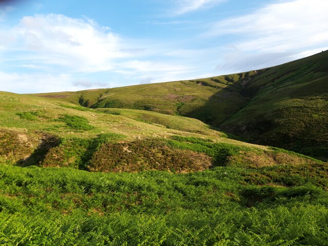
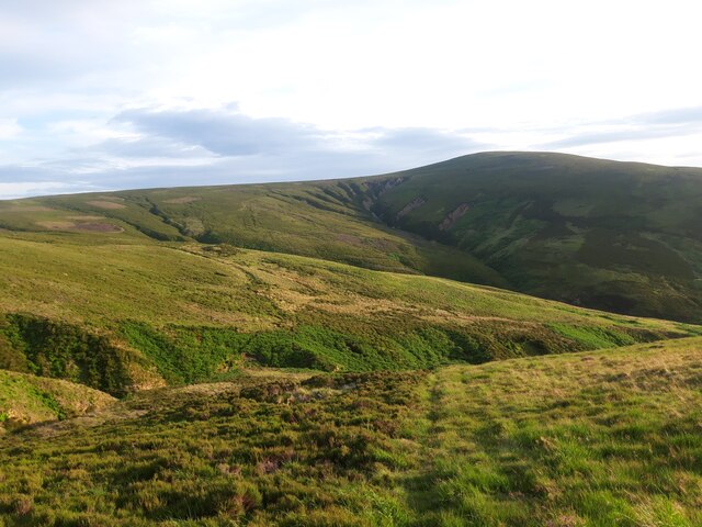
The valley is characterized by its tranquil atmosphere and untouched wilderness. It is home to a diverse range of flora and fauna, making it a haven for nature enthusiasts and wildlife lovers. Visitors to Over Cleuch can expect to see a variety of plant species, including heather, wildflowers, and native trees such as oak and birch.

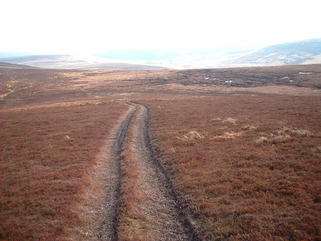
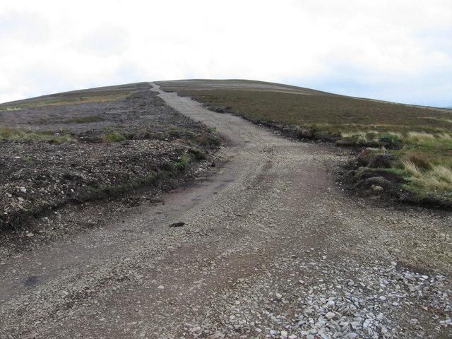
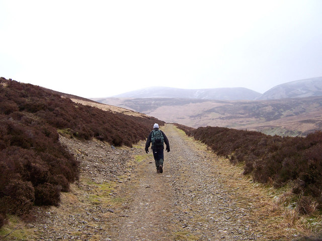
Nature trails and walking paths crisscross the valley, providing opportunities for hikers and ramblers to explore its scenic surroundings. The valley is also intersected by a charming river, which adds to the overall beauty of the landscape.

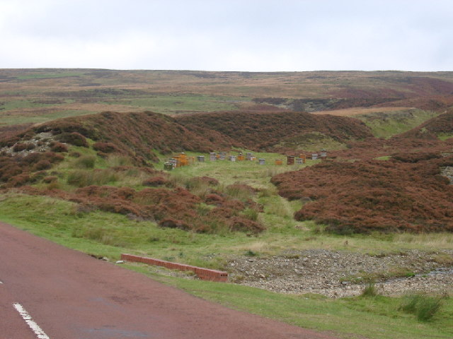
Over Cleuch has a rich history, with evidence of human habitation dating back centuries. Ruins of old settlements and historical sites can be found throughout the valley, offering a glimpse into its past. The valley's history is deeply intertwined with the mining industry, with remnants of old mines still visible today.

Overall, Over Cleuch is a hidden gem in Lanarkshire, offering visitors a chance to experience the tranquility of Scottish countryside and immerse themselves in its natural wonders. Whether it's exploring the walking trails, admiring the diverse wildlife, or delving into the valley's history, Over Cleuch has something to offer for everyone.

If you have any feedback on the listing, please let us know in the comments section below.

Over Cleuch Images

Images are sourced within 2km of 55.428649/-3.7320268 or Grid Reference NS9016. Thanks to Geograph Open Source API. All images are credited.

Looking down on the B7040 Taken from the track between the B7040 and the disused Leadhills and Wanlockhead railway.
Looking down on the B7040
Taken from the track between the B7040 and the disused Leadhills and Wanlockhead railway.
Summer evening view towards the Lowther Hills A view across heather moorland south of Bulmer Moss on a late-June evening.
Summer evening view towards the Lowther Hills
A view across heather moorland south of Bulmer Moss on a late-June evening.
Wheel ruts on Wool Law Looking towards Dun Law, Dungrain Law and the Lowther Hills on a late-June evening.
Wheel ruts on Wool Law
Looking towards Dun Law, Dungrain Law and the Lowther Hills on a late-June evening.
Faint path on the north-eastern spur of Wool Law Looking towards Clowgill Dod and Wellgrain Dod, on the opposite side of the Bellgill Burn.
Faint path on the north-eastern spur of Wool Law
Looking towards Clowgill Dod and Wellgrain Dod, on the opposite side of the Bellgill Burn.
View into Well Grain Various paths, erosion scars and signs of old lead-mining workings are visible on these hillsides.
View into Well Grain
Various paths, erosion scars and signs of old lead-mining workings are visible on these hillsides.
Grains (stream valleys) at the head of the Bellgill Burn The various gullies visible here are named Well Grain, Middle Grain and Rushy Grain. 'Grain' is a Scots word meaning 'the branch or fork of a stream or river'. It usually describes small branches at the upper reaches of a burn.
Grains (stream valleys) at the head of the Bellgill Burn
The various gullies visible here are named Well Grain, Middle Grain and Rushy Grain. 'Grain' is a Scots word meaning 'the branch or fork of a stream or river'. It usually describes small branches at the upper reaches of a burn.
Looking towards Wool Law from slopes near Well Grain A view of the hillsides around the headwaters of the Bellgill Burn on a late-June evening.
Looking towards Wool Law from slopes near Well Grain
A view of the hillsides around the headwaters of the Bellgill Burn on a late-June evening.
Beehives, near Leadhills You can just make out the old railway track above the hives. This does show the type of vegetation well - and lots of potential Heather Honey.
Beehives, near Leadhills
You can just make out the old railway track above the hives. This does show the type of vegetation well - and lots of potential Heather Honey.
Road up Glen Ea's Hill, nr Leadburn Shows the hill track up Glen Ea's Hill, with the valley of the Glen Aise Burn (that could be Glen Aise I assume!) and Dun Law behind.
Road up Glen Ea's Hill, nr Leadburn
Shows the hill track up Glen Ea's Hill, with the valley of the Glen Aise Burn (that could be Glen Aise I assume!) and Dun Law behind.
Old railway embankment near Leadhills This is looking up Scapcleugh Burn but really just shows the old railway embankment and typical Leadhills hills.
Old railway embankment near Leadhills
This is looking up Scapcleugh Burn but really just shows the old railway embankment and typical Leadhills hills.
Elvan Water
Elvan Water
Wellgrain Dod
Wellgrain Dod
Laggen  Gill below Wellgrain Dod
Laggen Gill below Wellgrain Dod
New track on Coom Dod
Long Cleuch from Middle Wood
The old railway line on Howkwood Rig. An old branch line running from Elvanfoot to the lead mines at Leadhills and Wanlockhead.
The old railway line on Howkwood Rig.
An old branch line running from Elvanfoot to the lead mines at Leadhills and Wanlockhead.
On the summit dome of Glen Ea's Hill This heathery hill is dedicated to the rearing, and subsequent killing, of Lagopus Lagopus Scotticus, the Red Grouse.
On the summit dome of Glen Ea's Hill
This heathery hill is dedicated to the rearing, and subsequent killing, of Lagopus Lagopus Scotticus, the Red Grouse.
Glen Ea's Hill Home to some grouse butts and an access track (on the north side) for shooters.
Glen Ea's Hill
Home to some grouse butts and an access track (on the north side) for shooters.
Show me another place!

Over Cleuch is located at Grid Ref: NS9016 (Lat: 55.428649, Lng: -3.7320268)

Unitary Authority: South Lanarkshire

Police Authority: Lanarkshire

What 3 Words

///director.stored.waltzed. Near Sanquhar, Dumfries & Galloway

Nearby Locations

Nether Cleuch Over Cleuch

Related Wikis

Leadhills

Leadhills, originally settled for the accommodation of miners, is a village in South Lanarkshire, Scotland, 5+3⁄4 miles (9.3 km) WSW of Elvanfoot. The...

Scots Mining Company House

The Scots Mining Company House, also known as Woodlands Hall, is an early-18th-century mansion house in Leadhills, South Lanarkshire, Scotland. The house...

Leadhills railway station

Leadhills railway station was opened on 1 October 1901 as the intermediate stop on the Leadhills and Wanlockhead Light Railway and served the lead mining...

Leadhills and Wanlockhead Railway

The Leadhills and Wanlockhead Railway is a 2 ft (610 mm) narrow gauge railway in South Lanarkshire, Scotland. It is laid on the trackbed of the former...

Nearby Amenities

Located within 500m of 55.428649,-3.7320268
Old lead mine
Historic: mine
Lat/Long: 55.4309759/-3.7342123
The data included in this document is from www.openstreetmap.org. The data is made available under ODbL.

Have you been to Over Cleuch?

Leave your review of Over Cleuch below (or comments, questions and feedback).