Cwm Crai

Valley in Brecknockshire

Wales

Cwm Crai

Footpath through a bluebell wood near Crai
Footpath through a bluebell wood near Crai Credit: peter robinson

The requested URL returned error: 429 Too Many Requests

If you have any feedback on the listing, please let us know in the comments section below.
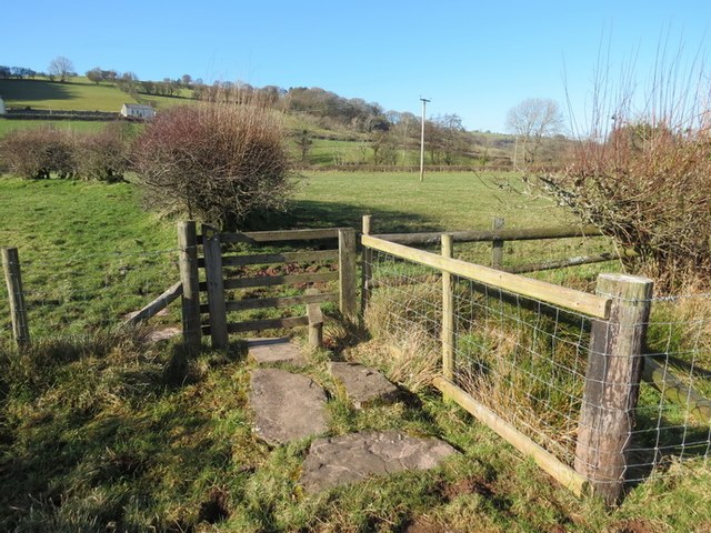
Cwm Crai Images

Images are sourced within 2km of 51.925931/-3.6092484 or Grid Reference SN8926. Thanks to Geograph Open Source API. All images are credited.

Footpath through a bluebell wood near Crai
St Ilid's church, Crai The Church in Wales church is located about 100 metres north of the central cluster of buildings in the hamlet of Crai, Powys. The church was consecrated in 1883. At the time of my visit, midday on a Sunday, the entrance gates were locked and there was no church name sign on display.
St Ilid's church, Crai
The Church in Wales church is located about 100 metres north of the central cluster of buildings in the hamlet of Crai, Powys. The church was consecrated in 1883. At the time of my visit, midday on a Sunday, the entrance gates were locked and there was no church name sign on display.
Church partly hidden by trees, Crai The church is St Ilid's. <a title="https://www.geograph.org.uk/photo/2525316" href="https://www.geograph.org.uk/photo/2525316">Link</a> There was no church name board on display, and the entrance gates on the right were padlocked.
Church partly hidden by trees, Crai
The church is St Ilid's. Link There was no church name board on display, and the entrance gates on the right were padlocked.
Clwydcaenewydd Farm buildings, Crai The farm is between the parish hall <a title="https://www.geograph.org.uk/photo/2525149" href="https://www.geograph.org.uk/photo/2525149">Link</a> and the church. <a title="https://www.geograph.org.uk/photo/2525316" href="https://www.geograph.org.uk/photo/2525316">Link</a>
Clwydcaenewydd Farm buildings, Crai
The farm is between the parish hall Link and the church. Link
Track on the eastern side of St Ilid's church, Crai On the left are the entrance gates to the church. <a title="https://www.geograph.org.uk/photo/2525316" href="https://www.geograph.org.uk/photo/2525316">Link</a> The gates were padlocked.
Track on the eastern side of St Ilid's church, Crai
On the left are the entrance gates to the church. Link The gates were padlocked.
Looking towards the Crai valley from the edge of St Ilid's church, Crai Viewed from a field gate opposite the northern edge of the church <a title="https://www.geograph.org.uk/photo/2525316" href="https://www.geograph.org.uk/photo/2525316">Link</a> grounds. The distant buildings are in Cwm Crai, the valley of the Afon Crai, a tributary of the Usk.
Looking towards the Crai valley from the edge of St Ilid's church, Crai
Viewed from a field gate opposite the northern edge of the church Link grounds. The distant buildings are in Cwm Crai, the valley of the Afon Crai, a tributary of the Usk.
Hedged road at the northern edge of Crai A few metres north of the village church <a title="https://www.geograph.org.uk/photo/2525316" href="https://www.geograph.org.uk/photo/2525316">Link</a> a narrow road heads out of Crai.
Hedged road at the northern edge of Crai
A few metres north of the village church Link a narrow road heads out of Crai.
Northern edge of Crai Crai is a hamlet in Powys, in the Brecon Beacons National Park. On the left is St Ilid's church. <a title="https://www.geograph.org.uk/photo/2525316" href="https://www.geograph.org.uk/photo/2525316">Link</a>
Northern edge of Crai
Crai is a hamlet in Powys, in the Brecon Beacons National Park. On the left is St Ilid's church. Link
NE edge of Clwydcaenewydd Farm, Crai Viewed from the road past the village church. <a title="https://www.geograph.org.uk/photo/2525316" href="https://www.geograph.org.uk/photo/2525316">Link</a>
NE edge of Clwydcaenewydd Farm, Crai
Viewed from the road past the village church. Link
Llwybr ceffyl Nantyrharn / Nantyrharn bridleway Llwybr ceffyl yn arwain lan at rostir Fforest Fach o Ffarm Nantyrharn

A bridleway leading up towards Fforest Fach moor from Nantyrharn Farm
Llwybr ceffyl Nantyrharn / Nantyrharn bridleway
Llwybr ceffyl yn arwain lan at rostir Fforest Fach o Ffarm Nantyrharn A bridleway leading up towards Fforest Fach moor from Nantyrharn Farm
Llwybr Pont Ty Gwyn Path, Crai Sticil ar lwybr cyhoeddus yn arwain at Bont Ty Gwyn, Crai

A stile on the footpath leading to Pont Ty Gwyn Bridge, Crai
Llwybr Pont Ty Gwyn Path, Crai
Sticil ar lwybr cyhoeddus yn arwain at Bont Ty Gwyn, Crai A stile on the footpath leading to Pont Ty Gwyn Bridge, Crai
Hen Heol Tanyfedw / Tanyfedw old Road Hen heol ddymunol yn cysylltu Ffarm Fadogfechan â Ffarm Tanyfedw, Crai. Mae'r heol bellach wedi ei israddio i lwybr ceffyl

An old pleasant road linking the farms of Madogfechan with Tanyfedw, Crai. The road has been downgraded to a bridleway.
Hen Heol Tanyfedw / Tanyfedw old Road
Hen heol ddymunol yn cysylltu Ffarm Fadogfechan â Ffarm Tanyfedw, Crai. Mae'r heol bellach wedi ei israddio i lwybr ceffyl An old pleasant road linking the farms of Madogfechan with Tanyfedw, Crai. The road has been downgraded to a bridleway.
Llwybr Berth Ifan Path, Crai Llwybr cyhoeddus yn arwain at Ffarm Berth Ifan, Crai / Footpath leading to Berth Ifan Farm (trans. Ivan's Hedge), Crai
Llwybr Berth Ifan Path, Crai
Llwybr cyhoeddus yn arwain at Ffarm Berth Ifan, Crai / Footpath leading to Berth Ifan Farm (trans. Ivan's Hedge), Crai
Hen Gapel Horeb  / Old Horeb Chapel Adeiladwyd Capel y Methodistiad Horeb cyntaf yn 1807. Y capel yn y llun yw'r ail addoldy a godwyd ar y safle tua 1840. Yn 1899 codwyd capel newydd tua hanner canllath i'r de ac fe ddaeth yr hen gapel yn festri. Ar y pryd fe ychwanegwyd ty i'r gofalwr a gynigai hefyd lety i bregethwyr gwadd.

Circa 1840 Horeb Methodist Chapel (pictured) replaced the first meeting house built on the site in 1807. In 1899 a brand new chapel was constructed approximately 50 yards to the south and the old chapel became a vestry. At the same time a caretakers house was also added which also served as lodgings for visiting preachers.
Hen Gapel Horeb / Old Horeb Chapel
Adeiladwyd Capel y Methodistiad Horeb cyntaf yn 1807. Y capel yn y llun yw'r ail addoldy a godwyd ar y safle tua 1840. Yn 1899 codwyd capel newydd tua hanner canllath i'r de ac fe ddaeth yr hen gapel yn festri. Ar y pryd fe ychwanegwyd ty i'r gofalwr a gynigai hefyd lety i bregethwyr gwadd. Circa 1840 Horeb Methodist Chapel (pictured) replaced the first meeting house built on the site in 1807. In 1899 a brand new chapel was constructed approximately 50 yards to the south and the old chapel became a vestry. At the same time a caretakers house was also added which also served as lodgings for visiting preachers.
Cow Lights A4067
Cow Lights
A4067
Country Lane Lane used as public path leading to Tanyfedw off the Crai-Trecastle road. Footpath marker post in need of repair.
Country Lane
Lane used as public path leading to Tanyfedw off the Crai-Trecastle road. Footpath marker post in need of repair.
Bridge Over Afon Crai Inscription stones on bridge decayed, stone on nearside shows a date of 1814.
Bridge Over Afon Crai
Inscription stones on bridge decayed, stone on nearside shows a date of 1814.
Bridge Over Afon Crai Crai to Trecastle road, Crai to Sennybridge road hedges  visible middle left.
Bridge Over Afon Crai
Crai to Trecastle road, Crai to Sennybridge road hedges visible middle left.
Show me another place!

Cwm Crai is located at Grid Ref: SN8926 (Lat: 51.925931, Lng: -3.6092484)

Unitary Authority: Powys

Police Authority: Dyfed Powys

What 3 Words

///projects.gearing.collides. Near Cray, Powys

Nearby Locations

Cwm Crai

Related Wikis

Fforest Fach

Fforest Fach is a small area of unenclosed land within Brecon Beacons National Park southwest of Sennybridge in the county of Powys, Wales. Translating...

Crai, Powys

Crai is a community including the village of Crai and the hamlet of Felin-Crai in Breconshire, Powys, Wales. The population was 241 as of the 2011 UK Census...

Crai (village)

Crai is a village in the Brecon Beacons National Park in the county of Powys, Wales and the historic county of Breconshire. The population of Cray community...

Cray railway station

Cray railway station served the village of Crai, in the historical county of Breconshire, Wales, from 1870 to 1962 on the Neath and Brecon Railway. �...

Have you been to Cwm Crai?

Leave your review of Cwm Crai below (or comments, questions and feedback).