Appletree Cleuch

Valley in Dumfriesshire

Scotland

Appletree Cleuch

Pastures and derelict building at Whitefaulds The ruined building by the clump of trees is named Whitefauld on the large-scale OS plan. Bellybought Hill rises in the background.
Pastures and derelict building at Whitefaulds Credit: Alan O'Dowd

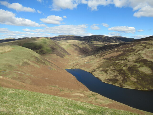
Appletree Cleuch is a picturesque valley located in Dumfriesshire, a historic county in the southern part of Scotland. Nestled within the rolling hills and lush green landscapes, this enchanting valley offers a serene retreat for nature enthusiasts and those seeking tranquility.

The valley is named after the Appletree Burn, a small stream that meanders through its heart, adding to the area's charm and beauty. The Cleuch, which means a narrow gorge or ravine, describes the valley's unique topography, with steep hillsides enclosing the tranquil setting.

As visitors explore Appletree Cleuch, they are treated to breathtaking views of the surrounding countryside, with its vibrant flora and diverse wildlife. The valley is home to a rich variety of plant species, including wildflowers, ferns, and mosses, creating a colorful and inviting ambiance.

The area also boasts an abundance of birdlife, making it an ideal spot for birdwatching enthusiasts. Birds such as buzzards, kestrels, and even rare species like peregrine falcons can be spotted soaring above the valley. Additionally, small mammals like rabbits, hares, and voles can be seen scurrying through the undergrowth.

Appletree Cleuch is a popular destination for hikers and walkers, with various trails and pathways traversing the valley. These offer opportunities to explore the natural beauty of the surroundings and experience the tranquility of this hidden gem.

In conclusion, Appletree Cleuch is a captivating valley in Dumfriesshire that offers a haven of natural beauty and tranquility. Its stunning landscapes, diverse flora and fauna, and abundance of recreational activities make it a must-visit destination for nature lovers and outdoor enthusiasts.

If you have any feedback on the listing, please let us know in the comments section below.

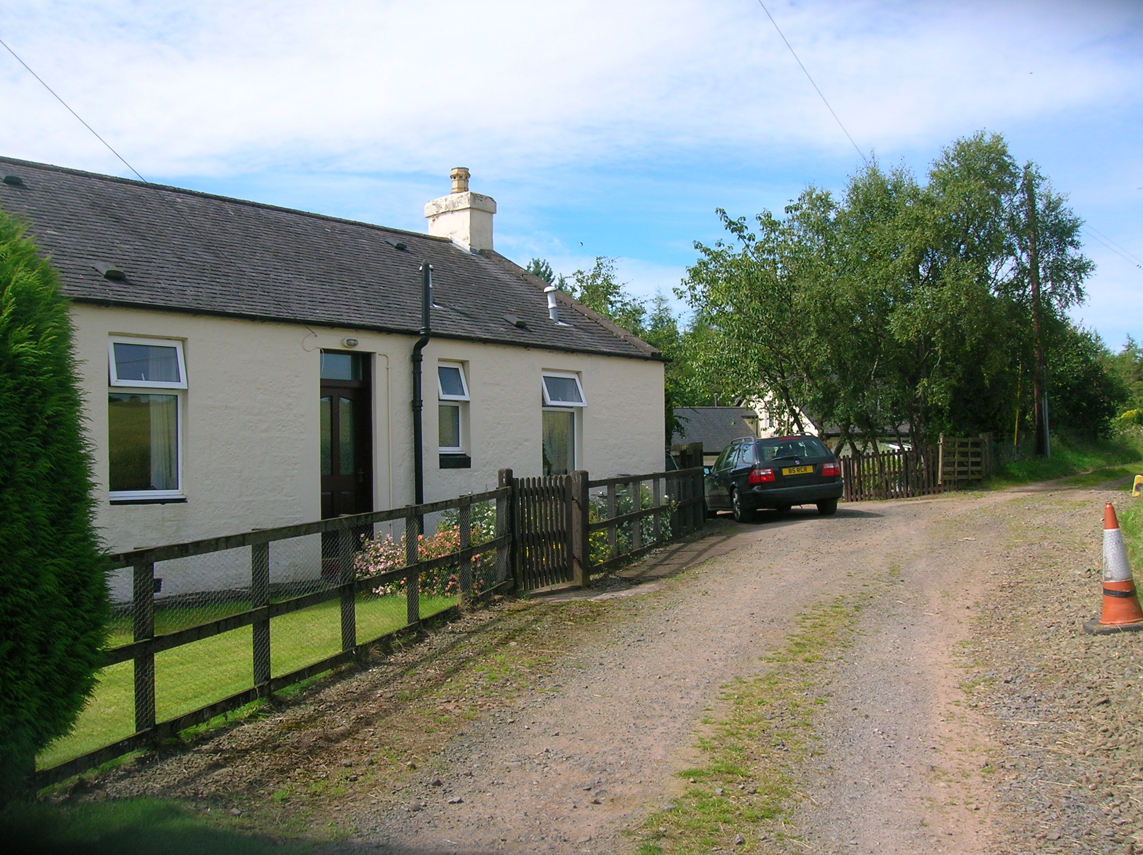
Appletree Cleuch Images

Images are sourced within 2km of 55.280396/-3.7510396 or Grid Reference NX8899. Thanks to Geograph Open Source API. All images are credited.

Pastures and derelict building at Whitefaulds The ruined building by the clump of trees is named Whitefauld on the large-scale OS plan. Bellybought Hill rises in the background.
Pastures and derelict building at Whitefaulds
The ruined building by the clump of trees is named Whitefauld on the large-scale OS plan. Bellybought Hill rises in the background.
Track above The Shaw Some gnarled trees beside the track that branches off the main Kettleton Reservoir track and contours around Bellybought Hill and Par Hill.
Track above The Shaw
Some gnarled trees beside the track that branches off the main Kettleton Reservoir track and contours around Bellybought Hill and Par Hill.
Course of medieval boundary, Bellybought Hill It has been suggested that this bank, which seems to have been built up into a stone wall in places, might be a field boundary made around 1329–32.

For further details, see <span class="nowrap"><a title="https://canmore.org.uk/site/65972/morton-park" rel="nofollow ugc noopener" href="https://canmore.org.uk/site/65972/morton-park">Link</a><img style="margin-left:2px;" alt="External link" title="External link - shift click to open in new window" src="https://s1.geograph.org.uk/img/external.png" width="10" height="10"/></span>.
Course of medieval boundary, Bellybought Hill
It has been suggested that this bank, which seems to have been built up into a stone wall in places, might be a field boundary made around 1329–32. For further details, see LinkExternal link.
Trig pillar and summit shelter, Bellybought Hill Unlike many hills in the Southern Uplands, there are quite a lot of (lichen-covered) stones on Bellybought Hill – enough for a fairly sizeable shelter.
Trig pillar and summit shelter, Bellybought Hill
Unlike many hills in the Southern Uplands, there are quite a lot of (lichen-covered) stones on Bellybought Hill – enough for a fairly sizeable shelter.
Goldie Knoll Old hazelnut tree, Durisdeer hills in the distance, and daffodils at Goldie Knoll.
Photo taken on the 27th March, 2022.
Goldie Knoll
Old hazelnut tree, Durisdeer hills in the distance, and daffodils at Goldie Knoll. Photo taken on the 27th March, 2022.
New Ducks at Goldie Knoll New ducks on the pond at Goldie Knoll.
This photo was taken on the 16th September 2022.
New Ducks at Goldie Knoll
New ducks on the pond at Goldie Knoll. This photo was taken on the 16th September 2022.
Kettleton Reservoir from Bellybought Hill Kettleton Reservoir, seen here nestling below Morton Mains Hill and East Morton Hill, was created in the mid-twentieth century by damming the Kettleton Burn.
Kettleton Reservoir from Bellybought Hill
Kettleton Reservoir, seen here nestling below Morton Mains Hill and East Morton Hill, was created in the mid-twentieth century by damming the Kettleton Burn.
View towards the head of the Kettleton Burn The small peak-like hill in the middle distance is Sware Knowe.
View towards the head of the Kettleton Burn
The small peak-like hill in the middle distance is Sware Knowe.
The northern end of Kettleton Reservoir Kettleton Reservoir was created in the mid twentieth century by damming the Kettleton Burn. Part of a drystane dyke can be seen partially submerged in the water.
The northern end of Kettleton Reservoir
Kettleton Reservoir was created in the mid twentieth century by damming the Kettleton Burn. Part of a drystane dyke can be seen partially submerged in the water.
Clump of trees, The Hass The word 'hass' (sometimes 'hause' or 'hawse'), meaning 'neck', refers to a pass or col between hills. It refers here to this col between Morton Mains Hill and East Morton Hill.
Clump of trees, The Hass
The word 'hass' (sometimes 'hause' or 'hawse'), meaning 'neck', refers to a pass or col between hills. It refers here to this col between Morton Mains Hill and East Morton Hill.
The northern end of Kettleton Reservoir A view of the reservoir from Morton Mains Hill. The reservoir was created in the mid twentieth century by damming the Kettleton Burn.
The northern end of Kettleton Reservoir
A view of the reservoir from Morton Mains Hill. The reservoir was created in the mid twentieth century by damming the Kettleton Burn.
Goldie Knoll Goldie Knoll, with Morton Mains in the distance.
Goldie Knoll
Goldie Knoll, with Morton Mains in the distance.
Wee Waterfall at Goldie Knoll A wee waterfall on the Morton Gill near Goldie Knoll.
Wee Waterfall at Goldie Knoll
A wee waterfall on the Morton Gill near Goldie Knoll.
A702 near High Enoch
Tractor tyre blocking the entrance to a gravelled area
Path towards Carron Linns
East Morton East Morton farm, from the roadside.
East Morton
East Morton farm, from the roadside.
Show me another place!

Appletree Cleuch is located at Grid Ref: NX8899 (Lat: 55.280396, Lng: -3.7510396)

Unitary Authority: Dumfries and Galloway

Police Authority: Dumfries and Galloway

What 3 Words

///shaped.learn.standards. Near Thornhill, Dumfries & Galloway

Related Wikis

Morton Castle

Morton Castle is located by an artificial loch in the hills above Nithsdale, in Dumfries and Galloway, south-west Scotland. It lies 2.5 miles (4 km) north...

Carronbridge railway station

Carronbridge railway station was a railway station in Dumfries and Galloway north of Dumfries, serving the village of Carronbridge and district. The station...

Carronbridge

Carronbridge is a village in the parish of Morton in Dumfries and Galloway, Scotland. The village is at the junction of the A76 and A702 roads approximately...

Carron Water, Dumfriesshire

The Carron Water (Scottish Gaelic: Carrann) is a tributary of the River Nith in southwest Scotland. It rises in the Dalveen Pass in the Lowther Hills as...

Nearby Amenities

Located within 500m of 55.280396,-3.7510396
Power: pole
Lat/Long: 55.2781216/-3.7574186
Power: pole
Lat/Long: 55.2779041/-3.7563112
Power: pole
Lat/Long: 55.2777639/-3.7546946
Power: pole
Lat/Long: 55.2776986/-3.7539585
The data included in this document is from www.openstreetmap.org. The data is made available under ODbL.

Have you been to Appletree Cleuch?

Leave your review of Appletree Cleuch below (or comments, questions and feedback).