Bagley Combe

Valley in Somerset Somerset West and Taunton

England

Bagley Combe

Dunkery Beacon Dunkery Beacon on Exmoor, with the view of the Brendon Hills and more distant Quantock Hills behind.
Dunkery Beacon Credit: Marika Reinholds

Bagley Combe is a picturesque valley located in Somerset, England. Situated near the village of Bagley, the combe is known for its stunning natural beauty and tranquil atmosphere. The valley is nestled between rolling hills and dense woodland, creating a sense of seclusion and serenity.

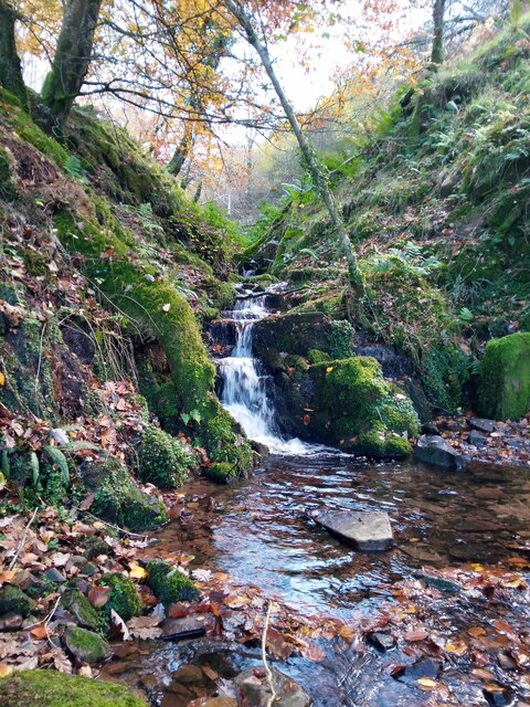
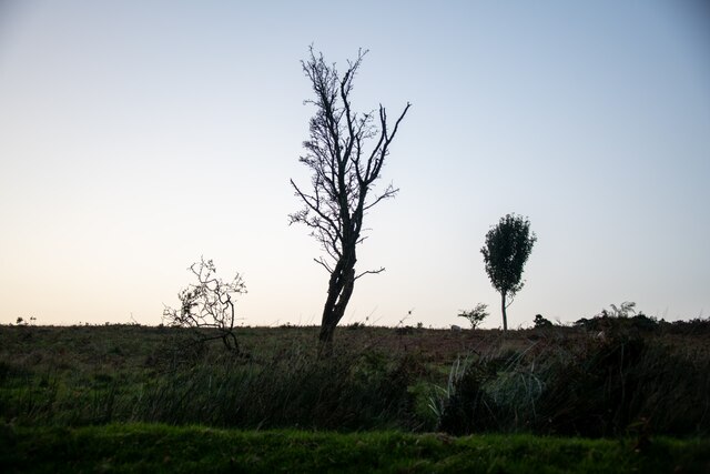
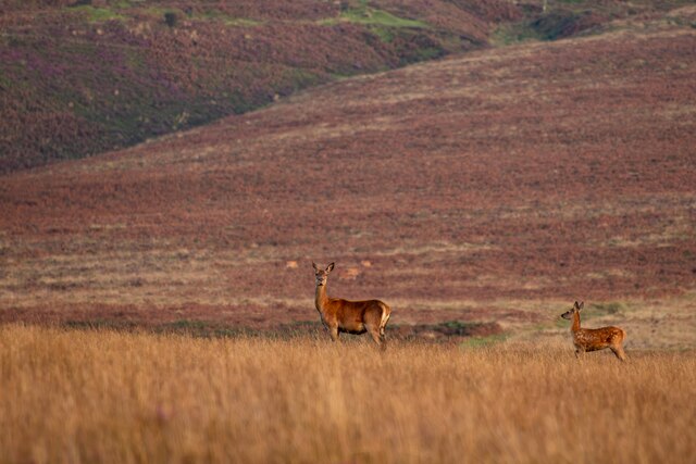
The main feature of Bagley Combe is a small river that meanders through the valley, adding to its charm and providing a habitat for various species of wildlife. The river is flanked by lush greenery, including ancient oak and beech trees, which create a canopy overhead and offer shade on hot summer days.

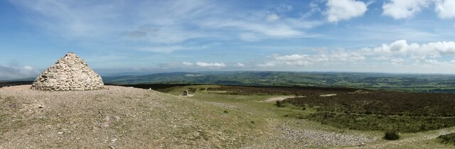
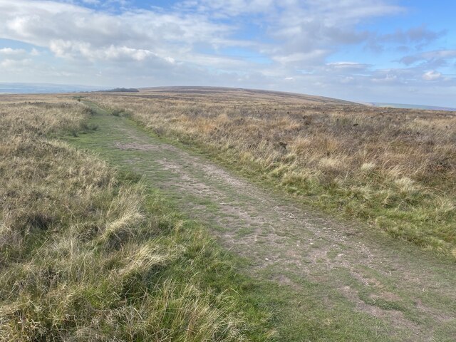
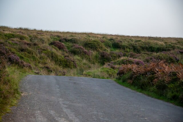
The area is popular with nature enthusiasts and hikers due to its extensive network of walking trails that wind through the combe and surrounding countryside. These trails offer breathtaking views of the valley and its surrounding landscape, providing ample opportunities for photography and exploration.

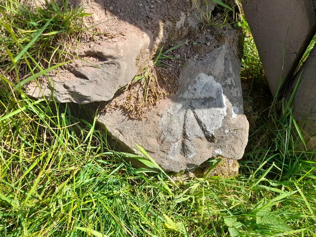
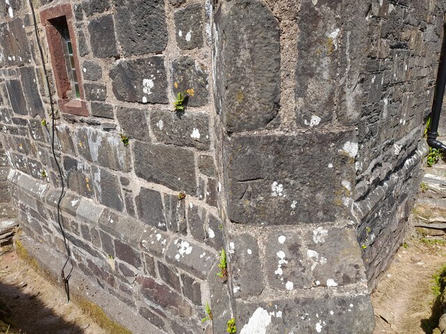
In addition to its natural beauty, Bagley Combe is also home to historical sites and landmarks. The remains of an old mill can be found near the river, serving as a reminder of the area's industrial past. This historical significance adds an extra layer of interest to the combe, making it a fascinating destination for history buffs as well.

Overall, Bagley Combe is a hidden gem in Somerset, offering a peaceful retreat from the hustle and bustle of everyday life. Its stunning scenery, diverse wildlife, and rich history make it a must-visit destination for those seeking a connection with nature and a glimpse into the past.

If you have any feedback on the listing, please let us know in the comments section below.
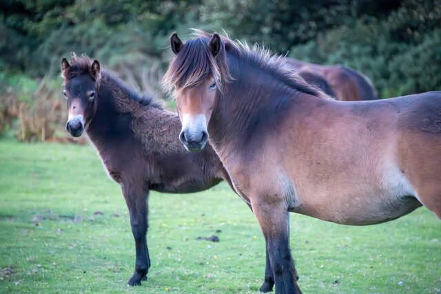
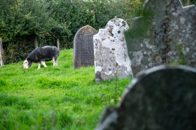
Bagley Combe Images

Images are sourced within 2km of 51.170451/-3.604775 or Grid Reference SS8742. Thanks to Geograph Open Source API. All images are credited.

Dunkery Beacon Dunkery Beacon on Exmoor, with the view of the Brendon Hills and more distant Quantock Hills behind.
Dunkery Beacon
Dunkery Beacon on Exmoor, with the view of the Brendon Hills and more distant Quantock Hills behind.
Moorland track, west of Dunkery Beacon
Dunkery Beacon At 519m the highest point on Exmoor.
Dunkery Beacon
At 519m the highest point on Exmoor.
Stream in November An upland stream which might be a raging torrent after heavy rainfall but on a fine sunny day it was just beautiful.
Stream in November
An upland stream which might be a raging torrent after heavy rainfall but on a fine sunny day it was just beautiful.
Ordnance Survey Cut Mark This OS cut mark can be found on the stone SE side of the road. It marks a point 343.645m above mean sea level.
Ordnance Survey Cut Mark
This OS cut mark can be found on the stone SE side of the road. It marks a point 343.645m above mean sea level.
Ordnance Survey Cut Mark This OS cut mark can be found on the south angle of Stoke Pero Church. It marks a point 305.760m above mean sea level.
Ordnance Survey Cut Mark
This OS cut mark can be found on the south angle of Stoke Pero Church. It marks a point 305.760m above mean sea level.
Cutcombe : Exmoor - Dunkery Beacon I headed up to Dunkery Beacon on a clear September evening to see if I could see the stars and the Milky Way, after all, they do say this is a good spot for it. Got to the top, and soon after two other chaps were doing the same thing. One of them had a red light on his hat, it illuminated the beacon. He (Farmer Torque), wanted to get a nice shot of him looking at the stars.
Cutcombe : Exmoor - Dunkery Beacon
I headed up to Dunkery Beacon on a clear September evening to see if I could see the stars and the Milky Way, after all, they do say this is a good spot for it. Got to the top, and soon after two other chaps were doing the same thing. One of them had a red light on his hat, it illuminated the beacon. He (Farmer Torque), wanted to get a nice shot of him looking at the stars.
Cutcombe : Exmoor - Dunkery Beacon A man is taking photographs of the night sky.
Cutcombe : Exmoor - Dunkery Beacon
A man is taking photographs of the night sky.
Cutcombe : Exmoor - Moorland Scenery The Moon has come into view over the Bristol Channel.
Cutcombe : Exmoor - Moorland Scenery
The Moon has come into view over the Bristol Channel.
Cutcombe : Exmoor - Moorland Scenery Looking down the moorland from Dunkery Beacon and across the Bristol Channel where the lights of South Wales glow.
Cutcombe : Exmoor - Moorland Scenery
Looking down the moorland from Dunkery Beacon and across the Bristol Channel where the lights of South Wales glow.
Cutcombe : Exmoor - Dunkery Beacon Looking towards Dunkery Beacon with the many stars seen in the sky, including the white glow of the Milky Way.
Cutcombe : Exmoor - Dunkery Beacon
Looking towards Dunkery Beacon with the many stars seen in the sky, including the white glow of the Milky Way.
Cutcombe : Exmoor - Moorland Scenery From the top of Dunkery Beacon, looking into the night sky with the Milky Way in view.
Cutcombe : Exmoor - Moorland Scenery
From the top of Dunkery Beacon, looking into the night sky with the Milky Way in view.
Luccombe : Road A road across Exmoor.
Luccombe : Road
A road across Exmoor.
Luccombe : Exmoor Scenery From the road looking towards some trees.
Luccombe : Exmoor Scenery
From the road looking towards some trees.
Cutcombe : Exmoor - Dunkery Beacon Looking across Exmoor from the top of Dunkery Beacon, with the Milky Way in view.
Cutcombe : Exmoor - Dunkery Beacon
Looking across Exmoor from the top of Dunkery Beacon, with the Milky Way in view.
Luccombe : Exmoor Scenery Looking across Exmoor with two deer in view. I think they have spotted me.
Luccombe : Exmoor Scenery
Looking across Exmoor with two deer in view. I think they have spotted me.
Luccombe : Exmoor Ponies Exmoor ponies seen on the moors.
Luccombe : Exmoor Ponies
Exmoor ponies seen on the moors.
Luccombe : Stoke Pero Church Grounds In the churchgrounds of Stoke Pero Church is Dolly the sheep acting as a lawnmower among the headstones.
Luccombe : Stoke Pero Church Grounds
In the churchgrounds of Stoke Pero Church is Dolly the sheep acting as a lawnmower among the headstones.
Show me another place!

Bagley Combe is located at Grid Ref: SS8742 (Lat: 51.170451, Lng: -3.604775)

Administrative County: Somerset

District: Somerset West and Taunton

Police Authority: Avon and Somerset

What 3 Words

///saves.schools.newsstand. Near Porlock, Somerset

Related Wikis

Sweetworthy

Sweetworthy is the site of two Iron Age hill forts or enclosures at Luccombe, 4 kilometres (2 mi) south of Porlock, Somerset, England. They are on the...

Stoke Pero Church

Stoke Pero Church in Stoke Pero, Somerset, England was built in the 13th century. It is a Grade II* listed building. Standing 1,013 feet (309 meters) above...

Dunkery Hill

Dunkery Beacon at the summit of Dunkery Hill is the highest point on Exmoor and in Somerset, England. It is also the highest point in southern England...

Nutscale Reservoir

Nutscale Reservoir is a reservoir located in Exmoor in north west Somerset, England. It supplies the town of Minehead and nearby Porlock and Porlock Weir...

Berry Castle, Somerset

Berry Castle (sometimes known as Berry Camp) is an early Roman (possible Iron Age) hillslope enclosure in the West Somerset district of Somerset, England...

Hawkcombe Woods

Hawkcombe Woods is a national nature reserve near Porlock on Exmoor, Somerset, England.The 101 hectares (250 acres) woodlands are notable for their lichens...

Almsworthy Common

Almsworthy Common is a small area of unenclosed land in Exmoor, south-western England. It contains a number of archaeological sites. It is about 2 miles...

Luccombe, Somerset

Luccombe or Luckham is a village and civil parish in the Exmoor National Park in the English county of Somerset. It at the foot of the moor's highest hill...

Nearby Amenities

Located within 500m of 51.170451,-3.604775
Goosemoor Common
Place: locality
Lat/Long: 51.167198/-3.6016222
Bagley Combe
Place: locality
Lat/Long: 51.1697275/-3.6070296
Stoke Ridge Plantation
Place: locality
Lat/Long: 51.174343/-3.6061889
The data included in this document is from www.openstreetmap.org. The data is made available under ODbL.

Have you been to Bagley Combe?

Leave your review of Bagley Combe below (or comments, questions and feedback).