Stoke Pero Common

Downs, Moorland in Somerset Somerset West and Taunton

England

Stoke Pero Common

Dunkery Beacon Dunkery Beacon on Exmoor, with the view of the Brendon Hills and more distant Quantock Hills behind.
Dunkery Beacon Credit: Marika Reinholds

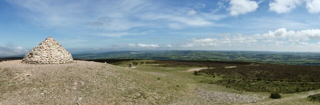
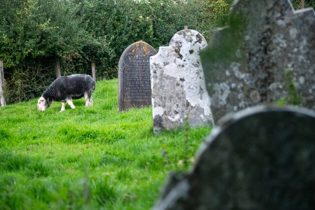
Stoke Pero Common, located in Somerset, England, is a picturesque and diverse natural area encompassing downs and moorland. Spanning over a vast expanse, the common is characterized by its rolling hills, open spaces, and stunning views of the surrounding countryside. It is situated near the village of Stoke Pero and is a popular destination for both locals and tourists.

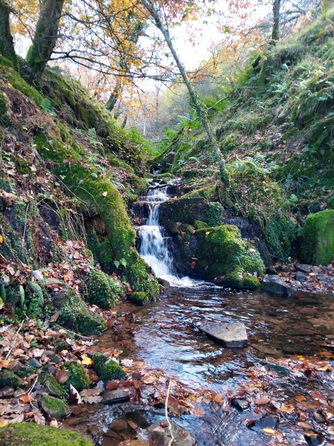
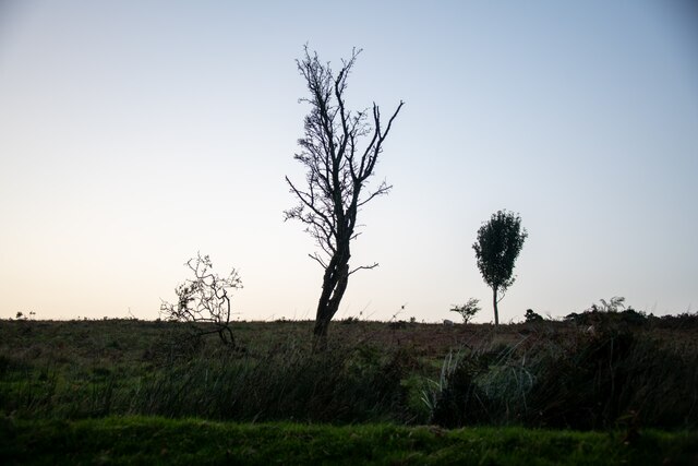
The common is home to a rich variety of flora and fauna, making it a haven for nature enthusiasts. The open downs are covered in a patchwork of grasses and wildflowers, providing a vibrant display of colors during the summer months. Dotted throughout the common are several species of trees, including oak and beech, offering shade and shelter for the local wildlife.

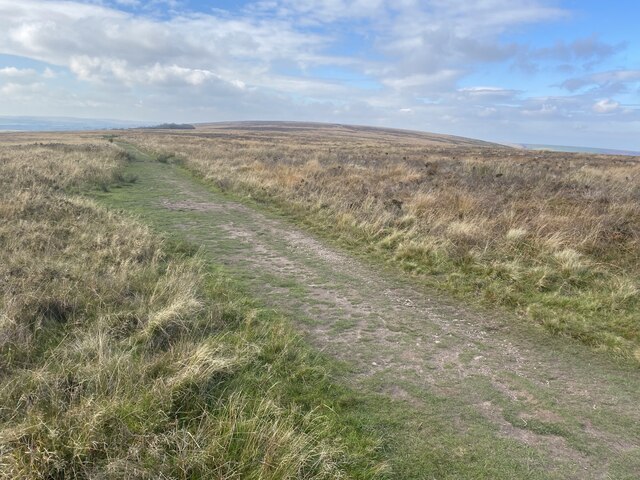
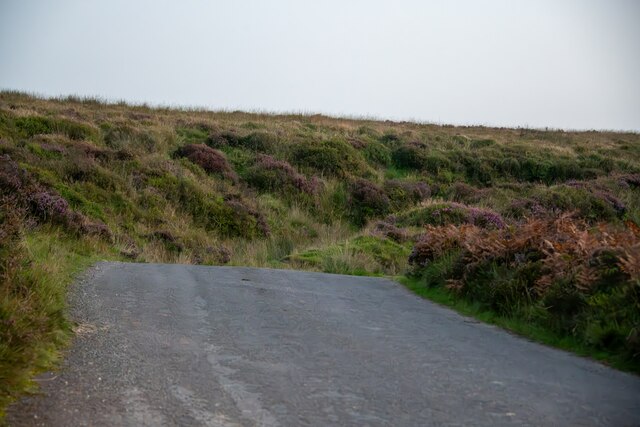
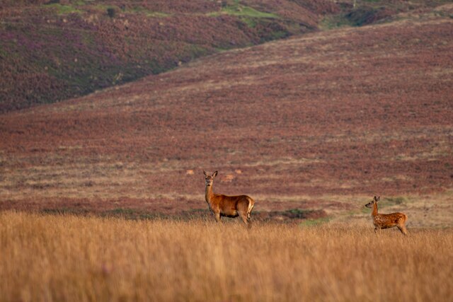
The moorland areas of Stoke Pero Common are a stark contrast to the downs, with heather and gorse dominating the landscape. This unique habitat supports a range of bird species, such as buzzards and kestrels, as well as small mammals like rabbits and voles.

Visitors to Stoke Pero Common can enjoy a variety of activities, including walking, hiking, and birdwatching. Several walking trails traverse the common, offering breathtaking views of the surrounding countryside and opportunities to spot the local wildlife. The tranquil atmosphere and untouched beauty of the common make it a perfect place for those seeking a peaceful retreat in nature.

Overall, Stoke Pero Common is a stunning natural area in Somerset, boasting a diverse range of habitats and providing a haven for both flora and fauna. Its downs and moorland offer visitors a chance to connect with nature and enjoy the beauty of the Somerset countryside.

If you have any feedback on the listing, please let us know in the comments section below.

Stoke Pero Common Images

Images are sourced within 2km of 51.168763/-3.6117683 or Grid Reference SS8742. Thanks to Geograph Open Source API. All images are credited.

Dunkery Beacon Dunkery Beacon on Exmoor, with the view of the Brendon Hills and more distant Quantock Hills behind.
Dunkery Beacon
Dunkery Beacon on Exmoor, with the view of the Brendon Hills and more distant Quantock Hills behind.
Moorland track, west of Dunkery Beacon
Dunkery Beacon At 519m the highest point on Exmoor.
Dunkery Beacon
At 519m the highest point on Exmoor.
Stream in November An upland stream which might be a raging torrent after heavy rainfall but on a fine sunny day it was just beautiful.
Stream in November
An upland stream which might be a raging torrent after heavy rainfall but on a fine sunny day it was just beautiful.
Ordnance Survey Cut Mark This OS cut mark can be found on the stone SE side of the road. It marks a point 343.645m above mean sea level.
Ordnance Survey Cut Mark
This OS cut mark can be found on the stone SE side of the road. It marks a point 343.645m above mean sea level.
Ordnance Survey Cut Mark This OS cut mark can be found on the south angle of Stoke Pero Church. It marks a point 305.760m above mean sea level.
Ordnance Survey Cut Mark
This OS cut mark can be found on the south angle of Stoke Pero Church. It marks a point 305.760m above mean sea level.
Cutcombe : Exmoor - Dunkery Beacon I headed up to Dunkery Beacon on a clear September evening to see if I could see the stars and the Milky Way, after all, they do say this is a good spot for it. Got to the top, and soon after two other chaps were doing the same thing. One of them had a red light on his hat, it illuminated the beacon. He (Farmer Torque), wanted to get a nice shot of him looking at the stars.
Cutcombe : Exmoor - Dunkery Beacon
I headed up to Dunkery Beacon on a clear September evening to see if I could see the stars and the Milky Way, after all, they do say this is a good spot for it. Got to the top, and soon after two other chaps were doing the same thing. One of them had a red light on his hat, it illuminated the beacon. He (Farmer Torque), wanted to get a nice shot of him looking at the stars.
Cutcombe : Exmoor - Dunkery Beacon A man is taking photographs of the night sky.
Cutcombe : Exmoor - Dunkery Beacon
A man is taking photographs of the night sky.
Cutcombe : Exmoor - Moorland Scenery The Moon has come into view over the Bristol Channel.
Cutcombe : Exmoor - Moorland Scenery
The Moon has come into view over the Bristol Channel.
Cutcombe : Exmoor - Moorland Scenery Looking down the moorland from Dunkery Beacon and across the Bristol Channel where the lights of South Wales glow.
Cutcombe : Exmoor - Moorland Scenery
Looking down the moorland from Dunkery Beacon and across the Bristol Channel where the lights of South Wales glow.
Cutcombe : Exmoor - Dunkery Beacon Looking towards Dunkery Beacon with the many stars seen in the sky, including the white glow of the Milky Way.
Cutcombe : Exmoor - Dunkery Beacon
Looking towards Dunkery Beacon with the many stars seen in the sky, including the white glow of the Milky Way.
Cutcombe : Exmoor - Moorland Scenery From the top of Dunkery Beacon, looking into the night sky with the Milky Way in view.
Cutcombe : Exmoor - Moorland Scenery
From the top of Dunkery Beacon, looking into the night sky with the Milky Way in view.
Luccombe : Road A road across Exmoor.
Luccombe : Road
A road across Exmoor.
Luccombe : Exmoor Scenery From the road looking towards some trees.
Luccombe : Exmoor Scenery
From the road looking towards some trees.
Cutcombe : Exmoor - Dunkery Beacon Looking across Exmoor from the top of Dunkery Beacon, with the Milky Way in view.
Cutcombe : Exmoor - Dunkery Beacon
Looking across Exmoor from the top of Dunkery Beacon, with the Milky Way in view.
Luccombe : Exmoor Scenery Looking across Exmoor with two deer in view. I think they have spotted me.
Luccombe : Exmoor Scenery
Looking across Exmoor with two deer in view. I think they have spotted me.
Luccombe : Exmoor Ponies Exmoor ponies seen on the moors.
Luccombe : Exmoor Ponies
Exmoor ponies seen on the moors.
Luccombe : Stoke Pero Church Grounds In the churchgrounds of Stoke Pero Church is Dolly the sheep acting as a lawnmower among the headstones.
Luccombe : Stoke Pero Church Grounds
In the churchgrounds of Stoke Pero Church is Dolly the sheep acting as a lawnmower among the headstones.
Show me another place!

Stoke Pero Common is located at Grid Ref: SS8742 (Lat: 51.168763, Lng: -3.6117683)

Administrative County: Somerset

District: Somerset West and Taunton

Police Authority: Avon and Somerset

What 3 Words

///cocoons.burying.blackouts. Near Porlock, Somerset

Related Wikis

Stoke Pero Church

Stoke Pero Church in Stoke Pero, Somerset, England was built in the 13th century. It is a Grade II* listed building. Standing 1,013 feet (309 meters) above...

Sweetworthy

Sweetworthy is the site of two Iron Age hill forts or enclosures at Luccombe, 4 kilometres (2 mi) south of Porlock, Somerset, England. They are on the...

Nutscale Reservoir

Nutscale Reservoir is a reservoir located in Exmoor in north west Somerset, England. It supplies the town of Minehead and nearby Porlock and Porlock Weir...

Dunkery Hill

Dunkery Beacon at the summit of Dunkery Hill is the highest point on Exmoor and in Somerset, England. It is also the highest point in southern England...

Berry Castle, Somerset

Berry Castle (sometimes known as Berry Camp) is an early Roman (possible Iron Age) hillslope enclosure in the West Somerset district of Somerset, England...

Almsworthy Common

Almsworthy Common is a small area of unenclosed land in Exmoor, south-western England. It contains a number of archaeological sites. It is about 2 miles...

Alderman's Barrow

Alderman's Barrow is a bowl barrow on Exmoor. It was created as a burial chamber in the Bronze Age and subsequently became a marker for the boundary of...

Porlock Stone Circle

Porlock Stone Circle is a stone circle located on Exmoor, near the village of Porlock in the south-western English county of Somerset. The Porlock ring...

Nearby Amenities

Located within 500m of 51.168763,-3.6117683
Bagley Combe
Place: locality
Lat/Long: 51.1697275/-3.6070296
Stoke Pero Common
Place: locality
Lat/Long: 51.1685166/-3.6149904
Lang Combe
Place: locality
Lat/Long: 51.1687318/-3.6178013
Ford: yes
Lat/Long: 51.1720167/-3.6162147
The data included in this document is from www.openstreetmap.org. The data is made available under ODbL.

Have you been to Stoke Pero Common?

Leave your review of Stoke Pero Common below (or comments, questions and feedback).