Cwm Nant-gwyn

Valley in Glamorgan

Wales

Cwm Nant-gwyn

Pont Rhyd-y-cyff Shops Near the north side of the square
Pont Rhyd-y-cyff Shops Credit: Chris Shaw

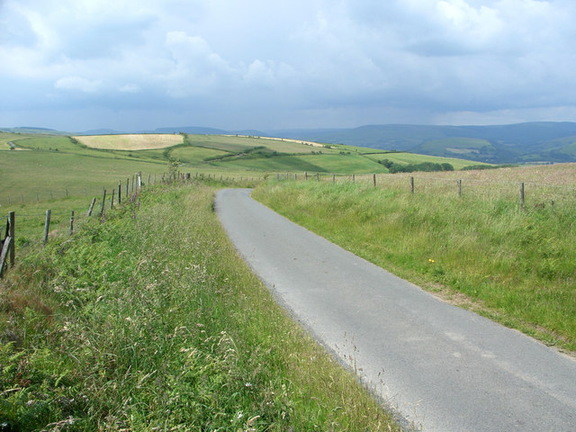
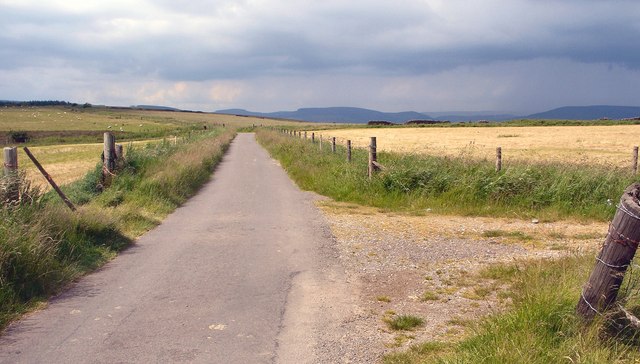
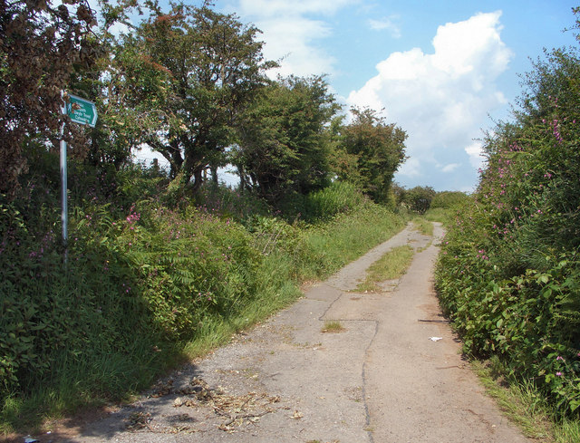
Cwm Nant-gwyn is a picturesque valley located in Glamorgan, Wales. Situated in the heart of the countryside, this valley is renowned for its stunning natural beauty and tranquil surroundings. The name "Cwm Nant-gwyn" translates to "White Brook Valley" in English, which aptly describes the crystal-clear streams that flow through the area.

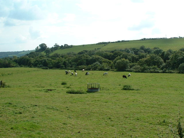
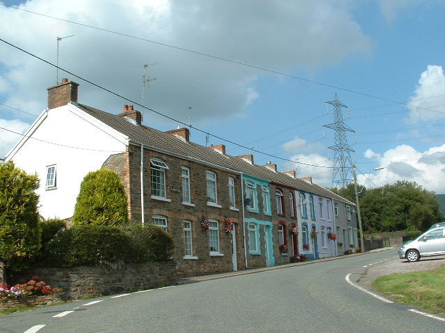
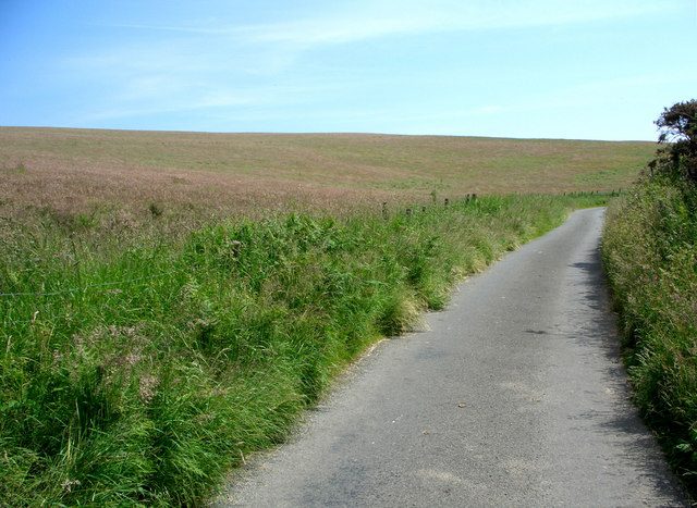
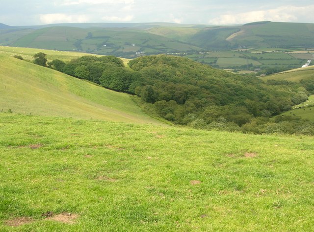
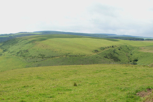
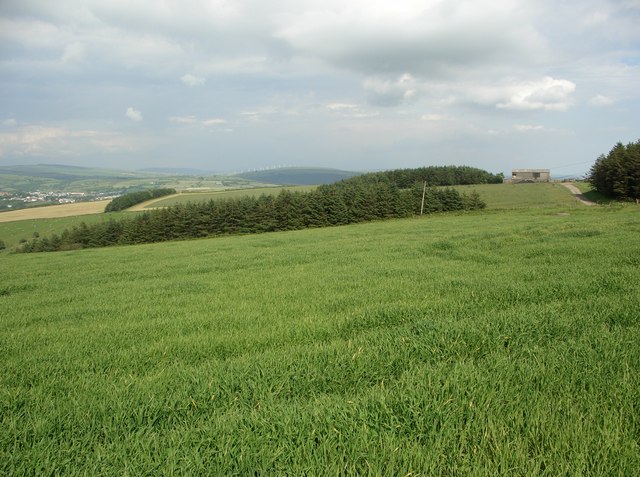
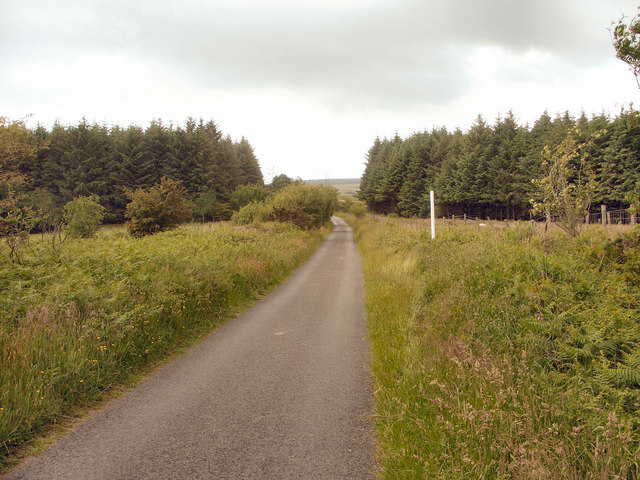
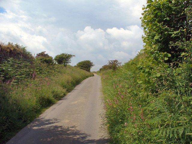
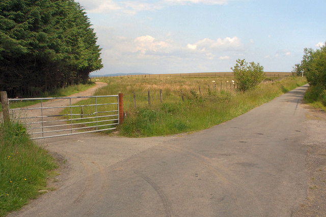
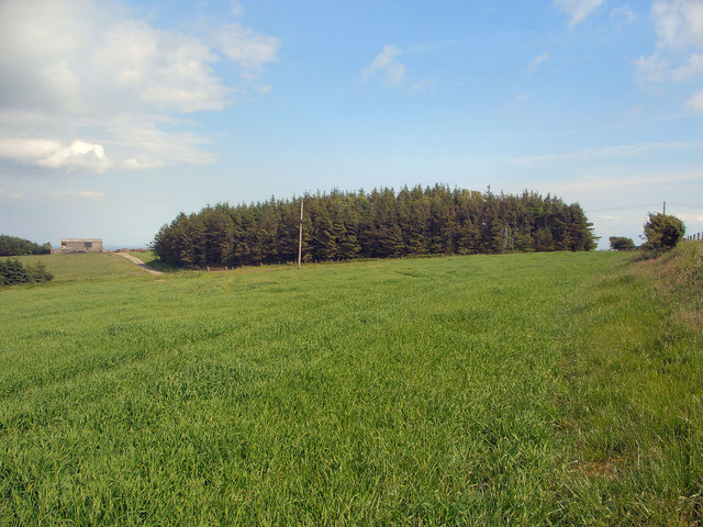
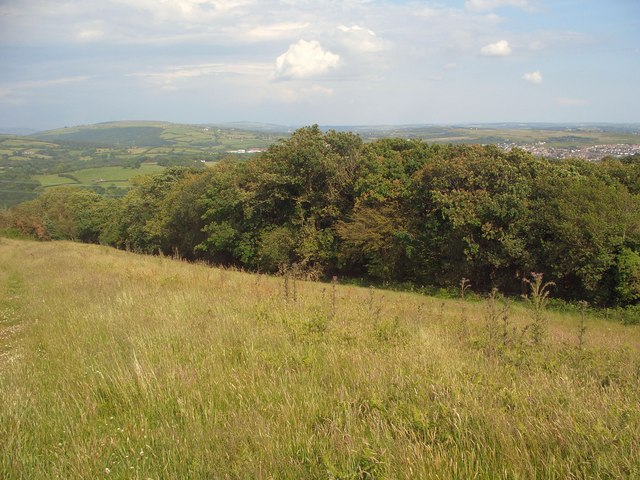
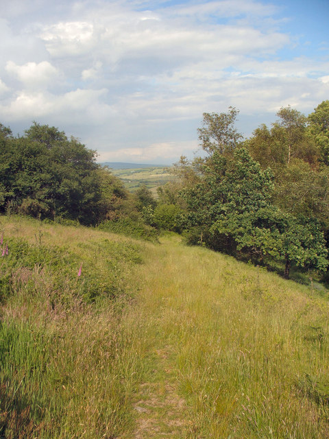
The valley is characterized by its lush greenery, with rolling hills covered in meadows and dense forests. The landscape is dotted with charming cottages and traditional farmhouses, adding to the idyllic atmosphere of the region. Walking through Cwm Nant-gwyn, visitors can enjoy breathtaking views of the surrounding mountains and valleys.

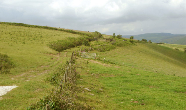
The valley is home to a variety of wildlife, including birds, rabbits, and occasionally deer. Nature enthusiasts can explore the numerous walking trails that wind through the valley, offering the opportunity to spot these creatures in their natural habitat.

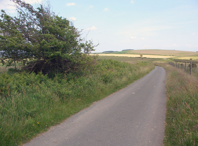
For those seeking outdoor adventures, Cwm Nant-gwyn offers ample opportunities for activities such as hiking, cycling, and picnicking. There are several well-maintained paths and trails that cater to different skill levels, allowing visitors to explore the valley at their own pace.

Cwm Nant-gwyn is also known for its historical significance, with remnants of ancient settlements and structures scattered throughout the area. These archaeological sites provide a glimpse into the valley's rich past and offer a fascinating insight into the lives of its former inhabitants.

Overall, Cwm Nant-gwyn is a hidden gem in Glamorgan, offering visitors a chance to immerse themselves in the beauty of nature and discover the region's intriguing history.

If you have any feedback on the listing, please let us know in the comments section below.

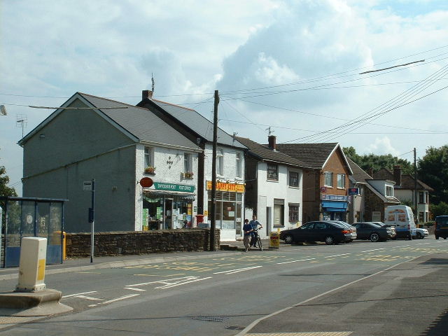
Cwm Nant-gwyn Images

Images are sourced within 2km of 51.567453/-3.6311849 or Grid Reference SS8786. Thanks to Geograph Open Source API. All images are credited.

Pont Rhyd-y-cyff Shops Near the north side of the square
Pont Rhyd-y-cyff Shops
Near the north side of the square
Nr Lletty Brongu Looking South over green pastures and the valley hiding the River Llynfi and the railway
Nr Lletty Brongu
Looking South over green pastures and the valley hiding the River Llynfi and the railway
Shwt Cottages In the village of Shwt at the western edge of this square
Shwt Cottages
In the village of Shwt at the western edge of this square
Lane and field by Mynydd Baedan Southward view of a stretch of the high lane which runs through the grid square. Also seen is part of a large field which seems to cover much of the west-facing slope of Mynydd Baedan.
Lane and field by Mynydd Baedan
Southward view of a stretch of the high lane which runs through the grid square. Also seen is part of a large field which seems to cover much of the west-facing slope of Mynydd Baedan.
High lane to the north of Ffordd-y-Gyfraith Looking roughly northwards along a stretch of the lane which passes through the grid square. This lane continues to run at altitude over hills through several grid squares to the north and north west of here.
High lane to the north of Ffordd-y-Gyfraith
Looking roughly northwards along a stretch of the lane which passes through the grid square. This lane continues to run at altitude over hills through several grid squares to the north and north west of here.
Cwm Nant-gwyn Wooded valley in the eastern half of the grid square as seen from a point adjacent to the junction of lane and footpath in the south of the square.
Cwm Nant-gwyn
Wooded valley in the eastern half of the grid square as seen from a point adjacent to the junction of lane and footpath in the south of the square.
Mynydd Ty-talwyn View from a roadside position near the centre of the grid square of the east and south facing slopes of Mynydd Ty-talwyn.
Mynydd Ty-talwyn
View from a roadside position near the centre of the grid square of the east and south facing slopes of Mynydd Ty-talwyn.
High fields and woodland to the west of Coytrahen Looking roughly eastwards over fields and patches of woodland on Mynydd Baedan from a footpath location in the western half of the grid square. The photograph covers much of the land in the middle and the north-eastern quarter of the square. The barn visible to the right lies close to the square's centre whereas scrutiny of Ordnance Survey's 1:25,000 map reveals that the eastern margin of the square passes through the rather isolated hillside line of trees towards the left of the picture. This line of trees also lies just a little to the south of the square's northern edge.
High fields and woodland to the west of Coytrahen
Looking roughly eastwards over fields and patches of woodland on Mynydd Baedan from a footpath location in the western half of the grid square. The photograph covers much of the land in the middle and the north-eastern quarter of the square. The barn visible to the right lies close to the square's centre whereas scrutiny of Ordnance Survey's 1:25,000 map reveals that the eastern margin of the square passes through the rather isolated hillside line of trees towards the left of the picture. This line of trees also lies just a little to the south of the square's northern edge.
Lane/ridgeway walk by Mynydd Ty-talwyn Looking north-northwest along the lane which passes through the south and west of the grid square. For the course of its passage through the square, and three others to the west and north west, this lane doubles as a stretch of the Ogwr Ridgeway Walk.
Lane/ridgeway walk by Mynydd Ty-talwyn
Looking north-northwest along the lane which passes through the south and west of the grid square. For the course of its passage through the square, and three others to the west and north west, this lane doubles as a stretch of the Ogwr Ridgeway Walk.
Mountain lane and conifers to the south of Llangynwyd Looking north west along the high lane which passes through the grid square towards the conifer plantations which it meets near the square's northern edge.
Mountain lane and conifers to the south of Llangynwyd
Looking north west along the high lane which passes through the grid square towards the conifer plantations which it meets near the square's northern edge.
Ascending lane to the north of Ffordd-y-Gyfraith View, looking north-northwest from a point in the south of the grid square, of a lane nearing the end of a climb begun in the hamlet Ffordd-y-Gyfraith to the south.
Ascending lane to the north of Ffordd-y-Gyfraith
View, looking north-northwest from a point in the south of the grid square, of a lane nearing the end of a climb begun in the hamlet Ffordd-y-Gyfraith to the south.
Gated lane junction north of Mynydd Ty-talwyn View, looking roughly eastwards, of a junction in the north of the grid square where a rather bumpy lane which has run south west from the A 4063 in the Llynfi Valley meets the mountain lane which passes through the square - as well as a gate.
Gated lane junction north of Mynydd Ty-talwyn
View, looking roughly eastwards, of a junction in the north of the grid square where a rather bumpy lane which has run south west from the A 4063 in the Llynfi Valley meets the mountain lane which passes through the square - as well as a gate.
Field and conifer plantation to the west of Coytrahen Photograph taken from a similar spot to <a href="https://www.geograph.org.uk/photo/847955">SS8785 : High fields and woodland to the west of Coytrahen</a>  though offering a more southerly view and showing a conifer plantation (mostly) not included in that other picture.
Field and conifer plantation to the west of Coytrahen
Photograph taken from a similar spot to SS8785 : High fields and woodland to the west of Coytrahen though offering a more southerly view and showing a conifer plantation (mostly) not included in that other picture.
Ridgeway walk towards Mynydd Baedan Looking south east along a stretch of the lane which passes through the grid square at a spot fairly close to the square's eastern margin. The 20 km Ogwr Ridgeway Walk follows the lane at this point and for over 1 km both to the south east and the north west of here; and in the distance can be seen Mynydd Baedan over whose slopes this walk continues by footpath once the lane is left to the south east.
Ridgeway walk towards Mynydd Baedan
Looking south east along a stretch of the lane which passes through the grid square at a spot fairly close to the square's eastern margin. The 20 km Ogwr Ridgeway Walk follows the lane at this point and for over 1 km both to the south east and the north west of here; and in the distance can be seen Mynydd Baedan over whose slopes this walk continues by footpath once the lane is left to the south east.
Woodland edge to the west of Coytrahen Looking roughly eastwards from a footpath towards an edge of the westernmost part of an area of woodland which occupies a good deal of the south of the grid square.
Woodland edge to the west of Coytrahen
Looking roughly eastwards from a footpath towards an edge of the westernmost part of an area of woodland which occupies a good deal of the south of the grid square.
Hillside track above Cwm Nant-gwyn Looking north-northeast along a farm track (beginning to the left of the fence in the foreground) from a position close to its junction with a lane in the south of the grid square. The track follows a course marked by a line of black dashes on Ordnance Survey's 1:50,000 map.
Hillside track above Cwm Nant-gwyn
Looking north-northeast along a farm track (beginning to the left of the fence in the foreground) from a position close to its junction with a lane in the south of the grid square. The track follows a course marked by a line of black dashes on Ordnance Survey's 1:50,000 map.
Footpath/track by Mynydd Baedan Looking along an initial stage of a track, also a public footpath, running up Mynydd Baedan at the point of its junction with the lane which passes through the grid square.
Footpath/track by Mynydd Baedan
Looking along an initial stage of a track, also a public footpath, running up Mynydd Baedan at the point of its junction with the lane which passes through the grid square.
Footpath to the west of Coytrahen Looking along the public footpath which runs down from Mynydd Baedan into Coytrahen at a point where it runs along the edge of an area of woodland in the southern half of the grid square. The path may appear rather faint in the photograph although on the ground it seems well defined, with there being little chance of losing one's way.
Footpath to the west of Coytrahen
Looking along the public footpath which runs down from Mynydd Baedan into Coytrahen at a point where it runs along the edge of an area of woodland in the southern half of the grid square. The path may appear rather faint in the photograph although on the ground it seems well defined, with there being little chance of losing one's way.
Show me another place!

Cwm Nant-gwyn is located at Grid Ref: SS8786 (Lat: 51.567453, Lng: -3.6311849)

Unitary Authority: Bridgend

Police Authority: South Wales

What 3 Words

///hubcaps.synthetic.sharpen. Near Pont Rhyd-y-cyff, Bridgend

Nearby Locations

Cwm Cefnydfa Cwm Nant-gwyn

Related Wikis

Llangynwyd Lower

Llangynwyd Lower is a community in Bridgend County Borough, south Wales. It is located to the north west of Bridgend and contains the village of Coytrahen...

Llynfi power station

Llynfi power station supplied electricity to the Bridgend area of Glamorgan South Wales from 1943 to 1977. The coal-fired station was originally built...

Ysgol Gyfun Gymraeg Llangynwyd

Ysgol Gyfun Gymraeg Llangynwyd is a Welsh-medium secondary school for pupils aged between 11 and 18. The school is based in the village of Llangynwyd in...

A4063 road

The A4063 links the town of Bridgend with Cymer in Wales. == Settlements on route == Settlements served by the route include: Bridgend Wild Mill Pen-y...

Llangynwyd

Llangynwyd is a village (and electoral ward) 2 miles to the south of Maesteg, in the county borough of Bridgend, Wales. It was part of the medieval commote...

Llangynwyd Middle

Llangynwyd Middle is a community in Bridgend County Borough, south Wales. It is located to the south of Maesteg and contains the villages of Llangynwyd...

Cwm Risca Meadow

Cwm Risca Meadow is a Site of Special Scientific Interest in Bridgend, south Wales. It is nationally important marshy grassland supporting the marsh fritillary...

Llangynwyd railway station

Llangynwyd railway station is on the Maesteg Line in Bridgend County Borough, Wales. It was closed to regular passenger trains on 22 June 1970 but continued...

Nearby Amenities

Located within 500m of 51.567453,-3.6311849
Power: pole
Lat/Long: 51.5718951/-3.632251
Power: pole
Lat/Long: 51.5698312/-3.6295379
Power: pole
Lat/Long: 51.5689018/-3.6263381
The data included in this document is from www.openstreetmap.org. The data is made available under ODbL.

Have you been to Cwm Nant-gwyn?

Leave your review of Cwm Nant-gwyn below (or comments, questions and feedback).