Lanehead

Settlement in Durham

England

Lanehead

Pipeline crossing valley of Black Cleugh Being so close to Burnhope Reservoir it's assumed that the pipe carries water either to or from there. Both the pipe and the reservoir surface are close to the 400 m. contour so it's unclear in which direction, (if under gravity), water would flow.
Pipeline crossing valley of Black Cleugh Credit: Trevor Littlewood

Lanehead is a small village located in County Durham, England. Situated approximately 5 miles west of Durham city, Lanehead is nestled in a rural setting surrounded by picturesque countryside. The village is part of the larger civil parish of Burnhope, and its location offers residents a peaceful and idyllic place to call home.

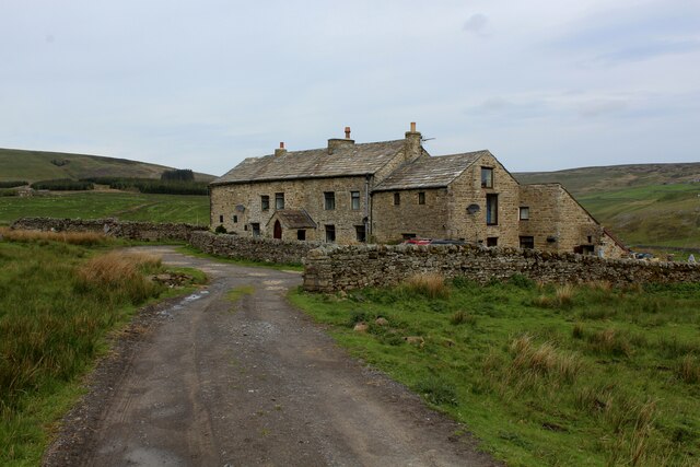
Lanehead retains a strong sense of community, with a population of around 400 residents. The village is characterized by its charming traditional stone-built houses and well-manicured gardens, which add to its overall appeal. The local community is tight-knit and actively involved in organizing various events and activities throughout the year.

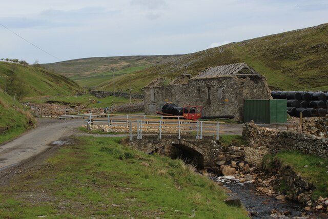
Despite its small size, Lanehead offers a range of amenities to its residents. These include a primary school, a village hall, and a local pub, providing essential services and opportunities for social interaction. The village is also well-connected to neighboring towns and cities, with regular bus services running to Durham and other nearby locations.

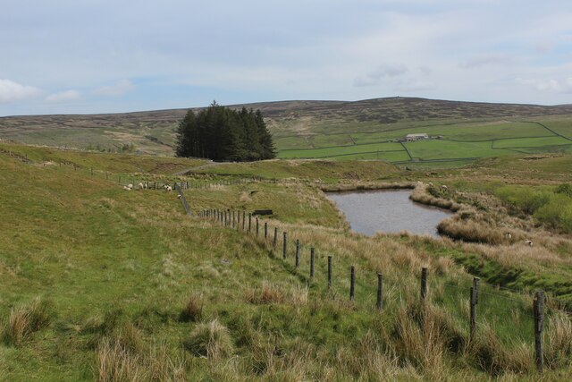
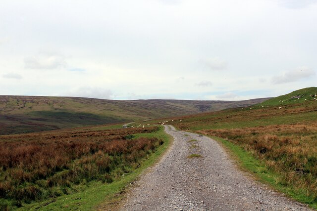
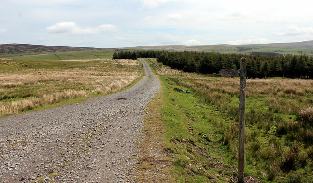
One of the main attractions in Lanehead is its stunning natural surroundings. The village is surrounded by rolling hills, green fields, and woodland, making it an ideal spot for outdoor enthusiasts. There are plenty of walking and cycling routes to explore, allowing residents and visitors to fully appreciate the beauty of the Durham countryside.

Overall, Lanehead is a charming village that offers a tranquil and close-knit community, beautiful rural landscapes, and easy access to nearby amenities. It provides a desirable living environment for those seeking a peaceful retreat away from the hustle and bustle of city life.

If you have any feedback on the listing, please let us know in the comments section below.

Lanehead Images

Images are sourced within 2km of 54.769006/-2.245085 or Grid Reference NY8441. Thanks to Geograph Open Source API. All images are credited.

Pipeline crossing valley of Black Cleugh Being so close to Burnhope Reservoir it's assumed that the pipe carries water either to or from there. Both the pipe and the reservoir surface are close to the 400 m. contour so it's unclear in which direction, (if under gravity), water would flow.
Pipeline crossing valley of Black Cleugh
Being so close to Burnhope Reservoir it's assumed that the pipe carries water either to or from there. Both the pipe and the reservoir surface are close to the 400 m. contour so it's unclear in which direction, (if under gravity), water would flow.
Road north of Blackcleugh Upper Weardale has a number of minor roads on slopes above the valley bottom. This one if followed behind the camera position leads to Burnhope Reservoir.
Road north of Blackcleugh
Upper Weardale has a number of minor roads on slopes above the valley bottom. This one if followed behind the camera position leads to Burnhope Reservoir.
Ruin near Cleugh Head Cleugh Head is a vague location on the broad moorland ridge running eastwards into Weardale from Highwatch Currick. The feature does indeed appear to be a ruin, (rather than simply a stone pile), as certain corner stones appear to have been shaped for their purpose. The view beyond is to the south-east, into Weardale with Chapel Fell showing most obviously among the moorlands of its south side.
Ruin near Cleugh Head
Cleugh Head is a vague location on the broad moorland ridge running eastwards into Weardale from Highwatch Currick. The feature does indeed appear to be a ruin, (rather than simply a stone pile), as certain corner stones appear to have been shaped for their purpose. The view beyond is to the south-east, into Weardale with Chapel Fell showing most obviously among the moorlands of its south side.
Cleugh Head
Cleugh Head
Sinkhole, Cleugh Head Descending from Highwatch Head
Sinkhole, Cleugh Head
Descending from Highwatch Head
Road to Burnhope Emerging off the moors onto the single track road which links Cowshill with the reservoir
Road to Burnhope
Emerging off the moors onto the single track road which links Cowshill with the reservoir
Pasture, Wearhead, Stanhope Looking across the valley of Burnhope Burn. Black Cleugh is seen descending from the right.
Pasture, Wearhead, Stanhope
Looking across the valley of Burnhope Burn. Black Cleugh is seen descending from the right.
Weardale Way approaching Quarry Hill The small reservoir passed by on the Weardale Way is probably associated with the long ceased lead mining operations that prevailed in this location.
Weardale Way approaching Quarry Hill
The small reservoir passed by on the Weardale Way is probably associated with the long ceased lead mining operations that prevailed in this location.
Track over Limekiln Hill
Weardale Way heading for the Plantation on Garrick's Hags A 77 mile route following the River Wear from the sea at the Lindisfarne Memorial, Sunderland to the headwaters in the east Pennines, keeping as close as is possible to the river. It visits Lumley Castle, Durham (where the Castle and Cathedral forms a World Heritage Site), Bishop Auckland and Stanhope. After Stanhope the Way makes a northward loop to Rookhope to take in part of a tributary, Rookhope Burn.
Weardale Way heading for the Plantation on Garrick's Hags
A 77 mile route following the River Wear from the sea at the Lindisfarne Memorial, Sunderland to the headwaters in the east Pennines, keeping as close as is possible to the river. It visits Lumley Castle, Durham (where the Castle and Cathedral forms a World Heritage Site), Bishop Auckland and Stanhope. After Stanhope the Way makes a northward loop to Rookhope to take in part of a tributary, Rookhope Burn.
Ruin by Killhopeburn Bridge Substantial ruin beside the Killhope Burn
Ruin by Killhopeburn Bridge
Substantial ruin beside the Killhope Burn
Blakely Field Looks to have been recently refurbished into a private dwelling. Passed by on the Weardale Way long distance footpath
Blakely Field
Looks to have been recently refurbished into a private dwelling. Passed by on the Weardale Way long distance footpath
Heathery Bridge Crosses the Killhope Burn below the community of Lanehead - seen here from the Weardale Way long distance footpath
Heathery Bridge
Crosses the Killhope Burn below the community of Lanehead - seen here from the Weardale Way long distance footpath
Weardale Way heading towards the Dwelling of Middlerush Track descending gradually from High Rush
Weardale Way heading towards the Dwelling of Middlerush
Track descending gradually from High Rush
Track heading up The Hill
Burtreeford Bridge Crosses the Killhope Burn into Cowshill. Adopted by the Weardale Way long distance footpath, which also makes use of this bridge.
Burtreeford Bridge
Crosses the Killhope Burn into Cowshill. Adopted by the Weardale Way long distance footpath, which also makes use of this bridge.
Killhope Burn above Cowshill Looking downstream while following the Weardale Way long distance footpath towards the small village of Cowshill.
This is the major feeder to the River Wear.
Killhope Burn above Cowshill
Looking downstream while following the Weardale Way long distance footpath towards the small village of Cowshill. This is the major feeder to the River Wear.
Copthill Quarry Flooded quarry beside the Killhope Burn, and passed by on the Weardale Way long distance footpath.
<a href="https://www.geograph.org.uk/photo/1562709">NY8540 : Copthill Quarry</a>
Copthill Quarry
Flooded quarry beside the Killhope Burn, and passed by on the Weardale Way long distance footpath. NY8540 : Copthill Quarry
Show me another place!

Lanehead is located at Grid Ref: NY8441 (Lat: 54.769006, Lng: -2.245085)

Unitary Authority: County Durham

Police Authority: Durham

What 3 Words

///work.drifting.bulky. Near Alston, Cumbria

Related Wikis

Cornriggs

Cornriggs is a hamlet in the civil parish of Stanhope, in County Durham, England. It is situated on the north side of Weardale in the North Pennines,...

Cornriggs Meadows

Cornriggs Meadows is a Site of Special Scientific Interest in Upper Weardale in north-west County Durham, England. It consists of a group of fields, located...

Lanehead

Lanehead is a hamlet in the civil parish of Stanhope, in County Durham, England. It lies at the head of Weardale, approximately 2 km west of Cowshill....

Cowshill

Cowshill is a village in the civil parish of Stanhope, in County Durham, England. It is situated at the top of Weardale, between Lanehead and Wearhead...

Nearby Amenities

Located within 500m of 54.769006,-2.245085
Lanehead
Place: hamlet
Wikidata: Q6485485
Wikipedia: en:Lanehead
Lat/Long: 54.7694394/-2.2440062
Bus Stop
Field Centre
Naptan AtcoCode: 13004522D
Naptan Bearing: SE
Naptan CommonName: Field Centre
Naptan Indicator: south east bound
Naptan Landmark: Landmark not known
Naptan NaptanCode: durdatdm
Naptan Notes: Opposite South View- A689- Lanehead
Naptan Street: A689
Naptan Verified: no
Source: naptan_import
Lat/Long: 54.7698533/-2.2455771
Bus Stop
Field Centre
Naptan AtcoCode: 13004522H
Naptan Bearing: NW
Naptan CommonName: Field Centre
Naptan Indicator: north west bound
Naptan Landmark: Landmark not known
Naptan NaptanCode: durdatdp
Naptan Notes: Pudding Cottage- A689- Lanehead
Naptan Street: A689
Naptan Verified: no
Source: naptan_import
Lat/Long: 54.7696121/-2.2448762
Barrier: entrance
Lat/Long: 54.7716888/-2.2433227
Low Moss
Place: locality
Lat/Long: 54.7646258/-2.2459415
Lanehead View
Place: locality
Lat/Long: 54.7659073/-2.2479286
HE Ref: 1278782
Disused Man Made: kiln
Listed Status: Grade II
Wikidata: Q26568066
Lat/Long: 54.773282/-2.2464788
Crossing
Lat/Long: 54.7687666/-2.2481315
Power: pole
Lat/Long: 54.7667696/-2.2481109
Power: pole
Lat/Long: 54.7672625/-2.2480063
Power: pole
Lat/Long: 54.7678675/-2.2449835
Power: pole
Lat/Long: 54.7676098/-2.2459799
Power: pole
Lat/Long: 54.7673569/-2.2469616
Power: pole
Lat/Long: 54.7673275/-2.2479728
Power: pole
Lat/Long: 54.7672895/-2.2490403
Power: pole
Lat/Long: 54.7675828/-2.2501172
Power: pole
Lat/Long: 54.7679108/-2.2510251
Power: pole
Lat/Long: 54.7682156/-2.2518285
Power: pole
Lat/Long: 54.7685375/-2.2526801
Turning Loop
Lat/Long: 54.7700262/-2.2454948
Power: pole
Lat/Long: 54.7695138/-2.2384053
Power: pole
Lat/Long: 54.7694728/-2.2393629
Power: pole
Lat/Long: 54.7694434/-2.2402668
Power: pole
Lat/Long: 54.7693815/-2.2421967
Low Cornriggs Farm
Place: farm
Source Name: OS OpenData StreetView
Lat/Long: 54.7677081/-2.2390585
Location Transition: yes
Mapillary: 784598552449736
Power: pole
Lat/Long: 54.7692608/-2.2437309
Mapillary: 784598552449736
Power: pole
Transformer: distribution
Lat/Long: 54.7692686/-2.243643
The data included in this document is from www.openstreetmap.org. The data is made available under ODbL.

Have you been to Lanehead?

Leave your review of Lanehead below (or comments, questions and feedback).