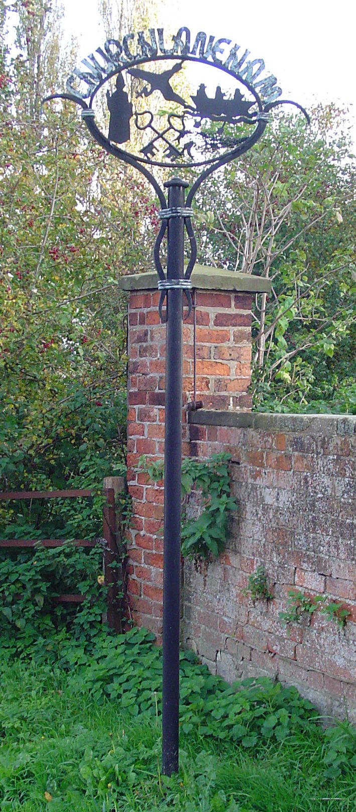
Laneham

Settlement in Nottinghamshire Bassetlaw

England

Laneham

Dunham-on-Trent, The White Swan
Dunham-on-Trent, The White Swan Credit: David Dixon

Laneham is a small village located in the Bassetlaw district of Nottinghamshire, England. Situated on the eastern bank of the River Trent, it lies approximately 10 miles north of the market town of Newark-on-Trent. The village is part of the civil parish of Laneham and Dunham-on-Trent.

With a population of around 250 residents, Laneham exudes a tranquil and picturesque charm. It is known for its scenic countryside, characterized by rolling hills and fields, providing stunning views and ample opportunities for outdoor activities such as walking, cycling, and fishing, particularly along the river.

Laneham boasts a rich history, with evidence of settlement dating back to Roman times. The village's notable landmarks include the Grade II listed St. Peter's Church, a beautiful medieval structure featuring a Norman tower and a rare triple lancet window. Additionally, the nearby Laneham Ferry, which has been in operation for over 1,000 years, provides a unique connection across the River Trent and attracts visitors interested in experiencing a traditional river crossing.

Though small in size, Laneham offers basic amenities such as a village hall and a pub, which serves as a social hub for locals and visitors alike. The village also hosts various community events throughout the year, including the annual Laneham Street Fayre, which showcases local crafts, food, and entertainment.

Overall, Laneham is a charming and idyllic village that offers a peaceful retreat from the hustle and bustle of city life, making it a desirable destination for nature enthusiasts and those seeking a quintessentially English countryside experience.

If you have any feedback on the listing, please let us know in the comments section below.

Laneham Images

Images are sourced within 2km of 53.278275/-0.78807 or Grid Reference SK8076. Thanks to Geograph Open Source API. All images are credited.

Dunham-on-Trent, The White Swan
View down the River Trent at Church Laneham Cottam Power Station, one of several stretched along the Trent valley, is a few miles downstream.
View down the River Trent at Church Laneham
Cottam Power Station, one of several stretched along the Trent valley, is a few miles downstream.
Church Laneham: St Peter's Church, and postbox
Church Laneham: the Ferry-Boat Inn from the churchyard
Willow trees in the water, River Trent, Church Laneham
Laneham: aerial 2023 (1)
Laneham: aerial 2023 (2)
Laneham to the Trent and its Power stations: aerial 2023 (1) Former Cottam Power Station in <a href="https://www.geograph.org.uk/gridref/SK8179">SK8179</a>.
Laneham to the Trent and its Power stations: aerial 2023 (1)
Former Cottam Power Station in SK8179.
Laneham to the Trent and its Power stations: aerial 2023 (2)
Dunham Rack on the River Trent: aerial 2023
Laneham Street in Rampton
On Long Lane This section of the road is unfenced. Cottam Power Station provides the backdrop.
On Long Lane
This section of the road is unfenced. Cottam Power Station provides the backdrop.
The end of Long Lane The junction with Laneham Road; Cottam Power Station in the background.
The end of Long Lane
The junction with Laneham Road; Cottam Power Station in the background.
"Bridgemede" - isolated house south of Rampton
View west to Laneham Fox Covert
After the harvest Straw bales and stubble with Rampton church in the distance, seen in a field between Rampton and Laneham
After the harvest
Straw bales and stubble with Rampton church in the distance, seen in a field between Rampton and Laneham
Path and Woods This track is a short footpath which goes nowhere other than to join with a track from Stokeham.
Path and Woods
This track is a short footpath which goes nowhere other than to join with a track from Stokeham.
Laneham Fields The harvest has now been gathered in from Laneham Fields and the remains rolled up into giant cylinders of straw.  The chimneys in the background are at the now disused High Marnham power station.
Laneham Fields
The harvest has now been gathered in from Laneham Fields and the remains rolled up into giant cylinders of straw. The chimneys in the background are at the now disused High Marnham power station.
Show me another place!

Laneham is located at Grid Ref: SK8076 (Lat: 53.278275, Lng: -0.78807)

Administrative County: Nottinghamshire

District: Bassetlaw

Police Authority: Nottinghamshire

What 3 Words

///splashes.panicking.lightbulb. Near East Markham, Nottinghamshire

Nearby Locations

Laneham Laneham

Related Wikis

Laneham

Laneham is a village and civil parish on the banks of the River Trent in Bassetlaw District in Nottinghamshire, England. The population of the civil parish...

Church Laneham

Church Laneham is a hamlet in Nottinghamshire, England. It is located 9 miles east of Retford, on the west bank of the tidal section of the River Trent...

St Peter's Church, Laneham

St Peter's Church, Laneham is a Grade I listed parish church in the Church of England in Laneham, Nottinghamshire, England. == History == Various parts...

St Oswald's Church, Dunham-on-Trent

St Oswald's Church, Dunham-on-Trent is a Grade I listed former parish church in the Church of England in Dunham, Nottinghamshire. The church is currently...

Dunham-on-Trent

Dunham-on-Trent is a village and civil parish in Nottinghamshire, England. It is located on the A57 road, about 0.5 miles (0.8 km) west of Dunham Bridge...

Dunham Bridge

Dunham Bridge is a toll bridge across the River Trent in England. It spans the border between Nottinghamshire and Lincolnshire to the west and east respectively...

Rampton and Woodbeck

Rampton and Woodbeck is a civil parish in the Bassetlaw district, within the county of Nottinghamshire, England. The overall area had a population of...

Rampton, Nottinghamshire

Rampton is a village in the civil parish of Rampton and Woodbeck, about 6 miles (10 km) east of Retford in the Bassetlaw district, in the county of Nottinghamshire...

Nearby Amenities

Located within 500m of 53.278275,-0.78807
Bus Stop
Main Street
Naptan AtcoCode: 3300BA0640
Naptan Bearing: E
Naptan CommonName: Main Street
Naptan Crossing: Broadings Lane
Naptan Indicator: E-bound
Naptan NaptanCode: ntsdpmdg
Naptan Notes: None
Naptan Street: Main Street
Naptan Verified: no
Source: naptan_import
Lat/Long: 53.2774596/-0.7926459
Power: tower
Source: Bing
Lat/Long: 53.2761781/-0.7896534
Power: tower
Source: Bing
Lat/Long: 53.2795717/-0.7888809
Power: tower
Source: Bing
Lat/Long: 53.2794049/-0.7877544
Power: tower
Source: Bing
Lat/Long: 53.2818553/-0.7871751
Power: tower
Source: Bing
Lat/Long: 53.2743112/-0.7848576
Power: tower
Source: Bing
Lat/Long: 53.276903/-0.786424
Cherry Tree Farm
Place: farm
Source: Bing
Lat/Long: 53.2774688/-0.7909394
Willow Tree Farm
Place: farm
Source: Bing
Wikidata: Q26527006
Lat/Long: 53.2773841/-0.7908099
Fixme: Needs survey - how does the path get through the hedge?
Lat/Long: 53.2802264/-0.7912081
Barrier: kissing_gate
Lat/Long: 53.2785034/-0.7868636
Information: board
Tourism: information
Lat/Long: 53.2778638/-0.7907204
Barrier: kissing_gate
Lat/Long: 53.2754294/-0.7930045
Barrier: kissing_gate
Lat/Long: 53.274963/-0.7926609
Barrier: kissing_gate
Lat/Long: 53.2760914/-0.7910832
Barrier: kissing_gate
Lat/Long: 53.2783465/-0.7869927
Barrier: kissing_gate
Lat/Long: 53.2808798/-0.7850697
Information: route_marker
Tourism: information
Lat/Long: 53.2808759/-0.7850504
Direction: SSE
Generator Method: photovoltaic
Generator Output Electricity: yes
Generator Solar Modules: 11
Generator Source: solar
Generator Type: solar_photovoltaic_panel
Location: roof
Power: generator
Lat/Long: 53.2773711/-0.7917559
Direction: WSW
Generator Method: photovoltaic
Generator Output Electricity: yes
Generator Solar Modules: 10
Generator Source: solar
Generator Type: solar_photovoltaic_panel
Location: roof
Power: generator
Lat/Long: 53.279047/-0.7932787
The data included in this document is from www.openstreetmap.org. The data is made available under ODbL.

Have you been to Laneham?

Leave your review of Laneham below (or comments, questions and feedback).