Anstey's Combe

Valley in Devon North Devon

England

Anstey's Combe

Molland : Country Lane Looking along a small country lane.
Molland : Country Lane Credit: Lewis Clarke

Anstey's Combe is a picturesque valley located in the county of Devon, England. Situated in the southeastern part of the county, it is nestled within the rolling hills of the Dartmoor National Park. The valley is named after the Anstey family, who have owned and inhabited the area for centuries.

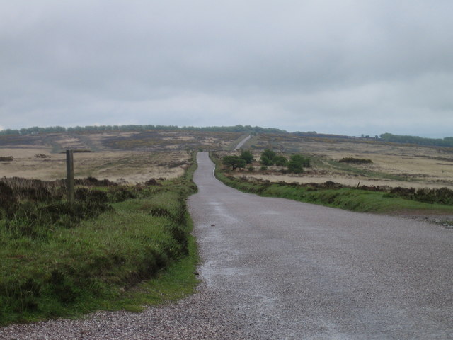
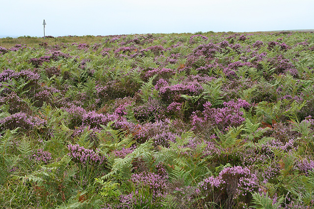
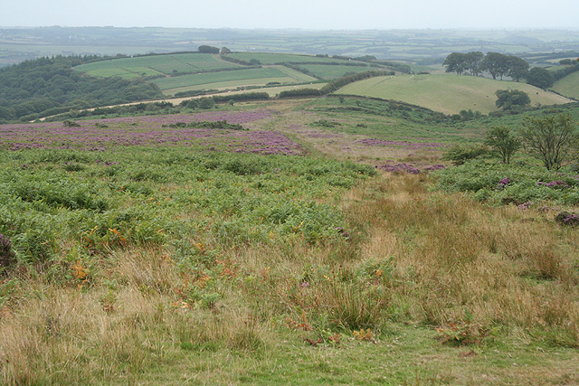
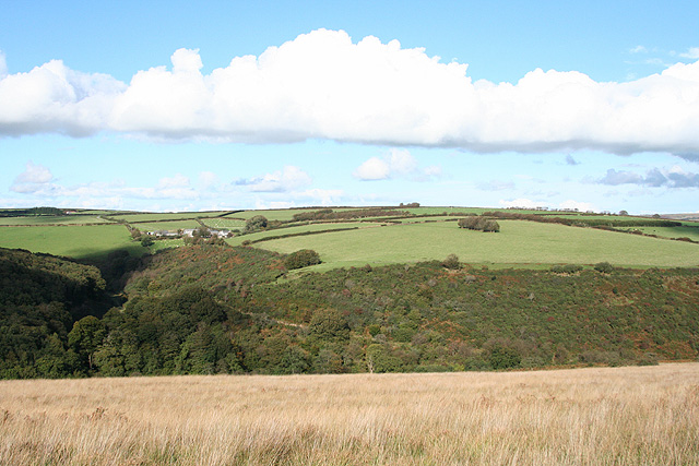
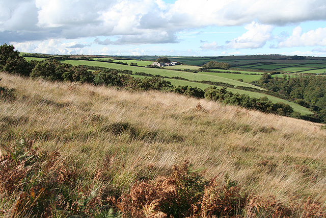
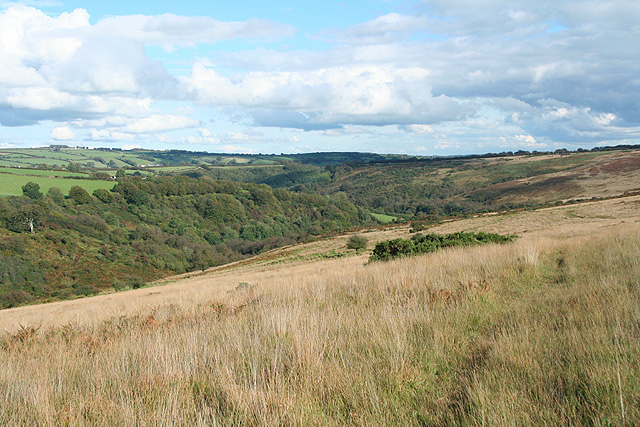
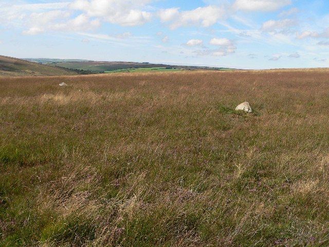
The landscape of Anstey's Combe is characterized by its lush greenery, meandering streams, and breathtaking views. The valley is home to a diverse range of flora and fauna, including rare species of plants and various bird species. It is a haven for nature enthusiasts and offers a peaceful retreat from the bustling cities.

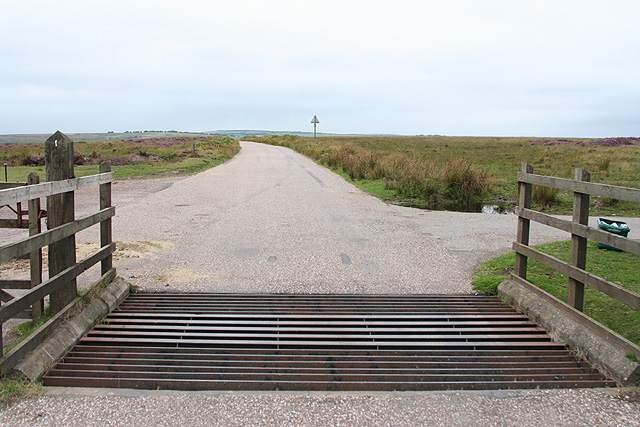
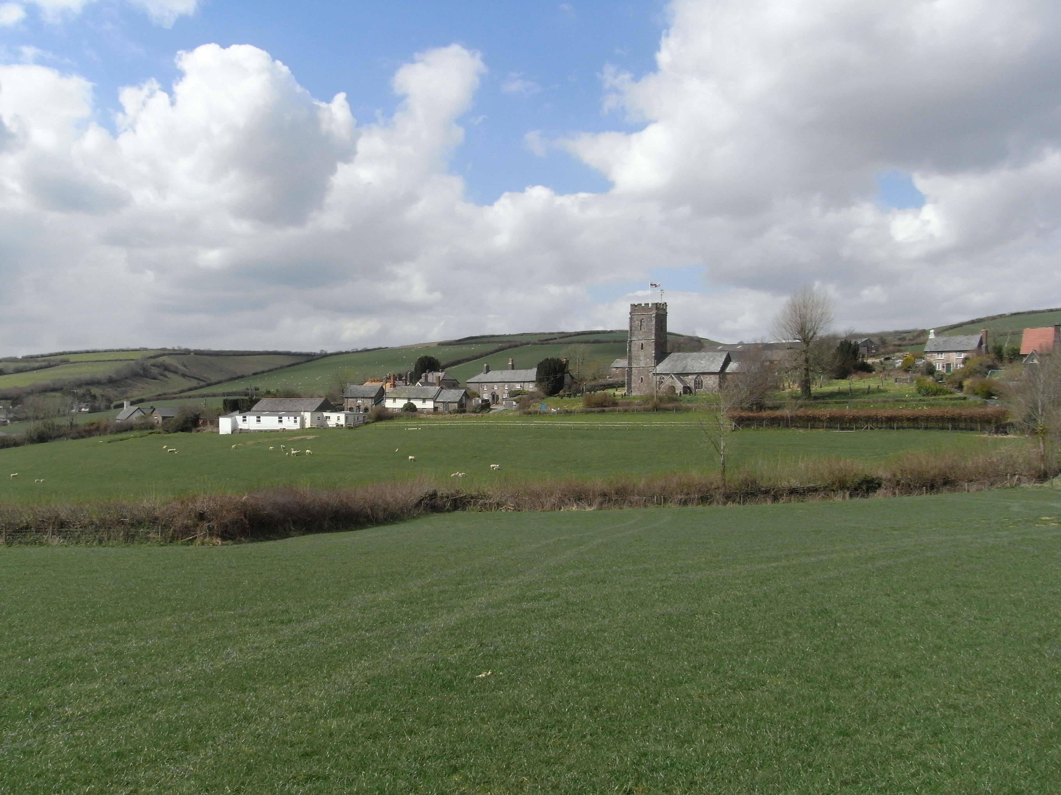
The valley is dotted with charming cottages and farmhouses, many of which date back to the 18th and 19th centuries. These historic buildings add to the quaint and timeless atmosphere of the area. Visitors to Anstey's Combe can enjoy scenic walks along the numerous footpaths that crisscross the valley, taking in the beauty of the surrounding countryside.

Anstey's Combe is also known for its rich history. The valley was once a thriving center of the local mining industry, with evidence of old mine workings still visible today. The remnants of these mines provide an intriguing glimpse into the region's industrial past.

Overall, Anstey's Combe is a truly enchanting destination that offers visitors a chance to immerse themselves in the natural beauty and history of Devon. Whether exploring the picturesque landscape or delving into the valley's past, there is something for everyone to discover in this idyllic corner of England.

If you have any feedback on the listing, please let us know in the comments section below.

Anstey's Combe Images

Images are sourced within 2km of 51.053502/-3.6744386 or Grid Reference SS8229. Thanks to Geograph Open Source API. All images are credited.

Molland : Country Lane Looking along a small country lane.
Molland : Country Lane
Looking along a small country lane.
Molland : Grassy Field & Sheep Some sheep in the field on the hill.
Molland : Grassy Field & Sheep
Some sheep in the field on the hill.
Molland : Moor Lane Cross North At the road junction with the signpost.
Molland : Moor Lane Cross North
At the road junction with the signpost.
Molland : Grassy Field Looking across the countryside.
Molland : Grassy Field
Looking across the countryside.
Molland : Grassy Field & Sheep Looking across a field of sheep.
Molland : Grassy Field & Sheep
Looking across a field of sheep.
Molland : Grassy Field & Gate Looking into the field beyond the gate.
Molland : Grassy Field & Gate
Looking into the field beyond the gate.
Molland : Moor Lane Looking along a small country lane.
Molland : Moor Lane
Looking along a small country lane.
Molland : Moor Lane Looking along a small country lane.
Molland : Moor Lane
Looking along a small country lane.
Molland : Grassy Field Looking across the hedgerow and gate in the corner of the field.
Molland : Grassy Field
Looking across the hedgerow and gate in the corner of the field.
Molland: leat to Bremley Possibly an old mining leat which has been retained for farm use. Bremley was scene of mining activity in the 19th century
Molland: leat to Bremley
Possibly an old mining leat which has been retained for farm use. Bremley was scene of mining activity in the 19th century
Molland: Bremley Farm Copper was mined near here in the mid-19th century and iron ore from 1878 until 1894. A leat still runs to the farm, which may have used water power at one time. The farm appeared to be unoccupied when the photograph was taken in 1996
Molland: Bremley Farm
Copper was mined near here in the mid-19th century and iron ore from 1878 until 1894. A leat still runs to the farm, which may have used water power at one time. The farm appeared to be unoccupied when the photograph was taken in 1996
West Anstey Common The Ridge Road over West Anstey Common.
West Anstey Common
The Ridge Road over West Anstey Common.
Molland: Brimblecombe Hill Heather and bracken close to the road at Anstey Gate: the road sign on the horizon indicates the location. It warns of a cattle grid at the gate. Looking west
Molland: Brimblecombe Hill
Heather and bracken close to the road at Anstey Gate: the road sign on the horizon indicates the location. It warns of a cattle grid at the gate. Looking west
West Anstey: Anstey Gate Looking west-north-west towards Molland Common
West Anstey: Anstey Gate
Looking west-north-west towards Molland Common
Molland: above Anstey’s Combe Looking south from White Moor
Molland: above Anstey’s Combe
Looking south from White Moor
West Anstey: on West Anstey Common Looking north towards Shircombe Farm. Below the farm, nearer the camera, the Dane’s Brook turns through a right angle to run south-south-west past Lyshwell Wood before resuming a more easterly course. It has a confluence with the Barle near Mounsey Castle.
West Anstey: on West Anstey Common
Looking north towards Shircombe Farm. Below the farm, nearer the camera, the Dane’s Brook turns through a right angle to run south-south-west past Lyshwell Wood before resuming a more easterly course. It has a confluence with the Barle near Mounsey Castle.
West Anstey: towards Lyshwell Farm Looking north west on the edge of the moor towards Exmoor farmland
West Anstey: towards Lyshwell Farm
Looking north west on the edge of the moor towards Exmoor farmland
West Anstey: Anstey Rhiney Moor Looking east-north-east over the Dane’s Brook valley
West Anstey: Anstey Rhiney Moor
Looking east-north-east over the Dane’s Brook valley
Show me another place!

Anstey's Combe is located at Grid Ref: SS8229 (Lat: 51.053502, Lng: -3.6744386)

Administrative County: Devon

District: North Devon

Police Authority: Devon and Cornwall

What 3 Words

///clever.ramps.promotes. Near Dulverton, Somerset

Related Wikis

Molland

Molland is a small village, civil parish, dual ecclesiastical parish with Knowstone, located in the foothills of Exmoor in Devon, England. It lies within...

West Anstey

West Anstey is a village and civil parish on the River Yeo, about 5 miles west of Dulverton, in the North Devon district, in the county of Devon, England...

Church of St Giles, Hawkridge

The Anglican Church of St Giles in Hawkridge, Somerset, England was built in the 14th century. It is a Grade II* listed building. == History == The oldest...

Twitchen, Devon

Twitchen is a village and civil parish in Devon, England, located within the North Devon local authority area. Historically it formed part of South Molton...

Bickingcott

Bickingcott is a village in Devon, England. == External links == Media related to Bickingcott at Wikimedia Commons

Tarr Steps

The Tarr Steps is a clapper bridge across the River Barle in the Exmoor National Park, Somerset, England. They are located in a national nature reserve...

Withypool Stone Circle

Withypool Stone Circle, also known as Withypool Hill Stone Circle, is a stone circle located on the Exmoor moorland, near the village of Withypool in the...

Brewer's Castle

Brewer's Castle is a defended Iron Age settlement in the West Somerset district of Somerset, England. The hill fort is situated approximately 2 miles...

Nearby Amenities

Located within 500m of 51.053502,-3.6744386
The data included in this document is from www.openstreetmap.org. The data is made available under ODbL.

Have you been to Anstey's Combe?

Leave your review of Anstey's Combe below (or comments, questions and feedback).