Clannel Combe

Valley in Somerset Somerset West and Taunton

England

Clannel Combe

Somerset border sign on the A39 east
Somerset border sign on the A39 east Credit: Roy Hughes

Clannel Combe is a picturesque valley located in Somerset, England. Nestled within the Mendip Hills, this valley is renowned for its natural beauty and rich biodiversity. The name "Clannel Combe" is derived from the Old English words "clannel," meaning narrow, and "combe," meaning valley, accurately describing the topography of the area.

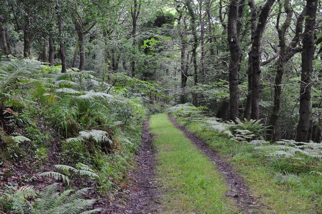
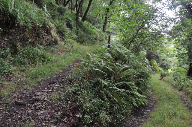
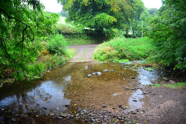
Lush green meadows, rolling hills, and dense woodlands characterize Clannel Combe. It is home to a diverse range of plant and animal species, making it an excellent destination for nature enthusiasts. The valley is particularly known for its wildflower meadows that burst into a riot of colors during the spring and summer months.

Several streams and small rivers meander through Clannel Combe, providing a serene and tranquil atmosphere. These water bodies also support a thriving ecosystem of aquatic life, including fish, water insects, and amphibians.

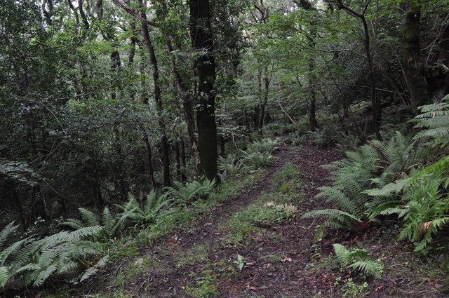
The valley offers numerous walking trails and hiking routes, allowing visitors to explore and appreciate the beauty of the surrounding countryside. The trails lead through ancient woodlands, where one can find towering trees and a carpet of bluebells in the spring.

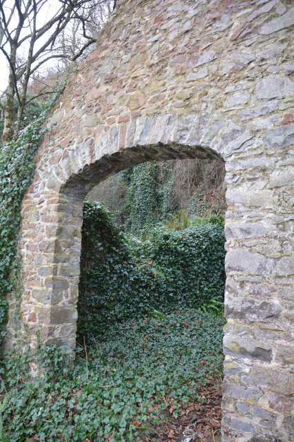
In addition to its natural wonders, Clannel Combe boasts a rich historical heritage. The valley is dotted with archaeological sites, including Iron Age hillforts and Roman settlements, offering a glimpse into the area's past.

Overall, Clannel Combe is a true gem of Somerset, offering visitors a chance to immerse themselves in the tranquility of nature while exploring its fascinating history.

If you have any feedback on the listing, please let us know in the comments section below.

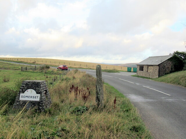
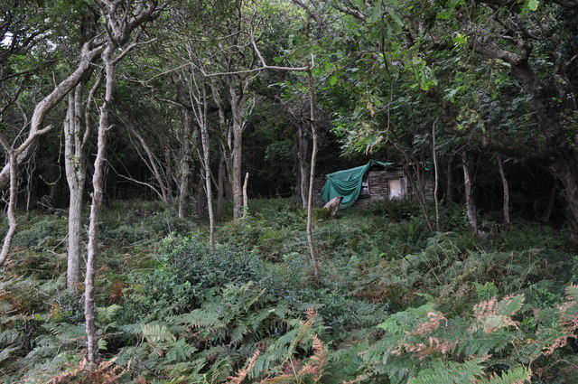
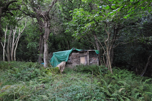
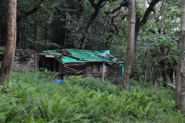
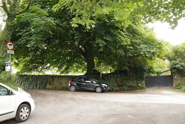
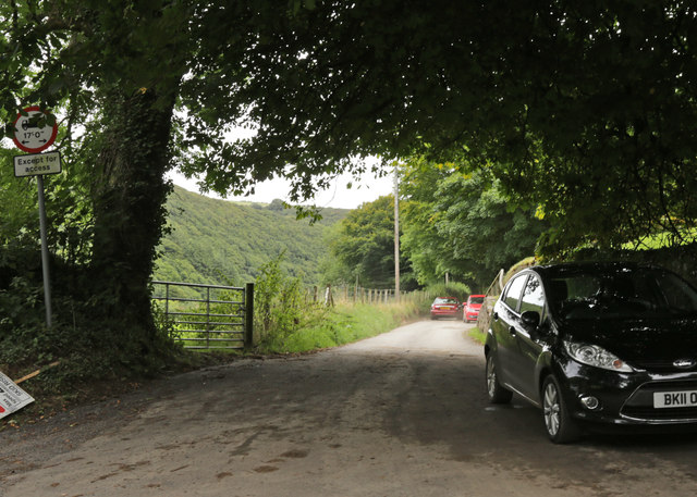
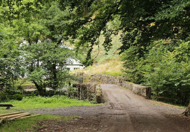
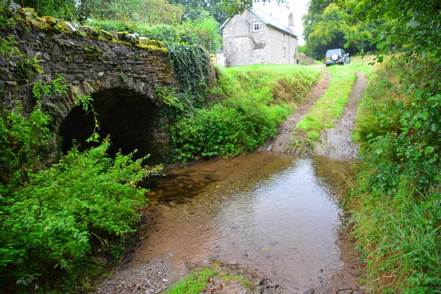
Clannel Combe Images

Images are sourced within 2km of 51.217633/-3.7164724 or Grid Reference SS8047. Thanks to Geograph Open Source API. All images are credited.

Somerset border sign on the A39 east
East Lyn river valley from County Gate
West Somerset : Coastal Scenery Looking out across the pebble beach near Embelle Wood.
West Somerset : Coastal Scenery
Looking out across the pebble beach near Embelle Wood.
West Somerset : Embelle Wood Beach Looking across the coastline along Embelle Wood Beach.
West Somerset : Embelle Wood Beach
Looking across the coastline along Embelle Wood Beach.
West Somerset : Embelle Wood Difficult to believe that some bloke lived in that hidden shack, undiscovered by the local Exmoor authorities for over 20 years.
West Somerset : Embelle Wood
Difficult to believe that some bloke lived in that hidden shack, undiscovered by the local Exmoor authorities for over 20 years.
West Somerset : Embelle Wood Embelle Wood with a shack were a man once lived not too long ago <span class="nowrap"><a title="http://www.bbc.co.uk/news/uk-england-bristol-16226934" rel="nofollow ugc noopener" href="http://www.bbc.co.uk/news/uk-england-bristol-16226934">Link</a><img style="margin-left:2px;" alt="External link" title="External link - shift click to open in new window" src="https://s1.geograph.org.uk/img/external.png" width="10" height="10"/></span>
West Somerset : Embelle Wood
Embelle Wood with a shack were a man once lived not too long ago LinkExternal link
West Somerset : Embelle Wood A wooden hut where the man of the woodlands lives <span class="nowrap"><a title="http://www.bbc.co.uk/news/uk-england-bristol-16226934" rel="nofollow ugc noopener" href="http://www.bbc.co.uk/news/uk-england-bristol-16226934">Link</a><img style="margin-left:2px;" alt="External link" title="External link - shift click to open in new window" src="https://s1.geograph.org.uk/img/external.png" width="10" height="10"/></span>
West Somerset : Embelle Wood
A wooden hut where the man of the woodlands lives LinkExternal link
West Somerset : Embelle Wood A small track heading up through Embelle Wood.
West Somerset : Embelle Wood
A small track heading up through Embelle Wood.
West Somerset : Embelle Wood A track heading down through the woodlands and onto the coastline.
West Somerset : Embelle Wood
A track heading down through the woodlands and onto the coastline.
West Somerset : Bristol Channel Looking out across the Bristol Channel from West Somerset.
West Somerset : Bristol Channel
Looking out across the Bristol Channel from West Somerset.
West Somerset : Bristol Channel Looking out across the Bristol Channel and towards the South Wales coast.
West Somerset : Bristol Channel
Looking out across the Bristol Channel and towards the South Wales coast.
West Somerset : Embelle Wood A track heading through the woodland.
West Somerset : Embelle Wood
A track heading through the woodland.
Left to Robbers Bridge; Right to Malmsmead
This way to Robbers Bridge
Oareford Farm over the bridge
Oareford Ford This ford is found at Oareford a short distance from Robber's Bridge Ford.
Oareford Ford
This ford is found at Oareford a short distance from Robber's Bridge Ford.
Oareford Ford This is a second ford at Oareford found beside Oareford Farm.
Oareford Ford
This is a second ford at Oareford found beside Oareford Farm.
West Somerset : Limekiln The building is listed - <span class="nowrap"><a title="https://historicengland.org.uk/listing/the-list/list-entry/1173368" rel="nofollow ugc noopener" href="https://historicengland.org.uk/listing/the-list/list-entry/1173368">Link</a><img style="margin-left:2px;" alt="External link" title="External link - shift click to open in new window" src="https://s1.geograph.org.uk/img/external.png" width="10" height="10"/></span>
West Somerset : Limekiln
The building is listed - LinkExternal link
Show me another place!

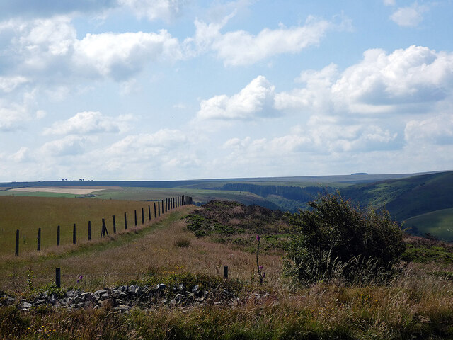
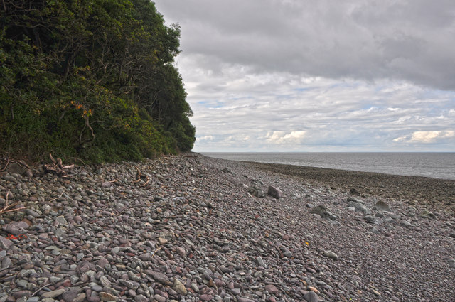
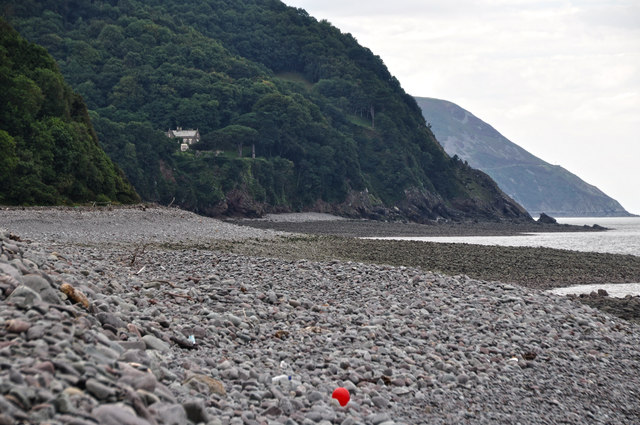
Clannel Combe is located at Grid Ref: SS8047 (Lat: 51.217633, Lng: -3.7164724)

Administrative County: Somerset

District: Somerset West and Taunton

Police Authority: Avon and Somerset

What 3 Words

///marine.claps.laces. Near Porlock, Somerset

Related Wikis

Church of St Mary, Oare

The Anglican Church of St Mary in Oare, Somerset, England, was built in the 15th century. It is a Grade II* listed building. == History == The nave and...

Oare Water

Oare Water passes through the village of Oare, on Exmoor in Somerset, England. It joins Badgworthy Water before flowing to Watersmeet and the Bristol Channel...

Badgworthy Water

Badgworthy Water is a small river which flows through Malmsmead on Exmoor, close to the border between Devon and Somerset, England. It merges with Oare...

Malmsmead Bridge

Malmsmead Bridge is a 17th-century stone bridge which crosses Badgworthy Water in the hamlet of Malmsmead, on the road between Oare and Brendon. The Badgworthy...

Malmsmead

Malmsmead is a hamlet on the border between the English counties of Devon and Somerset. The nearest town is Lynton, which lies approximately 4.7 miles...

East Lyn Valley

East Lyn Valley is a valley of Exmoor, covering northern Devon and western Somerset, England. The East Lyn River is formed from several main tributaries...

Glenthorne

Glenthorne (grid reference SS800497) is a 13.3 hectare geological Site of Special Scientific Interest in the parish of Oare within the Exmoor National...

Oare, Somerset

Oare is a village and civil parish on Oare Water on Exmoor in the Somerset West and Taunton district of Somerset, England. It is located 6 miles (10 km...

Have you been to Clannel Combe?

Leave your review of Clannel Combe below (or comments, questions and feedback).