Netherlaw Glen

Valley in Kirkcudbrightshire

Scotland

Netherlaw Glen

Minor road towards Port Mary A dead end, and much potholed lane heading south from the A711.
Minor road towards Port Mary Credit: Gordon Hatton

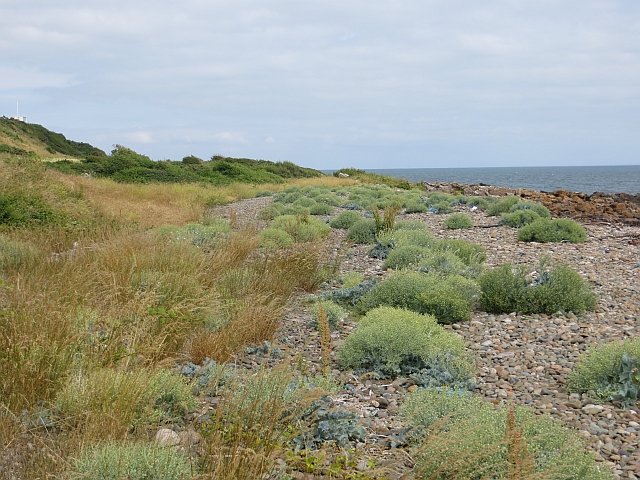
Netherlaw Glen is a picturesque valley located in the historic county of Kirkcudbrightshire, Scotland. Nestled amidst rolling hills and lush greenery, this enchanting glen captivates visitors with its natural beauty and tranquility. The valley is situated near the town of Kirkcudbright, known for its rich artistic heritage and stunning coastal landscape.

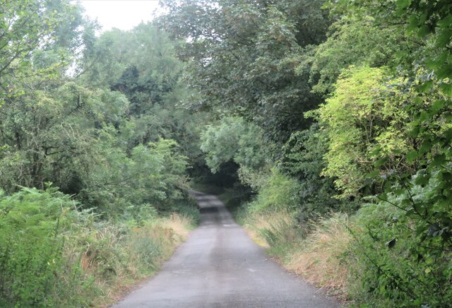
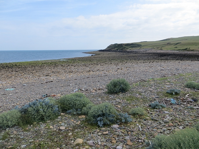
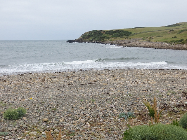
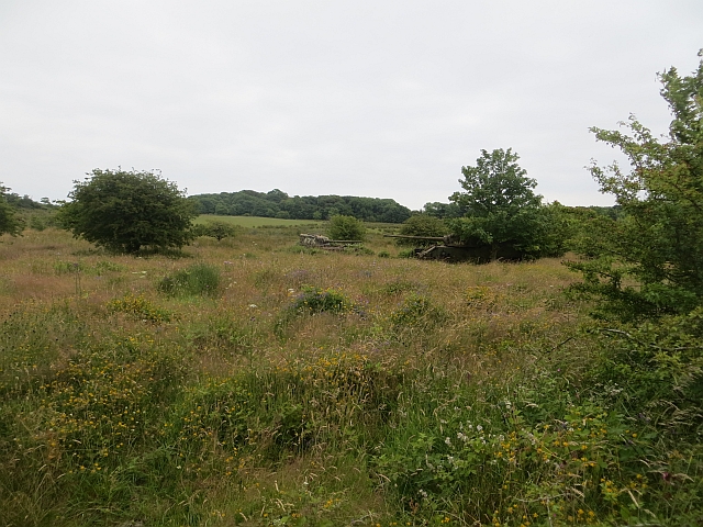
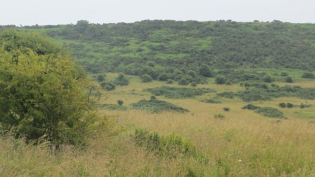
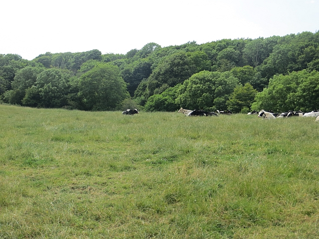
Netherlaw Glen is characterized by its diverse flora and fauna, making it a haven for nature enthusiasts and wildlife lovers. The glen is home to a variety of indigenous plant species, including oak, birch, and rowan trees, which create a vibrant display of colors throughout the seasons. The peaceful stream that meanders through the valley adds to the serene atmosphere, providing a calming soundtrack to visitors' explorations.

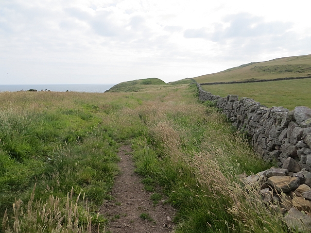
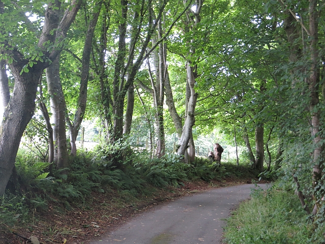
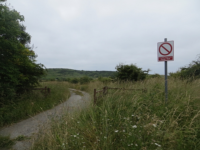
Walking trails crisscross the glen, offering visitors the opportunity to immerse themselves in the surrounding natural beauty. The trails wind through woodlands, meadows, and along the stream, providing breathtaking views of the valley from different vantage points. Additionally, the glen is a popular spot for birdwatching, with a plethora of avian species frequenting the area.

The valley's idyllic setting has also captured the attention of artists and photographers, who are drawn to its ethereal charm. The interplay of light and shadows, along with the ever-changing colors of the landscape, provide endless inspiration for creative endeavors.

Netherlaw Glen is not only a place of natural beauty but also a haven for those seeking solace and rejuvenation. Its peaceful ambiance and stunning vistas make it a must-visit destination for anyone exploring the Kirkcudbrightshire region.

If you have any feedback on the listing, please let us know in the comments section below.

Netherlaw Glen Images

Images are sourced within 2km of 54.783278/-3.9556649 or Grid Reference NX7444. Thanks to Geograph Open Source API. All images are credited.

Minor road towards Port Mary A dead end, and much potholed lane heading south from the A711.
Minor road towards Port Mary
A dead end, and much potholed lane heading south from the A711.
Old Target An old target on Kirkcudbright Ranges.
Old Target
An old target on Kirkcudbright Ranges.
Kirkcudbright Ranges An old tank used as a target on the Kirkcudbright Ranges.
Kirkcudbright Ranges
An old tank used as a target on the Kirkcudbright Ranges.
Coastline at Spouty Dennans
Grassland below Rerrick Park Farm
Cottage at Rerrick Park Farm
Abbey Head Bouldery beach and headland. The boulders are mostly sandstone but there are a few lumps of granite in there as well.
Abbey Head
Bouldery beach and headland. The boulders are mostly sandstone but there are a few lumps of granite in there as well.
Abbey Head A dyke between the cattle (this bit of the range is still farmed) and the cliffs.
Abbey Head
A dyke between the cattle (this bit of the range is still farmed) and the cliffs.
Burnfoot Beach A helpful notice by the road end, west of Dundrennan tells you if the road through the range to the beach is open. <a href="https://www.geograph.org.uk/photo/3564913">NX7447 : Burnfoot Beach sign</a> View towards Abbey Head on the bouldery beach which was used painstakingly to get at the undocumented squares there.

At a higher state of the tide: <a href="https://www.geograph.org.uk/photo/3564964">NX7444 : Burnfoot Beach</a>
Burnfoot Beach
A helpful notice by the road end, west of Dundrennan tells you if the road through the range to the beach is open. NX7447 : Burnfoot Beach sign View towards Abbey Head on the bouldery beach which was used painstakingly to get at the undocumented squares there. At a higher state of the tide: NX7444 : Burnfoot Beach
Dense vegetation, Abbey Burn Thick vegetation, a bit like what you may find on the way down to a Cornish beach beside the Port Mary road.
Dense vegetation, Abbey Burn
Thick vegetation, a bit like what you may find on the way down to a Cornish beach beside the Port Mary road.
Burnfoot Beach Near high water. Comparison: <a href="https://www.geograph.org.uk/photo/3564897">NX7444 : Burnfoot Beach</a>
Burnfoot Beach
Near high water. Comparison: NX7444 : Burnfoot Beach
Road, Netherlaw Burn A former public road to Abbey Burnfoot (which no longer exists). Now part of the Kirkcudbright Infantry Training Range. The road is part of a waymarked traverse of the range which is open when the flags are down.
Road, Netherlaw Burn
A former public road to Abbey Burnfoot (which no longer exists). Now part of the Kirkcudbright Infantry Training Range. The road is part of a waymarked traverse of the range which is open when the flags are down.
Controlled Impact Area South of the waymarked route along the Netherlaw Burn, a large expanse of now wild land which appears to be the recipient of a lot of ordnance, hence the sign.
Some signs have been covered in sacking, my guess is that they are reflecting light at the gunners.

This is one of the few keep out signs that I am happy to photograph from the front.
Controlled Impact Area
South of the waymarked route along the Netherlaw Burn, a large expanse of now wild land which appears to be the recipient of a lot of ordnance, hence the sign. Some signs have been covered in sacking, my guess is that they are reflecting light at the gunners. This is one of the few keep out signs that I am happy to photograph from the front.
Tanks, Kirkcudbright Infantry Training Range On former farmland, now flowery grassland, of Barcheskie.
Tanks, Kirkcudbright Infantry Training Range
On former farmland, now flowery grassland, of Barcheskie.
Range road, Netherlaw Wood A former public road, now part of the Kirkcudbright Infantry Training Range. The waymarked path crossing the range rather conveniently turns left here, giving easy access to a surprising number of (at the time unvisited) gridsquares.
Range road, Netherlaw Wood
A former public road, now part of the Kirkcudbright Infantry Training Range. The waymarked path crossing the range rather conveniently turns left here, giving easy access to a surprising number of (at the time unvisited) gridsquares.
Controlled Impact Area The heart of the Kirkcudbright Range, no longer farmed and a vast area of wild land on the slopes of Wall Hill.

The range was not operational today, hence the photos from a road open to public use at such times. Unfortunately Corporal Cleg was on still on manoeuvres.
Controlled Impact Area
The heart of the Kirkcudbright Range, no longer farmed and a vast area of wild land on the slopes of Wall Hill. The range was not operational today, hence the photos from a road open to public use at such times. Unfortunately Corporal Cleg was on still on manoeuvres.
Cattle, Netherlaw A farmed bit of the Dundrennan Ranges.
Cattle, Netherlaw
A farmed bit of the Dundrennan Ranges.
Burnfoot Beach Plant life just above the high water mark.
Burnfoot Beach
Plant life just above the high water mark.
Show me another place!

Netherlaw Glen is located at Grid Ref: NX7444 (Lat: 54.783278, Lng: -3.9556649)

Unitary Authority: Dumfries and Galloway

Police Authority: Dumfries and Galloway

What 3 Words

///successor.slopes.couriers. Near Kirkcudbright, Dumfries & Galloway

Related Wikis

Abbey Head

Abbey Head is a headland on the Solway Firth coast of Dumfries and Galloway. == References ==

Dundrennan Abbey

Dundrennan Abbey, in Dundrennan, Scotland, near to Kirkcudbright, was a Cistercian monastery in the Romanesque architectural style, established in 1142...

Dundrennan

Dundrennan (Gaelic: Dun Droighnein) is a village Dumfries and Galloway, Scotland, about 5 miles (8 km) east of Kirkcudbright. Its population is around...

Dundrennan Range

Dundrennan Range is a weapons testing range on the Solway Firth, near Kirkcudbright in Dumfries and Galloway, in south west Scotland, it is part of the...

Wickerman Festival

The Wickerman Festival was an annual music festival held near Auchencairn in Dumfries and Galloway, Scotland. Dubbed "Scotland's Alternative Music festival...

High Banks cup and ring markings

The High Banks cup and ring markings are a series of Neolithic or Bronze Age carvings on an outcrop of rock near High Banks farm, 3 km SE of Kirkcudbright...

Kirkcudbright Bay

Kirkcudbright Bay is an inlet of the Irish Sea on the coast of Galloway in southwest Scotland. Its coastline falls entirely within the modern administrative...

River Dee, Galloway

The River Dee (Scottish Gaelic: Dè / Uisge Dhè), in south-west Scotland, flows from its source in Loch Dee amongst the Galloway Hills, firstly to Clatteringshaws...

Nearby Amenities

Located within 500m of 54.783278,-3.9556649
Source: PGS
Lat/Long: 54.7797367/-3.95777
Source: PGS
Lat/Long: 54.7797401/-3.9570265
Source: PGS
Lat/Long: 54.7798428/-3.9563758
Source: PGS
Lat/Long: 54.7800937/-3.9553007
Source: PGS
Lat/Long: 54.7803217/-3.9547766
Source: PGS
Lat/Long: 54.7806131/-3.9541726
Source: PGS
Lat/Long: 54.7809652/-3.9532671
Source: PGS
Lat/Long: 54.7806787/-3.9535267
Source: PGS
Lat/Long: 54.7807479/-3.9533047
Source: PGS
Lat/Long: 54.7808618/-3.9529196
Source: PGS
Lat/Long: 54.7809989/-3.952631
Source: PGS
Lat/Long: 54.7811299/-3.9524269
Source: PGS
Lat/Long: 54.7814516/-3.9521661
Source: PGS
Lat/Long: 54.7816584/-3.9517318
Source: PGS
Lat/Long: 54.7817075/-3.9508544
Source: PGS
Lat/Long: 54.7818948/-3.950539
Source: PGS
Lat/Long: 54.7820559/-3.9499429
Source: PGS
Lat/Long: 54.7820659/-3.9494555
Source: PGS
Lat/Long: 54.7822441/-3.9492097
Source: PGS
Lat/Long: 54.7825096/-3.9484893
Source: PGS
Lat/Long: 54.782752/-3.9480067
Generator Method: wind_turbine
Generator Source: wind
Power: generator
Lat/Long: 54.7811891/-3.9536636
Man Made: tower
Tower Type: observation
Lat/Long: 54.7811669/-3.953314
The data included in this document is from www.openstreetmap.org. The data is made available under ODbL.

Have you been to Netherlaw Glen?

Leave your review of Netherlaw Glen below (or comments, questions and feedback).