Patie's Cleuch

Valley in Dumfriesshire

Scotland

Patie's Cleuch

Forestry track on north side of Mullwhanny Showing a section of forest that has been felled and replanted
Forestry track on north side of Mullwhanny Credit: wrobison

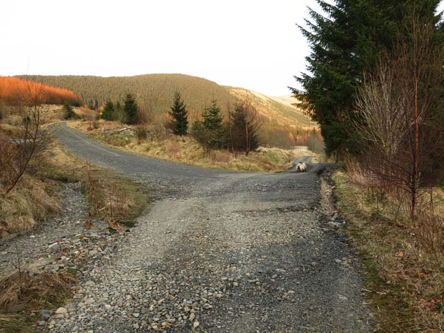
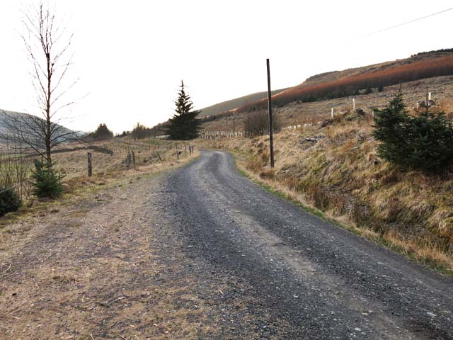
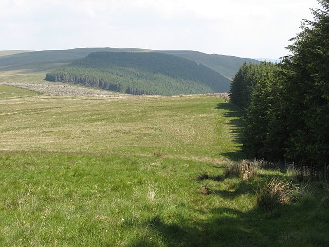
Patie's Cleuch is a picturesque valley located in the region of Dumfriesshire, Scotland. Nestled in the southern part of the country, the valley is celebrated for its natural beauty and tranquil atmosphere. The name "cleuch" refers to a narrow, steep-sided ravine or gorge, which aptly describes the topography of this enchanting landscape.

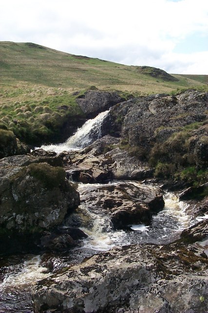
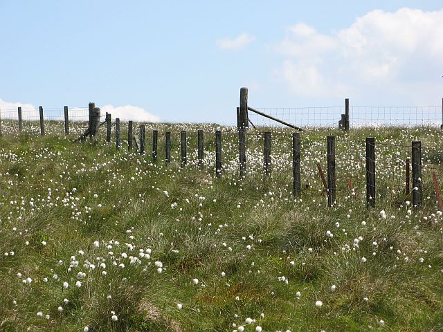
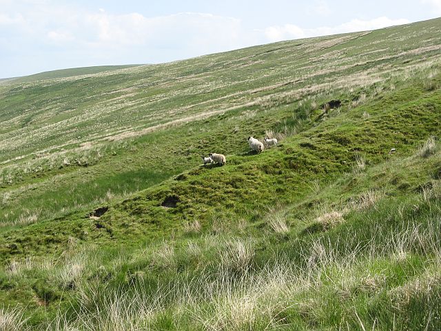
Situated amidst rolling hills and lush greenery, Patie's Cleuch offers visitors a glimpse into the unspoiled Scottish countryside. The valley is home to a diverse range of flora and fauna, including heather, wildflowers, and various species of birds. The meandering streams that flow through the valley contribute to its idyllic charm, creating a soothing soundscape that complements the surrounding scenery.

Patie's Cleuch is a haven for outdoor enthusiasts, providing ample opportunities for hiking, walking, and wildlife spotting. The valley is crisscrossed by an extensive network of trails, catering to both novice and experienced hikers. As visitors explore the valley, they can enjoy panoramic views of the surrounding hills and valleys, offering a sense of awe-inspiring beauty.

The area surrounding Patie's Cleuch is steeped in history and culture. Nearby, there are remnants of ancient settlements, providing a glimpse into the lives of those who once called this area home. The valley also boasts a rich folklore, with tales and legends that have been passed down through generations.

Whether it is the serene natural beauty, the abundance of outdoor activities, or the historical significance, Patie's Cleuch is a destination that captivates all who visit. It is a place where one can immerse themselves in the majesty of Scotland's countryside and experience a true connection with nature.

If you have any feedback on the listing, please let us know in the comments section below.

Patie's Cleuch Images

Images are sourced within 2km of 55.268793/-4.0078715 or Grid Reference NX7299. Thanks to Geograph Open Source API. All images are credited.

Forestry track on north side of Mullwhanny Showing a section of forest that has been felled and replanted
Forestry track on north side of Mullwhanny
Showing a section of forest that has been felled and replanted
Forestry track on west side of Mullwhanny
Forestry track crossing the Appin Burn
Forestry track below Peat Rig Showing an area of felled trees on the left and some wind damaged trees on the right
Forestry track below Peat Rig
Showing an area of felled trees on the left and some wind damaged trees on the right
Forestry track near the Appin Burn Showing an area of replanted young trees then mature trees and in the distance an area being felled
Forestry track near the Appin Burn
Showing an area of replanted young trees then mature trees and in the distance an area being felled
Forestry track near Shinnelhead A recently felled area of the forest, looking towards Shinnelhead
Forestry track near Shinnelhead
A recently felled area of the forest, looking towards Shinnelhead
Forestry track junction near Shinnelhead
Road from Shinnellhead The left hand fork is one of the many forestry tracks in the area
Road from Shinnellhead
The left hand fork is one of the many forestry tracks in the area
Road to Shinnellhead The road follows the Shinnel Water through a mixture of moorland and forestry
Road to Shinnellhead
The road follows the Shinnel Water through a mixture of moorland and forestry
Peat  Rig from road to Shinnelhead The Rig is the ridge; the hill right of centre is Lamgarroch
Peat Rig from road to Shinnelhead
The Rig is the ridge; the hill right of centre is Lamgarroch
Chanlock Burn,  waterfall
Chanlock Burn, waterfall
Shinnelhead West of here there's not another habitation for 6 km squares
Shinnelhead
West of here there's not another habitation for 6 km squares
Herd Naze The Shinnel Water side of the watershed is Forestry Commission land.
Herd Naze
The Shinnel Water side of the watershed is Forestry Commission land.
Fence junction, Ox Hill Fence junction amongst cotton grass on Ox Hill. Of the three sectors, only the photographer's is still grazed. The other two sides of the fences are now forestry land.
Fence junction, Ox Hill
Fence junction amongst cotton grass on Ox Hill. Of the three sectors, only the photographer's is still grazed. The other two sides of the fences are now forestry land.
Ox Hill Fence running along the summit.
Ox Hill
Fence running along the summit.
Deep grass, Ox Hill The Shinnel side of Ox Hill has not been grazed for many years as it has been fenced off for forestry. As a result the ground is soft and hard to walk on.
Deep grass, Ox Hill
The Shinnel side of Ox Hill has not been grazed for many years as it has been fenced off for forestry. As a result the ground is soft and hard to walk on.
Scaur Law The ridge running southeast from Ox Hill is owned by the Forestry Commission on the Shinnel side. The Chanlock side of the hill is still a sheep farm.
Scaur Law
The ridge running southeast from Ox Hill is owned by the Forestry Commission on the Shinnel side. The Chanlock side of the hill is still a sheep farm.
Sheep on Scaur Law Blackface ewes and lambs on the slopes of Scaur Law.
Sheep on Scaur Law
Blackface ewes and lambs on the slopes of Scaur Law.
Show me another place!

Patie's Cleuch is located at Grid Ref: NX7299 (Lat: 55.268793, Lng: -4.0078715)

Unitary Authority: Dumfries and Galloway

Police Authority: Dumfries and Galloway

What 3 Words

///clubbing.maker.tent. Near Sanquhar, Dumfries & Galloway

Nearby Locations

Patie's Cleuch

Related Wikis

Carsphairn and Scaur Hills

The Carsphairn and Scaur Hills are the western and eastern hills respectively of a hill range in the Southern Uplands of Scotland. Ordnance Survey maps...

Craigdarroch

"Craigdarroch, An Accessory to Murder" is an expansion set for the board game Kill Doctor Lucky Craigdarroch is a house near Moniaive, Dumfries and Galloway...

Moniaive

Moniaive ( 'monny-IVE'; Scottish Gaelic: Am Moine Naomh, "The Holy Moor") is a village in the Parish of Glencairn, in Dumfries and Galloway, southwest...

Moniaive railway station

Moniaive railway station is the closed station terminus of the Cairn Valley Light Railway (CVR) branch, from Dumfries. It served the rural area of Moniaive...

Have you been to Patie's Cleuch?

Leave your review of Patie's Cleuch below (or comments, questions and feedback).