Landwade

Settlement in Cambridgeshire / Suffolk West Suffolk

England

Landwade

Roundabout on Newmarket Road, Fordham Abbey The first visit <a title="https://www.geograph.org.uk/photo/6566270" href="https://www.geograph.org.uk/photo/6566270">Link</a>
Roundabout on Newmarket Road, Fordham Abbey Credit: David Howard

Landwade is a small village located on the border of Cambridgeshire and Suffolk in England. It is situated near the town of Newmarket and is surrounded by beautiful countryside and farmland. The village is known for its picturesque setting and peaceful atmosphere, making it a popular destination for those seeking a quiet retreat.

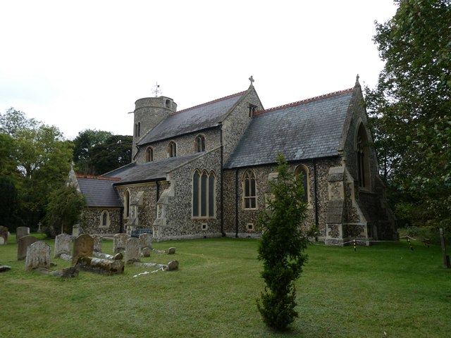
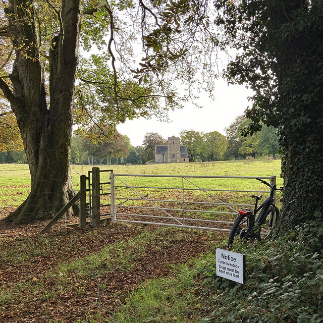
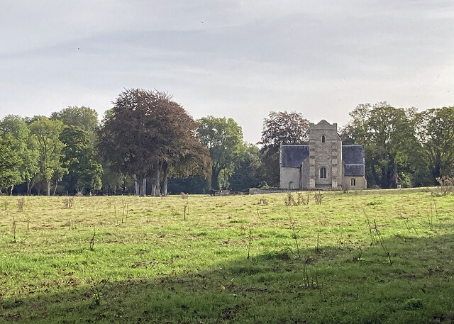
Landwade is home to a number of historic buildings, including a church dating back to the 12th century and several traditional thatched cottages. The village also has a small community hall, where local events and gatherings are held throughout the year.

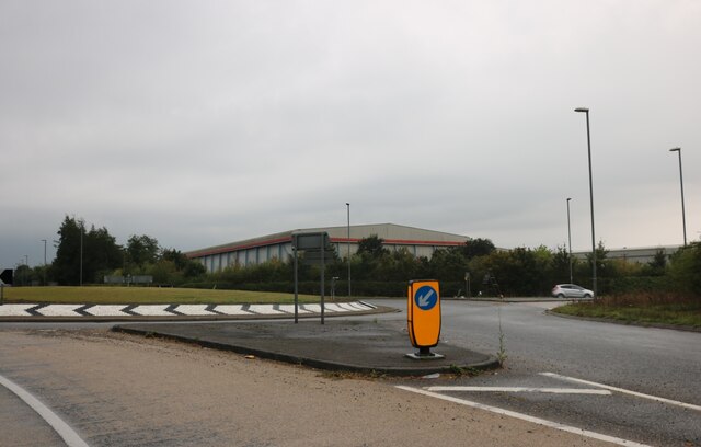
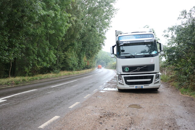
Although Landwade is a small village, it is well-connected to nearby towns and cities via road and public transportation. The village is just a short drive from Newmarket, where residents can find a range of amenities including shops, restaurants, and schools.

Overall, Landwade is a charming and idyllic village that offers a peaceful and tranquil way of life for its residents. It is a perfect place for those looking to escape the hustle and bustle of city life and enjoy the beauty of the English countryside.

If you have any feedback on the listing, please let us know in the comments section below.

Landwade Images

Images are sourced within 2km of 52.285699/0.377307 or Grid Reference TL6267. Thanks to Geograph Open Source API. All images are credited.

Roundabout on Newmarket Road, Fordham Abbey The first visit <a title="https://www.geograph.org.uk/photo/6566270" href="https://www.geograph.org.uk/photo/6566270">Link</a>
Roundabout on Newmarket Road, Fordham Abbey
The first visit Link
Lorry parked on Fordham Road
Layby on Fordham Road
A restricted byway on the edge of Suffolk This track runs from Landwade to the B1103 between Exning and Burwell (ahead). On a bright August morning the sun was briefly behind a scrap of high cloud.
A restricted byway on the edge of Suffolk
This track runs from Landwade to the B1103 between Exning and Burwell (ahead). On a bright August morning the sun was briefly behind a scrap of high cloud.
A line of trees on the edge of Suffolk The trees on the other side of this narrow field next to a restricted byway line the former course of the Cambridge to Mildenhall railway line, which is also the county boundary hereabouts. The line closed in the 1960s.

In the first week of August the harvest is well advanced in this part of East Anglia.
A line of trees on the edge of Suffolk
The trees on the other side of this narrow field next to a restricted byway line the former course of the Cambridge to Mildenhall railway line, which is also the county boundary hereabouts. The line closed in the 1960s. In the first week of August the harvest is well advanced in this part of East Anglia.
Beechams House and the course of the Mildenhall branch line Beechams House was originally a crossing-keeper's cottage. This is where the lanes from Exning to the top end of Burwell crossed the railway, whose course to Cambridge is ahead, to the left of the tall tree. The line's course is also the boundary between Suffolk (left) and Cambridgeshire for the next three-quarters of a mile or so.
Beechams House and the course of the Mildenhall branch line
Beechams House was originally a crossing-keeper's cottage. This is where the lanes from Exning to the top end of Burwell crossed the railway, whose course to Cambridge is ahead, to the left of the tall tree. The line's course is also the boundary between Suffolk (left) and Cambridgeshire for the next three-quarters of a mile or so.
Plantation and field boundary East of Haycroft Lane in the low chalk hills between Burwell and Newmarket. The lane here is the county boundary and this is the Suffolk side.
Plantation and field boundary
East of Haycroft Lane in the low chalk hills between Burwell and Newmarket. The lane here is the county boundary and this is the Suffolk side.
Farmland seen from Landwade Road
St Peter, Snailwell: early October 2023 How my heart leaps when I see a round towered church <span class="nowrap"><a title="https://en.wikipedia.org/wiki/Round-tower_church" rel="nofollow ugc noopener" href="https://en.wikipedia.org/wiki/Round-tower_church">Link</a><img style="margin-left:2px;" alt="External link" title="External link - shift click to open in new window" src="https://s1.geograph.org.uk/img/external.png" width="10" height="10"/></span>
St Peter, Snailwell: early October 2023
How my heart leaps when I see a round towered church LinkExternal link
Towards Landwade Church St Nicholas is a 15th-century Grade II* listed church.
Towards Landwade Church
St Nicholas is a 15th-century Grade II* listed church.
Landwade: St Nicholas "Built c.1445 for Sir Walter Cotton. Cruciform plan and west tower. Some re-used Barnack stone and limestone dressings, flint and pebble rubble originally plastered. Interior details in clunch. Welsh slate roofs; plain tile pyramidal tower roof and pent roof to tower turret. Two massive gault brick buttresses, mid C19, to west elevation of tower" (from the Grade II* listing).
Landwade: St Nicholas
"Built c.1445 for Sir Walter Cotton. Cruciform plan and west tower. Some re-used Barnack stone and limestone dressings, flint and pebble rubble originally plastered. Interior details in clunch. Welsh slate roofs; plain tile pyramidal tower roof and pent roof to tower turret. Two massive gault brick buttresses, mid C19, to west elevation of tower" (from the Grade II* listing).
Farm cottages at Landwade Landwade Road, from Exning, ends here, but continues as a restricted byway to North End.
Farm cottages at Landwade
Landwade Road, from Exning, ends here, but continues as a restricted byway to North End.
Landwade: a gated farm track Looking out into The Fens on an early-autumn morning.
Landwade: a gated farm track
Looking out into The Fens on an early-autumn morning.
Restricted byway to Landwade Part of the wooded northern stretch of a byway from North End to Landwade (ahead).
Restricted byway to Landwade
Part of the wooded northern stretch of a byway from North End to Landwade (ahead).
A solar farm in The Fens Seen from the restricted byway from North End to Landwade (right) on an early-autumn morning.
A solar farm in The Fens
Seen from the restricted byway from North End to Landwade (right) on an early-autumn morning.
On the way to Landwade The southern section of a restricted byway from North End to Landwade.
On the way to Landwade
The southern section of a restricted byway from North End to Landwade.
Exning: North End House One of several large houses on North End.
Exning: North End House
One of several large houses on North End.
Exning: Northmore Stud Farm, North End The Grade II listed 16th/17th-century farmhouse has twentieth-century additions. The pantiled outbuildings on the left have clunch walls.
Exning: Northmore Stud Farm, North End
The Grade II listed 16th/17th-century farmhouse has twentieth-century additions. The pantiled outbuildings on the left have clunch walls.
Show me another place!

Landwade is located at Grid Ref: TL6267 (Lat: 52.285699, Lng: 0.377307)

Administrative County: Suffolk

District: West Suffolk

Police Authority: Suffolk

What 3 Words

///translate.riverside.devotion. Near Exning, Suffolk

Nearby Locations

Landwade

Related Wikis

Landwade

Landwade is a village and former civil parish, now in the parish of Exning, in the West Suffolk district, in the county of Suffolk, England. It is 4 miles...

Snailwell Meadows

Snailwell Meadows is a 14.8-hectare (37-acre) biological Site of Special Scientific Interest in Snailwell in Cambridgeshire.The meadows are on peat overlying...

Fordham railway station

Fordham railway station is a disused railway station that served the village of Fordham, Cambridgeshire. Opened in 1879, the station formed the junction...

Brackland Rough

Brackland Rough is a 10.7-hectare (26-acre) biological Site of Special Scientific Interest in Fordham in Cambridgeshire. It is managed by the Wildlife...

Nearby Amenities

Located within 500m of 52.285699,0.377307
Power: pole
Lat/Long: 52.28763/0.3718076
Power: pole
Lat/Long: 52.2868917/0.3709386
Power: pole
Lat/Long: 52.2882436/0.372285
Post Box
Collection Times: Mo-Fr 16:30; Sa 11:30
Operator: Royal Mail
Post Box Design: hovis
Post Box Mounting: wooden_post
Post Box Type: lamp
Ref: CB8 103
Royal Cypher: GR
Royal Cypher Wikidata: Q33102273
Source: survey
Lat/Long: 52.2821871/0.3769973
The data included in this document is from www.openstreetmap.org. The data is made available under ODbL.

Have you been to Landwade?

Leave your review of Landwade below (or comments, questions and feedback).