Cwm Moch

Valley in Merionethshire

Wales

Cwm Moch

A small and sparse wood above Nant Pasgan valley
A small and sparse wood above Nant Pasgan valley Credit: David Medcalf

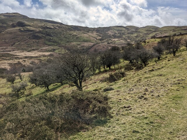
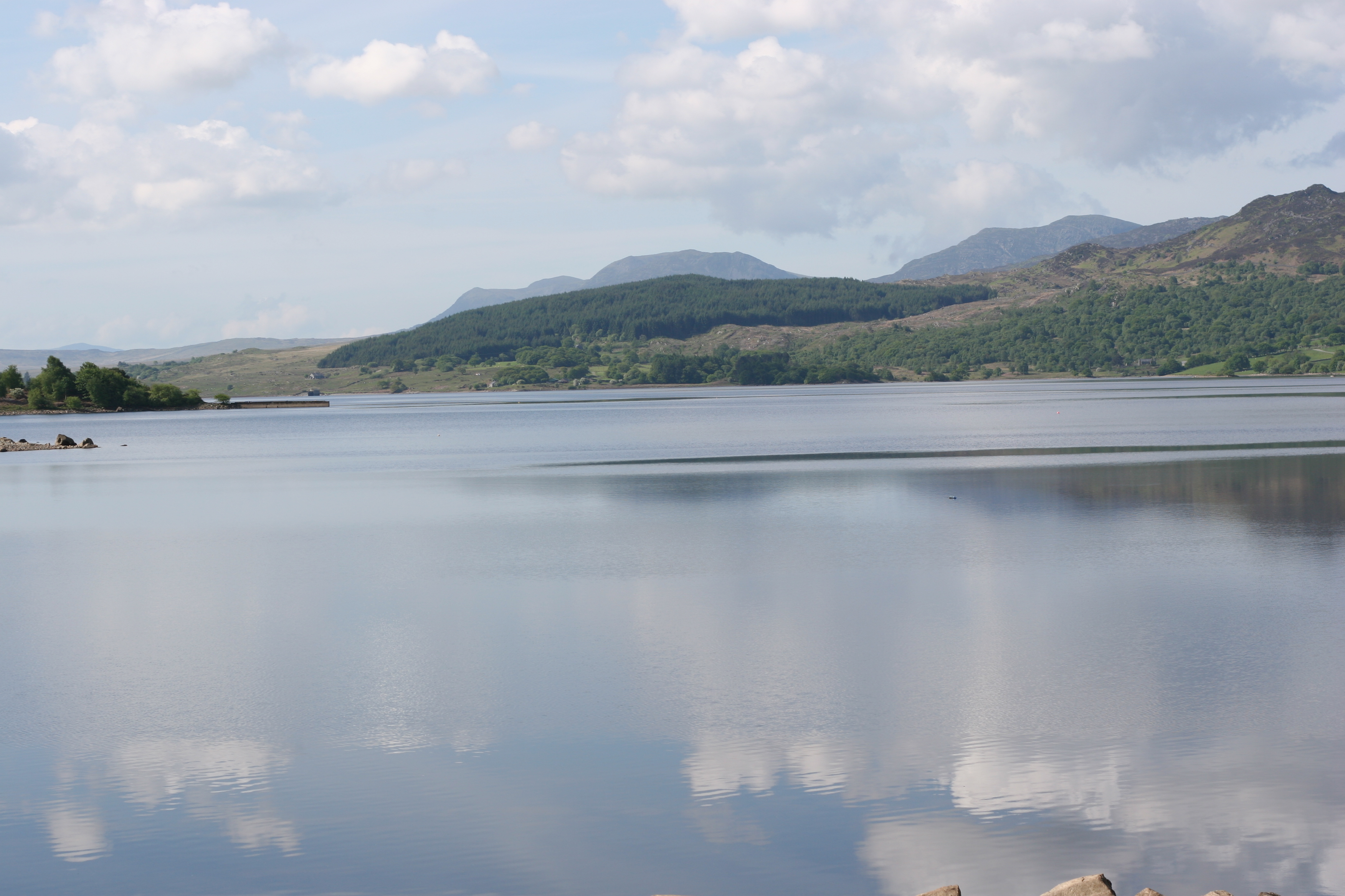
Cwm Moch is a picturesque valley located in the county of Merionethshire, Wales. Nestled in the heart of Snowdonia National Park, this valley offers breathtaking natural beauty and a tranquil atmosphere.

The valley is surrounded by majestic mountains, including Cadair Idris and Rhinog Fawr, which provide a stunning backdrop to the scenic landscape. The river Moch flows through the valley, creating a series of cascades and waterfalls that add to its charm.

Cwm Moch is known for its diverse wildlife and rich biodiversity. The valley is home to a wide range of plant and animal species, including rare birds such as the peregrine falcon and the red kite. It also boasts a variety of wildflowers and ferns, adding bursts of color to the green meadows and hillsides.

Hiking and walking trails crisscross the valley, offering outdoor enthusiasts the opportunity to explore its beauty up close. The popular Precipice Walk, which follows the edge of the valley, provides stunning panoramic views of the surrounding countryside.

Cwm Moch is also a popular spot for camping and picnicking. Several designated areas offer facilities for visitors to enjoy a day out in nature, surrounded by the peaceful ambiance of the valley.

Overall, Cwm Moch is a hidden gem in Merionethshire, offering a peaceful retreat for those seeking to connect with nature and experience the beauty of the Welsh countryside.

If you have any feedback on the listing, please let us know in the comments section below.

Cwm Moch Images

Images are sourced within 2km of 52.907365/-3.9864348 or Grid Reference SH6636. Thanks to Geograph Open Source API. All images are credited.

A small and sparse wood above Nant Pasgan valley
Scrubland above Nant Pasgan valley
Fields above Nant Pasgan Looking northeast towards Llyn Llenyrch, which is just visible.
Fields above Nant Pasgan
Looking northeast towards Llyn Llenyrch, which is just visible.
Trawsfynydd dam viewed from the lake
Entering the lagoon Formerly used to channel cooling water for the power station.
Entering the lagoon
Formerly used to channel cooling water for the power station.
Wild camp on Moel y Gyrafolen A night out for the lunar eclipse
Wild camp on Moel y Gyrafolen
A night out for the lunar eclipse
The crown-like silhouette of Bryn Cader Faner This is the view from the south. The monument is situated on rise above an area of blanket bog.
The crown-like silhouette of Bryn Cader Faner
This is the view from the south. The monument is situated on rise above an area of blanket bog.
The Bryn Cader Faner Bronze Age Cairn <span class="nowrap"><a title="https://en.wikipedia.org/wiki/Bryn_Cader_Faner" rel="nofollow ugc noopener" href="https://en.wikipedia.org/wiki/Bryn_Cader_Faner">Link</a><img style="margin-left:2px;" alt="External link" title="External link - shift click to open in new window" src="https://s1.geograph.org.uk/img/external.png" width="10" height="10"/></span>
The Bryn Cader Faner Bronze Age Cairn
New Cycle trail around Llyn Trawsfynydd View of new cycle trail, chunky gravel, very steep as trail heads over headland
New Cycle trail around Llyn Trawsfynydd
View of new cycle trail, chunky gravel, very steep as trail heads over headland
Above Moelfryn-uchaf
Ruined Shelter Below Moel Y Gyrafolen
Below Craig Y Gwynt
Below Craig Y Gwynt
Above Cwm Moch
Above Cwm Moch
The Plateau Of Diffwys A haven for red grouse.
The Plateau Of Diffwys
A haven for red grouse.
The Summit Of Foel Penolau Showing the cleft between the two rock plateaus that make up the summit.  I sometimes wonder if this gave rise to the less 'polite' meaning of the name.
The Summit Of Foel Penolau
Showing the cleft between the two rock plateaus that make up the summit. I sometimes wonder if this gave rise to the less 'polite' meaning of the name.
Trig Point, Moel Ysgyfarnogod
Cefn Y Clawdd Manganese Workings Started during the first world war, work ended in the twenties.
Cefn Y Clawdd Manganese Workings
Started during the first world war, work ended in the twenties.
Boundary Wall And Simple Bridge Above Cefn Clawdd The track to the old manganese workings crosses a small stream using slabs.
Boundary Wall And Simple Bridge Above Cefn Clawdd
The track to the old manganese workings crosses a small stream using slabs.
Show me another place!

Cwm Moch is located at Grid Ref: SH6636 (Lat: 52.907365, Lng: -3.9864348)

Unitary Authority: Gwynedd

Police Authority: North Wales

What 3 Words

///messaging.downfield.thud. Near Trawsfynydd, Gwynedd

Nearby Locations

Cwm Moch

Related Wikis

Foel Penolau

Foel Penolau is a mountain close to Moel Ysgyfarnogod in Snowdonia, North Wales and is the northernmost summit of the Rhinogydd, and overlooks Llyn Trawsfynydd...

Coed y Rhygen National Nature Reserve

Coed y Rhygen National Nature Reserve is located on the western shore of Llyn Trawsfynydd in Gwynedd, North Wales. As an example of Atlantic Rainforest...
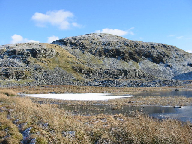
Moel Ysgyfarnogod

Moel Ysgyfarnogod ('Bare hill of the hares' in Welsh) is a mountain in Snowdonia, North Wales and is the northernmost of the Rhinogydd. Rhinog Fawr lies...
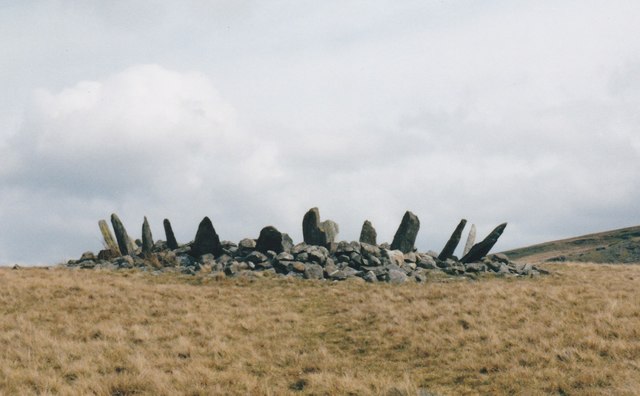
Bryn Cader Faner

Bryn Cader Faner is a Bronze Age round cairn which lies to the east of the small hamlet of Talsarnau in the Ardudwy area of Gwynedd in Wales. The diameter...

Llyn Trawsfynydd

Llyn Trawsfynydd is a large artificial reservoir situated near the village of Trawsfynydd in Gwynedd, North Wales. With a total surface area of 4.8 km2...

Trawsfynydd nuclear power station

Trawsfynydd nuclear power station (Welsh: Atomfa Trawsfynydd) is a former Magnox nuclear power station situated in Snowdonia National Park in Gwynedd,...

Maentwrog power station

Maentwrog power station was built by the North Wales Power Company and supplied electricity to North Wales, Deeside and Cheshire. It exploits the water...

Llandecwyn

Llandecwyn () is a hamlet near Penrhyndeudraeth in Gwynedd, Wales. The bulk of the population (between 40 and 50 houses) is now located around Cilfor close...

Nearby Amenities

Located within 500m of 52.907365,-3.9864348
Barrier: stile
Bicycle: no
Material: wood
Stile: ladder
Lat/Long: 52.9075643/-3.9888365
Hut Circle
Archaeological Site: hut_circle
Historic: archaeological_site
Lat/Long: 52.9090595/-3.9897002
Hut Circle
Archaeological Site: hut_circle
Historic: archaeological_site
Lat/Long: 52.9088371/-3.9897143
Hut Circles
Archaeological Site: settlement
Historic: archaeological_site
Lat/Long: 52.9083593/-3.9891313
Cwm Moch Ancient Settlement
Archaeological Site: settlement
Historic: archaeological_site
Historic Civilization: iron-age
Lat/Long: 52.9069434/-3.9866888
Ford: yes
Lat/Long: 52.9070924/-3.9861605
Hut Circle
Archaeological Site: hut_circle
Historic: archaeological_site
Historic Civilization: iron-age
Lat/Long: 52.9072429/-3.9872325
Hut Circle
Archaeological Site: hut_circle
Historic: archaeological_site
Historic Civilization: iron-age
Lat/Long: 52.9074554/-3.987652
Hut Circle
Archaeological Site: hut_circle
Historic: archaeological_site
Historic Civilization: iron-age
Lat/Long: 52.9070651/-3.9872646
Hut Circle
Archaeological Site: hut_circle
Historic: archaeological_site
Historic Civilization: iron-age
Lat/Long: 52.9078902/-3.987522
The data included in this document is from www.openstreetmap.org. The data is made available under ODbL.

Have you been to Cwm Moch?

Leave your review of Cwm Moch below (or comments, questions and feedback).