Bwlch y Battel

Valley in Merionethshire

Wales

Bwlch y Battel

Llyn Cwm-y-foel from path near Llyn yr Adar
Llyn Cwm-y-foel from path near Llyn yr Adar Credit: Colin Park

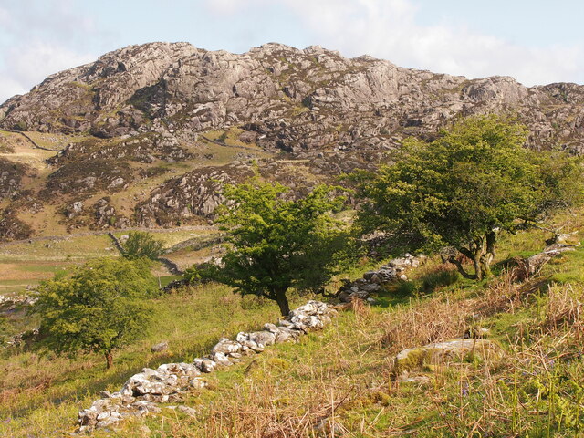
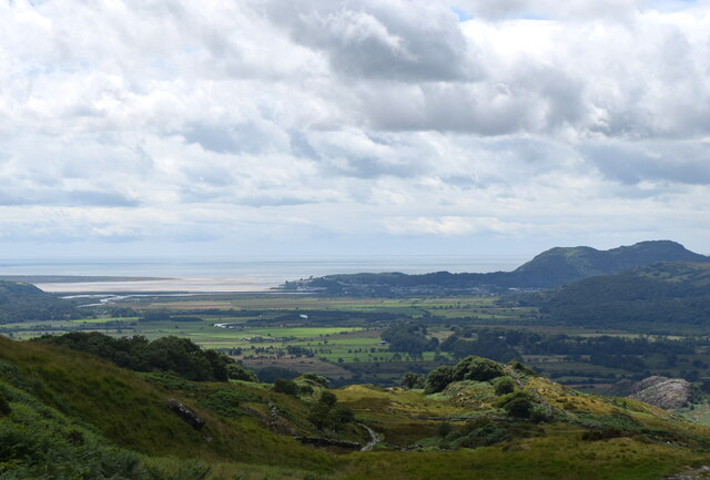
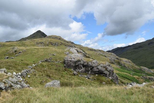
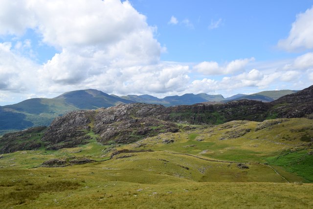
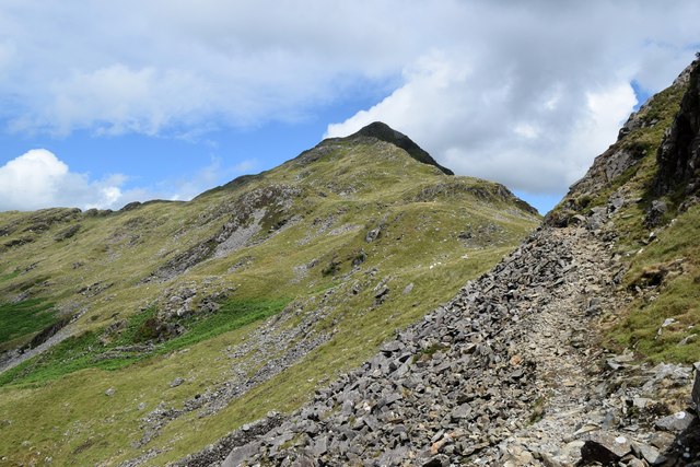
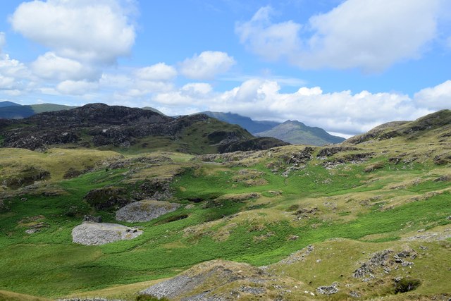
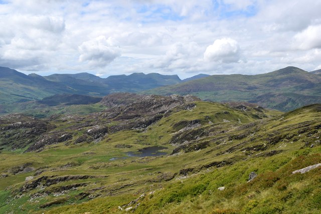
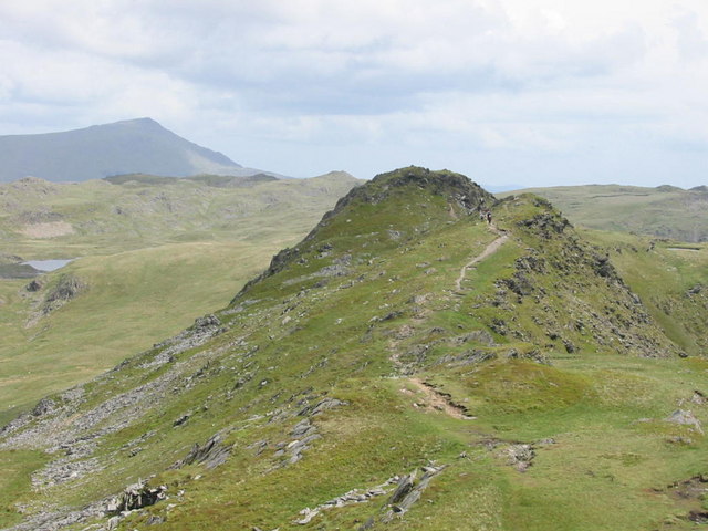
Bwlch y Battel is a small valley located in Merionethshire, Wales. The valley is situated in the heart of Snowdonia National Park, surrounded by beautiful mountains and lush greenery. Bwlch y Battel is known for its stunning natural landscapes, with rolling hills and meandering streams creating a picturesque setting for visitors to enjoy.

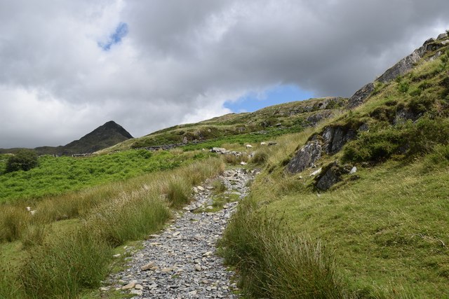
The valley is popular with hikers and outdoor enthusiasts, as it offers a variety of walking trails and opportunities for exploring the great outdoors. One of the most well-known trails in the area is the Bwlch y Battel Circular Walk, which takes visitors on a scenic journey through the valley and surrounding countryside.

In addition to its natural beauty, Bwlch y Battel is also home to a number of historic sites and landmarks. The valley is dotted with ancient ruins and remnants of old settlements, providing a glimpse into the area's rich history.

Overall, Bwlch y Battel is a peaceful and serene destination for those looking to escape the hustle and bustle of everyday life and immerse themselves in the beauty of nature.

If you have any feedback on the listing, please let us know in the comments section below.

Bwlch y Battel Images

Images are sourced within 2km of 53.003684/-4.0305007 or Grid Reference SH6347. Thanks to Geograph Open Source API. All images are credited.

Llyn Cwm-y-foel from path near Llyn yr Adar
Landscape North of Croesor Yr Arddu in the background.
Landscape North of Croesor
Yr Arddu in the background.
Climbing towards Cnicht The path of slate and granite chips is mostly well-defined.  Cnicht looms in the background.
Climbing towards Cnicht
The path of slate and granite chips is mostly well-defined. Cnicht looms in the background.
Looking back towards the coast The Glaslyn estuary and Porthmadog, some 10 km away, with clouds starting to gather...
Looking back towards the coast
The Glaslyn estuary and Porthmadog, some 10 km away, with clouds starting to gather...
Sheep by the path... ...on the way to Cnicht.  They seemed surprised to see me, perhaps they had a sense that a storm was blowing in...    The rock is (I think) part of an intrusion of igneous bedrock formed between 485.4 and 443.8 million years ago during the Ordovician period.
Sheep by the path...
...on the way to Cnicht. They seemed surprised to see me, perhaps they had a sense that a storm was blowing in... The rock is (I think) part of an intrusion of igneous bedrock formed between 485.4 and 443.8 million years ago during the Ordovician period.
Climbing towards Cnicht The terrain is getting rockier but there is still a long way to go...
Climbing towards Cnicht
The terrain is getting rockier but there is still a long way to go...
Looking towards Yr Arddu Yr Arddu is an igneous intrusion of rhyolite, being bedrock formed between 485.4 and 443.8 million years ago during the Ordovician period.   There are countless sheep in the blown-up photo...
Looking towards Yr Arddu
Yr Arddu is an igneous intrusion of rhyolite, being bedrock formed between 485.4 and 443.8 million years ago during the Ordovician period. There are countless sheep in the blown-up photo...
Scramble over the scree... ...on the way to Cnicht.    There is a path of sorts, but this is maybe the trickiest point of the ascent.
Scramble over the scree...
...on the way to Cnicht. There is a path of sorts, but this is maybe the trickiest point of the ascent.
Snowdonia glacial landscape Drumlins and waste heaps from abandoned late quarries.
Snowdonia glacial landscape
Drumlins and waste heaps from abandoned late quarries.
Clambering to Cnicht The 'Matterhorn' like peak is getting steeper but the path is well-defined and steady progress can be made...
Clambering to Cnicht
The 'Matterhorn' like peak is getting steeper but the path is well-defined and steady progress can be made...
Vista of Cwm Creosor This spectacular view suddenly appears from the ridge south of the summit.
Vista of Cwm Creosor
This spectacular view suddenly appears from the ridge south of the summit.
Glacial landscape south of Bwlch y Battel Rocks scoured and scraped by a glacier some 10,000 years ago.   A footpath on the OS map seems to pass through the middle of the lake.
Glacial landscape south of Bwlch y Battel
Rocks scoured and scraped by a glacier some 10,000 years ago. A footpath on the OS map seems to pass through the middle of the lake.
Cnicht: rocks at the top The 689-metre summit affords spectacular views, but there is no trig point.    The clouds are starting to look a little ominous.
Cnicht: rocks at the top
The 689-metre summit affords spectacular views, but there is no trig point. The clouds are starting to look a little ominous.
Looking back down the ridge... ...from the summit of Cnicht.    Porthmadog can just be seen in the far distance.
Looking back down the ridge...
...from the summit of Cnicht. Porthmadog can just be seen in the far distance.
Landscape with slate waste The upper reaches of Cwm Croesor are littered with rubble and quarry waste.    Various ruined inclines and tramways can be seen in the blown-up photo.
Landscape with slate waste
The upper reaches of Cwm Croesor are littered with rubble and quarry waste. Various ruined inclines and tramways can be seen in the blown-up photo.
Light and shade in Cwm Croesor... ...as seen from Cnicht.
Light and shade in Cwm Croesor...
...as seen from Cnicht.
Looking north-west from Cnicht The minor road from the A4085 to Bethania can just be seen in the distance.
Looking north-west from Cnicht
The minor road from the A4085 to Bethania can just be seen in the distance.
Path along the ridge
Show me another place!

Bwlch y Battel is located at Grid Ref: SH6347 (Lat: 53.003684, Lng: -4.0305007)

Unitary Authority: Gwynedd

Police Authority: North Wales

What 3 Words

///condition.glider.windpipe. Near Blaenau-Ffestiniog, Gwynedd

Related Wikis

Cnicht

Cnicht is a mountain in Snowdonia which forms part of the Moelwynion mountain range. == Features == Its appearance when viewed from the south-west, i.e...

Cnicht North Top

Cnicht North Top is a top of Cnicht in Snowdonia, which forms part of the Moelwynion mountain range. It is one of the Nuttalls, a list of 443 hills in...

Yr Arddu (South)

Yr Arddu is a large hill in Snowdonia, Wales (Not to be confused with the 589 metre Yr Arddu (North) to the east of Snowdon). It lies approximately 2.5...

Hafod Garregog National Nature Reserve

Hafod Garegog National Nature Reserve is a national nature reserve located near the village of Nantmor, about 6 kilometres north of Porthmadog in Gwynedd...

Nearby Amenities

Located within 500m of 53.003684,-4.0305007
Bwlch y Battel
Image: https://www.geograph.org.uk/photo/6504295
Natural: saddle
Lat/Long: 53.0016723/-4.0323286
Ford: yes
Lat/Long: 53.0035691/-4.0306972
Settlements
Historic: archaeological_site
Lat/Long: 53.0058258/-4.0312306
Settlements
Historic: archaeological_site
Lat/Long: 53.0076348/-4.0338017
Hut Circle
Historic: archaeological_site
Lat/Long: 53.0061178/-4.0316537
Ford: yes
Lat/Long: 53.0007379/-4.0327749
Ford: yes
Lat/Long: 53.0009135/-4.0248399
Ford: stepping_stones
Lat/Long: 53.0070712/-4.0327093
Ford: stepping_stones
Lat/Long: 53.0075099/-4.0333321
The data included in this document is from www.openstreetmap.org. The data is made available under ODbL.

Have you been to Bwlch y Battel?

Leave your review of Bwlch y Battel below (or comments, questions and feedback).