Nant Ffrancon

Valley in Caernarfonshire

Wales

Nant Ffrancon

Emerging onto flat ground A few minutes after <a href="https://www.geograph.org.uk/photo/1671327">SH6562 : Down the headwall of Cwm Ffynnon Lloer, winter conditions</a>, and just about at the top of the steep frozen snowslope that covered the scree on the hillside. The steep craggy buttresses of Craig Lloer are visible behind the climber, with a tiny patch of open water in Llyn Lloer in the depths of the cwm below.
Emerging onto flat ground Credit: Richard Law

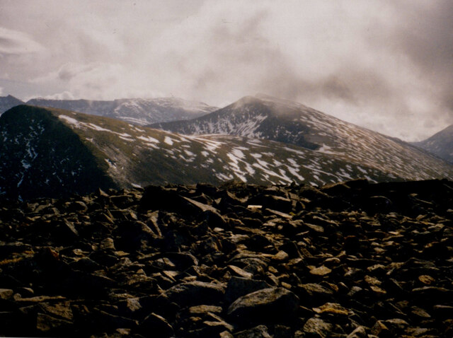
Nant Ffrancon is a picturesque valley located in the county of Caernarfonshire, in the north-west of Wales. The valley is situated within the Snowdonia National Park, known for its stunning natural beauty and diverse wildlife.

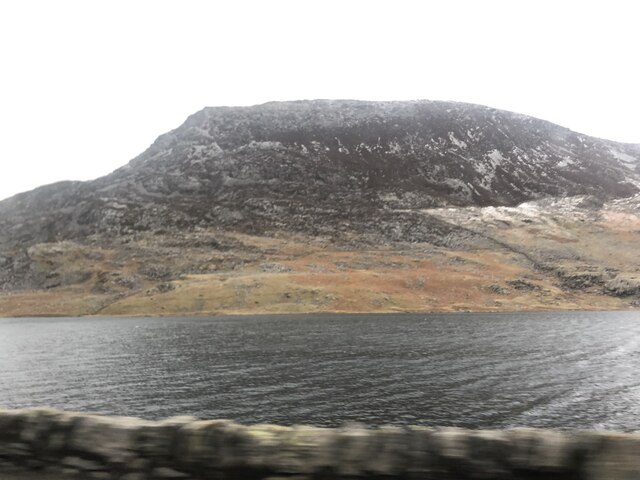
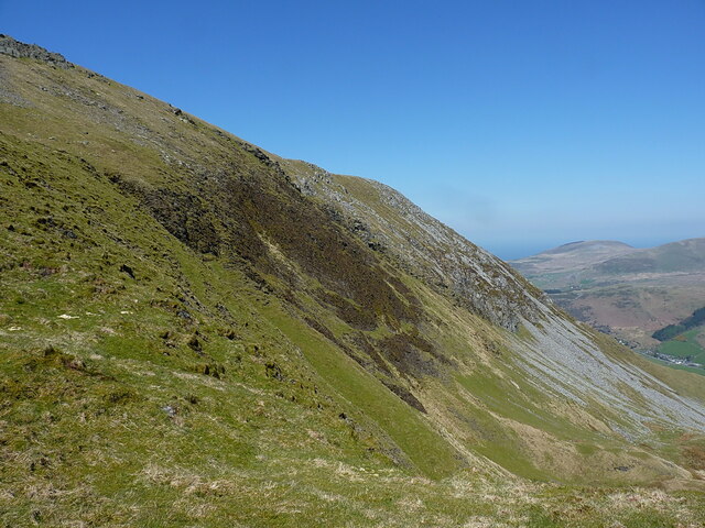
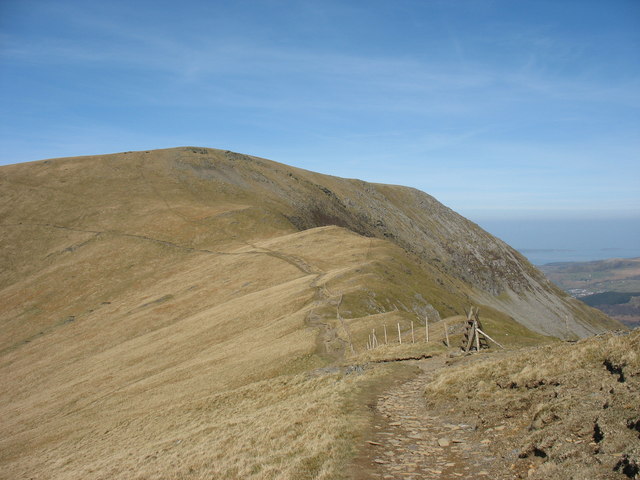
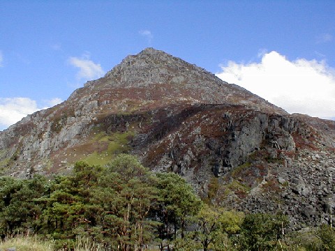
The valley is surrounded by majestic mountains, including Tryfan and the Glyderau range, providing a dramatic backdrop for visitors to enjoy. The valley is also home to the Nant Ffrancon Pass, a popular route for hikers and cyclists looking to explore the rugged terrain and take in the breathtaking views.

Nant Ffrancon is a haven for outdoor enthusiasts, offering a range of activities such as hiking, rock climbing, and birdwatching. The valley is also home to a variety of plant and animal species, making it a great spot for nature lovers to explore and appreciate the local flora and fauna.

Visitors to Nant Ffrancon can enjoy the tranquility and serenity of the valley, as well as the opportunity to immerse themselves in the stunning natural surroundings. Whether it's a leisurely stroll or a challenging mountain climb, Nant Ffrancon has something to offer for everyone seeking a peaceful escape in the heart of Snowdonia.

If you have any feedback on the listing, please let us know in the comments section below.

Nant Ffrancon Images

Images are sourced within 2km of 53.143862/-4.0375727 or Grid Reference SH6362. Thanks to Geograph Open Source API. All images are credited.

Emerging onto flat ground A few minutes after <a href="https://www.geograph.org.uk/photo/1671327">SH6562 : Down the headwall of Cwm Ffynnon Lloer, winter conditions</a>, and just about at the top of the steep frozen snowslope that covered the scree on the hillside. The steep craggy buttresses of Craig Lloer are visible behind the climber, with a tiny patch of open water in Llyn Lloer in the depths of the cwm below.
Emerging onto flat ground
A few minutes after SH6562 : Down the headwall of Cwm Ffynnon Lloer, winter conditions, and just about at the top of the steep frozen snowslope that covered the scree on the hillside. The steep craggy buttresses of Craig Lloer are visible behind the climber, with a tiny patch of open water in Llyn Lloer in the depths of the cwm below.
Foel Goch and Y Garn from the block field on Moel Perfedd
Tai-newyddion (new houses) on the map Now this is the Snowdonia Mountain Hostel, in a wonderful setting.
Tai-newyddion (new houses) on the map
Now this is the Snowdonia Mountain Hostel, in a wonderful setting.
The old road up the Nant Ffrancon
Fields in the Nant Ffrancon
Looking down the Nant Ffrancon
The A5 heading south from Bethesda The conical peak of Tryfan at centre
The A5 heading south from Bethesda
The conical peak of Tryfan at centre
Pen yr Ole Wen from across Llyn Ogwen Pen yr Ole Wen is the seventh highest mountain in Snowdonia and is the same height as England's highest, Scafell Pike. It is the most southerly of the Carneddau range.
Pen yr Ole Wen from across Llyn Ogwen
Pen yr Ole Wen is the seventh highest mountain in Snowdonia and is the same height as England's highest, Scafell Pike. It is the most southerly of the Carneddau range.
Cairn on the summit of Carnedd y Filiast On the other side of the Marchlyn Valley is Elidir Fach with the disused Marchlyn Quarry on its north-eastern flank.
Cairn on the summit of Carnedd y Filiast
On the other side of the Marchlyn Valley is Elidir Fach with the disused Marchlyn Quarry on its north-eastern flank.
View north along Nant Ffrancon The Nant Ffrancon is a steep-sided glacial valley which runs between Bethesda in the north to Llyn Ogwen in the south, a distance of about 3½ miles. The A5 road runs along the east side of the valley, the original road, Lord Penrhyn's Highway, runs along the west side of the valley. The Afon/River Ogwen meanders along the floor of the valley.
View north along Nant Ffrancon
The Nant Ffrancon is a steep-sided glacial valley which runs between Bethesda in the north to Llyn Ogwen in the south, a distance of about 3½ miles. The A5 road runs along the east side of the valley, the original road, Lord Penrhyn's Highway, runs along the west side of the valley. The Afon/River Ogwen meanders along the floor of the valley.
Nant Ffrancon The Nant Ffrancon is a steep-sided glacial valley which runs between Bethesda in the north to Llyn Ogwen in the south, a distance of about 3½ miles. The A5 road runs along the east side of the valley, the original road, Lord Penrhyn's Highway, runs along the west side of the valley. The Afon/River Ogwen meanders along the floor of the valley.
Nant Ffrancon
The Nant Ffrancon is a steep-sided glacial valley which runs between Bethesda in the north to Llyn Ogwen in the south, a distance of about 3½ miles. The A5 road runs along the east side of the valley, the original road, Lord Penrhyn's Highway, runs along the west side of the valley. The Afon/River Ogwen meanders along the floor of the valley.
View south along Nant Ffrancon The Nant Ffrancon is a steep-sided glacial valley which runs between Bethesda in the north to Llyn Ogwen in the south, a distance of about 3½ miles. The A5 road runs along the east side of the valley, the original road, Lord Penrhyn's Highway, runs along the west side of the valley. The Afon/River Ogwen meanders along the floor of the valley.
View south along Nant Ffrancon
The Nant Ffrancon is a steep-sided glacial valley which runs between Bethesda in the north to Llyn Ogwen in the south, a distance of about 3½ miles. The A5 road runs along the east side of the valley, the original road, Lord Penrhyn's Highway, runs along the west side of the valley. The Afon/River Ogwen meanders along the floor of the valley.
Path contouring below Foel Goch Rather than ascend and redescend the summit of Foel Goch, this path allows walkers to make an easy traverse of the hillside below that hill, when they're walking between Elidir Fawr and Y Garn.
Path contouring below Foel Goch
Rather than ascend and redescend the summit of Foel Goch, this path allows walkers to make an easy traverse of the hillside below that hill, when they're walking between Elidir Fawr and Y Garn.
View directly down Cwm Dudodyn Something of a hanging valley above Nant Peris, Cwm Dudodyn has a stream which flows into Llyn Peris more or less here <a href="https://www.geograph.org.uk/photo/4169217">SH6058 : Looking over Llyn Peris</a>. On the far side of the valley are the hills of Yr Wyddfa, with Moel Cynghorion and the Nantlle Ridge beyond that again.
View directly down Cwm Dudodyn
Something of a hanging valley above Nant Peris, Cwm Dudodyn has a stream which flows into Llyn Peris more or less here SH6058 : Looking over Llyn Peris. On the far side of the valley are the hills of Yr Wyddfa, with Moel Cynghorion and the Nantlle Ridge beyond that again.
Wind shelter and a standing stone on Mynydd Perfedd The wind shelter looks to have been recently rebuilt, it's certainly tidier than it was in 2007 <a href="https://www.geograph.org.uk/photo/543166">SH6261 : Cairn shelter on summit of Mynydd Perfedd</a>  and <a href="https://www.geograph.org.uk/photo/580782">SH6261 : Summit Cairn of Mynydd Perfedd</a>, and is a perfect place to sit and boil up a packet of soup. The slightly tilted standing stone in the foreground isn't marked on the OS maps, nor recorded by any of the archeological surveys that I can find, so I'm assuming it's not of antiquity.
Wind shelter and a standing stone on Mynydd Perfedd
The wind shelter looks to have been recently rebuilt, it's certainly tidier than it was in 2007 SH6261 : Cairn shelter on summit of Mynydd Perfedd and SH6261 : Summit Cairn of Mynydd Perfedd, and is a perfect place to sit and boil up a packet of soup. The slightly tilted standing stone in the foreground isn't marked on the OS maps, nor recorded by any of the archeological surveys that I can find, so I'm assuming it's not of antiquity.
On the plateau edge, north of Mynydd Perfedd Between Mynydd Perfedd and Carnedd y Filiast there's an extensive grassy plateau area with steep-walled cwms bitten out of the eastern side by glaciers. This is the view along the boundary line between those two habitats, with ever-steepening ground on the right.
On the plateau edge, north of Mynydd Perfedd
Between Mynydd Perfedd and Carnedd y Filiast there's an extensive grassy plateau area with steep-walled cwms bitten out of the eastern side by glaciers. This is the view along the boundary line between those two habitats, with ever-steepening ground on the right.
The steep eastern face of Mynydd Perfedd The 'headwall' of Cwm Perfedd is mainly comprised of steep(ish) scree and boulders with a partial covering of heather and grass.
The steep eastern face of Mynydd Perfedd
The 'headwall' of Cwm Perfedd is mainly comprised of steep(ish) scree and boulders with a partial covering of heather and grass.
Grassy spur between two cwms This grassy hillside separates Cwm Perfedd (off to the left) from Cwm Bual (down to the right) and initially at least provides a very reasonable descent route into the Nant Ffrancon from Bwlch Brecan, It becomes quite a bit steeper and more entertaining further down.
Grassy spur between two cwms
This grassy hillside separates Cwm Perfedd (off to the left) from Cwm Bual (down to the right) and initially at least provides a very reasonable descent route into the Nant Ffrancon from Bwlch Brecan, It becomes quite a bit steeper and more entertaining further down.
Show me another place!

Nant Ffrancon is located at Grid Ref: SH6362 (Lat: 53.143862, Lng: -4.0375727)

Unitary Authority: Gwynedd

Police Authority: North Wales

What 3 Words

///forehand.submits.promotion. Near Bethesda, Gwynedd

Nearby Locations

Nant Ffrancon

Related Wikis

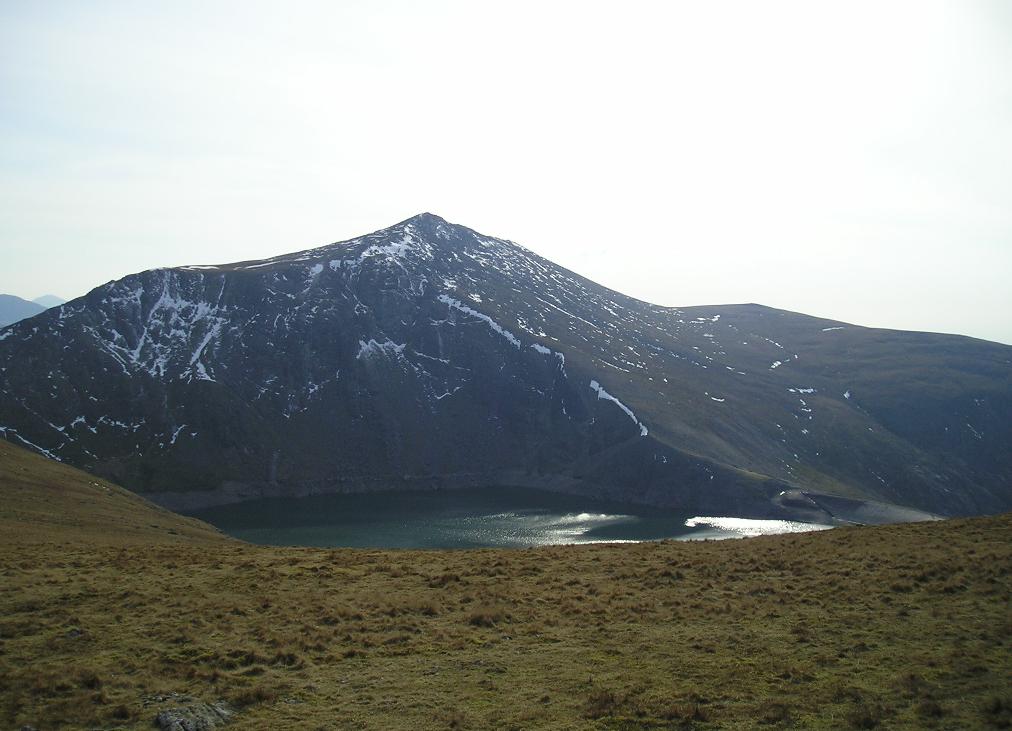
Carnedd y Filiast (Glyderau)

Carnedd y Filiast is a mountain in Snowdonia, Wales, forming part of the Glyderau. It, along with its top Y Fronllwyd (721 m), forms the most northerly...

Mynydd Perfedd

Mynydd Perfedd is a mountain in Snowdonia, Wales, forming part of the Glyderau. The summit has a shelter cairn, offering good views of Foel-goch's north...
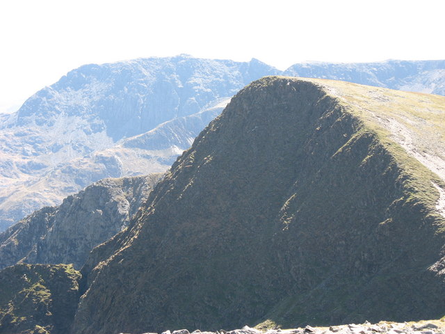
Foel-goch

Foel-goch is a mountain in Snowdonia, north-west Wales, and forms part of the Glyderau range, in Gwynedd. It lies in between Y Garn and Mynydd Perfedd...

Pen yr Ole Wen

Pen yr Ole Wen is the seventh highest mountain in Snowdonia and in Wales. It is the most southerly of the Carneddau range. The mountain lies to the north...

Related Videos

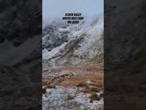
#westie #travel #photography #hiking #uk

Dog's Hilarious Photo Editing Adventure! **Title:** "Pawsitively Hilarious! Dog Edits His Own Photos on Computer!

Nearby Amenities

Located within 500m of 53.143862,-4.0375727
Waterway: weir
Lat/Long: 53.1426356/-4.0360865
Fixme: continues
Lat/Long: 53.1436629/-4.0335715
Barrier: cattle_grid
Lat/Long: 53.1402585/-4.0370356
Man Made: utility_pole
Lat/Long: 53.148211/-4.0371862
Man Made: utility_pole
Lat/Long: 53.1472911/-4.0362386
Man Made: utility_pole
Lat/Long: 53.14775/-4.0367089
Man Made: utility_pole
Lat/Long: 53.1468833/-4.0358317
Man Made: utility_pole
Lat/Long: 53.1460661/-4.0348331
Man Made: utility_pole
Lat/Long: 53.1464323/-4.0353182
Man Made: utility_pole
Lat/Long: 53.1456381/-4.0342388
Man Made: utility_pole
Lat/Long: 53.1451665/-4.033788
Man Made: utility_pole
Lat/Long: 53.1447191/-4.0334847
Man Made: utility_pole
Lat/Long: 53.1441965/-4.0332219
Man Made: utility_pole
Lat/Long: 53.1435298/-4.0324801
Man Made: utility_pole
Lat/Long: 53.143963/-4.0330788
Man Made: utility_pole
Lat/Long: 53.1426835/-4.0315231
Man Made: utility_pole
Lat/Long: 53.1430545/-4.0320365
Man Made: utility_pole
Lat/Long: 53.1422994/-4.0308017
Barrier: kissing_gate
Foot: designated
Motor Vehicle: no
Lat/Long: 53.1439964/-4.0330882
The data included in this document is from www.openstreetmap.org. The data is made available under ODbL.

Have you been to Nant Ffrancon?

Leave your review of Nant Ffrancon below (or comments, questions and feedback).