Glen Vorlich

Valley in Perthshire

Scotland

Glen Vorlich

Track in Glen Vorlich
Track in Glen Vorlich Credit: Steven Brown

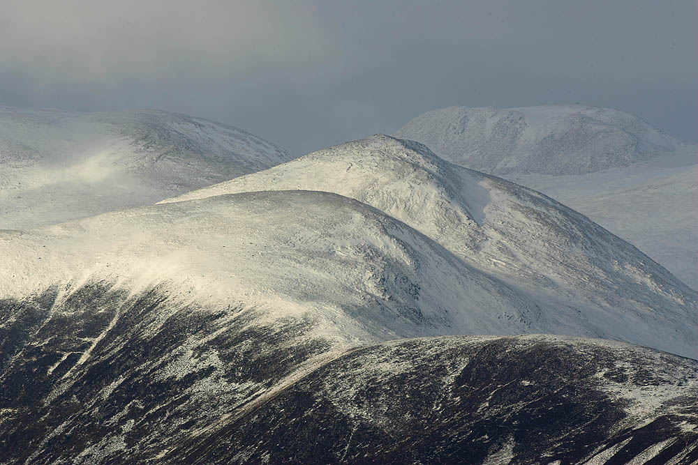
Glen Vorlich is a picturesque valley located in the county of Perthshire, Scotland. Situated in the southern part of the Scottish Highlands, it is known for its stunning natural beauty and captivating landscapes. The glen is named after the mountain peak, Ben Vorlich, which stands majestically at its eastern end.

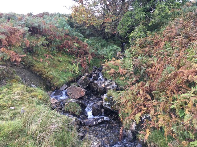
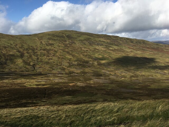
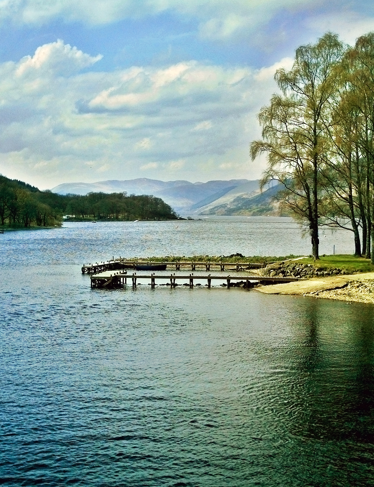
The valley is characterized by rolling hills, lush green meadows, and sparkling lochs, making it a paradise for nature lovers and outdoor enthusiasts. It is home to a diverse range of wildlife, including red deer, golden eagles, and ospreys, providing ample opportunities for wildlife spotting and birdwatching.

The glen offers a plethora of outdoor activities for visitors to enjoy. Hiking and hillwalking are particularly popular, with various trails and routes catering to different levels of experience. The ascent of Ben Vorlich itself is a challenging yet rewarding adventure, offering panoramic views of the surrounding countryside from its summit.

Fishing is another popular activity in Glen Vorlich, with its numerous lochs teeming with salmon and trout. Anglers can enjoy a serene day by the water, surrounded by the tranquility of the valley.

For those seeking a more relaxed experience, the glen is dotted with charming villages and towns, where visitors can explore local shops, pubs, and restaurants, offering a taste of traditional Scottish hospitality.

In conclusion, Glen Vorlich is a breathtaking valley in Perthshire, Scotland, offering a wealth of natural beauty, outdoor activities, and cultural experiences. It is the perfect destination for those seeking to immerse themselves in the splendor of the Scottish Highlands.

If you have any feedback on the listing, please let us know in the comments section below.

Glen Vorlich Images

Images are sourced within 2km of 56.360421/-4.2122221 or Grid Reference NN6320. Thanks to Geograph Open Source API. All images are credited.

Track in Glen Vorlich
Small stream above Glen Vorlich
Path towards Ardvorlich
Looking across towards Ben Our
Path on the northern slopes of Ben Vorlich
Ben Vorlich hill path Looking back down the path towards Glen Vorlich and Loch Earn.
Ben Vorlich hill path
Looking back down the path towards Glen Vorlich and Loch Earn.
The Ben Vorlich path winds on
Beinn Domhnuill Rough moorland to the south of Beinn Domhnuill.
Beinn Domhnuill
Rough moorland to the south of Beinn Domhnuill.
Bealach Gliogarsnaich Glen Vorlich narrowing down towards the bealach.
Bealach Gliogarsnaich
Glen Vorlich narrowing down towards the bealach.
Walkers on north ridge, Ben Vorlich Part of Loch Earn is visible in the background
Walkers on north ridge, Ben Vorlich
Part of Loch Earn is visible in the background
Approaching the summit of Ben Vorlich Most walkers that we saw (including these men) had put their crampons on for the final steep pull to the summit on snow with an icy crust, but a few seemed content to plough on with neither crampons nor ice axe (not recommended!)
Approaching the summit of Ben Vorlich
Most walkers that we saw (including these men) had put their crampons on for the final steep pull to the summit on snow with an icy crust, but a few seemed content to plough on with neither crampons nor ice axe (not recommended!)
Sgiath nan Tarmachan ('wing of the ptarmigan') This is the rather evocative name given on the map to the upper part of Ben Vorlich's south ridge.  The use of the Gaelic word sgiath in Perthshire hill names is said to indicate a place of shelter, like the crook of a wing, and usually indicates a place sheltered from the prevailing westerly winds, such as the crook formed by the bend in the ridge here.

Loch Earn lies down below, with Ben Lawers visible through the cloud layers.
Sgiath nan Tarmachan ('wing of the ptarmigan')
This is the rather evocative name given on the map to the upper part of Ben Vorlich's south ridge. The use of the Gaelic word sgiath in Perthshire hill names is said to indicate a place of shelter, like the crook of a wing, and usually indicates a place sheltered from the prevailing westerly winds, such as the crook formed by the bend in the ridge here. Loch Earn lies down below, with Ben Lawers visible through the cloud layers.
Descending into Coire Buidhe ('yellow corrie') The slopes sweep up to the summit of Ben Our on the left of the photo.
Descending into Coire Buidhe ('yellow corrie')
The slopes sweep up to the summit of Ben Our on the left of the photo.
Upper reaches of Coire Buidhe ('yellow corrie') Looking towards Ben Vorlich's north ridge, Sgiath nan Tarmachan ('wing of the ptarmigan').
Upper reaches of Coire Buidhe ('yellow corrie')
Looking towards Ben Vorlich's north ridge, Sgiath nan Tarmachan ('wing of the ptarmigan').
Ben Vorlich's Northern Slopes Looking across Strathyre Forest to the Braes of Balquhidder, with Loch Voil just visible in the far middle.
Ben Vorlich's Northern Slopes
Looking across Strathyre Forest to the Braes of Balquhidder, with Loch Voil just visible in the far middle.
Ben Vorlich in evening light One of the few Munros in the area.
Ben Vorlich in evening light
One of the few Munros in the area.
Alpenglow on Ben Vorlich and Stuc a' Chroin Viewed from the southern slopes of Meall Monachyle the snow covered tops of Ben Vorlich and Stuc a' Chroin are lit by the alpenglow from the setting sun.

This was the first significant snowfall of the winter and there is light coverage down to about 300m.
Alpenglow on Ben Vorlich and Stuc a' Chroin
Viewed from the southern slopes of Meall Monachyle the snow covered tops of Ben Vorlich and Stuc a' Chroin are lit by the alpenglow from the setting sun. This was the first significant snowfall of the winter and there is light coverage down to about 300m.
Show me another place!

Glen Vorlich is located at Grid Ref: NN6320 (Lat: 56.360421, Lng: -4.2122221)

Unitary Authority: Perth and Kinross

Police Authority: Tayside

What 3 Words

///wipes.inhaled.warned. Near Callander, Stirling

Nearby Locations

Glen Vorlich

Related Wikis

Ben Vorlich, Loch Earn

Ben Vorlich (Scottish Gaelic: Beinn Mhùrlaig) is a mountain in the Southern Highlands of Scotland. It lies south of Loch Earn and Ardvorlich, and a short...

Loch Earn

Loch Earn (Scottish Gaelic, Loch Eire/Loch Éireann) is a freshwater loch in the southern highlands of Scotland, in the districts of Perth and Kinross and...

Falls of Edinample

The falls of Edinample is a waterfall near the village of Craggan in the district of Stirling in Scotland. == See also == Waterfalls of Scotland ��2�...
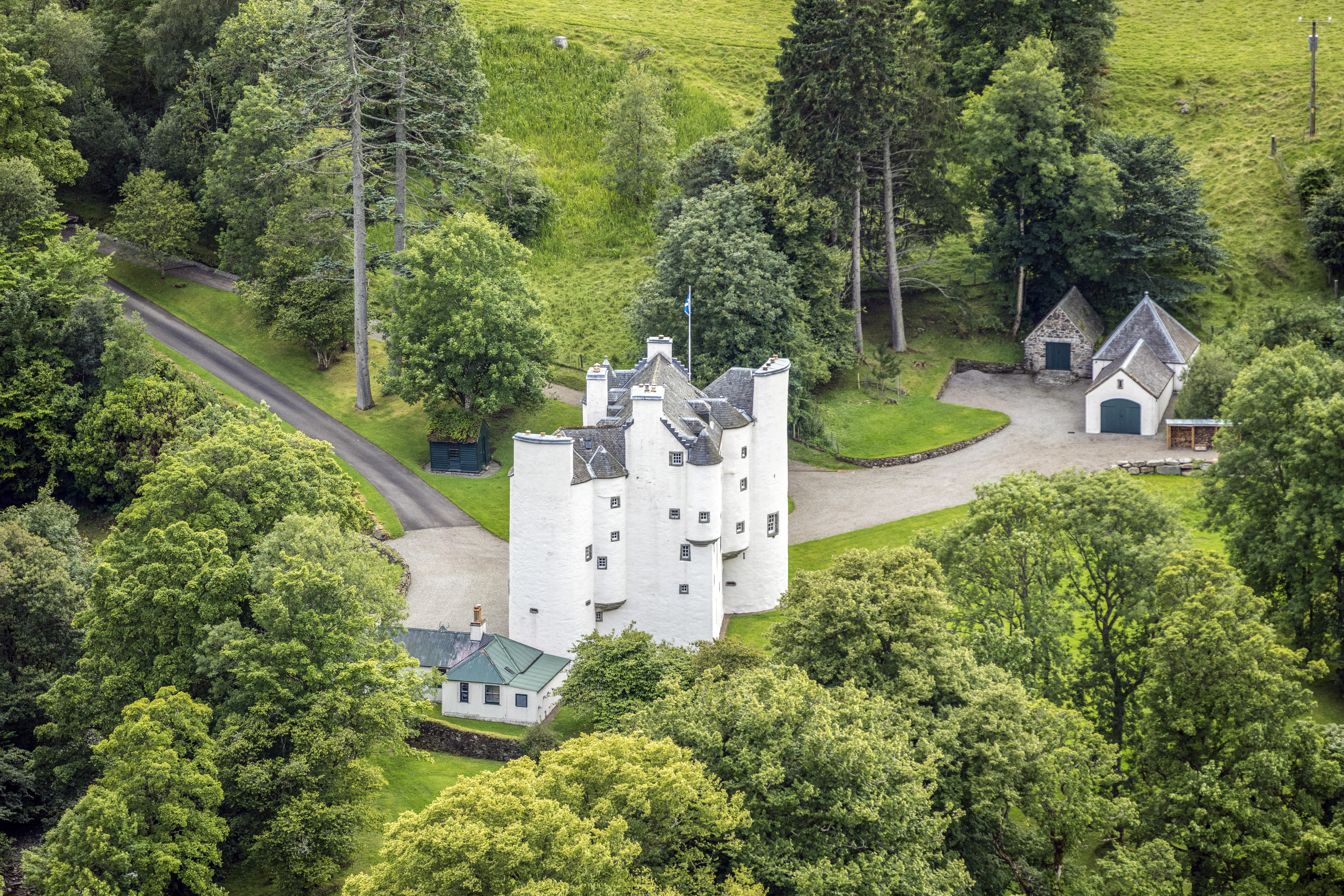
Edinample Castle

Edinample Castle is a late 16th-century tower house on the southern shores of Loch Earn near Balquhidder in the Stirling council area of Scotland. It was...

Stùc a' Chroin

Stùc a' Chroin (Scottish Gaelic: Stùc a' Chrodhain, 'cloven hoof peak') (also translated as 'hill of the little sheepfold' or 'peak of danger') is a mountain...

Breadalbane, Scotland

Breadalbane , from Scottish Gaelic Bràghaid Albann ("upper Alba" or "upland of Alba"), is a region of the southern/central Scottish Highlands. It is a...

Lochearnhead

Lochearnhead (Scottish Gaelic: Ceann Loch Èireann) is a village in Perthshire on the A84 Stirling to Crianlarich road at the foot of Glen Ogle, 14 miles...

Lochearnhead railway station

Lochearnhead is a former railway station in the village of Lochearnhead in Perthshire. It opened in 1904 as part of the Comrie, St Fillans & Lochearnhead...

Nearby Amenities

Located within 500m of 56.360421,-4.2122221
Bench
Lat/Long: 56.3576175/-4.2183504
The data included in this document is from www.openstreetmap.org. The data is made available under ODbL.

Have you been to Glen Vorlich?

Leave your review of Glen Vorlich below (or comments, questions and feedback).