Cwm Ceunant

Valley in Caernarfonshire

Wales

Cwm Ceunant

Tai-newyddion (new houses) on the map Now this is the Snowdonia Mountain Hostel, in a wonderful setting.
Tai-newyddion (new houses) on the map Credit: David Medcalf

Cwm Ceunant is a picturesque valley located in the county of Caernarfonshire, Wales. Situated near the town of Caernarfon, this charming valley is surrounded by breathtaking natural beauty and offers a serene escape from urban life.

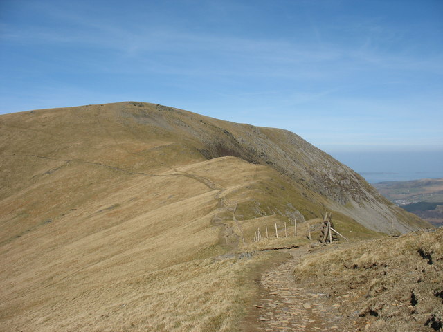
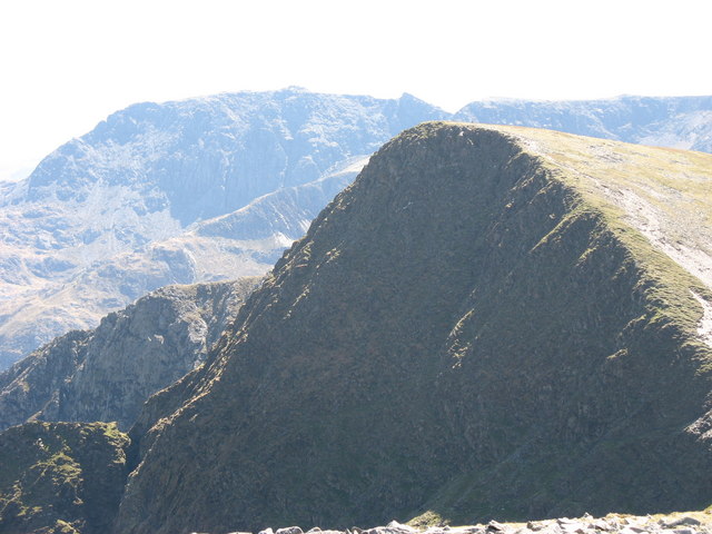
The valley is nestled between towering mountains and lush green landscapes, creating a stunning backdrop for visitors. The River Ceunant flows through the valley, adding to its tranquil atmosphere. The river is known for its crystal-clear waters and is a popular spot for fishing and wildlife spotting.

Cwm Ceunant is renowned for its diverse flora and fauna. The valley is home to numerous species of plants, including rare orchids, ferns, and wildflowers. It also serves as a habitat for various bird species, such as buzzards, peregrine falcons, and red kites.

Hiking enthusiasts are drawn to Cwm Ceunant due to its network of scenic walking trails. These trails offer breathtaking views of the surrounding mountains and valleys, making it a paradise for nature lovers and photographers. The valley also boasts several cascading waterfalls, which are a sight to behold and provide a refreshing spot for a picnic or a moment of tranquility.

Overall, Cwm Ceunant is a hidden gem in Caernarfonshire, offering visitors a chance to immerse themselves in the beauty of nature. Whether it's exploring the walking trails, fishing in the river, or simply enjoying the peaceful ambiance, this valley promises an unforgettable experience for all who venture into its embrace.

If you have any feedback on the listing, please let us know in the comments section below.

Cwm Ceunant Images

Images are sourced within 2km of 53.152592/-4.0568754 or Grid Reference SH6263. Thanks to Geograph Open Source API. All images are credited.

Tai-newyddion (new houses) on the map Now this is the Snowdonia Mountain Hostel, in a wonderful setting.
Tai-newyddion (new houses) on the map
Now this is the Snowdonia Mountain Hostel, in a wonderful setting.
The old road up the Nant Ffrancon
Flooded Penrhyn Slate Quarry Penrhyn Quarry is home to Zip World which has the world's fastest and Europe's longest zip line. Velocity 2 has four parallel lines that span 1.5 kilometres over Penrhyn Quarry lake, it is possible to reach speeds of over 100 mph.
Flooded Penrhyn Slate Quarry
Penrhyn Quarry is home to Zip World which has the world's fastest and Europe's longest zip line. Velocity 2 has four parallel lines that span 1.5 kilometres over Penrhyn Quarry lake, it is possible to reach speeds of over 100 mph.
The A5 heading south from Bethesda The conical peak of Tryfan at centre
The A5 heading south from Bethesda
The conical peak of Tryfan at centre
Cairn on the summit of Carnedd y Filiast On the other side of the Marchlyn Valley is Elidir Fach with the disused Marchlyn Quarry on its north-eastern flank.
Cairn on the summit of Carnedd y Filiast
On the other side of the Marchlyn Valley is Elidir Fach with the disused Marchlyn Quarry on its north-eastern flank.
Dew ponds in the col between Carnedd y Filiast and Y Fronllwyd The image was created on the summit ridge of Carnedd y Filiast.
Dew ponds in the col between Carnedd y Filiast and Y Fronllwyd
The image was created on the summit ridge of Carnedd y Filiast.
Nant Ffrancon The Nant Ffrancon is a steep-sided glacial valley which runs between Bethesda in the north to Llyn Ogwen in the south, a distance of about 3½ miles. The A5 road runs along the east side of the valley, the original road, Lord Penrhyn's Highway, runs along the west side of the valley. The Afon/River Ogwen meanders along the floor of the valley.
Nant Ffrancon
The Nant Ffrancon is a steep-sided glacial valley which runs between Bethesda in the north to Llyn Ogwen in the south, a distance of about 3½ miles. The A5 road runs along the east side of the valley, the original road, Lord Penrhyn's Highway, runs along the west side of the valley. The Afon/River Ogwen meanders along the floor of the valley.
Wind shelter and a standing stone on Mynydd Perfedd The wind shelter looks to have been recently rebuilt, it's certainly tidier than it was in 2007 <a href="https://www.geograph.org.uk/photo/543166">SH6261 : Cairn shelter on summit of Mynydd Perfedd</a>  and <a href="https://www.geograph.org.uk/photo/580782">SH6261 : Summit Cairn of Mynydd Perfedd</a>, and is a perfect place to sit and boil up a packet of soup. The slightly tilted standing stone in the foreground isn't marked on the OS maps, nor recorded by any of the archeological surveys that I can find, so I'm assuming it's not of antiquity.
Wind shelter and a standing stone on Mynydd Perfedd
The wind shelter looks to have been recently rebuilt, it's certainly tidier than it was in 2007 SH6261 : Cairn shelter on summit of Mynydd Perfedd and SH6261 : Summit Cairn of Mynydd Perfedd, and is a perfect place to sit and boil up a packet of soup. The slightly tilted standing stone in the foreground isn't marked on the OS maps, nor recorded by any of the archeological surveys that I can find, so I'm assuming it's not of antiquity.
On the plateau edge, north of Mynydd Perfedd Between Mynydd Perfedd and Carnedd y Filiast there's an extensive grassy plateau area with steep-walled cwms bitten out of the eastern side by glaciers. This is the view along the boundary line between those two habitats, with ever-steepening ground on the right.
On the plateau edge, north of Mynydd Perfedd
Between Mynydd Perfedd and Carnedd y Filiast there's an extensive grassy plateau area with steep-walled cwms bitten out of the eastern side by glaciers. This is the view along the boundary line between those two habitats, with ever-steepening ground on the right.
The steep eastern face of Mynydd Perfedd The 'headwall' of Cwm Perfedd is mainly comprised of steep(ish) scree and boulders with a partial covering of heather and grass.
The steep eastern face of Mynydd Perfedd
The 'headwall' of Cwm Perfedd is mainly comprised of steep(ish) scree and boulders with a partial covering of heather and grass.
Grassy spur between two cwms This grassy hillside separates Cwm Perfedd (off to the left) from Cwm Bual (down to the right) and initially at least provides a very reasonable descent route into the Nant Ffrancon from Bwlch Brecan, It becomes quite a bit steeper and more entertaining further down.
Grassy spur between two cwms
This grassy hillside separates Cwm Perfedd (off to the left) from Cwm Bual (down to the right) and initially at least provides a very reasonable descent route into the Nant Ffrancon from Bwlch Brecan, It becomes quite a bit steeper and more entertaining further down.
Grassy spur between two cwms Looking down the pleasant grassy ridge which separates Cwm Perfedd (off to the left) from Cwm Bual (down to the right), with the steep wall of Braich Ty Du in the background. Easy walking on grass to begin with, it gets noticeably steeper and rockier a bit lower down towards the floor of the Nant Ffrancon valley.
Grassy spur between two cwms
Looking down the pleasant grassy ridge which separates Cwm Perfedd (off to the left) from Cwm Bual (down to the right), with the steep wall of Braich Ty Du in the background. Easy walking on grass to begin with, it gets noticeably steeper and rockier a bit lower down towards the floor of the Nant Ffrancon valley.
Uphill towards Foel Goch
Remains of an old boundary Just about discernible in the foreground is the line of an old field boundary, primarily composed of rock & turf, and no longer used. The current 1:25000 map shows it running across from Cwm Bual (behind the photographer) over this spur and down into Cwm Perfedd.
Remains of an old boundary
Just about discernible in the foreground is the line of an old field boundary, primarily composed of rock & turf, and no longer used. The current 1:25000 map shows it running across from Cwm Bual (behind the photographer) over this spur and down into Cwm Perfedd.
A view down the steep end of Y Galan Assuming Y Galan is the name of the grassy spur that comes down from the hills to the west, this is pretty much the point at which the grassy slope gives out to steeper rocky ground, which is itself invisible from above.
A view down the steep end of Y Galan
Assuming Y Galan is the name of the grassy spur that comes down from the hills to the west, this is pretty much the point at which the grassy slope gives out to steeper rocky ground, which is itself invisible from above.
The rocky spur of Y Galan A view down the Nant Ffrancon from the steep ground on the slopes above Maes Caradoc farm
The rocky spur of Y Galan
A view down the Nant Ffrancon from the steep ground on the slopes above Maes Caradoc farm
Looking downhill into the Nant Francon The flat floor of this classic U-shaped glacial valley contrasts markedly with the screes of Braich Ty Du on the far side.
Looking downhill into the Nant Francon
The flat floor of this classic U-shaped glacial valley contrasts markedly with the screes of Braich Ty Du on the far side.
Uphill towards the crags of Y Galan From above, this little crag is practically invisible <a href="https://www.geograph.org.uk/photo/7468604">SH6362 : A view down the steep end of Y Galan</a>, which is why I alarmed myself by descending pretty much through the middle of it...
Uphill towards the crags of Y Galan
From above, this little crag is practically invisible SH6362 : A view down the steep end of Y Galan, which is why I alarmed myself by descending pretty much through the middle of it...
Show me another place!

Cwm Ceunant is located at Grid Ref: SH6263 (Lat: 53.152592, Lng: -4.0568754)

Unitary Authority: Gwynedd

Police Authority: North Wales

What 3 Words

///relate.mealtime.stage. Near Bethesda, Gwynedd

Nearby Locations

Cwm Ceunant

Related Wikis

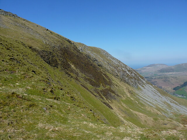
Carnedd y Filiast (Glyderau)

Carnedd y Filiast is a mountain in Snowdonia, Wales, forming part of the Glyderau. It, along with its top Y Fronllwyd (721 m), forms the most northerly...
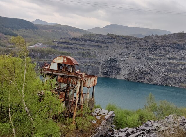
Penrhyn quarry

The Penrhyn quarry is a slate quarry located near Bethesda, North Wales. At the end of the nineteenth century it was the world's largest slate quarry;...
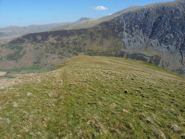
Mynydd Perfedd

Mynydd Perfedd is a mountain in Snowdonia, Wales, forming part of the Glyderau. The summit has a shelter cairn, offering good views of Foel-goch's north...
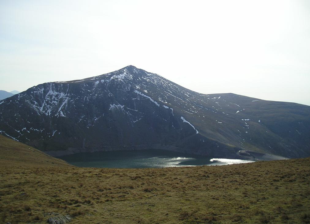
Marchlyn Mawr

Marchlyn Mawr reservoir is a high level lake in Snowdonia behind Elidir Fawr mountain. It is used as the high level water source for Dinorwig power station...

Afon Llafar

For the river which flows into Bala Lake see Afon Llafar (Dee)Afon Llafar is a river in the Carneddau, Snowdonia. It rises where many streams flow down...

Foel-goch

Foel-goch is a mountain in Snowdonia, north-west Wales, and forms part of the Glyderau range, in Gwynedd. It lies in between Y Garn and Mynydd Perfedd...

Bethesda Athletic F.C.

Bethesda Athletic F.C. (; Welsh: [bɛθ'ɛsda]) is a football club based in the Welsh town of Bethesda, in northwest Wales. They play in the Ardal NW which...

Mynydd Llandygai

Mynydd Llandygái (also spelt Mynydd Llandegai, [ˌmənɨðˌɬandəˈɡai] ; from Welsh mynydd "mountain", Llandygai "Church of St Tegai") is a small, partly forested...

Nearby Amenities

Located within 500m of 53.152592,-4.0568754
Landscape
Board Type: history
Information: board
Tourism: information
Lat/Long: 53.1540254/-4.0510772
Man Made: adit
Lat/Long: 53.1530603/-4.0567182
Man Made: adit
Lat/Long: 53.1532213/-4.0561134
Man Made: adit
Lat/Long: 53.1527969/-4.0575302
Man Made: adit
Lat/Long: 53.1529811/-4.0577553
Ford: yes
Lat/Long: 53.1548353/-4.0525966
The data included in this document is from www.openstreetmap.org. The data is made available under ODbL.

Have you been to Cwm Ceunant?

Leave your review of Cwm Ceunant below (or comments, questions and feedback).