Land Gate

Settlement in Lancashire

England

Land Gate

Footbridge  - northbound M6
Footbridge - northbound M6 Credit: Dave Thompson

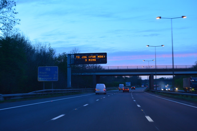
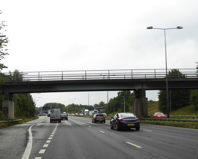
Land Gate is a small village located in the county of Lancashire, England. Situated in the borough of West Lancashire, it is nestled amidst the picturesque countryside, offering stunning views of rolling hills and lush green fields. The village is located approximately 5 miles east of the market town of Ormskirk and is easily accessible via the A570 road.

Although Land Gate is a small village, it boasts a rich history dating back several centuries. The village is surrounded by numerous historical landmarks, including the 13th-century St. Michael's Church, a beautiful example of medieval architecture. The church is known for its stunning stained glass windows and intricate stonework.

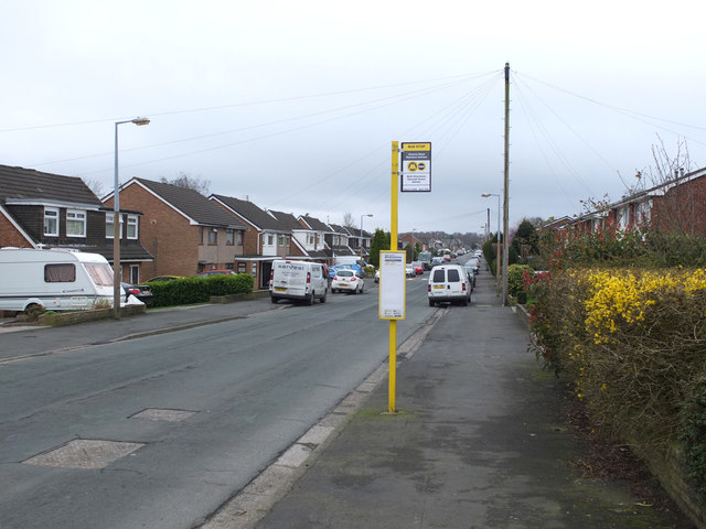
The village itself is quaint and charming, with a close-knit community atmosphere. It is home to a small number of residential properties, some dating back to the 19th century, adding to the village's historic charm. The village also has a local pub, offering a cozy spot for residents and visitors to relax and enjoy a pint.

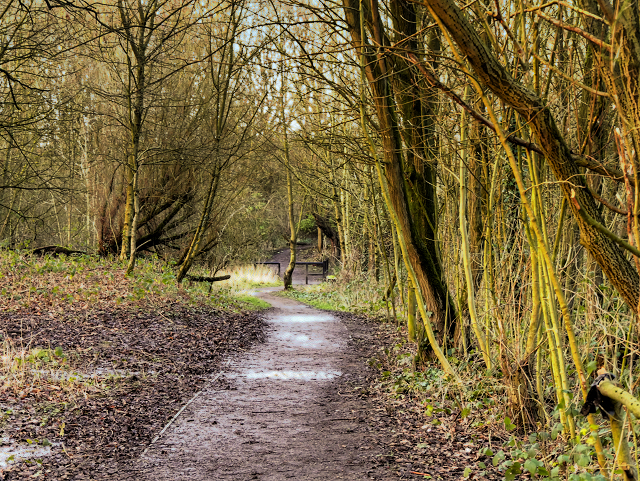
The surrounding countryside provides ample opportunities for outdoor activities, including walking, hiking, and cycling. Land Gate is also located near several nature reserves, making it an ideal destination for wildlife enthusiasts.

Overall, Land Gate is a peaceful and idyllic village, perfect for those seeking a tranquil retreat away from the hustle and bustle of city life. Its rich history, charming architecture, and stunning natural surroundings make it a hidden gem in the heart of Lancashire.

If you have any feedback on the listing, please let us know in the comments section below.
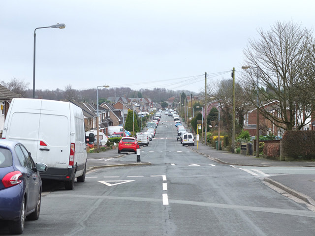
Land Gate Images

Images are sourced within 2km of 53.507422/-2.649836 or Grid Reference SD5701. Thanks to Geograph Open Source API. All images are credited.

Footbridge  - northbound M6
Footbridge - northbound M6
Downall Green Road crossing M6
Footbridge over M6
Footbridge over M6
Downall Green Road crossing M6 northbound
Brocstedes Road crossing M6 northbound
Electricity Pylon near Park House Farm
Lane by Land Gate Industrial Estate
Path Through Skitters Wood Skitters Woodland is relatively small area of ancient woodland on the western side of Ashton-in-Makerfield, which is used by the local community for walking. It has a narrow linear shape with Millingford Brook running through the centre which lies in a natural valley. Examination of old maps shows that the outline shape of Skitters Woodland has not altered since the 1800s with the exception of the  removal of the lake in the 1950s and the building of the motorway straight through in the 1960s. 

It was bordered to the South by Home Farm which farmed the lands up to where the natural valley dropped down to the brook. It was bordered to the North by Old Road Farm which farmed the lands up to where the natural valley dropped down to the brook. It was bordered to the East by the Town Centre. It was bordered to the West by Skitters Farm which was situated off Low Bank Road. It would appear that due to the natural valley of the line of Millingford Brook the farms which bordered the Woodland did not farm in the area around the brook which has allowed the woodland to develop unhindered.  Skitters is now bordered to the North and South by the housing estates built in the 1970s on the farm land.

Skitters is a valued resource for the local community, and was noted as a priority habitat recorded as a Site of  Biological Importance in Wigan Council’s Local Development Framework Core Strategy Core Strategy Preferred Options Report of June 2009. The oldest trees to be found in Skitters are approximately 150 years old.

<span class="nowrap"><a title="http://www.friendsofashton.org.uk/skitters.htm" rel="nofollow ugc noopener" href="http://www.friendsofashton.org.uk/skitters.htm">Link</a><img style="margin-left:2px;" alt="External link" title="External link - shift click to open in new window" src="https://s1.geograph.org.uk/img/external.png" width="10" height="10"/></span>  Friends of Ashton
Path Through Skitters Wood
Skitters Woodland is relatively small area of ancient woodland on the western side of Ashton-in-Makerfield, which is used by the local community for walking. It has a narrow linear shape with Millingford Brook running through the centre which lies in a natural valley. Examination of old maps shows that the outline shape of Skitters Woodland has not altered since the 1800s with the exception of the removal of the lake in the 1950s and the building of the motorway straight through in the 1960s. It was bordered to the South by Home Farm which farmed the lands up to where the natural valley dropped down to the brook. It was bordered to the North by Old Road Farm which farmed the lands up to where the natural valley dropped down to the brook. It was bordered to the East by the Town Centre. It was bordered to the West by Skitters Farm which was situated off Low Bank Road. It would appear that due to the natural valley of the line of Millingford Brook the farms which bordered the Woodland did not farm in the area around the brook which has allowed the woodland to develop unhindered. Skitters is now bordered to the North and South by the housing estates built in the 1970s on the farm land. Skitters is a valued resource for the local community, and was noted as a priority habitat recorded as a Site of Biological Importance in Wigan Council’s Local Development Framework Core Strategy Core Strategy Preferred Options Report of June 2009. The oldest trees to be found in Skitters are approximately 150 years old. LinkExternal link Friends of Ashton
Skitters Wood, Millingford Brook Skitters Woodland is relatively small area of ancient woodland on the western side of Ashton-in-Makerfield, which is used by the local community for walking. It has a narrow linear shape with Millingford Brook running through the centre which lies in a natural valley. Examination of old maps shows that the outline shape of Skitters Woodland has not altered since the 1800s with the exception of the  removal of the lake in the 1950s and the building of the motorway straight through in the 1960s. 

It was bordered to the South by Home Farm which farmed the lands up to where the natural valley dropped down to the brook. It was bordered to the North by Old Road Farm which farmed the lands up to where the natural valley dropped down to the brook. It was bordered to the East by the Town Centre. It was bordered to the West by Skitters Farm which was situated off Low Bank Road. It would appear that due to the natural valley of the line of Millingford Brook the farms which bordered the Woodland did not farm in the area around the brook which has allowed the woodland to develop unhindered.  Skitters is now bordered to the North and South by the housing estates built in the 1970s on the farm land.

Skitters is a valued resource for the local community, and was noted as a priority habitat recorded as a Site of  Biological Importance in Wigan Council’s Local Development Framework Core Strategy Core Strategy Preferred Options Report of June 2009. The oldest trees to be found in Skitters are approximately 150 years old.

<span class="nowrap"><a title="http://www.friendsofashton.org.uk/skitters.htm" rel="nofollow ugc noopener" href="http://www.friendsofashton.org.uk/skitters.htm">Link</a><img style="margin-left:2px;" alt="External link" title="External link - shift click to open in new window" src="https://s1.geograph.org.uk/img/external.png" width="10" height="10"/></span>  Friends of Ashton
Skitters Wood, Millingford Brook
Skitters Woodland is relatively small area of ancient woodland on the western side of Ashton-in-Makerfield, which is used by the local community for walking. It has a narrow linear shape with Millingford Brook running through the centre which lies in a natural valley. Examination of old maps shows that the outline shape of Skitters Woodland has not altered since the 1800s with the exception of the removal of the lake in the 1950s and the building of the motorway straight through in the 1960s. It was bordered to the South by Home Farm which farmed the lands up to where the natural valley dropped down to the brook. It was bordered to the North by Old Road Farm which farmed the lands up to where the natural valley dropped down to the brook. It was bordered to the East by the Town Centre. It was bordered to the West by Skitters Farm which was situated off Low Bank Road. It would appear that due to the natural valley of the line of Millingford Brook the farms which bordered the Woodland did not farm in the area around the brook which has allowed the woodland to develop unhindered. Skitters is now bordered to the North and South by the housing estates built in the 1970s on the farm land. Skitters is a valued resource for the local community, and was noted as a priority habitat recorded as a Site of Biological Importance in Wigan Council’s Local Development Framework Core Strategy Core Strategy Preferred Options Report of June 2009. The oldest trees to be found in Skitters are approximately 150 years old. LinkExternal link Friends of Ashton
Skitters Wood, Bridge over Millingford Brook Skitters Woodland is relatively small area of ancient woodland on the western side of Ashton-in-Makerfield, which is used by the local community for walking. It has a narrow linear shape with Millingford Brook running through the centre which lies in a natural valley. Examination of old maps shows that the outline shape of Skitters Woodland has not altered since the 1800s with the exception of the  removal of the lake in the 1950s and the building of the motorway straight through in the 1960s. 

It was bordered to the South by Home Farm which farmed the lands up to where the natural valley dropped down to the brook. It was bordered to the North by Old Road Farm which farmed the lands up to where the natural valley dropped down to the brook. It was bordered to the East by the Town Centre. It was bordered to the West by Skitters Farm which was situated off Low Bank Road. It would appear that due to the natural valley of the line of Millingford Brook the farms which bordered the Woodland did not farm in the area around the brook which has allowed the woodland to develop unhindered.  Skitters is now bordered to the North and South by the housing estates built in the 1970s on the farm land.

Skitters is a valued resource for the local community, and was noted as a priority habitat recorded as a Site of  Biological Importance in Wigan Council’s Local Development Framework Core Strategy Core Strategy Preferred Options Report of June 2009. The oldest trees to be found in Skitters are approximately 150 years old.

<span class="nowrap"><a title="http://www.friendsofashton.org.uk/skitters.htm" rel="nofollow ugc noopener" href="http://www.friendsofashton.org.uk/skitters.htm">Link</a><img style="margin-left:2px;" alt="External link" title="External link - shift click to open in new window" src="https://s1.geograph.org.uk/img/external.png" width="10" height="10"/></span>  Friends of Ashton
Skitters Wood, Bridge over Millingford Brook
Skitters Woodland is relatively small area of ancient woodland on the western side of Ashton-in-Makerfield, which is used by the local community for walking. It has a narrow linear shape with Millingford Brook running through the centre which lies in a natural valley. Examination of old maps shows that the outline shape of Skitters Woodland has not altered since the 1800s with the exception of the removal of the lake in the 1950s and the building of the motorway straight through in the 1960s. It was bordered to the South by Home Farm which farmed the lands up to where the natural valley dropped down to the brook. It was bordered to the North by Old Road Farm which farmed the lands up to where the natural valley dropped down to the brook. It was bordered to the East by the Town Centre. It was bordered to the West by Skitters Farm which was situated off Low Bank Road. It would appear that due to the natural valley of the line of Millingford Brook the farms which bordered the Woodland did not farm in the area around the brook which has allowed the woodland to develop unhindered. Skitters is now bordered to the North and South by the housing estates built in the 1970s on the farm land. Skitters is a valued resource for the local community, and was noted as a priority habitat recorded as a Site of Biological Importance in Wigan Council’s Local Development Framework Core Strategy Core Strategy Preferred Options Report of June 2009. The oldest trees to be found in Skitters are approximately 150 years old. LinkExternal link Friends of Ashton
Garswood House, Wentworth Road Residential care home approximately one mile from the town centre.
Garswood House, Wentworth Road
Residential care home approximately one mile from the town centre.
Metropolitan Borough of Wigan : The M6 Motorway Heading northbound on the M6 Motorway through the Metropolitan Borough of Wigan.
Metropolitan Borough of Wigan : The M6 Motorway
Heading northbound on the M6 Motorway through the Metropolitan Borough of Wigan.
Footpath and access bridge over M6 at J24 southbound The M6 motorway runs from junction 19 of the M1 at the Catthorpe Interchange, near Rugby to the Gretna junction (J45). Here it becomes the A74(M) and M74 which continues to Glasgow.

The M6 is the longest motorway in the United Kingdom (232 miles) and one of the busiest. It incorporates the first length of motorway opened in the UK (the Preston bypass in 1958) and forms part of a motorway "Backbone of Britain", running north-south between London and Glasgow via the industrial north of England. It is also part of the east-west route between the Midlands and the east coast ports.
Footpath and access bridge over M6 at J24 southbound
The M6 motorway runs from junction 19 of the M1 at the Catthorpe Interchange, near Rugby to the Gretna junction (J45). Here it becomes the A74(M) and M74 which continues to Glasgow. The M6 is the longest motorway in the United Kingdom (232 miles) and one of the busiest. It incorporates the first length of motorway opened in the UK (the Preston bypass in 1958) and forms part of a motorway "Backbone of Britain", running north-south between London and Glasgow via the industrial north of England. It is also part of the east-west route between the Midlands and the east coast ports.
Bus Stop on Victoria Road, Garswood
Victoria Road, Garswood
Church on Victoria Road, Garswood
Ashton-in-Makerfield : M6 Motorway The M6 Motorway between Junction 24 and Junction 25.
Ashton-in-Makerfield : M6 Motorway
The M6 Motorway between Junction 24 and Junction 25.
M6 Motorway northbound by Junction 24 entry slip The early days of the M6. Note no central reservation crash barrier. Today, the vegetation either side of the motorway has grown up obscuring the view.
M6 Motorway northbound by Junction 24 entry slip
The early days of the M6. Note no central reservation crash barrier. Today, the vegetation either side of the motorway has grown up obscuring the view.
Show me another place!

Land Gate is located at Grid Ref: SD5701 (Lat: 53.507422, Lng: -2.649836)

Unitary Authority: Wigan

Police Authority: Greater Manchester

What 3 Words

///other.lost.record. Near Ashton in Makerfield, Manchester

Nearby Locations

Land Gate

Related Wikis

Bryn railway station

Bryn railway station is a railway station serving the suburb of Bryn in Ashton-in-Makerfield, Greater Manchester, England. The station is situated on the...

Bryn, Greater Manchester

Bryn is a suburb of Ashton-in-Makerfield in the Metropolitan Borough of Wigan in Greater Manchester, England. The population of the suburb at the 2011...

Ashton Athletic F.C.

Ashton Athletic Football Club is a football club based in Ashton-in-Makerfield, Greater Manchester, England. They are currently members of the North West...

Bryn Hall Colliery

Bryn Hall Colliery was a coal mine on the Lancashire Coalfield in Bryn, Ashton-in-Makerfield, Greater Manchester then in the historic county of Lancashire...

Nearby Amenities

Located within 500m of 53.507422,-2.649836
Barrier: cycle_barrier
Lat/Long: 53.5091387/-2.6430923
Bus Stop
Wigan Road/Eddleston Street
Bus: yes
Naptan AtcoCode: 1800WK04951
Naptan Bearing: S
Naptan CommonName: Wigan Road/Eddleston Street
Naptan Indicator: Fields
Naptan Landmark: FIELDS
Naptan NaptanCode: manptgwa
Naptan PlusbusZoneRef: MNCRPIC
Naptan ShortCommonName: Eddleston Street
Naptan Street: WIGAN ROAD
Naptan Verified: no
Network: TfGM
Public Transport: platform
Shelter: yes
Source: naptan_import
Lat/Long: 53.503268/-2.6500325
Bus Stop
Wigan Road/Eddleston Street
Bus: yes
Naptan AtcoCode: 1800WK04961
Naptan Bearing: N
Naptan CommonName: Wigan Road/Eddleston Street
Naptan Indicator: Op House 1
Naptan Landmark: OP HOUSE 1
Naptan NaptanCode: manptgwd
Naptan PlusbusZoneRef: MNCRPIC
Naptan ShortCommonName: Eddleston Street
Naptan Street: WIGAN ROAD
Naptan Verified: no
Network: TfGM
Public Transport: platform
Shelter: yes
Source: naptan_import
Lat/Long: 53.5037798/-2.651099
Bus Stop
Wigan Road/Land Gate
Bus: yes
Naptan AtcoCode: 1800WK04971
Naptan Bearing: N
Naptan CommonName: Wigan Road/Land Gate
Naptan Indicator: House 561
Naptan Landmark: HOUSE 561
Naptan NaptanCode: manptgwg
Naptan Notes: INDICATOR AMENDED
Naptan PlusbusZoneRef: MNCRPIC
Naptan ShortCommonName: Land Gate
Naptan Street: WIGAN ROAD
Naptan Verified: no
Network: TfGM
Public Transport: platform
Source: naptan_import
Lat/Long: 53.507316/-2.6516059
Bus Stop
Wigan Road/Land Gate
Bus: yes
Naptan AtcoCode: 1800WK04991
Naptan Bearing: S
Naptan CommonName: Wigan Road/Land Gate
Naptan Indicator: Park Hotel Opp
Naptan Landmark: PARK HOTEL OPP
Naptan NaptanCode: manptgwj
Naptan PlusbusZoneRef: MNCRPIC
Naptan ShortCommonName: Land Gate
Naptan Street: WIGAN ROAD
Naptan Verified: no
Network: TfGM
Public Transport: platform
Shelter: yes
Source: naptan_import
Lat/Long: 53.5086108/-2.6514457
Bus Stop
Wigan Road/Park Lane Chapel
Bus: yes
Naptan AtcoCode: 1800WK05001
Naptan Bearing: N
Naptan CommonName: Wigan Road/Park Lane Chapel
Naptan Indicator: Park Hotel
Naptan Landmark: PARK HOTEL
Naptan NaptanCode: manptgwm
Naptan PlusbusZoneRef: MNCRPIC
Naptan ShortCommonName: Park Lane Chapel
Naptan Street: WIGAN ROAD
Naptan Verified: no
Network: TfGM
Public Transport: platform
Source: naptan_import
Lat/Long: 53.5097267/-2.6512961
Biergarten
The Park Hotel
Lat/Long: 53.5094704/-2.6523982
Bench
Lat/Long: 53.5057877/-2.6526624
Bench
Lat/Long: 53.5058436/-2.6523968
Bench
Lat/Long: 53.505599/-2.6521312
Bench
Lat/Long: 53.5055277/-2.6522323
Playground: swing
Lat/Long: 53.5051615/-2.6532852
Playground: structure
Lat/Long: 53.5055012/-2.6520772
Bench
Source: survey
Lat/Long: 53.5041021/-2.6508918
Generator Method: photovoltaic
Generator Output Electricity: yes
Generator Source: solar
Generator Type: solar_photovoltaic_panel
Location: roof
Power: generator
Lat/Long: 53.5096746/-2.6464034
Generator Method: photovoltaic
Generator Output Electricity: yes
Generator Source: solar
Generator Type: solar_photovoltaic_panel
Location: roof
Power: generator
Lat/Long: 53.5095661/-2.6479923
Generator Method: photovoltaic
Generator Output Electricity: yes
Generator Source: solar
Generator Type: solar_photovoltaic_panel
Location: roof
Power: generator
Lat/Long: 53.5095587/-2.6480889
Generator Method: photovoltaic
Generator Output Electricity: yes
Generator Source: solar
Generator Type: solar_photovoltaic_panel
Location: roof
Power: generator
Lat/Long: 53.5095484/-2.6481995
Generator Method: photovoltaic
Generator Output Electricity: yes
Generator Source: solar
Generator Type: solar_photovoltaic_panel
Location: roof
Power: generator
Lat/Long: 53.50954/-2.6483038
Generator Method: photovoltaic
Generator Output Electricity: yes
Generator Source: solar
Generator Type: solar_photovoltaic_panel
Location: roof
Power: generator
Lat/Long: 53.5092164/-2.6482475
Generator Method: photovoltaic
Generator Output Electricity: yes
Generator Source: solar
Generator Type: solar_photovoltaic_panel
Location: roof
Power: generator
Lat/Long: 53.5091494/-2.6481214
Generator Method: photovoltaic
Generator Output Electricity: yes
Generator Source: solar
Generator Type: solar_photovoltaic_panel
Location: roof
Power: generator
Lat/Long: 53.508891/-2.646504
Generator Method: photovoltaic
Generator Output Electricity: yes
Generator Source: solar
Generator Type: solar_photovoltaic_panel
Location: roof
Power: generator
Lat/Long: 53.5088687/-2.6465899
Generator Method: photovoltaic
Generator Output Electricity: yes
Generator Source: solar
Generator Type: solar_photovoltaic_panel
Location: roof
Power: generator
Lat/Long: 53.5088431/-2.646791
Generator Method: photovoltaic
Generator Output Electricity: yes
Generator Source: solar
Generator Type: solar_photovoltaic_panel
Location: roof
Power: generator
Lat/Long: 53.5088304/-2.6468903
Generator Method: photovoltaic
Generator Output Electricity: yes
Generator Source: solar
Generator Type: solar_photovoltaic_panel
Location: roof
Power: generator
Lat/Long: 53.5088112/-2.6470727
Generator Method: photovoltaic
Generator Output Electricity: yes
Generator Source: solar
Generator Type: solar_photovoltaic_panel
Location: roof
Power: generator
Lat/Long: 53.5088033/-2.6471773
Generator Method: photovoltaic
Generator Output Electricity: yes
Generator Source: solar
Generator Type: solar_photovoltaic_panel
Location: roof
Power: generator
Lat/Long: 53.5085975/-2.6476172
Generator Method: photovoltaic
Generator Output Electricity: yes
Generator Source: solar
Generator Type: solar_photovoltaic_panel
Location: roof
Power: generator
Lat/Long: 53.5085943/-2.6475528
Generator Method: photovoltaic
Generator Output Electricity: yes
Generator Source: solar
Generator Type: solar_photovoltaic_panel
Location: roof
Power: generator
Lat/Long: 53.5085879/-2.6474965
Generator Method: photovoltaic
Generator Output Electricity: yes
Generator Source: solar
Generator Type: solar_photovoltaic_panel
Location: roof
Power: generator
Lat/Long: 53.5085815/-2.6474321
Generator Method: photovoltaic
Generator Output Electricity: yes
Generator Source: solar
Generator Type: solar_photovoltaic_panel
Location: roof
Power: generator
Lat/Long: 53.5085815/-2.6472819
Generator Method: photovoltaic
Generator Output Electricity: yes
Generator Source: solar
Generator Type: solar_photovoltaic_panel
Location: roof
Power: generator
Lat/Long: 53.5085783/-2.6472282
Generator Method: photovoltaic
Generator Output Electricity: yes
Generator Source: solar
Generator Type: solar_photovoltaic_panel
Location: roof
Power: generator
Lat/Long: 53.5085831/-2.6471558
Generator Method: photovoltaic
Generator Output Electricity: yes
Generator Source: solar
Generator Type: solar_photovoltaic_panel
Location: roof
Power: generator
Lat/Long: 53.5085879/-2.6470888
Generator Method: photovoltaic
Generator Output Electricity: yes
Generator Source: solar
Generator Type: solar_photovoltaic_panel
Location: roof
Power: generator
Lat/Long: 53.5086406/-2.6466462
Generator Method: photovoltaic
Generator Output Electricity: yes
Generator Source: solar
Generator Type: solar_photovoltaic_panel
Location: roof
Power: generator
Lat/Long: 53.5086517/-2.6465899
Generator Method: photovoltaic
Generator Output Electricity: yes
Generator Source: solar
Generator Type: solar_photovoltaic_panel
Location: roof
Power: generator
Lat/Long: 53.5089819/-2.6462358
Generator Method: photovoltaic
Generator Output Electricity: yes
Generator Source: solar
Generator Type: solar_photovoltaic_panel
Location: roof
Power: generator
Lat/Long: 53.5090106/-2.6460561
Generator Method: photovoltaic
Generator Output Electricity: yes
Generator Source: solar
Generator Type: solar_photovoltaic_panel
Location: roof
Power: generator
Lat/Long: 53.5090266/-2.6459542
Generator Method: photovoltaic
Generator Output Electricity: yes
Generator Source: solar
Generator Type: solar_photovoltaic_panel
Location: roof
Power: generator
Lat/Long: 53.5088798/-2.6455599
Generator Method: photovoltaic
Generator Output Electricity: yes
Generator Source: solar
Generator Type: solar_photovoltaic_panel
Location: roof
Power: generator
Lat/Long: 53.5089149/-2.6454285
Generator Method: photovoltaic
Generator Output Electricity: yes
Generator Source: solar
Generator Type: solar_photovoltaic_panel
Location: roof
Power: generator
Lat/Long: 53.5086533/-2.6477781
Generator Method: photovoltaic
Generator Output Electricity: yes
Generator Source: solar
Generator Type: solar_photovoltaic_panel
Location: roof
Power: generator
Lat/Long: 53.5086565/-2.6478398
Generator Method: photovoltaic
Generator Output Electricity: yes
Generator Source: solar
Generator Type: solar_photovoltaic_panel
Location: roof
Power: generator
Lat/Long: 53.5086645/-2.6479202
Generator Method: photovoltaic
Generator Output Electricity: yes
Generator Source: solar
Generator Type: solar_photovoltaic_panel
Location: roof
Power: generator
Lat/Long: 53.5086693/-2.6479685
Generator Method: photovoltaic
Generator Output Electricity: yes
Generator Source: solar
Generator Type: solar_photovoltaic_panel
Location: roof
Power: generator
Lat/Long: 53.5083455/-2.6483467
Generator Method: photovoltaic
Generator Output Electricity: yes
Generator Source: solar
Generator Type: solar_photovoltaic_panel
Location: roof
Power: generator
Lat/Long: 53.5087809/-2.6489395
Generator Method: photovoltaic
Generator Output Electricity: yes
Generator Source: solar
Generator Type: solar_photovoltaic_panel
Location: roof
Power: generator
Lat/Long: 53.5083758/-2.6486713
Generator Method: photovoltaic
Generator Output Electricity: yes
Generator Source: solar
Generator Type: solar_photovoltaic_panel
Location: roof
Power: generator
Lat/Long: 53.5083662/-2.6485506
Generator Method: photovoltaic
Generator Output Electricity: yes
Generator Source: solar
Generator Type: solar_photovoltaic_panel
Location: roof
Power: generator
Lat/Long: 53.5088017/-2.6491246
Generator Method: photovoltaic
Generator Output Electricity: yes
Generator Source: solar
Generator Type: solar_photovoltaic_panel
Location: roof
Power: generator
Lat/Long: 53.5083534/-2.6484379
Generator Method: photovoltaic
Generator Output Electricity: yes
Generator Source: solar
Generator Type: solar_photovoltaic_panel
Location: roof
Power: generator
Lat/Long: 53.5083985/-2.6489278
Generator Method: photovoltaic
Generator Output Electricity: yes
Generator Source: solar
Generator Type: solar_photovoltaic_panel
Location: roof
Power: generator
Lat/Long: 53.5084077/-2.6490173
Generator Method: photovoltaic
Generator Output Electricity: yes
Generator Source: solar
Generator Type: solar_photovoltaic_panel
Location: roof
Power: generator
Lat/Long: 53.5084396/-2.6492614
Generator Method: photovoltaic
Generator Output Electricity: yes
Generator Source: solar
Generator Type: solar_photovoltaic_panel
Location: roof
Power: generator
Lat/Long: 53.5088144/-2.6492667
Generator Method: photovoltaic
Generator Output Electricity: yes
Generator Source: solar
Generator Type: solar_photovoltaic_panel
Location: roof
Power: generator
Lat/Long: 53.5088479/-2.6494706
Generator Method: photovoltaic
Generator Output Electricity: yes
Generator Source: solar
Generator Type: solar_photovoltaic_panel
Location: roof
Power: generator
Lat/Long: 53.5090106/-2.6489851
Generator Method: photovoltaic
Generator Output Electricity: yes
Generator Source: solar
Generator Type: solar_photovoltaic_panel
Location: roof
Power: generator
Lat/Long: 53.509001/-2.6488912
Generator Method: photovoltaic
Generator Output Electricity: yes
Generator Source: solar
Generator Type: solar_photovoltaic_panel
Location: roof
Power: generator
Lat/Long: 53.50895/-2.648505
Generator Method: photovoltaic
Generator Output Electricity: yes
Generator Source: solar
Generator Type: solar_photovoltaic_panel
Location: roof
Power: generator
Lat/Long: 53.5089325/-2.6484004
Generator Method: photovoltaic
Generator Output Electricity: yes
Generator Source: solar
Generator Type: solar_photovoltaic_panel
Location: roof
Power: generator
Lat/Long: 53.5089197/-2.6482904
Generator Method: photovoltaic
Generator Output Electricity: yes
Generator Source: solar
Generator Type: solar_photovoltaic_panel
Location: roof
Power: generator
Lat/Long: 53.5089117/-2.6481777
Generator Method: photovoltaic
Generator Output Electricity: yes
Generator Source: solar
Generator Type: solar_photovoltaic_panel
Location: roof
Power: generator
Lat/Long: 53.509864/-2.647939
Generator Method: photovoltaic
Generator Output Electricity: yes
Generator Source: solar
Generator Type: solar_photovoltaic_panel
Location: roof
Power: generator
Lat/Long: 53.509848/-2.6480651
Generator Method: photovoltaic
Generator Output Electricity: yes
Generator Source: solar
Generator Type: solar_photovoltaic_panel
Location: roof
Power: generator
Lat/Long: 53.509789/-2.6483601
Generator Method: photovoltaic
Generator Output Electricity: yes
Generator Source: solar
Generator Type: solar_photovoltaic_panel
Location: roof
Power: generator
Lat/Long: 53.5100506/-2.6481724
Generator Method: photovoltaic
Generator Output Electricity: yes
Generator Source: solar
Generator Type: solar_photovoltaic_panel
Location: roof
Power: generator
Lat/Long: 53.5097109/-2.6486579
Generator Method: photovoltaic
Generator Output Electricity: yes
Generator Source: solar
Generator Type: solar_photovoltaic_panel
Location: roof
Power: generator
Lat/Long: 53.5096614/-2.6488054
Generator Method: photovoltaic
Generator Output Electricity: yes
Generator Source: solar
Generator Type: solar_photovoltaic_panel
Location: roof
Power: generator
Lat/Long: 53.5096136/-2.6489288
Generator Method: photovoltaic
Generator Output Electricity: yes
Generator Source: solar
Generator Type: solar_photovoltaic_panel
Location: roof
Power: generator
Lat/Long: 53.5098289/-2.6491541
Generator Method: photovoltaic
Generator Output Electricity: yes
Generator Source: solar
Generator Type: solar_photovoltaic_panel
Location: roof
Power: generator
Lat/Long: 53.5097906/-2.6492506
Generator Method: photovoltaic
Generator Output Electricity: yes
Generator Source: solar
Generator Type: solar_photovoltaic_panel
Location: roof
Power: generator
Lat/Long: 53.5097428/-2.6494464
Generator Method: photovoltaic
Generator Output Electricity: yes
Generator Source: solar
Generator Type: solar_photovoltaic_panel
Location: roof
Power: generator
Lat/Long: 53.5097284/-2.6495376
Generator Method: photovoltaic
Generator Output Electricity: yes
Generator Source: solar
Generator Type: solar_photovoltaic_panel
Location: roof
Power: generator
Lat/Long: 53.5097252/-2.6497522
Generator Method: photovoltaic
Generator Output Electricity: yes
Generator Source: solar
Generator Type: solar_photovoltaic_panel
Location: roof
Power: generator
Lat/Long: 53.509722/-2.6498461
Generator Method: photovoltaic
Generator Output Electricity: yes
Generator Source: solar
Generator Type: solar_photovoltaic_panel
Location: roof
Power: generator
Lat/Long: 53.5097284/-2.6500472
Generator Method: photovoltaic
Generator Output Electricity: yes
Generator Source: solar
Generator Type: solar_photovoltaic_panel
Location: roof
Power: generator
Lat/Long: 53.5095067/-2.6501384
Generator Method: photovoltaic
Generator Output Electricity: yes
Generator Source: solar
Generator Type: solar_photovoltaic_panel
Location: roof
Power: generator
Lat/Long: 53.5090879/-2.6499762
Generator Method: photovoltaic
Generator Output Electricity: yes
Generator Source: solar
Generator Type: solar_photovoltaic_panel
Location: roof
Power: generator
Lat/Long: 53.5091032/-2.6501116
Generator Method: photovoltaic
Generator Output Electricity: yes
Generator Source: solar
Generator Type: solar_photovoltaic_panel
Location: roof
Power: generator
Lat/Long: 53.5091335/-2.6503409
Generator Method: photovoltaic
Generator Output Electricity: yes
Generator Source: solar
Generator Type: solar_photovoltaic_panel
Location: roof
Power: generator
Lat/Long: 53.5088718/-2.6501492
Generator Method: photovoltaic
Generator Output Electricity: yes
Generator Source: solar
Generator Type: solar_photovoltaic_panel
Location: roof
Power: generator
Lat/Long: 53.5086246/-2.6502886
Generator Method: photovoltaic
Generator Output Electricity: yes
Generator Source: solar
Generator Type: solar_photovoltaic_panel
Location: roof
Power: generator
Lat/Long: 53.5086406/-2.6504844
Generator Method: photovoltaic
Generator Output Electricity: yes
Generator Source: solar
Generator Type: solar_photovoltaic_panel
Location: roof
Power: generator
Lat/Long: 53.5086055/-2.6501894
Generator Method: photovoltaic
Generator Output Electricity: yes
Generator Source: solar
Generator Type: solar_photovoltaic_panel
Location: roof
Power: generator
Lat/Long: 53.5084109/-2.6502243
Generator Method: photovoltaic
Generator Output Electricity: yes
Generator Source: solar
Generator Type: solar_photovoltaic_panel
Location: roof
Power: generator
Lat/Long: 53.5084316/-2.6504925
Generator Method: photovoltaic
Generator Output Electricity: yes
Generator Source: solar
Generator Type: solar_photovoltaic_panel
Location: roof
Power: generator
Lat/Long: 53.5084587/-2.6506051
Generator Method: photovoltaic
Generator Output Electricity: yes
Generator Source: solar
Generator Type: solar_photovoltaic_panel
Location: roof
Power: generator
Lat/Long: 53.5084651/-2.6507553
Generator Method: photovoltaic
Generator Output Electricity: yes
Generator Source: solar
Generator Type: solar_photovoltaic_panel
Location: roof
Power: generator
Lat/Long: 53.5084778/-2.6508412
Generator Method: photovoltaic
Generator Output Electricity: yes
Generator Source: solar
Generator Type: solar_photovoltaic_panel
Location: roof
Power: generator
Lat/Long: 53.5084364/-2.6510504
Generator Method: photovoltaic
Generator Output Electricity: yes
Generator Source: solar
Generator Type: solar_photovoltaic_panel
Location: roof
Power: generator
Lat/Long: 53.5084396/-2.6511577
Generator Method: photovoltaic
Generator Output Electricity: yes
Generator Source: solar
Generator Type: solar_photovoltaic_panel
Location: roof
Power: generator
Lat/Long: 53.5082067/-2.6510128
Generator Method: photovoltaic
Generator Output Electricity: yes
Generator Source: solar
Generator Type: solar_photovoltaic_panel
Location: roof
Power: generator
Lat/Long: 53.5082147/-2.6511443
Generator Method: photovoltaic
Generator Output Electricity: yes
Generator Source: solar
Generator Type: solar_photovoltaic_panel
Location: roof
Power: generator
Lat/Long: 53.5080264/-2.6509941
Generator Method: photovoltaic
Generator Output Electricity: yes
Generator Source: solar
Generator Type: solar_photovoltaic_panel
Location: roof
Power: generator
Lat/Long: 53.5079881/-2.6507446
Generator Method: photovoltaic
Generator Output Electricity: yes
Generator Source: solar
Generator Type: solar_photovoltaic_panel
Location: roof
Power: generator
Lat/Long: 53.5079754/-2.65064
Generator Method: photovoltaic
Generator Output Electricity: yes
Generator Source: solar
Generator Type: solar_photovoltaic_panel
Location: roof
Power: generator
Lat/Long: 53.5079419/-2.650471
Generator Method: photovoltaic
Generator Output Electricity: yes
Generator Source: solar
Generator Type: solar_photovoltaic_panel
Location: roof
Power: generator
Lat/Long: 53.5079307/-2.6503637
Generator Method: photovoltaic
Generator Output Electricity: yes
Generator Source: solar
Generator Type: solar_photovoltaic_panel
Location: roof
Power: generator
Lat/Long: 53.508111/-2.6496315
Generator Method: photovoltaic
Generator Output Electricity: yes
Generator Source: solar
Generator Type: solar_photovoltaic_panel
Location: roof
Power: generator
Lat/Long: 53.5080966/-2.6495296
Generator Method: photovoltaic
Generator Output Electricity: yes
Generator Source: solar
Generator Type: solar_photovoltaic_panel
Location: roof
Power: generator
Lat/Long: 53.5087331/-2.6443261
Generator Method: photovoltaic
Generator Output Electricity: yes
Generator Source: solar
Generator Type: solar_photovoltaic_panel
Location: roof
Power: generator
Lat/Long: 53.5087538/-2.6442483
Generator Method: photovoltaic
Generator Output Electricity: yes
Generator Source: solar
Generator Type: solar_photovoltaic_panel
Location: roof
Power: generator
Lat/Long: 53.5089245/-2.6445219
Generator Method: photovoltaic
Generator Output Electricity: yes
Generator Source: solar
Generator Type: solar_photovoltaic_panel
Location: roof
Power: generator
Lat/Long: 53.5092004/-2.6437333
Generator Method: photovoltaic
Generator Output Electricity: yes
Generator Source: solar
Generator Type: solar_photovoltaic_panel
Location: roof
Power: generator
Lat/Long: 53.5092244/-2.6436233
Generator Method: photovoltaic
Generator Output Electricity: yes
Generator Source: solar
Generator Type: solar_photovoltaic_panel
Location: roof
Power: generator
Lat/Long: 53.5094939/-2.6444857
Generator Method: photovoltaic
Generator Output Electricity: yes
Generator Source: solar
Generator Type: solar_photovoltaic_panel
Location: roof
Power: generator
Lat/Long: 53.5095194/-2.6443838
Generator Method: photovoltaic
Generator Output Electricity: yes
Generator Source: solar
Generator Type: solar_photovoltaic_panel
Location: roof
Power: generator
Lat/Long: 53.5098241/-2.6440431
Generator Method: photovoltaic
Generator Output Electricity: yes
Generator Source: solar
Generator Type: solar_photovoltaic_panel
Location: roof
Power: generator
Lat/Long: 53.5098815/-2.6441558
Generator Method: photovoltaic
Generator Output Electricity: yes
Generator Source: solar
Generator Type: solar_photovoltaic_panel
Location: roof
Power: generator
Lat/Long: 53.5100719/-2.6439619
Generator Method: photovoltaic
Generator Output Electricity: yes
Generator Source: solar
Generator Type: solar_photovoltaic_panel
Location: roof
Power: generator
Lat/Long: 53.5101373/-2.6441603
Generator Method: photovoltaic
Generator Output Electricity: yes
Generator Source: solar
Generator Type: solar_photovoltaic_panel
Location: roof
Power: generator
Lat/Long: 53.5096484/-2.6451385
Generator Method: photovoltaic
Generator Output Electricity: yes
Generator Source: solar
Generator Type: solar_photovoltaic_panel
Location: roof
Power: generator
Lat/Long: 53.5102936/-2.6450213
Generator Method: photovoltaic
Generator Output Electricity: yes
Generator Source: solar
Generator Type: solar_photovoltaic_panel
Location: roof
Power: generator
Lat/Long: 53.5102761/-2.644619
Generator Method: photovoltaic
Generator Output Electricity: yes
Generator Source: solar
Generator Type: solar_photovoltaic_panel
Location: roof
Power: generator
Lat/Long: 53.5102834/-2.6453482
Generator Method: photovoltaic
Generator Output Electricity: yes
Generator Source: solar
Generator Type: solar_photovoltaic_panel
Location: roof
Power: generator
Lat/Long: 53.510267/-2.6455083
Generator Method: photovoltaic
Generator Output Electricity: yes
Generator Source: solar
Generator Type: solar_photovoltaic_panel
Location: roof
Power: generator
Lat/Long: 53.5102481/-2.6457165
Generator Method: photovoltaic
Generator Output Electricity: yes
Generator Source: solar
Generator Type: solar_photovoltaic_panel
Location: roof
Power: generator
Lat/Long: 53.5099539/-2.6458877
Generator Method: photovoltaic
Generator Output Electricity: yes
Generator Source: solar
Generator Type: solar_photovoltaic_panel
Location: roof
Power: generator
Lat/Long: 53.5099571/-2.6461532
Generator Method: photovoltaic
Generator Output Electricity: yes
Generator Source: solar
Generator Type: solar_photovoltaic_panel
Location: roof
Power: generator
Lat/Long: 53.5099523/-2.6462525
Generator Method: photovoltaic
Generator Output Electricity: yes
Generator Source: solar
Generator Type: solar_photovoltaic_panel
Location: roof
Power: generator
Lat/Long: 53.5102059/-2.64618
Generator Method: photovoltaic
Generator Output Electricity: yes
Generator Source: solar
Generator Type: solar_photovoltaic_panel
Location: roof
Power: generator
Lat/Long: 53.5104436/-2.6471591
Generator Method: photovoltaic
Generator Output Electricity: yes
Generator Source: solar
Generator Type: solar_photovoltaic_panel
Location: roof
Power: generator
Lat/Long: 53.5103192/-2.647438
Generator Method: photovoltaic
Generator Output Electricity: yes
Generator Source: solar
Generator Type: solar_photovoltaic_panel
Location: roof
Power: generator
Lat/Long: 53.5099682/-2.6487228
Generator Method: photovoltaic
Generator Output Electricity: yes
Generator Source: solar
Generator Type: solar_photovoltaic_panel
Location: roof
Power: generator
Lat/Long: 53.509914/-2.6488971
Generator Method: photovoltaic
Generator Output Electricity: yes
Generator Source: solar
Generator Type: solar_photovoltaic_panel
Location: roof
Power: generator
Lat/Long: 53.5034323/-2.6522939
Generator Method: photovoltaic
Generator Output Electricity: yes
Generator Source: solar
Generator Type: solar_photovoltaic_panel
Location: roof
Power: generator
Lat/Long: 53.5035223/-2.652105
Generator Method: photovoltaic
Generator Output Electricity: yes
Generator Source: solar
Generator Type: solar_photovoltaic_panel
Location: roof
Power: generator
Lat/Long: 53.503977/-2.6526773
Generator Method: photovoltaic
Generator Output Electricity: yes
Generator Source: solar
Generator Type: solar_photovoltaic_panel
Location: roof
Power: generator
Lat/Long: 53.5043008/-2.6526424
Generator Method: photovoltaic
Generator Output Electricity: yes
Generator Source: solar
Generator Type: solar_photovoltaic_panel
Location: roof
Power: generator
Lat/Long: 53.5093201/-2.6459458
Generator Method: photovoltaic
Generator Output Electricity: yes
Generator Source: solar
Generator Type: solar_photovoltaic_panel
Location: roof
Power: generator
Lat/Long: 53.5092894/-2.646289
Generator Method: photovoltaic
Generator Output Electricity: yes
Generator Source: solar
Generator Type: solar_photovoltaic_panel
Location: roof
Power: generator
Lat/Long: 53.509271/-2.646453
Generator Method: photovoltaic
Generator Output Electricity: yes
Generator Source: solar
Generator Type: solar_photovoltaic_panel
Location: roof
Power: generator
Lat/Long: 53.5092569/-2.6465563
Generator Method: photovoltaic
Generator Output Electricity: yes
Generator Source: solar
Generator Type: solar_photovoltaic_panel
Location: roof
Power: generator
Lat/Long: 53.5069171/-2.6539305
Parking
Lat/Long: 53.5098819/-2.6524643
Cycleway: asl
Direction: backward
Lat/Long: 53.5055452/-2.6513655
Traffic Signals
Traffic Signals: signal
Traffic Signals Direction: backward
Lat/Long: 53.5055817/-2.6513732
Crossing
Button Operated: yes
Crossing: traffic_signals
Crossing Island: no
Crossing Markings: dots
Crossing Ref: toucan
Tactile Paving: yes
Lat/Long: 53.5052936/-2.6511548
Traffic Signals
Traffic Signals: signal
Lat/Long: 53.5053314/-2.6510527
Traffic Signals
Traffic Signals: signal
Lat/Long: 53.5053651/-2.6510582
Cycleway: asl
Lat/Long: 53.5053668/-2.6511272
Cycleway: asl
Lat/Long: 53.5053115/-2.6511061
Traffic Signals
Traffic Signals: signal
Traffic Signals Direction: forward
Lat/Long: 53.5052443/-2.6513254
Cycleway: asl
Direction: forward
Lat/Long: 53.505281/-2.6513292
Crossing
Button Operated: yes
Crossing: traffic_signals
Crossing Island: no
Crossing Markings: dots
Crossing Ref: toucan
Tactile Paving: yes
Lat/Long: 53.5054371/-2.6510963
Crossing
Button Operated: yes
Crossing: traffic_signals
Crossing Island: no
Crossing Markings: dots
Crossing Ref: toucan
Tactile Paving: yes
Lat/Long: 53.5053683/-2.6511847
Crossing
Button Operated: yes
Crossing: traffic_signals
Crossing Island: no
Crossing Markings: dots
Crossing Ref: puffin
Tactile Paving: yes
Lat/Long: 53.5053162/-2.6513326
Addr City: Ashton-in-Makerfield
Addr Housenumber: 532
Addr Street: Wigan Road
Lat/Long: 53.506873/-2.6513172
Addr City: Ashton-in-Makerfield
Addr Housenumber: 516
Addr Street: Wigan Road
Lat/Long: 53.5065587/-2.651285
Sara Beauty and Barbers
Addr City: Ashton-in-Makerfield
Addr Housenumber: 514
Addr Street: Wigan Road
Shop: hairdresser
Lat/Long: 53.506521/-2.6512807
Addr City: Ashton-in-Makerfield
Addr Housenumber: 550
Addr Street: Wigan Road
Lat/Long: 53.5073733/-2.6513645
Addr City: Ashton-in-Makerfield
Addr Housenumber: 534
Addr Street: Wigan Road
Lat/Long: 53.5070321/-2.6513323
Speed Camera
Direction: 195
Maxspeed: 30 mph
Lat/Long: 53.5103574/-2.6509293
Crossing
Crossing: unmarked
Crossing Island: no
Tactile Paving: no
Lat/Long: 53.5104609/-2.6508783
Crossing
Crossing: unmarked
Crossing Island: no
Tactile Paving: no
Lat/Long: 53.5113087/-2.6507835
Crossing
Crossing: pavement
Lat/Long: 53.5117416/-2.6511811
Crossing
Crossing: unmarked
Crossing Island: no
Tactile Paving: no
Lat/Long: 53.509509/-2.6513762
Crossing
Crossing: unmarked
Crossing Island: no
Tactile Paving: no
Lat/Long: 53.5095687/-2.6513549
Bus Stop
Dryden Avenue
Bus: yes
Naptan AtcoCode: 1800WKH5181
Naptan Bearing: S
Naptan CommonName: Dryden Avenue
Naptan Indicator: S-bound
Naptan Street: Dryden Avenue
Naptan Verified: no
Network: TfGM
Public Transport: platform
Source: naptan;bing;naptan_compare_tool
Lat/Long: 53.5038586/-2.6536067
Bus Stop
Dryden Avenue
Bus: yes
Naptan AtcoCode: 1800WKH5171
Naptan Bearing: N
Naptan CommonName: Dryden Avenue
Naptan Indicator: N-bound
Naptan Street: Dryden Avenue
Naptan Verified: no
Network: TfGM
Public Transport: platform
Source: naptan;bing;naptan_compare_tool
Lat/Long: 53.5038216/-2.6538021
Bus Stop
Sougher's Lane
Bus: yes
Naptan AtcoCode: 1800WKH2101
Naptan Bearing: SW
Naptan CommonName: Sougher's Lane
Naptan Indicator: SW-bound
Naptan Street: Sougher's Lane
Naptan Verified: no
Network: TfGM
Public Transport: platform
Source: naptan;bing;naptan_compare_tool
Lat/Long: 53.504982/-2.6552825
Bus Stop
Sougher's Lane
Bus: yes
Naptan AtcoCode: 1800WKH0561
Naptan Bearing: NE
Naptan CommonName: Sougher's Lane
Naptan Indicator: NE-bound
Naptan Street: Sougher's Lane
Naptan Verified: no
Network: TfGM
Public Transport: platform
Source: naptan;bing;naptan_compare_tool
Lat/Long: 53.5050173/-2.6554036
Bus Stop
Sougher's Lane
Bus: yes
Naptan AtcoCode: 1800WKH5201
Naptan Bearing: W
Naptan CommonName: Sougher's Lane
Naptan Indicator: W-bound
Naptan Street: Sougher's Lane
Naptan Verified: no
Network: TfGM
Public Transport: platform
Source: naptan;bing;naptan_compare_tool
Lat/Long: 53.5063814/-2.6525147
Bus Stop
Sougher's Lane
Bus: yes
Naptan AtcoCode: 1800WKH5191
Naptan Bearing: E
Naptan CommonName: Sougher's Lane
Naptan Indicator: E-bound
Naptan Street: Sougher's Lane
Naptan Verified: no
Network: TfGM
Public Transport: platform
Source: naptan;bing;naptan_compare_tool
Lat/Long: 53.5065249/-2.6525772
Bus Stop
Sougher's Lane
Bus: yes
Naptan AtcoCode: 1800WK00801
Naptan Bearing: S
Naptan CommonName: Sougher's Lane
Naptan Indicator: opp
Naptan NaptanCode: MANWAGPW
Naptan Street: Wigan Road
Naptan Verified: no
Network: TfGM
Public Transport: platform
Source: naptan;bing;naptan_compare_tool
Lat/Long: 53.5063156/-2.6513828
Bus Stop
Land Gate Lane
Bus: yes
Naptan AtcoCode: 1800WKH2181
Naptan Bearing: W
Naptan CommonName: Land Gate Lane
Naptan Indicator: W-bound
Naptan Street: Land Gate Lane
Naptan Verified: no
Network: TfGM
Public Transport: platform
Source: naptan;bing;naptan_compare_tool
Lat/Long: 53.5077933/-2.6507421
Bus Stop
Land Gate Lane
Bus: yes
Naptan AtcoCode: 1800WKH5091
Naptan Bearing: E
Naptan CommonName: Land Gate Lane
Naptan Indicator: E-bound
Naptan Street: Land Gate Lane
Naptan Verified: no
Network: TfGM
Public Transport: platform
Source: naptan;bing;naptan_compare_tool
Lat/Long: 53.5078829/-2.6507887
Bus Stop
Dovedale Road
Bus: yes
Naptan AtcoCode: 1800WKH2191
Naptan Bearing: N
Naptan CommonName: Dovedale Road
Naptan Indicator: N-bound
Naptan Street: Dovedale Road
Naptan Verified: no
Network: TfGM
Public Transport: platform
Source: naptan;bing;naptan_compare_tool
Lat/Long: 53.5081114/-2.6500835
Bus Stop
Yewdale Road
Bus: yes
Naptan AtcoCode: 1800WKH0241
Naptan Bearing: E
Naptan CommonName: Yewdale Road
Naptan Indicator: E-bound
Naptan Street: Yewdale Road
Naptan Verified: no
Network: TfGM
Public Transport: platform
Source: naptan;bing;naptan_compare_tool
Lat/Long: 53.5083915/-2.6465142
Bus Stop
Dovedale Road
Bus: yes
Naptan AtcoCode: 1800WKH2201
Naptan Bearing: S
Naptan CommonName: Dovedale Road
Naptan Indicator: S-bound
Naptan Street: Dovedale Road
Naptan Verified: no
Network: TfGM
Public Transport: platform
Source: naptan;bing;naptan_compare_tool
Lat/Long: 53.5096355/-2.6491719
Bus Stop
Dovedale Road
Bus: yes
Naptan AtcoCode: 1800WKH0231
Naptan Bearing: E
Naptan CommonName: Dovedale Road
Naptan Indicator: E-bound
Naptan Street: DOVEDALE ROAD
Naptan Verified: no
Network: TfGM
Public Transport: platform
Source: naptan;bing;naptan_compare_tool
Lat/Long: 53.5101283/-2.6444748
Bus Stop
Dovedale Road
Bus: yes
Naptan AtcoCode: 1800WKH4431
Naptan Bearing: W
Naptan CommonName: Dovedale Road
Naptan Indicator: W-bound
Naptan Street: Dovedale Road
Naptan Verified: no
Network: TfGM
Public Transport: platform
Source: naptan;bing;naptan_compare_tool
Lat/Long: 53.5100305/-2.6442773
Addr City: Bryn
Addr Housenumber: 1
Addr Street: Soughers Lane
Source: survey
Lat/Long: 53.5065562/-2.6516729
Addr City: Bryn
Addr Housenumber: 573
Addr Street: Wigan Road
Source: survey
Lat/Long: 53.5076045/-2.6517941
Addr City: Bryn
Addr Housenumber: 559
Addr Street: Wigan Road
Source: survey
Lat/Long: 53.5072322/-2.6517663
Addr City: Bryn
Addr Housenumber: 561
Addr Street: Wigan Road
Source: survey
Lat/Long: 53.5073258/-2.6517647
Premier Hair and Beauty
Addr City: Bryn
Addr Street: Soughers Lane
Shop: hairdresser
Lat/Long: 53.5067912/-2.6517305
Fast Food
Deli-cious
Cuisine: sandwich
Lat/Long: 53.5067571/-2.6517801
Addr City: Bryn
Addr Housenumber: 15
Addr Street: Soughers Lane
Source: survey
Lat/Long: 53.5064386/-2.6520779
Titan Flooring
Shop: flooring
Lat/Long: 53.5087646/-2.6521007
Shelter
Lat/Long: 53.5076968/-2.6475812
DCS Automotive
Addr City: Bryn
Addr Housename: Unit 1
Addr Street: Wigan Road
Second Hand: only
Shop: car
Source: survey
Website: https://www.dcsauto.co.uk/
Lat/Long: 53.5084784/-2.6528157
Addr City: Bryn
Addr Housenumber: 6
Addr Street: Brookside Avenue
Source: survey
Lat/Long: 53.5086759/-2.6506376
Bryn Motor Company
Second Hand: only
Shop: car
Lat/Long: 53.5103217/-2.6500251
Addr City: Bryn
Addr Housenumber: 11
Addr Street: Cranberry Court
Source: survey
Lat/Long: 53.5116644/-2.6518279
Addr City: Bryn
Addr Housenumber: 7
Addr Street: Dovedale Road
Source: survey
Lat/Long: 53.5094993/-2.6497903
Addr City: Bryn
Addr Housenumber: 2
Addr Street: Parkside Avenue
Source: survey
Lat/Long: 53.5090833/-2.6499264
Go Local
Shop: supermarket
Lat/Long: 53.5084793/-2.6496131
Shop: alcohol
Lat/Long: 53.5084589/-2.6494581
Addr City: Bryn
Addr Housenumber: 47
Addr Street: Yewdale Road
Source: survey
Lat/Long: 53.50833/-2.6482436
Post Box
Colour: Red
Operator: Royal Mail
Operator Wikidata: Q638098
Post Box Type: lamp
Ref: WN4 119
Royal Cypher: EIIR
Source: survey
Lat/Long: 53.5084057/-2.6495741
Barrier: bollard
Lat/Long: 53.5084432/-2.6498124
Addr City: Bryn
Addr Housenumber: 1
Addr Street: Brookside Avenue
Source: survey
Lat/Long: 53.5086191/-2.6500842
Addr City: Bryn
Addr Housenumber: 2
Addr Street: Mossdale Road
Source: survey
Lat/Long: 53.5088511/-2.6476783
Addr City: Bryn
Addr Housenumber: 19
Addr Street: Patterdale Road
Source: survey
Lat/Long: 53.5089065/-2.6480825
Addr City: Bryn
Addr Housenumber: 1
Addr Street: Patterdale Road
Lat/Long: 53.509026/-2.6490976
Addr City: Bryn
Addr Housenumber: 7
Addr Street: Patterdale Road
Source: survey
Lat/Long: 53.5089882/-2.6487818
Addr City: Bryn
Addr Housenumber: 14
Addr Street: Mossdale Road
Lat/Long: 53.5092742/-2.6474967
Addr City: Bryn
Addr Housenumber: 32
Addr Street: Mossdale Road
Lat/Long: 53.5099221/-2.6471627
Addr City: Bryn
Addr Housenumber: 7
Addr Street: Mossdale Road
Lat/Long: 53.5098913/-2.6476478
Addr City: Bryn
Addr Housenumber: 33
Addr Street: Dovedale Road
Source: survey
Lat/Long: 53.5102226/-2.6462905
Addr City: Bryn
Addr Housenumber: 14
Addr Street: Bankside Avenue
Source: survey
Lat/Long: 53.5102385/-2.6466124
Addr City: Bryn
Addr Housenumber: 8
Addr Street: Bankside Avenue
Source: survey
Lat/Long: 53.5105113/-2.6471113
Addr City: Bryn
Addr Housenumber: 59
Addr Street: Dovedale Road
Source: survey
Lat/Long: 53.5103365/-2.6448261
Addr City: Bryn
Addr Housenumber: 51
Addr Street: Dovedale Road
Source: survey
Lat/Long: 53.5102956/-2.6452807
Addr City: Bryn
Addr Housenumber: 7
Addr Street: Meadowside Avenue
Source: survey
Lat/Long: 53.5095399/-2.6484289
Addr City: Bryn
Addr Housenumber: 19
Addr Street: Wasdale Road
Source: survey
Lat/Long: 53.5098657/-2.6457408
Addr City: Bryn
Addr Housenumber: 14
Addr Street: Daleside Avenue
Source: survey
Lat/Long: 53.5096879/-2.6463239
Addr City: Bryn
Addr Housenumber: 7
Addr Street: Daleside Avenue
Source: survey
Lat/Long: 53.5093133/-2.6467325
Addr City: Bryn
Addr Housenumber: 7
Addr Street: Wasdale Road
Source: survey
Lat/Long: 53.5093629/-2.6455867
Barrier: yes
Lat/Long: 53.5082317/-2.6481547
Addr City: Bryn
Addr Housenumber: 113
Addr Street: Yewdale Road
Source: survey
Lat/Long: 53.5089008/-2.6447402
Addr City: Bryn
Addr Housenumber: 1
Addr Street: Woodside Avenue
Lat/Long: 53.5091866/-2.6445484
Addr City: Bryn
Addr Housenumber: 5
Addr Street: Woodside Avenue
Lat/Long: 53.5094906/-2.6446052
Addr City: Bryn
Addr Housenumber: 12
Addr Street: Woodside Avenue
Lat/Long: 53.5093204/-2.6439913
Addr City: Bryn
Addr Housenumber: 127
Addr Street: Yewdale Road
Lat/Long: 53.5092851/-2.6435024
Telephone
Booth: KX100
Covered: booth
Lat/Long: 53.5091486/-2.6452594
Addr City: Bryn
Addr Housenumber: 9
Addr Street: Woodside Avenue
Source: survey
Lat/Long: 53.5095495/-2.6441521
Addr City: Bryn
Addr Housenumber: 1
Addr Street: Dovedale Crescent
Source: survey
Lat/Long: 53.509656/-2.6453041
Addr City: Bryn
Addr Housenumber: 8
Addr Street: Dovedale Crescent
Lat/Long: 53.5099898/-2.6447741
Addr City: Bryn
Addr Housenumber: 3
Addr Street: Cranberry Court
Lat/Long: 53.5113864/-2.6512263
Pall Mall Carpets Warehouse
Shop: carpet
Lat/Long: 53.5113911/-2.6482211
Rose Hill
Place: neighbourhood
Source: local knowledge
Lat/Long: 53.503733/-2.651237
Tactile Paving: yes
Lat/Long: 53.5053052/-2.6509762
Crossing
Crossing: pavement
Crossing Island: no
Crossing Markings: no
Tactile Paving: no
Lat/Long: 53.5053419/-2.650677
Crossing
Crossing: pavement
Crossing Island: no
Crossing Markings: no
Tactile Paving: no
Lat/Long: 53.5045107/-2.6511702
Crossing
Crossing: pavement
Crossing Island: no
Crossing Markings: no
Tactile Paving: no
Lat/Long: 53.5047396/-2.6512011
Tactile Paving: yes
Lat/Long: 53.5056494/-2.651282
Tactile Paving: yes
Lat/Long: 53.5054677/-2.6509688
Crossing
Crossing: pavement
Crossing Island: no
Crossing Markings: no
Tactile Paving: no
Lat/Long: 53.5061197/-2.6513829
Crossing
Crossing: pavement
Crossing Island: no
Crossing Markings: no
Tactile Paving: no
Lat/Long: 53.5069347/-2.6514474
Crossing
Crossing: unmarked
Crossing Island: no
Crossing Markings: no
Tactile Paving: yes
Lat/Long: 53.5079039/-2.651505
Crossing
Check Date: 2023-09-02
Crossing: unmarked
Crossing Island: yes
Crossing Markings: no
Source: survey
Tactile Paving: yes
Lat/Long: 53.5034422/-2.6504477
Waste Basket
Operator: Wigan Council
Source: survey
Lat/Long: 53.5041129/-2.6509528
The data included in this document is from www.openstreetmap.org. The data is made available under ODbL.

Have you been to Land Gate?

Leave your review of Land Gate below (or comments, questions and feedback).