Lancing

Settlement in Sussex Adur

England

Lancing

Grinstead Lane railway bridge The Bridge was built in the mid sixties for the new A2025 bypass road. The level crossing could be avoided.
Grinstead Lane railway bridge Credit: James Emmans

Lancing is a small town located in the county of West Sussex, in the southern part of England. Situated on the English Channel coast, it is part of the larger Worthing urban area and lies approximately 60 miles south of London. Lancing is bordered by the towns of Shoreham-by-Sea to the east and Worthing to the west.

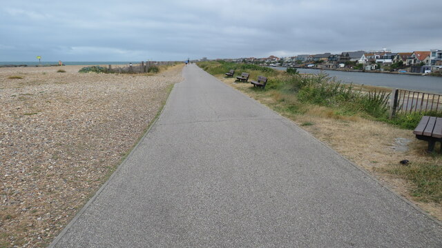
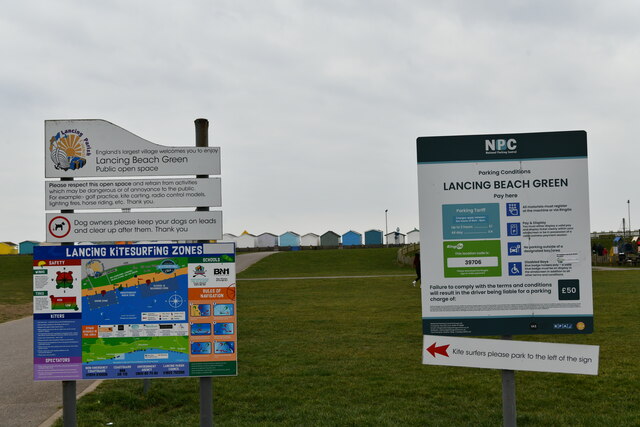
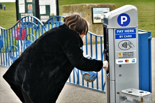
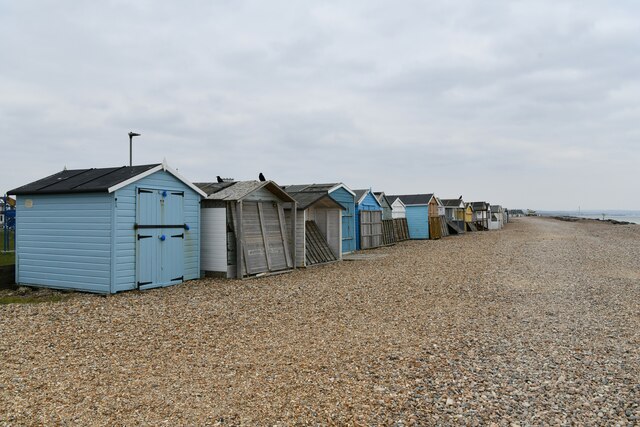
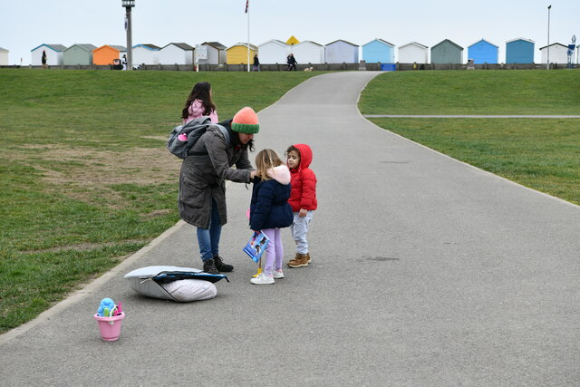
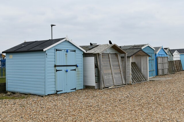
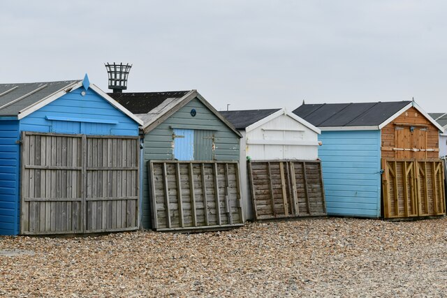
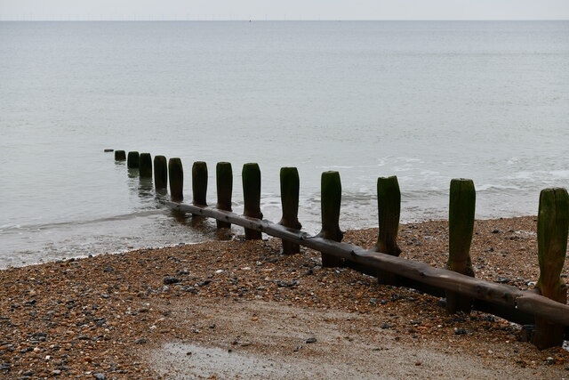
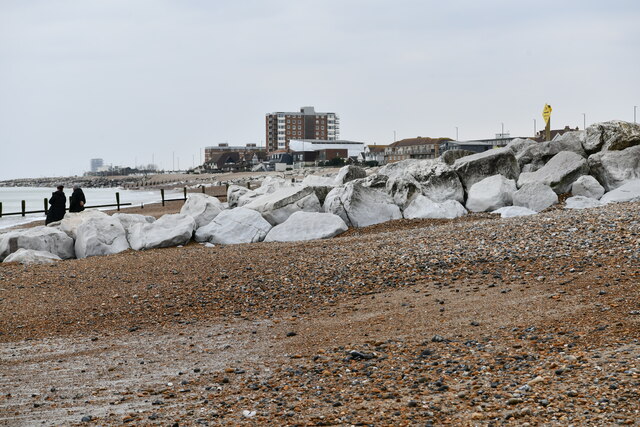
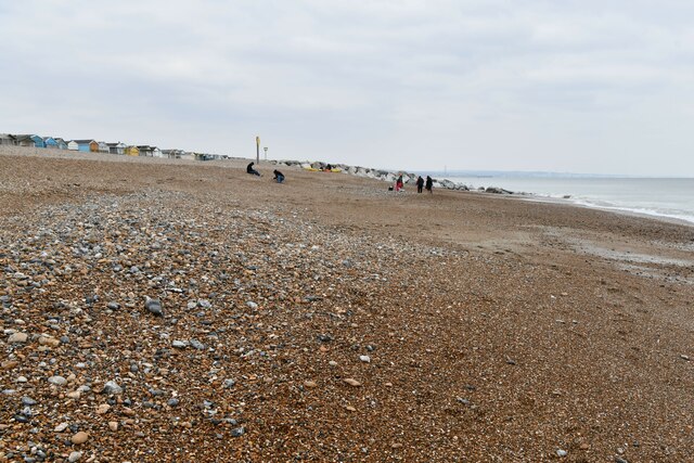
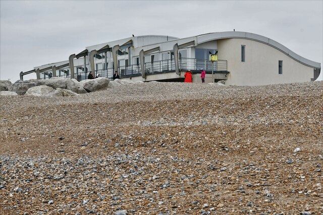
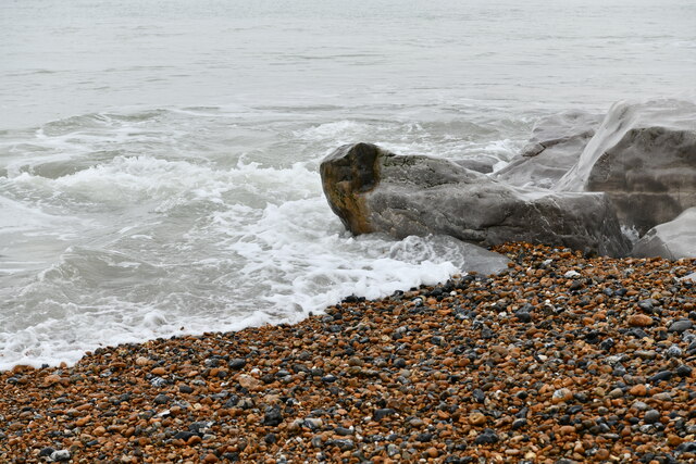
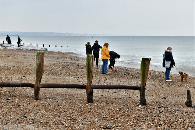
The town is known for its beautiful pebble beach, which stretches for several miles along the coastline. Lancing Beach is a popular spot for locals and tourists alike, offering stunning views of the sea and the South Downs National Park in the distance. The beach is also home to a variety of water sports, such as kite surfing and paddleboarding, making it a hub for outdoor enthusiasts.

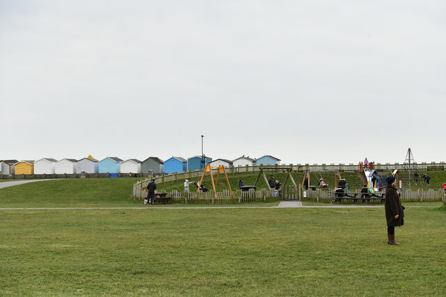
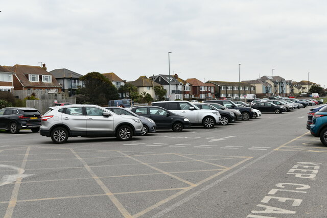
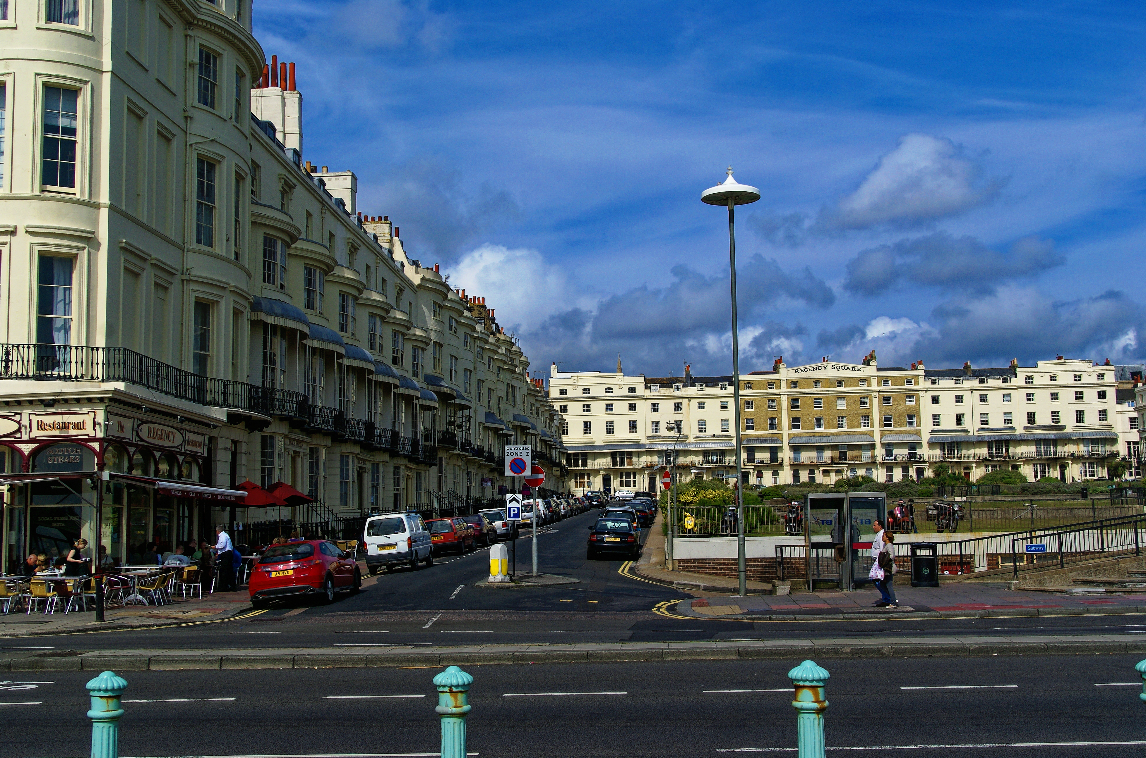
Lancing is a thriving community with a range of amenities, including shops, cafes, and restaurants. The town boasts a rich history, with notable landmarks such as Lancing College, a prestigious independent school founded in 1848. The college's iconic Gothic Revival chapel, with its towering spires, is a prominent feature of the town's skyline.

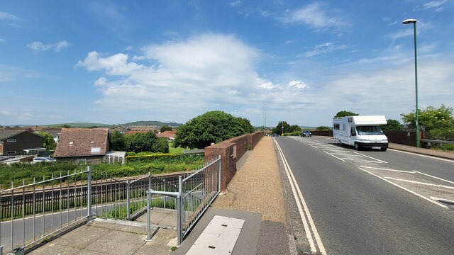
Transport links in Lancing are excellent, with regular train services connecting it to Brighton and London. The town is also well-served by buses, providing convenient access to surrounding areas. Additionally, Lancing benefits from its proximity to major road networks, including the A27, which connects to other parts of Sussex and beyond.

Overall, Lancing offers residents and visitors a charming coastal retreat, with its picturesque beach, historic landmarks, and convenient location.

If you have any feedback on the listing, please let us know in the comments section below.

Lancing Images

Images are sourced within 2km of 50.826812/-0.322764 or Grid Reference TQ1804. Thanks to Geograph Open Source API. All images are credited.

Grinstead Lane railway bridge The Bridge was built in the mid sixties for the new A2025 bypass road. The level crossing could be avoided.
Grinstead Lane railway bridge
The Bridge was built in the mid sixties for the new A2025 bypass road. The level crossing could be avoided.
Path by Widewater Lagoon, lancing Widewater Lagoon is an area of brackish water landlocked by a man-made shingle bank. It lies between the beach and A259 coast road (Brighton Road) in Lancing; between the far east of Lancing Beach and the far west of Shoreham Beach.
This path runs between the beach and lagoon
Path by Widewater Lagoon, lancing
Widewater Lagoon is an area of brackish water landlocked by a man-made shingle bank. It lies between the beach and A259 coast road (Brighton Road) in Lancing; between the far east of Lancing Beach and the far west of Shoreham Beach. This path runs between the beach and lagoon
The Quadrant, Marlborough Road, Lancing
Lancing: Play area
Lancing: Play area
Lancing: Beach Green information boards
Lancing: Beach Green Car Park
Lancing: Beach Green Car Park, 'pay by card'
Lancing: Incoming tide on the large boulder breakwater
Lancing Beach: Huts
Lancing Beach: Huts
Lancing Beach Green: Path to the beach
Lancing Beach: Huts
Lancing Beach: Huts
Lancing Beach: Huts
Lancing Beach: Huts
Lancing Beach: Breakwater
Lancing Beach: Large boulder breakwater
Lancing Beach looking east
Lancing Beach: Perch Cafe and Gym
Lancing: Incoming tide on the large boulder breakwater
Lancing Beach
Lancing Beach
Show me another place!

Lancing is located at Grid Ref: TQ1804 (Lat: 50.826812, Lng: -0.322764)

Administrative County: West Sussex

District: Adur

Police Authority: Sussex

What 3 Words

///issues.door.behind. Near Lancing, West Sussex

Nearby Locations

Lancing

Related Wikis

Lancing railway station

Lancing railway station is in Lancing in the county of West Sussex, England. It is 8 miles 19 chains (13.3 km) down the line from Brighton. The station...

Montpelier Villa F.C.

Montpelier Villa F.C. is an English football club located in Falmer, Brighton in East Sussex. The club are currently members of the Southern Combination...

Lancing F.C.

Lancing Football Club is a football club based in Lancing, West Sussex, England. They are members of the Isthmian League South East Division and play at...

East Worthing and Shoreham (UK Parliament constituency)

East Worthing and Shoreham is a constituency represented in the House of Commons of the UK Parliament since 1997 by Tim Loughton of the Conservative Party...

Lancing, West Sussex

Lancing is a large coastal village and civil parish in the Adur district of West Sussex, England, on the western edge of the Adur Valley. It occupies part...

Lancing Carriage Works

Lancing Carriage Works was a railway carriage and wagon building and maintenance facility in the village of Lancing near Shoreham-by-Sea in the county...

Brighton and Hove built-up area

The Brighton and Hove Built-up area or Brighton/Worthing/Littlehampton conurbation has a population of 474,485 (2011 census), making it England's 12th...

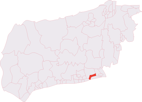
Lancing (electoral division)

Lancing is an electoral division of West Sussex in the United Kingdom, and returns one member to sit on West Sussex County Council. == Extent == The division...

Nearby Amenities

Located within 500m of 50.826812,-0.322764
Lancing
Alt Name: South Lancing
Place: village
Source: npe
Wikidata: Q1020014
Lat/Long: 50.8258666/-0.322551
Crossing
Crossing: traffic_signals
Crossing Island: no
Crossing Markings: dots
Crossing Signals: yes
Lat/Long: 50.8258957/-0.3221745
Crossing
Crossing: unmarked
Crossing Continuous: no
Crossing Island: yes
Crossing Markings: no
Kerb: lowered
Tactile Paving: yes
Lat/Long: 50.8240252/-0.3228738
Crossing
Button Operated: yes
Crossing: traffic_signals
Crossing Island: no
Crossing Markings: dots
Crossing Signals: yes
Kerb: lowered
Tactile Paving: yes
Traffic Signals Vibration: no
Lat/Long: 50.8230221/-0.3238673
Lancing
Naptan AtcoCode: 9100LNCG
Network: National Rail
Network Website: https://www.nationalrail.co.uk/stations/lac/
Network Wikidata: Q26334
Operator: Southern
Public Transport: station
Railway: station
Ref Crs: LAC
Train: yes
Wheelchair: yes
Wikidata: Q2308589
Wikipedia: en:Lancing railway station
Lat/Long: 50.8270176/-0.3232037
Crossing
Crossing: unmarked
Crossing Continuous: no
Crossing Island: yes
Crossing Markings: no
Kerb: lowered
Tactile Paving: yes
Lat/Long: 50.8279663/-0.3225913
Crossing Barrier: double_half
Crossing Light: yes
Railway: level_crossing
Lat/Long: 50.8271035/-0.3226964
Mini Roundabout
Direction: clockwise
Lat/Long: 50.8310765/-0.3212561
Mini Roundabout
Direction: clockwise
Lat/Long: 50.8290537/-0.3220789
Parking
Created By: Potlatch 0.10f
Lat/Long: 50.8286532/-0.3212492
Parking
Lat/Long: 50.8296103/-0.3204958
Noexit: yes
Lat/Long: 50.8232079/-0.3265054
Noexit: yes
Lat/Long: 50.8245053/-0.3286049
Turning Circle
Turning Circle: hammer
Lat/Long: 50.8242894/-0.3282764
Traffic Calming: hump
Lat/Long: 50.8264731/-0.3237474
Turning Circle
Lat/Long: 50.8268228/-0.3229983
Crossing
Crossing Island: no
Crossing Markings: no
Crossing Signals: no
Tactile Paving: no
Lat/Long: 50.8230211/-0.3250586
Parking
For: library and health centre
Lat/Long: 50.8285828/-0.3235209
Bus Stop
North Road South
Bus: yes
Naptan AtcoCode: 4400AD0075
Naptan Bearing: S
Naptan CommonName: North Road South
Naptan Indicator: o/s 15
Naptan Landmark: Grinstead Lane
Naptan NaptanCode: wsxadgmg
Naptan ShortCommonName: North Road South
Naptan Street: North Road
Naptan Verified: no
Public Transport: platform
Source: naptan_import
Lat/Long: 50.8260961/-0.3230073
Bus Stop
North Road South
Bin: no
Bus: yes
Naptan AtcoCode: 4400AD0076
Naptan Bearing: N
Naptan CommonName: North Road South
Naptan Indicator: o/s 36
Naptan Landmark: Grinstead Lane
Naptan NaptanCode: wsxadgmj
Naptan ShortCommonName: North Road South
Naptan Street: North Road
Public Transport: platform
Shelter: no
Source: naptan_import
Lat/Long: 50.8259633/-0.3231541
Bus Stop
Ingleside Crescent
Bus: yes
Naptan AtcoCode: 4400AD0085
Naptan Bearing: E
Naptan CommonName: Ingleside Crescent
Naptan Indicator: o/s 137
Naptan Landmark: Ingleside Crescent
Naptan NaptanCode: wsxadgpt
Naptan Street: Kings Road
Naptan Verified: no
Public Transport: platform
Source: naptan_import
Lat/Long: 50.8254395/-0.3211282
Bus Stop
Russells Drive
Bus: yes
Naptan AtcoCode: 4400AD0086
Naptan Bearing: S
Naptan CommonName: Russells Drive
Naptan Indicator: adj Milton Close
Naptan Landmark: Milton Close
Naptan NaptanCode: wsxadgpw
Naptan Street: Russells Drive
Naptan Verified: no
Public Transport: platform
Source: naptan_import
Lat/Long: 50.8267472/-0.3195051
Russells Drive
Naptan AtcoCode: 4400AD0087
Naptan Bearing: W
Naptan BusStopType: CUS
Naptan CommonName: Russells Drive
Naptan Indicator: opp. Milton Close
Naptan Landmark: Milton Close
Naptan NaptanCode: wsxadgta
Naptan Street: Russells Drive
Naptan Verified: no
Source: naptan_import
Lat/Long: 50.8267672/-0.3196464
Bus Stop
North Road Post Office
Bench: no
Bin: yes
Bus: yes
Naptan AtcoCode: 4400AD0094
Naptan Bearing: N
Naptan CommonName: North Road Post Office
Naptan Indicator: opp
Naptan Landmark: Penstone Park
Naptan NaptanCode: wsxadgwa
Naptan ShortCommonName: North Road PO
Naptan Street: North Road
Naptan Verified: no
Public Transport: platform
Shelter: no
Source: naptan_import
Lat/Long: 50.8279358/-0.3227284
Bus Stop
North Road Post Office
Bus: yes
Naptan AtcoCode: 4400AD0095
Naptan Bearing: S
Naptan CommonName: North Road Post Office
Naptan Indicator: adj
Naptan Landmark: Penstone Park
Naptan NaptanCode: wsxadgwd
Naptan ShortCommonName: North Road PO
Naptan Street: North Road
Naptan Verified: no
Public Transport: platform
Source: naptan_import
Lat/Long: 50.8281384/-0.3224371
Bus Stop
Bus: yes
Naptan AtcoCode: 4400AD0096
Naptan Bearing: S
Naptan CommonName: Police Station
Naptan Indicator: opp Police Station
Naptan Landmark: North Farm Road
Naptan NaptanCode: wsxadgwg
Naptan Street: North Road
Naptan Verified: no
Public Transport: platform
Source: naptan_import
Lat/Long: 50.8300421/-0.3216021
Bus Stop
Police Station
Bus: yes
Naptan AtcoCode: 4400AD0097
Naptan Bearing: N
Naptan CommonName: Police Station
Naptan Indicator: adj Police Station
Naptan Landmark: North Farm Road
Naptan NaptanCode: wsxadgwj
Naptan Street: North Road
Naptan Verified: no
Public Transport: platform
Source: naptan_import
Lat/Long: 50.830304/-0.3216779
Bus Stop
Lancing Station
Bus: yes
Naptan AtcoCode: 4400AD0117
Naptan Bearing: W
Naptan CommonName: Lancing Station
Naptan Indicator: o/s Station
Naptan Landmark: St Bernards Ct
Naptan NaptanCode: wsxadjga
Naptan Street: Sompting Road
Naptan Verified: no
Public Transport: platform
Source: naptan_import
Lat/Long: 50.8271153/-0.3232122
Bus Stop
Lancing Station
Bus: yes
Naptan AtcoCode: 4400AD0118
Naptan Bearing: E
Naptan CommonName: Lancing Station
Naptan Indicator: opp Station
Naptan Landmark: St Bernards Ct
Naptan NaptanCode: wsxadjgd
Naptan Street: Sompting Road
Naptan Verified: no
Public Transport: platform
Source: naptan_import
Lat/Long: 50.8271082/-0.323965
Bus Stop
Wembley Avenue
Naptan AtcoCode: 4400AD0119
Naptan Bearing: E
Naptan CommonName: Wembley Avenue
Naptan Indicator: adj Wembley Avenue
Naptan Landmark: Wembley Avenue
Naptan NaptanCode: wsxadjgj
Naptan Street: Sompting Road
Naptan Verified: no
Public Transport: platform
Source: naptan_import
Lat/Long: 50.8279999/-0.3278239
Bus Stop
Wembley Avenue
Naptan AtcoCode: 4400AD0120
Naptan Bearing: W
Naptan CommonName: Wembley Avenue
Naptan Indicator: opp Wembley Avenue
Naptan Landmark: Wembley Avenue
Naptan NaptanCode: wsxadjgm
Naptan Street: Sompting Road
Naptan Verified: no
Public Transport: platform
Source: naptan_import
Lat/Long: 50.8279343/-0.3282664
Bus Stop
Tower Road No 1
Naptan AtcoCode: 4400AD0132
Naptan Bearing: E
Naptan CommonName: Tower Road No 1
Naptan Indicator: o/s 20
Naptan Landmark: Sompting Road
Naptan NaptanCode: wsxadjpd
Naptan Street: Tower Road
Naptan Verified: no
Public Transport: platform
Source: naptan_import
Lat/Long: 50.8269339/-0.3281176
Bus Stop
Tower Road No 1
Naptan AtcoCode: 4400AD0133
Naptan Bearing: W
Naptan CommonName: Tower Road No 1
Naptan Indicator: o/s 25
Naptan Landmark: Sompting Road
Naptan NaptanCode: wsxadjpg
Naptan Street: tower Road
Naptan Verified: no
Public Transport: platform
Source: naptan_import
Lat/Long: 50.8267917/-0.3282363
North Farm Road
Naptan AtcoCode: 4400LH0733
Naptan Bearing: S
Naptan BusStopType: CUS
Naptan CommonName: North Farm Road
Naptan Indicator: opp
Naptan Landmark: Hail & Ride
Naptan NaptanCode: wsxdtjgm
Naptan Street: Grinstead Lane
Naptan Verified: no
Source: naptan_import
Lat/Long: 50.828879/-0.3195279
Taxi
Station Taxi
Check Date: 2024-03-26
Naptan AtcoCode: 4400TAXI045
Naptan CommonName: Station Taxi
Naptan Indicator: o/s
Naptan Landmark: Lancing Station
Naptan Street: North Street
Naptan Verified: no
Source: naptan_import
Lat/Long: 50.8268299/-0.3233786
Taxi
North Street Taxi
Naptan AtcoCode: 4400TAXI046
Naptan CommonName: North Street Taxi
Naptan Indicator: o/s Tablernacle
Naptan Landmark: Lancing Tabernacle Church
Naptan Street: North Street
Naptan Verified: no
Source: naptan_import
Lat/Long: 50.8301334/-0.3216982
Noexit: yes
Lat/Long: 50.8230839/-0.3209541
Turning Circle
Lat/Long: 50.8270383/-0.3190143
Turning Circle
Lat/Long: 50.8281199/-0.3192592
Noexit: yes
Lat/Long: 50.8224625/-0.3230872
Turning Circle
Lat/Long: 50.8254866/-0.326847
Noexit: yes
Lat/Long: 50.8278693/-0.3216169
Crossing
Crossing: unmarked
Crossing Continuous: no
Crossing Island: no
Crossing Markings: no
Kerb: lowered
Tactile Paving: yes
Lat/Long: 50.8272453/-0.3228137
Noexit: yes
Lat/Long: 50.8246536/-0.3232367
Post Box
Brand: Royal Mail
Brand Wikidata: Q638098
Brand Wikipedia: en:Royal Mail
Collection Plate: CP1
Collection Times: Mo-Fr 17:00; Sa 12:15
Operator: Royal Mail
Operator Wikidata: Q638098
Post Box Type: pillar
Ref: BN15 1409
Royal Cypher: EIIR
Royal Cypher Wikidata: Q33102113
Lat/Long: 50.8268562/-0.3225849
Telephone
Booth: KX100
Covered: booth
Payment Coins: yes
Phone: +44 1903 756496
Postal Code: BN15 8BL
Lat/Long: 50.8270252/-0.3225986
Post Box
Brand: Royal Mail
Brand Wikidata: Q638098
Brand Wikipedia: en:Royal Mail
Collection Plate: WN
Collection Times: Mo-Fr 17:00; Sa 12:00
Operator: Royal Mail
Operator Wikidata: Q638098
Post Box Type: wall
Royal Cypher: no
Lat/Long: 50.8280642/-0.3223809
Post Box
Brand: Royal Mail
Brand Wikidata: Q638098
Brand Wikipedia: en:Royal Mail
Collection Plate: CP8D
Collection Times: Mo-Fr 09:00; Sa 07:00
Operator: Royal Mail
Operator Wikidata: Q638098
Post Box Type: pillar
Ref: BN15 1381D
Royal Cypher: EIIR
Royal Cypher Wikidata: Q33102113
Lat/Long: 50.8289956/-0.3192834
Bench
Lat/Long: 50.8301479/-0.3227361
Crossing
Crossing: unmarked
Crossing Continuous: no
Crossing Island: yes
Crossing Markings: no
Kerb: lowered
Tactile Paving: yes
Lat/Long: 50.8268225/-0.3227666
Bus: yes
Direction: backward
Public Transport: stop_position
Lat/Long: 50.8259562/-0.3230375
Crossing
Crossing: unmarked
Crossing Continuous: no
Crossing Island: yes
Crossing Markings: no
Kerb: lowered
Tactile Paving: yes
Lat/Long: 50.8269316/-0.3225772
Crossing
Crossing: unmarked
Crossing Continuous: no
Crossing Island: yes
Crossing Markings: no
Tactile Paving: yes
Lat/Long: 50.825383/-0.3224983
Traffic Signals
Crossing: no
Traffic Signals: pedestrian_crossing
Traffic Signals Direction: forward
Lat/Long: 50.8230621/-0.3238529
Crossing
Crossing: unmarked
Crossing Markings: no
Lat/Long: 50.8309992/-0.3213145
Noexit: yes
Lat/Long: 50.8273352/-0.3218568
Barrier: kerb
Kerb: flush
Tactile Paving: yes
Lat/Long: 50.8281576/-0.3226709
Barrier: kerb
Kerb: flush
Tactile Paving: yes
Lat/Long: 50.8281005/-0.3226864
Crossing
Crossing: unmarked
Crossing Island: yes
Crossing Markings: no
Kerb: lowered
Tactile Paving: yes
Lat/Long: 50.8271218/-0.3207492
Noexit: yes
Lat/Long: 50.8255853/-0.3252616
Noexit: yes
Lat/Long: 50.8259025/-0.3259943
Noexit: yes
Lat/Long: 50.8276572/-0.3157691
Atm
Brand: Barclays
Brand Wikidata: Q245343
Fee: no
Opening Hours: 24/7
Operator: Barclays
Operator Wikidata: Q245343
Source: survey
Lat/Long: 50.8266502/-0.3237497
Post Box
Brand: Post Office
Brand Wikidata: Q1783168
Brand Wikipedia: en:Post Office Ltd
Collection Plate: CP7D
Collection Times: Mo-Fr 09:00; Sa 07:00
Last Checked: 2020-09-29
Operator: Post Office
Operator Wikidata: Q1783168
Post Box Type: lamp
Ref: BN15 1416D
Royal Cypher: EIIR
Royal Cypher Wikidata: Q33102113
Source: survey
Lat/Long: 50.8256581/-0.3274175
Waste Basket
Source: survey
Waste: dog_excrement
Lat/Long: 50.8252862/-0.3179394
Post Box
Brand: Royal Mail
Brand Wikidata: Q638098
Brand Wikipedia: en:Royal Mail
Collection Plate: CP7D
Collection Times: Mo-Fr 09:00; Sa 07:00
Last Checked: 2020-09-29
Note: This postbox is of a brand new EIIR lamp design.
Operator: Royal Mail
Operator Wikidata: Q638098
Post Box Type: lamp
Ref: BN15 1380D
Royal Cypher: EIIR
Royal Cypher Wikidata: Q33102113
Source: survey
Lat/Long: 50.8251646/-0.3180014
Bench
Backrest: yes
Colour: brown
Material: wood
Source: survey
Lat/Long: 50.8251959/-0.3179483
Post Box
Brand: Royal Mail
Brand Wikidata: Q638098
Brand Wikipedia: en:Royal Mail
Check Date: 2024-04-06
Collection Plate: CP1D
Collection Times: Mo-Fr 09:00; Sa 07:00
Operator: Royal Mail
Operator Wikidata: Q638098
Post Box Type: pillar
Ref: BN15 1392D
Royal Cypher: GR
Royal Cypher Wikidata: Q33102273
Source: survey
Lat/Long: 50.8234799/-0.323576
Crossing Barrier: double_half
Crossing Light: yes
Railway: level_crossing
Lat/Long: 50.8270694/-0.3226984
Lancing
Public Transport: stop_position
Railway: stop
Train: yes
Lat/Long: 50.8269195/-0.3235905
Lancing
Public Transport: stop_position
Railway: stop
Train: yes
Lat/Long: 50.8269506/-0.3235989
Crossing
Crossing: unmarked
Crossing Island: no
Crossing Markings: no
Tactile Paving: yes
Lat/Long: 50.829074/-0.3222133
Crossing
Crossing: unmarked
Crossing Markings: no
Lat/Long: 50.8296889/-0.3217507
Crossing
Crossing: unmarked
Crossing Markings: no
Lat/Long: 50.8293722/-0.3218912
Crossing
Button Operated: yes
Crossing: traffic_signals
Crossing Island: no
Crossing Markings: dots
Crossing Signals: yes
Kerb: lowered
Tactile Paving: yes
Traffic Signals Vibration: no
Lat/Long: 50.8282966/-0.3224696
Crossing
Crossing: unmarked
Crossing Continuous: no
Crossing Island: no
Crossing Markings: no
Kerb: flush
Surface: paving_stones
Tactile Paving: yes
Traffic Calming: table
Lat/Long: 50.828129/-0.3226786
Crossing
Crossing: unmarked
Crossing Markings: no
Lat/Long: 50.8303383/-0.3215197
Crossing
Crossing: unmarked
Lat/Long: 50.8310989/-0.3210694
Secondhand Timber Supplies
Shop: trade
Lat/Long: 50.824806/-0.3220639
Historic: memorial
Memorial: war_memorial
Lat/Long: 50.8239018/-0.3231646
Noexit: yes
Lat/Long: 50.8268127/-0.3157832
Give Way
Direction: forward
Lat/Long: 50.8274397/-0.3197867
Noexit: yes
Lat/Long: 50.8257209/-0.318634
Noexit: yes
Lat/Long: 50.8258434/-0.3185982
Give Way
Direction: backward
Lat/Long: 50.8251298/-0.3178961
Bicycle Rental
Lancing Station
Bicycle Rental: docking_station
Brand: Donkey Republic
Brand Wikidata: Q63753939
Covered: no
Fee: yes
Network: Adur&Worthing
Operator: Donkey Republic
Payment App: yes
Website: https://www.donkey.bike/cities/bike-rental-worthing/
Lat/Long: 50.8268364/-0.3226275
Crossing
Crossing: unmarked
Crossing Markings: no
Lat/Long: 50.8283301/-0.3236781
Childcare
Lancing Childminding
Addr City: Lancing
Addr Housenumber: 27
Addr Postcode: BN15 8HA
Addr Street: Penhill Road
Check Date: 2023-07-19
Website: https://lancingchildminding.co.uk/
Lat/Long: 50.8241468/-0.3209635
Defibrillator
Access: yes
Defibrillator Location: outside Lancing and Sompting Lions Hall, Roberts Road, Lancing
Emergency: defibrillator
Indoor: no
Ref GB The Circuit: 457462BD-478D-4D3B-BBDD-AEBD0167C8F5
Lat/Long: 50.8229175/-0.3222039
Tamp & Grind
Shop: coffee
Lat/Long: 50.8242558/-0.3228954
Give Way
Direction: backward
Lat/Long: 50.8239643/-0.3204502
Crossing
Crossing: unmarked
Crossing Continuous: no
Crossing Island: no
Crossing Markings: no
Tactile Paving: yes
Lat/Long: 50.8239755/-0.3204468
Crossing
Crossing: unmarked
Crossing Continuous: no
Crossing Island: no
Crossing Markings: no
Tactile Paving: yes
Lat/Long: 50.8247637/-0.3202111
Give Way
Direction: forward
Lat/Long: 50.8247809/-0.3202059
Barrier: kerb
Kerb: lowered
Tactile Paving: yes
Lat/Long: 50.8231669/-0.3237125
Barrier: kerb
Kerb: lowered
Tactile Paving: yes
Lat/Long: 50.8230147/-0.3238157
Barrier: kerb
Kerb: lowered
Tactile Paving: yes
Lat/Long: 50.8230287/-0.3239144
Barrier: kerb
Kerb: lowered
Tactile Paving: yes
Lat/Long: 50.8229293/-0.3239945
Noexit: yes
Lat/Long: 50.8231508/-0.3243052
Noexit: yes
Lat/Long: 50.8227788/-0.3244224
Barrier: bollard
Bollard: fixed
Lat/Long: 50.8229557/-0.3245404
Crossing
Crossing: unmarked
Crossing Continuous: no
Crossing Island: no
Crossing Markings: no
Kerb: lowered
Tactile Paving: yes
Lat/Long: 50.8231885/-0.323705
Crossing
Crossing: unmarked
Crossing Continuous: no
Crossing Island: no
Crossing Markings: no
Kerb: lowered
Tactile Paving: yes
Lat/Long: 50.8229038/-0.3240068
Give Way
Direction: forward
Lat/Long: 50.8231933/-0.32375
Traffic Signals
Crossing: no
Traffic Signals: pedestrian_crossing
Traffic Signals Direction: backward
Lat/Long: 50.8229792/-0.3238832
Crossing
Crossing: unmarked
Crossing Continuous: no
Crossing Island: yes
Crossing Markings: no
Kerb: lowered
Tactile Paving: yes
Lat/Long: 50.826684/-0.3230011
Noexit: yes
Lat/Long: 50.8276916/-0.322936
Waste Basket
Lat/Long: 50.8275205/-0.3225216
Crossing
Crossing: unmarked
Crossing Continuous: yes
Crossing Island: no
Crossing Markings: no
Kerb: no
Tactile Paving: no
Lat/Long: 50.8276235/-0.3225135
Crossing
Crossing: unmarked
Crossing Continuous: yes
Crossing Island: no
Crossing Markings: no
Kerb: no
Tactile Paving: no
Lat/Long: 50.8276835/-0.3226966
Barrier: kerb
Kerb: lowered
Tactile Paving: yes
Lat/Long: 50.8272854/-0.3228166
Barrier: kerb
Kerb: lowered
Tactile Paving: yes
Lat/Long: 50.8271867/-0.3228092
Give Way
Direction: forward
Lat/Long: 50.8272529/-0.3227311
Barrier: kerb
Kerb: lowered
Tactile Paving: yes
Lat/Long: 50.8279743/-0.3226603
Barrier: kerb
Kerb: lowered
Tactile Paving: yes
Lat/Long: 50.8279572/-0.3225115
Barrier: kerb
Kerb: lowered
Tactile Paving: yes
Lat/Long: 50.8280059/-0.3224314
Barrier: kerb
Kerb: lowered
Tactile Paving: yes
Lat/Long: 50.8280351/-0.3224196
Barrier: kerb
Kerb: lowered
Tactile Paving: yes
Lat/Long: 50.8282873/-0.3224191
Crossing
Crossing: unmarked
Crossing Continuous: no
Crossing Island: no
Crossing Markings: no
Kerb: lowered
Tactile Paving: yes
Lat/Long: 50.8280213/-0.3224237
Noexit: yes
Lat/Long: 50.8279339/-0.3217793
Camera Mount: pole
Man Made: surveillance
Surveillance Type: camera
Surveillance Zone: town
Lat/Long: 50.8280486/-0.3224411
Barrier: kerb
Kerb: lowered
Tactile Paving: yes
Lat/Long: 50.8283066/-0.3225236
Give Way
Direction: forward
Lat/Long: 50.8281157/-0.3226087
Traffic Signals
Crossing: no
Traffic Signals: pedestrian_crossing
Traffic Signals Direction: forward
Lat/Long: 50.8282539/-0.3224861
Traffic Signals
Crossing: no
Traffic Signals: pedestrian_crossing
Traffic Signals Direction: backward
Lat/Long: 50.8283414/-0.3224523
Noexit: yes
Lat/Long: 50.8275302/-0.3229574
Crossing
Crossing: unmarked
Crossing Continuous: no
Crossing Island: no
Crossing Markings: no
Crossing Signals: no
Kerb: lowered
Tactile Paving: yes
Lat/Long: 50.8264623/-0.3229407
Bench
Backrest: yes
Material: wood
Lat/Long: 50.8225325/-0.3236662
Bench
Backrest: yes
Material: wood
Lat/Long: 50.8224504/-0.3236928
Historic: memorial
Material: stone
Memorial: stele
Lat/Long: 50.8225233/-0.3235222
Waste Basket
Lat/Long: 50.8225288/-0.3237139
Bench
Backrest: yes
Material: wood
Lat/Long: 50.8224617/-0.3234195
Crossing
Crossing Island: no
Crossing Markings: no
Crossing Signals: no
Kerb: lowered
Tactile Paving: yes
Lat/Long: 50.8270791/-0.3221098
Noexit: yes
Lat/Long: 50.8225937/-0.3245297
Noexit: yes
Lat/Long: 50.8225338/-0.3247047
Barrier: kerb
Kerb: lowered
Tactile Paving: yes
Lat/Long: 50.8228814/-0.3240179
Noexit: yes
Lat/Long: 50.8226746/-0.3246322
Crossing
Crossing: unmarked
Crossing Continuous: no
Crossing Island: yes
Crossing Markings: no
Kerb: lowered
Tactile Paving: yes
Lat/Long: 50.8255251/-0.3226397
Give Way
Direction: forward
Lat/Long: 50.825557/-0.3229426
Barrier: kerb
Tactile Paving: yes
Lat/Long: 50.8259241/-0.3222399
Barrier: kerb
Kerb: lowered
Tactile Paving: yes
Lat/Long: 50.8253861/-0.3225893
Barrier: kerb
Kerb: lowered
Tactile Paving: yes
Lat/Long: 50.8240404/-0.3229336
Crossing
Crossing: unmarked
Crossing Continuous: no
Crossing Island: no
Crossing Markings: no
Kerb: lowered
Tactile Paving: yes
Lat/Long: 50.8242187/-0.3226288
Barrier: kerb
Tactile Paving: yes
Lat/Long: 50.8258637/-0.3221
Traffic Signals
Crossing: no
Traffic Signals: pedestrian_crossing
Traffic Signals Direction: forward
Lat/Long: 50.8259329/-0.3221331
Crossing
Crossing: unmarked
Crossing Continuous: no
Crossing Island: no
Crossing Markings: no
Tactile Paving: yes
Lat/Long: 50.8255419/-0.322979
Barrier: kerb
Tactile Paving: yes
Lat/Long: 50.8255065/-0.322945
Barrier: kerb
Kerb: lowered
Tactile Paving: yes
Lat/Long: 50.8253799/-0.322402
Barrier: kerb
Kerb: lowered
Tactile Paving: yes
Lat/Long: 50.8240085/-0.3228091
Barrier: kerb
Tactile Paving: yes
Lat/Long: 50.825574/-0.3230102
Give Way
Direction: forward
Lat/Long: 50.8242269/-0.3226872
Give Way
Direction: forward
Lat/Long: 50.8255087/-0.3225533
Give Way
Direction: forward
Lat/Long: 50.8256646/-0.322251
Traffic Signals
Crossing: no
Traffic Signals: pedestrian_crossing
Traffic Signals Direction: backward
Lat/Long: 50.8258531/-0.3222153
Crossing
Crossing: unmarked
Crossing Continuous: no
Crossing Island: no
Crossing Markings: no
Kerb: lowered
Tactile Paving: yes
Lat/Long: 50.824937/-0.3225945
Bar
Level: 0
Lat/Long: 50.8294284/-0.3243238
Access: customers
Barrier: turnstile
Lat/Long: 50.8294329/-0.3244595
Access: customers
Barrier: turnstile
Lat/Long: 50.8294349/-0.3244727
Barrier: kerb
Kerb: lowered
Tactile Paving: yes
Lat/Long: 50.824892/-0.3225947
Barrier: kerb
Kerb: lowered
Tactile Paving: yes
Lat/Long: 50.8249892/-0.3225947
Crossing
Crossing: unmarked
Crossing Continuous: no
Crossing Island: no
Crossing Markings: no
Kerb: lowered
Tactile Paving: no
Lat/Long: 50.8258004/-0.3230782
Barrier: kerb
Kerb: lowered
Tactile Paving: yes
Lat/Long: 50.8254692/-0.3226611
Barrier: kerb
Kerb: lowered
Tactile Paving: no
Lat/Long: 50.825783/-0.3230703
Barrier: kerb
Kerb: lowered
Tactile Paving: no
Lat/Long: 50.8258255/-0.3230879
Barrier: kerb
Kerb: lowered
Tactile Paving: yes
Lat/Long: 50.8255798/-0.3226208
Barrier: kerb
Kerb: lowered
Tactile Paving: yes
Lat/Long: 50.8264676/-0.3229862
Crossing
Crossing: unmarked
Crossing Continuous: no
Crossing Island: no
Crossing Markings: no
Lat/Long: 50.8257513/-0.3224131
Barrier: kerb
Kerb: lowered
Tactile Paving: yes
Lat/Long: 50.8264575/-0.3228993
Noexit: yes
Lat/Long: 50.8231973/-0.3209254
Noexit: yes
Lat/Long: 50.8262366/-0.3209022
Noexit: yes
Lat/Long: 50.8258563/-0.3210068
Noexit: yes
Lat/Long: 50.8268098/-0.3206083
Noexit: yes
Lat/Long: 50.8245553/-0.3271782
Noexit: yes
Lat/Long: 50.8246008/-0.3273517
Give Way
Direction: backward
Lat/Long: 50.825643/-0.3275628
Noexit: yes
Lat/Long: 50.8252268/-0.3278728
Noexit: yes
Lat/Long: 50.8245865/-0.3287272
Noexit: yes
Lat/Long: 50.8252164/-0.325247
Noexit: yes
Lat/Long: 50.8235226/-0.3264404
Noexit: yes
Lat/Long: 50.8235956/-0.3269961
Noexit: yes
Lat/Long: 50.8241692/-0.3264228
Noexit: yes
Lat/Long: 50.8242073/-0.3266119
Give Way
Direction: backward
Lat/Long: 50.8248348/-0.3238787
Give Way
Direction: backward
Lat/Long: 50.8247452/-0.3251443
Noexit: yes
Lat/Long: 50.8261968/-0.3243039
Noexit: yes
Lat/Long: 50.8235185/-0.3276144
Noexit: yes
Lat/Long: 50.8242899/-0.3273297
Noexit: yes
Lat/Long: 50.8231536/-0.3266733
Noexit: yes
Lat/Long: 50.8252921/-0.3244869
Noexit: yes
Lat/Long: 50.8253755/-0.3243381
Give Way
Direction: forward
Lat/Long: 50.8254159/-0.3232813
Give Way
Direction: forward
Lat/Long: 50.8269216/-0.3226555
Give Way
Direction: backward
Lat/Long: 50.8266453/-0.3234135
Give Way
Direction: backward
Lat/Long: 50.8266671/-0.3229195
Noexit: yes
Lat/Long: 50.8265499/-0.3247043
Stop
Direction: forward
Lat/Long: 50.8262712/-0.3251233
Bench
Lat/Long: 50.8241827/-0.3281303
Bench
Lat/Long: 50.8241716/-0.3281568
Bench
Lat/Long: 50.8240246/-0.3281483
Bench
Lat/Long: 50.8238841/-0.327842
Bench
Lat/Long: 50.8238694/-0.3278747
Noexit: yes
Lat/Long: 50.8243729/-0.3276862
Entrance: main
Lat/Long: 50.826882/-0.3231967
Crossing
Crossing Island: no
Crossing Markings: no
Crossing Signals: no
Kerb: lowered
Tactile Paving: yes
Lat/Long: 50.8270031/-0.3221823
Give Way
Direction: backward
Lat/Long: 50.8270237/-0.3221901
Barrier: kerb
Kerb: lowered
Tactile Paving: yes
Lat/Long: 50.8268752/-0.3225504
Barrier: kerb
Kerb: lowered
Tactile Paving: yes
Lat/Long: 50.8269881/-0.322604
Barrier: kerb
Kerb: lowered
Tactile Paving: yes
Lat/Long: 50.8268066/-0.3227019
Barrier: kerb
Kerb: lowered
Tactile Paving: yes
Lat/Long: 50.8268385/-0.3228313
Barrier: kerb
Kerb: lowered
Tactile Paving: yes
Lat/Long: 50.8266128/-0.3230412
Barrier: kerb
Kerb: lowered
Tactile Paving: yes
Lat/Long: 50.8267384/-0.3229705
Noexit: yes
Lat/Long: 50.825754/-0.3234679
Noexit: yes
Lat/Long: 50.8260724/-0.3235742
Noexit: yes
Lat/Long: 50.8257803/-0.3234585
Barrier: kerb
Kerb: lowered
Tactile Paving: no
Lat/Long: 50.8261384/-0.3231021
Noexit: yes
Lat/Long: 50.8263101/-0.323409
Noexit: yes
Lat/Long: 50.8263521/-0.3241626
Barrier: kerb
Kerb: lowered
Tactile Paving: no
Lat/Long: 50.8265516/-0.3229862
Noexit: yes
Lat/Long: 50.8260751/-0.3237667
Barrier: kerb
Kerb: lowered
Tactile Paving: yes
Lat/Long: 50.8270929/-0.3221165
Barrier: kerb
Kerb: lowered
Tactile Paving: yes
Lat/Long: 50.8270658/-0.3221035
Barrier: kerb
Kerb: lowered
Tactile Paving: yes
Lat/Long: 50.8270241/-0.3221531
Barrier: kerb
Kerb: lowered
Tactile Paving: yes
Lat/Long: 50.8269933/-0.3221994
Barrier: kerb
Kerb: lowered
Tactile Paving: yes
Lat/Long: 50.8276869/-0.3202162
Barrier: kerb
Kerb: lowered
Tactile Paving: yes
Lat/Long: 50.8277242/-0.3203309
Barrier: kerb
Kerb: lowered
Tactile Paving: yes
Lat/Long: 50.8271017/-0.3206916
Crossing
Crossing: unmarked
Crossing Island: yes
Crossing Markings: no
Tactile Paving: yes
Lat/Long: 50.8277056/-0.3202735
Barrier: kerb
Kerb: lowered
Tactile Paving: yes
Lat/Long: 50.8271389/-0.3207984
The data included in this document is from www.openstreetmap.org. The data is made available under ODbL.

Have you been to Lancing?

Leave your review of Lancing below (or comments, questions and feedback).