Coire an Tuirc

Valley in Inverness-shire

Scotland

Coire an Tuirc

Looking down Coire Fhàr With the useful stalkers' path making its way up through the heather, and the A9 visible in the distance.
Looking down Coire Fhàr Credit: Nigel Brown

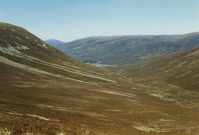
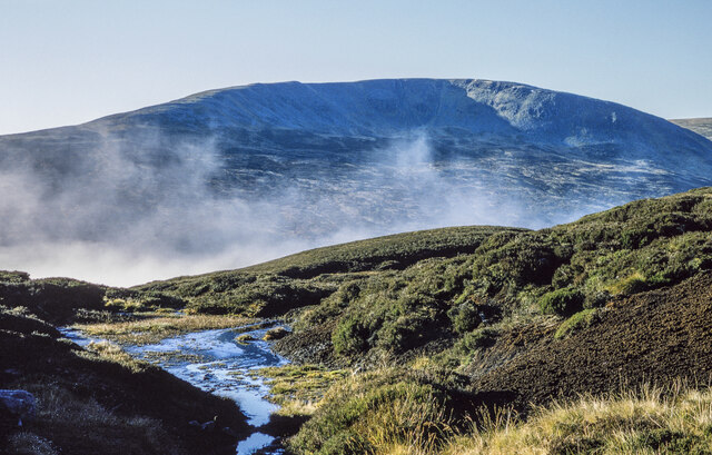
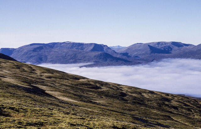
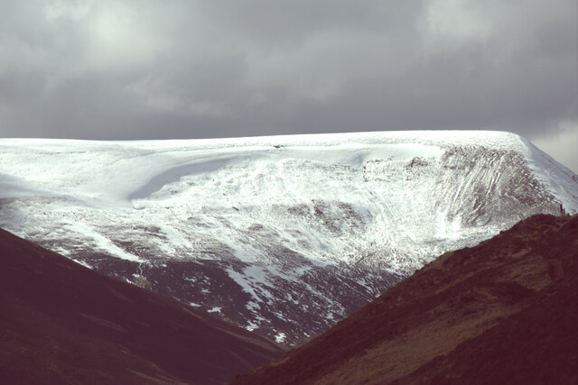
Coire an Tuirc, located in Inverness-shire, Scotland, is a breathtaking glacial valley that lies within the larger Cairngorms National Park. The valley is surrounded by majestic mountains and offers visitors a stunning natural landscape to explore.

The name "Coire an Tuirc" translates to "Corrie of the Boar" in English, referencing the valley's shape resembling a boar's head. The valley is situated in the eastern part of the Cairngorms, known for its rugged beauty and diverse wildlife.

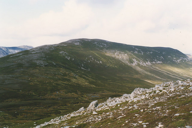
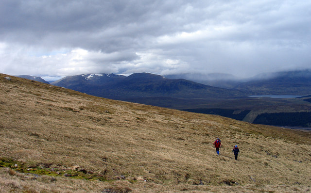
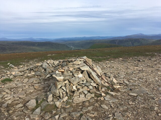
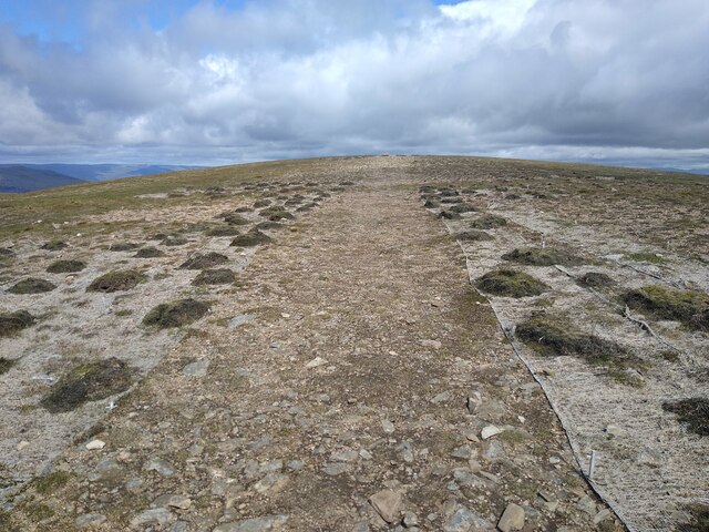
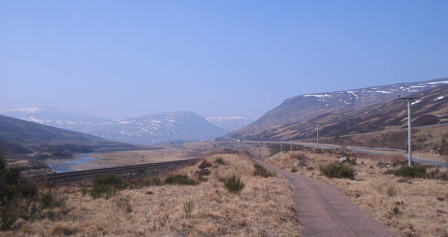
Coire an Tuirc is popular among hikers and nature enthusiasts due to its accessibility and stunning vistas. The valley provides numerous opportunities for outdoor activities such as hiking, mountaineering, and birdwatching. The trails within the valley cater to different levels of fitness, allowing both experienced hikers and casual walkers to enjoy the area.

The landscape within Coire an Tuirc is characterized by steep slopes, rocky cliffs, and a glistening loch nestled at its heart. The loch, known as Loch Avon, is a picturesque gem that adds to the valley's allure. It offers a peaceful setting for picnics or simply taking in the surrounding beauty.

Wildlife is abundant in the area, with various species of birds, such as golden eagles and ptarmigans, frequently spotted. Red deer and mountain hares are also commonly seen in the valley, adding to the natural charm of the location.

Coire an Tuirc is a place of outstanding natural beauty, providing visitors with an opportunity to immerse themselves in the stunning Scottish Highlands. Whether it's for a day trip or an extended stay, this valley offers an unforgettable experience for those seeking solace in nature's embrace.

If you have any feedback on the listing, please let us know in the comments section below.

Coire an Tuirc Images

Images are sourced within 2km of 56.857111/-4.2736995 or Grid Reference NN6176. Thanks to Geograph Open Source API. All images are credited.

Looking down Coire Fhàr With the useful stalkers' path making its way up through the heather, and the A9 visible in the distance.
Looking down Coire Fhàr
With the useful stalkers' path making its way up through the heather, and the A9 visible in the distance.
Geal Charn from A' Mharconaich Looking over the col at the head of Coire Fhàr to Geal Charn, from the western end of A' Mharconaich's summit ridge.
Geal Charn from A' Mharconaich
Looking over the col at the head of Coire Fhàr to Geal Charn, from the western end of A' Mharconaich's summit ridge.
Grassy slope of Coire Fhàr Coire Fhàr is a very shallow affair, hardly a corrie in anything but name; it's located on the northern flanks of the Munro, A' Mharconaich. A fragment of Loch Ericht can be seen at the right side of the image behind the two walkers and the dark peaks left of centre are Ben Alder and Beinn Bheoil. To the right of those mountains the haze of a rain shower can be seen.
Grassy slope of Coire Fhàr
Coire Fhàr is a very shallow affair, hardly a corrie in anything but name; it's located on the northern flanks of the Munro, A' Mharconaich. A fragment of Loch Ericht can be seen at the right side of the image behind the two walkers and the dark peaks left of centre are Ben Alder and Beinn Bheoil. To the right of those mountains the haze of a rain shower can be seen.
A9, Pass of Drumochter A single carriageway stretch.
A9, Pass of Drumochter
A single carriageway stretch.
The Pass of Drumochter Without any doubt one of my favourite places in Scotland.
The Pass of Drumochter
Without any doubt one of my favourite places in Scotland.
Pass of Drumochter Taken a short walk south of the large layby. The Boar of Badenoch is the prominent hill to the left in the photograph.
Pass of Drumochter
Taken a short walk south of the large layby. The Boar of Badenoch is the prominent hill to the left in the photograph.
Crude wind shelter atop A' Mharconaich
A9, entering The Highlands
Erosion protection The last stretch of path to the summit of A' Mharconaich, over the windblown plateau, is protected on both sides by mesh, to hold the sparse vegetation in place.
Erosion protection
The last stretch of path to the summit of A' Mharconaich, over the windblown plateau, is protected on both sides by mesh, to hold the sparse vegetation in place.
Gap in the trees, Pass of Drumochter A strip of trees was planted beside the A9 to keep the snow off. The gap here, by a big layby, was cut for the service road used to build the Beauly Denny powerline. The road has since been removed from here.
Gap in the trees, Pass of Drumochter
A strip of trees was planted beside the A9 to keep the snow off. The gap here, by a big layby, was cut for the service road used to build the Beauly Denny powerline. The road has since been removed from here.
Druimuachdar Pass Summit, 1983 Railway sign for Druimuachdar Summit, the highest point of the UK railway network at 1,484 feet above sea level. The sign has since been replaced. The vehicles in the background are on the A9.
Druimuachdar Pass Summit, 1983
Railway sign for Druimuachdar Summit, the highest point of the UK railway network at 1,484 feet above sea level. The sign has since been replaced. The vehicles in the background are on the A9.
A9 north of Dalnaspidal
Bog and peat banks at col The col between A' Mharconaich and the Boar of Badenoch.
Sgairneach Mhòr is the mountain beyond the wisps of mist.
Bog and peat banks at col
The col between A' Mharconaich and the Boar of Badenoch. Sgairneach Mhòr is the mountain beyond the wisps of mist.
North-west facing slope of A' Mharconaich A temperature inversion has allowed a sea of cloud to develop over Loch Ericht.
In the distance are Ben Bheòil and Ben Alder at the left side of the image. Aonach Beag is the highest among the mountains in the chain to the right.
North-west facing slope of A' Mharconaich
A temperature inversion has allowed a sea of cloud to develop over Loch Ericht. In the distance are Ben Bheòil and Ben Alder at the left side of the image. Aonach Beag is the highest among the mountains in the chain to the right.
The Highland Main Line Train on the Inverness to S Scotland line, nearing its highest point
The Highland Main Line
Train on the Inverness to S Scotland line, nearing its highest point
A9 at Pass of Drumochter
Dalnaspidal Forest from the Pass of Drumochter
An Torc from Dalnapsidal
Show me another place!

Coire an Tuirc is located at Grid Ref: NN6176 (Lat: 56.857111, Lng: -4.2736995)

Unitary Authority: Highland

Police Authority: Highlands and Islands

What 3 Words

///comment.ironclad.toast. Near Newtonmore, Highland

Nearby Locations

Coire an Tuirc

Related Wikis

A' Mharconaich

A' Mharconaich (Scottish Gaelic: A' Mharcanaich) is a mountain near Dalwhinnie in the Scottish Highlands. It is a Munro with a height of 975 metres (3...

Pass of Drumochter

The Pass of Drumochter (Scottish Gaelic: Druim Uachdair) meaning simply 'high ridge' is the main mountain pass between the northern and southern central...

The Sow of Atholl

The Sow of Atholl (Scottish Gaelic: Meall an Dobharchain) is a Scottish hill which is situated 27 kilometres west-northwest of the town of Blair Atholl...

Sgairneach Mhòr

Sgairneach Mhòr is a Scottish mountain which lies in a group of seven Munros near the summit of the Pass of Drumochter and are known as the Drumochter...

Have you been to Coire an Tuirc?

Leave your review of Coire an Tuirc below (or comments, questions and feedback).