Barons Court

Settlement in Middlesex

England

Barons Court

Philanthropic dwellings, Lillie Road, SW6 Names over the entrances identify 'Block A' and 'Block B' - rather heartlessly, it seems to me - as if this were a penal colony.   Looking at the style of the block, my guess was that these are (or were) Peabody buildings - and other contributions confirm that this is the case.   They must date from about 1900.

On a Friday evening in August the street was rather busier than the image suggests - I waited for a gap in pedestrian traffic.
Philanthropic dwellings, Lillie Road, SW6 Credit: Stefan Czapski

Barons Court is a residential district located in the London Borough of Hammersmith and Fulham, in the former county of Middlesex, England. Situated in West London, it borders the affluent neighborhoods of Kensington and Chelsea, Hammersmith, and Fulham.

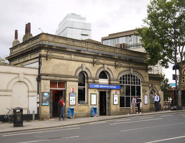
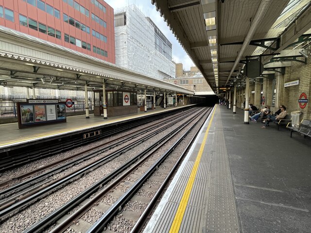
The area takes its name from the Barons Court railway station, which was opened in 1905 and remains a key transport hub for commuters. The station provides convenient access to the District and Piccadilly lines, connecting Barons Court to the wider London Underground network.

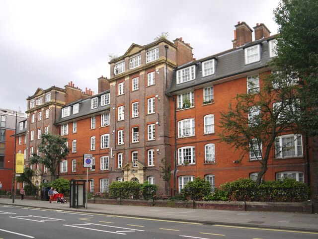
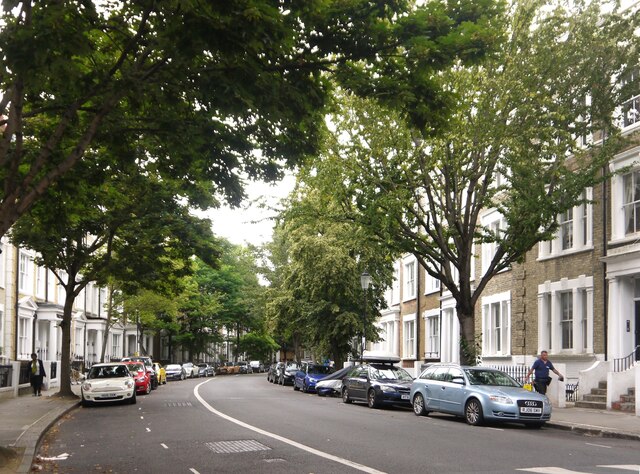
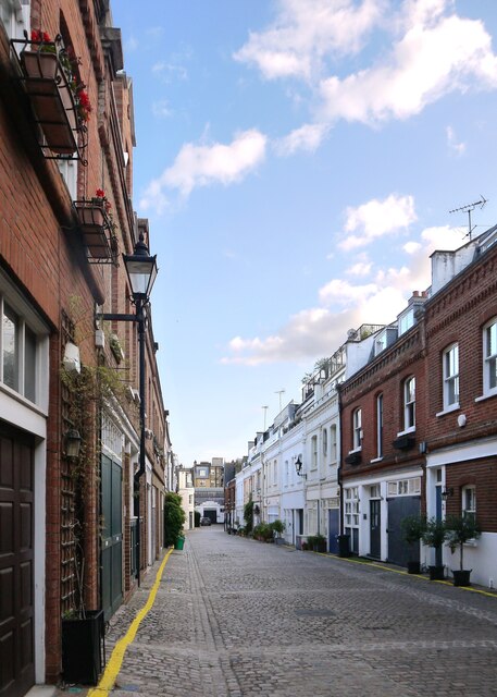
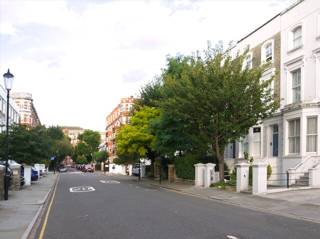
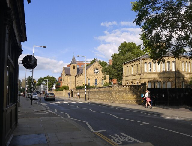
Barons Court is primarily a residential area, characterized by rows of Victorian and Edwardian terraced houses, many of which have been converted into flats. The district attracts a mix of young professionals, families, and students due to its proximity to several prominent educational institutions, including Imperial College London and the Royal College of Art.

The area offers a range of amenities, including local shops, cafes, and restaurants, with the nearby North End Road hosting a popular street market. Residents can also enjoy the green spaces of Normand Park and Bishops Park, which offer recreational facilities such as playgrounds and sports fields.

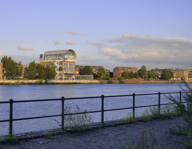
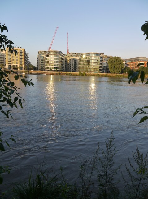
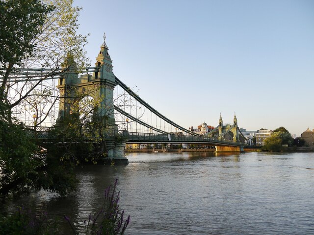
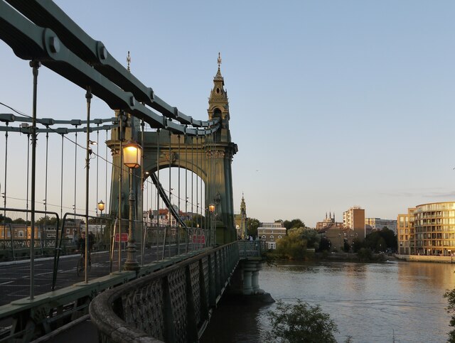
Barons Court's central location provides easy access to various cultural and entertainment venues, including the Olympia Exhibition Centre and Hammersmith Apollo, both within walking distance. Additionally, the nearby River Thames offers picturesque walks and access to the Thames Path.

Overall, Barons Court offers a desirable residential location with excellent transport links, a variety of amenities, and close proximity to renowned educational institutions and cultural attractions.

If you have any feedback on the listing, please let us know in the comments section below.

Barons Court Images

Images are sourced within 2km of 51.489041/-0.211051 or Grid Reference TQ2478. Thanks to Geograph Open Source API. All images are credited.

Philanthropic dwellings, Lillie Road, SW6 Names over the entrances identify 'Block A' and 'Block B' - rather heartlessly, it seems to me - as if this were a penal colony.   Looking at the style of the block, my guess was that these are (or were) Peabody buildings - and other contributions confirm that this is the case.   They must date from about 1900.

On a Friday evening in August the street was rather busier than the image suggests - I waited for a gap in pedestrian traffic.
Philanthropic dwellings, Lillie Road, SW6
Names over the entrances identify 'Block A' and 'Block B' - rather heartlessly, it seems to me - as if this were a penal colony. Looking at the style of the block, my guess was that these are (or were) Peabody buildings - and other contributions confirm that this is the case. They must date from about 1900. On a Friday evening in August the street was rather busier than the image suggests - I waited for a gap in pedestrian traffic.
Brompton Cemetery: a view towards the colonnades Much of the northern part of the cemetery is overgrown, in effect left as a nature reserve.
Brompton Cemetery: a view towards the colonnades
Much of the northern part of the cemetery is overgrown, in effect left as a nature reserve.
West Brompton station: entrance hall For as long as I can remember - and that means about half a century - this station has  looked shabby.   I don't suppose there's much that can be done about the clutter of signs and posters around a railway station.  But it is known that the façade was originally symmetrical, with two tall arched windows on either side of the central doorway - the outsize window to the right is a 20th-century alteration. <span class="nowrap"><a title="https://historicengland.org.uk/listing/the-list/list-entry/1385365" rel="nofollow ugc noopener" href="https://historicengland.org.uk/listing/the-list/list-entry/1385365">Link</a><img style="margin-left:2px;" alt="External link" title="External link - shift click to open in new window" src="https://s1.geograph.org.uk/img/external.png" width="10" height="10"/></span>    Surely the 'streetscape' would benefit if the building's symmetry were restored?  

Or am I being too 'architectural'?  The big 'orangery' window will let in a lot more daylight - and help limit the building's carbon footprint.

A photo taken by Ben Brooksbank in 1963 shows that this area was once something of an urban backwater: <a title="https://www.geograph.org.uk/photo/1974041" href="https://www.geograph.org.uk/photo/1974041">Link</a>   Local industry included the London factory of the Rover car company, in Seagrave Road,  Residential density has increased greatly in the last 30 years, and buildings are far taller than they were in the mid-20th century.
West Brompton station: entrance hall
For as long as I can remember - and that means about half a century - this station has looked shabby. I don't suppose there's much that can be done about the clutter of signs and posters around a railway station. But it is known that the façade was originally symmetrical, with two tall arched windows on either side of the central doorway - the outsize window to the right is a 20th-century alteration. LinkExternal link Surely the 'streetscape' would benefit if the building's symmetry were restored? Or am I being too 'architectural'? The big 'orangery' window will let in a lot more daylight - and help limit the building's carbon footprint. A photo taken by Ben Brooksbank in 1963 shows that this area was once something of an urban backwater: Link Local industry included the London factory of the Rover car company, in Seagrave Road, Residential density has increased greatly in the last 30 years, and buildings are far taller than they were in the mid-20th century.
Counters Creek (or the Kensington Canal?) by West Brompton station Leaving West Brompton station after travelling for the very first time on the West London line, I looked over my shoulder and noticed this body of water and the old seed-heads of reed mace - bullrushes. As a schoolboy I had (for seven years) travelled into town on the District Line, and in those days there were railway sidings here - where the tall block of flats now stands.  I'd never suspected that there was a watercourse here, between the station and sidings - there hardly seemed to be room.

As for the identity of this body of water, Geograph came to the rescue - in the person of Christopher Hilton.  He doesn't seem to have seen this stretch of water, but spotted the remains of a bridge a little further north.  <a href="https://www.geograph.org.uk/photo/2874319">TQ2578 : West Brompton: traces of Counters Creek and the Kensington Canal</a>   He also suggests that the same watercourse is known as Chelsea Creek where it reaches the Thames:  
<a href="https://www.geograph.org.uk/photo/3409463">TQ2677 : Former Lots Road Power Station, from the Thames</a>

A quick look at a map or two suggests that the boundary between the old boroughs of Fulham (to the west) and Kensington and Chelsea runs along Counters Creek from here right down to the Thames.  It's a hypothesis I need to look at in more detail.

Incidentally, along the Thames the name 'creek' generally denotes a tidal tributary.  It's a bizarre thought, but is it possible that the tide once flowed under the Old Brompton Road?
Counters Creek (or the Kensington Canal?) by West Brompton station
Leaving West Brompton station after travelling for the very first time on the West London line, I looked over my shoulder and noticed this body of water and the old seed-heads of reed mace - bullrushes. As a schoolboy I had (for seven years) travelled into town on the District Line, and in those days there were railway sidings here - where the tall block of flats now stands. I'd never suspected that there was a watercourse here, between the station and sidings - there hardly seemed to be room. As for the identity of this body of water, Geograph came to the rescue - in the person of Christopher Hilton. He doesn't seem to have seen this stretch of water, but spotted the remains of a bridge a little further north. TQ2578 : West Brompton: traces of Counters Creek and the Kensington Canal He also suggests that the same watercourse is known as Chelsea Creek where it reaches the Thames: TQ2677 : Former Lots Road Power Station, from the Thames A quick look at a map or two suggests that the boundary between the old boroughs of Fulham (to the west) and Kensington and Chelsea runs along Counters Creek from here right down to the Thames. It's a hypothesis I need to look at in more detail. Incidentally, along the Thames the name 'creek' generally denotes a tidal tributary. It's a bizarre thought, but is it possible that the tide once flowed under the Old Brompton Road?
An Indian Bean Tree in Brompton Cemetery Seed-cases of the Indian bean tree (Catalpa bignonioides).  The name might be considered misleading, as the tree is native to the south-eastern states of the USA.

I know of only one other example of this species - a street tree on the Twickenham side of Richmond Bridge (in Duck Walk, I think).
An Indian Bean Tree in Brompton Cemetery
Seed-cases of the Indian bean tree (Catalpa bignonioides). The name might be considered misleading, as the tree is native to the south-eastern states of the USA. I know of only one other example of this species - a street tree on the Twickenham side of Richmond Bridge (in Duck Walk, I think).
Kempsford Gardens, London, SW5
'Beans' on an Indian Bean Tree, Brompton Cemetery 'Indian' in this instance means Native American.   The seed-pods in the picture are fully-grown but still ripening - blackish where they face the sun, still green on the sheltered side.  Most are a foot (30cm) or more in length.

The Linnean name for this species is Catalpa bignonioides.
'Beans' on an Indian Bean Tree, Brompton Cemetery
'Indian' in this instance means Native American. The seed-pods in the picture are fully-grown but still ripening - blackish where they face the sun, still green on the sheltered side. Most are a foot (30cm) or more in length. The Linnean name for this species is Catalpa bignonioides.
An Indian Bean Tree (Catalpa bignonioides) in Brompton Cemetery By the fourth week of August there was quite a heavy crop of 'beans' on this tree.
An Indian Bean Tree (Catalpa bignonioides) in Brompton Cemetery
By the fourth week of August there was quite a heavy crop of 'beans' on this tree.
Brompton Cemetery: light and shade in a colonnade This is one of four colonnades that form a circle (or, more accurately, a near-circle).

I find it hard to convey - either in words or in pictures - the scale and ambition of the cemetery's colonnades.  It is almost as if the Romans had built a Stonehenge or an Avebury in their own style - abandoning it to be adopted as a burial ground by a later civilisation.

The building material is limestone of a very warm colour - perhaps Ancaster stone from Lincolnshire.
Brompton Cemetery: light and shade in a colonnade
This is one of four colonnades that form a circle (or, more accurately, a near-circle). I find it hard to convey - either in words or in pictures - the scale and ambition of the cemetery's colonnades. It is almost as if the Romans had built a Stonehenge or an Avebury in their own style - abandoning it to be adopted as a burial ground by a later civilisation. The building material is limestone of a very warm colour - perhaps Ancaster stone from Lincolnshire.
Rush-hour in Adam & Eve Mews, W8 Adam & Eve Mews is a direct turning off Kensington High Street, not far from the Underground station.  At a quarter past six in the evening I dodged through here on my way to Abingdon Villas.   I saw not a single motor vehicle and scarcely a living soul - just one resident sitting outside her front door, reading.

Good to see that cobbles have survived here.
Rush-hour in Adam & Eve Mews, W8
Adam & Eve Mews is a direct turning off Kensington High Street, not far from the Underground station. At a quarter past six in the evening I dodged through here on my way to Abingdon Villas. I saw not a single motor vehicle and scarcely a living soul - just one resident sitting outside her front door, reading. Good to see that cobbles have survived here.
Abingdon Villas, Kensington W8
Fulham riverside seen from the Barnes towpath Photo taken by evening light from a point close to the old Harrods depository.   The tide was high, and just turning.
Fulham riverside seen from the Barnes towpath
Photo taken by evening light from a point close to the old Harrods depository. The tide was high, and just turning.
Fulham riverside developments, August 2021 Seen from the Barnes towpath by Riverview Gardens.
Fulham riverside developments, August 2021
Seen from the Barnes towpath by Riverview Gardens.
Hammersmith Bridge at sunset (1) Photo taken from the towpath by Riverview Gardens.
Hammersmith Bridge at sunset (1)
Photo taken from the towpath by Riverview Gardens.
Hammersmith Bridge at sunset (2) Taken at a time when the bridge was closed to motor traffic because of structural problems.
Hammersmith Bridge at sunset (2)
Taken at a time when the bridge was closed to motor traffic because of structural problems.
"Marjon's", Fulham Road The Victorian brick buildings used to house the College of St Mark and St John, a teacher-training college.  The OS mapping suggests that they now form part of Kensington & Chelsea College.  The brickwork is a good deal brighter and cleaner than it used to be.

Marjon's moved to Devon a good many years ago, and has now become the University of St Mark & St John, Plymouth.
"Marjon's", Fulham Road
The Victorian brick buildings used to house the College of St Mark and St John, a teacher-training college. The OS mapping suggests that they now form part of Kensington & Chelsea College. The brickwork is a good deal brighter and cleaner than it used to be. Marjon's moved to Devon a good many years ago, and has now become the University of St Mark & St John, Plymouth.
High Street Kensington Underground station, London Opened in 1868 as "Kensington High Street" by the Metropolitan Railway on its line from Edgware Road to Gloucester Road. The name was changed to the current one in 1895.
View north west towards Notting Hill Gate and Edgware Road.
High Street Kensington Underground station, London
Opened in 1868 as "Kensington High Street" by the Metropolitan Railway on its line from Edgware Road to Gloucester Road. The name was changed to the current one in 1895. View north west towards Notting Hill Gate and Edgware Road.
St Paul's Church, Hammersmith
Show me another place!

Barons Court is located at Grid Ref: TQ2478 (Lat: 51.489041, Lng: -0.211051)

Unitary Authority: Hammersmith and Fulham

Police Authority: Metropolitan

What 3 Words

///rides.humans.weds. Near Hammersmith, London

Related Wikis

Barons Court Theatre

Barons Court Theatre is a small theatre of 52 cinema-style seats located in the basement of The Curtains Up public house in Comeragh Road in West London...

Queen's Club Championships

The Queen's Club Championships is an annual tournament for men's tennis, held on grass courts at the Queen's Club in West Kensington, London. The event...
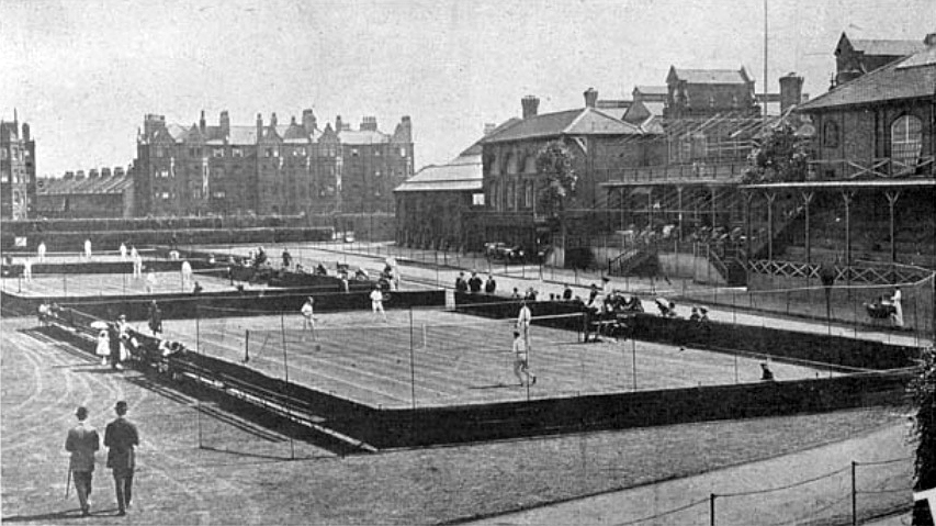
Queen's Club

The Queen's Club is a private sporting club in Barons Court, West Kensington, London, England. The club hosts the annual Queen's Club Championships men...

Barons Court tube station

Barons Court is a London Underground station in West Kensington in the London Borough of Hammersmith and Fulham, Greater London. This station serves the...

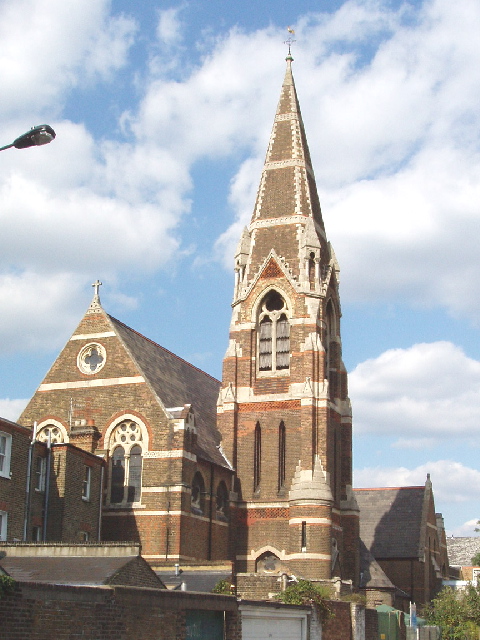
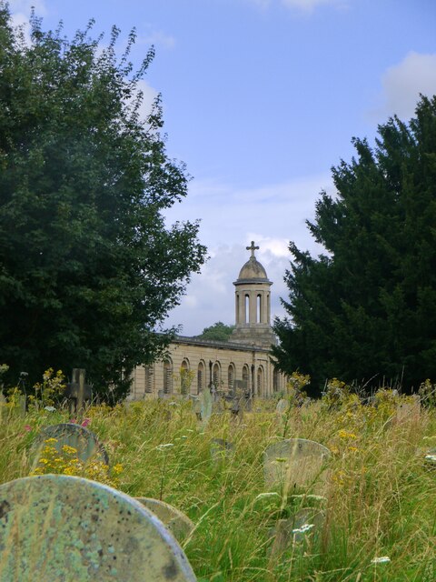
St Andrew's Church, Fulham

St. Andrew's Church, Fulham, also known as St. Andrew's Church, West Kensington, is a Church of England church located in West Kensington, near Fulham...

London Academy of Music and Dramatic Art

The London Academy of Music and Dramatic Art (LAMDA) is a drama school located in Hammersmith, London. It is the oldest specialist drama school in the...

Fulham School

Fulham School, originally founded as Fulham Preparatory School, is a school in Fulham, London, teaching children from the age of three up to eighteen....
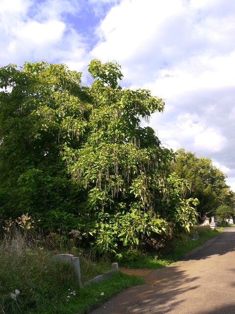
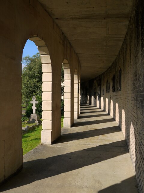
Margravine Cemetery

Margravine Cemetery, also known as Hammersmith Cemetery, is in the London Borough of Hammersmith and Fulham. The closest London Underground station is...

Nearby Amenities

Located within 500m of 51.489041,-0.211051
Motorway Junction
Hammersmith Flyover
Lat/Long: 51.4908023/-0.2174154
Ref GB Tflcid: RWG043961
Traffic Calming: cushion
Lat/Long: 51.4879732/-0.2072347
Ref GB Tflcid: RWG043106
Traffic Calming: cushion
Lat/Long: 51.4883451/-0.2074913
Mini Roundabout
Direction: clockwise
Lat/Long: 51.4918221/-0.2111168
Traffic Calming: cushion
Lat/Long: 51.4932241/-0.2115559
Traffic Calming: cushion
Lat/Long: 51.493203/-0.2107157
Car Sharing
Capacity: 1
Operator: Streetcar
Source: WebSite
Lat/Long: 51.4851779/-0.2142549
Car Sharing
Capacity: 1
Operator: Streetcar
Source: WebSite
Lat/Long: 51.485405/-0.21359
Car Sharing
Capacity: 1
Operator: Streetcar
Source: WebSite
Lat/Long: 51.487102/-0.2167439
Pub
The Colton Arms
Created By: Potlatch 0.10f
Lat/Long: 51.4865599/-0.210879
Post Box
Ref: W14 33
Lat/Long: 51.4864202/-0.2107548
Post Box
Ref: W14 32
Lat/Long: 51.4861742/-0.2077451
Post Box
Collection Times: Mo-Fr 17:30; Sa 12:00
Operator: Royal Mail
Operator Wikidata: Q638098
Ref: W14 7
Lat/Long: 51.4863844/-0.2058798
Barons Court
Naptan AtcoCode: 490000017E
Naptan Bearing: E
Naptan CommonName: Barons Court
Naptan Indicator: Stop
Naptan Verified: no
No Highway: bus_stop
Note: There is no street furniture, no layby and it is a red route (no stopping)
Lat/Long: 51.4908037/-0.2128851
Barons Court
Naptan AtcoCode: 490000017W
Naptan Bearing: W
Naptan CommonName: Barons Court
Naptan Indicator: Stop
Naptan Verified: no
No Highway: bus_stop
Note: There is no street furniture, no layby and it is a red route (no stopping)
Lat/Long: 51.4905725/-0.2129835
Bus Stop
West Kensington Station
Bench: yes
Bin: yes
Bus: yes
Local Ref: S
Naptan AtcoCode: 490000265A
Naptan Bearing: S
Naptan CommonName: West Kensington
Naptan Indicator: Stop S
Naptan Street: NORTH END ROAD
Naptan Verified: no
Public Transport: platform
Shelter: yes
Lat/Long: 51.4905333/-0.2065895
Bus Stop
West Kensington Station
Bench: yes
Bin: no
Bus: yes
Local Ref: T
Naptan AtcoCode: 490000265B
Naptan Bearing: N
Naptan CommonName: West Kensington
Naptan Indicator: Stop T
Naptan Street: NORTH END ROAD
Naptan Verified: yes
Public Transport: platform
Shelter: yes
Lat/Long: 51.4899213/-0.2064561
Bus Stop
Lytton Estate
Bench: yes
Bin: yes
Bus: yes
Lit: yes
Local Ref: R
Naptan AtcoCode: 490009492S
Naptan Bearing: S
Naptan CommonName: Lytton Estate
Naptan Indicator: Stop R
Naptan Street: NORTH END ROAD
Naptan Verified: no
Public Transport: platform
Ref: 76311
Shelter: yes
Source Ref: naptan
Tactile Paving: no
Lat/Long: 51.4926464/-0.2076477
Beaumont Crescent
Naptan AtcoCode: 490016278S
Naptan Bearing: S
Naptan CommonName: Beaumont Crescent
Naptan Verified: no
Lat/Long: 51.4889285/-0.2048174
Post Box
Ref: W14 35
Lat/Long: 51.492081/-0.2131855
Post Box
Fixme: Check exact position.
Ref: W14 22
Lat/Long: 51.4880968/-0.2100836
Ref GB Tflcid: RWG043972
Traffic Calming: cushion
Lat/Long: 51.4865457/-0.2132899
The Idle Hour
Addr City: London
Addr Country: GB
Addr Housenumber: 171
Addr Postcode: W6 8NL
Addr Street: Greyhound Road
Disused Amenity: pub
Phone: +44 20 7386 9007
Lat/Long: 51.4861911/-0.2129888
Bicycle: no
Foot: yes
Horse: no
Motor Vehicle: no
Opening Hours: Jan-Mo-Sa 09:00-16:00; Jan-Mo-Sa 09: Su 10:00-16:00; Feb-Mo-Sa 09:00-17:00; Feb-Mo-Sa 09: Su 10:00-17:00; Mar-Mo-Sa 09:00-18:00; Mar-Mo-Sa 09: Su 10:00-18:00; Apr-Mo-Sa 09:00-19:00; Apr-Mo-Sa 09: Su 10:00-19:00; May-Jul-Mo-Sa 09:00-20:00; May-Jul-Mo-Sa 09
Lat/Long: 51.490115/-0.2140424
Historic: memorial
Lat/Long: 51.488488/-0.21613
Crossing
Crossing: traffic_signals
Lat/Long: 51.4906625/-0.2130971
Crossing
Crossing: traffic_signals
Crossing Ref: pelican
Traffic Signals Sound: no
Traffic Signals Vibration: no
Lat/Long: 51.4907871/-0.2135611
Crossing
Button Operated: yes
Crossing: traffic_signals
Crossing Ref: pelican
Tactile Paving: yes
Traffic Signals Sound: no
Traffic Signals Vibration: no
Lat/Long: 51.4907052/-0.2135717
Crossing
Crossing: traffic_signals
Tactile Paving: no
Lat/Long: 51.4907569/-0.2130833
Atm
Brand: NoteMachine
Brand Wikidata: Q104368525
Fee: no
Operator: NoteMachine
Operator Short: NMATM
Operator Wikidata: Q104368525
Lat/Long: 51.4909945/-0.213483
Bicycle Parking
Capacity: 24
Covered: no
Lat/Long: 51.4908598/-0.2135519
Addr City: London
Addr Housenumber: 1A
Addr Postcode: W14 0SY
Addr Street: Fitz-George Avenue
Entrance: yes
Lat/Long: 51.4930151/-0.2119947
Note: Estate office.
Lat/Long: 51.4934285/-0.2114199
Post Box
Ref: W14 39
Lat/Long: 51.4932935/-0.2112253
Post Box
Post Box Apertures: 2
Post Box Design: type_c
Post Box Type: pillar
Ref: W14 43
Lat/Long: 51.4902475/-0.2132939
Barrier: entrance
Lat/Long: 51.4909748/-0.2133854
Telephone
Booth: KXPlus
Lat/Long: 51.4903333/-0.2132923
West Kensington
Operator: Transport for London
Public Transport: stop_position
Railway: stop
Source: GPX
Subway: yes
Lat/Long: 51.4906873/-0.2059366
Level: 0
Lat/Long: 51.4902599/-0.213602
Barons Court
Operator: Transport for London
Public Transport: stop_position
Railway: stop
Subway: yes
Lat/Long: 51.4902649/-0.2144762
Barons Court
Level: 0
Railway: subway_entrance
Wheelchair: no
Lat/Long: 51.4902844/-0.2133495
Barons Court
Operator: Transport for London
Public Transport: stop_position
Railway: stop
Subway: yes
Lat/Long: 51.4903359/-0.2144949
Level: 0
Lat/Long: 51.4903484/-0.2135834
Barons Court
Operator: Transport for London
Public Transport: stop_position
Railway: stop
Subway: yes
Lat/Long: 51.4904269/-0.214492
Post Box
Collection Times: Mo-Fr 16:00; Sa 12:00
Ref: W14 6
Lat/Long: 51.4890454/-0.2069173
Railway: subway_entrance
Lat/Long: 51.490573/-0.2065713
Crossing
Button Operated: yes
Crossing: traffic_signals
Crossing Ref: pelican
Tactile Paving: yes
Lat/Long: 51.4908688/-0.2066935
Crossing
Crossing: traffic_signals
Crossing Ref: pelican
Lat/Long: 51.491002/-0.2065632
Sainsbury's Local
Addr Housenumber: 3
Addr Street: North End Crescent
Brand: Sainsbury's Local
Brand Wikidata: Q13218434
Brand Wikipedia: en:Sainsbury's Local
Old Name: The Fox (pub)
Operator: Sainsbury's
Shop: convenience
Source: survey
Website: https://stores.sainsburys.co.uk/4408/hammersmith-north-end-crescent-local
Lat/Long: 51.4921991/-0.2072432
Crossing
Button Operated: yes
Crossing: traffic_signals
Crossing Island: no
Crossing Ref: pelican
Source: Bing;photographic_survey
Tactile Paving: yes
Traffic Signals Sound: yes
Traffic Signals Vibration: yes
Lat/Long: 51.4902584/-0.2065722
Man Made: surveillance
Source: photograph
Surveillance: public
Lat/Long: 51.4907331/-0.2069236
Crossing
Crossing: traffic_signals
Crossing Ref: pelican
Source: Bing;photographic_survey
Lat/Long: 51.4907874/-0.2071459
Crossing
Crossing: traffic_signals
Crossing Ref: pelican
Source: Bing;photographic_survey
Lat/Long: 51.4909202/-0.207109
Body Lounge Spa
Beauty: spa
Shop: beauty
Source: photograph
Lat/Long: 51.4897251/-0.2065017
Bicycle Parking
Bicycle Parking: stands
Capacity: 1
Check Date: 2023-02-19
Source: photograph
Lat/Long: 51.4888633/-0.2057203
Atm
Source: photograph
Lat/Long: 51.4889224/-0.2058294
Bicycle Parking
Bicycle Parking: stands
Capacity: 3
Check Date: 2023-02-19
Source: photograph
Lat/Long: 51.4889156/-0.2058043
Crossing
Button Operated: yes
Crossing: traffic_signals
Crossing Island: no
Crossing Ref: pelican
Source: Bing;photographic_survey
Tactile Paving: yes
Traffic Signals Sound: yes
Traffic Signals Vibration: yes
Lat/Long: 51.4894742/-0.2060877
Post Box
Brand: Royal Mail
Brand Wikidata: Q638098
Collection Times: Mo-Fr 17:30; Sa 12:00
Operator: Royal Mail
Operator Wikidata: Q638098
Post Box Type: pillar
Ref: W14 30
Source: photograph
Lat/Long: 51.4900171/-0.2065358
Telephone
Colour: black
Note: Non-BT payphone, presumably Spectrum Interactive?
Lat/Long: 51.4901708/-0.2066325
Bicycle Parking
Bicycle Parking: stands
Capacity: 6
Covered: no
Source: photograph
Lat/Long: 51.4901655/-0.2066096
Telephone
Booth: InLink
Operator: BT
Source: photograph
Lat/Long: 51.4881891/-0.2042058
Vending Machine
Operator: Hammersmith and Fulham Council
Ref: 503
Source: survey
Vending: parking_tickets
Lat/Long: 51.4914466/-0.2171208
Telephone
Booth: KXPlus
Operator: BT
Operator Wikidata: Q593786
Source: survey
Lat/Long: 51.4910714/-0.2133441
Telephone
Booth: KXPlus
Operator: BT
Source: survey
Lat/Long: 51.4922453/-0.2075941
Telephone
Operator: Spectrum Interactive
Source: survey
Lat/Long: 51.4922749/-0.2076131
Atm
Brand: Sainsbury's Bank
Brand Wikidata: Q7400525
Brand Wikipedia: en:Sainsbury's Bank
Fee: no
Operator: Sainsbury's Bank
Operator Wikidata: Q7400525
Source: photograph
Lat/Long: 51.492274/-0.207338
Ref GB Tflcid: RWG043096
Traffic Calming: cushion
Lat/Long: 51.489712/-0.2103695
Ref GB Tflcid: RWG043191
Traffic Calming: cushion
Lat/Long: 51.4897617/-0.2113843
Atm
Source: photograph
Wheelchair: yes
Lat/Long: 51.490052/-0.2134251
Telephone
Note: Non-BT payphone, presumably Spectrum Interactive?
Source: photograph
Lat/Long: 51.4900856/-0.2134298
Addr City: London
Addr Country: GB
Addr Housenumber: 21
Addr Street: Barons Court Road
Source: survey
Lat/Long: 51.4897712/-0.2083411
Old Phone: +44 20 7370 2227
Removed Amenity: telephone
Source: survey
Lat/Long: 51.4892766/-0.2097951
Barons Court
Fare Zone: 2
Line: District;Piccadilly
Name Ru: Баронс-Корт
Naptan AtcoCode: 940GZZLUBSC
Network: London Underground
Network Wikidata: Q20075
Platforms: 2
Public Transport: station
Railway: station
Ref Crs: ZBQ
Station: subway
Subway: yes
Wheelchair: no
Wikidata: Q808729
Wikipedia: en:Barons Court tube station
Lat/Long: 51.4903477/-0.2144055
West Kensington
Operator: Transport for London
Public Transport: stop_position
Railway: stop
Source: GPX
Subway: yes
Lat/Long: 51.4907142/-0.2059484
Barons Court
Operator: Transport for London
Public Transport: stop_position
Railway: stop
Subway: yes
Lat/Long: 51.4903646/-0.2144911
Barrier: bollard
Motor Vehicle: no
Source: bing
Lat/Long: 51.4896081/-0.2098834
Addr City: London
Addr Housenumber: 71
Addr Postcode: W6 8RN
Addr Street: Margravine Gardens
Building: yes
Lat/Long: 51.489382/-0.217886
Cycleway: asl
Direction: backward
Lat/Long: 51.4908728/-0.2132246
Cycleway: asl
Direction: forward
Lat/Long: 51.4905566/-0.2132223
Traffic Signals
Traffic Signals Direction: forward
Lat/Long: 51.4907922/-0.2136423
Traffic Signals
Traffic Signals Direction: forward
Lat/Long: 51.4906552/-0.2130267
Traffic Signals
Traffic Signals Direction: forward
Lat/Long: 51.4909082/-0.2071819
Crossing
Crossing: traffic_signals
Crossing Island: yes
Crossing Markings: dots
Crossing Ref: pelican
Lat/Long: 51.4907606/-0.2067978
Traffic Signals
Traffic Signals Direction: forward
Lat/Long: 51.4910702/-0.2070019
Traffic Signals
Traffic Signals Direction: backward
Lat/Long: 51.4907385/-0.2067853
Crossing
Crossing: traffic_signals
Crossing Ref: pelican
Lat/Long: 51.4910405/-0.2069833
Traffic Signals
Traffic Signals Direction: forward
Lat/Long: 51.4908873/-0.2065824
Addr City: London
Addr Housename: Block N
Addr Housenumber: 22-36
Addr Postcode: W14 9XB
Addr Street: Cheesemans Terrace
Level: 2
Lat/Long: 51.4876212/-0.2073622
Addr City: London
Addr Housenumber: 37-52
Addr Postcode: W14 9XD
Addr Street: Cheesemans Terrace
Level: 0
Lat/Long: 51.487818/-0.2064353
Addr City: London
Addr Housenumber: 80-103
Addr Postcode: W14 9XQ
Addr Street: Cheesemans Terrace
Level: 2
Lat/Long: 51.4879488/-0.2061448
Addr City: London
Addr Housenumber: 155-173
Addr Postcode: W14 9XR
Addr Street: Cheesemans Terrace
Level: 2
Lat/Long: 51.4875074/-0.2047204
Addr City: London
Addr Housenumber: 198-215
Addr Postcode: W14 9XT
Addr Street: Cheesemans Terrace
Level: 2
Lat/Long: 51.4880843/-0.2046653
Bicycle Rental
Colet Gardens
Bicycle Rental: docking_station
Brand: Santander Cycles
Brand Wikidata: Q807961
Local: Hammersmith
Network: tfl_cycle_hire
Official Name: Colet Gardens, Hammersmith
Official Ref: 608
Operator: Serco
Operator Wikidata: Q499104
Lat/Long: 51.4910339/-0.2164955
Bicycle Parking
Bicycle Parking: stands
Capacity: 12
Covered: no
Lat/Long: 51.4910496/-0.2070861
Bar
Nell's Jazz & Blues
Addr Housenumber: 3
Addr Street: North End Crescent
Website: https://nells.co.uk/
Lat/Long: 51.4923186/-0.2073341
Access: permissive
Barrier: lift_gate
Motor Vehicle: private
Lat/Long: 51.4933635/-0.20966
Entrance: yes
Lat/Long: 51.4934323/-0.211378
Entrance: yes
Lat/Long: 51.4934403/-0.2109619
West Kensington
Place: suburb
Wikidata: Q3567431
Wikipedia: en:West Kensington
Lat/Long: 51.4909928/-0.207486
Bicycle Parking
Lat/Long: 51.4902528/-0.2062599
Post Box
Brand: Royal Mail
Brand Wikidata: Q638098
Collection Times: Mo-Sa 09:00
Operator: Royal Mail
Operator Wikidata: Q638098
Post Box Type: pillar
Ref: W6 3D
Royal Cypher: no
Lat/Long: 51.4900458/-0.2164527
Recycling
Shoes and clothes
Name Es: Zapatos y ropa
Lat/Long: 51.4925734/-0.2075587
West Kensington
Fare Zone: 2
Line: District
Name Ru: Вест-Кенсингтон
Naptan AtcoCode: 940GZZLUWKN
Network: London Underground
Network Wikidata: Q20075
Public Transport: station
Railway: station
Source: GPX
Station: subway
Subway: yes
Wheelchair: no
Wikidata: Q944664
Wikipedia: en:West Kensington tube station
Lat/Long: 51.4907023/-0.2059442
Crossing
Crossing: unmarked
Crossing Island: yes
Tactile Paving: no
Lat/Long: 51.4929167/-0.2080834
Traffic Signals
Traffic Signals Direction: forward
Lat/Long: 51.4907021/-0.2135263
Level: -1
Lat/Long: 51.4902671/-0.2137228
Level: -0.5
Lat/Long: 51.4902643/-0.2136765
Level: -0.5
Lat/Long: 51.4902633/-0.2136602
Level: -1
Lat/Long: 51.4903578/-0.2137162
Level: -0.5
Lat/Long: 51.4903537/-0.2136584
Level: -0.5
Lat/Long: 51.4903525/-0.213641
Toilets
Lat/Long: 51.4881478/-0.2114458
Toilets
Lat/Long: 51.4879324/-0.212583
Internet Access: wlan
Lat/Long: 51.4879608/-0.2124757
Internet Access: wlan
Lat/Long: 51.4883332/-0.2114833
Bicycle Parking
Bicycle Parking: stands
Capacity: 8
Covered: no
Operator: Santander
Lat/Long: 51.4909927/-0.2055247
Barrier: cycle_barrier
Lat/Long: 51.4859522/-0.2146223
Bicycle Rental
Greyhound Road
Bicycle Rental: docking_station
Brand: Santander Cycles
Brand Wikidata: Q807961
Local: Hammersmith
Network: tfl_cycle_hire
Official Name: Greyhound Road, Hammersmith
Official Ref: 635
Operator: Serco
Lat/Long: 51.4860787/-0.2143191
Bicycle Rental
West Kensington Station
Bicycle Rental: docking_station
Brand: Santander Cycles
Brand Wikidata: Q807961
Capacity: 22
Local: West Kensington
Network: tfl_cycle_hire
Official Name: West Kensington Station, West Kensington
Official Ref: 660
Operator: Serco
Operator Wikidata: Q499104
Lat/Long: 51.4908716/-0.2059575
Bicycle Rental
Vereker Road
Bicycle Rental: docking_station
Brand: Santander Cycles
Brand Wikidata: Q807961
Local: West Kensington
Network: tfl_cycle_hire
Official Name: Vereker Road, West Kensington
Official Ref: 633
Operator: Serco
Operator Wikidata: Q499104
Lat/Long: 51.4896/-0.209379
Bicycle Rental
Gwendwr Road
Bicycle Rental: docking_station
Brand: Santander Cycles
Brand Wikidata: Q807961
Local: West Kensington
Network: tfl_cycle_hire
Official Name: Gwendwr Road, West Kensington
Official Ref: 770
Operator: Serco
Operator Wikidata: Q499104
Lat/Long: 51.4910108/-0.2091834
Bicycle Rental
Star Road
Bicycle Rental: docking_station
Brand: Santander Cycles
Brand Wikidata: Q807961
Local: West Kensington
Network: tfl_cycle_hire
Official Name: Star Road, West Kensington
Official Ref: 720
Operator: Serco
Lat/Long: 51.4871975/-0.2053836
Bicycle Rental
Barons Court Station
Bicycle Rental: docking_station
Brand: Santander Cycles
Brand Wikidata: Q807961
Local: West Kensington
Network: tfl_cycle_hire
Official Name: Barons Court Station, West Kensington
Official Ref: 707
Operator: Serco
Operator Wikidata: Q499104
Lat/Long: 51.4902/-0.215087
Bicycle Repair Station
Access: yes
Fee: no
Opening Hours: 24/7
Service Bicycle Chain Tool: no
Service Bicycle Pump: yes
Lat/Long: 51.4901966/-0.2139367
Traffic Signals
Traffic Signals Direction: backward
Lat/Long: 51.4902375/-0.2065629
Community Centre
Lat/Long: 51.4901589/-0.2043248
Traffic Calming: bump
Lat/Long: 51.4888478/-0.2067036
Traffic Calming: bump
Lat/Long: 51.487864/-0.2098324
Traffic Calming: bump
Lat/Long: 51.4858282/-0.2122276
Traffic Calming: cushion
Lat/Long: 51.486675/-0.2079921
Crossing
Crossing: unmarked
Crossing Island: yes
Lat/Long: 51.4869755/-0.2079595
Traffic Calming: bump
Lat/Long: 51.4853793/-0.2070335
Addr City: London
Addr Housenumber: 122
Addr Street: Baron's Court Road
Lat/Long: 51.4900499/-0.2129399
Addr City: London
Addr Housenumber: 120
Addr Street: Baron's Court Road
Lat/Long: 51.49004/-0.2128534
Addr City: London
Addr Housenumber: 118
Addr Street: Baron's Court Road
Lat/Long: 51.4900301/-0.2127669
Addr City: London
Addr Housenumber: 116
Addr Street: Baron's Court Road
Lat/Long: 51.4900202/-0.2126804
Addr City: London
Addr Housenumber: 114
Addr Street: Baron's Court Road
Lat/Long: 51.4900104/-0.2125939
Addr City: London
Addr Housenumber: 112
Addr Street: Baron's Court Road
Lat/Long: 51.4900005/-0.2125074
Addr City: London
Addr Housenumber: 110
Addr Street: Baron's Court Road
Lat/Long: 51.4899906/-0.2124208
Addr City: London
Addr Housenumber: 108
Addr Street: Baron's Court Road
Lat/Long: 51.4899807/-0.2123343
Addr City: London
Addr Housenumber: 106
Addr Street: Baron's Court Road
Lat/Long: 51.4899708/-0.2122478
Addr City: London
Addr Housenumber: 104
Addr Street: Baron's Court Road
Lat/Long: 51.4899609/-0.2121613
Addr City: London
Addr Housenumber: 102
Addr Street: Baron's Court Road
Lat/Long: 51.4899511/-0.2120748
Addr City: London
Addr Housenumber: 124
Addr Street: Baron's Court Road
Lat/Long: 51.4900598/-0.2130264
Addr City: London
Addr Housenumber: 98
Addr Street: Baron's Court Road
Lat/Long: 51.4899322/-0.2119024
Addr City: London
Addr Housenumber: 96
Addr Street: Baron's Court Road
Lat/Long: 51.4899232/-0.2118164
Addr City: London
Addr Housenumber: 94
Addr Street: Baron's Court Road
Lat/Long: 51.4899141/-0.2117304
Addr City: London
Addr Housenumber: 92
Addr Street: Baron's Court Road
Lat/Long: 51.4899051/-0.2116444
Addr City: London
Addr Housenumber: 90
Addr Street: Baron's Court Road
Lat/Long: 51.4898961/-0.2115585
Addr City: London
Addr Housenumber: 88
Addr Street: Baron's Court Road
Lat/Long: 51.4898871/-0.2114725
Addr City: London
Addr Housenumber: 86
Addr Street: Baron's Court Road
Lat/Long: 51.4898783/-0.2113864
Addr City: London
Addr Housenumber: 84
Addr Street: Baron's Court Road
Lat/Long: 51.4898695/-0.2113004
Addr City: London
Addr Housenumber: 82
Addr Street: Baron's Court Road
Lat/Long: 51.4898606/-0.2112144
Addr City: London
Addr Housenumber: 80
Addr Street: Baron's Court Road
Lat/Long: 51.4898518/-0.2111284
Addr City: London
Addr Housenumber: 78
Addr Street: Baron's Court Road
Lat/Long: 51.489843/-0.2110423
Addr City: London
Addr Housenumber: 76
Addr Street: Baron's Court Road
Lat/Long: 51.489838/-0.2109556
Addr City: London
Addr Housenumber: 74
Addr Street: Baron's Court Road
Lat/Long: 51.489834/-0.2108686
Addr City: London
Addr Housenumber: 72
Addr Street: Baron's Court Road
Lat/Long: 51.4898301/-0.2107817
Addr City: London
Addr Housenumber: 70
Addr Street: Baron's Court Road
Lat/Long: 51.4898262/-0.2106947
Addr City: London
Addr Housenumber: 68
Addr Street: Baron's Court Road
Lat/Long: 51.4898223/-0.2106077
Addr City: London
Addr Housenumber: 66
Addr Street: Baron's Court Road
Lat/Long: 51.4898184/-0.2105208
Addr City: London
Addr Housenumber: 64
Addr Street: Baron's Court Road
Lat/Long: 51.4898144/-0.2104338
Addr City: London
Addr Housenumber: 62
Addr Street: Baron's Court Road
Lat/Long: 51.4898159/-0.2103467
Addr City: London
Addr Housenumber: 60
Addr Street: Baron's Court Road
Lat/Long: 51.4898175/-0.2102595
Addr City: London
Addr Housenumber: 58
Addr Street: Baron's Court Road
Lat/Long: 51.4898192/-0.2101724
Addr City: London
Addr Housenumber: 56
Addr Street: Baron's Court Road
Lat/Long: 51.4898209/-0.2100852
Addr City: London
Addr Housenumber: 54
Addr Street: Baron's Court Road
Lat/Long: 51.4898226/-0.2099981
Addr City: London
Addr Housenumber: 52
Addr Street: Baron's Court Road
Lat/Long: 51.4898243/-0.2099109
Addr City: London
Addr Housenumber: 100
Addr Street: Baron's Court Road
Lat/Long: 51.4899412/-0.2119883
Addr City: London
Addr Housenumber: 48
Addr Street: Baron's Court Road
Lat/Long: 51.4898321/-0.2097374
Addr City: London
Addr Housenumber: 46
Addr Street: Baron's Court Road
Lat/Long: 51.4898383/-0.209651
Addr City: London
Addr Housenumber: 44
Addr Street: Baron's Court Road
Lat/Long: 51.4898445/-0.2095646
Addr City: London
Addr Housenumber: 42
Addr Street: Baron's Court Road
Lat/Long: 51.4898507/-0.2094782
Addr City: London
Addr Housenumber: 40
Addr Street: Baron's Court Road
Lat/Long: 51.4898569/-0.2093918
Addr City: London
Addr Housenumber: 38
Addr Street: Baron's Court Road
Lat/Long: 51.4898631/-0.2093054
Addr City: London
Addr Housenumber: 36
Addr Street: Baron's Court Road
Lat/Long: 51.4898693/-0.209219
Addr City: London
Addr Housenumber: 34
Addr Street: Baron's Court Road
Lat/Long: 51.4898755/-0.2091326
Addr City: London
Addr Housenumber: 32
Addr Street: Baron's Court Road
Lat/Long: 51.4898817/-0.2090462
Addr City: London
Addr Housenumber: 30
Addr Street: Baron's Court Road
Lat/Long: 51.4898879/-0.2089598
Addr City: London
Addr Housenumber: 28
Addr Street: Baron's Court Road
Lat/Long: 51.4898941/-0.2088734
Addr City: London
Addr Housenumber: 26
Addr Street: Baron's Court Road
Lat/Long: 51.4899002/-0.208787
Addr City: London
Addr Housenumber: 24
Addr Street: Baron's Court Road
Lat/Long: 51.4899083/-0.208701
Addr City: London
Addr Housenumber: 22
Addr Street: Baron's Court Road
Lat/Long: 51.4899167/-0.2086151
Addr City: London
Addr Housenumber: 20
Addr Street: Baron's Court Road
Lat/Long: 51.489925/-0.2085291
Addr City: London
Addr Housenumber: 18
Addr Street: Baron's Court Road
Lat/Long: 51.4899334/-0.2084432
Addr City: London
Addr Housenumber: 16
Addr Street: Baron's Court Road
Lat/Long: 51.4899417/-0.2083573
Addr City: London
Addr Housenumber: 14
Addr Street: Baron's Court Road
Lat/Long: 51.4899551/-0.208273
Addr City: London
Addr Housenumber: 12
Addr Street: Baron's Court Road
Lat/Long: 51.4899692/-0.2081891
Addr City: London
Addr Housenumber: 10
Addr Street: Baron's Court Road
Lat/Long: 51.4899833/-0.2081051
Addr City: London
Addr Housenumber: 8
Addr Street: Baron's Court Road
Lat/Long: 51.4899974/-0.2080211
Addr City: London
Addr Housenumber: 6
Addr Street: Baron's Court Road
Lat/Long: 51.4900115/-0.2079372
Addr City: London
Addr Housenumber: 4
Addr Street: Baron's Court Road
Lat/Long: 51.4900256/-0.2078532
Addr City: London
Addr Housenumber: 50
Addr Street: Baron's Court Road
Lat/Long: 51.4898259/-0.2098238
Addr City: London
Addr Housenumber: 2
Addr Street: Baron's Court Road
Lat/Long: 51.4900397/-0.2077692
Addr City: London
Addr Housenumber: 34
Addr Postcode: W14 9XF
Addr Street: Star Road
Lat/Long: 51.4871555/-0.207156
Addr City: London
Addr Housenumber: 46
Addr Postcode: W14 9XF
Addr Street: Star Road
Lat/Long: 51.4871639/-0.2076736
Addr Housenumber: 57
Addr Street: Star Road
Lat/Long: 51.4870713/-0.2059813
Addr Housenumber: 59
Addr Street: Star Road
Lat/Long: 51.487086/-0.2058904
Entrance: main
Level: 0
Lat/Long: 51.4873734/-0.206707
Addr City: London
Addr Housenumber: 53-79
Addr Postcode: W14 9XG
Addr Street: Cheesemans Terrace
Level: 2
Lat/Long: 51.4877659/-0.2061925
Addr City: London
Addr Housenumber: 10
Addr Postcode: W14 9XL
Addr Street: Shuters Square
Level: 0
Lat/Long: 51.4878237/-0.2061082
Addr City: London
Addr Housenumber: 17
Addr Postcode: W14 9XL
Addr Street: Shuters Square
Level: 0
Lat/Long: 51.4878145/-0.2055127
Addr City: London
Addr Housenumber: 116-139
Addr Postcode: W14 9XJ
Addr Street: Cheesemans Terrace
Level: 2
Lat/Long: 51.4881759/-0.2047372
Addr City: London
Addr Housenumber: 5
Addr Postcode: W14 9XN
Addr Street: Sun Road
Level: 0
Lat/Long: 51.4880781/-0.2054135
Addr City: London
Addr Housenumber: 12
Addr Postcode: W14 9XN
Addr Street: Sun Road
Level: 0
Lat/Long: 51.4880654/-0.2048057
Addr City: London
Addr Housenumber: 1
Addr Postcode: W14 9XN
Addr Street: Sun Road
Level: 0
Lat/Long: 51.48776/-0.2051429
Addr City: London
Addr Housenumber: 4
Addr Postcode: W14 9XN
Addr Street: Sun Road
Level: 0
Lat/Long: 51.4879279/-0.2051336
Addr City: London
Addr Housenumber: 140-154
Addr Postcode: W14 9XP
Addr Street: Cheesemans Terrace
Level: 2
Lat/Long: 51.4876554/-0.2048169
Addr City: London
Addr Housenumber: 104-115
Addr Postcode: W14 9XH
Addr Street: Cheesemans Terrace
Level: 2
Lat/Long: 51.4877389/-0.2052975
Entrance: yes
Lat/Long: 51.4877177/-0.2053177
Addr City: London
Addr Housename: Block M
Addr Housenumber: 1-21
Addr Postcode: W14 9XA
Addr Street: Cheesemans Terrace
Level: 2
Lat/Long: 51.4872888/-0.2076921
Addr City: London
Addr Housenumber: 1
Addr Postcode: W14 9XE
Addr Street: Orchard Square
Level: 0
Lat/Long: 51.4873852/-0.2072474
Addr City: London
Addr Housenumber: 5
Addr Postcode: W14 9XE
Addr Street: Orchard Square
Level: 0
Lat/Long: 51.4876008/-0.2072343
Addr City: London
Addr Housenumber: 13
Addr Postcode: W14 9XE
Addr Street: Orchard Square
Level: 0
Lat/Long: 51.4878285/-0.2065285
Addr City: London
Addr Housenumber: 6
Addr Postcode: W14 9XE
Addr Street: Orchard Square
Level: 0
Lat/Long: 51.48767/-0.2071195
Addr City: London
Addr Housenumber: 1
Addr Postcode: W14 9XL
Addr Street: Shuters Square
Level: 0
Lat/Long: 51.4873076/-0.2060205
Addr City: London
Addr Housenumber: 9
Addr Postcode: W14 9XL
Addr Street: Shuters Square
Level: 0
Lat/Long: 51.4877344/-0.2060075
Addr City: London
Addr Housenumber: 2
Addr Postcode: W14 9XX
Addr Street: Star Road
Lat/Long: 51.4875017/-0.2044105
Addr City: London
Addr Housenumber: 10
Addr Postcode: W14 9XX
Addr Street: Star Road
Lat/Long: 51.4875038/-0.2047494
Addr City: London
Addr Housenumber: 20
Addr Postcode: W14 9XW
Addr Street: Star Road
Lat/Long: 51.4873173/-0.2055315
Addr City: London
Addr Housenumber: 32
Addr Postcode: W14 9XW
Addr Street: Star Road
Lat/Long: 51.4873194/-0.2058704
Addr City: London
Addr Housenumber: 1
Addr Postcode: W14 9XU
Addr Street: Vine Square
Level: 0
Lat/Long: 51.4876819/-0.2046656
Addr City: London
Addr Housenumber: 5
Addr Postcode: W14 9XU
Addr Street: Vine Square
Level: 0
Lat/Long: 51.4879064/-0.2046618
Addr City: London
Addr Housenumber: 6
Addr Postcode: W14 9XU
Addr Street: Vine Square
Level: 0
Lat/Long: 51.4879779/-0.2046672
Addr City: London
Addr Housenumber: 11
Addr Postcode: W14 9XU
Addr Street: Vine Square
Level: 0
Lat/Long: 51.4879688/-0.2042305
Geoffrey De Havilland
Historic: memorial
Inscription: Sir Geoffrey De Havilland (1882-1965) Aircraft designer lived here 1909-1910
Memorial: blue_plaque
Openplaques Id: 626
Subject Wikidata: Q654779
Lat/Long: 51.4898355/-0.2090217
Mahatma Gandhi
Historic: memorial
Inscription: Mahatma Gandhi 1869-1948 lived here as a law student
Memorial: blue_plaque
Openplaques Id: 480
Subject Wikidata: Q1001
Subject Wikipedia: en:Mahatma Gandhi
Lat/Long: 51.4898824/-0.2085049
Marcus Garvey
Historic: memorial
Inscription: Marcus Garvey (1887–1940) Pan-Africanist Leader lived and died here
Memorial: plaque
Openplaques Id: 193
Lat/Long: 51.4903359/-0.2095427
The Goossens family
Historic: memorial
Inscription: This was the home of the Goossens family of musicians 1912-1927
Memorial: blue_plaque
Openplaques Id: 1288
Subject Wikidata: Q721925
Lat/Long: 51.4922768/-0.2102535
Rider Haggard
Historic: memorial
Inscription: Sir Henry Rider Haggard (1856-1925) Novelist lived here 1885-1888
Memorial: blue_plaque
Openplaques Id: 312
Subject Wikidata: Q237196
Lat/Long: 51.4918726/-0.2107101
Bicycle Parking
Access: private
Bicycle Parking: shed
Capacity: 6
Covered: yes
Fee: yes
Operator: cyclehoop
Ref: Bikehangar 1274
Lat/Long: 51.4917432/-0.2093317
Bicycle Parking
Access: private
Bicycle Parking: shed
Capacity: 6
Covered: yes
Fee: yes
Operator: cyclehoop
Ref: Bikehangar 1275
Lat/Long: 51.4888285/-0.2089515
Bicycle Parking
Access: private
Bicycle Parking: shed
Capacity: 6
Covered: yes
Fee: yes
Operator: cyclehoop
Ref: Bikehangar 1647
Lat/Long: 51.4868389/-0.2161196
Post Box
Ref: W14 25
Lat/Long: 51.4912498/-0.2094017
Addr City: London
Addr Flats: 36-39
Addr Housename: Broadmead
Addr Postcode: W14 0SS
Addr Street: Auriol Road
Entrance: yes
Lat/Long: 51.4931989/-0.2125607
Addr City: London
Addr Flats: 32-35
Addr Housename: Broadmead
Addr Postcode: W14 0SS
Addr Street: Auriol Road
Entrance: yes
Lat/Long: 51.4932742/-0.2126447
Addr City: London
Addr Flats: 28-31
Addr Housename: Broadmead
Addr Postcode: W14 0SS
Addr Street: Auriol Road
Entrance: yes
Lat/Long: 51.4933495/-0.2127287
Addr City: London
Addr Housenumber: 2A
Addr Postcode: W14 0SN
Addr Street: Fitz-George Avenue
Entrance: yes
Lat/Long: 51.4932359/-0.2119754
Addr City: London
Addr Housenumber: 2,4,6,8,10
Addr Postcode: W14 0SN
Addr Street: Fitz-George Avenue
Entrance: yes
Lat/Long: 51.4932559/-0.2122587
Addr City: London
Addr Housenumber: 1,3,5,7
Addr Postcode: W14 0SY
Addr Street: Fitz-George Avenue
Entrance: yes
Lat/Long: 51.4929228/-0.211879
Entrance: yes
Lat/Long: 51.4927128/-0.2122476
Entrance: yes
Lat/Long: 51.4925742/-0.2109976
Post Box
Ref: W14 4
Lat/Long: 51.4924272/-0.2112419
Entrance: yes
Lat/Long: 51.4922837/-0.2109218
Barrier: kerb
Kerb: flush
Lat/Long: 51.4910354/-0.2065786
Barrier: kerb
Kerb: flush
Tactile Paving: yes
Lat/Long: 51.4908167/-0.213076
Crossing
Crossing: unmarked
Lat/Long: 51.4903239/-0.206707
Crossing
Crossing: unmarked
Lat/Long: 51.4902976/-0.2066937
Barrier: kerb
Kerb: flush
Tactile Paving: yes
Lat/Long: 51.4902713/-0.2065059
Barrier: bollard
Lat/Long: 51.4919842/-0.2133871
Traffic Signals
Traffic Signals Direction: backward
Lat/Long: 51.4909145/-0.2132249
Traffic Signals
Traffic Signals Direction: forward
Lat/Long: 51.4905033/-0.2132213
Give Way
Direction: forward
Lat/Long: 51.4907632/-0.2174591
Traffic Signals
Traffic Signals Direction: forward
Lat/Long: 51.4907983/-0.2070936
Traffic Signals
Traffic Signals Direction: forward
Lat/Long: 51.4909896/-0.2066469
Addr City: London
Addr Housenumber: 62
Addr Postcode: W14 9AL
Addr Street: North End Road
Entrance: yes
Lat/Long: 51.4913215/-0.2074182
Man Made: street_cabinet
Operator: UK Power Networks
Power: substation
Ref: 10349
Street Cabinet: power
Substation: minor_distribution
Lat/Long: 51.485532/-0.2098949
Man Made: street_cabinet
Operator: UK Power Networks
Power: substation
Ref: 10350
Street Cabinet: power
Substation: minor_distribution
Lat/Long: 51.4859333/-0.2085841
Post Box
Ref: W14 28
Lat/Long: 51.4923185/-0.2067795
Post Box
Ref: W14 14
Lat/Long: 51.4896347/-0.2103107
Entrance: yes
Lat/Long: 51.4919119/-0.2129984
Barrier: lift_gate
Lat/Long: 51.4917908/-0.2136661
Barrier: kerb
Kerb: flush
Lat/Long: 51.4908344/-0.2135538
Traffic Calming: cushion
Lat/Long: 51.4910879/-0.2132262
Traffic Calming: cushion
Lat/Long: 51.4914926/-0.2132348
Traffic Calming: cushion
Lat/Long: 51.4925681/-0.213264
Traffic Calming: cushion
Lat/Long: 51.4932381/-0.2135669
Crossing
Lat/Long: 51.4917898/-0.2133325
Crossing
Lat/Long: 51.4919845/-0.2133343
Traffic Calming: cushion
Lat/Long: 51.4934148/-0.2099774
Entrance: yes
Lat/Long: 51.4932963/-0.2116789
Entrance: yes
Lat/Long: 51.4934943/-0.2107092
Access: permissive
Barrier: lift_gate
Motor Vehicle: private
Lat/Long: 51.4907183/-0.2092818
Crossing
Lat/Long: 51.4934159/-0.2097402
Crossing
Lat/Long: 51.4931378/-0.2118057
Bicycle Parking
Lat/Long: 51.4931468/-0.2106185
Barrier: bollard
Lat/Long: 51.4920951/-0.2076794
Barrier: bollard
Lat/Long: 51.492093/-0.2076184
Barrier: bollard
Lat/Long: 51.4921001/-0.2075802
Barrier: bollard
Lat/Long: 51.4921214/-0.2075406
Barrier: bollard
Lat/Long: 51.4921506/-0.2075547
Barrier: bollard
Lat/Long: 51.4921824/-0.2075728
Barrier: bollard
Lat/Long: 51.4922095/-0.2075896
Addr City: London
Addr Housenumber: 1
Addr Postcode: W14 9BH
Addr Street: Gliddon Road
Lat/Long: 51.4923435/-0.2130511
Addr City: London
Addr Housenumber: 2
Addr Postcode: W14 9BH
Addr Street: Gliddon Road
Lat/Long: 51.4922562/-0.2130552
Addr City: London
Addr Housenumber: 3-4
Addr Postcode: W14 9BH
Addr Street: Gliddon Road
Lat/Long: 51.4921564/-0.2130472
Addr City: London
Addr Housenumber: 12;26
Addr Postcode: W14 9BJ
Addr Street: Trevanion Road
Lat/Long: 51.4906853/-0.2098773
Addr City: London
Addr Housenumber: 14;25
Addr Postcode: W14 9BJ
Addr Street: Trevanion Road
Lat/Long: 51.4906877/-0.2100202
Addr City: London
Addr Housenumber: 15;24
Addr Postcode: W14 9BJ
Addr Street: Trevanion Road
Lat/Long: 51.4906893/-0.2101168
Addr City: London
Addr Housenumber: 16;23
Addr Postcode: W14 9BJ
Addr Street: Trevanion Road
Lat/Long: 51.4906904/-0.2101804
Addr City: London
Addr Housenumber: 17;22
Addr Postcode: W14 9BJ
Addr Street: Trevanion Road
Lat/Long: 51.4906919/-0.2102743
Addr City: London
Addr Housenumber: 18;21
Addr Postcode: W14 9BJ
Addr Street: Trevanion Road
Lat/Long: 51.4906933/-0.2103547
Addr City: London
Addr Housenumber: 19;20
Addr Postcode: W14 9BJ
Addr Street: Trevanion Road
Lat/Long: 51.4906947/-0.2104432
Entrance: yes
Lat/Long: 51.491591/-0.2094605
Crossing
Crossing: marked
Lat/Long: 51.4915913/-0.209286
Crossing
Crossing: marked
Lat/Long: 51.4916524/-0.2093547
Crossing
Crossing: marked
Lat/Long: 51.4916957/-0.2092664
Crossing
Crossing: marked
Lat/Long: 51.4916364/-0.2092024
Bench
Lat/Long: 51.4907566/-0.2086612
Bench
Lat/Long: 51.4908779/-0.2079295
Cafe
Cafe Continente
Addr City: London
Addr Housenumber: 62
Addr Postcode: W14 9EP
Addr Street: North End Road
Fhrs Id: 345343
Phone: +44 20 7603 6311
Source: Bing;photographic_survey
Source Addr: FHRS Open Data
Website: https://www.cafe-continente.com/
Lat/Long: 51.4913085/-0.2073197
Entrance: yes
Lat/Long: 51.4912648/-0.2075515
Handy Hardware
Addr City: London
Addr Housenumber: 64
Addr Postcode: W14 9EP
Addr Street: North End Road
Phone: +44 20 7603 9323
Shop: hardware
Source: Bing;photographic_survey
Lat/Long: 51.4912312/-0.207257
Restaurant
Best Mangal 1996
Addr City: London
Addr Housenumber: 66
Addr Postcode: W14 9EP
Addr Street: North End Road
Cuisine: turkish
Fhrs Id: 345344
Phone: +44 20 7602 0212
Source: Bing;photographic_survey
Source Addr: FHRS Open Data
Website: https://www.bestmangal1996.com/
Lat/Long: 51.4911765/-0.2072294
Kensington Computer Repairs
Addr City: London
Addr Housenumber: 68a
Addr Postcode: W14 9EP
Addr Street: North End Road
Craft: electronics_repair
Old Name: On The Go Tours
Source: Bing;photographic_survey
Website: https://www.kensingtoncomputerrepairs.com/
Lat/Long: 51.4911212/-0.2072006
Addr City: London
Addr Housenumber: 70
Addr Postcode: W14 9EP
Addr Street: North End Road
Office: vacant
Old Name: Forest & Co.
Source: Bing;photographic_survey
Lat/Long: 51.4910666/-0.207165
Entrance: yes
Lat/Long: 51.4917496/-0.2069508
Entrance: yes
Lat/Long: 51.4913721/-0.2070535
Entrance: yes
Lat/Long: 51.4914587/-0.2062896
Entrance: yes
Lat/Long: 51.4910981/-0.206349
Traffic Calming: cushion
Lat/Long: 51.4922627/-0.2069942
Cafe
Chapter Coffee Co.
Addr City: London
Addr Housenumber: 137
Addr Street: North End Road
Old Name: Barclays
Phone: +44 20 3875 3655
Source: Bing;photographic_survey
Website: https://www.chaptercoffee.com/
Lat/Long: 51.4920036/-0.2070581
Addr City: London
Addr Housenumber: 2
Addr Postcode: W14 8UP
Addr Street: Edith Villas
Lat/Long: 51.4919507/-0.2067654
Addr City: London
Addr Housenumber: 3
Addr Postcode: W14 8UP
Addr Street: Edith Villas
Lat/Long: 51.4919065/-0.2066487
Prestige Wines
Addr City: London
Addr Housenumber: 4
Addr Street: North End Crescent
Old Name: The New Pantry
Shop: alcohol
Source: Bing;photographic_survey
Lat/Long: 51.4920794/-0.2069883
Fast Food
Chicken Shack
Addr Housenumber: 6
Addr Street: North End Crescent
Cuisine: chicken;indian
Phone: +44 20 7603 9200
Source: Bing;photographic_survey
Lat/Long: 51.4921228/-0.2069425
Moneywise
Addr Housenumber: 8
Addr Street: North End Crescent
Shop: convenience
Source: Bing;photographic_survey
Lat/Long: 51.4921696/-0.2068988
Addr Housenumber: 10-12
Addr Street: North End Crescent
Old Name: Mace
Shop: vacant
Source: Bing;photographic_survey
Lat/Long: 51.4922314/-0.2068273
Barrier: kerb
Kerb: flush
Lat/Long: 51.4919708/-0.2072053
Barrier: kerb
Kerb: flush
Lat/Long: 51.491937/-0.2073668
Crossing
Crossing: marked
Crossing Island: yes
Tactile Paving: yes
Lat/Long: 51.4919517/-0.2072967
Entrance: yes
Lat/Long: 51.4925113/-0.2072388
Barrier: kerb
Kerb: raised
Lat/Long: 51.4921203/-0.2074802
Barrier: kerb
Kerb: raised
Lat/Long: 51.4921556/-0.2073147
Crossing
Crossing: marked
Crossing Island: yes
Tactile Paving: no
Lat/Long: 51.4921368/-0.207403
Citizens Advice Hammersmith
Office: consulting
Lat/Long: 51.4925764/-0.2069902
Barrier: lift_gate
Lat/Long: 51.4906549/-0.2049606
The Repair Centre
Addr City: London
Addr Country: GB
Addr Housenumber: 177a
Addr Street: North End Road
Craft: electronics_repair
Level: 0
Shop: mobile_phone
Source: Bing;photographic_survey
Lat/Long: 51.4902999/-0.2064561
Mobile & Laptop Repairs
Addr Housenumber: 175b
Addr Street: North End Road
Craft: electronics_repair
Lat/Long: 51.4903391/-0.2064764
Fast Food
Chicken Cottage
Addr City: London
Addr Housenumber: 82
Addr Postcode: W14 9ES
Addr Street: North End Road
Brand: Chicken Cottage
Brand Wikidata: Q5096233
Brand Wikipedia: en:Chicken Cottage
Cuisine: chicken
Fhrs Id: 867441
Phone: +44 20 7603 2471
Source: Bing;photographic_survey
Source Addr: FHRS Open Data
Takeaway: yes
Website: https://chickencottage.com/chicken-cottage-west-kensington/
Lat/Long: 51.4905964/-0.206889
Serenity Nails & Beauty
Addr City: London
Addr Country: GB
Addr Housenumber: 78
Addr Street: North End Road
Phone: +44 20 7603 5001
Shop: beauty
Source: Bing;photographic_survey
Lat/Long: 51.4907164/-0.2069515
Dana Dry Cleaners
Addr City: London
Addr Housenumber: 80
Addr Postcode: W14 9ES
Addr Street: North End Road
Phone: +44 20 7371 1691
Shop: dry_cleaning
Source: Bing;photographic_survey
Lat/Long: 51.4906503/-0.2069168
Moma
Addr Housenumber: 84
Addr Street: North End Road
Phone: +44 20 7602 2829
Shop: hairdresser
Website: http://www.momasalons.co.uk/
Lat/Long: 51.490536/-0.2068591
Crossing
Lat/Long: 51.4905121/-0.2067868
Addr Flats: 89-96
Entrance: yes
Lat/Long: 51.4904514/-0.2121386
Addr Flats: 81-88
Entrance: yes
Lat/Long: 51.4904673/-0.2122795
Addr Flats: 73-80
Entrance: yes
Lat/Long: 51.4904901/-0.2124803
Addr Flats: 65-72
Entrance: yes
Lat/Long: 51.4905087/-0.2126449
Addr Flats: 57-64
Entrance: yes
Lat/Long: 51.4905299/-0.2128323
Addr Flats: 49-56
Entrance: yes
Lat/Long: 51.490551/-0.2130186
Addr City: London
Addr Housenumber: 135
Addr Postcode: W14 9DA
Addr Street: Talgarth Road
Lat/Long: 51.4905432/-0.2133672
Addr City: London
Addr Housenumber: 137
Addr Postcode: W14 9DA
Addr Street: Talgarth Road
Lat/Long: 51.4905486/-0.213477
Addr City: London
Addr Housenumber: 139
Addr Postcode: W14 9DA
Addr Street: Talgarth Road
Lat/Long: 51.4905536/-0.2135776
Addr City: London
Addr Housenumber: 141
Addr Postcode: W14 9DA
Addr Street: Talgarth Road
Lat/Long: 51.4905591/-0.2136883
Addr City: London
Addr Housenumber: 143
Addr Postcode: W14 9DA
Addr Street: Talgarth Road
Lat/Long: 51.4905642/-0.2137921
Addr City: London
Addr Housenumber: 145
Addr Postcode: W14 9DA
Addr Street: Talgarth Road
Lat/Long: 51.4905695/-0.2138985
Addr City: London
Addr Housenumber: 147
Addr Postcode: W14 9DA
Addr Street: Talgarth Road
Lat/Long: 51.490575/-0.2140084
Addr City: London
Addr Housenumber: 149
Addr Postcode: W14 9DA
Addr Street: Talgarth Road
Lat/Long: 51.4905801/-0.214111
Nicolai Legat
Historic: memorial
Inscription: Nicolai Gustavovich Legat, born St Petersburg, Russia 1869, died London 1937. Russian ballet dancer and teacher with the Imperial Mariinsky Theatre, St Petersburg. His studio here (formerly 46 Colet Gardens) was attended by leading international ballet da
Memorial: plaque
Lat/Long: 51.490646/-0.2144123
Piotr Ouspensky
Historic: memorial
Inscription: Piotr Demianovich Ouspensky, b. Moscow 1878, d. Lyne 1947. Philosopher & author. Teacher of the Fourth Way. Author of A New Model of the Universe, Tertium Organum, In Search of the Miraculous. Taught and stayed here 1938 - 1947.
Memorial: plaque
Lat/Long: 51.4906439/-0.2143167
Entrance: yes
Lat/Long: 51.4906448/-0.2143575
Theatre
Sainsbury Theatre
Lat/Long: 51.4905116/-0.2165652
Traffic Calming: table
Lat/Long: 51.4868777/-0.2081286
Access: private
Barrier: lift_gate
Lat/Long: 51.4882241/-0.2119925
Crossing
Crossing: marked
Crossing Markings: yes
Fixme: The pedestrian crossing of the side road here may be either via a speed table or a "Copenhagen Crossing" (not checked when imported) #tflcid #surveyme
Lat/Long: 51.4874022/-0.2048475
Crossing
Fixme: The pedestrian crossing of the side road here may be either via a speed table or a "Copenhagen Crossing" (not checked when imported) #tflcid #surveyme
Lat/Long: 51.4872182/-0.2062901
Crossing
Fixme: The pedestrian crossing of the side road here may be either via a speed table or a "Copenhagen Crossing" (not checked when imported) #tflcid #surveyme
Lat/Long: 51.4896646/-0.2094369
Crossing
Fixme: The pedestrian crossing of the side road here may be either via a speed table or a "Copenhagen Crossing" (not checked when imported) #tflcid #surveyme
Lat/Long: 51.4870938/-0.2077908
Crossing
Crossing: uncontrolled
Crossing Markings: yes
Traffic Calming: table
Lat/Long: 51.4902246/-0.2064552
Crossing
Crossing: uncontrolled
Crossing Markings: yes
Traffic Calming: table
Lat/Long: 51.4882504/-0.2041879
Crossing
Fixme: The pedestrian crossing of the side road here may be either via a speed table or a "Copenhagen Crossing" (not checked when imported) #tflcid #surveyme
Lat/Long: 51.4896004/-0.2060703
Crossing
Crossing: uncontrolled
Crossing Markings: yes
Traffic Calming: table
Lat/Long: 51.489619/-0.2063518
Crossing
Fixme: The pedestrian crossing of the side road here may be either via a speed table or a "Copenhagen Crossing" (not checked when imported) #tflcid #surveyme
Lat/Long: 51.488611/-0.2048778
Crossing
Fixme: The pedestrian crossing of the side road here may be either via a speed table or a "Copenhagen Crossing" (not checked when imported) #tflcid #surveyme
Lat/Long: 51.4892103/-0.2060594
Crossing
Crossing: uncontrolled
Crossing Markings: yes
Traffic Calming: table
Lat/Long: 51.4887405/-0.2049487
Bicycle Parking
Access: yes
Capacity: 2
Covered: no
Fee: no
Lat/Long: 51.4863438/-0.2154094
Traffic Calming: choker
Lat/Long: 51.4866014/-0.2151127
Post Box
Operator: Royal Mail
Operator Wikidata: Q638098
Post Box Type: pillar
Ref: W6 1D
Royal Cypher: GR
Royal Cypher Wikidata: Q33102273
Lat/Long: 51.48615/-0.2144507
Location: indoor
Operator: UK Power Networks
Power: substation
Ref: 10311
Substation: minor_distribution
Lat/Long: 51.4864623/-0.2134301
Bicycle Parking
Bicycle Parking: stands
Capacity: 2
Ref GB Tflcid: RWG044292
Lat/Long: 51.492972/-0.2083037
Bicycle Parking
Bicycle Parking: stands
Capacity: 2
Covered: no
Ref GB Tflcid: RWG044294
Lat/Long: 51.4930137/-0.2083608
Bicycle Parking
Bicycle Parking: stands
Capacity: 2
Covered: no
Ref GB Tflcid: RWG044295
Lat/Long: 51.4930432/-0.2084196
Bicycle Parking
Bicycle Parking: stands
Capacity: 2
Ref GB Tflcid: RWG044290
Lat/Long: 51.4929224/-0.2082233
Bicycle Parking
Bicycle Parking: stands
Capacity: 2
Ref GB Tflcid: RWG044431
Lat/Long: 51.4897534/-0.2105927
Bicycle Parking
Bicycle Parking: stands
Capacity: 4
Ref GB Tflcid: RWG044339
Lat/Long: 51.489618/-0.2095256
Bicycle Parking
Bicycle Parking: stands
Capacity: 2
Ref GB Tflcid: RWG044273
Lat/Long: 51.4922274/-0.2095391
Bicycle Parking
Bicycle Parking: stands
Capacity: 2
Ref GB Tflcid: RWG044269
Lat/Long: 51.4908881/-0.2092633
Bicycle Parking
Bicycle Parking: stands
Capacity: 2
Ref GB Tflcid: RWG044346
Lat/Long: 51.4896778/-0.2099587
Bicycle Parking
Bicycle Parking: stands
Capacity: 2
Ref GB Tflcid: RWG044341
Lat/Long: 51.4897479/-0.2095505
Bicycle Parking
Bicycle Parking: stands
Capacity: 2
Ref GB Tflcid: RWG044347
Lat/Long: 51.4897534/-0.2104906
Bicycle Parking
Bicycle Parking: stands
Capacity: 2
Ref GB Tflcid: RWG044344
Lat/Long: 51.4896989/-0.2098682
Bicycle Parking
Bicycle Parking: stands
Capacity: 2
Ref GB Tflcid: RWG044345
Lat/Long: 51.4896999/-0.2099695
Bicycle Parking
Bicycle Parking: stands
Capacity: 2
Ref GB Tflcid: RWG044430
Lat/Long: 51.4896126/-0.2102272
Bicycle Parking
Bicycle Parking: stands
Capacity: 2
Ref GB Tflcid: RWG044432
Lat/Long: 51.4897602/-0.2107711
Bicycle Parking
Bicycle Parking: stands
Capacity: 2
Ref GB Tflcid: RWG044832
Lat/Long: 51.4912322/-0.2115337
Bicycle Parking
Bicycle Parking: stands
Capacity: 2
Covered: no
Ref GB Tflcid: RWG044829
Lat/Long: 51.4912115/-0.2112527
Bicycle Parking
Bicycle Parking: stands
Capacity: 2
Ref GB Tflcid: RWG044271
Lat/Long: 51.4911293/-0.2102093
Bicycle Parking
Bicycle Parking: stands
Capacity: 2
Ref GB Tflcid: RWG044270
Lat/Long: 51.4911535/-0.2104918
Bicycle Parking
Bicycle Parking: stands
Capacity: 8
Ref GB Tflcid: RWG089394
Lat/Long: 51.4920673/-0.2075756
Bicycle Parking
Bicycle Parking: stands
Capacity: 8
Ref GB Tflcid: RWG088999
Lat/Long: 51.4920091/-0.2075406
Bicycle Parking
Bicycle Parking: stands
Capacity: 2
Covered: no
Ref GB Tflcid: RWG044491
Lat/Long: 51.4905354/-0.2125035
Bicycle Parking
Bicycle Parking: stands
Capacity: 2
Ref GB Tflcid: RWG044358
Lat/Long: 51.4891059/-0.2080742
Bicycle Parking
Bicycle Parking: stands
Capacity: 2
Ref GB Tflcid: RWG044429
Lat/Long: 51.4890063/-0.2122255
Bicycle Parking
Bicycle Parking: stands
Capacity: 2
Ref GB Tflcid: RWG044356
Lat/Long: 51.488696/-0.2096736
Bicycle Parking
Bicycle Parking: stands
Capacity: 2
Ref GB Tflcid: RWG044425
Lat/Long: 51.4885868/-0.2118389
Bicycle Parking
Bicycle Parking: stands
Capacity: 2
Ref GB Tflcid: RWG044424
Lat/Long: 51.4886553/-0.2123533
Bicycle Parking
Bicycle Parking: stands
Capacity: 2
Ref GB Tflcid: RWG044363
Lat/Long: 51.48853/-0.2087839
Bicycle Parking
Bicycle Parking: stands
Capacity: 2
Ref GB Tflcid: RWG044361
Lat/Long: 51.4884811/-0.2085891
Bicycle Parking
Bicycle Parking: stands
Capacity: 2
Ref GB Tflcid: RWG044827
Lat/Long: 51.4925208/-0.210914
Bicycle Parking
Bicycle Parking: stands
Capacity: 10
Ref GB Tflcid: RWG044283
Lat/Long: 51.4921285/-0.2075341
Bicycle Parking
Bicycle Parking: stands
Capacity: 6
Covered: no
Ref GB Tflcid: RWG044495
Lat/Long: 51.4903713/-0.2100974
Bicycle Parking
Bicycle Parking: stands
Capacity: 2
Ref GB Tflcid: RWG045704
Lat/Long: 51.488036/-0.2100018
Bicycle Parking
Bicycle Parking: stands
Capacity: 4
Ref GB Tflcid: RWG045703
Lat/Long: 51.488433/-0.2102501
Bicycle Parking
Bicycle Parking: stands
Capacity: 2
Ref GB Tflcid: RWG044340
Lat/Long: 51.4897531/-0.2094566
Bicycle Parking
Bicycle Parking: stands
Capacity: 2
Ref GB Tflcid: RWG044343
Lat/Long: 51.4897365/-0.2099672
Bicycle Parking
Bicycle Parking: stands
Capacity: 2
Ref GB Tflcid: RWG044342
Lat/Long: 51.4897431/-0.2097271
Bicycle Parking
Bicycle Parking: stands
Capacity: 2
Ref GB Tflcid: RWG044433
Lat/Long: 51.4897699/-0.2110267
Bicycle Parking
Bicycle Parking: stands
Capacity: 2
Ref GB Tflcid: RWG044426
Lat/Long: 51.4887137/-0.2113742
Bicycle Parking
Bicycle Parking: stands
Capacity: 2
Ref GB Tflcid: RWG044427
Lat/Long: 51.4887473/-0.211269
Bicycle Parking
Bicycle Parking: stands
Capacity: 2
Ref GB Tflcid: RWG044428
Lat/Long: 51.4889793/-0.2123185
Bicycle Parking
Bicycle Parking: stands
Capacity: 2
Ref GB Tflcid: RWG044422
Lat/Long: 51.4888724/-0.2124944
Bicycle Parking
Bicycle Parking: stands
Capacity: 2
Ref GB Tflcid: RWG044423
Lat/Long: 51.4886077/-0.2123261
Bicycle Parking
Bicycle Parking: stands
Capacity: 2
Ref GB Tflcid: RWG044351
Lat/Long: 51.4892308/-0.209097
Bicycle Parking
Bicycle Parking: stands
Capacity: 2
Ref GB Tflcid: RWG044352
Lat/Long: 51.4891041/-0.2091789
Bicycle Parking
Bicycle Parking: stands
Capacity: 2
Ref GB Tflcid: RWG044353
Lat/Long: 51.4891456/-0.2092042
Bicycle Parking
Bicycle Parking: stands
Capacity: 2
Ref GB Tflcid: RWG044354
Lat/Long: 51.4891877/-0.2092359
Bicycle Parking
Bicycle Parking: stands
Capacity: 2
Ref GB Tflcid: RWG044355
Lat/Long: 51.4892268/-0.2092563
Bicycle Parking
Bicycle Parking: stands
Capacity: 2
Covered: no
Ref GB Tflcid: RWG044830
Lat/Long: 51.4912209/-0.2113806
Bicycle Parking
Bicycle Parking: stands
Capacity: 2
Covered: no
Ref GB Tflcid: RWG044831
Lat/Long: 51.4912295/-0.2114606
Bicycle Parking
Bicycle Parking: stands
Capacity: 2
Covered: no
Ref GB Tflcid: RWG044833
Lat/Long: 51.4910956/-0.2110196
Bicycle Parking
Bicycle Parking: stands
Capacity: 2
Ref GB Tflcid: RWG044272
Lat/Long: 51.4911158/-0.21002
Bicycle Parking
Bicycle Parking: stands
Capacity: 2
Ref GB Tflcid: RWG044362
Lat/Long: 51.4885758/-0.2086395
Bicycle Parking
Bicycle Parking: stands
Capacity: 2
Ref GB Tflcid: RWG044360
Lat/Long: 51.4884475/-0.2087206
Bicycle Parking
Bicycle Parking: stands
Capacity: 2
Ref GB Tflcid: RWG044826
Lat/Long: 51.4925326/-0.2110005
Bicycle Parking
Bicycle Parking: stands
Capacity: 2
Ref GB Tflcid: RWG044357
Lat/Long: 51.4890764/-0.208197
Bicycle Parking
Bicycle Parking: stands
Capacity: 2
Ref GB Tflcid: RWG044492
Lat/Long: 51.4904851/-0.2119319
Bicycle Parking
Bicycle Parking: stands
Capacity: 2
Covered: no
Ref GB Tflcid: RWG044828
Lat/Long: 51.4911175/-0.2111904
Bicycle Parking
Bicycle Parking: stands
Capacity: 4
Ref GB Tflcid: RWG044824
Lat/Long: 51.4928792/-0.2132676
Bicycle Parking
Bicycle Parking: stands
Capacity: 2
Ref GB Tflcid: RWG045730
Lat/Long: 51.485079/-0.2092589
Bicycle Parking
Bicycle Parking: stands
Capacity: 2
Ref GB Tflcid: RWG045737
Lat/Long: 51.4851996/-0.210059
Bicycle Parking
Bicycle Parking: stands
Capacity: 2
Ref GB Tflcid: RWG045758
Lat/Long: 51.4856447/-0.2103658
Bicycle Parking
Bicycle Parking: stands
Capacity: 2
Ref GB Tflcid: RWG045733
Lat/Long: 51.4849452/-0.2097719
Bicycle Parking
Bicycle Parking: stands
Capacity: 2
Ref GB Tflcid: RWG045753
Lat/Long: 51.4862462/-0.2106253
Bicycle Parking
Bicycle Parking: post_hoop
Capacity: 2
Ref GB Tflcid: RWG045754
Lat/Long: 51.4864095/-0.2107457
Bicycle Parking
Bicycle Parking: stands
Capacity: 2
Ref GB Tflcid: RWG045707
Lat/Long: 51.4872623/-0.2077978
Bicycle Parking
Bicycle Parking: stands
Capacity: 2
Ref GB Tflcid: RWG045748
Lat/Long: 51.485853/-0.209342
Bicycle Parking
Bicycle Parking: stands
Capacity: 2
Ref GB Tflcid: RWG045749
Lat/Long: 51.4857468/-0.2096745
Bicycle Parking
Bicycle Parking: stands
Capacity: 2
Ref GB Tflcid: RWG045705
Lat/Long: 51.4875921/-0.2081621
Bicycle Parking
Bicycle Parking: stands
Capacity: 4
Ref GB Tflcid: RWG044823
Lat/Long: 51.4928478/-0.2134417
Bicycle Parking
Bicycle Parking: stands
Capacity: 2
Ref GB Tflcid: RWG045715
Lat/Long: 51.4856263/-0.2080051
Bicycle Parking
Bicycle Parking: stands
Capacity: 4
Ref GB Tflcid: RWG045717
Lat/Long: 51.4857203/-0.2081325
Bicycle Parking
Bicycle Parking: post_hoop
Capacity: 2
Ref GB Tflcid: RWG045740
Lat/Long: 51.4854062/-0.2100318
Bicycle Parking
Bicycle Parking: post_hoop
Capacity: 2
Ref GB Tflcid: RWG045723
Lat/Long: 51.48586/-0.2084327
Bicycle Parking
Bicycle Parking: stands
Capacity: 2
Ref GB Tflcid: RWG045726
Lat/Long: 51.485454/-0.2083667
Bicycle Parking
Bicycle Parking: stands
Capacity: 2
Ref GB Tflcid: RWG045709
Lat/Long: 51.4871131/-0.2077425
Bicycle Parking
Bicycle Parking: stands
Capacity: 2
Ref GB Tflcid: RWG045734
Lat/Long: 51.4850044/-0.2098915
Bicycle Parking
Bicycle Parking: stands
Capacity: 2
Ref GB Tflcid: RWG045738
Lat/Long: 51.4853559/-0.2101671
Bicycle Parking
Bicycle Parking: stands
Capacity: 2
Ref GB Tflcid: RWG045757
Lat/Long: 51.4858173/-0.210483
Bicycle Parking
Bicycle Parking: stands
Capacity: 2
Ref GB Tflcid: RWG045728
Lat/Long: 51.4853386/-0.208659
Bicycle Parking
Bicycle Parking: post_hoop
Capacity: 2
Ref GB Tflcid: RWG045750
Lat/Long: 51.485639/-0.2101708
Bicycle Parking
Bicycle Parking: stands
Capacity: 2
Ref GB Tflcid: RWG045744
Lat/Long: 51.4861204/-0.208245
Bicycle Parking
Bicycle Parking: post_hoop
Capacity: 2
Ref GB Tflcid: RWG045722
Lat/Long: 51.4856457/-0.2083422
Bicycle Parking
Bicycle Parking: stands
Capacity: 2
Ref GB Tflcid: RWG045716
Lat/Long: 51.4856365/-0.2080928
Bicycle Parking
Bicycle Parking: stands
Capacity: 2
Ref GB Tflcid: RWG045736
Lat/Long: 51.4851266/-0.210002
Bicycle Parking
Bicycle Parking: stands
Capacity: 2
Ref GB Tflcid: RWG045719
Lat/Long: 51.4857774/-0.2082655
Bicycle Parking
Bicycle Parking: post_hoop
Capacity: 2
Ref GB Tflcid: RWG045742
Lat/Long: 51.4851411/-0.2098302
Bicycle Parking
Bicycle Parking: stands
Capacity: 2
Ref GB Tflcid: RWG045746
Lat/Long: 51.4860351/-0.2087736
Bicycle Parking
Bicycle Parking: stands
Capacity: 2
Ref GB Tflcid: RWG045729
Lat/Long: 51.4852062/-0.2089647
Bicycle Parking
Bicycle Parking: stands
Capacity: 2
Ref GB Tflcid: RWG045731
Lat/Long: 51.4849633/-0.2095202
Bicycle Parking
Bicycle Parking: stands
Capacity: 2
Ref GB Tflcid: RWG045756
Lat/Long: 51.4860157/-0.2105939
Bicycle Parking
Bicycle Parking: stands
Capacity: 2
Ref GB Tflcid: RWG045751
Lat/Long: 51.4857113/-0.2102158
Bicycle Parking
Bicycle Parking: stands
Capacity: 2
Ref GB Tflcid: RWG045752
Lat/Long: 51.4860202/-0.2104692
Ref GB Tflcid: RWG043042
Traffic Calming: hump
Lat/Long: 51.4927235/-0.2091118
Ref GB Tflcid: RWG043031
Traffic Calming: cushion
Lat/Long: 51.4922753/-0.2095063
Ref GB Tflcid: RWG043186
Traffic Calming: cushion
Lat/Long: 51.4892901/-0.2126866
Ref GB Tflcid: RWG043043
Traffic Calming: hump
Lat/Long: 51.4927535/-0.2095185
Ref GB Tflcid: RWG043190
Traffic Calming: cushion
Lat/Long: 51.4894143/-0.2108486
Ref GB Tflcid: RWG043962
Traffic Calming: cushion
Lat/Long: 51.4883935/-0.2101728
Ref GB Tflcid: RWG043107
Traffic Calming: cushion
Lat/Long: 51.4879075/-0.2091316
Ref GB Tflcid: RWG043101
Traffic Calming: cushion
Lat/Long: 51.4887348/-0.2096924
Ref GB Tflcid: RWG043188
Traffic Calming: cushion
Lat/Long: 51.4888583/-0.2110238
Ref GB Tflcid: RWG043983
Traffic Calming: cushion
Lat/Long: 51.4876406/-0.2138177
Ref GB Tflcid: RWG043097
Traffic Calming: cushion
Lat/Long: 51.4895002/-0.2086415
Ref GB Tflcid: RWG043111
Traffic Calming: cushion
Lat/Long: 51.4883747/-0.2091708
Ref GB Tflcid: RWG043032
Traffic Calming: cushion
Lat/Long: 51.4921407/-0.2085055
Ref GB Tflcid: RWG043980
Traffic Calming: hump
Lat/Long: 51.4877446/-0.2132974
Ref GB Tflcid: RWG043192
Traffic Calming: cushion
Lat/Long: 51.489849/-0.2122082
Ref GB Tflcid: RWG043100
Traffic Calming: cushion
Lat/Long: 51.4891917/-0.2097787
Ref GB Tflcid: RWG043531
Traffic Calming: cushion
Lat/Long: 51.4925161/-0.2114686
Ref GB Tflcid: RWG043102
Traffic Calming: cushion
Lat/Long: 51.4891447/-0.2081456
Ref GB Tflcid: RWG043187
Traffic Calming: cushion
Lat/Long: 51.4888699/-0.2123968
Ref GB Tflcid: RWG043115
Traffic Calming: cushion
Lat/Long: 51.4886813/-0.2080021
Ref GB Tflcid: RWG043030
Traffic Calming: cushion
Lat/Long: 51.4923977/-0.2104893
Ref GB Tflcid: RWG043098
Traffic Calming: cushion
Lat/Long: 51.4895701/-0.2071851
Ref GB Tflcid: RWG043189
Traffic Calming: cushion
Lat/Long: 51.4892369/-0.2115264
Ref GB Tflcid: RWG043040
Traffic Calming: hump
Lat/Long: 51.4930612/-0.2091499
Bicycle Parking
Bicycle Parking: stands
Capacity: 2
Covered: no
Ref GB Tflcid: RWG044309
Lat/Long: 51.4914383/-0.2071247
Bicycle Parking
Bicycle Parking: stands
Capacity: 2
Covered: no
Ref GB Tflcid: RWG044307
Lat/Long: 51.4917565/-0.2071864
Bicycle Parking
Bicycle Parking: stands
Capacity: 2
Covered: no
Ref GB Tflcid: RWG044308
Lat/Long: 51.4915543/-0.2071546
Bicycle Parking
Bicycle Parking: stands
Capacity: 2
Covered: no
Ref GB Tflcid: RWG044310
Lat/Long: 51.491378/-0.2070944
Bicycle Parking
Bicycle Parking: stands
Capacity: 2
Ref GB Tflcid: RWG044369
Lat/Long: 51.4897716/-0.2062168
Bicycle Parking
Bicycle Parking: stands
Capacity: 4
Ref GB Tflcid: RWG044378
Lat/Long: 51.488552/-0.2043157
Bicycle Parking
Bicycle Parking: stands
Capacity: 2
Ref GB Tflcid: RWG044282
Lat/Long: 51.4921356/-0.2075114
Bicycle Parking
Bicycle Parking: stands
Capacity: 2
Covered: no
Ref GB Tflcid: RWG044289
Lat/Long: 51.4924303/-0.2074954
Bicycle Parking
Bicycle Parking: stands
Capacity: 10
Covered: no
Ref GB Tflcid: RWG088993
Lat/Long: 51.4923023/-0.207406
Bicycle Parking
Bicycle Parking: stands
Capacity: 4
Ref GB Tflcid: RWG044349
Lat/Long: 51.489552/-0.2072576
Bicycle Parking
Bicycle Parking: stands
Capacity: 6
Ref GB Tflcid: RWG044350
Lat/Long: 51.4896626/-0.2072142
Bicycle Parking
Bicycle Parking: stands
Capacity: 2
Covered: no
Ref GB Tflcid: RWG044321
Lat/Long: 51.4913299/-0.2072569
Bicycle Parking
Bicycle Parking: stands
Capacity: 8
Ref GB Tflcid: RWG044377
Lat/Long: 51.4885201/-0.2050091
Bicycle Parking
Bicycle Parking: stands
Capacity: 2
Ref GB Tflcid: RWG044367
Lat/Long: 51.4896741/-0.2061306
Bicycle Parking
Bicycle Parking: stands
Capacity: 2
Ref GB Tflcid: RWG044368
Lat/Long: 51.4897277/-0.20619
Bicycle Parking
Bicycle Parking: stands
Capacity: 2
Ref GB Tflcid: RWG044365
Lat/Long: 51.4895035/-0.2062335
Bicycle Parking
Bicycle Parking: stands
Capacity: 2
Ref GB Tflcid: RWG044366
Lat/Long: 51.4895555/-0.2063459
Bicycle Parking
Bicycle Parking: stands
Capacity: 4
Ref GB Tflcid: RWG044376
Lat/Long: 51.4886582/-0.2050722
Bicycle Parking
Bicycle Parking: stands
Capacity: 4
Covered: no
Ref GB Tflcid: RWG044499
Lat/Long: 51.4906908/-0.2073982
Bicycle Parking
Bicycle Parking: stands
Capacity: 2
Ref GB Tflcid: RWG044825
Lat/Long: 51.4926616/-0.2133598
Bicycle Parking
Bicycle Parking: stands
Capacity: 4
Ref GB Tflcid: RWG044822
Lat/Long: 51.4926935/-0.2130471
Bicycle Parking
Bicycle Parking: stands
Capacity: 12
Ref GB Tflcid: RWG044512
Lat/Long: 51.4920928/-0.2133517
Bicycle Parking
Bicycle Parking: stands
Capacity: 20
Covered: no
Ref GB Tflcid: RWG044489
Lat/Long: 51.4905689/-0.2128151
Bicycle Parking
Bicycle Parking: stands
Capacity: 4
Ref GB Tflcid: RWG044514
Lat/Long: 51.4919625/-0.2131846
Bicycle Parking
Bicycle Parking: stands
Capacity: 2
Ref GB Tflcid: RWG044511
Lat/Long: 51.4910091/-0.2131579
Bicycle Parking
Bicycle Parking: stands
Capacity: 40
Ref GB Tflcid: RWG044434
Lat/Long: 51.4900955/-0.2137047
Bicycle Parking
Bicycle Parking: stands
Capacity: 24
Covered: no
Ref GB Tflcid: RWG044834
Lat/Long: 51.4909526/-0.214254
Bicycle Parking
Bicycle Parking: stands
Capacity: 6
Ref GB Tflcid: RWG045702
Lat/Long: 51.4898897/-0.2131943
Bicycle Parking
Bicycle Parking: stands
Capacity: 2
Ref GB Tflcid: RWG044421
Lat/Long: 51.4890638/-0.2126158
Bicycle Parking
Bicycle Parking: stands
Capacity: 2
Ref GB Tflcid: RWG044509
Lat/Long: 51.4910356/-0.2131582
Bicycle Parking
Bicycle Parking: stands
Capacity: 8
Ref GB Tflcid: RWG088997
Lat/Long: 51.4914204/-0.2168721
Ref GB Tflcid: RWG043967
Traffic Calming: hump
Lat/Long: 51.4863833/-0.212908
Ref GB Tflcid: RWG043968
Traffic Calming: hump
Lat/Long: 51.4866749/-0.2127945
Ref GB Tflcid: RWG043973
Traffic Calming: hump
Lat/Long: 51.4868964/-0.2131565
Ref GB Tflcid: RWG044062
Traffic Calming: hump
Lat/Long: 51.4849107/-0.2115812
Ref GB Tflcid: RWG044031
Traffic Calming: cushion
Lat/Long: 51.4865717/-0.2072831
Ref GB Tflcid: RWG044060
Traffic Calming: cushion
Lat/Long: 51.4853289/-0.2118758
Ref GB Tflcid: RWG044041
Traffic Calming: cushion
Lat/Long: 51.4858237/-0.2064386
Ref GB Tflcid: RWG044039
Traffic Calming: cushion
Lat/Long: 51.4861768/-0.2056515
Ref GB Tflcid: RWG043966
Traffic Calming: cushion
Lat/Long: 51.4875618/-0.2087471
Ref GB Tflcid: RWG044038
Traffic Calming: cushion
Lat/Long: 51.4862349/-0.2067112
Ref GB Tflcid: RWG044065
Traffic Calming: cushion
Lat/Long: 51.4846361/-0.2110501
Bicycle Parking
Bicycle Parking: stands
Capacity: 8
Ref GB Tflcid: RWG045713
Lat/Long: 51.4870946/-0.2052744
Barrier: kissing_gate
Note: Broken (open) last time I visited
Lat/Long: 51.4872366/-0.2070357
Addr City: London
Addr Housename: Block M
Addr Housenumber: 1-21
Addr Postcode: W14 9XA
Addr Street: Cheesemans Terrace
Level: 2
Lat/Long: 51.4872206/-0.2077241
Tomb Of Abraham Smith
Historic: tomb
Tomb: yes
Wikidata: Q26328370
Lat/Long: 51.4881551/-0.2180778
Blake's Munitions War Memorial
Historic: memorial
Memorial: cross
Wikidata: Q66477912
Lat/Long: 51.4892247/-0.2162556
Tomb Of George Broad
Historic: tomb
Tomb: yes
Wikidata: Q26328367
Lat/Long: 51.4885747/-0.216646
Ashton Matthews
Area: yes
Level: 0
Office: estate_agent
Shop: estate_agent
Source: Bing;photographic_survey
Lat/Long: 51.4897576/-0.2061215
A-List Hair & Beaty
Shop: hairdresser
Source: Bing;photographic_survey
Lat/Long: 51.4897423/-0.2061112
Addr Housenumber: 2
Addr Street: Castletown Road
Lat/Long: 51.4896834/-0.2064974
Addr Housenumber: 4
Addr Street: Castletown Road
Lat/Long: 51.489665/-0.2066221
Addr Housenumber: 88
Addr Street: North End Road
Lat/Long: 51.4900677/-0.2066671
Addr Housenumber: 90
Addr Street: North End Road
Lat/Long: 51.4899988/-0.2066197
Crossing
Crossing Markings: yes
Lat/Long: 51.4885685/-0.2044032
The data included in this document is from www.openstreetmap.org. The data is made available under ODbL.

Have you been to Barons Court?

Leave your review of Barons Court below (or comments, questions and feedback).