Strath Melness

Valley in Sutherland

Scotland

Strath Melness

Old croft-house at West Strathan
Old croft-house at West Strathan Credit: Alan Reid

The requested URL returned error: 429 Too Many Requests

If you have any feedback on the listing, please let us know in the comments section below.

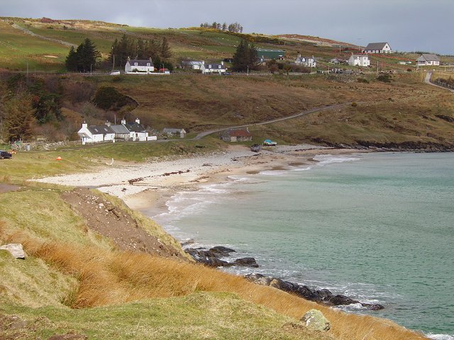
Strath Melness Images

Images are sourced within 2km of 58.541198/-4.4655352 or Grid Reference NC5664. Thanks to Geograph Open Source API. All images are credited.

Old croft-house at West Strathan
View over Strath Melness, Sutherland Strath Melness is a small valley on the north coast of Scotland.  The peaks of Ben Loyal are in the background.
View over Strath Melness, Sutherland
Strath Melness is a small valley on the north coast of Scotland. The peaks of Ben Loyal are in the background.
Disused Postbox at Dalnafree, Strath Melness, Sutherland An old postbox painted black and covered with a metal plate to prevent usage.
Disused Postbox at Dalnafree, Strath Melness, Sutherland
An old postbox painted black and covered with a metal plate to prevent usage.
Strath Melness from West Strathan, A' Mhòine, Sutherland View down the valley Strath Melness on the north coast of Scotland.
Strath Melness from West Strathan, A' Mhòine, Sutherland
View down the valley Strath Melness on the north coast of Scotland.
Moorland Track near Melness, A' Mhòine Peninsula, Sutherland
Typical Moorland of the A' Mhòine Peninsula, Sutherland
The "Allt nam Breac Buidhe" watercourse, A' Mhoine, Sutherland
Wintry road in Melness A collection of photographs (just one from each contributor) taken on New Year's Day 2023 by Geographers from all over Great Britain, Ireland and the Isle of Man.

View all the photos on a map here: <a title="https://www.geograph.org.uk/search.php?i=172163615" href="https://www.geograph.org.uk/search.php?i=172163615">Link</a>
Wintry road in Melness
A collection of photographs (just one from each contributor) taken on New Year's Day 2023 by Geographers from all over Great Britain, Ireland and the Isle of Man. View all the photos on a map here: Link
View from Cnoc na Moine View from the top of this small hill. Ben Loyal and Ben Hope in view.
View from Cnoc na Moine
View from the top of this small hill. Ben Loyal and Ben Hope in view.
Divergence The track splits here. I took the left one.
Divergence
The track splits here. I took the left one.
Loch Vasgo
Loch Vasgo
Croft land, Achnahuaigh The drainage is failing but there is some improved land near the almost ruined house, now used as a byre.
Croft land, Achnahuaigh
The drainage is failing but there is some improved land near the almost ruined house, now used as a byre.
Loch Vasgo In the midst of some very rugged terrain. Thin peaty soils unfit for cultivation.
Loch Vasgo
In the midst of some very rugged terrain. Thin peaty soils unfit for cultivation.
Abandoned house, Strath Melness From the end of the road in Strath Melness, a farm from another age. The sheep are sitting out a sharp shower on a cold northwesterly. That is why they lamb late here.
Abandoned house, Strath Melness
From the end of the road in Strath Melness, a farm from another age. The sheep are sitting out a sharp shower on a cold northwesterly. That is why they lamb late here.
Moors above Dalvraid Sodden peatland, relieved by Ben Hutig on the skyline.  A track has been cut, removing the peat down to the rock below. This allows easier access for the crofters to the sheep grazing on the moor.
Moors above Dalvraid
Sodden peatland, relieved by Ben Hutig on the skyline. A track has been cut, removing the peat down to the rock below. This allows easier access for the crofters to the sheep grazing on the moor.
Bulldozed track The peat has been stripped away to make a hard surfaced track up onto the moors around Ben Hutig. The poor quality grazing is used to raise sheep.
Bulldozed track
The peat has been stripped away to make a hard surfaced track up onto the moors around Ben Hutig. The poor quality grazing is used to raise sheep.
Allt na Caillich Burn draining the east of Ben Hutig (skyline hill).
Allt na Caillich
Burn draining the east of Ben Hutig (skyline hill).
Farmyard in Strath Melness Shorthorn cow and calf. The calf is very young and has not yet had its EU eartag fitted. (All cattle carry "numberplates in the European Union.") The cow was unhappy , but there was an easy route round.
Farmyard in Strath Melness
Shorthorn cow and calf. The calf is very young and has not yet had its EU eartag fitted. (All cattle carry "numberplates in the European Union.") The cow was unhappy , but there was an easy route round.
Show me another place!

Strath Melness is located at Grid Ref: NC5664 (Lat: 58.541198, Lng: -4.4655352)

Unitary Authority: Highland

Police Authority: Highlands and Islands

What 3 Words

///acrobatic.career.grades. Near Altnaharra, Highland

Related Wikis

Achnahuaigh

Achnahuaigh or Achinahuaigh (Scottish Gaelic: Achadh na h-Uamha) is a crofting hamlet and neighbourhood in the Melness area of Sutherland in the Highland...

Midfield, Highland

Midfield is a remote hamlet on the north coast of Scotland in Sutherland in the Highland Council Area. It is a mile south of Tormade Point and just over...

Melness

Melness (Gaelic: Taobh Mhealanais) is a locality comprising a group of small remote crofting townships, lying to the west of Tongue Bay opposite Coldbackie...

Talmine, Sutherland

Talmine is a crofting and fishing township, overlooking Talmine Bay, an inlet on the western shore of Tongue Bay in northern Sutherland, Scottish Highlands...

Nearby Amenities

Located within 500m of 58.541198,-4.4655352
Ford: yes
Lat/Long: 58.5447244/-4.4668955
The data included in this document is from www.openstreetmap.org. The data is made available under ODbL.

Have you been to Strath Melness?

Leave your review of Strath Melness below (or comments, questions and feedback).