Barnwood

Settlement in Gloucestershire Gloucester

England

Barnwood

Path and cycle track near busy junction Approaching the roundabout at the junction of the B4063 and the A40
Path and cycle track near busy junction Credit: Clint Mann

Barnwood is a suburban area located in the county of Gloucestershire, England. Situated approximately 3 miles east of the city center of Gloucester, Barnwood is primarily a residential area with a mix of housing types including detached houses, semi-detached houses, and some apartment complexes. The area is known for its peaceful and family-friendly atmosphere.

Barnwood benefits from its proximity to major transportation links, including the A417 and A40 roads, providing easy access to surrounding areas. The nearby M5 motorway also offers convenient connections to Bristol, Birmingham, and the South West of England.

In terms of amenities, Barnwood has a range of local shops, including convenience stores, bakeries, and a post office, providing residents with essential services. There are also several supermarkets located within a short drive, offering a wider selection of groceries and household goods.

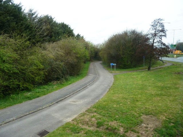
For recreational activities, Barnwood is home to the Barnwood Park and Arboretum, a beautiful green space that spans over 30 acres. The park features walking trails, sports fields, and a children's playground, providing ample opportunities for outdoor leisure and exercise.

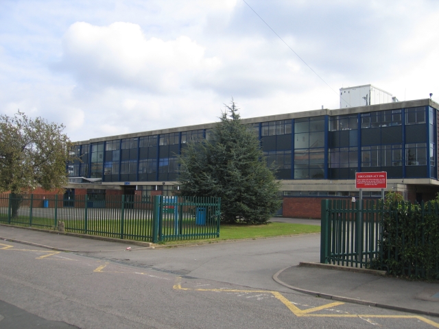
Barnwood is also well-served by educational facilities, with several primary and secondary schools in the area, including Barnwood Park Arts College and Harewood Junior School.

Overall, Barnwood offers a peaceful and convenient location for residents, combining suburban living with easy access to amenities and transportation links.

If you have any feedback on the listing, please let us know in the comments section below.
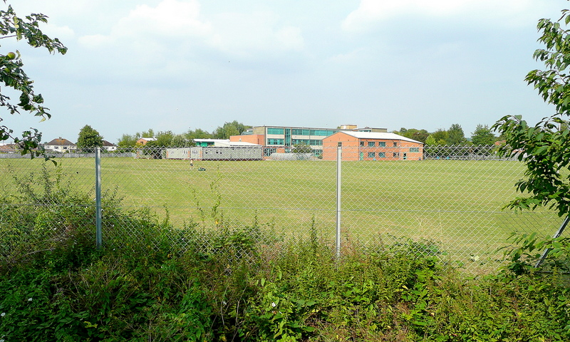
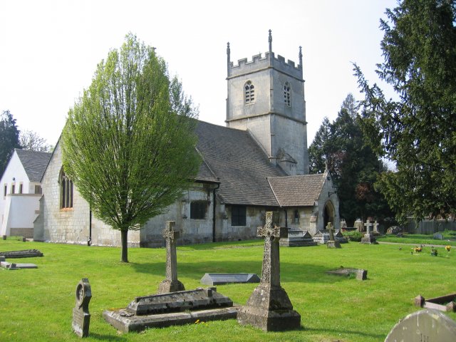
Barnwood Images

Images are sourced within 2km of 51.861346/-2.208643 or Grid Reference SO8518. Thanks to Geograph Open Source API. All images are credited.

Path and cycle track near busy junction Approaching the roundabout at the junction of the B4063 and the A40
Path and cycle track near busy junction
Approaching the roundabout at the junction of the B4063 and the A40
Barnwood The Church of St Lawrence
Barnwood
The Church of St Lawrence
Barnwood Barnwood Avenue, complete with May Blossom
Barnwood
Barnwood Avenue, complete with May Blossom
Gloucester New Yard The machines looking like something out of "The War of the Worlds" are involved a major railway track renewal scheme
Gloucester New Yard
The machines looking like something out of "The War of the Worlds" are involved a major railway track renewal scheme
Gloucester Tramway Junction Looking across Tramway Junction and the site of the GWR loco sheds, with Gloucester station just on the left.
Gloucester Tramway Junction
Looking across Tramway Junction and the site of the GWR loco sheds, with Gloucester station just on the left.
Sir Thomas Rich's School, Gloucester Founded in 1668 as the Blue Coat Hospital for boys from the will of Sir Thomas Rich, it changed name to Sir Thomas Rich's in 1882.  The school moved to this current site in Elmbridge in 1964 from its previous site in Barton Street (<a href="https://www.geograph.org.uk/photo/61708">SO8318 : Richleigh, Barton Street, Gloucester</a>) and today has been awarded Beacon school status. For more information see <span class="nowrap"><a title="http://www.school-portal.co.uk/GroupHomepage.asp?GroupID=14257" rel="nofollow ugc noopener" href="http://www.school-portal.co.uk/GroupHomepage.asp?GroupID=14257">Link</a><img style="margin-left:2px;" alt="External link" title="External link - shift click to open in new window" src="https://s1.geograph.org.uk/img/external.png" width="10" height="10"/></span>
Sir Thomas Rich's School, Gloucester
Founded in 1668 as the Blue Coat Hospital for boys from the will of Sir Thomas Rich, it changed name to Sir Thomas Rich's in 1882. The school moved to this current site in Elmbridge in 1964 from its previous site in Barton Street (SO8318 : Richleigh, Barton Street, Gloucester) and today has been awarded Beacon school status. For more information see LinkExternal link
Ukrainian Catholic Church In Derby Road, Gloucester.
Ukrainian Catholic Church
In Derby Road, Gloucester.
Kingscroft Road, Hucclecote Some of the older houses on this road. Hucclecote was at one time a village on the   road from Gloucester to Cirencester but has now been absorbed as the suburbs of Gloucester.
Kingscroft Road, Hucclecote
Some of the older houses on this road. Hucclecote was at one time a village on the road from Gloucester to Cirencester but has now been absorbed as the suburbs of Gloucester.
Barton Street, Gloucester Looking east with the India House pub at the point at which Barton street makes a slight "S" bend through this multi-cultural area of the city.
Barton Street, Gloucester
Looking east with the India House pub at the point at which Barton street makes a slight "S" bend through this multi-cultural area of the city.
Barton Street, Gloucester The traffic lights mark the junction with Derby Road and the view is looking west along the old Roman east-west axis through the city.
Barton Street, Gloucester
The traffic lights mark the junction with Derby Road and the view is looking west along the old Roman east-west axis through the city.
Derby Road, Gloucester Looking north with the old technical school on the right.  The bridge in the distance carries the new eastern spine road whilst beyond can be seen the raised barriers of Horton Road (a.k.a.Tramway) Crossing.
Derby Road, Gloucester
Looking north with the old technical school on the right. The bridge in the distance carries the new eastern spine road whilst beyond can be seen the raised barriers of Horton Road (a.k.a.Tramway) Crossing.
Collingwood Crescent Originally part of the Gloucester Hospital this has now been sold off to developers and is being converted into flats.
Collingwood Crescent
Originally part of the Gloucester Hospital this has now been sold off to developers and is being converted into flats.
Kingscroft Road, Hucclecote Looking west along Kingscroft Road.
Kingscroft Road, Hucclecote
Looking west along Kingscroft Road.
Playing Fields, Sir Thomas Rich's School The playing fields and sport hall at the rear of the school in Oxlease, Gloucester.
Playing Fields, Sir Thomas Rich's School
The playing fields and sport hall at the rear of the school in Oxlease, Gloucester.
Royal Oak, Hucclecote This public house was in the centre of the village of Hucclecote and was extended in the 1960s to serve the housing developments that accompanied the growth of the boundaries of Gloucester to engulf the village.
Royal Oak, Hucclecote
This public house was in the centre of the village of Hucclecote and was extended in the 1960s to serve the housing developments that accompanied the growth of the boundaries of Gloucester to engulf the village.
Hucclecote Millennium Garden Located in the corner of Hucclecote Road and Porchester Road, with Hucclecote Court on the right.
Hucclecote Millennium Garden
Located in the corner of Hucclecote Road and Porchester Road, with Hucclecote Court on the right.
Hucclecote Court Once a country house, this building right on the eastern edge of the square is now home to a firm of solicitors.
Hucclecote Court
Once a country house, this building right on the eastern edge of the square is now home to a firm of solicitors.
Estcourt Road, Gloucester This road originally formed a northern bypass for Gloucester but as the city has grown a newer bypass has been built further out.  At the time the picture was taken one carriageway was closed for the resurfacing work seen in the distance.
Estcourt Road, Gloucester
This road originally formed a northern bypass for Gloucester but as the city has grown a newer bypass has been built further out. At the time the picture was taken one carriageway was closed for the resurfacing work seen in the distance.
Show me another place!

Barnwood is located at Grid Ref: SO8518 (Lat: 51.861346, Lng: -2.208643)

Administrative County: Gloucestershire

District: Gloucester

Police Authority: Gloucestershire

What 3 Words

///riders.porch.cheat. Near Barnwood, Gloucestershire

Nearby Locations

Barnwood

Related Wikis

Barnwood House Hospital

Barnwood House Hospital was a private mental hospital in Barnwood, Gloucester, England. It was founded by the Gloucester Asylum Trust in 1860 as Barnwood...

Longlevens A.F.C.

Longlevens Association Football Club is a football club based in the Longlevens suburb of Gloucester, Gloucestershire, England. They are currently members...

Barnwood Park School

Barnwood Park School is a coeducational secondary school located in the Barnwood area of Gloucester in the English county of Gloucestershire.It was originally...

Barnwood

Barnwood is an suburb and former civil parish in the city of Gloucester, in the county of Gloucestershire, England. It lies about 1.8 miles (2.9 km) east...

Related Videos

Secrets of Gloucester Revealed | Walking Tour | 4K

Come with us to Gloucester! We spend a beautiful afternoon touring the the Gloucester city center, historic docks, and best of all ...

Walking the Gloucestershire Way (UK). Day 1 Chepstow to Parkend (13 miles)

Day 1 of 6 walking the Gloucestershire Way (100 miles) as part of my 'walk a long distance path in each county of England' ...

Walking the Gloucestershire Way (UK). Day 6 of 6. Stow on the Wold to Tewkesbury (25 miles)

Day 6 of 6 walking the Gloucestershire Way (100 miles) as part of my 'walk a long distance path in each county of England' ...

Gloucester City Centre Walk 4K | June 2023

Gloucester is a city in the west of England, near the Cotswolds rural area. It's known for 11th-century Gloucester Cathedral, which ...

Nearby Amenities

Located within 500m of 51.861346,-2.208643
Crossing
Crossing: traffic_signals
Crossing Island: no
Crossing Ref: pelican
Kerb: lowered
Tactile Paving: yes
Lat/Long: 51.8633561/-2.2109868
Crossing
Bicycle: yes
Crossing: traffic_signals
Crossing Ref: toucan
Kerb: lowered
Tactile Paving: yes
Lat/Long: 51.8636428/-2.2133674
Crossing
Bicycle: yes
Crossing: traffic_signals
Crossing Ref: toucan
Kerb: lowered
Tactile Paving: yes
Lat/Long: 51.8638661/-2.213582
Crossing
Crossing: traffic_signals
Crossing Island: no
Tactile Paving: yes
Lat/Long: 51.8607335/-2.2030113
Barnwood
Is In: Gloucester, Gloucestershire, England, UK
Place: suburb
Lat/Long: 51.8611852/-2.2045701
Crossing
Bicycle: yes
Crossing: traffic_signals
Crossing Ref: toucan
Kerb: lowered
Tactile Paving: yes
Lat/Long: 51.8647126/-2.2126989
Crossing
Bicycle: yes
Crossing: traffic_signals
Crossing Ref: toucan
Kerb: lowered
Tactile Paving: yes
Lat/Long: 51.8644747/-2.2123134
Bus Stop
Hazel Court
Bench: no
Bin: no
Bus: yes
Naptan AtcoCode: 1600GL295
Naptan Bearing: SE
Naptan CommonName: Gloucestershire Deaf Assoc
Naptan Indicator: Opp
Naptan NaptanCode: glodgmpm
Naptan PlusbusZoneRef: GLOSTER
Naptan Street: Barnwood Rd
Naptan Verified: no
Public Transport: platform
Shelter: no
Source: naptan_import
Tactile Paving: no
Lat/Long: 51.863313/-2.210701
Bus Stop
Budgen's Garage
Bench: yes
Bin: no
Bus: yes
Naptan AtcoCode: 1600GL296
Naptan Bearing: NW
Naptan CommonName: Gloucestershire Deaf Assoc
Naptan NaptanCode: glodgmta
Naptan PlusbusZoneRef: GLOSTER
Naptan Street: Barnwood Rd
Naptan Verified: no
Public Transport: platform
Shelter: yes
Source: naptan_import
Tactile Paving: no
Lat/Long: 51.8634249/-2.2114011
Bus Stop
Church Lane
Bench: yes
Bin: no
Bus: yes
Lit: yes
Naptan AtcoCode: 1600GL299
Naptan Bearing: SE
Naptan CommonName: Church Ln
Naptan Indicator: Opp
Naptan NaptanCode: glodgwtg
Naptan PlusbusZoneRef: GLOSTER
Naptan Street: Barnwood Rd
Naptan Verified: no
Public Transport: platform
Shelter: yes
Source: naptan_import
Tactile Paving: no
Lat/Long: 51.8605648/-2.2022795
Bus Stop
Church Lane
Bench: yes
Bin: yes
Bus: yes
Check Date Shelter: 2021-05-23
Lit: yes
Naptan AtcoCode: 1600GL300
Naptan Bearing: NW
Naptan CommonName: Church Ln
Naptan NaptanCode: glodgwmw
Naptan PlusbusZoneRef: GLOSTER
Naptan Street: Barnwood Rd
Naptan Verified: no
Public Transport: platform
Shelter: yes
Source: naptan_import
Tactile Paving: no
Lat/Long: 51.8609402/-2.2037885
Bus Stop
Chester Rd
Naptan AtcoCode: 1600GL9020
Naptan Bearing: NE
Naptan CommonName: Chester Rd
Naptan NaptanCode: glodgmdp
Naptan PlusbusZoneRef: GLOSTER
Naptan Street: Chester Rd
Naptan Verified: no
Source: naptan_import
Lat/Long: 51.8594142/-2.2127047
Bus Stop
Wotton Hall Club
Bench: yes
Bin: yes
Bus: yes
Lit: no
Naptan AtcoCode: 1600GLB115
Naptan Bearing: SE
Naptan CommonName: Wotton Hall Club
Naptan Indicator: Opp
Naptan NaptanCode: glodgtpd
Naptan PlusbusZoneRef: GLOSTER
Naptan Street: Barnwood Rd
Naptan Verified: no
Public Transport: platform
Shelter: yes
Source: naptan_import
Tactile Paving: no
Lat/Long: 51.8620427/-2.2067668
Bus Stop
Wotton Hall Club
Bench: no
Bin: yes
Bus: yes
Lit: no
Naptan AtcoCode: 1600GLB116
Naptan Bearing: NW
Naptan CommonName: Wotton Hall Club
Naptan NaptanCode: glodgtpg
Naptan PlusbusZoneRef: GLOSTER
Naptan Street: Barnwood Rd
Naptan Verified: no
Public Transport: platform
Shelter: no
Source: naptan_import
Tactile Paving: no
Lat/Long: 51.8621054/-2.2073004
Post Box
Collection Times: Mo-Fr 17:30; Sa 12:00
Ref: GL4 81
Source: survey
Lat/Long: 51.8592314/-2.2125757
Post Box
Collection Times: Mo-Fr 18:00; Sa 13:00
Ref: GL4 760
Source: survey
Lat/Long: 51.8598106/-2.2076428
Toilets
Lat/Long: 51.8645968/-2.2046559
Fuel
BP
Brand: BP
Brand Wikidata: Q152057
Operator: BP
Source: local knowledge
Lat/Long: 51.8638694/-2.2115576
M&S Simply Food
Brand: M&S Simply Food
Brand Wikidata: Q714491
Brand Wikipedia: en:Marks & Spencer
Contact Website: https://www.marksandspencer.com/stores/barnwood-bp-1227
Operator: M&S
Shop: convenience
Source: local knowldege
Lat/Long: 51.863908/-2.2117338
Atm
Brand: Cashzone
Brand Wikidata: Q110738461
Check Date: 2023-06-28
Network: Allpoint
Network Wikidata: Q4733264
Operator: Cash Zone
Lat/Long: 51.8637904/-2.2118488
Post Box
Addr Street: Eastern Ave
Collection Times: Mo-Fr 19:30; Sa 13:30
Operator: Royal Mail
Operator Wikidata: Q638098
Ref: GL4 395
Lat/Long: 51.863361/-2.2144207
Crossing
Bicycle: yes
Crossing: traffic_signals
Crossing Ref: toucan
Kerb: lowered
Tactile Paving: yes
Lat/Long: 51.8642932/-2.2138709
Traffic Signals
Traffic Signals: signal
Traffic Signals Direction: forward
Lat/Long: 51.8644109/-2.2125589
Traffic Signals
Traffic Signals: signal
Traffic Signals Direction: forward
Lat/Long: 51.8647588/-2.2117453
Traffic Signals
Traffic Signals Direction: forward
Lat/Long: 51.8643689/-2.2136661
Crossing
Crossing: uncontrolled
Kerb: lowered
Lat/Long: 51.86442/-2.2106703
Traffic Signals
Traffic Signals: signal
Traffic Signals Direction: forward
Lat/Long: 51.8638414/-2.2135985
Traffic Signals
Traffic Signals: signal
Traffic Signals Direction: forward
Lat/Long: 51.8645128/-2.2122971
Crossing
Crossing: uncontrolled
Kerb: lowered
Lat/Long: 51.8643198/-2.2103508
Traffic Signals
Traffic Signals: pedestrian_crossing
Traffic Signals Direction: forward
Lat/Long: 51.8646909/-2.2127345
Crossing
Crossing: uncontrolled
Kerb: lowered
Lat/Long: 51.8642686/-2.2105335
Traffic Signals
Traffic Signals: signal
Traffic Signals Direction: forward
Lat/Long: 51.8648524/-2.2117312
Crossing
Bicycle: yes
Kerb: lowered
Tactile Paving: yes
Lat/Long: 51.8639056/-2.2122828
Crossing
Bicycle: yes
Kerb: lowered
Tactile Paving: yes
Lat/Long: 51.863793/-2.2123078
Traffic Signals
Traffic Signals Direction: forward
Lat/Long: 51.8633409/-2.2109473
Traffic Signals
Traffic Signals Direction: backward
Lat/Long: 51.8633736/-2.2110433
Barrier: cycle_barrier
Cycle Barrier: double
Cycle Barrier Installation: fixed
Lat/Long: 51.8635652/-2.2113759
Traffic Signals
Traffic Signals: pedestrian_crossing
Traffic Signals Direction: forward
Lat/Long: 51.8636624/-2.2133242
Crossing
Bicycle: yes
Crossing: uncontrolled
Kerb: lowered
Tactile Paving: yes
Lat/Long: 51.8632083/-2.214299
Crossing
Bicycle: yes
Crossing: uncontrolled
Kerb: lowered
Tactile Paving: yes
Lat/Long: 51.8618523/-2.2155512
Crossing
Crossing: uncontrolled
Kerb: lowered
Lat/Long: 51.8644263/-2.2108672
Crossing
Crossing: uncontrolled
Kerb: lowered
Lat/Long: 51.8643945/-2.2108953
Crossing
Crossing: marked
Crossing Island: no
Crossing Markings: yes
Tactile Paving: yes
Lat/Long: 51.8620707/-2.2070791
Crossing
Bicycle: yes
Crossing: traffic_signals
Crossing Island: no
Crossing Ref: toucan
Kerb: lowered
Tactile Paving: yes
Lat/Long: 51.864367/-2.2136116
Parking
Lat/Long: 51.857634/-2.2066878
Barrier: cycle_barrier
Lat/Long: 51.8587233/-2.2064109
Post Box
Brand: Royal Mail
Brand Wikidata: Q638098
Operator: Royal Mail
Operator Wikidata: Q638098
Lat/Long: 51.8620291/-2.207128
Bicycle Parking
Bicycle Parking: stands
Capacity: 12
Covered: no
Lat/Long: 51.8619713/-2.2064332
Bicycle Parking
Bicycle Parking: stands
Covered: no
Lat/Long: 51.8620618/-2.2067481
Bicycle Parking
Bicycle Parking: stands
Capacity: 6
Covered: no
Lat/Long: 51.8639895/-2.2121809
Parking Space
Lat/Long: 51.863752/-2.2119219
Waste Basket
Lat/Long: 51.8637881/-2.2119673
Barnwood Barbers
Shop: hairdresser
Lat/Long: 51.8629678/-2.2106088
Information: guidepost
Tourism: information
Lat/Long: 51.8636789/-2.2119908
Man Made: street_cabinet
Lat/Long: 51.8645458/-2.2126459
Man Made: street_cabinet
Lat/Long: 51.86095/-2.2043339
Waste Basket
Lat/Long: 51.8633944/-2.2135176
Man Made: street_cabinet
Lat/Long: 51.8637127/-2.2126422
Man Made: street_cabinet
Lat/Long: 51.8641679/-2.2138668
Man Made: street_cabinet
Lat/Long: 51.8641472/-2.2138392
Traffic Signals
Traffic Signals: pedestrian_crossing
Traffic Signals Direction: forward
Lat/Long: 51.8642674/-2.2138162
Traffic Signals
Traffic Signals: signal
Traffic Signals Direction: forward
Lat/Long: 51.8642982/-2.2135047
Traffic Signals
Traffic Signals: signal
Traffic Signals Direction: forward
Lat/Long: 51.8639136/-2.2133794
The data included in this document is from www.openstreetmap.org. The data is made available under ODbL.

Have you been to Barnwood?

Leave your review of Barnwood below (or comments, questions and feedback).