Coire nam Bò Dubha

Valley in Cromartyshire

Scotland

Coire nam Bò Dubha

Plantation boundary I had ventured far enough from the nearest recognised path to secure this difficult to access square for my Geograph total. There was no difficulty in making progress along the boundary.
Plantation boundary Credit: Julian Paren

The requested URL returned error: 429 Too Many Requests

If you have any feedback on the listing, please let us know in the comments section below.

Coire nam Bò Dubha Images

Images are sourced within 2km of 57.637503/-4.5814075 or Grid Reference NH4563. Thanks to Geograph Open Source API. All images are credited.

Plantation boundary I had ventured far enough from the nearest recognised path to secure this difficult to access square for my Geograph total. There was no difficulty in making progress along the boundary.
Plantation boundary
I had ventured far enough from the nearest recognised path to secure this difficult to access square for my Geograph total. There was no difficulty in making progress along the boundary.
Stacked timber near Cnoc na Gearraisich Naturally the timber lies in an area that is now devoid of mature trees. The forestry road is very well maintained for the large extraction vehicles.
Stacked timber near Cnoc na Gearraisich
Naturally the timber lies in an area that is now devoid of mature trees. The forestry road is very well maintained for the large extraction vehicles.
A compartment of the forest with young trees From this point on the forest road there is an extensive view with snow streaks on the distant mountains.
A compartment of the forest with young trees
From this point on the forest road there is an extensive view with snow streaks on the distant mountains.
Forest track junction
Forest track view
Forest track view
Reservoir by Allt Gleann Sgathaich
Forest quarry This snowy scene is a quarry, a source of stone presumably used for the formation and repair of tracks in the forest.
Forest quarry
This snowy scene is a quarry, a source of stone presumably used for the formation and repair of tracks in the forest.
Young pines by rocky outcrop This area of hillside has seen tree planting in recent years.
Young pines by rocky outcrop
This area of hillside has seen tree planting in recent years.
Falls on Allt Gleann Sgathaich
Gate in deer fence above Allt Gleann Sgathaich
Meander, Allt Coire Eilteachaidh Coire a' Bhothain behind.
Meander, Allt Coire Eilteachaidh
Coire a' Bhothain behind.
Cnoc nan Each Mòr
Cnoc nan Each Mòr
Allt Coire na Feithe Riabhaich This small moorland stream shows the same features as its larger lowland cousin, here a meander.
Allt Coire na Feithe Riabhaich
This small moorland stream shows the same features as its larger lowland cousin, here a meander.
Aqueduct, Coire na Fèithe Riabhaich This aqueduct leads water from Allt a' Bhealaich Mhòir into the Allt Gleann Sgathaich system, presumably to feed the generator at Glen Sgathaich Farmhouse (see <a title="https://www.geograph.org.uk/photo/3849834)" href="https://www.geograph.org.uk/photo/3849834)">Link</a>.
Aqueduct, Coire na Fèithe Riabhaich
This aqueduct leads water from Allt a' Bhealaich Mhòir into the Allt Gleann Sgathaich system, presumably to feed the generator at Glen Sgathaich Farmhouse (see Link.
Old fence on southern flank of Ben Wyvis
Old fence to the south of Ben Wyvis Given the state of this fence, it is difficult to justify the name or its appearance on the OS map.
Old fence to the south of Ben Wyvis
Given the state of this fence, it is difficult to justify the name or its appearance on the OS map.
Cnoc nan Each Beag
Cnoc nan Each Beag
Show me another place!

Coire nam Bò Dubha is located at Grid Ref: NH4563 (Lat: 57.637503, Lng: -4.5814075)

Unitary Authority: Highland

Police Authority: Highlands and Islands

What 3 Words

///screen.pavement.dreamers. Near Strathpeffer, Highland

Nearby Locations

Coire nam Bò Dubha

Related Wikis

Ben Wyvis

Ben Wyvis (Scottish Gaelic: Beinn Uais) is a mountain in Easter Ross, in the northern Highlands of Scotland. It lies north-west of Dingwall, in the council...

Achterneed

Achterneed (Scottish Gaelic: Uachdar Niad), also spelled Auchterneed, is a village in Highland, Scotland, lying on the slopes above Strath Peffer. Achterneed...

Achterneed railway station

Achterneed railway station was a railway station serving Strathpeffer and located on the Kyle of Lochalsh Line, in Wester Ross, Scotland. == History... ==
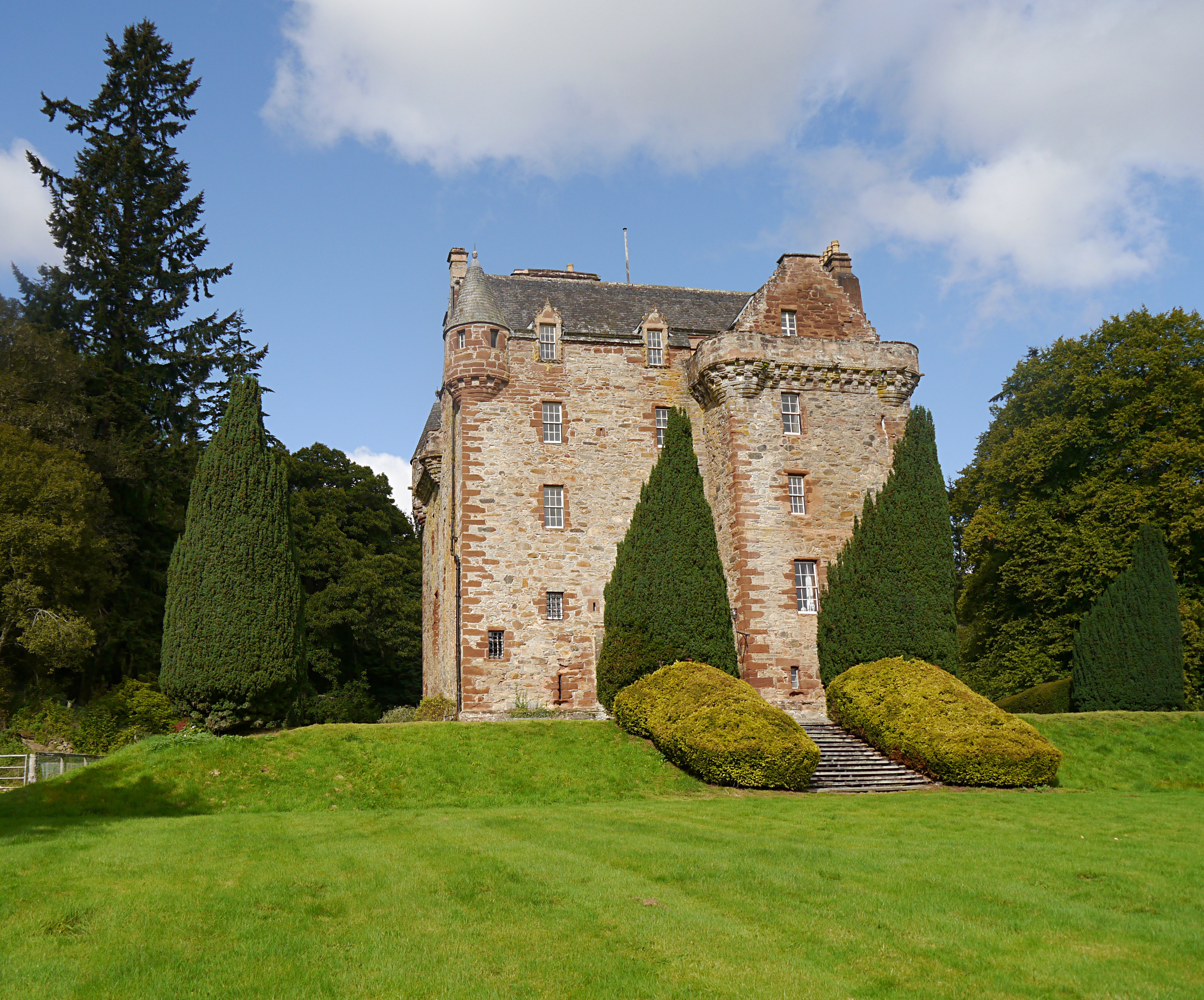
Castle Leod

Castle Leod is the seat of the Clan Mackenzie. It is a category A listed building, and the grounds are listed in the Inventory of Gardens and Designed...

Nearby Amenities

Located within 500m of 57.637503,-4.5814075
The data included in this document is from www.openstreetmap.org. The data is made available under ODbL.

Have you been to Coire nam Bò Dubha?

Leave your review of Coire nam Bò Dubha below (or comments, questions and feedback).