Lambeth Palace

Settlement in Surrey

England

Lambeth Palace

Secker Street at the junction of Cornwall Road
Secker Street at the junction of Cornwall Road Credit: David Howard

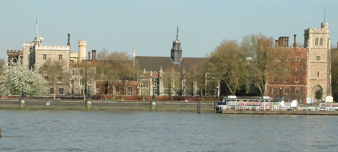
Lambeth Palace, located in Lambeth, Surrey, is one of the most iconic historical landmarks in England. It is primarily known for being the official residence of the Archbishop of Canterbury, the highest-ranking bishop in the Church of England. Situated on the southern bank of the River Thames, the palace has a rich history dating back to the 13th century.

The architecture of Lambeth Palace is a stunning blend of medieval and Gothic styles, with various extensions and renovations over the centuries. The Great Hall, built in the 15th century, is one of its most notable features, boasting a magnificent timber roof and beautiful stained glass windows.

Aside from serving as the Archbishop's home, Lambeth Palace also houses the Lambeth Palace Library, which holds an extensive collection of manuscripts, books, and archives, including some of the oldest and rarest religious texts in the country. The library is a significant resource for researchers and scholars interested in religious history.

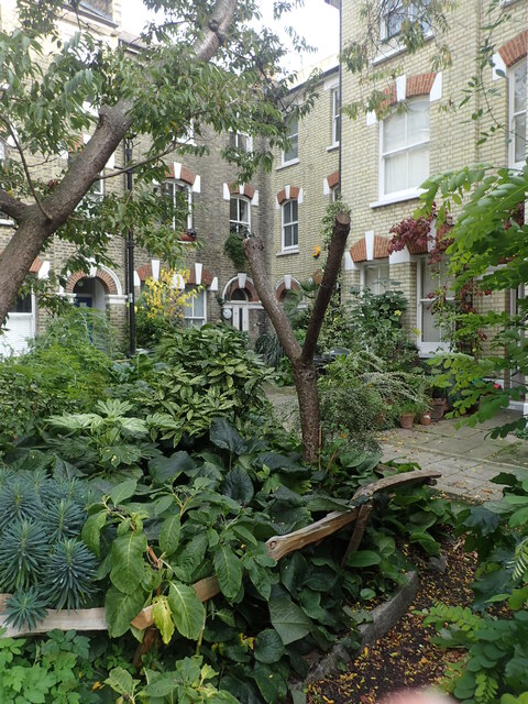
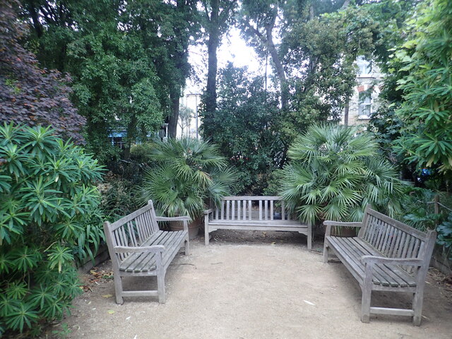
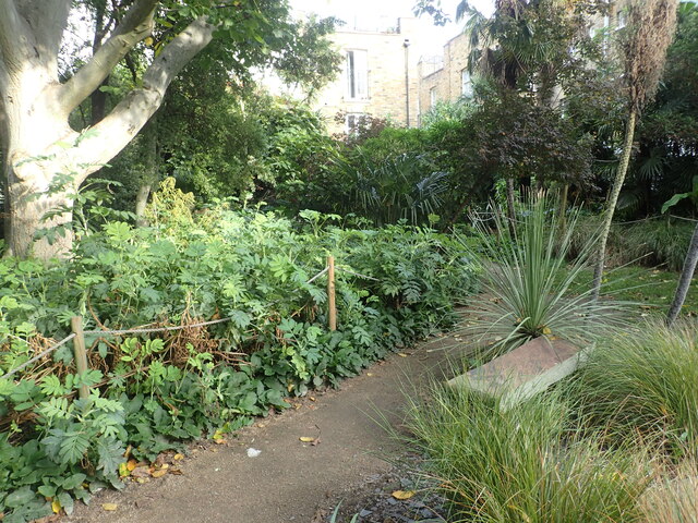
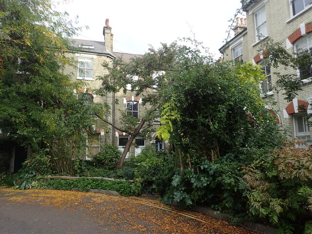
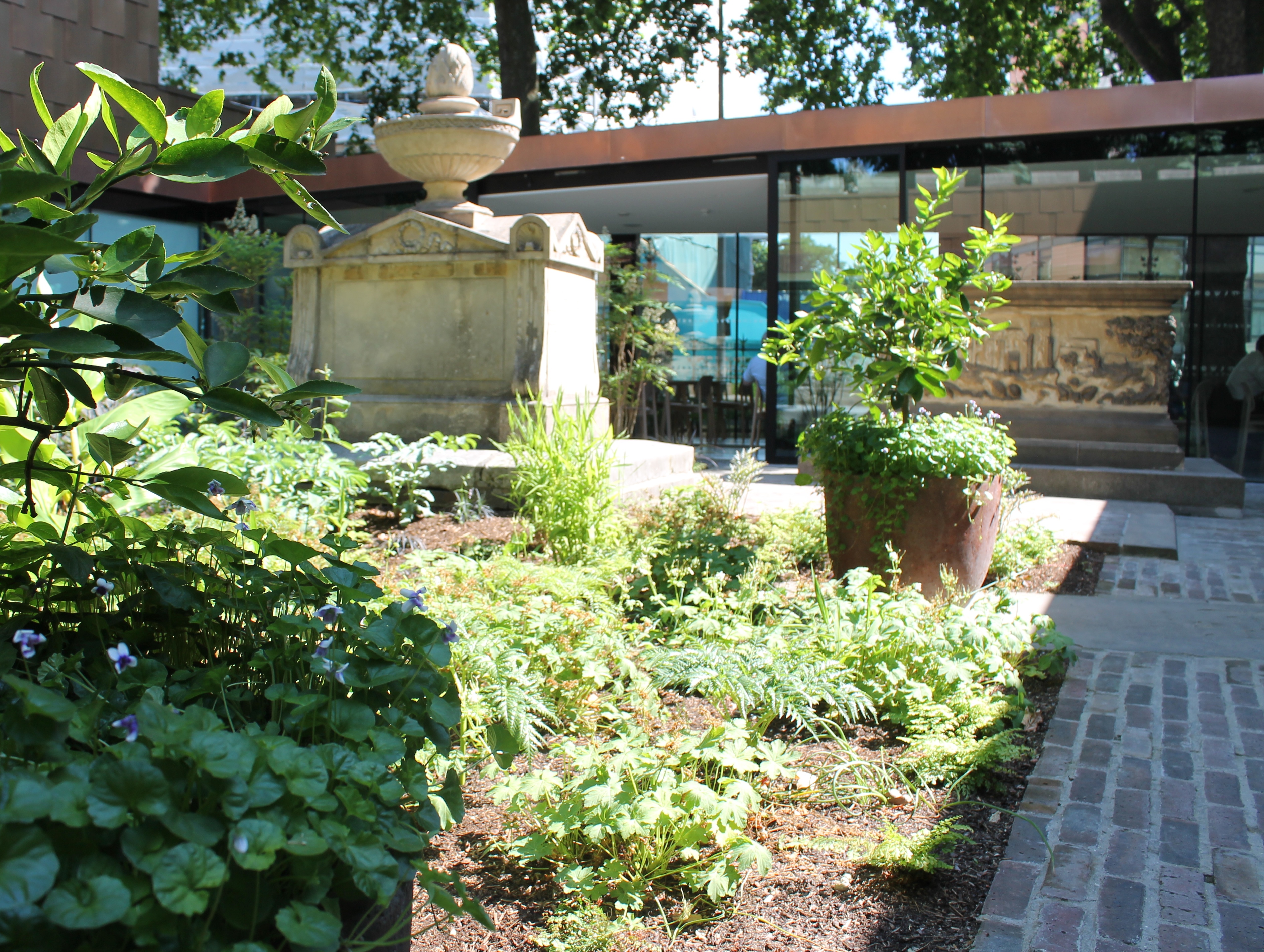
The palace and its surrounding gardens span over ten acres, providing a tranquil retreat from the hustle and bustle of London. The peacefulness of the grounds is enhanced by the presence of the River Thames, which runs alongside the palace, offering scenic views and a sense of serenity.

Lambeth Palace is not only a place of religious significance but also a popular tourist attraction. Guided tours are available for visitors, allowing them to explore the historic rooms, admire the architectural marvels, and learn about the palace's role in British history.

Overall, Lambeth Palace stands as a testament to the enduring legacy of the Church of England and offers an immersive experience into the country's religious and architectural heritage.

If you have any feedback on the listing, please let us know in the comments section below.

Lambeth Palace Images

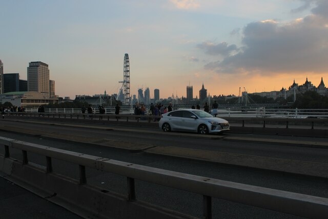
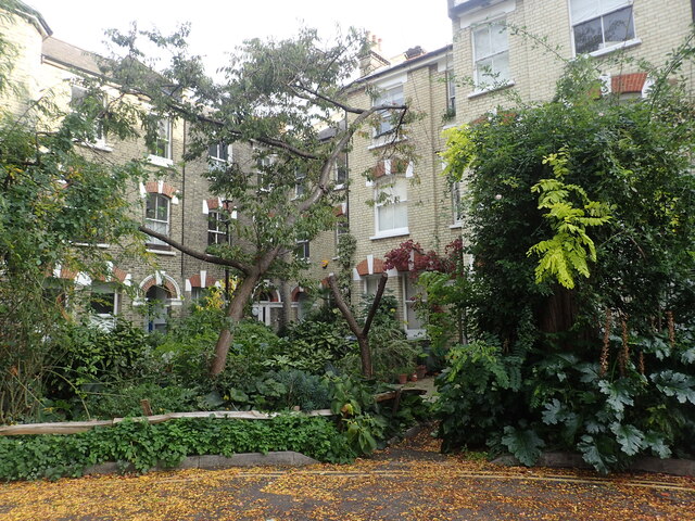
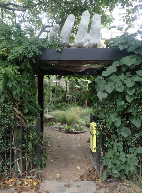
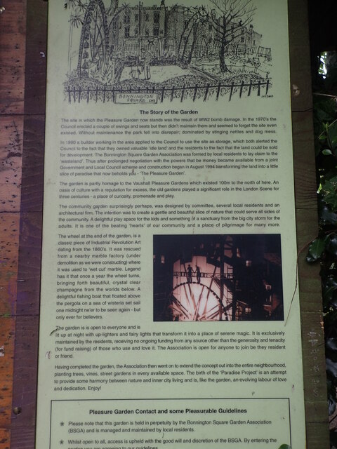
Images are sourced within 2km of 51.495688/-0.118588 or Grid Reference TQ3079. Thanks to Geograph Open Source API. All images are credited.

Secker Street at the junction of Cornwall Road
Secker Street, Waterloo Looking towards the back of St John's Church
Secker Street, Waterloo
Looking towards the back of St John's Church
Cornwall Road from Secker Street
View of the London Eye and Houses of Parliament from Waterloo Bridge Looking south-southwest.
View of the London Eye and Houses of Parliament from Waterloo Bridge
Looking south-southwest.
Returning to Nine Elms – 1966 Bulleid 'Battle of Britain' class light pacific 34059 'Sir Archibald Sinclair' makes its way back to shed at Nine Elms after working a train into Waterloo Station. This locomotive has survived into preservation, currently (2021) on the Bluebell Railway <a title="https://www.geograph.org.uk/photo/2431565" href="https://www.geograph.org.uk/photo/2431565">Link</a>
Returning to Nine Elms – 1966
Bulleid 'Battle of Britain' class light pacific 34059 'Sir Archibald Sinclair' makes its way back to shed at Nine Elms after working a train into Waterloo Station. This locomotive has survived into preservation, currently (2021) on the Bluebell Railway Link
The derelict Cricketers pub The Cricketers pub next to Kennington Oval has been closed and derelict since 2002. In March 2019, planning permission was granted for demolition and construction of a new residential development with a replacement ground floor public house. Behind are the famous Grade II gasholders, familiar from test matches at the Oval. The shape of the Oval Cricket Ground was determined by the pre-existing street pattern – not the other way around.
The derelict Cricketers pub
The Cricketers pub next to Kennington Oval has been closed and derelict since 2002. In March 2019, planning permission was granted for demolition and construction of a new residential development with a replacement ground floor public house. Behind are the famous Grade II gasholders, familiar from test matches at the Oval. The shape of the Oval Cricket Ground was determined by the pre-existing street pattern – not the other way around.
A corner of Bonnington Square Bonnington Square in Vauxhall is an amazing oasis to stumble across near to the high-rise towers of Vauxhall and area. It can be reached via a passageway through a house from Harleyford Road Community Garden and on the other side you reach a square of houses built in the 1870s in order to house railway workers. By the late 1970s, Bonnington Square was compulsorily purchased for the Inner London Education Authority, which intended to demolish it in order to build a new school. A Turkish shopkeeper in one of the buildings managed to prevent the demolition through legal means during the period in which all the houses' occupants were departing, and shortly afterward squatters began moving into the vacated buildings. 

It has a secret garden at the centre, leafy overgrown corners, vines climbing up the house fronts and both tropical and native trees planted in every available space. More about the place can be seen at <span class="nowrap"><a title="https://livinglondonhistory.com/the-fascinating-story-of-vauxhalls-secret-jungle-neighbourhood/" rel="nofollow ugc noopener" href="https://livinglondonhistory.com/the-fascinating-story-of-vauxhalls-secret-jungle-neighbourhood/">Link</a><img style="margin-left:2px;" alt="External link" title="External link - shift click to open in new window" src="https://s1.geograph.org.uk/img/external.png" width="10" height="10"/></span>  The writer of this post says that he has found one of his new secret spots in London and I agree.
A corner of Bonnington Square
Bonnington Square in Vauxhall is an amazing oasis to stumble across near to the high-rise towers of Vauxhall and area. It can be reached via a passageway through a house from Harleyford Road Community Garden and on the other side you reach a square of houses built in the 1870s in order to house railway workers. By the late 1970s, Bonnington Square was compulsorily purchased for the Inner London Education Authority, which intended to demolish it in order to build a new school. A Turkish shopkeeper in one of the buildings managed to prevent the demolition through legal means during the period in which all the houses' occupants were departing, and shortly afterward squatters began moving into the vacated buildings. It has a secret garden at the centre, leafy overgrown corners, vines climbing up the house fronts and both tropical and native trees planted in every available space. More about the place can be seen at LinkExternal link The writer of this post says that he has found one of his new secret spots in London and I agree.
The Pleasure Garden at Bonnington Square Bonnington Square in Vauxhall is an amazing oasis to stumble across near to the high-rise towers of Vauxhall and area. It can be reached via a passageway through a house from Harleyford Road Community Garden and on the other side you reach a square of houses built in the 1870s in order to house railway workers. By the late 1970s, Bonnington Square was compulsorily purchased for the Inner London Education Authority, which intended to demolish it in order to build a new school. A Turkish shopkeeper in one of the buildings managed to prevent the demolition through legal means during the period in which all the houses' occupants were departing, and shortly afterward squatters began moving into the vacated buildings. 

It has a secret garden at the centre (known as the Pleasure Garden), leafy overgrown corners, vines climbing up the house fronts and both tropical and native trees planted in every available space. This is the entrance to the Pleasure Garden with the hand almost beckoning you in. The information board at the entrance can be seen at <a title="https://www.geograph.org.uk/photo/6998018" href="https://www.geograph.org.uk/photo/6998018">Link</a>

More about the place can be seen at <span class="nowrap"><a title="https://livinglondonhistory.com/the-fascinating-story-of-vauxhalls-secret-jungle-neighbourhood/" rel="nofollow ugc noopener" href="https://livinglondonhistory.com/the-fascinating-story-of-vauxhalls-secret-jungle-neighbourhood/">Link</a><img style="margin-left:2px;" alt="External link" title="External link - shift click to open in new window" src="https://s1.geograph.org.uk/img/external.png" width="10" height="10"/></span>  The writer of this post says that he has found one of his new secret spots in London and I agree.
The Pleasure Garden at Bonnington Square
Bonnington Square in Vauxhall is an amazing oasis to stumble across near to the high-rise towers of Vauxhall and area. It can be reached via a passageway through a house from Harleyford Road Community Garden and on the other side you reach a square of houses built in the 1870s in order to house railway workers. By the late 1970s, Bonnington Square was compulsorily purchased for the Inner London Education Authority, which intended to demolish it in order to build a new school. A Turkish shopkeeper in one of the buildings managed to prevent the demolition through legal means during the period in which all the houses' occupants were departing, and shortly afterward squatters began moving into the vacated buildings. It has a secret garden at the centre (known as the Pleasure Garden), leafy overgrown corners, vines climbing up the house fronts and both tropical and native trees planted in every available space. This is the entrance to the Pleasure Garden with the hand almost beckoning you in. The information board at the entrance can be seen at Link More about the place can be seen at LinkExternal link The writer of this post says that he has found one of his new secret spots in London and I agree.
Information about the Pleasure Garden at Bonnington Square This is the information board at the entrance to the Pleasure Garden in Bonnington Square. See <a title="https://www.geograph.org.uk/photo/6998015" href="https://www.geograph.org.uk/photo/6998015">Link</a>
Information about the Pleasure Garden at Bonnington Square
This is the information board at the entrance to the Pleasure Garden in Bonnington Square. See Link
A corner of Bonnington Square Bonnington Square in Vauxhall is an amazing oasis to stumble across near to the high-rise towers of Vauxhall and area. It can be reached via a passageway through a house from Harleyford Road Community Garden and on the other side you reach a square of houses built in the 1870s in order to house railway workers. By the late 1970s, Bonnington Square was compulsorily purchased for the Inner London Education Authority, which intended to demolish it in order to build a new school. A Turkish shopkeeper in one of the buildings managed to prevent the demolition through legal means during the period in which all the houses' occupants were departing, and shortly afterward squatters began moving into the vacated buildings. 

It has a secret garden at the centre, leafy overgrown corners, vines climbing up the house fronts and both tropical and native trees planted in every available space. More about the place can be seen at <span class="nowrap"><a title="https://livinglondonhistory.com/the-fascinating-story-of-vauxhalls-secret-jungle-neighbourhood/" rel="nofollow ugc noopener" href="https://livinglondonhistory.com/the-fascinating-story-of-vauxhalls-secret-jungle-neighbourhood/">Link</a><img style="margin-left:2px;" alt="External link" title="External link - shift click to open in new window" src="https://s1.geograph.org.uk/img/external.png" width="10" height="10"/></span>  The writer of this post says that he has found one of his new secret spots in London and I agree.
A corner of Bonnington Square
Bonnington Square in Vauxhall is an amazing oasis to stumble across near to the high-rise towers of Vauxhall and area. It can be reached via a passageway through a house from Harleyford Road Community Garden and on the other side you reach a square of houses built in the 1870s in order to house railway workers. By the late 1970s, Bonnington Square was compulsorily purchased for the Inner London Education Authority, which intended to demolish it in order to build a new school. A Turkish shopkeeper in one of the buildings managed to prevent the demolition through legal means during the period in which all the houses' occupants were departing, and shortly afterward squatters began moving into the vacated buildings. It has a secret garden at the centre, leafy overgrown corners, vines climbing up the house fronts and both tropical and native trees planted in every available space. More about the place can be seen at LinkExternal link The writer of this post says that he has found one of his new secret spots in London and I agree.
In the Pleasure Garden at Bonnington Square Bonnington Square in Vauxhall is an amazing oasis to stumble across near to the high-rise towers of Vauxhall and area. It can be reached via a passageway through a house from Harleyford Road Community Garden and on the other side you reach a square of houses built in the 1870s in order to house railway workers. By the late 1970s, Bonnington Square was compulsorily purchased for the Inner London Education Authority, which intended to demolish it in order to build a new school. A Turkish shopkeeper in one of the buildings managed to prevent the demolition through legal means during the period in which all the houses' occupants were departing, and shortly afterward squatters began moving into the vacated buildings. 

It has a secret garden at the centre (known as the Pleasure Garden), leafy overgrown corners, vines climbing up the house fronts and both tropical and native trees planted in every available space. This is the Pleasure Garden. The information board at the entrance can be seen at <a title="https://www.geograph.org.uk/photo/6998018" href="https://www.geograph.org.uk/photo/6998018">Link</a>

More about the place can be seen at <span class="nowrap"><a title="https://livinglondonhistory.com/the-fascinating-story-of-vauxhalls-secret-jungle-neighbourhood/" rel="nofollow ugc noopener" href="https://livinglondonhistory.com/the-fascinating-story-of-vauxhalls-secret-jungle-neighbourhood/">Link</a><img style="margin-left:2px;" alt="External link" title="External link - shift click to open in new window" src="https://s1.geograph.org.uk/img/external.png" width="10" height="10"/></span>  The writer of this post says that he has found one of his new secret spots in London and I agree.
In the Pleasure Garden at Bonnington Square
Bonnington Square in Vauxhall is an amazing oasis to stumble across near to the high-rise towers of Vauxhall and area. It can be reached via a passageway through a house from Harleyford Road Community Garden and on the other side you reach a square of houses built in the 1870s in order to house railway workers. By the late 1970s, Bonnington Square was compulsorily purchased for the Inner London Education Authority, which intended to demolish it in order to build a new school. A Turkish shopkeeper in one of the buildings managed to prevent the demolition through legal means during the period in which all the houses' occupants were departing, and shortly afterward squatters began moving into the vacated buildings. It has a secret garden at the centre (known as the Pleasure Garden), leafy overgrown corners, vines climbing up the house fronts and both tropical and native trees planted in every available space. This is the Pleasure Garden. The information board at the entrance can be seen at Link More about the place can be seen at LinkExternal link The writer of this post says that he has found one of his new secret spots in London and I agree.
Seats in the Pleasure Garden at Bonnington Square Bonnington Square in Vauxhall is an amazing oasis to stumble across near to the high-rise towers of Vauxhall and area. It can be reached via a passageway through a house from Harleyford Road Community Garden and on the other side you reach a square of houses built in the 1870s in order to house railway workers. By the late 1970s, Bonnington Square was compulsorily purchased for the Inner London Education Authority, which intended to demolish it in order to build a new school. A Turkish shopkeeper in one of the buildings managed to prevent the demolition through legal means during the period in which all the houses' occupants were departing, and shortly afterward squatters began moving into the vacated buildings. 

It has a secret garden at the centre (known as the Pleasure Garden), leafy overgrown corners, vines climbing up the house fronts and both tropical and native trees planted in every available space. This is the Pleasure Garden and as can be seen seating is here so that neighbours can meet up. There is a real community feel. The information board at the entrance can be seen at <a title="https://www.geograph.org.uk/photo/6998018" href="https://www.geograph.org.uk/photo/6998018">Link</a>

More about the place can be seen at <span class="nowrap"><a title="https://livinglondonhistory.com/the-fascinating-story-of-vauxhalls-secret-jungle-neighbourhood/" rel="nofollow ugc noopener" href="https://livinglondonhistory.com/the-fascinating-story-of-vauxhalls-secret-jungle-neighbourhood/">Link</a><img style="margin-left:2px;" alt="External link" title="External link - shift click to open in new window" src="https://s1.geograph.org.uk/img/external.png" width="10" height="10"/></span>  The writer of this post says that he has found one of his new secret spots in London and I agree.
Seats in the Pleasure Garden at Bonnington Square
Bonnington Square in Vauxhall is an amazing oasis to stumble across near to the high-rise towers of Vauxhall and area. It can be reached via a passageway through a house from Harleyford Road Community Garden and on the other side you reach a square of houses built in the 1870s in order to house railway workers. By the late 1970s, Bonnington Square was compulsorily purchased for the Inner London Education Authority, which intended to demolish it in order to build a new school. A Turkish shopkeeper in one of the buildings managed to prevent the demolition through legal means during the period in which all the houses' occupants were departing, and shortly afterward squatters began moving into the vacated buildings. It has a secret garden at the centre (known as the Pleasure Garden), leafy overgrown corners, vines climbing up the house fronts and both tropical and native trees planted in every available space. This is the Pleasure Garden and as can be seen seating is here so that neighbours can meet up. There is a real community feel. The information board at the entrance can be seen at Link More about the place can be seen at LinkExternal link The writer of this post says that he has found one of his new secret spots in London and I agree.
In the Pleasure Garden at Bonnington Square Bonnington Square in Vauxhall is an amazing oasis to stumble across near to the high-rise towers of Vauxhall and area. It can be reached via a passageway through a house from Harleyford Road Community Garden and on the other side you reach a square of houses built in the 1870s in order to house railway workers. By the late 1970s, Bonnington Square was compulsorily purchased for the Inner London Education Authority, which intended to demolish it in order to build a new school. A Turkish shopkeeper in one of the buildings managed to prevent the demolition through legal means during the period in which all the houses' occupants were departing, and shortly afterward squatters began moving into the vacated buildings. 

It has a secret garden at the centre (known as the Pleasure Garden), leafy overgrown corners, vines climbing up the house fronts and both tropical and native trees planted in every available space. This is in the Pleasure Garden. The information board at the entrance can be seen at <a title="https://www.geograph.org.uk/photo/6998018" href="https://www.geograph.org.uk/photo/6998018">Link</a>

More about the place can be seen at <span class="nowrap"><a title="https://livinglondonhistory.com/the-fascinating-story-of-vauxhalls-secret-jungle-neighbourhood/" rel="nofollow ugc noopener" href="https://livinglondonhistory.com/the-fascinating-story-of-vauxhalls-secret-jungle-neighbourhood/">Link</a><img style="margin-left:2px;" alt="External link" title="External link - shift click to open in new window" src="https://s1.geograph.org.uk/img/external.png" width="10" height="10"/></span>  The writer of this post says that he has found one of his new secret spots in London and I agree.
In the Pleasure Garden at Bonnington Square
Bonnington Square in Vauxhall is an amazing oasis to stumble across near to the high-rise towers of Vauxhall and area. It can be reached via a passageway through a house from Harleyford Road Community Garden and on the other side you reach a square of houses built in the 1870s in order to house railway workers. By the late 1970s, Bonnington Square was compulsorily purchased for the Inner London Education Authority, which intended to demolish it in order to build a new school. A Turkish shopkeeper in one of the buildings managed to prevent the demolition through legal means during the period in which all the houses' occupants were departing, and shortly afterward squatters began moving into the vacated buildings. It has a secret garden at the centre (known as the Pleasure Garden), leafy overgrown corners, vines climbing up the house fronts and both tropical and native trees planted in every available space. This is in the Pleasure Garden. The information board at the entrance can be seen at Link More about the place can be seen at LinkExternal link The writer of this post says that he has found one of his new secret spots in London and I agree.
In the Pleasure Garden at Bonnington Square Bonnington Square in Vauxhall is an amazing oasis to stumble across near to the high-rise towers of Vauxhall and area. It can be reached via a passageway through a house from Harleyford Road Community Garden and on the other side you reach a square of houses built in the 1870s in order to house railway workers. By the late 1970s, Bonnington Square was compulsorily purchased for the Inner London Education Authority, which intended to demolish it in order to build a new school. A Turkish shopkeeper in one of the buildings managed to prevent the demolition through legal means during the period in which all the houses' occupants were departing, and shortly afterward squatters began moving into the vacated buildings. 

It has a secret garden at the centre (known as the Pleasure Garden), leafy overgrown corners, vines climbing up the house fronts and both tropical and native trees planted in every available space. This is near the entrance to the Pleasure Garden. The information board at the entrance can be seen at <a title="https://www.geograph.org.uk/photo/6998018" href="https://www.geograph.org.uk/photo/6998018">Link</a>

More about the place can be seen at <span class="nowrap"><a title="https://livinglondonhistory.com/the-fascinating-story-of-vauxhalls-secret-jungle-neighbourhood/" rel="nofollow ugc noopener" href="https://livinglondonhistory.com/the-fascinating-story-of-vauxhalls-secret-jungle-neighbourhood/">Link</a><img style="margin-left:2px;" alt="External link" title="External link - shift click to open in new window" src="https://s1.geograph.org.uk/img/external.png" width="10" height="10"/></span>  The writer of this post says that he has found one of his new secret spots in London and I agree.
In the Pleasure Garden at Bonnington Square
Bonnington Square in Vauxhall is an amazing oasis to stumble across near to the high-rise towers of Vauxhall and area. It can be reached via a passageway through a house from Harleyford Road Community Garden and on the other side you reach a square of houses built in the 1870s in order to house railway workers. By the late 1970s, Bonnington Square was compulsorily purchased for the Inner London Education Authority, which intended to demolish it in order to build a new school. A Turkish shopkeeper in one of the buildings managed to prevent the demolition through legal means during the period in which all the houses' occupants were departing, and shortly afterward squatters began moving into the vacated buildings. It has a secret garden at the centre (known as the Pleasure Garden), leafy overgrown corners, vines climbing up the house fronts and both tropical and native trees planted in every available space. This is near the entrance to the Pleasure Garden. The information board at the entrance can be seen at Link More about the place can be seen at LinkExternal link The writer of this post says that he has found one of his new secret spots in London and I agree.
In Bonnington Square Bonnington Square in Vauxhall is an amazing oasis to stumble across near to the high-rise towers of Vauxhall and area. It can be reached via a passageway through a house from Harleyford Road Community Garden and on the other side you reach a square of houses built in the 1870s in order to house railway workers. By the late 1970s, Bonnington Square was compulsorily purchased for the Inner London Education Authority, which intended to demolish it in order to build a new school. A Turkish shopkeeper in one of the buildings managed to prevent the demolition through legal means during the period in which all the houses' occupants were departing, and shortly afterward squatters began moving into the vacated buildings. 

It has a secret garden at the centre, leafy overgrown corners, vines climbing up the house fronts and both tropical and native trees planted in every available space. More about the place can be seen at <span class="nowrap"><a title="https://livinglondonhistory.com/the-fascinating-story-of-vauxhalls-secret-jungle-neighbourhood/" rel="nofollow ugc noopener" href="https://livinglondonhistory.com/the-fascinating-story-of-vauxhalls-secret-jungle-neighbourhood/">Link</a><img style="margin-left:2px;" alt="External link" title="External link - shift click to open in new window" src="https://s1.geograph.org.uk/img/external.png" width="10" height="10"/></span>  The writer of this post says that he has found one of his new secret spots in London and I agree.
In Bonnington Square
Bonnington Square in Vauxhall is an amazing oasis to stumble across near to the high-rise towers of Vauxhall and area. It can be reached via a passageway through a house from Harleyford Road Community Garden and on the other side you reach a square of houses built in the 1870s in order to house railway workers. By the late 1970s, Bonnington Square was compulsorily purchased for the Inner London Education Authority, which intended to demolish it in order to build a new school. A Turkish shopkeeper in one of the buildings managed to prevent the demolition through legal means during the period in which all the houses' occupants were departing, and shortly afterward squatters began moving into the vacated buildings. It has a secret garden at the centre, leafy overgrown corners, vines climbing up the house fronts and both tropical and native trees planted in every available space. More about the place can be seen at LinkExternal link The writer of this post says that he has found one of his new secret spots in London and I agree.
An alpaca at Vauxhall City Farm Vauxhall City Farm has been in existence since 1977 and its compact site holds a wide variety of animals including sheep, ducks, turkeys, chickens, rabbits goats, alpacas and pigs. It also has a cafe. 

More detail about this delightful resource, including more about its history, can be found at <span class="nowrap"><a title="http://www.vauxhallcityfarm.org/" rel="nofollow ugc noopener" href="http://www.vauxhallcityfarm.org/">Link</a><img style="margin-left:2px;" alt="External link" title="External link - shift click to open in new window" src="https://s1.geograph.org.uk/img/external.png" width="10" height="10"/></span>
An alpaca at Vauxhall City Farm
Vauxhall City Farm has been in existence since 1977 and its compact site holds a wide variety of animals including sheep, ducks, turkeys, chickens, rabbits goats, alpacas and pigs. It also has a cafe. More detail about this delightful resource, including more about its history, can be found at LinkExternal link
Show me another place!

Lambeth Palace is located at Grid Ref: TQ3079 (Lat: 51.495688, Lng: -0.118588)

Unitary Authority: Lambeth

Police Authority: Metropolitan

What 3 Words

///elaborate.hands.polite. Near Lambeth, London

Related Wikis

Lambeth Palace

Lambeth Palace is the official London residence of the Archbishop of Canterbury. It is situated in north Lambeth, London, on the south bank of the River...

Community of Saint Anselm

The Community of Saint Anselm is an Anglican religious order of young people, devoted to prayer, study and service to the poor. It is based at Lambeth...

Garden Museum

The Garden Museum (formerly known as the Museum of Garden History) in London is Britain's only museum of the art, history and design of gardens. The museum...

Royal Pharmaceutical Society

The Royal Pharmaceutical Society (RPharmS or RPS) is the body responsible for the leadership and support of the pharmacy profession (pharmacists) within...

Nearby Amenities

Located within 500m of 51.495688,-0.118588
Railway: switch
Railway Aws: yes
Railway Switch: double_slip
Railway Tpws: yes
Lat/Long: 51.4974397/-0.1149285
Ref GB Tflcid: RWG055015
Traffic Calming: hump
Lat/Long: 51.4922807/-0.1210206
Railway: switch
Railway Aws: yes
Railway Switch: default
Railway Tpws: yes
Lat/Long: 51.4988778/-0.114654
Crossing
Crossing: uncontrolled
Crossing Island: yes
Crossing Ref: zebra
Tactile Paving: yes
Lat/Long: 51.4951146/-0.1170931
Crossing
Bicycle: yes
Button Operated: yes
Crossing: traffic_signals
Crossing Island: no
Crossing Markings: dots
Crossing Signals: yes
Crossing Ref: toucan
Tactile Paving: yes
Traffic Signals Sound: yes
Traffic Signals Vibration: yes
Lat/Long: 51.4987929/-0.117049
Crossing
Crossing: unmarked
Crossing Island: yes
Crossing Markings: no
Lat/Long: 51.4982855/-0.117586
Barrier: bollard
Bollard: fixed
Lat/Long: 51.4922045/-0.117341
Direction: both
Surface: asphalt
Traffic Calming: table
Lat/Long: 51.4917083/-0.1188106
Barrier: bollard
Bicycle: yes
Foot: yes
Lat/Long: 51.4918764/-0.1181657
Direction: both
Surface: asphalt
Traffic Calming: table
Lat/Long: 51.4916768/-0.1187402
Lambeth
Is In: Lambeth, London
Phonetic En: /ˈlæmbəθ/
Place: suburb
Wikidata: Q148349
Wikipedia: en:Lambeth
Lat/Long: 51.4952111/-0.1163354
Street Lamp
Lat/Long: 51.495257/-0.1211048
Surface: asphalt
Traffic Calming: table
Lat/Long: 51.4934299/-0.1158769
Give Way
Direction: forward
Lat/Long: 51.4952837/-0.1156103
Direction: both
Surface: asphalt
Traffic Calming: table
Lat/Long: 51.4947644/-0.1139427
Cycleway: asl
Direction: forward
Lat/Long: 51.4964129/-0.1117134
Telephone
Colour: black
Note: not BT
Lat/Long: 51.4967666/-0.1117774
Bicycle Parking
Bicycle Parking: stands
Capacity: 8
Covered: no
Lat/Long: 51.4951597/-0.1253081
Post Box
Brand: Royal Mail
Brand Wikidata: Q638098
Brand Wikipedia: en:Royal Mail
Collection Times: Mo-Fr 18:30; Sa 13:00
Drive Through: no
Operator: Royal Mail
Operator Wikidata: Q638098
Post Box Apertures: 2
Post Box Design: type_c
Post Box Type: pillar
Postal Code: SE1
Ref: SE1 53;SE1 153
Royal Cypher: EIIR
Royal Cypher Wikidata: Q33102113
Source: survey
Lat/Long: 51.4940985/-0.1195353
Railway: switch
Railway Switch: default
Lat/Long: 51.4958708/-0.1156873
Car Sharing
Capacity: 1
Operator: Streetcar
Operator Wikidata: Q7623070
Source: WebSite
Lat/Long: 51.4920588/-0.1200986
Man Made: surveillance
Note: approximate location - tweak away
Source: Lambeth Council website
Surveillance: public
Lat/Long: 51.4963948/-0.1123998
Bus Stop
Lambeth Road / Kennington Road
Bench: yes
Bin: no
Bus: yes
Flag: yes
Lit: yes
Local Ref: J
Naptan AtcoCode: 490008647E
Naptan Bearing: E
Naptan CommonName: Lambeth Road Kennington Road
Naptan Indicator: J
Naptan Street: LAMBETH ROAD
Naptan Verified: yes
Public Transport: platform
Ref: 57316
Shelter: yes
Tactile Paving: no
Lat/Long: 51.4962434/-0.1126985
Post Box
Brand: Royal Mail
Brand Wikidata: Q638098
Brand Wikipedia: en:Royal Mail
Check Date: 2024-03-17
Collection Times: Mo-Fr 18:30; Sa 13:00
Colour: #005EB8
Drive Through: no
Inscription: Thank you NHS
Note: “Thank you NHS” laminated lettering on several sides, the post box is painted blue
Operator: Royal Mail
Operator Wikidata: Q638098
Post Box Apertures: 2
Post Box Design: type_c
Post Box Type: pillar
Postal Code: SE1
Ref: SE1 51;SE1 151
Royal Cypher: EIIR
Royal Cypher Wikidata: Q33102113
Source: survey
Lat/Long: 51.4986421/-0.1173866
The Burghers Of Calais
Artist Wikidata: Q30755
Artist Name: Auguste Rodin
Artwork Type: sculpture
Heritage: 2
Heritage Operator: he
Heritage Website: https://historicengland.org.uk/listing/the-list/list-entry/1066150
Historic: statue
Listed Status: Grade I
Memorial: statue
Name Hu: A calais-i polgárok
Ref GB Nhle: 1066150
Start Date: 1915
Tourism: artwork
Wheelchair: yes
Wheelchair Description: In paved area. Step-free from street.
Wikidata: Q25338408
Lat/Long: 51.4974775/-0.1249119
Telephone
Booth: K6
Covered: booth
Listed Status: Grade II
Wikidata: Q27082244
Lat/Long: 51.4949427/-0.1210818
London Fire Brigade Headquarters
Historic Amenity: fire_station
Lat/Long: 51.4928494/-0.1213633
Embankment Grocery
Addr City: London
Addr Housenumber: 9B
Addr Postcode: SE1 7SP
Addr Street: Albert Embankment
Fhrs Authority: Lambeth
Fhrs Id: 483195
Fhrs Inspectiondate: 2010-03-12
Fhrs Rating: 4
Shop: convenience
Lat/Long: 51.4920609/-0.1213969
Cafe
The Corner Cafe
Lat/Long: 51.4957701/-0.1152559
Post Box
Brand: Royal Mail
Brand Wikidata: Q638098
Brand Wikipedia: en:Royal Mail
Check Date: 2021-07-19
Collection Times: Mo-Fr 18:30; Sa 13:00
Drive Through: no
Note: LHS ref is the 152 which is not usual way round
Operator: Royal Mail
Operator Wikidata: Q638098
Post Box Apertures: 2
Post Box Design: type_c
Post Box Type: pillar
Postal Code: SE1
Ref: SE1 152;SE1 52
Royal Cypher: EIIR
Royal Cypher Wikidata: Q33102113
Source: survey
Lat/Long: 51.4956764/-0.1145113
Special Operations Executive
Alt Name: SOE
Historic: memorial
Inscription: The Special Operations Executive was secretly formed for the purpose of recruiting agents, men and women of many nationalities who would volunteer to continue the fight for freedom by performing acts of sabotage in countries occupied by the enemy
Inscription 2: during the Second World War. This monument is in honour of all the courageous SOE agents: those who did survive and those who did not survive their perilous missions. Their services were beyond the call of duty.
Memorial: bust
Subject Wikidata: Q255016
Wikidata: Q66309298
Lat/Long: 51.4957977/-0.1207868
Buxton Memorial Fountain
Addr City: London
Addr Street: Mill Bank
Architect: Charles Buxton;Samuel Sanders Teulon
Architect Wikidata: Q5075948;Q7412567
Historic: memorial
Material: stone
Memorial: fountain
Start Date: 1865
Wheelchair: yes
Wheelchair Description: Memorial and information board in paved area, step-free from street.
Wikidata: Q2920532
Wikipedia: en:Buxton Memorial Fountain
Lat/Long: 51.496129/-0.1247439
Crossing
Crossing: uncontrolled
Crossing Ref: zebra
Tactile Paving: yes
Lat/Long: 51.4947054/-0.1247886
Crossing
Crossing: uncontrolled
Crossing Island: no
Crossing Ref: zebra
Tactile Paving: yes
Lat/Long: 51.4947517/-0.1256387
Crossing
Crossing: uncontrolled
Crossing Ref: zebra
Kerb: flush
Tactile Paving: yes
Lat/Long: 51.4944716/-0.1252609
Cycleway: asl
Direction: forward
Lat/Long: 51.4945413/-0.1208151
Traffic Signals
Traffic Signals: signal
Traffic Signals Direction: forward
Lat/Long: 51.4943276/-0.12045
Traffic Signals
Crossing: no
Traffic Signals: signal
Traffic Signals Direction: forward
Lat/Long: 51.4940691/-0.1208698
Cycleway: asl
Direction: forward
Lat/Long: 51.4940855/-0.1209522
Traffic Signals
Crossing: no
Traffic Signals: traffic_lights
Traffic Signals Direction: forward
Lat/Long: 51.4942913/-0.1210334
Traffic Signals
Crossing: no
Traffic Signals: pedestrian_crossing
Traffic Signals Direction: forward
Lat/Long: 51.4939893/-0.120896
Cycleway: asl
Direction: forward
Lat/Long: 51.4943673/-0.1203738
Traffic Signals
Crossing: no
Traffic Signals: traffic_lights
Traffic Signals Direction: forward
Lat/Long: 51.4942683/-0.1211362
Barrier: bollard
Bicycle: yes
Bollard: fixed
Lat/Long: 51.4943719/-0.12095
Crossing
Crossing: uncontrolled
Crossing Island: separate
Crossing Markings: zebra;dots
Crossing Ref: zebra
Kerb: flush
Tactile Paving: yes
Traffic Calming: table
Lat/Long: 51.4950539/-0.1250976
Bus Stop
Horseferry Road
Bench: yes
Bin: no
Bus: yes
Lit: yes
Local Ref: NJ
Naptan AtcoCode: 490006007E
Naptan Bearing: E
Naptan CommonName: Horseferry Road
Naptan Indicator: Stop NJ
Naptan Street: MILLBANK
Public Transport: platform
Shelter: yes
Tactile Paving: no
Lat/Long: 51.4953076/-0.1252998
Bus Stop
Horseferry Road
Bench: yes
Bin: no
Bus: yes
Covered: yes
Lit: yes
Local Ref: NK
Naptan AtcoCode: 490006007N
Naptan Bearing: N
Naptan CommonName: Horseferry Road
Naptan Indicator: Stop NK
Naptan Street: MILLBANK
Public Transport: platform
Ref: 52933
Shelter: yes
Tactile Paving: no
Lat/Long: 51.4957103/-0.1254068
Bus Stop
Horseferry Road
Bench: yes
Bin: no
Bus: yes
Lit: yes
Local Ref: NB
Naptan AtcoCode: 490006007S1
Naptan Bearing: S
Naptan CommonName: Horseferry Road
Naptan Indicator: Stop NB
Public Transport: platform
Ref: 76526
Shelter: yes
Lat/Long: 51.4955302/-0.1251854
Bus Stop
Horseferry Road
Bench: yes
Bin: no
Bus: yes
Lit: yes
Local Ref: NA
Naptan AtcoCode: 490006007S2
Naptan Bearing: S
Naptan CommonName: Horseferry Road
Naptan Indicator: NA
Naptan Street: MILLBANK
Public Transport: platform
Shelter: yes
Tactile Paving: no
Lat/Long: 51.4956406/-0.1252136
Bus Stop
Lambeth Road / Kennington Road
Bench: yes
Bin: no
Bus: yes
Lit: yes
Local Ref: H
Naptan AtcoCode: 490008647W
Naptan Bearing: W
Naptan CommonName: Lambeth Road Kennington Road
Naptan Indicator: Stop H
Naptan Street: LAMBETH ROAD
Naptan Verified: no
Public Transport: platform
Ref: 48874
Shelter: yes
Tactile Paving: no
Lat/Long: 51.4962474/-0.1121011
Bus Stop
Lambeth Bridge
Bench: yes
Bin: yes
Bus: yes
Lit: yes
Local Ref: SN
Naptan AtcoCode: 490008916E
Naptan Bearing: E
Naptan CommonName: Lambeth Bridge
Naptan Indicator: Stop SN
Naptan Street: ALBERT EMBANKMENT
Public Transport: platform
Ref: 57310
Shelter: yes
Tactile Paving: no
Lat/Long: 51.4934906/-0.1214378
Bus Stop
Lambeth Bridge
Bench: no
Bin: no
Bus: yes
Lit: yes
Local Ref: SE
Naptan AtcoCode: 490008916S
Naptan Bearing: S
Naptan CommonName: Lambeth Bridge
Naptan Indicator: Stop SE
Naptan Street: ALBERT EMBANKMENT
Public Transport: platform
Ref: 76112
Shelter: no
Tactile Paving: no
Lat/Long: 51.4931878/-0.1212971
Bus Stop
Lambeth Palace
Bench: yes
Bin: no
Bus: yes
Departures Board: timetable
Local Ref: SC
Naptan AtcoCode: 490008917E1
Naptan Bearing: E
Naptan CommonName: Lambeth Palace
Naptan Indicator: Stop SC
Naptan Street: LAMBETH ROAD
Naptan Verified: yes
Public Transport: platform
Ref: 77108
Shelter: no
Lat/Long: 51.494871/-0.1189617
Bus Stop
Lambeth Palace
Bench: yes
Bin: no
Bus: yes
Lit: yes
Local Ref: SB
Naptan AtcoCode: 490008917E2
Naptan Bearing: E
Naptan CommonName: Lambeth Palace
Naptan Indicator: Stop SB
Naptan Street: LAMBETH ROAD
Naptan Verified: yes
Public Transport: platform
Ref: 51511
Shelter: yes
Tactile Paving: no
Lat/Long: 51.4948579/-0.119073
Bus Stop
Lambeth Palace
Bench: no
Bin: yes
Bus: yes
Lit: yes
Local Ref: SP
Naptan AtcoCode: 490008917N
Naptan Bearing: N
Naptan CommonName: Lambeth Palace
Naptan Indicator: Stop SP
Naptan Street: LAMBETH PALACE ROAD
Naptan Verified: no
Public Transport: platform
Ref: 72019
Shelter: no
Tactile Paving: no
Lat/Long: 51.495109/-0.1208821
Bus Stop
Lambeth Palace
Bench: yes
Bin: yes
Bus: yes
Lit: yes
Naptan AtcoCode: 490008917N1
Naptan Bearing: N
Naptan CommonName: Lambeth Palace
Naptan Indicator: Stop
Naptan Verified: no
Public Transport: platform
Shelter: yes
Tactile Paving: no
Lat/Long: 51.4949679/-0.1209133
Bus Stop
Lambeth Palace
Bench: yes
Bin: yes
Bus: yes
Lit: yes
Local Ref: SA
Naptan AtcoCode: 490008917S
Naptan Bearing: S
Naptan CommonName: Lambeth Palace
Naptan Indicator: Stop SA
Naptan Street: LAMBETH PALACE ROAD
Naptan Verified: no
Public Transport: platform
Ref: 56012
Shelter: yes
Tactile Paving: no
Lat/Long: 51.4952953/-0.1207239
Bus Stop
Lambeth Palace
Bench: yes
Bin: no
Bus: yes
Lit: yes
Local Ref: SD
Naptan AtcoCode: 490008917W
Naptan Bearing: W
Naptan CommonName: Lambeth Palace
Naptan Indicator: Stop SD
Naptan Street: LAMBETH ROAD
Naptan Verified: yes
Public Transport: platform
Ref: 47033
Shelter: yes
Tactile Paving: no
Lat/Long: 51.4943869/-0.1199022
Bus Stop
Pratt Walk
Bench: no
Bin: no
Bus: yes
Lit: no
Naptan AtcoCode: 490011169E
Naptan Bearing: E
Naptan CommonName: Pratt Walk
Naptan Indicator: Stop
Naptan Street: LAMBETH ROAD
Naptan Verified: no
Public Transport: platform
Ref: 54076
Shelter: no
Tactile Paving: no
Lat/Long: 51.4952437/-0.1167952
Bus Stop
Pratt Walk
Bench: no
Bin: no
Bus: yes
Lit: yes
Naptan AtcoCode: 490011169W
Naptan Bearing: W
Naptan CommonName: Pratt Walk
Naptan Indicator: Stop
Naptan Street: LAMBETH ROAD
Naptan Verified: no
Public Transport: platform
Ref: 71809
Shelter: no
Tactile Paving: no
Lat/Long: 51.495165/-0.1166416
Bus Stop
St Thomas' Hospital
Bench: yes
Bin: yes
Bus: yes
Lit: yes
Local Ref: B
Naptan AtcoCode: 490012954B
Naptan Bearing: S
Naptan CommonName: St.Thomas Hospital
Naptan Indicator: B
Naptan Street: LAMBETH PALACE ROAD
Naptan Verified: no
Public Transport: platform
Ref: 53045
Shelter: yes
Tactile Paving: no
Lat/Long: 51.4985144/-0.1171921
Bus Stop
St Thomas' Hospital / A & E Department
Bus: yes
Local Ref: C
Naptan AtcoCode: 490012954C
Naptan Bearing: N
Naptan CommonName: St.Thomas Hospital
Naptan Indicator: C
Naptan Street: LAMBETH PALACE ROAD
Naptan Verified: no
Public Transport: platform
Ref: 53819
Lat/Long: 51.4994863/-0.1170031
Bus Stop
Tyers Street
Bench: yes
Bin: no
Bus: yes
Lit: yes
Local Ref: SH
Naptan AtcoCode: 490016271E
Naptan Bearing: E
Naptan CommonName: Tyers Street
Naptan Indicator: Stop SH
Naptan Street: BLACK PRINCE ROAD
Public Transport: platform
Ref: 49770
Shelter: yes
Tactile Paving: no
Wheelchair: yes
Lat/Long: 51.4913055/-0.1176779
Bicycle Parking
Bicycle Parking: stands
Capacity: 6
Covered: no
Source: survey ch
Lat/Long: 51.4941325/-0.1148253
Bicycle Parking
Bicycle Parking: stands
Capacity: 6
Check Date Capacity: 2021-04-18
Covered: no
Source: Survey CH
Lat/Long: 51.4946488/-0.1138858
Post Box
Brand: Royal Mail
Brand Wikidata: Q638098
Brand Wikipedia: en:Royal Mail
Collection Times: Mo-Fr 18:30; Sa 13:00
Drive Through: no
Operator: Royal Mail
Operator Wikidata: Q638098
Post Box Apertures: 2
Post Box Design: type_c
Post Box Type: pillar
Postal Code: SE1
Ref: SE1 9;SE1 109
Royal Cypher: EIIR
Royal Cypher Wikidata: Q33102113
Source: survey
Lat/Long: 51.4972703/-0.1119725
Street Lamp
Lat/Long: 51.4949296/-0.1211837
Bench
Boat bench
Backrest: yes
Lat/Long: 51.4922539/-0.1215852
Bench
Boat bench
Backrest: yes
Lat/Long: 51.4921633/-0.1216173
Bench
Boat bench
Backrest: yes
Lat/Long: 51.49221/-0.1216012
Boat skeletons
Tourism: artwork
Lat/Long: 51.4922992/-0.1214987
the Seafarers Memorial
Artist Name: Michael Sandle
Artwork Type: sculpture
Description: A seven-metre high, ten-tonne bronze representation of the bow of a cargo ship projects from the front of the building. A lone seafarer stands on the deck looking out across the Embankment to the Thames.
Mapillary: 1408023499563387
Material: bronze
Survey Date: 2021-07-11
Tourism: artwork
Website: https://manchesterhistory.net/architecture/1980/maritime.html
Wheelchair: yes
Wikidata: Q100256283
Lat/Long: 51.4934666/-0.1211835
Tourism: viewpoint
Viewpoint: telescope
Lat/Long: 51.496109/-0.1208733
Barrier: bollard
Bollard: fixed
Lat/Long: 51.4960065/-0.1206013
Lieutenant Colonel John By
Historic: memorial
Memorial: plaque
Lat/Long: 51.4961752/-0.1207824
Pharmacy
Cam Pharmacy
Addr Housenumber: 42
Addr Street: Kennington Road
Healthcare: pharmacy
Lat/Long: 51.4971632/-0.1120901
Restaurant
Cafe Ishaq
Alt Name: Cafe Ishaq Fine Indian Dining
Cuisine: indian
Website: http://www.cafeishaq.co.uk
Lat/Long: 51.4970969/-0.1120632
Dentist
SE1 Dental Care
Addr Housenumber: 52
Addr Street: Kennington Road
Healthcare: dentist
Lat/Long: 51.4970019/-0.1120651
Telephone
Booth: KXPlus
Covered: booth
Lat/Long: 51.496286/-0.111631
Restaurant
Seveni
Addr City: London
Addr Housenumber: 82
Addr Postcode: SE11 6NL
Addr Street: Kennington Road
Cuisine: chinese
Fhrs Id: 1064610
Name Fa: سه ونی
Outdoor Seating: yes
Source Addr: FHRS Open Data
Lat/Long: 51.4959251/-0.1117837
Pharmacy
Lambeth Pharmacy
Addr City: London
Addr Housenumber: 76
Addr Postcode: SE11 6NL
Addr Street: Kennington Road
Email: pharmacy.lambeth@gmail.com
Healthcare: pharmacy
Opening Hours: Mo-Fr 09:00-18:30; Sa 09:00-13:00; Su off
Operator: Chana Chemist
Phone: +44 207 735 9883
Website: https://chanachemist.co.uk/pharmacy/lambeth-pharmacy
Lat/Long: 51.4960122/-0.1119058
Telephone
Booth: KXPlus
Covered: booth
Lat/Long: 51.495902/-0.113388
Traffic Signals
Crossing: no
Traffic Signals: traffic_lights
Traffic Signals Direction: forward
Lat/Long: 51.4943977/-0.1212752
Bicycle Parking
Bicycle Parking: stands
Capacity: 6
Covered: no
Lat/Long: 51.4957902/-0.1254394
Bicycle Rental
Lambeth Road
Bicycle Rental: docking_station
Brand: Santander Cycles
Brand Wikidata: Q807961
Capacity: 18
Check Date: 2023-06-07
Fee: yes
Historic Ref: CH18056
Local: Vauxhall
Network: tfl_cycle_hire
Official Name: Lambeth Road, Vauxhall
Official Ref: 139
Operator: Serco
Operator Wikidata: Q499104
Payment Cash: no
Payment Mastercard: yes
Payment Visa: yes
Wheelchair: yes
Lat/Long: 51.4948774/-0.1179369
Bicycle Rental
Lollard Street
Bicycle Rental: docking_station
Brand: Santander Cycles
Brand Wikidata: Q807961
Capacity: 25
Fee: yes
Local: Vauxhall
Network: tfl_cycle_hire
Official Name: Lollard Street, Vauxhall
Official Ref: 117
Operator: Serco
Operator Type: public
Operator Wikidata: Q499104
Payment Credit Cards: yes
Payment Debit Cards: yes
Was Ref: CH18057
Lat/Long: 51.4928833/-0.1150299
Give Way
Direction: forward
Lat/Long: 51.4915373/-0.1189709
Barrier: bollard
Bicycle: yes
Bollard: fixed
Foot: yes
Lat/Long: 51.4923983/-0.1178573
Description: Solar PV array on Lambeth river fire station
Generator Method: photovoltaic
Generator Output Electricity: 12 kW
Generator Source: solar
Generator Type: solar_photovoltaic_panel
Operator: London Fire Brigade
Operator Wikidata: Q3091309
Power: generator
Source: London DataStore
Lat/Long: 51.4930989/-0.1222456
Ref GB Tflcid: RWG054976
Traffic Calming: hump
Lat/Long: 51.4966548/-0.1140641
Ref GB Tflcid: RWG054974
Traffic Calming: hump
Lat/Long: 51.4967113/-0.1144651
Crossing
Crossing: unmarked
Crossing Markings: no
Traffic Calming: table
Lat/Long: 51.4944122/-0.1145635
Leisure: playground
Wheelchair: yes
Lat/Long: 51.494102/-0.112217
Bicycle Parking
Bicycle Parking: stands
Capacity: 6
Covered: no
Service Bicycle Pump: yes
Lat/Long: 51.4918987/-0.1220539
Bicycle Parking
Bicycle Parking: stands
Capacity: 2
Covered: no
Lat/Long: 51.49166/-0.1214505
Bicycle Parking
Capacity: 4
Lat/Long: 51.4915462/-0.121178
London Necropolis
Historic Railway: station
Railway: site
Wikidata: Q801117
Wikipedia: en:London Necropolis railway station
Lat/Long: 51.4986449/-0.1135969
Ref GB Tflcid: RWG054973
Traffic Calming: hump
Lat/Long: 51.4977697/-0.112624
Barrier: bollard
Bollard: foldable
Foot: yes
Source: survey;Bing
Lat/Long: 51.4981472/-0.1126811
Leisure: playground
Source: survey; Bing
Lat/Long: 51.4974232/-0.1131822
Barrier: bollard
Lat/Long: 51.4973051/-0.1126586
Crossing
Crossing: uncontrolled
Crossing Ref: zebra
Kerb: flush
Tactile Paving: yes
Lat/Long: 51.4944687/-0.125143
Barrier: bollard
Bollard: fixed
Lat/Long: 51.4949605/-0.12101
Crossing
Crossing: uncontrolled
Crossing Island: separate
Crossing Markings: zebra;dots
Crossing Ref: zebra
Kerb: flush
Tactile Paving: yes
Traffic Calming: table
Lat/Long: 51.49505/-0.1252204
Crossing
Crossing: uncontrolled
Crossing Ref: zebra
Tactile Paving: yes
Lat/Long: 51.4947744/-0.1247667
Crossing
Crossing: unmarked
Crossing Markings: no
Lat/Long: 51.4983993/-0.1176033
Bench
Lat/Long: 51.4978147/-0.1242497
Cycleway: asl
Direction: forward
Lat/Long: 51.4943986/-0.1212062
Traffic Signals
Crossing: no
Traffic Signals: traffic_lights
Traffic Signals Direction: forward
Lat/Long: 51.4945279/-0.1208794
Railway: switch
Railway Switch: default
Lat/Long: 51.4955592/-0.1156031
Railway: switch
Railway Switch: default
Lat/Long: 51.4957726/-0.1158113
Railway: switch
Railway Switch: default
Lat/Long: 51.4958615/-0.1156385
Railway: switch
Railway Switch: default
Lat/Long: 51.4959541/-0.1155167
Railway: switch
Railway Switch: default
Lat/Long: 51.4959565/-0.1153974
Railway: switch
Railway Aws: yes
Railway Switch: default
Railway Tpws: yes
Lat/Long: 51.4962256/-0.1152384
Railway: switch
Railway Switch: default
Lat/Long: 51.4963741/-0.1154947
Railway: switch
Railway Switch: default
Lat/Long: 51.496502/-0.1153782
Railway: switch
Railway Switch: default
Lat/Long: 51.4965102/-0.1153213
Railway: switch
Railway Switch: default
Lat/Long: 51.4965862/-0.1152246
Railway: switch
Railway Switch: default
Lat/Long: 51.496595/-0.1153871
Railway: switch
Railway Aws: yes
Railway Switch: double_slip
Railway Tpws: yes
Lat/Long: 51.4966292/-0.1150942
Railway: switch
Railway Switch: double_slip
Lat/Long: 51.4969047/-0.1150345
Railway: switch
Railway Switch: double_slip
Lat/Long: 51.4969294/-0.1151909
International Junction
Railway: switch
Railway Switch: default
Lat/Long: 51.4970791/-0.1151799
International Junction
Railway: switch
Railway Switch: default
Lat/Long: 51.4970839/-0.115128
Railway: switch
Railway Switch: double_slip
Lat/Long: 51.4971341/-0.1149876
Railway: switch
Railway Switch: double_slip
Lat/Long: 51.4971623/-0.1150438
Railway: railway_crossing
Lat/Long: 51.4972874/-0.1149589
International Junction
Railway: switch
Railway Switch: double_slip;default
Lat/Long: 51.4974425/-0.1150242
Railway: switch
Railway Switch: default
Lat/Long: 51.4975033/-0.1148335
Railway: switch
Railway Aws: yes
Railway Switch: double_slip
Railway Tpws: yes
Lat/Long: 51.4976109/-0.1148961
Railway: switch
Lat/Long: 51.4979721/-0.1142905
Railway: switch
Railway Aws: yes
Railway Switch: default
Railway Tpws: yes
Lat/Long: 51.4980216/-0.1147967
Railway: switch
Railway Aws: yes
Railway Switch: default
Railway Tpws: yes
Lat/Long: 51.4982707/-0.1148791
Railway: switch
Railway Aws: yes
Railway Switch: default
Railway Tpws: yes
Lat/Long: 51.4984926/-0.1149311
Railway: switch
Railway Aws: yes
Railway Switch: default
Railway Tpws: yes
Lat/Long: 51.4993687/-0.1151372
Railway: switch
Railway Switch: default
Lat/Long: 51.4995132/-0.1152346
Railway: switch
Railway Aws: yes
Railway Switch: default
Railway Tpws: yes
Lat/Long: 51.4989791/-0.1150127
Railway: switch
Railway Aws: yes
Railway Switch: default
Railway Tpws: yes
Lat/Long: 51.4989594/-0.1145745
Railway: switch
Railway Aws: yes
Railway Switch: default
Railway Tpws: yes
Lat/Long: 51.4989894/-0.1147827
Railway: switch
Railway Aws: yes
Railway Switch: default
Railway Tpws: yes
Lat/Long: 51.4992557/-0.1148646
Railway: switch
Railway Aws: yes
Railway Switch: double_slip
Railway Tpws: yes
Lat/Long: 51.4992731/-0.1147172
Railway: switch
Railway Aws: yes
Railway Switch: double_slip
Railway Tpws: yes
Lat/Long: 51.499309/-0.1148308
Railway: switch
Railway Aws: yes
Railway Switch: default
Railway Tpws: yes
Lat/Long: 51.4991189/-0.1144665
Railway: switch
Railway Aws: yes
Railway Switch: default
Railway Tpws: yes
Lat/Long: 51.4994518/-0.1147831
Entrance: yes
Lat/Long: 51.496266/-0.1256186
M&S Simply Food
Addr City: London
Addr Housename: North Wing, St Thomas' Hospital
Addr Housenumber: 249
Addr Postcode: SE1 7EH
Addr Street: Westminster Bridge Road
Brand: M&S Simply Food
Brand Wikidata: Q714491
Brand Wikipedia: en:Marks & Spencer
Contact Website: https://www.marksandspencer.com/stores/st-thomas-whs-1081
Cuisine: coffee_shop
Fhrs Authority: Lambeth
Fhrs Id: 483517
Fhrs Inspectiondate: 2012-11-13
Fhrs Rating: 5
Shop: convenience
Smoking: no
Takeaway: yes
Wheelchair: yes
Lat/Long: 51.4996379/-0.1191308
WHSmith
Brand: WHSmith
Brand Wikidata: Q1548712
Brand Wikipedia: en:WHSmith
Shop: newsagent
Lat/Long: 51.4996678/-0.1195305
Cafe
Shepherds Hall
Addr City: London
Addr Housename: South Wing, St Thomas' Hospital
Addr Housenumber: 249
Addr Postcode: SE1 7EH
Addr Street: Westminster Bridge Road
Fhrs Authority: Lambeth
Fhrs Id: 483596
Fhrs Inspectiondate: 2011-02-23
Fhrs Rating: 5
Internet Access: no
Smoking: no
Takeaway: yes
Wheelchair: yes
Lat/Long: 51.498058/-0.119787
Seamark Bridge Category: fixed
Seamark Bridge Clearance Height: 13
Seamark Name: Lambeth Bridge
Seamark Type: bridge
Lat/Long: 51.4945367/-0.1228261
Barrier: kerb
Kerb: flush
Tactile Paving: yes
Lat/Long: 51.4947068/-0.1256232
Traffic Signals
Traffic Signals Direction: forward
Lat/Long: 51.4929288/-0.1214563
Traffic Signals
Traffic Signals Direction: forward
Lat/Long: 51.492615/-0.1215795
Traffic Signals
Traffic Signals Direction: forward
Lat/Long: 51.4923163/-0.1218541
Tourism: information
Lat/Long: 51.4995787/-0.1188113
Traffic Signals
Traffic Signals Direction: forward
Lat/Long: 51.492362/-0.1213864
Traffic Signals
Bicycle: yes
Traffic Signals Direction: forward
Lat/Long: 51.4945854/-0.1207621
Crossing
Crossing: traffic_signals
Crossing Island: separate
Crossing Markings: dots
Crossing Signals: yes
Crossing Ref: pelican
Lat/Long: 51.4946444/-0.1207199
Crossing
Button Operated: yes
Crossing: traffic_signals
Crossing Island: separate
Crossing Markings: dots
Crossing Signals: yes
Crossing Ref: pelican
Tactile Paving: yes
Traffic Signals Sound: no
Traffic Signals Vibration: yes
Lat/Long: 51.4946597/-0.120884
Pub
Oxymoron
Addr City: London
Addr Housenumber: 78
Addr Postcode: SE11 6QU
Addr Street: Fitzalan Street
Fhrs Authority: Lambeth
Fhrs Id: 484098
Fhrs Inspectiondate: 2014-03-25
Fhrs Rating: 5
Old Name: Royal Oak
Opening Hours: closed
Wifi: no
Lat/Long: 51.4933071/-0.1131345
Bicycle Parking
Bicycle Parking: stands
Capacity: 14
Covered: no
Source: Survey CH
Lat/Long: 51.4976083/-0.1120851
Bicycle Parking
Bicycle Parking: post_hoop
Capacity: 1
Covered: no
Source: Survey CH
Lat/Long: 51.4956639/-0.1126775
Bicycle Parking
Bicycle Parking: stands
Capacity: 4
Covered: no
Source: Survey CH
Lat/Long: 51.4953333/-0.11277
Bicycle Parking
Bicycle Parking: stands
Capacity: 16
Covered: no
Source: survey
Lat/Long: 51.4980415/-0.1192701
Bicycle Parking
Bicycle Parking: stands
Capacity: 2
Check Date Capacity: 2023-02-17
Covered: no
Source: survey ch
Lat/Long: 51.4975743/-0.1161832
Bicycle Parking
Bicycle Parking: stands
Capacity: 6
Check Date Capacity: 2021-10-03
Covered: no
Source: survey ch
Lat/Long: 51.494904/-0.1211733
Bicycle Parking
Bicycle Parking: plantlockers
Capacity: 6
Covered: no
Lat/Long: 51.4947823/-0.1202334
Bicycle Parking
Bicycle Parking: post_hoop
Capacity: 2
Covered: no
Source: survey ch
Lat/Long: 51.4940208/-0.1158238
Bicycle Parking
Bicycle Parking: post_hoop
Capacity: 2
Covered: no
Source: survey ch
Lat/Long: 51.4922874/-0.1181949
Bicycle Parking
Bicycle Parking: stands
Capacity: 2
Check Date Capacity: 2021-05-12
Covered: no
Source: survey ch
Lat/Long: 51.4917578/-0.1188326
Bicycle Parking
Bicycle Parking: stands
Capacity: 20
Covered: no
Source: survey ch
Lat/Long: 51.4912785/-0.1179719
Bicycle Parking
Bicycle Parking: stands
Capacity: 4
Check Date Capacity: 2021-10-04
Covered: no
Source: survey ch
Lat/Long: 51.4920636/-0.1202146
Bicycle Parking
Bicycle Parking: stands
Capacity: 2
Covered: no
Source: survey ch
Lat/Long: 51.4920836/-0.1203675
Studio
Al Jazeera
Addr City: London
Addr Housename: Westminster Tower
Addr Housenumber: 3
Addr Postcode: SE1 7SL
Addr Street: Albert Embankment
Lat/Long: 51.4937208/-0.1209007
Traffic Signals
Traffic Signals Direction: backward
Lat/Long: 51.4966743/-0.1115691
Lambeth Bridge
Rcn: yes
Rcn Name: Lambeth Bridge
Lat/Long: 51.4946638/-0.1252931
Street Lamp
Lat/Long: 51.4946195/-0.1212646
Barrier: block
Foot: yes
Layer: 1
Vehicle: no
Lat/Long: 51.4944492/-0.1213492
Cycleway: asl
Direction: forward
Lat/Long: 51.4943043/-0.1211695
Tactile Paving: yes
Lat/Long: 51.4939504/-0.1209165
Crossing
Button Operated: yes
Crossing: traffic_signals
Crossing Markings: dots
Crossing Signals: yes
Source: Bing
Tactile Paving: yes
Traffic Signals Sound: no
Traffic Signals Vibration: yes
Lat/Long: 51.4939684/-0.1209382
Traffic Signals
Crossing: no
Traffic Signals: signal
Traffic Signals Direction: forward
Lat/Long: 51.4939728/-0.1211255
Crossing
Button Operated: yes
Crossing: traffic_signals
Crossing Markings: dots
Crossing Signals: yes
Source: Bing
Tactile Paving: yes
Traffic Signals Sound: no
Traffic Signals Vibration: yes
Lat/Long: 51.4940344/-0.1210702
Tactile Paving: yes
Lat/Long: 51.4940546/-0.1211301
Crossing
Crossing: unmarked
Crossing Island: no
Crossing Markings: no
Lat/Long: 51.4945133/-0.1196967
Crossing
Crossing: uncontrolled
Crossing Markings: zebra;dots
Source: Bing
Tactile Paving: yes
Lat/Long: 51.4946825/-0.1194249
Crossing
Crossing: uncontrolled
Crossing Markings: zebra;dots
Source: Bing
Tactile Paving: yes
Lat/Long: 51.4947385/-0.119462
Tactile Paving: yes
Lat/Long: 51.4946573/-0.1208274
Crossing
Button Operated: yes
Crossing: traffic_signals
Crossing Island: separate
Crossing Markings: dots
Crossing Signals: yes
Crossing Ref: pelican
Source: Bing
Tactile Paving: yes
Traffic Signals Sound: no
Traffic Signals Vibration: yes
Lat/Long: 51.4942724/-0.1202817
Tactile Paving: yes
Lat/Long: 51.4942949/-0.1203042
Tactile Paving: yes
Lat/Long: 51.4943207/-0.1203037
Crossing
Button Operated: yes
Crossing: traffic_signals
Crossing Island: separate
Crossing Markings: dots
Crossing Signals: yes
Crossing Ref: pelican
Source: Bing
Tactile Paving: yes
Traffic Signals Sound: no
Traffic Signals Vibration: yes
Lat/Long: 51.4943606/-0.1203041
Street Lamp
Lat/Long: 51.4950958/-0.1211499
Telephone
Booth: KX100
Covered: booth
Lat/Long: 51.4915379/-0.1188792
Tactile Paving: yes
Lat/Long: 51.4946623/-0.1209447
Tactile Paving: yes
Lat/Long: 51.4947749/-0.1256368
Tactile Paving: yes
Lat/Long: 51.4947888/-0.1256357
Crossing
Crossing: uncontrolled
Crossing Island: no
Crossing Ref: zebra
Tactile Paving: yes
Lat/Long: 51.4948153/-0.1256336
Barrier: kerb
Kerb: flush
Tactile Paving: yes
Lat/Long: 51.494473/-0.1252105
Barrier: kerb
Kerb: flush
Tactile Paving: yes
Lat/Long: 51.4944724/-0.1251796
Tactile Paving: yes
Lat/Long: 51.4947315/-0.1247978
Tactile Paving: yes
Lat/Long: 51.4947519/-0.1247861
Barrier: kerb
Kerb: flush
Tactile Paving: yes
Lat/Long: 51.4950471/-0.1251444
Barrier: kerb
Kerb: flush
Tactile Paving: yes
Lat/Long: 51.4950454/-0.1251779
Tactile Paving: yes
Lat/Long: 51.4946792/-0.1247793
Fast Food
Deliverance
Addr City: London
Addr Postcode: SE1 7LH
Addr Street: Carlisle Lane
Cuisine: sandwich
Fhrs Authority: Lambeth
Fhrs Id: 690927
Fhrs Inspectiondate: 2014-07-16
Fhrs Rating: 4
Lat/Long: 51.4976424/-0.1151143
Cafe
The Ragged Canteen At Beaconsfield
Addr City: London
Addr Housenumber: 22
Addr Postcode: SE11 6AY
Addr Street: Newport Street
Fhrs Authority: Lambeth
Fhrs Id: 483126
Fhrs Inspectiondate: 2012-03-02
Fhrs Rating: 4
Opening Hours: We-Fr 08:00-16:00; Sa 10:00-16:00
Lat/Long: 51.492093/-0.118698
Traffic Calming: cushion
Lat/Long: 51.4912957/-0.1177798
Traffic Signals
Bicycle: yes
Crossing: no
Traffic Signals: traffic_lights
Traffic Signals Direction: forward
Lat/Long: 51.4943529/-0.1211485
Tactile Paving: yes
Lat/Long: 51.4943844/-0.1203051
Street Lamp
Lat/Long: 51.4955816/-0.1210238
Street Lamp
Lat/Long: 51.4962361/-0.1208744
Street Lamp
Lat/Long: 51.4970502/-0.1207096
Cafe
Riverside Cafe
Addr City: London
Addr Housename: Lambeth Pier
Addr Postcode: SE1 7SG
Addr Street: Albert Embankment
Check Date: 2023-08-15
Check Date Opening Hours: 2023-01-28
Fhrs Id: 294457
Opening Hours Signed: no
Payment Mastercard: yes
Payment Visa: yes
Source Addr: FHRS Open Data
Lat/Long: 51.4950281/-0.1212294
Fine Crown Patisserie
Shop: bakery
Lat/Long: 51.4950665/-0.1167968
Car Wash
Complete Clean Hand Car Wash & Vacuum
Automated: no
Self Service: no
Lat/Long: 51.4961571/-0.1152332
Hire 4 Lower
Shop: tool_hire
Lat/Long: 51.4950049/-0.1164279
Garton Jones
Office: estate_agent
Lat/Long: 51.4922222/-0.1212969
Fast Food
The Sandwichman
Lat/Long: 51.4950904/-0.1167293
Addr City: London
Addr Housenumber: 189
Addr Postcode: SE11 6AB
Addr Street: Lambeth Walk
Lat/Long: 51.4918987/-0.117475
Plumber
Pimlico Plumbers
Craft: plumber
Shop: plumber
Lat/Long: 51.4947141/-0.1158111
Bench
Backrest: yes
Check Date: 2021-06-02
Lat/Long: 51.4946223/-0.1202597
Bench
Backrest: yes
Mapillary: 307841794204090
Survey Date: 2017-07-26
Lat/Long: 51.4945548/-0.1201608
Hire 4 Lower
Shop: trade
Lat/Long: 51.4950386/-0.1164044
Post Box
Brand: Royal Mail
Brand Wikidata: Q638098
Brand Wikipedia: en:Royal Mail
Check Date: 2024-03-17
Collection Times: Mo-Fr 17:30, Sa 12:00
Colour: red
Drive Through: no
Operator: Royal Mail
Operator Wikidata: Q638098
Post Box Apertures: 1
Post Box Design: type_a
Post Box Type: pillar
Ref: SE11 2
Royal Cypher: GR
Royal Cypher Wikidata: Q33102273
Source: survey
Lat/Long: 51.4915063/-0.118364
Tactile Paving: yes
Lat/Long: 51.4942509/-0.1202586
Crossing
Crossing: uncontrolled
Crossing Island: yes
Crossing Ref: zebra
Tactile Paving: yes
Lat/Long: 51.4961033/-0.1130243
Cycleway: asl
Direction: forward
Lat/Long: 51.4957666/-0.1150659
Traffic Signals
Traffic Signals Direction: forward
Lat/Long: 51.4958091/-0.115068
Traffic Signals
Traffic Signals: signal
Traffic Signals Direction: backward
Lat/Long: 51.4956729/-0.1148258
Restaurant
Pharmacy 2
Addr City: London
Addr Postcode: SE11 6AJ
Addr Street: Newport Street
Fhrs Id: 946749
Website: https://www.pharmacyrestaurant.com/
Lat/Long: 51.4934731/-0.1168643
Lambeth Palace
Bus: yes
Local Ref: SA
Public Transport: stop_position
Lat/Long: 51.4953019/-0.12078
Lambeth Palace
Bus: yes
Local Ref: SP
Public Transport: stop_position
Lat/Long: 51.495109/-0.1208434
Lambeth Palace
Bus: yes
Public Transport: stop_position
Lat/Long: 51.494969/-0.1208607
Lambeth Palace
Bus: yes
Direction: forward
Local Ref: SD
Public Transport: stop_position
Lat/Long: 51.4944539/-0.119995
Lambeth Palace
Bus: yes
Local Ref: SB
Public Transport: stop_position
Lat/Long: 51.4947813/-0.1190755
Lambeth Palace
Bus: yes
Local Ref: SC
Public Transport: stop_position
Lat/Long: 51.4948037/-0.1189295
Bus Stop
St Thomas' Hospital / Evelina London
Bench: no
Bin: no
Bus: yes
Lit: yes
Naptan AtcoCode: 490012954Z
Naptan NaptanCode: 92086
Public Transport: platform
Ref: 92086
Shelter: no
Tactile Paving: no
Lat/Long: 51.4978052/-0.1187397
St Thomas' Hospital / Evelina London
Bus: yes
Public Transport: stop_position
Lat/Long: 51.4977634/-0.118665
St Thomas' Hospital
Bus: yes
Local Ref: B
Public Transport: stop_position
Lat/Long: 51.4985881/-0.1172571
St Thomas' Hospital / A & E Department
Bus: yes
Local Ref: C
Public Transport: stop_position
Lat/Long: 51.4994656/-0.1168991
Disused Shop: yes
Lat/Long: 51.4973869/-0.1121756
Fruit Cake Patisserie
Shop: bakery
Lat/Long: 51.4970436/-0.1120409
Hooks News Agent & Off License
Shop: convenience
Lat/Long: 51.4978787/-0.1123578
Lambeth Dry Cleaners & Laundry
Opening Hours: Mo-Fr 09:00-18:00; Sa 10:00-18:00
Shop: dry_cleaning
Lat/Long: 51.4977555/-0.1123145
Locksmiths Tool Shop
Shop: hardware
Lat/Long: 51.4974358/-0.1121884
Reeds Rains
Brand: Reeds Rains
Brand Wikidata: Q120751970
Office: estate_agent
Lat/Long: 51.4972285/-0.1121339
Xtra Save
Addr City: London
Addr Housenumber: 38-40
Addr Postcode: SE1 7BL
Addr Street: Kennington Road
Alt Name: Xtra Save Food & Wine
Fhrs Id: 483112
Shop: convenience
Source Addr: FHRS Open Data
Lat/Long: 51.4973186/-0.1121416
Grit Bin
Lat/Long: 51.4948637/-0.1189935
Grit Bin
Lat/Long: 51.4962423/-0.1125936
Restaurant
The London Kitchen
Lat/Long: 51.4956573/-0.1155457
Bicycle Rental
Fire Brigade Pier
Bicycle Rental: docking_station
Brand: Santander Cycles
Brand Wikidata: Q807961
Capacity: 30
Local: Vauxhall
Network: tfl_cycle_hire
Official Name: Fire Brigade Pier, Vauxhall
Official Ref: 387
Operator: Serco
Operator Wikidata: Q499104
Lat/Long: 51.4933405/-0.1215347
Access: yes
Door: automatic
Entrance: main
Wheelchair: yes
Lat/Long: 51.499731/-0.1188119
Horseferry Road
Bus: yes
Local Ref: NK
Public Transport: stop_position
Lat/Long: 51.4957206/-0.1253241
Horseferry Road
Bus: yes
Local Ref: NA
Public Transport: stop_position
Lat/Long: 51.4956361/-0.1253018
Horseferry Road
Bus: yes
Local Ref: NB
Public Transport: stop_position
Lat/Long: 51.4955299/-0.1252739
Horseferry Road
Bus: yes
Local Ref: NJ
Public Transport: stop_position
Lat/Long: 51.495318/-0.1252133
Lambeth Road / Kennington Road
Bus: yes
Local Ref: J
Public Transport: stop_position
Lat/Long: 51.4961974/-0.1126488
Lambeth Road / Kennington Road
Bus: yes
Local Ref: H
Public Transport: stop_position
Lat/Long: 51.4962864/-0.1122812
Pratt Walk
Bus: yes
Public Transport: stop_position
Lat/Long: 51.4951975/-0.1167495
Pratt Walk
Bus: yes
Public Transport: stop_position
Lat/Long: 51.4952154/-0.1166752
Cafe
Old Paradise Yard
Cuisine: coffee_shop
Lat/Long: 51.4983856/-0.1166978
Coworking Space
Health Foundry
Level: 0
Website: https://www.healthfoundry.org/
Lat/Long: 51.4988705/-0.1156791
Bicycle Parking
Bicycle Parking: wall_hoops
Capacity: 12
Lat/Long: 51.498957/-0.116039
Crossing
Crossing: unmarked
Crossing Markings: no
Traffic Calming: table
Lat/Long: 51.495597/-0.1148487
Crossing
Button Operated: yes
Crossing: traffic_signals
Crossing Island: no
Crossing Ref: pelican
Tactile Paving: yes
Traffic Signals Sound: no
Traffic Signals Vibration: yes
Lat/Long: 51.4956587/-0.1148888
Give Way
Direction: backward
Lat/Long: 51.4942784/-0.1161911
Bicycle Parking
Bicycle Parking: stands
Capacity: 8
Covered: no
Lat/Long: 51.4916154/-0.1188357
Caxton Care Training
Addr Housenumber: 129
Addr Street: Lambeth Walk
Office: employment_agency
Opening Hours Signed: no
Lat/Long: 51.4930049/-0.1162416
Shop: yes
Lat/Long: 51.4928354/-0.1163945
Shop: yes
Lat/Long: 51.4927727/-0.116487
GG Cleaning Solutions
Office: cleaners
Website: http://www.ggcleaning.uk
Lat/Long: 51.4927243/-0.1165487
Lambeth Walk Off License
Opening Hours: Mo-Sa 10:00-21:00; Su 11:30-19:00
Shop: convenience
Lat/Long: 51.4926725/-0.116601
Patterson Health & Co
Addr Housenumber: 143
Addr Street: Lambeth Walk
Shop: chemist
Lat/Long: 51.4926249/-0.11666
Fast Food
Wood Stone Oven
Cuisine: pizza
Takeaway: yes
Lat/Long: 51.4925849/-0.116719
Addr Housename: Pory House
Addr Street: Lambeth Walk
Entrance: yes
Lat/Long: 51.4925414/-0.1168377
Fast Food
Lee's Fish and Chips Shop
Cuisine: fish_and_chips
Opening Hours Signed: no
Lat/Long: 51.4924863/-0.1168169
Launderette
Opening Hours: Mo-Su 07:00-21:30
Self Service: yes
Shop: laundry
Lat/Long: 51.4924387/-0.1168679
London News
Addr Housenumber: 155
Addr Street: Lambeth Walk
Opening Hours Signed: no
Shop: newsagent
Lat/Long: 51.4923995/-0.1169175
Arts Centre
Creative Sparkworks
Addr Housenumber: 157
Addr Street: Lambeth Walk
Postal Code: SE11 6EE
Website: https://www.creative-sparkworks.org/
Lat/Long: 51.4923619/-0.1169604
Shop: furniture
Lat/Long: 51.4923269/-0.1170033
Watmos Community Homes
Addr Housenumber: 163-165
Addr Street: Lambeth Walk
Office: estate_agent
Lat/Long: 51.4922409/-0.1171187
Bicycle Repair Station
Bicycle: yes
Service Bicycle Pump: yes
Lat/Long: 51.4955536/-0.1149813
Access: yes
Entrance: main
Wheelchair: yes
Lat/Long: 51.4984048/-0.1190546
Toilets
Access: yes
Fee: no
Lat/Long: 51.4994992/-0.1191955
Cafe
AMT Coffee
Addr City: London
Addr Postcode: SE1 7EH
Addr Street: Lambeth Palace Road
Brand: AMT Coffee
Brand Wikidata: Q80229
Cuisine: coffee_shop
Takeaway: yes
Lat/Long: 51.4996549/-0.1193201
Cafe
AMT Coffee
Addr City: London
Addr Postcode: SE1 7EH
Addr Street: Lambeth Palace Road
Brand: AMT Coffee
Brand Wikidata: Q80229
Cuisine: coffee_shop
Smoking: no
Takeaway: yes
Lat/Long: 51.4981906/-0.1180011
Bicycle Parking
Bicycle Parking: stands
Capacity: 16
Covered: no
Source: survey
Lat/Long: 51.497781/-0.1193323
Bicycle Parking
Bicycle Parking: stands
Capacity: 16
Covered: no
Source: survey
Lat/Long: 51.4978497/-0.1193056
Bicycle Parking
Bicycle Parking: stands
Capacity: 16
Covered: no
Source: survey
Lat/Long: 51.4979341/-0.1192877
Bicycle Parking
Bicycle Parking: stands
Capacity: 20
Covered: no
Lat/Long: 51.4964871/-0.1165552
Bicycle Parking
Bicycle Parking: stands
Covered: no
Lat/Long: 51.4997492/-0.1185405
Bicycle Parking
Bicycle Parking: stands
Capacity: 16
Covered: no
Lat/Long: 51.4947433/-0.1197332
Tree of Life
Artist Name: Chris Plowman
Artwork Type: sculpture
Material: metal
Start Date: 2006
Tourism: artwork
Lat/Long: 51.4977376/-0.1192174
Thames River Cruises
Check Date: 2023-06-28
Shop: travel_agency
Lat/Long: 51.494962/-0.1216942
Barrier: bollard
Bollard: fixed
Lat/Long: 51.4993314/-0.1162805
Crossing
Crossing Island: no
Lat/Long: 51.4996812/-0.1170158
Barrier: bollard
Bollard: fixed
Lat/Long: 51.4936283/-0.116741
The Florence Nightingale Museum
Addr City: London
Addr Housename: Gassiot House
Addr Housenumber: 252
Addr Postcode: SE1 7PD
Addr Street: Westminster Bridge Road
Fee: yes
Fee Conditional: no @ (age < 5)
Opening Hours Url: https://www.florence-nightingale.co.uk/visiting-us/
Tourism: museum
Website: https://www.florence-nightingale.co.uk/
Wheelchair: yes
Wikidata: Q5460739
Wikipedia: en:Florence Nightingale Museum
Lat/Long: 51.5000072/-0.1176697
Bicycle Parking
Bicycle Parking: stands
Capacity: 4
Covered: no
Lat/Long: 51.5000031/-0.1169666
Bicycle Parking
Bicycle Parking: stands
Capacity: 4
Covered: no
Lat/Long: 51.5000477/-0.1169568
Bicycle Parking
Bicycle Parking: stands
Capacity: 6
Covered: no
Lat/Long: 51.4999487/-0.1169723
Railway: switch
Railway Aws: yes
Railway Tpws: yes
Lat/Long: 51.4989343/-0.1144632
Drinking Water
Fountain: bubbler
Lat/Long: 51.4954012/-0.1247414
Restaurant
Florentine
Lat/Long: 51.4982585/-0.1135094
Tactile Paving: yes
Lat/Long: 51.4988867/-0.1168627
Crossing
Crossing: marked
Crossing Markings: yes
Lat/Long: 51.4989172/-0.1168556
Cycleway: asl
Direction: forward
Lat/Long: 51.4923723/-0.1214349
Bicycle Parking
Capacity: 4
Lat/Long: 51.4938785/-0.120948
Bicycle Rental
The London Bicycle Tour Company
Not Network: tfl_cycle_hire
Lat/Long: 51.4960848/-0.1119651
Bicycle Parking
Bicycle Parking: stands
Capacity: 8
Covered: no
Lat/Long: 51.4944346/-0.1195495
Bicycle Parking
Lat/Long: 51.4958913/-0.1132609
Lambeth Bridge
Bus: yes
Local Ref: SE
Public Transport: stop_position
Lat/Long: 51.4932126/-0.121361
Lambeth Bridge
Bus: yes
Local Ref: SN
Public Transport: stop_position
Lat/Long: 51.4934811/-0.1213456
Workspace - China Works
Office: company
Lat/Long: 51.4921699/-0.1201493
Check Date: 2023-01-28
Disused Shop: yes
Lat/Long: 51.4916037/-0.1186633
Barrier: kerb
Kerb: flush
Tactile Paving: yes
Lat/Long: 51.4950547/-0.1252629
Barrier: kerb
Kerb: flush
Tactile Paving: yes
Lat/Long: 51.4950607/-0.1250508
Tactile Paving: yes
Lat/Long: 51.4947969/-0.1247472
Tyers Street
Bus: yes
Local Ref: SH
Public Transport: stop_position
Lat/Long: 51.4912712/-0.1177262
Drinking Water
Bottle: yes
Operator: London Drinking Fountain Fund
Lat/Long: 51.4984909/-0.1196065
Yes
Barrier: bollard
Bollard: foldable
Emergency: yes
Lat/Long: 51.4970644/-0.1143068
Bench
Lat/Long: 51.499604/-0.1170107
Bench
Backrest: yes
Lat/Long: 51.4959815/-0.1208433
Bench
Backrest: yes
Lat/Long: 51.495797/-0.1208879
Traffic Signals
Traffic Signals Direction: forward
Lat/Long: 51.495577/-0.1152031
Traffic Signals
Bicycle: yes
Traffic Signals Direction: backward
Lat/Long: 51.4955332/-0.1150951
Access: private
Barrier: lift_gate
Lat/Long: 51.4995603/-0.1159373
Bicycle Parking
Bicycle Parking: stands
Covered: no
Lat/Long: 51.4963223/-0.1255263
Bicycle Rental
Archbishop's Park
Bicycle Rental: docking_station
Brand: Santander Cycles
Brand Wikidata: Q807961
Capacity: 23
Check Date: 2023-02-01
Fee: yes
Local: Waterloo
Network: tfl_cycle_hire
Official Name: Archbishop's Park, Waterloo
Official Ref: 641
Operator: Serco
Operator Wikidata: Q499104
Payment Credit Cards: yes
Lat/Long: 51.4982601/-0.117504
Street Lamp
Lat/Long: 51.4941222/-0.1214003
Traffic Signals
Crossing: no
Traffic Signals: signal
Traffic Signals Direction: forward
Lat/Long: 51.4943194/-0.1201781
Traffic Signals
Crossing: no
Traffic Signals: traffic_lights
Traffic Signals Direction: forward
Lat/Long: 51.4947306/-0.1207695
Traffic Signals
Bicycle: yes
Crossing: no
Traffic Signals: traffic_lights
Traffic Signals Direction: forward
Lat/Long: 51.494375/-0.1209225
Cycleway: asl
Direction: forward
Lat/Long: 51.4943369/-0.1210313
Traffic Signals
Traffic Signals: signal
Traffic Signals Direction: forward
Lat/Long: 51.4943891/-0.1204453
Cycleway: asl
Direction: forward
Lat/Long: 51.4942813/-0.1204425
Cycleway: asl
Direction: forward
Lat/Long: 51.4946809/-0.1207421
Bench
Backrest: yes
Lat/Long: 51.497755/-0.1189138
Bench
Backrest: yes
Lat/Long: 51.4986306/-0.1170484
Tactile Paving: yes
Lat/Long: 51.4939914/-0.1209644
Tactile Paving: yes
Lat/Long: 51.4940105/-0.1209984
International Junction
Railway: junction
Lat/Long: 51.4970257/-0.1151689
Surface: asphalt
Tfl Id: RWG055219
Traffic Calming: hump
Lat/Long: 51.4917227/-0.1178527
Direction: both
Surface: asphalt
Tfl Id: RWG055221
Traffic Calming: hump
Lat/Long: 51.4921244/-0.1174261
Tfl Id: RWG055220
Traffic Calming: hump
Lat/Long: 51.4919697/-0.1175904
Barrier: lift_gate
Lat/Long: 51.4973694/-0.1196295
Barrier: lift_gate
Lat/Long: 51.4997703/-0.1176528
Entrance: yes
Lat/Long: 51.4997034/-0.1180587
Barrier: lift_gate
Lat/Long: 51.4998519/-0.1189509
Barrier: lift_gate
Lat/Long: 51.4999517/-0.1189161
Barrier: lift_gate
Lat/Long: 51.4999992/-0.1188265
Entrance: yes
Lat/Long: 51.4980861/-0.1184662
Entrance: yes
Lat/Long: 51.498135/-0.1189753
Accident & Emergency Entrance
Emergency Ward Entrance
Emergency: emergency_ward_entrance
Emergency Ward Entrance: rescue_service
Entrance: yes
Lat/Long: 51.498781/-0.1176562
St Thomas' Hospital Accident & Emergency (Public Entrance)
Emergency Ward Entrance
Emergency: emergency_ward_entrance
Emergency Ward Entrance: walk-in
Entrance: yes
Lat/Long: 51.4990615/-0.1175579
Noexit: yes
Lat/Long: 51.4945728/-0.1182325
Noexit: yes
Lat/Long: 51.4946165/-0.118237
Traffic Calming: table
Lat/Long: 51.4936113/-0.1169163
Give Way
Direction: backward
Lat/Long: 51.4989275/-0.1169237
Cycleway: asl
Direction: forward
Lat/Long: 51.4946357/-0.1208908
Traffic Signals
Crossing: no
Traffic Signals: pedestrian_crossing
Traffic Signals Direction: forward
Lat/Long: 51.4945906/-0.1209042
Crossing
Button Operated: yes
Crossing: traffic_signals
Crossing Island: yes
Crossing Ref: pelican
Tactile Paving: yes
Traffic Signals Sound: no
Traffic Signals Vibration: yes
Lat/Long: 51.4964256/-0.1116508
Traffic Signals
Traffic Signals Direction: forward
Lat/Long: 51.4963994/-0.1117771
Crossing
Button Operated: yes
Crossing: traffic_signals
Crossing Island: yes
Crossing Ref: pelican
Tactile Paving: yes
Traffic Signals Sound: no
Traffic Signals Vibration: yes
Lat/Long: 51.4965876/-0.1115263
Crossing
Crossing: unmarked
Crossing Markings: no
Lat/Long: 51.497288/-0.1120116
Crossing
Crossing: unmarked
Crossing Markings: no
Lat/Long: 51.4975153/-0.1121048
Cycleway: asl
Direction: backward
Lat/Long: 51.4966308/-0.1115484
Lambeth Reach
Place: locality
Source: OS _OpenData_StreetView;Port of London Authority
Lat/Long: 51.497879/-0.1225256
Traffic Calming: bump
Lat/Long: 51.491646/-0.1186628
Give Way
Direction: backward
Lat/Long: 51.4917039/-0.1187179
Give Way
Direction: backward
Lat/Long: 51.4916844/-0.1188263
Give Way
Direction: backward
Lat/Long: 51.4922972/-0.1210098
Barrier: kerb
Kerb: lowered
Tactile Paving: yes
Lat/Long: 51.4924246/-0.1214846
Crossing
Crossing: marked
Crossing Island: no
Crossing Markings: yes
Tactile Paving: yes
Lat/Long: 51.4923885/-0.1215039
Give Way
Direction: forward
Lat/Long: 51.4954079/-0.1155881
Give Way
Direction: forward
Lat/Long: 51.4965805/-0.1154775
Give Way
Direction: forward
Lat/Long: 51.4935904/-0.1169347
Give Way
Direction: backward
Lat/Long: 51.4924187/-0.1182163
Give Way
Direction: forward
Lat/Long: 51.4939939/-0.1195496
Give Way
Direction: forward
Lat/Long: 51.4945267/-0.1197189
Give Way
Direction: backward
Lat/Long: 51.4974588/-0.1138556
Give Way
Direction: forward
Lat/Long: 51.4983883/-0.1150309
Give Way
Direction: backward
Lat/Long: 51.4988753/-0.1164316
Ben Greet
Addr Housenumber: 160
Addr Street: Lambeth Road
Historic: memorial
Inscription: Sir Phillip Ben Greet (1857–1936) Actor-manager lived here
Memorial: plaque
Openplaques Id: 9721
Lat/Long: 51.4960444/-0.1141144
Crossing
Crossing: marked
Crossing Island: no
Note: pedestrican crossing over the cycle track
Tactile Paving: yes
Lat/Long: 51.495961/-0.1113771
Crossing
Crossing: unmarked
Crossing Island: no
Crossing Markings: no
Tactile Paving: yes
Lat/Long: 51.496963/-0.1119124
Barrier: bollard
Lat/Long: 51.495464/-0.1116058
Pub
The Lambeth Walk
Disused: yes
Lat/Long: 51.4958693/-0.113161
Cycleway: asl
Direction: forward
Lat/Long: 51.4942878/-0.1202427
Cycleway: asl
Direction: forward
Lat/Long: 51.4940117/-0.1210905
Bicycle Parking
Access: private
Bicycle Parking: building
Lat/Long: 51.4961004/-0.1134986
Telephone
Booth: KXPlus
Covered: booth
Lat/Long: 51.4962674/-0.1116184
Crossing
Crossing: marked
Crossing Island: no
Crossing Markings: yes
Tactile Paving: yes
Traffic Calming: table
Lat/Long: 51.4993802/-0.1170537
Cycleway: asl
Direction: forward
Lat/Long: 51.4925539/-0.1216018
Cycleway: asl
Direction: forward
Lat/Long: 51.4923808/-0.1218286
Bicycle Parking
Bicycle Parking: stands
Capacity: 16
Covered: no
Lit: yes
Surface: paved
Lat/Long: 51.4933851/-0.1171159
Give Way
Direction: backward
Lat/Long: 51.494752/-0.1139247
Barrier: kerb
Kerb: lowered
Tactile Paving: yes
Lat/Long: 51.4947525/-0.1138746
Barrier: kerb
Kerb: lowered
Tactile Paving: yes
Lat/Long: 51.4947261/-0.1139264
Crossing
Crossing: unmarked
Crossing Island: no
Crossing Markings: no
Tactile Paving: yes
Lat/Long: 51.4947397/-0.1138989
Crossing
Lat/Long: 51.4946649/-0.1136939
Crossing
Lat/Long: 51.4940486/-0.1124259
Crossing
Crossing: unmarked
Crossing Markings: no
Tactile Paving: no
Lat/Long: 51.49425/-0.1128162
Crossing
Crossing: unmarked
Crossing Markings: no
Tactile Paving: no
Lat/Long: 51.4946023/-0.1135244
Traffic Calming: hump
Lat/Long: 51.4939145/-0.1122753
Crossing
Crossing: unmarked
Crossing Markings: no
Tactile Paving: no
Lat/Long: 51.4937798/-0.1121161
Crossing
Crossing: unmarked
Crossing Island: no
Crossing Markings: no
Tactile Paving: yes
Lat/Long: 51.4943809/-0.1133019
Crossing
Lat/Long: 51.4945888/-0.1136626
Crossing
Lat/Long: 51.4940969/-0.1127362
Crossing
Lat/Long: 51.4943165/-0.113164
Barrier: swing_gate
Lat/Long: 51.4943609/-0.1133261
Crossing
Lat/Long: 51.4941552/-0.1136711
Barrier: kerb
Kerb: lowered
Tactile Paving: yes
Lat/Long: 51.4943631/-0.1132625
Barrier: kerb
Kerb: lowered
Tactile Paving: yes
Lat/Long: 51.4943935/-0.1133282
Crossing
Crossing: marked
Crossing Markings: yes
Traffic Calming: table
Lat/Long: 51.4935981/-0.1139273
Barrier: kerb
Kerb: flush
Tactile Paving: yes
Lat/Long: 51.4940699/-0.1149402
Access: no
Barrier: bollard
Bollard: fixed
Foot: yes
Material: metal
Lat/Long: 51.4936326/-0.1141114
Barrier: kerb
Kerb: flush
Tactile Paving: yes
Lat/Long: 51.4941116/-0.1148779
Crossing
Crossing: unmarked
Crossing Markings: no
Traffic Calming: table
Lat/Long: 51.4940943/-0.1149047
Give Way
Direction: backward
Lat/Long: 51.4941075/-0.1149292
Give Way
Direction: backward
Lat/Long: 51.4939412/-0.1152782
Office: estate_agent
Lat/Long: 51.4941124/-0.1148188
Parking
Disabled: only
Fee: yes
Layer: -1
Operator: St Thomas' Hospital
Parking: underground
Lat/Long: 51.4999753/-0.1194561
Bus Stop
Hospital Bus
Bus: yes
Public Transport: platform
Lat/Long: 51.4997232/-0.1177795
Pharmacy
Lloyds Pharmacy
Addr City: London
Addr Housename: Lambeth Wing, St Thomas' Hospital
Addr Housenumber: 249
Addr Postcode: SE1 7EH
Addr Street: Westminster Bridge Road
Brand: Lloyds Pharmacy
Brand Wikidata: Q6662870
Brand Wikipedia: en:LloydsPharmacy
Dispensing: yes
Fhrs Authority: Lambeth
Fhrs Id: 483517
Fhrs Inspectiondate: 2012-11-13
Fhrs Rating: 5
Healthcare: pharmacy
Smoking: no
Wheelchair: yes
Lat/Long: 51.4996608/-0.1183694
Bicycle Parking
St Thomas' Hospital
Bicycle Parking: stands
Capacity: 46
Covered: no
Source: survey ch
Lat/Long: 51.500117/-0.1186625
Post Box
Brand: Royal Mail
Brand Wikidata: Q638098
Brand Wikipedia: en:Royal Mail
Collection Times: Mo-Fr 17:30, Sa 12:00
Drive Through: no
Operator: Royal Mail
Operator Wikidata: Q638098
Post Box Design: type_a
Post Box Type: pillar
Ref: SE11 18
Royal Cypher: VR
Royal Cypher Wikidata: Q33102356
Source: survey
Lat/Long: 51.4945317/-0.1142851
Bicycle Rental
Sail Street
Bicycle Rental: docking_station
Brand: Santander Cycles
Brand Wikidata: Q807961
Brand Wikipedia: en:Santander Cycles
Capacity: 24
Local: Vauxhall
Network: tfl_cycle_hire
Official Name: Sail Street, Vauxhall
Official Ref: 441
Operator: Serco
Operator Wikidata: Q499104
Lat/Long: 51.4957686/-0.1141181
Waste Basket
Lat/Long: 51.4930307/-0.1163026
Generator Method: photovoltaic
Generator Output Electricity: yes
Generator Source: solar
Generator Type: solar_photovoltaic_panel
Power: generator
Lat/Long: 51.4926544/-0.117316
Generator Method: photovoltaic
Generator Output Electricity: yes
Generator Source: solar
Generator Type: solar_photovoltaic_panel
Power: generator
Lat/Long: 51.4923615/-0.11735
Leisure: fitness_centre
Sport: boxing
Lat/Long: 51.4935404/-0.1171516
Generator Method: photovoltaic
Generator Output Electricity: yes
Generator Source: solar
Generator Type: solar_photovoltaic_panel
Power: generator
Lat/Long: 51.4932024/-0.1163235
Generator Method: photovoltaic
Generator Output Electricity: yes
Generator Source: solar
Generator Type: solar_photovoltaic_panel
Power: generator
Lat/Long: 51.4932057/-0.1165367
Generator Method: photovoltaic
Generator Output Electricity: yes
Generator Source: solar
Generator Type: solar_photovoltaic_panel
Power: generator
Lat/Long: 51.493078/-0.1168063
Generator Method: photovoltaic
Generator Output Electricity: yes
Generator Source: solar
Generator Type: solar_photovoltaic_panel
Power: generator
Lat/Long: 51.493073/-0.1167191
Bicycle Parking
Access: yes
Bicycle Parking: stands
Capacity: 6
Covered: no
Fee: no
Operator Type: public
Lat/Long: 51.4957282/-0.1151483
Tactile Paving: yes
Lat/Long: 51.4951841/-0.117121
Give Way
Direction: forward
Lat/Long: 51.4979278/-0.1151026
Tactile Paving: yes
Lat/Long: 51.4985793/-0.1171099
Crossing
Crossing: marked
Crossing Island: no
Traffic Calming: table
Lat/Long: 51.4985743/-0.1170948
Give Way
Direction: forward
Lat/Long: 51.497769/-0.1134734
Give Way
Direction: forward
Lat/Long: 51.4929451/-0.1203486
Crossing
Lat/Long: 51.4937118/-0.1175714
Crossing
Lat/Long: 51.4938593/-0.1183101
Crossing
Lat/Long: 51.4939066/-0.1188209
Crossing
Crossing: unmarked
Crossing Markings: no
Tactile Paving: no
Lat/Long: 51.4928704/-0.119895
Barrier: kerb
Kerb: flush
Tactile Paving: yes
Lat/Long: 51.4940222/-0.1195043
Crossing
Crossing: unmarked
Crossing Island: no
Crossing Markings: no
Tactile Paving: yes
Lat/Long: 51.4939936/-0.1195025
Fountain
Lat/Long: 51.4945888/-0.1202054
Crossing
Crossing: marked
Crossing Island: no
Tactile Paving: yes
Lat/Long: 51.495711/-0.1150427
Crossing
Crossing: unmarked
Crossing Markings: no
Tactile Paving: yes
Lat/Long: 51.4916684/-0.1188443
Traffic Calming: choker
Lat/Long: 51.4914077/-0.1190902
Barrier: bollard
Material: metal
Lat/Long: 51.4915694/-0.1190097
Give Way
Direction: forward
Lat/Long: 51.4913375/-0.1199942
Give Way
Direction: backward
Lat/Long: 51.4912161/-0.1192562
Crossing
Crossing: unmarked
Crossing Markings: no
Lat/Long: 51.4913265/-0.1200153
Crossing
Crossing: unmarked
Crossing Markings: no
Lat/Long: 51.4912208/-0.1192785
National Covid Memorial Wall
Historic: memorial
Wikidata: Q106509908
Wikipedia: en:National Covid Memorial Wall
Lat/Long: 51.4999572/-0.1200594
Crossing
Crossing: unmarked
Crossing Markings: no
Lat/Long: 51.4915573/-0.1188743
Barrier: kerb
Kerb: lowered
Lat/Long: 51.4987351/-0.1172613
Traffic Signals
Crossing: no
Traffic Signals: pedestrian_crossing
Traffic Signals Direction: forward
Lat/Long: 51.4987685/-0.1171906
Traffic Signals
Crossing: no
Traffic Signals: pedestrian_crossing
Traffic Signals Direction: forward
Lat/Long: 51.4988408/-0.1170228
Bicycle Parking
Access: yes
Bicycle Parking: stands
Capacity: 8
Covered: no
Fee: yes
Lat/Long: 51.4988273/-0.1168907
Barrier: kerb
Kerb: lowered
Tactile Paving: yes
Lat/Long: 51.4974607/-0.1139015
Crossing
Crossing: unmarked
Crossing Markings: no
Tactile Paving: yes
Lat/Long: 51.4974767/-0.1138806
Bicycle: yes
Colour Arrow: white
Colour Back: blue;#93D50A
Colour Text: white
Description: Cycleway 5 route sign, for cyclists joining from the un-numbered Cycleway link from St Thomas' Hospital. Shows left turn to Waterloo (3 mins) and right turn to Vauxhall (5 mins)
Destination: Waterloo;Vauxhall
Direction: 305
Guide Type: destination
Information: guidepost
Note: installed Dec 2021
Operator: Lambeth Council
Tourism: information
Traffic Sign: GB:2000
Lat/Long: 51.4974118/-0.1137533
Bicycle: yes
Colour Arrow: white
Colour Back: blue;#93D50A
Colour White: white
Cycle Network: GB:London Cycleways
Description: Cycleways sign, indictating a right turn onto Carlisle Lane
Direction: 115
Guide Type: destination
Information: guidepost
Note: installed Dec 2021
Operator: Lambeth Council
Tourism: information
Traffic Sign: GB:2000
Lat/Long: 51.4979147/-0.1151115
Bicycle Parking
Access: yes
Bicycle Parking: stands
Capacity: 2
Covered: no
Fee: no
Lat/Long: 51.4983659/-0.1151535
Charging Station
ChargePoint
Brand: ChargePoint
Brand Wikidata: Q5176149
Brand Wikipedia: en:ChargePoint
Capacity: 3
Operator: ChargePoint
Operator Wikidata: Q5176149
Lat/Long: 51.4981727/-0.1151237
Give Way
Direction: forward
Lat/Long: 51.4982205/-0.1150367
Bicycle: yes
Colour Arrow: white
Colour Back: blue;#93D50A
Colour Text: white
Cycle Network: GB:London Cycleways
Description: Cycleways sign, indictating a left turn into Royal Street
Direction: 200
Guide Type: destination
Information: guidepost
Note: installed Dec 2021
Operator: Lambeth Council
Tourism: information
Traffic Sign: GB:2000
Lat/Long: 51.4982948/-0.1150382
Bicycle: yes
Colour Arrow: white
Colour Back: blue;#93D50A
Colour Text: white
Description: Cycleways signs, indictating a right turn to Vauxhall on C5 (7 mins) and straight on to Lambeth on C56 (3 mins)
Destination: Vauxhall;Lambeth
Direction: 300
Guide Type: destination
Information: guidepost
Note: installed Dec 2021
Operator: Lambeth Council
Tourism: information
Traffic Sign: GB:2000
Lat/Long: 51.498455/-0.1151236
Tactile Paving: yes
Lat/Long: 51.4984296/-0.1150432
Crossing
Crossing: unmarked
Crossing Island: no
Crossing Markings: no
Lat/Long: 51.4984002/-0.1150604
Bicycle: yes
Colour Arrow: white
Colour Back: blue;#93D50A
Colour Text: white
Description: Cycleways sign, indictating a left turn into Virgil Street
Direction: 20
Information: guidepost
Note: installed Dec 2021
Operator: Lambeth Council
Tourism: information
Traffic Sign: GB:2000
Lat/Long: 51.498045/-0.1151953
Barrier: swing_gate
Lat/Long: 51.4991915/-0.1161598
Tactile Paving: yes
Lat/Long: 51.4989503/-0.1168325
Bicycle: yes
Colour Arrow: white
Colour Back: blue;#93D50A
Colour Text: white
Description: Cycleways sign, indicating that C5 continues to Vauxhall across the staggered junction
Destination: Vauxhall
Direction: 5
Guide Type: destination
Information: guidepost
Note: installed Dec 2021
Operator: Lambeth Council
Tourism: information
Traffic Sign: GB:2000
Lat/Long: 51.4958633/-0.114974
Bicycle: yes
Colour Back: blue;#93D50A
Colour Text: black
Description: route confirmation sign for Cycleway 5
Destination: Vauxhall
Direction: 20
Note: installed Dec 2021
Operator: Lambeth Council
Traffic Sign: GB:2000
Lat/Long: 51.4941958/-0.1162626
Bicycle: yes
Colour Arrow: white
Colour Back: blue;#93D50A
Colour Text: white
Description: Cycleways sign indicating a left turn (into Old Paradise Street) to Waterloo (7 mins) and Vauxhall (5 mins)
Destination: Waterloo;Vauxhall
Direction: 0
Guide Type: destination
Information: guidepost
Operator: Lambeth Council
Tourism: information
Traffic Sign: GB:2000
Lat/Long: 51.4940737/-0.1195429
Parking
Layer: -1
Parking: underground
Lat/Long: 51.4939796/-0.1186245
Give Way
Direction: backward
Lat/Long: 51.4934428/-0.1159156
Bicycle: yes
Colour Back: blue;#93D50A
Description: Cycleways sign indicating a right turn on C5 to Vauxhall (5 mins) and a left turn on C5 to Waterloo (6 mins).
Destination: Waterloo;Vauxhall
Direction: 280
Guide Type: destination
Information: guidepost
Operator: Lambeth Council
Tourism: information
Traffic Sign: GB:2000
Lat/Long: 51.4936345/-0.1168608
Bicycle: yes
Colour Back: blue;#93D50A
Colour Text: black
Description: Cycleway 5 route sign
Direction: 195
Operator: Lambeth Council
Traffic Sign: GB:2000
Lat/Long: 51.4937255/-0.1167264
Bicycle: yes
Colour Back: blue;#93D50A
Description: Cycleways C route sign
Direction: 300
Operator: Lambeth Council
Traffic Sign: GB:2000
Lat/Long: 51.4916887/-0.1185542
Bicycle: yes
Colour Back: blue;#93D50A
Description: Cycleways C5 route sign
Direction: 200
Operator: Lambeth Council
Traffic Sign: GB:2000
Lat/Long: 51.491815/-0.1186872
Bicycle: yes
Description: Cycleways C route sign
Direction: 120
Operator: Lambeth Council
Traffic Sign: GB:2000
Lat/Long: 51.491798/-0.1191039
Bicycle: yes
Description: Cycleways C route sign
Direction: 290
Operator: Lambeth Council
Traffic Sign: GB:2000
Lat/Long: 51.4923505/-0.1211841
Give Way
Direction: forward
Lat/Long: 51.4916756/-0.1215472
Barrier: kerb
Kerb: lowered
Tactile Paving: yes
Lat/Long: 51.492324/-0.1210181
Barrier: kerb
Kerb: lowered
Tactile Paving: yes
Lat/Long: 51.492309/-0.1209648
Crossing
Crossing: unmarked
Crossing Island: no
Crossing Markings: no
Tactile Paving: yes
Lat/Long: 51.4923186/-0.1209932
Crossing
Crossing: unmarked
Crossing Island: no
Crossing Markings: no
Tactile Paving: yes
Lat/Long: 51.4917411/-0.1186864
Crossing
Lat/Long: 51.4918584/-0.1190841
Bicycle Parking
Access: yes
Bicycle Parking: stands
Capacity: 10
Covered: no
Fee: no
Lat/Long: 51.4941591/-0.1148551
Crossing
Crossing: unmarked
Crossing Island: no
Crossing Markings: no
Tactile Paving: yes
Traffic Calming: table
Lat/Long: 51.4960087/-0.1130764
Bicycle Parking
Access: private
Bicycle Parking: shed
Capacity: 6
Operator: cyclehoop
Ref: Bikehangar 503
Lat/Long: 51.4941012/-0.1164615
School
King's College London Mathematics School Lambeth Walk Building
Lat/Long: 51.4957297/-0.1121661
Doctors
Lambeth Walk Group Practice
Addr City: London
Addr Housenumber: 5
Addr Postcode: SE11 6SP
Addr Street: Lambeth Walk
Healthcare: doctor
Url: http://www.lambethwalkgp.co.uk/
Website: https://lambethwalkgp.co.uk/
Lat/Long: 51.4956222/-0.112504
Source: https://www.bing.com/maps?cp=51.499499~-0.115673&lvl=17&dir=247.93&style=x&v=2&sV=1
Was Barrier: lift_gate
Lat/Long: 51.499426/-0.1156222
Source: https://www.bing.com/maps?cp=51.499499~-0.115673&lvl=17&dir=247.93&style=x&v=2&sV=1
Was Barrier: lift_gate
Lat/Long: 51.4994039/-0.1157022
Camera Direction: 281
Camera Mount: building
Camera Type: fixed
Man Made: surveillance
Surveillance: outdoor
Surveillance Type: camera
Lat/Long: 51.4954446/-0.1253957
Camera Mount: pole
Camera Type: panning
Man Made: surveillance
Surveillance: public
Surveillance Type: camera
Surveillance Zone: area
Lat/Long: 51.4948674/-0.1248464
Camera Mount: building
Camera Type: dome
Man Made: surveillance
Surveillance: public
Surveillance Type: camera
Lat/Long: 51.4946809/-0.1256029
Camera Mount: building
Camera Type: dome
Man Made: surveillance
Surveillance: public
Surveillance Type: camera
Lat/Long: 51.4945247/-0.1253934
Camera Mount: building
Camera Type: dome
Man Made: surveillance
Surveillance: public
Surveillance Type: camera
Lat/Long: 51.4944606/-0.1253445
Camera Mount: building
Camera Type: dome
Man Made: surveillance
Surveillance: public
Surveillance Type: camera
Lat/Long: 51.4941087/-0.1253232
Direction: 90
Man Made: surveillance
Surveillance: public
Surveillance Type: ALPR
Surveillance Zone: traffic
Lat/Long: 51.4946752/-0.1254878
Tactile Paving: yes
Lat/Long: 51.4987819/-0.1169954
Tactile Paving: yes
Lat/Long: 51.4988234/-0.1171983
Crossing
Bicycle: yes
Button Operated: yes
Crossing: traffic_signals
Crossing Island: no
Crossing Markings: dots
Crossing Signals: yes
Crossing Ref: toucan
Tactile Paving: yes
Traffic Signals Sound: yes
Traffic Signals Vibration: yes
Lat/Long: 51.4988159/-0.1171614
Crossing
Crossing: unmarked
Crossing Island: no
Crossing Markings: no
Tactile Paving: yes
Lat/Long: 51.4990244/-0.1171484
Tactile Paving: yes
Lat/Long: 51.4985701/-0.117083
Tactile Paving: yes
Lat/Long: 51.4993802/-0.1170667
Tactile Paving: yes
Lat/Long: 51.4983677/-0.1150781
Entrance: main
Lat/Long: 51.4949674/-0.124807
Give Way
Direction: backward
Lat/Long: 51.499385/-0.1168066
Crossing
Fixme: The pedestrian crossing of the side road here may be either via a speed table or a "Copenhagen Crossing" (not checked when imported) #tflcid #surveyme
Lat/Long: 51.4915176/-0.120641
Crossing
Fixme: The pedestrian crossing of the side road here may be either via a speed table or a "Copenhagen Crossing" (not checked when imported) #tflcid #surveyme
Lat/Long: 51.4913246/-0.1179798
Crossing
Fixme: The pedestrian crossing of the side road here may be either via a speed table or a "Copenhagen Crossing" (not checked when imported) #tflcid #surveyme
Lat/Long: 51.4920737/-0.1203154
Crossing
Fixme: The pedestrian crossing of the side road here may be either via a speed table or a "Copenhagen Crossing" (not checked when imported) #tflcid #surveyme
Lat/Long: 51.4913101/-0.1197049
Give Way
Direction: forward
Lat/Long: 51.4943708/-0.1209604
Barrier: block
Foot: yes
Layer: 1
Vehicle: no
Lat/Long: 51.4943189/-0.1214376
Barrier: block
Foot: yes
Layer: 1
Vehicle: no
Lat/Long: 51.4946495/-0.1245611
Barrier: block
Foot: yes
Layer: 1
Vehicle: no
Lat/Long: 51.4947834/-0.1245104
Barrier: kerb
Kerb: lowered
Tactile Paving: yes
Lat/Long: 51.4959734/-0.1254704
Barrier: kerb
Kerb: lowered
Tactile Paving: no
Lat/Long: 51.4961211/-0.1255329
Barrier: kerb
Kerb: lowered
Tactile Paving: no
Lat/Long: 51.4960135/-0.1255152
Barrier: kerb
Kerb: lowered
Tactile Paving: yes
Lat/Long: 51.4959873/-0.1253196
Crossing
Crossing: uncontrolled
Crossing Island: yes
Crossing Ref: zebra
Kerb: lowered
Tactile Paving: yes
Lat/Long: 51.495981/-0.1253884
Give Way
Direction: forward
Lat/Long: 51.4960691/-0.1254929
Crossing
Crossing: unmarked
Crossing Island: no
Tactile Paving: no
Lat/Long: 51.4960671/-0.1255237
Barrier: kerb
Kerb: flush
Tactile Paving: yes
Lat/Long: 51.4944702/-0.1253114
Barrier: kerb
Kerb: flush
Tactile Paving: yes
Lat/Long: 51.4944649/-0.1251065
Tactile Paving: yes
Lat/Long: 51.4947275/-0.1256406
Tactile Paving: yes
Lat/Long: 51.4948342/-0.1256321
Crossing
Crossing: unmarked
Crossing Island: no
Crossing Markings: no
Tactile Paving: yes
Lat/Long: 51.4950735/-0.1169188
Bobtail Fruit
Addr City: London
Addr Housenumber: 197
Addr Postcode: SE1 7LD
Addr Street: Hercules Road
Contact Phone: +44 20 7928 3902
Contact Website: https://www.bobtailfruit.co.uk/
Craft: caterer
Fhrs Id: 483294
Lat/Long: 51.4971577/-0.1145098
Bicycle: yes
Colour Arrow: white
Colour Back: blue;#93d50a
Colour Text: white
Cycle Network: GB:London Cycleways
Description: London Cycleways sign indicating a left turn on C56 to Lambeth (4 mins)
Destination: Lambeth
Direction: 0
Guide Type: destination
Information: guidepost
Operator: TfL
Tourism: information
Lat/Long: 51.4991667/-0.1167927
Bicycle: yes
Colour Arrow: white
Colour Back: blue;#93D50A
Colour Text: white
Description: Cycleways sign, indicating a left to to Waterloo via C5 (3 mins) and a right turn to Lambeth via C5 (2mins); Route marker for C56
Destination: Vauxhall;Waterloo
Direction: 300;120
Guide Type: destination
Information: guidepost
Operator: Lambeth Council
Tourism: information
Traffic Sign: GB:2000
Lat/Long: 51.4978079/-0.1136539
Bicycle: yes
Colour Arrow: white
Colour Back: blue;#93D50A
Colour Text: white
Description: Cycleways sign, indicatinga right turn for Westminster via C56 (6 mins) and straight on for Lambeth via C5 (2 mins)
Destination: Lambeth;Westminster
Direction: 35
Guide Type: destination
Information: guidepost
Operator: Lambeth Council
Tourism: information
Traffic Sign: GB:2000
Lat/Long: 51.4977792/-0.1132277
Bicycle: yes
Colour Arrow: white
Colour Back: blue;red
Colour Text: white
Cycle Network: UK:National Cycle Network
Description: NCN4 sticker indicating a left turn
Direction: 180
Information: guidepost
Operator: Sustrans
Tourism: information
Lat/Long: 51.4999166/-0.1169617
Bicycle: yes
Colour Arrow: white
Colour Back: blue;#93d50a
Colour Text: white
Cycle Network: GB:London Cycleways
Description: London Cycleways sign indicating to use the toucan crossing for Westminster via Cycleway 56 (5 minutes)
Destination: Westminster
Direction: 30
Guide Type: destination
Information: guidepost
Operator: TfL
Tourism: information
Lat/Long: 51.4987612/-0.1169624
Bicycle: yes
Colour Back: blue;#93d50a
Colour Text: black
Cycle Network: GB:London Cycleways
Description: route marker sign for Cycleway 56
Destination: Lambeth
Direction: 180
Information: guidepost
Operator: TfL
Tourism: information
Lat/Long: 51.4992373/-0.1170947
Noexit: yes
Lat/Long: 51.4994928/-0.1170142
Noexit: yes
Lat/Long: 51.4992684/-0.11705
Bicycle: yes
Colour Arrow: white
Colour Back: blue;#93d50a
Colour Text: white
Cycle Network: GB:London Cycleways
Description: London Cycleways sign indicating a leftturn through the traffic signals on C56 to Westminster (4 minutes)
Destination: Westminster
Direction: 180
Guide Type: destination
Information: guidepost
Operator: TfL
Tourism: information
Lat/Long: 51.4999876/-0.1169525
Crossing
Lat/Long: 51.499849/-0.1169815
Drinking Water
Access: yes
Check Date: 2022-08-24
Fee: no
Fountain: bubbler
Lat/Long: 51.495702/-0.1172878
Bicycle Parking
Bicycle Parking: stands
Capacity: 2
Covered: no
Fee: no
Lat/Long: 51.4920538/-0.1184496
Bicycle Parking
Bicycle Parking: stands
Capacity: 4
Covered: no
Fee: no
Lit: yes
Lat/Long: 51.4972096/-0.114011
Colour Text: white
Operator: Lambeth Council
Traffic Sign: GB:1057
Traffic Sign Direction: both
Lat/Long: 51.4935571/-0.1162199
Colour Text: white
Operator: Lambeth Council
Traffic Sign: GB:1057
Traffic Sign Direction: both
Lat/Long: 51.4935723/-0.1166968
Give Way
Direction: forward
Lat/Long: 51.4934013/-0.1158258
Traffic Calming: choker
Lat/Long: 51.4932876/-0.1160537
Crossing
Lat/Long: 51.4936348/-0.1163452
Barrier: kerb
Kerb: flush
Tactile Paving: yes
Lat/Long: 51.4934895/-0.115866
Crossing
Crossing: unmarked
Crossing Island: no
Crossing Markings: no
Tactile Paving: yes
Lat/Long: 51.493468/-0.1159795
Crossing
Crossing: unmarked
Crossing Markings: no
Lat/Long: 51.4935388/-0.1169912
Crossing
Lat/Long: 51.4935263/-0.1166106
Crossing
Lat/Long: 51.4934943/-0.1161813
Barrier: kerb
Kerb: flush
Tactile Paving: no
Lat/Long: 51.4914284/-0.1181654
Access: no
Barrier: bollard
Bicycle: yes
Bollard: fixed
Foot: yes
Material: metal
Lat/Long: 51.4915096/-0.1179928
Access: no
Barrier: bollard
Bicycle: yes
Bollard: fixed
Foot: yes
Material: metal
Lat/Long: 51.4915152/-0.1180157
Access: no
Barrier: bollard
Bicycle: yes
Bollard: fixed
Foot: yes
Material: metal
Lat/Long: 51.491536/-0.1180789
Access: no
Barrier: bollard
Bicycle: yes
Bollard: fixed
Foot: yes
Material: metal
Lat/Long: 51.491542/-0.1180963
Access: no
Barrier: bollard
Bicycle: yes
Bollard: fixed
Foot: yes
Material: metal
Lat/Long: 51.4915483/-0.1181131
Bicycle: yes
Colour Arrow: white
Colour Back: blue;#93D50A
Colour Text: white
Description: Cycleways sign, indicating that C5 continues to Waterloo across the staggered junction
Destination: Waterloo
Direction: backward
Guide Type: destination
Information: guidepost
Note: installed Dec 2021
Operator: Lambeth Council
Tourism: information
Traffic Sign: GB:2000
Lat/Long: 51.4953118/-0.1157086
Give Way
Direction: forward
Lat/Long: 51.4953759/-0.1155453
Access: no
Barrier: bollard
Bollard: fixed
Foot: yes
Material: metal
Lat/Long: 51.4960474/-0.1130227
Access: no
Barrier: bollard
Bollard: fixed
Foot: yes
Material: metal
Lat/Long: 51.4960063/-0.1131704
Access: no
Barrier: bollard
Bollard: fixed
Foot: yes
Material: metal
Lat/Long: 51.4959971/-0.1131632
Access: no
Barrier: bollard
Bollard: fixed
Foot: yes
Material: metal
Lat/Long: 51.4959386/-0.1130741
Access: no
Barrier: bollard
Bollard: fixed
Foot: yes
Material: metal
Lat/Long: 51.4959419/-0.1130646
Traffic Calming: choker
Lat/Long: 51.4959376/-0.1130211
Crossing
Crossing: unmarked
Crossing Markings: no
Tactile Paving: no
Lat/Long: 51.4958196/-0.1138605
Crossing
Crossing: unmarked
Crossing Markings: no
Tactile Paving: no
Lat/Long: 51.495671/-0.1144466
Crossing
Crossing: unmarked
Crossing Markings: no
Tactile Paving: no
Lat/Long: 51.4954758/-0.1152429
Barrier: kerb
Kerb: flush
Lat/Long: 51.4954193/-0.1126667
Access: no
Barrier: bollard
Bollard: fixed
Foot: yes
Material: metal
Lat/Long: 51.4947577/-0.1138789
Access: no
Barrier: bollard
Bollard: fixed
Foot: yes
Material: metal
Lat/Long: 51.4947668/-0.1138719
Access: no
Barrier: bollard
Bollard: fixed
Foot: yes
Material: metal
Lat/Long: 51.4947729/-0.113861
Access: no
Barrier: bollard
Bollard: fixed
Foot: yes
Material: metal
Lat/Long: 51.4947779/-0.1138512
Access: no
Barrier: bollard
Bollard: fixed
Foot: yes
Material: metal
Lat/Long: 51.4947228/-0.113943
Access: no
Barrier: bollard
Bollard: fixed
Foot: yes
Material: metal
Lat/Long: 51.4947144/-0.113955
Access: no
Barrier: bollard
Bollard: fixed
Foot: yes
Material: metal
Lat/Long: 51.4947086/-0.113962
Access: no
Barrier: bollard
Bollard: fixed
Foot: yes
Material: metal
Lat/Long: 51.4947042/-0.1139696
Bicycle Parking
Access: yes
Bicycle Parking: stands
Capacity: 6
Covered: no
Lat/Long: 51.4947069/-0.1139506
Bicycle Parking
Bicycle Parking: stands
Capacity: 1
Covered: no
Lat/Long: 51.4951196/-0.1131297
Access: no
Barrier: bollard
Bollard: fixed
Foot: yes
Material: metal
Lat/Long: 51.4954052/-0.1127038
Access: no
Barrier: bollard
Bollard: fixed
Foot: yes
Material: metal
Lat/Long: 51.4954176/-0.1126471
Access: no
Barrier: bollard
Bollard: fixed
Foot: yes
Material: metal
Lat/Long: 51.4954121/-0.1126205
Tactile Paving: yes
Lat/Long: 51.4955326/-0.1125829
Access: no
Barrier: bollard
Bollard: fixed
Foot: yes
Material: metal
Lat/Long: 51.4955839/-0.1126177
Access: no
Barrier: bollard
Bollard: fixed
Foot: yes
Material: metal
Lat/Long: 51.4955725/-0.1126099
Access: no
Barrier: bollard
Bollard: fixed
Foot: yes
Material: metal
Lat/Long: 51.4955559/-0.1126033
Access: no
Barrier: bollard
Bollard: fixed
Foot: yes
Material: metal
Lat/Long: 51.4955415/-0.1125946
Access: no
Barrier: bollard
Bollard: fixed
Foot: yes
Material: metal
Lat/Long: 51.4955301/-0.1125461
Access: no
Barrier: bollard
Bollard: fixed
Foot: yes
Material: metal
Lat/Long: 51.4955295/-0.1125731
Crossing
Crossing: unmarked
Crossing Island: no
Crossing Markings: no
Lat/Long: 51.4955071/-0.1125877
Traffic Calming: bump
Lat/Long: 51.4954666/-0.1125482
Bicycle: yes
Colour Arrow: white
Colour Back: blue
Colour Ref: blue
Colour Text: white
Cycle Network: GB:London Cycle Network
Direction: 300
Information: guidepost
Operator: Lambeth Council
Ref Colour: blue
Tourism: information
Lat/Long: 51.4939038/-0.1151665
Bicycle: yes
Colour Arrow: white
Colour Back: blue
Colour Ref: blue
Colour Text: white
Cycle Network: GB:London Cycle Network
Direction: 210
Information: guidepost
Operator: Lambeth Council
Ref Colour: blue
Tourism: information
Lat/Long: 51.4938186/-0.1153988
Bench
Material: stone
Lat/Long: 51.4943973/-0.1144965
Shop: yes
Lat/Long: 51.4942725/-0.1145848
Direction: both
Surface: cobblestone
Traffic Calming: hump
Lat/Long: 51.4955971/-0.1127004
Direction: both
Surface: cobblestone
Traffic Calming: hump
Lat/Long: 51.4954535/-0.1127106
Crossing
Crossing: unmarked
Crossing Island: no
Crossing Markings: no
Traffic Calming: table
Lat/Long: 51.4955012/-0.1126737
Crossing
Crossing: unmarked
Crossing Markings: no
Lat/Long: 51.4939459/-0.1152926
Access: no
Barrier: bollard
Bollard: fixed
Foot: yes
Material: metal
Lat/Long: 51.4938869/-0.1153285
Access: no
Barrier: bollard
Bollard: fixed
Foot: yes
Material: metal
Lat/Long: 51.4939218/-0.1153816
Access: no
Barrier: bollard
Bollard: fixed
Foot: yes
Material: metal
Lat/Long: 51.4939792/-0.1152959
Access: no
Barrier: bollard
Bollard: fixed
Foot: yes
Material: metal
Lat/Long: 51.4940029/-0.1151955
Tactile Paving: yes
Lat/Long: 51.4950559/-0.1169996
Crossing
Lat/Long: 51.4944792/-0.116874
Crossing
Crossing: unmarked
Crossing Markings: no
Lat/Long: 51.4942836/-0.1161918
Barrier: swing_gate
Lat/Long: 51.4942078/-0.1163192
Access: no
Barrier: bollard
Bollard: fixed
Foot: yes
Material: metal
Lat/Long: 51.4941964/-0.1162807
Bicycle: yes
Colour Back: blue;#93D50A
Colour Text: black
Description: Cycleway 5 route sign
Direction: forward
Operator: Lambeth Council
Traffic Sign: GB:2000
Lat/Long: 51.4941833/-0.1162926
Barrier: kerb
Kerb: lowered
Lat/Long: 51.4936112/-0.1167545
Drinking Water
Access: yes
Bottle: yes
Covered: no
Fee: no
Indoor: no
Wheelchair: yes
Lat/Long: 51.4987456/-0.1169654
Bicycle Parking
Access: yes
Bicycle Parking: stands
Capacity: 2
Covered: no
Lat/Long: 51.4961257/-0.1114501
Bicycle Parking
Bicycle Parking: stands
Capacity: 8
Covered: no
Lat/Long: 51.4958702/-0.1113693
Bicycle Parking
Access: yes
Bicycle Parking: stands
Capacity: 4
Covered: no
Fee: no
Lat/Long: 51.4960987/-0.1128065
Crossing
Crossing: unmarked
Crossing Island: no
Crossing Markings: no
Tactile Paving: yes
Lat/Long: 51.4934677/-0.1158193
Barrier: kerb
Kerb: flush
Tactile Paving: yes
Lat/Long: 51.4934111/-0.1157688
Barrier: kerb
Kerb: flush
Tactile Paving: yes
Lat/Long: 51.4933552/-0.1158315
Crossing
Crossing: unmarked
Crossing Island: no
Crossing Markings: no
Tactile Paving: yes
Lat/Long: 51.4933855/-0.1157975
Access: no
Barrier: bollard
Foot: yes
Lat/Long: 51.4934836/-0.1158912
Crossing
Lat/Long: 51.4930143/-0.1164562
Crossing
Lat/Long: 51.4928888/-0.1166068
Crossing
Lat/Long: 51.4926822/-0.1168547
Crossing
Crossing: unmarked
Crossing Island: no
Crossing Markings: no
Tactile Paving: yes
Lat/Long: 51.4916423/-0.1186502
Access: no
Barrier: bollard
Bollard: fixed
Foot: yes
Material: metal
Lat/Long: 51.4916808/-0.1186531
Access: no
Barrier: bollard
Bollard: fixed
Foot: yes
Material: metal
Lat/Long: 51.4917378/-0.1187705
Access: no
Barrier: bollard
Bollard: fixed
Foot: yes
Material: metal
Lat/Long: 51.4916501/-0.1187721
Access: no
Barrier: bollard
Bollard: fixed
Foot: yes
Material: metal
Lat/Long: 51.4916864/-0.1188506
Crossing
Lat/Long: 51.4925539/-0.1170087
Crossing
Lat/Long: 51.4918854/-0.1186438
Telephone
Booth: KXPlus
Covered: booth
Lat/Long: 51.4917518/-0.1218469
Bicycle Parking
Bicycle Parking: stands
Capacity: 2
Ref GB Tflcid: RWG050023
Lat/Long: 51.4922574/-0.1172514
Bicycle Parking
Bicycle Parking: stands
Capacity: 2
Ref GB Tflcid: RWG050025
Lat/Long: 51.4925454/-0.1168996
Bicycle Parking
Bicycle Parking: two-tier
Capacity: 24
Covered: yes
Ref GB Tflcid: RWG049738
Lat/Long: 51.4914769/-0.1208146
Bicycle Parking
Bicycle Parking: stands
Capacity: 4
Covered: no
Ref GB Tflcid: RWG049771
Lat/Long: 51.4922184/-0.1208683
Bicycle Parking
Bicycle Parking: stands
Capacity: 2
Ref GB Tflcid: RWG050026
Lat/Long: 51.4926084/-0.1168221
Bicycle Parking
Bicycle Parking: stands
Capacity: 4
Ref GB Tflcid: RWG049745
Lat/Long: 51.498588/-0.1130811
Bicycle Parking
Bicycle Parking: stands
Capacity: 2
Ref GB Tflcid: RWG049743
Lat/Long: 51.4920518/-0.1214743
Bicycle Parking
Bicycle Parking: stands
Capacity: 2
Ref GB Tflcid: RWG050027
Lat/Long: 51.4926948/-0.1167173
Bicycle Parking
Bicycle Parking: stands
Capacity: 2
Ref GB Tflcid: RWG050024
Lat/Long: 51.492479/-0.1169796
Bicycle Parking
Bicycle Parking: post_hoop
Capacity: 2
Ref GB Tflcid: RWG049707
Lat/Long: 51.4943139/-0.113173
Bicycle Parking
Bicycle Parking: stands
Capacity: 2
Covered: no
Ref GB Tflcid: RWG049699
Lat/Long: 51.4957447/-0.1173474
Bicycle Parking
Bicycle Parking: post_hoop
Capacity: 2
Covered: no
Ref GB Tflcid: RWG049964
Lat/Long: 51.4928254/-0.1146555
Bicycle Parking
Bicycle Parking: post_hoop
Capacity: 2
Ref GB Tflcid: RWG050038
Lat/Long: 51.4939586/-0.1154894
Bicycle Parking
Bicycle Parking: stands
Capacity: 2
Covered: no
Ref GB Tflcid: RWG049721
Lat/Long: 51.497182/-0.1119272
Ref GB Tflcid: RWG054983
Traffic Calming: hump
Lat/Long: 51.4968091/-0.1128636
Ref GB Tflcid: RWG055216
Traffic Calming: hump
Lat/Long: 51.4917638/-0.1169547
Ref GB Tflcid: RWG055212
Traffic Calming: hump
Lat/Long: 51.4923076/-0.1166648
Ref GB Tflcid: RWG054977
Traffic Calming: hump
Lat/Long: 51.4967745/-0.1139308
Ref GB Tflcid: RWG055211
Traffic Calming: hump
Lat/Long: 51.4925906/-0.11633
Ref GB Tflcid: RWG054978
Traffic Calming: hump
Lat/Long: 51.4968479/-0.1138491
Tactile Paving: yes
Lat/Long: 51.4954905/-0.1125976
Tactile Paving: yes
Lat/Long: 51.4954865/-0.112628
Tactile Paving: yes
Lat/Long: 51.4955107/-0.1127088
Barrier: bollard
Lat/Long: 51.4976196/-0.1245028
Access: private
Entrance: yes
Lat/Long: 51.4976981/-0.1244666
Bench
Lat/Long: 51.497663/-0.1246409
Bench
Backrest: no
Lat/Long: 51.4976797/-0.1249856
The Waterloo Barber Shop
Addr City: London
Addr Housenumber: 22
Addr Postcode: SE1 7BL
Addr Street: Kennington Road
Hairdresser: barber
Male: yes
Opening Hours: Mo-Sa 09:00-18:00
Payment Cash: yes
Payment Contactless: yes
Phone: +44 20 7928 6518
Reservation: recommended
Shop: hairdresser
Website: https://waterloobarbershop.co.uk/
Lat/Long: 51.49763/-0.112239
Give Way
Direction: forward
Lat/Long: 51.4913482/-0.1179576
Access: yes
Leisure: pitch
Lit: no
Sport: table_tennis
Lat/Long: 51.4978055/-0.1164244
Access: yes
Leisure: pitch
Lit: no
Sport: table_tennis
Lat/Long: 51.4978542/-0.1163841
Waste Basket
Lat/Long: 51.4959158/-0.1149653
Addr City: London
Addr Housename: The Bell Building
Addr Housenumber: 111A
Addr Postcode: SE1 7JL
Addr Street: Lambeth Road
Entrance: yes
Ref: 111A
Lat/Long: 51.4948123/-0.1183917
Entrance: yes
Lat/Long: 51.4941899/-0.119293
Entrance: secondary
Lat/Long: 51.4945346/-0.1188566
Entrance: main
Lat/Long: 51.4947513/-0.1186805
Parking
Novotel car park
Access: yes
Fee: yes
Layer: -1
Parking: underground
Lat/Long: 51.4942009/-0.1189077
Addr City: London
Addr Housenumber: 2
Addr Postcode: SE1 7JP
Addr Street: Norfolk Row
Entrance: yes
Ref: 2
Lat/Long: 51.4946722/-0.1182737
Access: private
Entrance: yes
Lat/Long: 51.4946008/-0.1182351
Entrance: yes
Ref: 1
Lat/Long: 51.4946446/-0.1182724
Prime London
Addr City: London
Addr Housename: Palace View
Addr Housenumber: 131
Addr Postcode: SE1 7JN
Addr Street: Lambeth Road
Entrance: yes
Lat/Long: 51.4946396/-0.1193191
Addr City: London
Addr Housename: Palace View
Addr Housenumber: 129
Addr Postcode: SE1 7JN
Addr Street: Lambeth Road
Entrance: yes
Ref: 129
Lat/Long: 51.4946773/-0.1191312
Mosaics with Black Prince
Description: Can be found on the tunnel walls under the bridge
Tourism: artwork
Lat/Long: 51.4918367/-0.1192024
Entrance: main
Ref: Palace view
Lat/Long: 51.4945949/-0.1194778
Bicycle Parking
Capacity: 8
Lat/Long: 51.4946391/-0.1193623
Prime London
Addr City: London
Addr Housenumber: 131
Addr Postcode: SE1 7JN
Addr Street: Lambeth Road
Office: estate_agent
Lat/Long: 51.4946295/-0.1193006
Crossing
Crossing: unmarked
Crossing Markings: no
Lat/Long: 51.4939545/-0.1186283
Parking
Access: private
Layer: -1
Parking: underground
Lat/Long: 51.4937651/-0.119785
Addr Housenumber: 46
Addr Street: Lambeth High Street
Entrance: yes
Ref: International Maritime Organization
Lat/Long: 51.4936732/-0.1197806
Entrance: main
Lat/Long: 51.4939757/-0.1185665
Watch House
Access: yes
Description: The stone was once to be seen built into the front wall of a two-storey house, erected in 1825. It was the Parish Watch House. Its purpose was to hold ‘the drunk and disorderly. Believed to be demolished between the First and Second World Wars.
Historic: ruins
Historic Civilization: modern
Inscription: Watch House 1825
Ruins: building
Lat/Long: 51.4933648/-0.1197585
Marine Society & Sea Cadets
Addr City: London
Addr Housenumber: 200b
Addr Postcode: SE1 7JY
Addr Street: Lambeth Road
Email: info@ms-sc.org
Office: charity
Phone: +44 20 7654 7000
Short Name En: MSSC
Website: https://www.ms-sc.org/
Wikidata: Q7750317
Lat/Long: 51.495974/-0.1164479
The Nautical Institute
Addr City: London
Addr Housenumber: 200B
Addr Postcode: SE1 7JY
Addr Street: Lambeth Road
Description: The Nautical Institute is a non-governmental organisation (NGO) with consultative status at the International Maritime Organization (IMO)
Office: ngo
Phone: +44 20 7401 2817
Website: https://www.nautinst.org/
Lat/Long: 51.4959842/-0.1162884
Entrance: main
Lat/Long: 51.49592/-0.1164035
Entrance: main
Lat/Long: 51.4960173/-0.1161306
Addr City: London
Addr Housenumber: 12B
Addr Postcode: SE11 6AR
Addr Street: Pratt Walk
Entrance: yes
Ref: 12B
Lat/Long: 51.4945371/-0.1170067
Addr Housenumber: 12
Addr Street: Pratt Walk
Entrance: yes
Ref: 12
Lat/Long: 51.4945742/-0.1171048
Entrance: main
Lat/Long: 51.4955905/-0.1160958
Cafe
Outdoor Kitchen
Lat/Long: 51.4986293/-0.1160924
Entrance: main
Lat/Long: 51.4987883/-0.1165118
Noexit: yes
Lat/Long: 51.4919712/-0.1186392
Lambeth Millenium Pathway
Historic: memorial
Inscription: This pathway was installed in june 2000 to celebrate the people, places and events that made Lambeth special over the last 1000 years. The content of the plaques was chosen by Lambeth Residents in collaboration with Lambeth Archives.
Memorial: plaque
Lat/Long: 51.4962933/-0.1177118
The Gardener’s hand
Artist Name: Tim Hollins
Artwork Type: sculpture
Material: brass
Tourism: artwork
Lat/Long: 51.4959039/-0.11839
Mud Gang
Addr City: London
Addr Housenumber: Arch 190
Addr Postcode: SE1 7LD
Addr Street: Hercules Road
Craft: pottery
Website: https://www.mudgang.com
Lat/Long: 51.4965951/-0.1148952
The Tuckshop Tanner
Artist Name: Jessica Wetherly
Artwork Type: statue
Description: Symbolize human kindness.The sculpture stands on the former site of a tuck shop which was run by women who gave sixpence to children on their birthdays. Tuck shop used by children attending Archbishop Temple School.
Material: bronze
Start Date: 2016
Tourism: artwork
Wikidata: Q122678557
Lat/Long: 51.4979231/-0.1162179
Lamp Post
Historic: lamp_post
Listed Status: Grade II
Ref GB Nhle: 1393769
Lat/Long: 51.4954817/-0.1155932
Recycling
Recycling Clothes: yes
Recycling Shoes: yes
Recycling Type: container
Lat/Long: 51.4956612/-0.1153083
Barrier: kerb
Kerb: lowered
Tactile Paving: yes
Lat/Long: 51.4974911/-0.1138568
Ginger provision
Shop: greengrocer
Lat/Long: 51.4914721/-0.1183514
Fast Food
Simplt bread
Cuisine: sandwich
Lat/Long: 51.4914955/-0.1184155
Prince Food & Wine
Shop: supermarket
Lat/Long: 51.4915169/-0.1185035
Cafe
The Queens Head
Cuisine: french;italian
Lat/Long: 51.4916828/-0.1189507
Entrance: main
Lat/Long: 51.4917757/-0.1191207
Luigi
Shop: hairdresser
Lat/Long: 51.4915498/-0.1185974
Entrance: yes
Lat/Long: 51.495359/-0.1180051
Entrance: yes
Lat/Long: 51.4913218/-0.1196359
Bench
Material: stone
Lat/Long: 51.4943594/-0.114555
Entrance: main
Lat/Long: 51.4996807/-0.116408
Entrance: secondary
Lat/Long: 51.4996484/-0.1160426
Entrance: service
Lat/Long: 51.4997961/-0.1160145
South of the River
Artist Name: Bernard Schottlander
Artwork Subject: abstract
Artwork Type: sculpture
Material: granite;steel
Start Date: 1975
Tourism: artwork
Wikidata: Q24036215
Lat/Long: 51.499793/-0.1164964
Toilets
Lat/Long: 51.4950787/-0.1198641
Tomb of John Tradescant and His Family
Historic: memorial
Memorial: tomb
Subject Wikidata: Q1701960
Subject Wikipedia: en:John Tradescant the Younger
Wikidata: Q17552956
Lat/Long: 51.49493/-0.1197267
Sonder The Prince
Addr Housenumber: 49
Addr Street: Black Prince Road
Brand: Sonder
Brand Wikidata: Q96419376
Tourism: hotel
Website: https://www.sonder.com/en-gb/destinations/london/the-prince/c32391
Lat/Long: 51.4913562/-0.1183878
Street Lamp
Lat/Long: 51.4960737/-0.1209087
Street Lamp
Lat/Long: 51.4959109/-0.120945
Street Lamp
Lat/Long: 51.4957478/-0.120985
Street Lamp
Lat/Long: 51.4954227/-0.1210624
Street Lamp
Lat/Long: 51.4972145/-0.120681
Street Lamp
Lat/Long: 51.4968896/-0.1207436
Street Lamp
Lat/Long: 51.4967139/-0.1207782
Street Lamp
Lat/Long: 51.4965623/-0.1208104
Street Lamp
Lat/Long: 51.4963979/-0.1208432
Street Lamp
Lat/Long: 51.4947688/-0.1212253
Street Lamp
Lat/Long: 51.4939613/-0.1214456
Street Lamp
Lat/Long: 51.4936366/-0.1215401
Street Lamp
Lat/Long: 51.4934732/-0.1215835
Street Lamp
Lat/Long: 51.4933118/-0.1216341
Street Lamp
Lat/Long: 51.4928273/-0.1217812
Street Lamp
Lat/Long: 51.4921823/-0.1219988
Street Lamp
Lat/Long: 51.4926623/-0.1218314
Street Lamp
Lat/Long: 51.4929753/-0.1216005
Stone Statue of Edward VI
Artist Name: Thomas Cartwright
Artwork Type: statue
Material: stone
Tourism: artwork
Wikidata: Q17552986
Wikipedia: en:Statue of Edward VI (Cartwright)
Lat/Long: 51.499751/-0.1187531
Statue of Robert Clayton
Artwork Type: statue
Tourism: artwork
Wikidata: Q17904355
Wikipedia: en:Statue of Robert Clayton
Lat/Long: 51.4991546/-0.1200734
Bronze Statue of Edward VI
Artist Name: Peter Scheemakers
Artwork Type: statue
Tourism: artwork
Wikidata: Q17552825
Wikipedia: en:Statue of Edward VI (Scheemakers)
Lat/Long: 51.4991265/-0.1195574
John Wisker died 1807
Historic: tomb
Lat/Long: 51.4930883/-0.1192921
Tactile Paving: yes
Lat/Long: 51.494662/-0.1194113
Tactile Paving: yes
Lat/Long: 51.4947597/-0.119476
Tactile Paving: yes
Lat/Long: 51.4947168/-0.1194476
Tactile Paving: yes
Lat/Long: 51.49471/-0.1194431
Kerb: flush
Tactile Paving: yes
Lat/Long: 51.4945396/-0.1196393
Kerb: flush
Tactile Paving: yes
Lat/Long: 51.4944945/-0.1197376
Bicycle Parking
Lat/Long: 51.4924137/-0.1147817
Kerb: lowered
Lat/Long: 51.4988715/-0.1167855
Addr Housename: Nine Albert Embankment
Addr Housenumber: 9
Addr Street: Albert Embankment
Entrance: yes
Lat/Long: 51.4921365/-0.1213865
Waste Basket
Waste: litter
Lat/Long: 51.4978152/-0.1155365
Bench: yes
Covered: no
Leisure: picnic_table
Material: wood
Lat/Long: 51.4961239/-0.1171109
Bench: yes
Covered: no
Leisure: picnic_table
Material: wood
Lat/Long: 51.496198/-0.117259
Bench: yes
Covered: no
Leisure: picnic_table
Material: wood
Lat/Long: 51.4960797/-0.1173573
Bench: yes
Covered: no
Leisure: picnic_table
Material: wood
Lat/Long: 51.4962237/-0.1174664
Bench: yes
Covered: no
Leisure: picnic_table
Material: wood
Lat/Long: 51.4961168/-0.1177565
Bench: yes
Covered: no
Leisure: picnic_table
Material: wood
Lat/Long: 51.4962819/-0.1178898
Bench: yes
Covered: no
Leisure: picnic_table
Material: wood
Lat/Long: 51.4965129/-0.1179958
Railway: buffer_stop
Lat/Long: 51.496775/-0.1148392
Railway: switch
Lat/Long: 51.4988253/-0.1150122
Railway: switch
Lat/Long: 51.4990387/-0.1150322
Barrier: cycle_barrier
Lat/Long: 51.4964236/-0.1128445
Park Plaza
Entrance: main
Lat/Long: 51.4916164/-0.1213925
Give Way
Direction: forward
Lat/Long: 51.4990212/-0.117109
Tactile Paving: yes
Lat/Long: 51.4993786/-0.1170412
Barrier: kerb
Lat/Long: 51.4948122/-0.1193075
Give Way
Direction: forward
Lat/Long: 51.4952029/-0.1164212
Crossing
Lat/Long: 51.4951905/-0.1164126
Barrier: kerb
Kerb: lowered
Tactile Paving: yes
Lat/Long: 51.4950816/-0.1168668
Tactile Paving: yes
Lat/Long: 51.4950591/-0.1170691
Proposed Highway: crossing
Lat/Long: 51.4959757/-0.1254459
Door: yes
Indoor: door
Lat/Long: 51.4985647/-0.1166534
Entrance: emergency
Lat/Long: 51.4985507/-0.1166647
Entrance: yes
Lat/Long: 51.4984996/-0.1168534
Door: yes
Indoor: door
Lat/Long: 51.4984151/-0.1162584
Leisure: picnic_table
Lat/Long: 51.4984504/-0.1167994
Addr Unit: 6
Lat/Long: 51.4981973/-0.1162836
Addr Unit: 7
Lat/Long: 51.4982206/-0.1162574
Addr Unit: 8
Lat/Long: 51.4982575/-0.116228
Addr Unit: 9
Lat/Long: 51.4983646/-0.1161329
Addr Unit: 10
Lat/Long: 51.4984321/-0.1160896
Door: yes
Indoor: door
Lat/Long: 51.4984866/-0.1164852
Door: yes
Indoor: door
Lat/Long: 51.4984922/-0.1165028
Door: yes
Indoor: door
Lat/Long: 51.4985152/-0.1165759
Door: yes
Indoor: door
Lat/Long: 51.4985053/-0.1166102
Door: yes
Indoor: door
Lat/Long: 51.4984991/-0.1165904
Door: yes
Indoor: door
Lat/Long: 51.4984748/-0.1165134
Door: yes
Indoor: door
Lat/Long: 51.4985214/-0.1164245
Door: yes
Indoor: door
Lat/Long: 51.4985131/-0.1163981
Entrance: yes
Lat/Long: 51.4984562/-0.1167155
Entrance: yes
Lat/Long: 51.4984186/-0.1165967
Entrance: yes
Lat/Long: 51.4983918/-0.1165118
Entrance: yes
Lat/Long: 51.4983428/-0.1163564
Door: yes
Indoor: door
Lat/Long: 51.4984587/-0.1164297
Entrance: yes
Lat/Long: 51.4985234/-0.1164063
Entrance: yes
Lat/Long: 51.4984968/-0.1163222
Barrier: bollard
Lat/Long: 51.4993108/-0.1163667
Barrier: bollard
Lat/Long: 51.4992894/-0.1163827
Barrier: bollard
Lat/Long: 51.4993005/-0.1163743
Barrier: bollard
Lat/Long: 51.4992784/-0.1163909
Barrier: bollard
Lat/Long: 51.4989394/-0.1167537
Barrier: bollard
Lat/Long: 51.4989458/-0.1167872
Barrier: bollard
Lat/Long: 51.4990116/-0.1164401
Barrier: bollard
Lat/Long: 51.4990611/-0.1164219
Barrier: bollard
Lat/Long: 51.4990446/-0.116428
Barrier: bollard
Lat/Long: 51.4990282/-0.116434
Entrance: yes
Lat/Long: 51.4992215/-0.1165647
Waste Disposal
Lat/Long: 51.499182/-0.1164138
Waste Disposal
Lat/Long: 51.4991526/-0.1164169
Waste Disposal
Lat/Long: 51.49915/-0.1163993
Waste Disposal
Lat/Long: 51.4991798/-0.1163942
Waste Disposal
Lat/Long: 51.4991779/-0.1163766
Man Made: manhole
Manhole: drain
Lat/Long: 51.4990399/-0.1163304
Man Made: manhole
Manhole: drain
Lat/Long: 51.4993596/-0.1160679
Man Made: manhole
Manhole: drain
Lat/Long: 51.4993405/-0.1163665
Canterbury & Stangate Office
Entrance: yes
Office: yes
Lat/Long: 51.4990972/-0.116244
Barrier: bollard
Lat/Long: 51.4991375/-0.1161913
Barrier: bollard
Lat/Long: 51.4991495/-0.1161822
Barrier: bollard
Lat/Long: 51.4991602/-0.116174
Barrier: bollard
Lat/Long: 51.499169/-0.1161673
Barrier: bollard
Lat/Long: 51.4992257/-0.1161416
Man Made: manhole
Manhole: telecom
Lat/Long: 51.4991624/-0.1162183
Street Lamp
Lat/Long: 51.4990962/-0.1162791
Street Lamp
Lat/Long: 51.4989231/-0.116348
Man Made: manhole
Lat/Long: 51.4988711/-0.1163426
Man Made: manhole
Manhole: drain
Lat/Long: 51.4988506/-0.1163307
Barrier: bollard
Lat/Long: 51.4986905/-0.1157459
Barrier: bollard
Lat/Long: 51.4986844/-0.1157287
Barrier: bollard
Lat/Long: 51.4986778/-0.1157103
Street Lamp
Lat/Long: 51.4986582/-0.1156779
Entrance: yes
Lat/Long: 51.4988529/-0.1155965
Waste Disposal
Lat/Long: 51.4988926/-0.1151521
Waste Disposal
Lat/Long: 51.4988473/-0.115136
Waste Disposal
Lat/Long: 51.49887/-0.115144
Waste Disposal
Lat/Long: 51.4988813/-0.115148
Waste Disposal
Lat/Long: 51.4988586/-0.11514
Man Made: manhole
Lat/Long: 51.4984491/-0.1150129
Man Made: manhole
Lat/Long: 51.4984561/-0.1150391
Traffic Sign: yes
Lat/Long: 51.4984508/-0.1150618
Man Made: manhole
Manhole: drain
Lat/Long: 51.4983909/-0.1151302
Man Made: manhole
Lat/Long: 51.4983715/-0.115118
Barrier: bollard
Lat/Long: 51.4983443/-0.1150538
Traffic Sign: yes
Lat/Long: 51.4983588/-0.1150693
Camera Mount: pole
Camera Type: panning
Man Made: surveillance
Surveillance: outdoor
Surveillance Type: camera
Lat/Long: 51.4983416/-0.1150871
Man Made: manhole
Manhole: telecom
Lat/Long: 51.4984078/-0.1152316
Man Made: manhole
Lat/Long: 51.4984038/-0.1151488
Man Made: manhole
Manhole: telecom
Lat/Long: 51.4985235/-0.1155778
Leisure: picnic_table
Lat/Long: 51.4984556/-0.1158023
Leisure: picnic_table
Lat/Long: 51.498448/-0.115775
Street Lamp
Lat/Long: 51.498807/-0.116482
Man Made: manhole
Lat/Long: 51.498865/-0.116885
Man Made: manhole
Lat/Long: 51.4988514/-0.1168645
Man Made: manhole
Lat/Long: 51.4988457/-0.1169438
Man Made: manhole
Lat/Long: 51.4988277/-0.1169481
Man Made: street_cabinet
Lat/Long: 51.498791/-0.116936
Man Made: street_cabinet
Lat/Long: 51.4988064/-0.1169323
Man Made: manhole
Lat/Long: 51.4988155/-0.116926
Bicycle Parking
Access: yes
Bicycle Parking: stands
Capacity: 8
Covered: no
Fee: yes
Lat/Long: 51.4988428/-0.116854
Bicycle Parking
Access: yes
Bicycle Parking: stands
Capacity: 8
Covered: no
Fee: yes
Lat/Long: 51.4988322/-0.1168791
Bicycle Parking
Access: yes
Bicycle Parking: stands
Capacity: 8
Covered: no
Fee: yes
Lat/Long: 51.4988375/-0.1168666
Grit Bin
Lat/Long: 51.4988425/-0.1167426
Barrier: bollard
Lat/Long: 51.4987344/-0.1170463
Man Made: manhole
Manhole: drain
Lat/Long: 51.4987731/-0.1171175
Camera Mount: pole
Camera Type: panning
Man Made: surveillance
Surveillance: outdoor
Surveillance Type: camera
Lat/Long: 51.4987295/-0.1171614
Street Lamp
Lat/Long: 51.4986611/-0.1173274
Man Made: manhole
Manhole: drain
Lat/Long: 51.4986507/-0.1173196
Man Made: manhole
Manhole: water
Lat/Long: 51.4986758/-0.1173217
Man Made: manhole
Manhole: water
Lat/Long: 51.4986805/-0.1173179
Man Made: manhole
Manhole: water
Lat/Long: 51.4986832/-0.1173154
Man Made: manhole
Manhole: water
Lat/Long: 51.4987098/-0.1172974
Man Made: manhole
Manhole: water
Lat/Long: 51.4987198/-0.1172868
Man Made: manhole
Manhole: water
Lat/Long: 51.4987096/-0.1173213
Man Made: manhole
Manhole: water
Lat/Long: 51.4987147/-0.1173376
Man Made: manhole
Manhole: water
Lat/Long: 51.4987365/-0.1173065
Man Made: manhole
Manhole: water
Lat/Long: 51.4987354/-0.117324
Man Made: manhole
Manhole: water
Lat/Long: 51.4987119/-0.1172788
Barrier: bollard
Lat/Long: 51.4987303/-0.1172683
Man Made: manhole
Manhole: drain
Lat/Long: 51.4987351/-0.117253
Man Made: manhole
Lat/Long: 51.4987271/-0.1172566
Barrier: bollard
Lat/Long: 51.4987552/-0.1172625
Man Made: manhole
Lat/Long: 51.4987482/-0.1172659
Man Made: manhole
Manhole: drain
Lat/Long: 51.4987937/-0.1172129
Man Made: manhole
Manhole: water
Lat/Long: 51.4987708/-0.1172404
Man Made: manhole
Manhole: water
Lat/Long: 51.4987704/-0.1172499
Man Made: manhole
Manhole: water
Lat/Long: 51.4987613/-0.1172564
Man Made: manhole
Lat/Long: 51.4988646/-0.1171864
Man Made: manhole
Lat/Long: 51.4988679/-0.1171949
Man Made: manhole
Lat/Long: 51.4988632/-0.1172183
Man Made: manhole
Lat/Long: 51.4988694/-0.1172499
Information: board
Tourism: information
Lat/Long: 51.4988876/-0.1171884
Advertising: billboard
Lat/Long: 51.4987537/-0.1172989
Man Made: manhole
Lat/Long: 51.4989234/-0.1171942
Man Made: manhole
Lat/Long: 51.4988954/-0.1171983
Man Made: manhole
Lat/Long: 51.4989212/-0.117231
Street Lamp
Lat/Long: 51.4989296/-0.1171645
Man Made: manhole
Manhole: drain
Lat/Long: 51.4990527/-0.11716
Barrier: bollard
Lat/Long: 51.4976798/-0.119214
Barrier: bollard
Lat/Long: 51.4976299/-0.1193089
Barrier: bollard
Lat/Long: 51.4976196/-0.1193268
Board Type: welcome_sign
Information: board
Tourism: information
Lat/Long: 51.4976925/-0.1192084
Crossing
Lat/Long: 51.4983807/-0.1175832
Crossing
Lat/Long: 51.4990194/-0.1170868
Crossing
Lat/Long: 51.4976164/-0.1192222
Crossing
Lat/Long: 51.4998445/-0.1169306
Defibrillator
Emergency: defibrillator
Indoor: no
Lat/Long: 51.4963962/-0.1122542
The data included in this document is from www.openstreetmap.org. The data is made available under ODbL.

Have you been to Lambeth Palace?

Leave your review of Lambeth Palace below (or comments, questions and feedback).