Balbeg Glen

Valley in Ayrshire

Scotland

Balbeg Glen

Crossing the Water of Girvan A touch of autumn colour on the Village Ramble around Straiton where the track crosses then water of Girvan. For a summer view, see <a href="https://www.geograph.org.uk/photo/1461648">NS3804 : Across The Water Of Girvan</a>
Crossing the Water of Girvan Credit: Mary and Angus Hogg

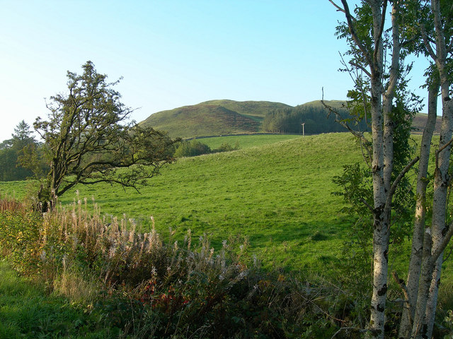
Balbeg Glen is a picturesque valley located in Ayrshire, Scotland. It is nestled in the rolling hills of the Southern Uplands, offering a serene and idyllic setting for nature enthusiasts. The glen is approximately 10 miles northeast of Ayr and covers an area of around 2 square miles.

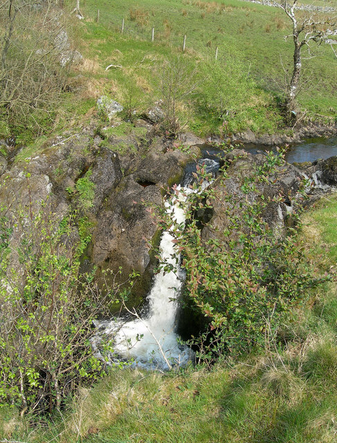
The glen is renowned for its breathtaking natural beauty, characterized by lush greenery, cascading waterfalls, and meandering streams. It boasts an abundant variety of flora and fauna, making it a haven for wildlife enthusiasts and birdwatchers. Visitors can expect to spot species such as red squirrels, roe deer, and a wide range of bird species including woodpeckers and buzzards.

Balbeg Glen offers several walking trails and paths that allow visitors to explore its natural wonders at their own pace. The trails vary in difficulty, catering to both casual walkers and more experienced hikers. The most popular trail is the Balbeg Circular, a 3-mile loop that takes visitors through ancient woodlands, past the stunning Balbeg Waterfalls, and offers panoramic views of the surrounding countryside.

Aside from its natural beauty, Balbeg Glen also holds historical significance. The ruins of Balbeg House, a 17th-century mansion, can be found nestled within the glen. The mansion was once owned by the Kennedy family, prominent figures in Scottish history.

Overall, Balbeg Glen is a hidden gem in Ayrshire, offering a tranquil escape from the hustle and bustle of everyday life. Its stunning landscapes, diverse wildlife, and rich history make it a must-visit destination for nature lovers and history enthusiasts alike.

If you have any feedback on the listing, please let us know in the comments section below.

Balbeg Glen Images

Images are sourced within 2km of 55.290945/-4.5534788 or Grid Reference NS3702. Thanks to Geograph Open Source API. All images are credited.

Crossing the Water of Girvan A touch of autumn colour on the Village Ramble around Straiton where the track crosses then water of Girvan. For a summer view, see <a href="https://www.geograph.org.uk/photo/1461648">NS3804 : Across The Water Of Girvan</a>
Crossing the Water of Girvan
A touch of autumn colour on the Village Ramble around Straiton where the track crosses then water of Girvan. For a summer view, see NS3804 : Across The Water Of Girvan
Steep ground at Craigencallie
Minor road below Craigencallie
The Buck at Straiton This is a fantastic little coffee shop and eat in snack shop. The toasted sandwiches and home made cakes are out of this world. A must stop for anyone passing through this lovely little town.
The Buck at Straiton
This is a fantastic little coffee shop and eat in snack shop. The toasted sandwiches and home made cakes are out of this world. A must stop for anyone passing through this lovely little town.
Craigencallie Craigencallie hill.
Craigencallie
Craigencallie hill.
Water of Girvan at Balbeg.
Bennan Wood Water of Girvan valley and Bennan Wood, Straiton.
Bennan Wood
Water of Girvan valley and Bennan Wood, Straiton.
Monument at Craigengower This obelisk near Straiton is in memory of Lt Col James Hunter Blair who was killed at the Battle of Inkerman in 1854.
Monument at Craigengower
This obelisk near Straiton is in memory of Lt Col James Hunter Blair who was killed at the Battle of Inkerman in 1854.
Craigengower Monument Inscription
Baing Farm Road The road leading to Baing Farm, near Straiton, with Big Hill of the Baing in the background
Baing Farm Road
The road leading to Baing Farm, near Straiton, with Big Hill of the Baing in the background
Baing Farm and Craig Hill Looking from the roadside towards Craig Hill
Baing Farm and Craig Hill
Looking from the roadside towards Craig Hill
Bennan Stud, near Straiton The village can be seen in the distance <a href="https://www.geograph.org.uk/gridref/NX3804">NX3804</a>.
Bennan Stud, near Straiton
The village can be seen in the distance NX3804.
Bennan Stables, Straiton Conversion of one of the farm buildings to form living accommodation.
Bennan Stables, Straiton
Conversion of one of the farm buildings to form living accommodation.
Farmland near Straiton
Towards Bennan Wood
Towards Bennan Wood
Looking over farmland to Straiton.
Water of Girvan Culdoch Farm at the foot of Doonan's Hill.
Water of Girvan
Culdoch Farm at the foot of Doonan's Hill.
The summit Bennan Hill The summit Bennan Hill
The summit Bennan Hill
Show me another place!

Balbeg Glen is located at Grid Ref: NS3702 (Lat: 55.290945, Lng: -4.5534788)

Unitary Authority: South Ayrshire

Police Authority: Ayrshire

What 3 Words

///bounding.suddenly.funnels. Near Patna, East Ayrshire

Related Wikis

Drunmore Linn

Drunmore Linn is a waterfall of Scotland, near Straiton, South Ayrshire. == See also == Waterfalls of Scotland == References ==

Straiton

Straiton is a village on the River Girvan in South Ayrshire in Scotland. It lies in the hills between Kirkmichael, Dalmellington, Crosshill, and Maybole...

Blairquhan Castle

Blairquhan ( blair-WHAHN, Scots: Blairwhan) is a Regency era castle near Maybole in South Ayrshire, Scotland. It was the historic home of the Hunter-Blair...

Tairlaw Linn

Tairlaw Linn is a waterfall of Scotland, near Straiton, South Ayrshire. == See also == Waterfalls of Scotland == References ==

Nearby Amenities

Located within 500m of 55.290945,-4.5534788
Turning Circle
Lat/Long: 55.2895708/-4.550944
Power: pole
Lat/Long: 55.2887517/-4.5466635
Power: pole
Lat/Long: 55.2888969/-4.5479502
Power: pole
Lat/Long: 55.2890515/-4.5493076
Power: pole
Lat/Long: 55.2919135/-4.5461843
Ford: yes
Lat/Long: 55.294032/-4.5565133
Barrier: stile
Stile: ladder
Lat/Long: 55.2936408/-4.5580368
The data included in this document is from www.openstreetmap.org. The data is made available under ODbL.

Have you been to Balbeg Glen?

Leave your review of Balbeg Glen below (or comments, questions and feedback).