Lamb Corner

Settlement in Essex Colchester

England

Lamb Corner

View of the vicarage of Dedham Parish Church from Brook Street Looking south-southeast.
View of the vicarage of Dedham Parish Church from Brook Street Credit: Robert Lamb

Lamb Corner is a small, picturesque village located in the county of Essex, England. Situated in the Tendring district, Lamb Corner is known for its charming rural setting and quaint atmosphere. With a population of around 500 residents, the village provides a close-knit community that thrives on its strong sense of belonging.

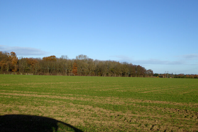
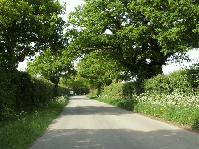
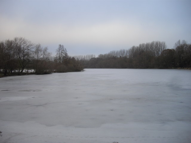
The village is surrounded by rolling countryside, offering stunning views of the English landscape. Its tranquil environment attracts nature enthusiasts and those seeking a peaceful escape from the bustling city life. The area is also home to a rich variety of flora and fauna, making it a haven for wildlife lovers.

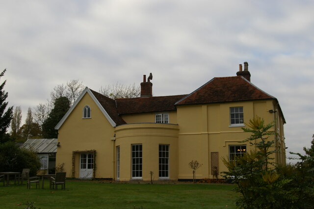
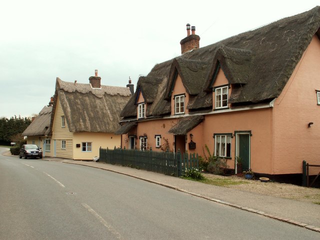
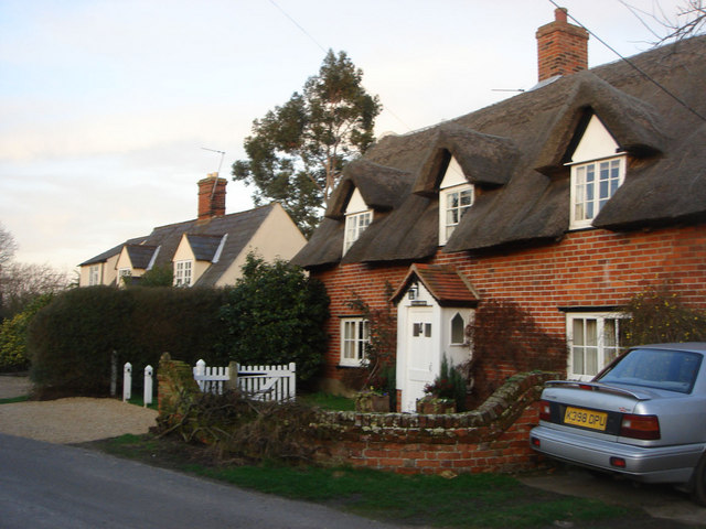
Lamb Corner boasts a range of architectural styles, with traditional cottages and buildings dating back to the 18th and 19th centuries. The village church, St. Mary's, is a prominent landmark, showcasing beautiful stained glass windows and a historic bell tower.

The village is well-equipped with amenities to cater to its residents' needs. It features a local pub, The Lamb Inn, which serves as a social hub for villagers and visitors alike. Additionally, there is a primary school, a village hall, and a small convenience store.

Lamb Corner is conveniently located near the town of Manningtree, which provides access to a wider range of amenities such as supermarkets, shops, and healthcare facilities. The village is also well-connected to other parts of Essex via reliable transport links, including regular bus services and nearby rail connections.

Overall, Lamb Corner offers a peaceful and idyllic setting, making it an appealing place to reside for those seeking a close community and a tranquil countryside lifestyle.

If you have any feedback on the listing, please let us know in the comments section below.

Lamb Corner Images

Images are sourced within 2km of 51.943484/0.9766 or Grid Reference TM0431. Thanks to Geograph Open Source API. All images are credited.

View of the vicarage of Dedham Parish Church from Brook Street Looking south-southeast.
View of the vicarage of Dedham Parish Church from Brook Street
Looking south-southeast.
View of the Dedham War Memorial from Brook Street Looking south-southeast.
View of the Dedham War Memorial from Brook Street
Looking south-southeast.
Former home of Sir Alfred Munnings, Dedham Sir Alfred Munnings (1878-1959) was born in Suffolk and trained as a painter at the Norwich School of Art and in Paris.  He is best known for his paintings of horses, and for his 1949 valedictory address as President of the Royal Academy in which he attacked Picasso and modern art in general; both facts present something of a caricature, in that Munnings was open to influences seen as modern and shocking in their day (much of his work is influenced by Impressionism, and his poster work is reminiscent of Lautrec) and his subject matter is more varied than the popular belief would have it, including rural scenes and depictions of Romany life.  After his death this, his home, became the Munnings Art Museum, housing many of his paintings and showing the house as he lived in it.
Former home of Sir Alfred Munnings, Dedham
Sir Alfred Munnings (1878-1959) was born in Suffolk and trained as a painter at the Norwich School of Art and in Paris. He is best known for his paintings of horses, and for his 1949 valedictory address as President of the Royal Academy in which he attacked Picasso and modern art in general; both facts present something of a caricature, in that Munnings was open to influences seen as modern and shocking in their day (much of his work is influenced by Impressionism, and his poster work is reminiscent of Lautrec) and his subject matter is more varied than the popular belief would have it, including rural scenes and depictions of Romany life. After his death this, his home, became the Munnings Art Museum, housing many of his paintings and showing the house as he lived in it.
Field north of Birchwood Road
National Cycle Network Milestone Langham Rowe Type National Cycle Network Milepost on Route 1 in Langham, Near Colchester, Essex.

1000 Millennium cast iron mileposts were funded by the Royal Bank of Scotland to mark the creation of the National Cycle Network, and found along the cycles routes through the UK.

There are four different types of posts, "Fossil Tree" by John Mills, "The Cockerel" by Iain McColl, "Rowe Type" by Andrew Rowe, and "Tracks" by David Dudgeon. The four artists are from each country of the UK though all posts can be found in all four countries.
National Cycle Network Milestone Langham
Rowe Type National Cycle Network Milepost on Route 1 in Langham, Near Colchester, Essex. 1000 Millennium cast iron mileposts were funded by the Royal Bank of Scotland to mark the creation of the National Cycle Network, and found along the cycles routes through the UK. There are four different types of posts, "Fossil Tree" by John Mills, "The Cockerel" by Iain McColl, "Rowe Type" by Andrew Rowe, and "Tracks" by David Dudgeon. The four artists are from each country of the UK though all posts can be found in all four countries.
Parish Church of St Mary, Dedham <span class="nowrap"><a title="https://historicengland.org.uk/listing/the-list/list-entry/1239340?section=official-list-entry" rel="nofollow ugc noopener" href="https://historicengland.org.uk/listing/the-list/list-entry/1239340?section=official-list-entry">Link</a><img style="margin-left:2px;" alt="External link" title="External link - shift click to open in new window" src="https://s1.geograph.org.uk/img/external.png" width="10" height="10"/></span>
Parish Church of St Mary, Dedham
Southfields, The Flemish Cottages, Dedham <span class="nowrap"><a title="https://historicengland.org.uk/listing/the-list/list-entry/1239217?section=official-list-entry" rel="nofollow ugc noopener" href="https://historicengland.org.uk/listing/the-list/list-entry/1239217?section=official-list-entry">Link</a><img style="margin-left:2px;" alt="External link" title="External link - shift click to open in new window" src="https://s1.geograph.org.uk/img/external.png" width="10" height="10"/></span>
Southfields, The Flemish Cottages, Dedham
Sceoppa House, Dydda House and Weavershed House, Dedham <span class="nowrap"><a title="https://historicengland.org.uk/listing/the-list/list-entry/1239215?section=official-list-entry" rel="nofollow ugc noopener" href="https://historicengland.org.uk/listing/the-list/list-entry/1239215?section=official-list-entry">Link</a><img style="margin-left:2px;" alt="External link" title="External link - shift click to open in new window" src="https://s1.geograph.org.uk/img/external.png" width="10" height="10"/></span> and <span class="nowrap"><a title="https://historicengland.org.uk/listing/the-list/list-entry/1273806?section=official-list-entry" rel="nofollow ugc noopener" href="https://historicengland.org.uk/listing/the-list/list-entry/1273806?section=official-list-entry">Link</a><img style="margin-left:2px;" alt="External link" title="External link - shift click to open in new window" src="https://s1.geograph.org.uk/img/external.png" width="10" height="10"/></span>
Sceoppa House, Dydda House and Weavershed House, Dedham
LinkExternal link and LinkExternal link
Thatched  cottages  on  the  corner  Dedham To the left Stratford Road on the front High Street B1029
Thatched cottages on the corner Dedham
To the left Stratford Road on the front High Street B1029
Road  junction  on  the  edge  of  Dedham The B1029 going up Shoebridge's Hill. Stratford Road goes to the right
Road junction on the edge of Dedham
The B1029 going up Shoebridge's Hill. Stratford Road goes to the right
River Stour near Milsoms A stretch of the River Stour viewed from the footpath near Milsoms.
River Stour near Milsoms
A stretch of the River Stour viewed from the footpath near Milsoms.
Part of Ardleigh village The road is known as The Street. The parish church of St. Mary can be seen and its beautiful tower is dated c.1500
Part of Ardleigh village
The road is known as The Street. The parish church of St. Mary can be seen and its beautiful tower is dated c.1500
Looking north along Dead Lane
Row of Gravestones at  St Mary The Virgin Ardleigh
Row of Gravestones at St Mary The Virgin Ardleigh
St Mary the Virgin Church, Ardleigh, Essex
Frozen Ardleigh Reservoir Ardleigh Reservoir is a 90,000 m2 lake near Colchester in Essex constructed in the valley of the Salary Brook. This picture is taken from Wick Lane.
Frozen Ardleigh Reservoir
Ardleigh Reservoir is a 90,000 m2 lake near Colchester in Essex constructed in the valley of the Salary Brook. This picture is taken from Wick Lane.
Southfields, Dedham, Essex Southfields was built in 1500 by a rich clothier. It is square in plan with an inner courtyard and has lots of exposed timbers. This view shows its east side.
Southfields, Dedham, Essex
Southfields was built in 1500 by a rich clothier. It is square in plan with an inner courtyard and has lots of exposed timbers. This view shows its east side.
Thatched cottages at Lamb Corner, Essex The road in this picture is the B1029 and Lamb Corner lies between Dedham and Ardleigh.
Thatched cottages at Lamb Corner, Essex
The road in this picture is the B1029 and Lamb Corner lies between Dedham and Ardleigh.
Show me another place!

Lamb Corner is located at Grid Ref: TM0431 (Lat: 51.943484, Lng: 0.9766)

Administrative County: Essex

District: Colchester

Police Authority: Essex

What 3 Words

///thrashed.messaging.smudges. Near Dedham, Essex

Nearby Locations

Lamb Corner Parney Heath

Related Wikis

Lamb Corner

Lamb Corner is a hamlet on the B1029 road, in the civil parish of Dedham in the Colchester district, in the county of Essex, England. Lamb Corner formerly...

Ardleigh Heath

Ardleigh Heath is a hamlet on the B1029 road, in the civil parish of Ardleigh, in the Tendring District of the county of Essex, England. It is located...

Dedham Heath

Dedham Heath, known locally as The Heath, is a hamlet in the civil parish of Dedham, in the Colchester district, in the county of Essex, England. In 2021...

Castle House, Dedham

Castle House in Dedham, Essex, England was the home of Sir Alfred Munnings from 1919 till his death in 1959. Architecturally the building contains a mixture...

Nearby Amenities

Located within 500m of 51.943484,0.9766
Monks Lane
Naptan AtcoCode: 150029750002
Naptan BusStopType: CUS
Naptan NaptanCode: esxgdwap
Naptan Verified: no
Public Transport: platform
Source: naptan_import
Lat/Long: 51.9452341/0.975097
Monks Lane
Naptan AtcoCode: 1500297500Y2
Naptan Bearing: N
Naptan BusStopType: CUS
Naptan CommonName: Monks Lane
Naptan Crossing: Monks Lane
Naptan Indicator: Opp
Naptan Landmark: Monks Lane
Naptan NaptanCode: esxgtjpj
Naptan Street: Monks Lane South
Naptan Verified: no
Public Transport: platform
Source: naptan_import
Lat/Long: 51.9451792/0.975137
Rye Farm
Naptan AtcoCode: 1500IM2007
Naptan Bearing: W
Naptan BusStopType: CUS
Naptan CommonName: Lamb Corner
Naptan Crossing: Ardleigh Road
Naptan Indicator: W-bound
Naptan Landmark: Lamb Corner
Naptan NaptanCode: esxadmtw
Naptan Street: Long Road West
Naptan Verified: no
Public Transport: platform
Source: naptan_import
Lat/Long: 51.9435042/0.977232
Rye Farm
Naptan AtcoCode: 1500IM2007B
Naptan Bearing: E
Naptan BusStopType: CUS
Naptan CommonName: Lamb Corner
Naptan Crossing: Ardleigh Road
Naptan Indicator: E-bound
Naptan Landmark: Lamb Corner
Naptan NaptanCode: esxjdapa
Naptan Street: Long Road West
Naptan Verified: no
Public Transport: platform
Source: naptan_import
Lat/Long: 51.9435762/0.9768729
Post Box
Lat/Long: 51.9437634/0.9761422
Power: pole
Transformer: distribution
Lat/Long: 51.9394906/0.9787231
The data included in this document is from www.openstreetmap.org. The data is made available under ODbL.

Have you been to Lamb Corner?

Leave your review of Lamb Corner below (or comments, questions and feedback).