Lamas

Settlement in Norfolk Broadland

England

Lamas

Buxton mill up for sale (March 2011)
Buxton mill up for sale (March 2011) Credit: Adrian S Pye

Lamas is a small village located in the county of Norfolk, England. Situated in the eastern part of the country, Lamas is nestled amidst picturesque countryside and is roughly 13 miles north of the city of Norwich. With a population of around 200 residents, the village boasts a tranquil and close-knit community.

Lamas is well-known for its rich history, dating back centuries. The village features a Grade I listed building, Lamas Abbey, which was originally established as a priory in the 12th century. Today, the abbey ruins serve as a popular tourist attraction, offering visitors a glimpse into the region's medieval past.

In addition to its historical significance, Lamas is surrounded by stunning natural landscapes. The village is encompassed by rolling fields, lush woodlands, and meandering rivers, making it an ideal destination for nature enthusiasts and outdoor activities. The nearby Bure Marshes National Nature Reserve is a haven for wildlife, offering visitors the opportunity to spot a diverse range of bird species and other flora and fauna.

Although small in size, Lamas provides basic amenities for its residents and visitors. The village features a local pub, The Lamas Arms, which serves as a social hub for the community. Additionally, there are a few small businesses, including a village store and a farm shop, catering to the daily needs of the inhabitants.

Overall, Lamas is a charming and historically significant village, offering a peaceful and idyllic retreat for those seeking a taste of rural Norfolk.

If you have any feedback on the listing, please let us know in the comments section below.
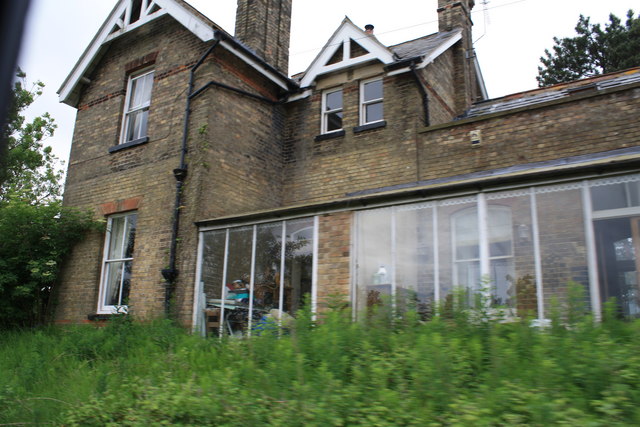
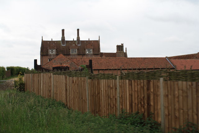
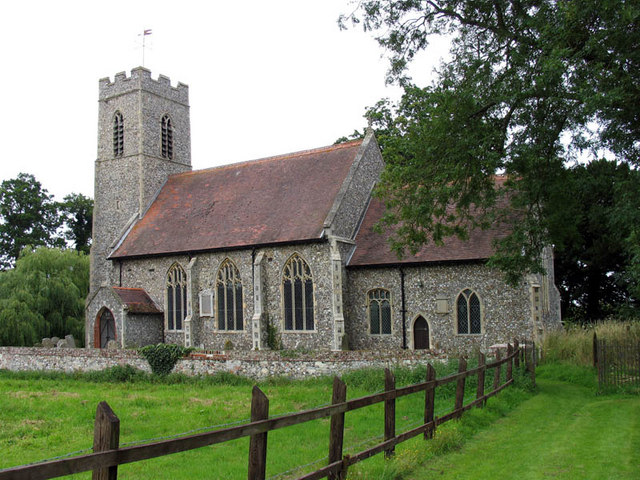
Lamas Images

Images are sourced within 2km of 52.759406/1.326534 or Grid Reference TG2423. Thanks to Geograph Open Source API. All images are credited.

Buxton mill up for sale (March 2011)
Approaching Buxton The approach to Buxton Station is seen from a Bure Valley Railway train heading towards Wroxham. On the left the footpath level crossing can just be made out. Adjacent to the station is a car park of railway users and walkers, with a housing estate beyond that.
Approaching Buxton
The approach to Buxton Station is seen from a Bure Valley Railway train heading towards Wroxham. On the left the footpath level crossing can just be made out. Adjacent to the station is a car park of railway users and walkers, with a housing estate beyond that.
Buxton Station Buxton Station is seen from a Bure Valley Railway train. A single platform serves trains heading in both directions. Just beyond the station can be glimpsed the buildings of the original Buxton station.
Buxton Station
Buxton Station is seen from a Bure Valley Railway train. A single platform serves trains heading in both directions. Just beyond the station can be glimpsed the buildings of the original Buxton station.
Buxton Station Buxton station has one platform, serving Bure Valley Railway trains heading in either direction. Just beyond the present station can be glimpsed one of the buildings remaining of the original Buxton station.
Buxton Station
Buxton station has one platform, serving Bure Valley Railway trains heading in either direction. Just beyond the present station can be glimpsed one of the buildings remaining of the original Buxton station.
Former station at Buxton This is the view from a Bure Valley Railway train of the former station buildings at Buxton, which are now in use as a private dwelling.
Former station at Buxton
This is the view from a Bure Valley Railway train of the former station buildings at Buxton, which are now in use as a private dwelling.
View across the Bure Valley This is a view across the Bure Valley from the Bure Valley Railway train, between Buxton and Coltishall.
View across the Bure Valley
This is a view across the Bure Valley from the Bure Valley Railway train, between Buxton and Coltishall.
View across the Bure Valley The Bure Valley is seen from a Bure Valley Railway train between Buxton and Coltishall.
View across the Bure Valley
The Bure Valley is seen from a Bure Valley Railway train between Buxton and Coltishall.
Bure Valley Railway warning sign This warning sign is at the beginning of a passing loop and is close to a level crossing connecting Fendyke Nursery with the marshes.
Bure Valley Railway warning sign
This warning sign is at the beginning of a passing loop and is close to a level crossing connecting Fendyke Nursery with the marshes.
Level Crossing near Fendyke Nursery This level crossing allows access across the Bure Valley Railway between Fendyke Nursery and the marshes. This is the view from a BVR train.
Level Crossing near Fendyke Nursery
This level crossing allows access across the Bure Valley Railway between Fendyke Nursery and the marshes. This is the view from a BVR train.
Bure Valley Railway passing loop This passing loop is close to Little Hautbois Hall.
Bure Valley Railway passing loop
This passing loop is close to Little Hautbois Hall.
Bure Valley Railway near Little Hautbois Hall The train from where this image was taken is on one of the tracks of a passing loop.
Bure Valley Railway near Little Hautbois Hall
The train from where this image was taken is on one of the tracks of a passing loop.
Bure Valley Railway near Little Hautbois Hall The train from which this image is taken is leaving the passing loop and entering the single-track section to Coltishall station. Some of the farm buildings at Little Hautbois Hall can be glimpsed beside the tree on the left.
Bure Valley Railway near Little Hautbois Hall
The train from which this image is taken is leaving the passing loop and entering the single-track section to Coltishall station. Some of the farm buildings at Little Hautbois Hall can be glimpsed beside the tree on the left.
Bure Valley Railway near Little Hautbois Hall The train from which this image is taken is leaving the passing loop and entering the single-track section to Coltishall station.
Bure Valley Railway near Little Hautbois Hall
The train from which this image is taken is leaving the passing loop and entering the single-track section to Coltishall station.
Little Hautbois Hall This is the view from a Bure Valley Railway train as it approaches the level crossing near Little Hautbois Hall.
Little Hautbois Hall
This is the view from a Bure Valley Railway train as it approaches the level crossing near Little Hautbois Hall.
Little Hautbois Hall This is a view from a Bure Valley Railway train as it passes over the level crossing adjacent to Little Hautbois Hall. At this point the Bure Valley Path crosses over the railway to parallel it from the south side.
Little Hautbois Hall
This is a view from a Bure Valley Railway train as it passes over the level crossing adjacent to Little Hautbois Hall. At this point the Bure Valley Path crosses over the railway to parallel it from the south side.
Little Hautbois Hall This is a view of Little Hautbois Hall from a passing Bure Valley Railway train.
Little Hautbois Hall
This is a view of Little Hautbois Hall from a passing Bure Valley Railway train.
Bure Valley Railway view This view from a Bure Valley Railway train shows a field between the railway and the boundary of the former RAF Coltishall. The low structure on the horizon just left of centre, is the remains of a concrete aircraft shelter.
Bure Valley Railway view
This view from a Bure Valley Railway train shows a field between the railway and the boundary of the former RAF Coltishall. The low structure on the horizon just left of centre, is the remains of a concrete aircraft shelter.
Former RAF Coltishall The concrete structures on the horizon belong to the former RAF Coltishall and are seen from a passing Bure Valley Railway train. The airfield perimeter fence can also be seen.
Former RAF Coltishall
The concrete structures on the horizon belong to the former RAF Coltishall and are seen from a passing Bure Valley Railway train. The airfield perimeter fence can also be seen.
Show me another place!

Lamas is located at Grid Ref: TG2423 (Lat: 52.759406, Lng: 1.326534)

Administrative County: Norfolk

District: Broadland

Police Authority: Norfolk

What 3 Words

///ambitions.dented.solving. Near Buxton, Norfolk

Nearby Locations

Nine Acre Plantation Lamas

Related Wikis

Buxton with Lamas

Buxton with Lamas is a civil parish in Broadland in the English county of Norfolk. It comprises the villages of Buxton lying to the west of the River Bure...
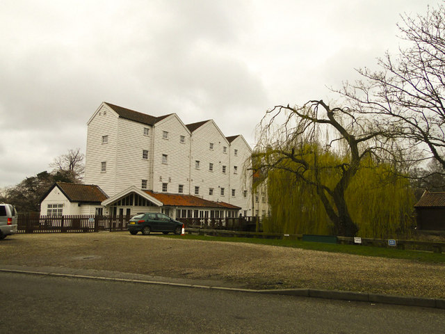
Buxton Watermill

Buxton Mill, is located on the River Bure about 0.5 miles (0.80 km) east of the village of Buxton, Norfolk, and is in the hamlet of Lamas, Norfolk. A watermill...

Lamas, Norfolk

Lamas (also spelled Lammas) is a village in Broadland, Norfolk, England. Administratively it falls within the civil parish of Buxton with Lamas. The village...

Little Hautbois

Little Hautbois is a small hamlet in Broadland, England, part of the parish of Lamas. The name is pronounced 'Hobbis', and can be seen thus spelled on...

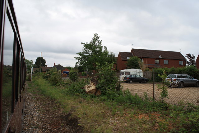
Buxton Lamas railway station

Buxton Lamas was a railway station in Buxton with Lamas, Norfolk. It was located near the Bure Valley Railway's present Buxton station. == References ==

HM Prison Bure

His Majesty's Prison Bure, more commonly known as HM Prison Bure, and often abbreviated to HMP Bure, is a Category C men's prison, located in the parish...

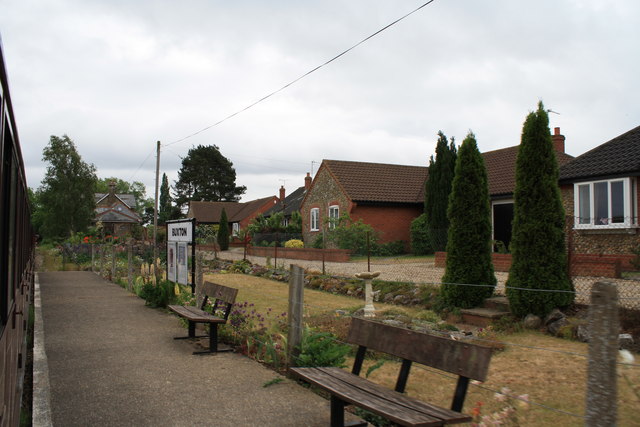
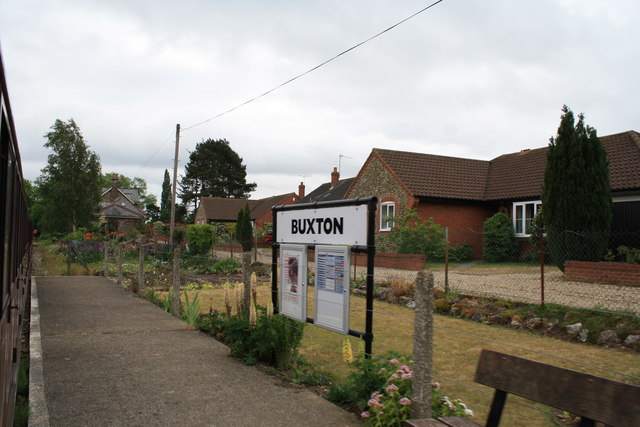
Buxton railway station (Norfolk)

Buxton railway station serves the village of Buxton in Norfolk and is served by the Bure Valley Railway.

Bure Valley Path

The Bure Valley Path is a 9-mile (14 km) long walking trail and cycling trail in Norfolk, England. It runs alongside the Bure Valley Railway, a heritage...

Nearby Amenities

Located within 500m of 52.759406,1.326534
Bus Stop
Hautbois Road, opp
Naptan AtcoCode: 2900B6716
Naptan Bearing: E
Naptan CommonName: Hautbois Road
Naptan Indicator: opp
Naptan Landmark: Hautbois Road
Naptan Locality: Buxton
Naptan NaptanCode: nfogpmwd
Naptan Street: The Street
Naptan Verified: no
Source: naptan_import
Lat/Long: 52.7587139/1.3270516
Hautbois Road, adj
Naptan AtcoCode: 2900B6717
Naptan Bearing: W
Naptan BusStopType: CUS
Naptan CommonName: Hautbois Road
Naptan Indicator: adj
Naptan Landmark: Hautbois Road
Naptan Locality: Buxton
Naptan NaptanCode: nfogpmwg
Naptan Street: The Street
Naptan Verified: no
Source: naptan_import
Lat/Long: 52.7586315/1.3271046
Barrier: stile
Lat/Long: 52.7608613/1.326055
Barrier: stile
Bicycle: no
Foot: yes
Material: wood
Stile: stepover
Lat/Long: 52.7586034/1.3192944
Barrier: stile
Lat/Long: 52.7628252/1.3255956
Post Box
Operator: Royal Mail
Post Box Mounting: pier
Post Box Type: lamp
Royal Cypher: EIIR
Royal Cypher Wikidata: Q33102113
Lat/Long: 52.7587543/1.3263749
Power: pole
Lat/Long: 52.7571004/1.3211999
Location Transition: yes
Power: pole
Lat/Long: 52.7577204/1.3227208
Lamas
Alt Name: Lammas
Place: village
Wikidata: Q4682506
Lat/Long: 52.7585095/1.3252151
Historic: memorial
Memorial: war_memorial
Lat/Long: 52.7588124/1.3263202
Disused Entrance: yes
Lat/Long: 52.7599542/1.3261436
Bench
Backrest: yes
Lat/Long: 52.7598695/1.3256188
Bench
Backrest: yes
Lat/Long: 52.7600789/1.3257891
Barrier: kissing_gate
Foot: yes
Material: wood
Lat/Long: 52.7593351/1.3264354
Entrance: yes
Lat/Long: 52.7598391/1.3263332
Entrance: main
Lat/Long: 52.7598606/1.326087
Inscription: yes
Lat/Long: 52.7573686/1.3206108
Inscription: yes
Lat/Long: 52.7573828/1.3206171
Inscription: yes
Lat/Long: 52.757397/1.3206235
Parking
Access: customers
Surface: grass
Lat/Long: 52.7593063/1.3266145
Turning Circle
Lat/Long: 52.7573649/1.3286313
Information: guidepost
Tourism: information
Lat/Long: 52.7586392/1.3278232
The data included in this document is from www.openstreetmap.org. The data is made available under ODbL.

Have you been to Lamas?

Leave your review of Lamas below (or comments, questions and feedback).