Coire na h-Eaglaise

Valley in Ross-shire

Scotland

Coire na h-Eaglaise

Strathconon to Orrin Reservoir track The track is ill defined and boggy at this point.
Strathconon to Orrin Reservoir track Credit: valenta

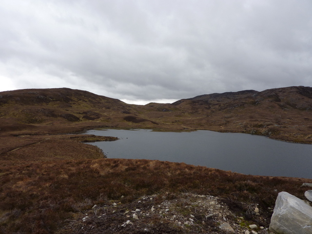
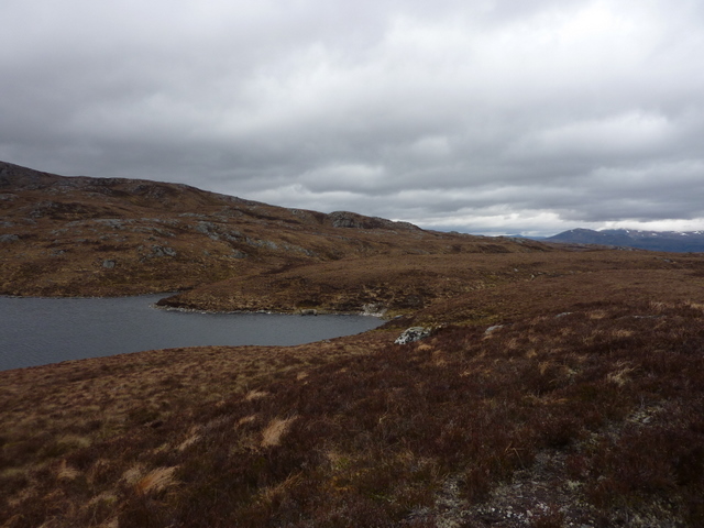
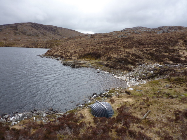
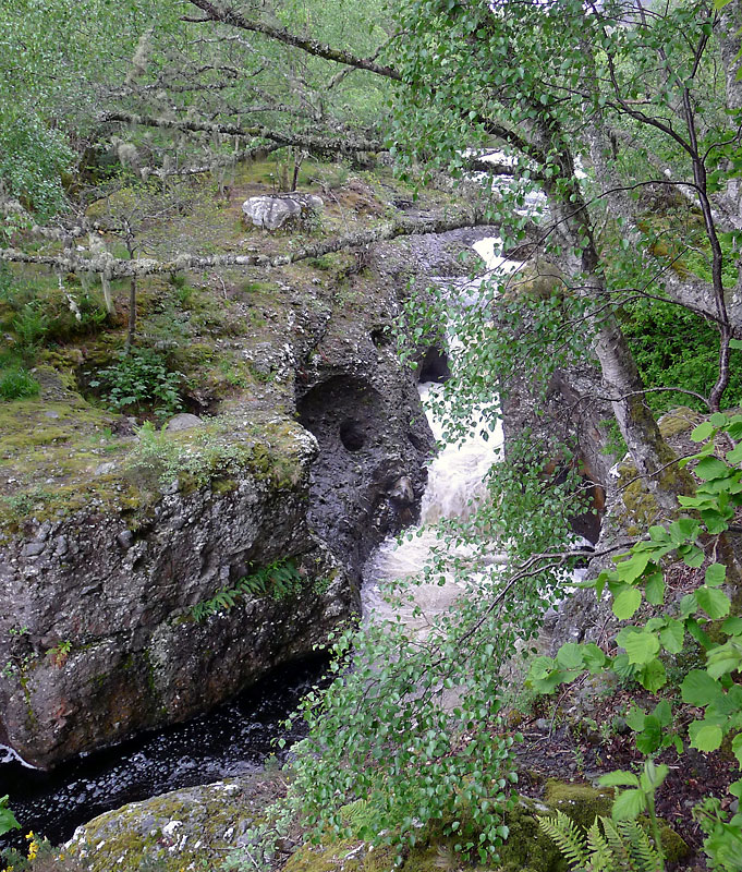
Coire na h-Eaglaise is a picturesque valley located in the county of Ross-shire in the Scottish Highlands. Situated amidst the stunning mountainous landscape, this valley is renowned for its natural beauty and is a popular destination for hikers, nature lovers, and outdoor enthusiasts.

The valley is nestled between towering peaks, with its floor featuring lush green meadows and a winding river that meanders through its center. The name "Coire na h-Eaglaise" translates to "Valley of the Church" in Scottish Gaelic, although the origin of this name remains uncertain.

The valley offers a plethora of outdoor activities for visitors to enjoy. Hiking trails crisscross the area, providing opportunities to explore the surrounding mountains and take in breathtaking panoramic views from the valley floor. The diverse flora and fauna found here make it a great spot for birdwatching and wildlife spotting.

Coire na h-Eaglaise is also home to a variety of archaeological and historical sites. Ruins of old churches and chapels can be found scattered throughout the valley, providing a glimpse into its rich cultural heritage. The surrounding hills are dotted with ancient burial mounds and standing stones, adding to the area's historical significance.

In addition to its natural and historical attractions, the valley offers a peaceful and tranquil atmosphere, making it an ideal place to escape the hustle and bustle of everyday life. Whether it's exploring the great outdoors, immersing oneself in history, or simply enjoying the serenity of the surroundings, Coire na h-Eaglaise offers an unforgettable experience for all who visit.

If you have any feedback on the listing, please let us know in the comments section below.

Coire na h-Eaglaise Images

Images are sourced within 2km of 57.531888/-4.7195394 or Grid Reference NH3752. Thanks to Geograph Open Source API. All images are credited.

Strathconon to Orrin Reservoir track The track is ill defined and boggy at this point.
Strathconon to Orrin Reservoir track
The track is ill defined and boggy at this point.
Old telegraph pole alongside track Isolated, solitary, disused telegraph pole (one of only several which remain) with no apparent destination. Loch Sgolbaidh and Loch an Fheoir in the distance. On the track to Orrin Reservoir from Strathconon.
Old telegraph pole alongside track
Isolated, solitary, disused telegraph pole (one of only several which remain) with no apparent destination. Loch Sgolbaidh and Loch an Fheoir in the distance. On the track to Orrin Reservoir from Strathconon.
Track to Orrin Reservoir from Strathconon Loch Sgolbaidh in the distance and Ben Wyvis in the far distance on the skyline.
Track to Orrin Reservoir from Strathconon
Loch Sgolbaidh in the distance and Ben Wyvis in the far distance on the skyline.
Track to Orrin Reservoir from Strathconon In the distance:- Loch Sgolbaidh on the left, Loch an Fheoir and Fairburn Windfarm on the right.
Track to Orrin Reservoir from Strathconon
In the distance:- Loch Sgolbaidh on the left, Loch an Fheoir and Fairburn Windfarm on the right.
Loch Aradaidh Viewed from track to Orrin Reservoir from Strathconon. Maoile Lunndaidh through the col in the distance.
Loch Aradaidh
Viewed from track to Orrin Reservoir from Strathconon. Maoile Lunndaidh through the col in the distance.
Moorland and moorland track above Loch Aradaidh Viewed from track to Orrin Reservoir from Strathconon.
Moorland and moorland track above Loch Aradaidh
Viewed from track to Orrin Reservoir from Strathconon.
Moorland above Loch Aradaidh Viewed from track to Orrin Reservoir from Strathconon.
Moorland above Loch Aradaidh
Viewed from track to Orrin Reservoir from Strathconon.
Upturned boat and ruined boathouse, Loch Aradaidh Remote loch below the track to Orrin Reservoir from Strathconon.
Upturned boat and ruined boathouse, Loch Aradaidh
Remote loch below the track to Orrin Reservoir from Strathconon.
Ruined boathouse on Loch Aradaidh Remote loch below the track to Orrin Reservoir from Strathconon.
Ruined boathouse on Loch Aradaidh
Remote loch below the track to Orrin Reservoir from Strathconon.
Cabaan Forest A view over the Cabaan Forest (Cabaan: An Cadha Bàn, the White Pass), a remote area situated to the north of the Orrin Reservoir, which can be seen in the distance, with Loch na Clachan Dubha closer to the camera.
Cabaan Forest
A view over the Cabaan Forest (Cabaan: An Cadha Bàn, the White Pass), a remote area situated to the north of the Orrin Reservoir, which can be seen in the distance, with Loch na Clachan Dubha closer to the camera.
Meall nan Damh The summit area of Meall nan Damh, a fine vantage point, although the view to the east of this hill has recently been embellished by a large wind farm.
Meall nan Damh
The summit area of Meall nan Damh, a fine vantage point, although the view to the east of this hill has recently been embellished by a large wind farm.
Loch na Larach Blaire above Strathconon
Loch Carn na Cloiche Moire in Scatwell Forest above Strathconon
Old boundary fence on Carn na Cloiche Moire in Scatwell Forest above Strathconon
Across the course of Allt Creag an h-Uaig above Strathconon
Summit area of Carn an Airich Beag looking south-east
Summit area of Carn an Airich Beag above Strathconon
Little top on Carn an Airich Beag above Strathconon
Show me another place!

Coire na h-Eaglaise is located at Grid Ref: NH3752 (Lat: 57.531888, Lng: -4.7195394)

Unitary Authority: Highland

Police Authority: Highlands and Islands

What 3 Words

///tangible.redeeming.hats. Near Strathpeffer, Highland

Nearby Locations

Coire na h-Eaglaise

Related Wikis

Loch Achilty

Loch Achilty is a large picturesque lowland freshwater loch set within a sloping birch and oakwood forest, and located near to Contin in Ross-shire, Scottish...

Beinn a' Bhathaich Àrd

Beinn a' Bhathaich Àrd is mountain on the northern side of Glen Strathfarrar, in the Highlands of Scotland. It is situated at the eastern end of the glen...

Contin Island

Contin Island is an inhabited riverine islet in Ross and Cromarty within the Highland council area of Scotland. Located in the Black Water, a tributary...

Garve railway station

Garve railway station is a railway station on the Kyle of Lochalsh Line, serving the village of Garve in the north of Scotland. Garve is located at the...

Contin

Contin (Gaelic: Cunndainn) is a Ross-shire village, and a civil parish and community council area between Strathpeffer and Garve in the Highland council...
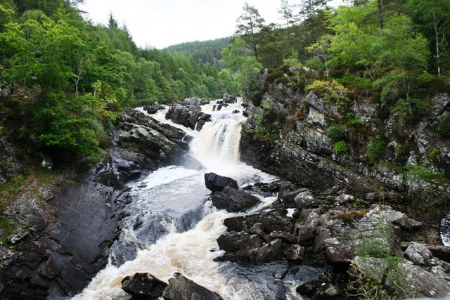
Rogie Falls

Rogie Falls (Gaelic: Eas Rothagaidh) are a series of waterfalls on the Black Water, a river in Ross-shire in the Highlands of Scotland. The falls are about...

Garve

Garve (Scottish Gaelic: Gairbh) is a village on the Black Water river, in Ross-shire, and is in the Highland Council area of Scotland. It is situated 5...

Falls of Orrin

Falls of Orrin is a waterfall on the River Orrin, in the Highlands of Scotland. == See also == Waterfalls of Scotland == References ==

Have you been to Coire na h-Eaglaise?

Leave your review of Coire na h-Eaglaise below (or comments, questions and feedback).